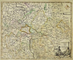
Items Similar to Map of the War -Vesfaglia and Lower Saxony - Etching - 19th Century


Want more images or videos?
Request additional images or videos from the seller
1 of 5
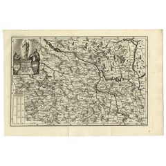
UnknownMap of the War -Vesfaglia and Lower Saxony - Etching - 19th Century19th Century
19th Century
$449.72
£341.96
€380
CA$631.01
A$689.51
CHF 357.47
MX$8,237.19
NOK 4,548.96
SEK 4,258.91
DKK 2,894.29
About the Item
Map of the War -Vestaglia and Lower Saxony is an etching realized during the 19th century.
Good condition.
- Creation Year:19th Century
- Dimensions:Height: 11.82 in (30 cm)Width: 17.33 in (44 cm)Depth: 0.04 in (1 mm)
- Medium:
- Movement & Style:
- Period:
- Framing:Framing Options Available
- Condition:Insurance may be requested by customers as additional service, contact us for more information.
- Gallery Location:Roma, IT
- Reference Number:Seller: T-1525181stDibs: LU650315638182
About the Seller
4.9
Platinum Seller
Premium sellers with a 4.7+ rating and 24-hour response times
1stDibs seller since 2017
7,810 sales on 1stDibs
Typical response time: 1 hour
- ShippingRetrieving quote...Shipping from: Roma, Italy
- Return Policy
More From This Seller
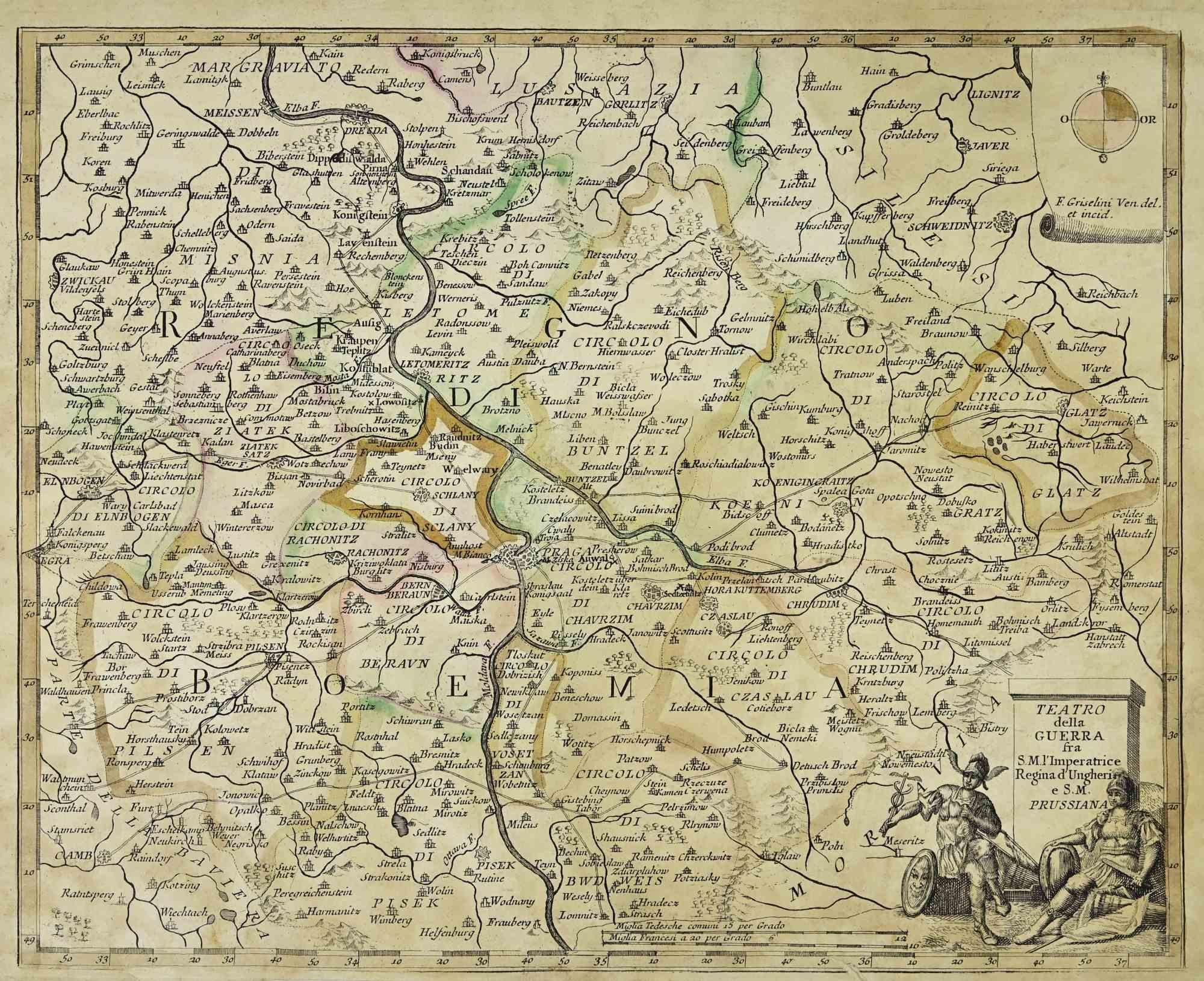
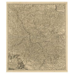
View AllMap of the War between Hungary and Prussia - Etching - 19th Century
Located in Roma, IT
Map of the War between Hungary and Prussia is an etching realized during the 19th century.
Good condition.
Category
Early 19th Century Modern Figurative Prints
Materials
Etching
Map of the War between Hungary and Prussia - Etching - 19th Century
Located in Roma, IT
Map of the War between Hungary and Prussia is an etching realized during the 19th century.
Good condition.
Category
Early 19th Century Modern Figurative Prints
Materials
Etching

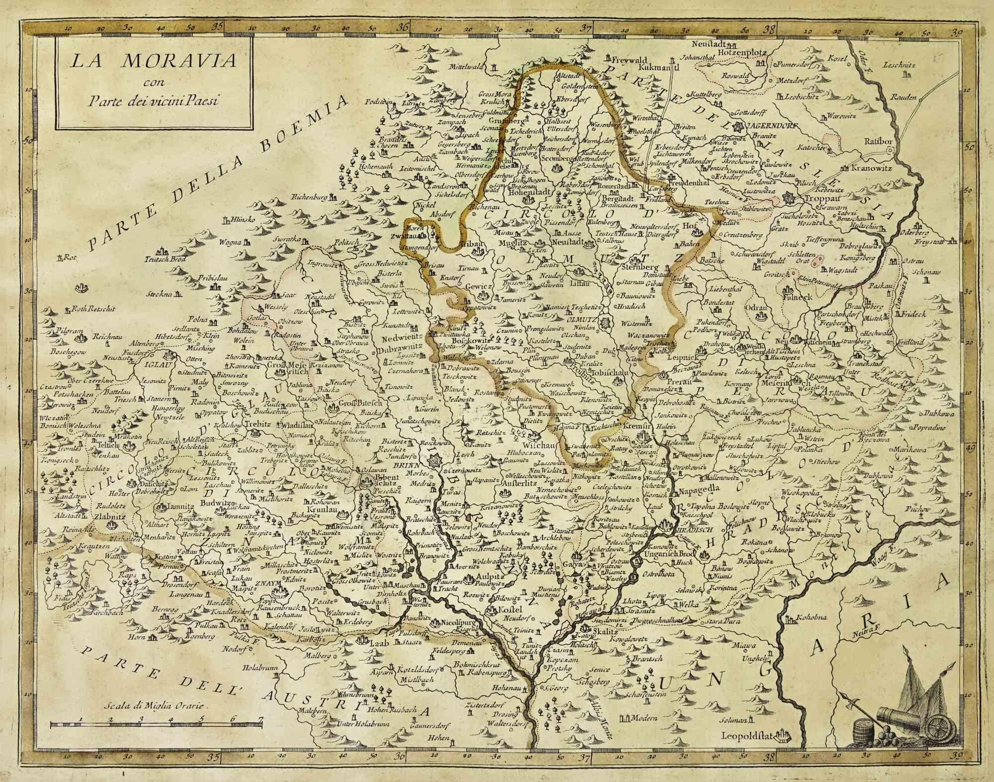
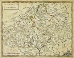
Map of Moravia - Etching - 19th Century
Located in Roma, IT
The Map of Moravia is an etching map realized in the 19th century.
Good conditions.
Category
19th Century Modern Figurative Prints
Materials
Etching
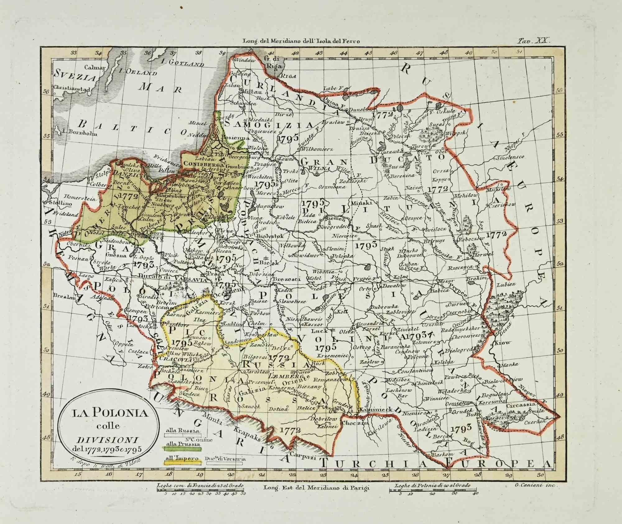
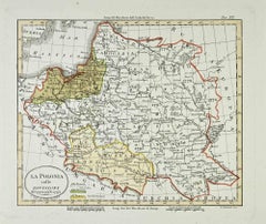
Map of Poland - Etching - Early 20th Century
Located in Roma, IT
Map of Poland is an etching map realized in the early 20th century.
Good conditions.
Category
Early 20th Century Modern Figurative Prints
Materials
Etching
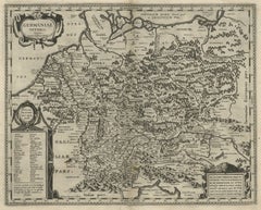
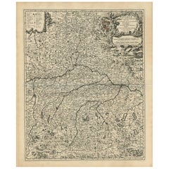
Map of Germany - Original Etching - 1820
Located in Roma, IT
Map of Germany is an Original Etching realized by an unknown artist of 19th century in 1820.
Very good condition on two sheets of white paper joined at...
Category
1820s Modern Figurative Prints
Materials
Etching

Map of Campaign of 1814 - Etching by Pierre François Tardieu - 1837
Located in Roma, IT
Map of Campaign of 1814 is an Etching realized by Pierre François Tardieu in 1837.
Good conditions.
The artwork is realized in a well-balanced composition. the artwork and belongs ...
Category
1830s Modern Figurative Prints
Materials
Lithograph

You May Also Like
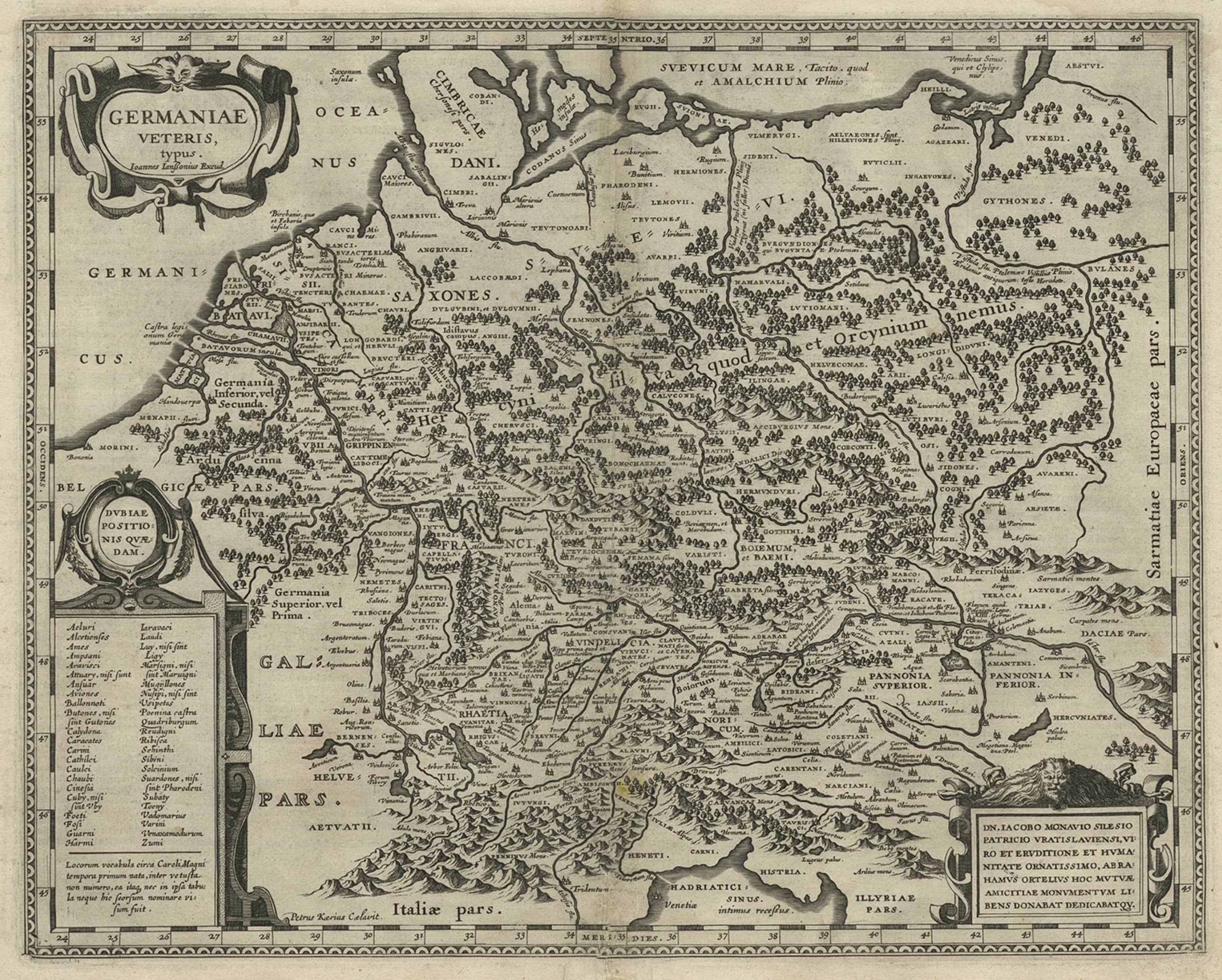
Original Rare Antique Map of the Ancient German Empire in Northern Europe, c1650
Located in Langweer, NL
Antique map titled 'Germaniae Veteris typus.'
Map of the ancient German Empire in Northern Europe, based upon an earlier map by Ortelius. Extends fr...
Category
Antique 1650s Maps
Materials
Paper
$624 Sale Price
20% Off
Antique Map of Saxony and Westphalia by Scherer, 1699
Located in Langweer, NL
Antique map titled 'Saxonia et Westphalia varijs in locis sacris erga dei matre est officiosa & ipsa vicissim erga utramq. Munifica.' Detailed uncommon map of Saxony and Westphalia i...
Category
Antique 17th Century Maps
Materials
Paper
$213 Sale Price
20% Off
Decorative Antique Map of Austria – Frederick de Wit, Amsterdam c.1690
Located in Langweer, NL
Antique Map of Austria – “Circuli Austriaci pars Septentrionalis” by F. de Wit, c.1670
This finely engraved map, titled “Circuli Austriaci pars Septent...
Category
Antique Late 17th Century Dutch Maps
Materials
Paper

Antique Map of the Niederrhein region, Germany
Located in Langweer, NL
Antique map titled 'Circulus Electorum Rheni sive Rhenanus Inferior (..)'. Original antique map of the Niederrhein region, Germany. By F. de Wit, circa 1690.
Frederick de Wit (1629-...
Category
Antique Late 17th Century Maps
Materials
Paper
$426 Sale Price
20% Off
Antique Map of Bavaria with many details, Germany
Located in Langweer, NL
Antique map titled 'Bavariae Circulus atq Electoratus tam cum Adiacentibus quam insertis Regionibus (..)'. Dutch map of Bavaria, showing the many cities, towns, and other features of...
Category
Antique Late 17th Century Maps
Materials
Paper
$624 Sale Price
20% Off
Antique Map of Lower Saxony in Germany, c.1740
Located in Langweer, NL
Antique map titled 'Nieuwe Kaart van de Neder Saxise Kreits (..).' Attractive detailed map showing Lower Saxony, Germany, including Mekelenburg, Lauwenburg, Holstein, Bremen, Verden ...
Category
Antique 18th Century Maps
Materials
Paper

More Ways To Browse
Icarus Matisse
Invader Marilyn
Itzchak Tarkay Lithograph
James Pryde
James Thurber
Jean Charlot Lithograph
Jim Banks
Jim Dine Rainbow
Jim Holland
John Asaro
John Baldessari Poster
John Lurie
John Rizzi
Karen Finley
Keith Haring Area Nightclub Invite New York 1986
Keith Haring Barking Dog
Keith Haring Jazz Poster
Keith Haring Lucky Strike