Items Similar to "Harbour Scene, " Engraving Landscape signed by Claude Gellee (Le Lorrain)


Want more images or videos?
Request additional images or videos from the seller
1 of 8
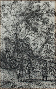
Claude Lorrain"Harbour Scene, " Engraving Landscape signed by Claude Gellee (Le Lorrain)1668
1668
About the Item
"Harbour Scene" is an engraving by Claude Gellee (Le Lorrain). The artist signed the piece in plate lower left.
7 3/4" x 9 5/8" art
18 1/8" x 20 1/4" frame
Biography
Claude Lorrain was born in c. 1604 into poverty in the town of Chamagne, Vosges in Lorraine—then the Duchy of Lorraine, an independent state until 1766 in northeastern France. He was one of five children. His name was Claude Gellée, however, he is known by the province in which he was born. He is often simply called Claude. Orphaned by the age of twelve, he went to live in Freiburg with an elder brother, Jean Gellée, a woodcarver. Claude went to Rome and then Naples from 1619 to 1621, where he apprenticed under Goffredo (Gottfried) Wals. He returned to Rome in April of 1625 and was apprenticed to Augustin Tassi.
Claude toured in Italy, France, and Germany, including his native Lorraine. Claude Deruet, painter to the Duke of Lorraine, kept him as an assistant for a year. He painted architectural subjects in Nancy at the Carmelite church.
In 1627, Claude returned to Rome. Two landscapes commissioned by Cardinal Bentivoglio earned him the patronage of Pope Urban VIII. From about 1627, he rapidly achieved fame as a painter of landscapes and seascapes. Apparently, he befriended his fellow Frenchman, Nicolas Poussin; together they would travel the Roman Campagna, sketching landscapes. Although both artists have been called landscape painters, they were history painters. In Poussin’s work, landscape is a backdrop for the figures that dominate the composition. Claude’s work is more landscape dominant, yet figures are always present.
To avoid the repetition of subjects and to combat copiers of his work, Claude made drawings of the pictures he sent to all his patrons. On the back of each drawing, he wrote the name of the purchaser. Called the Liber Veritatis (Book of Truth), the volume became a valuable study guide for Claude’s work.
Claude Lorrain died in Rome in November of 1682, leaving his wealth to his only surviving relatives, a nephew and an adopted daughter (possibly his niece).
Legacy
Landscape was not considered a serious subject for painting during Claude’s time. Despite his mastery of landscape and his legacy as one of the most accomplished landscape painters in Western art history, Claude was known during his time as a history painter, representing mythical and religious subjects. In seventeenth-century Europe, landscape, like still life and genre painting, reflected an aesthetic viewpoint that lacked moral seriousness. In the matter of the importance of landscape, Claude was prescient. He did not depict the uninhabited panoramas that were esteemed in later centuries, rather his works featured pastoral worlds populated by classical ruins or seascapes. To satisfy his patrons, his pictures include gods, heroes, and saints, even though his sketchbooks contain many drawings of the natural world. Joachim van Sandrart, a German artist and one of Claude’s biographers, described the artist’s working methods for capturing the essence of nature. He wrote that Claude “... studied his art with great seriousness and application; he tried by every means to penetrate nature, lying in the fields before the break of day and until night in order to learn to represent very exactly the red morning sky, sunrise and sunset and the evening hours. When he had well contemplated one or the other in the fields he immediately prepared his colours accordingly, returned home and applied them to the work he had in mind with much greater naturalness than anyone had ever done.”
John Constable described Claude Lorrain as "the most perfect landscape painter the world ever saw", and declared that in Claude’s landscape "all is lovely - all amiable - all is amenity and repose; the calm sunshine of the heart"
- Creator:Claude Lorrain (1604 - 1682, French)
- Creation Year:1668
- Dimensions:Height: 18.125 in (46.04 cm)Width: 20.25 in (51.44 cm)
- Medium:
- Movement & Style:
- Period:Mid-17th Century
- Condition:
- Gallery Location:Milwaukee, WI
- Reference Number:
About the Seller
4.9
Platinum Seller
These expertly vetted sellers are 1stDibs' most experienced sellers and are rated highest by our customers.
Established in 1966
1stDibs seller since 2017
390 sales on 1stDibs
Typical response time: 1 hour
- ShippingRetrieving quote...Ships From: Milwaukee, WI
- Return PolicyA return for this item may be initiated within 14 days of delivery.
More From This SellerView All
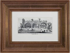
- "Tempio Della Pace, " Original 17th Century Engraving by Israel SilvestreBy Israel SilvestreLocated in Milwaukee, WI"Tempio Della Pace" is an original engraving by Israel Silvestre. The title is printed below the miniature image. It shows a frontal view of the remains of the Temple of Peace in Rom...Category
1650s Old Masters Landscape Prints
MaterialsPaper, Ink, Engraving
- "Mythological Scene-Satyr & GoatHerder"an Original Etching signed by CastiglioneBy Giovanni Benedetto CastiglioneLocated in Milwaukee, WI"Mythological Scene--Satyr & Goat Herder" is an original etching signed by Italian artist Giovanni Benedetto Castiglione. It depicts a satyr lounging on the left and an approaching g...Category
Mid-17th Century Old Masters Landscape Prints
MaterialsEtching
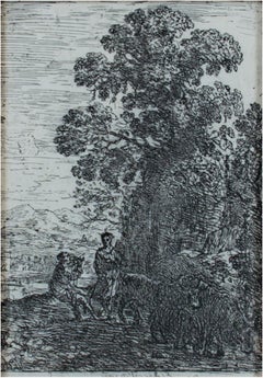
- "Les Chevres (The Goats), " Etching Landscape by Claude Gelle Le LorrainBy Claude LorrainLocated in Milwaukee, WI"Les Chevres (The Goats)" is an original etching by Claude Lorrain. It depicts two pairs of goats and a shepherd watching over them. This etching is also in the collections of the Me...Category
1630s Old Masters Animal Prints
MaterialsEtching
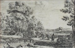
- "Le Patre et la Bergere (The Herdsman & Shepherdess), " Etching by Claude GelleeBy Claude LorrainLocated in Milwaukee, WI"Le Patre et la Bergere (The Herdsman & Shepherdess)" is an etching by Claude Gellee (Le Lorrain). This etching is in the collections of the Metropolitan Museum and the British Museu...Category
Mid-17th Century Old Masters Landscape Prints
MaterialsEtching
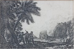
- "Scene de Brigands, " Landscape Etching signed by Claude Gellee (Le Lorrain)By Claude LorrainLocated in Milwaukee, WI"Scene de Brigands" is an etching by Claude Gellee (Le Lorrain). This etching is in the collections of the Louvre and the Art Institute of Chicago. Publisher: Mannocci #11. 5" x 7...Category
Mid-17th Century Old Masters Landscape Prints
MaterialsEtching
- "Le Point de Bois (Rebecca & Eliezer), " etching by Claude Gellee (Le Lorrain)By Claude LorrainLocated in Milwaukee, WI"Le Point de Bois (Rebecca & Eliezer)" is an etching by Claude Gellee (Le Lorrain). This etching is in the collections of the Metropolitan Museum and the Louvre. Publisher: Mannocci ...Category
Mid-17th Century Old Masters Landscape Prints
MaterialsEtching
You May Also Like
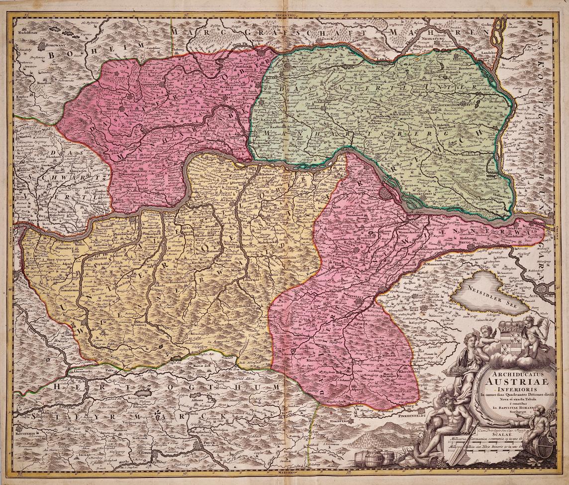
- Hand Colored 18th Century Homann Map of Austria Including Vienna & the DanubeBy Johann Baptist HomannLocated in Alamo, CA"Archiducatus Austriae inferioris" is a hand colored map of Austria created by Johann Baptist Homann (1663-1724) and published in Nuremberg, Germany in 1728 shortly after his death. ...Category
Early 18th Century Old Masters Landscape Prints
MaterialsEngraving
- Meissen, Germany : A Large Framed 18th Century Map by Petrus SchenkLocated in Alamo, CAThis is a hand-colored 18th century map of the Meissen region of Germany, entitled "Geographischer Entwurff Derer Aemmter Meissen als Creys-Procuratur-Schul-und Stiffts-Ammt benebst ...Category
Mid-18th Century Old Masters Landscape Prints
MaterialsEngraving
- Northern Italy: A 16th Century Hand-colored Map by Abraham OrteliusBy Abraham OrteliusLocated in Alamo, CAThis is a framed 16th century hand-colored copperplate map of northern Italy entitled "Veronae Urbis Territorium a Bernardo Bragnolo Descriptium" by Abraham Ortelius from his atlas "Theatrum Orbis Terrarum", which was the first modern atlas of the world, with the first volume published in 1570. This map was part of a subsequent volume, published in Antwerp in 1584. It was based on an earlier map by Bernardo Brognoli. This beautiful map of northern Italy is focussed on Verona and its environs, including Mantua. Lake Garda and the South Tyrol mountains are prominently depicted. There is a very large striking cartouche in the upper left and a decorative distance scale in the lower right. This striking hand-colored map of northern Italy is presented in a gold-colored wood frame and an olive green-colored mat. It is glazed with UV conservation glass. All mounting materials used are archival. The frame measures 21.5" high by 28" wide by 0.75" deep. There is a central vertical fold, as issued, with slight separation of the lower portion of the fold. There are faint spots in the upper and right margins, but the map is otherwise in very good condition. Abraham Ortelius (also known as Ortels, Orthellius, and Wortels) (1527-1598) was a Dutch cartographer, geographer, and cosmographer. He began his career as a map colorist. In 1547 he entered the Antwerp guild of St Luke as an "illuminator of maps". He had an affinity for business from an early age and most of his journeys before 1560, were for business. He was a dealer in antiques, coins, maps, and books. His business income allowed him to acquire an extensive collection of medals, coins, and antiques, as well as a large library of books...Category
16th Century Old Masters Landscape Prints
MaterialsEngraving
- Persia, Armenia & Adjacent Regions: A Hand-colored 17th Century Map by De WitBy Frederick de WitLocated in Alamo, CAThis colorful and detailed 17th century copperplate map by Frederick De Wit was published in Amsterdam between 1666 and 1690. It depicts the Caspian Se...Category
Late 17th Century Old Masters More Prints
MaterialsEngraving
- View of Pisaro, Italy: A 16th Century Hand-colored Map by Braun & HogenbergBy Franz HogenbergLocated in Alamo, CAThis is a 16th century original hand-colored copperplate engraved map of View of Pezaro (Pisaro), Italy entitled "Pisaurum vulgo Pezaro" by Georg Braun & Franz Hogenberg, from their famous city atlas "Civitates Orbis Terrarum", published in Augsberg, Germany in 1575. The map depicts a view of Pesaro, Italy from the west looking over the town to the Adriatic Sea. The River Foglia flows into the Adriatic in the foreground. The only identifiable building is the cathedral of San Domenico, which rises above the other roofs with its tall spire. Two women, dressed in styles of the 16th century are in conversation on a hill in the foreground on the left. Pesaro is in the province of Pesaro and Urbino and lies on the Adriatic and east of Florence. The city, which was founded by the Etruscans and named Pisaurum by the Romans, belonged from AD 754 onwards to the Papal States, and after 1285 was controlled by the princely families of Malatesta, Sforza and della Rovere. Today it is the capital of the province of Pesaro and Urbino and has a population of about 92,000. Pesaro's most famous resident, composer Gioacchino Rossini, was born here in 1792. The following is an English translation of an excerpt from Braun's description of the city: "We believe that the astonishingly short life of the inhabitants of Pesaro comes not only from the insalubrious air, but also from the great quantity of delectable and delicious fruits which they consume to excess. For this causes the production in their bodies of evil humours, which then lead to incurably fatal diseases. The area around the city is most charming and well planted with vineyards, fig trees, olive trees and other fruit-bearing trees." References: Van der Krogt 4, 3369, state 1; Taschen, Braun and Hogenberg...Category
16th Century Old Masters Landscape Prints
MaterialsEngraving
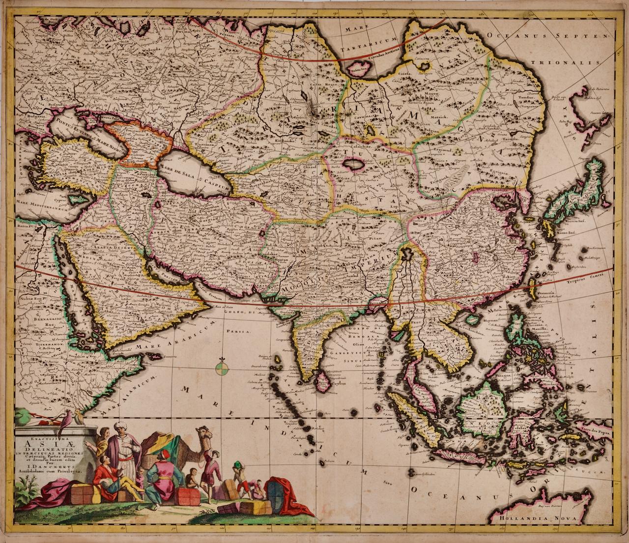
- Asia Declineatio: A 17th Century Hand-colored Map of Asia by Justus DanckertsLocated in Alamo, CAThis is a scarce 17th century beautifully hand-colored copperplate engraved map of Asia entitled “Exactissima Asiae Delineatio in Praecipuas Regiones Caerterasque Partes divisa et de...Category
Late 17th Century Old Masters Landscape Prints
MaterialsEngraving


