Items Similar to Europe: An Original 18th Century Hand-colored Map by E. Bowen


Want more images or videos?
Request additional images or videos from the seller
1 of 11
Emanuel BowenEurope: An Original 18th Century Hand-colored Map by E. Bowen1744
1744
$1,175
£896.21
€1,020.56
CA$1,651.23
A$1,800.90
CHF 954
MX$21,590.26
NOK 12,149.67
SEK 11,109.98
DKK 7,624.62
About the Item
This is an original 18th century hand-colored map entitled "A New & Accurate Map of Europe Drawn from the Best Authorities Assisted by the Most Improved Modern Charts and Maps." by Emanuel Bowen. It was published in 1744 in London in John Harris's "Navigantium atque Itinerantium Bibliotheca" or "A Complete Collection of Voyages and Travels". The map depicts Europe from Scandinavia in the north to the Mediterranean Sea in the south. Iceland is also included in the northwest, Russia in the east and North Africa and Asia are seen in the south.
The map is embellished with a Compass Rose in the lower left and a decorative title cartouche in the upper left.
This striking and beautifully hand-colored original 18th century map is printed on laid chain-linked paper and it is watermarked with a Fleur-de-Lys. The sheet measures 15.75" high and 19" wide. There is a central fold, as issued. The upper margin is somewhat thin compared with the other wide margins. There is a small chip at the upper edge and minimal irregularity of the lower edge on the right. The map is otherwise in very good to excellent condition.
Emanuel Bowen (1694-1767) was a prominent British engraver and cartographer. He was born in Wales and worked in London as a mapmaker and engraver for much of his career. Bowen was honored as a fellow of the Royal Society and as the Royal Mapmaker to both to King George II of England and Louis XV of France. Based in London, Bowen was highly regarded for producing some of the largest, most detailed, most accurate and most attractive maps of his era. He is known to have worked with some of the most prominent cartographic names of the period including Herman Moll, John Owen, and Thomas Kitchin. Bowen was known for his skill in combining information from various sources to create comprehensive and useful maps. Bowen produced a wide range of maps, including maps of the British Isles, Europe, North America, Africa, and Asia. He also created maps for several important atlases, including the "Complete Atlas" (1752) and "A Complete System of Geography" (1747). Despite his renown and success, Bowen, like many cartographers, died in poverty. Upon Emanuel Bowen's death, his cartographic work was taken over by his son, Thomas Bowen who also died in poverty. Bowen's legacy as one of the most influential cartographers of the 18th century lives on through his many important maps and atlases.
- Creator:Emanuel Bowen (1694 - 1767, British)
- Creation Year:1744
- Dimensions:Height: 15.75 in (40.01 cm)Width: 19 in (48.26 cm)
- Medium:
- Movement & Style:
- Period:
- Framing:Framing Options Available
- Condition:
- Gallery Location:Alamo, CA
- Reference Number:Seller: # 51951stDibs: LU1173212159562
About the Seller
5.0
Platinum Seller
Premium sellers with a 4.7+ rating and 24-hour response times
Established in 2011
1stDibs seller since 2019
298 sales on 1stDibs
Typical response time: 1 hour
- ShippingRetrieving quote...Shipping from: Alamo, CA
- Return Policy
More From This Seller
View AllMap of the World: An Original 18th Century Hand-colored Map by E. Bowen
Located in Alamo, CA
This is an original 18th century hand-colored map entitled "A New & Correct Chart of All The Known World Laid down according to Mercator's Projection" by Emanuel Bowen. It was published in 1744 in London in John Harris's "Navigantium atque Itinerantium Bibliotheca" or "A Complete Collection of Voyages and Travels". This highly detailed and colorful map depicts the world. as it was known in the mid 18th century. A majority of the northern and central portions of Canada and America are left blank due to the purity of knowledge at the time this map was published.
The map is embellished with four Compass Roses in the lower left, lower center, lower right and center, along with many rhumb lines. There a is a decorative title cartouche in the upper left. This colorful, attractive, historical and interesting 1744 map presents the entire world on Mercator's projection as it was understood in the middle part of the 18th century, before the landmark explorations of Captain’s Cook, Vancouver, Wilkes and others. It is an example of a nautical chart, a type of map that was designed specifically for use by mariners. The map is centered on the equator and includes both the Eastern and Western Hemispheres. The continents of North America, South America, Europe, Africa, and Asia are depicted, as well as various islands in the Atlantic, Pacific, and Indian Oceans. The map is laid out according to the Mercator projection, a type of cylindrical map projection that was developed in the 16th century by Flemish cartographer Gerardus Mercator. This projection has the advantage of preserving angles and shapes, making it useful for navigation. The map presents a paucity of inland detail, particularly for the Americas, but major cities, geographical landmarks, and regions are included. Ocean currents and Tradewinds are identified, as well as the magnetic declination lines or magnetic variance, which refers to the difference between true north and compass north. The continents are color coded, enhancing the beauty of this map. The three compass roses indicate the directions of the cardinal points.
The depiction of the western coast of America, the Pacific and Australia are interesting. There was very little exploration of Australia between the navigations of William Damper in 1699 and Tobias Furneaux in 1773. Most of the maps detail relies on the 17th century Dutch expeditions to Australia's western coast, by Abel Tasman and William Janszoon. Van Diemen's Land (Tasmania) and New Guinea appear connected to the Australian continent. New Zealand appears as a single landmass. North of New Zealand there is a landmass labelled 'Ter d' St. Esprit' which probably represents the New Hebrides Islands. This map precedes the accurate exploration of the South Pacific and east coast of Australia by Captain James Cook later in the 18th century. The map includes ‘Drakes' Port,' the site where Sir Francis Drake supposedly landed in 1579 during his 1579 circumnavigation of the globe. Here he claimed territory for England, restocked, and repaired his vessels. Drake named the region New Albion. The exact location of Drake's Port is a cartographic mystery. Drake's Harbor is believed to be in the region of San Francisco Bay, Bodega Bay, San Pablo Bay...
Category
Mid-18th Century Old Masters Landscape Prints
Materials
Engraving

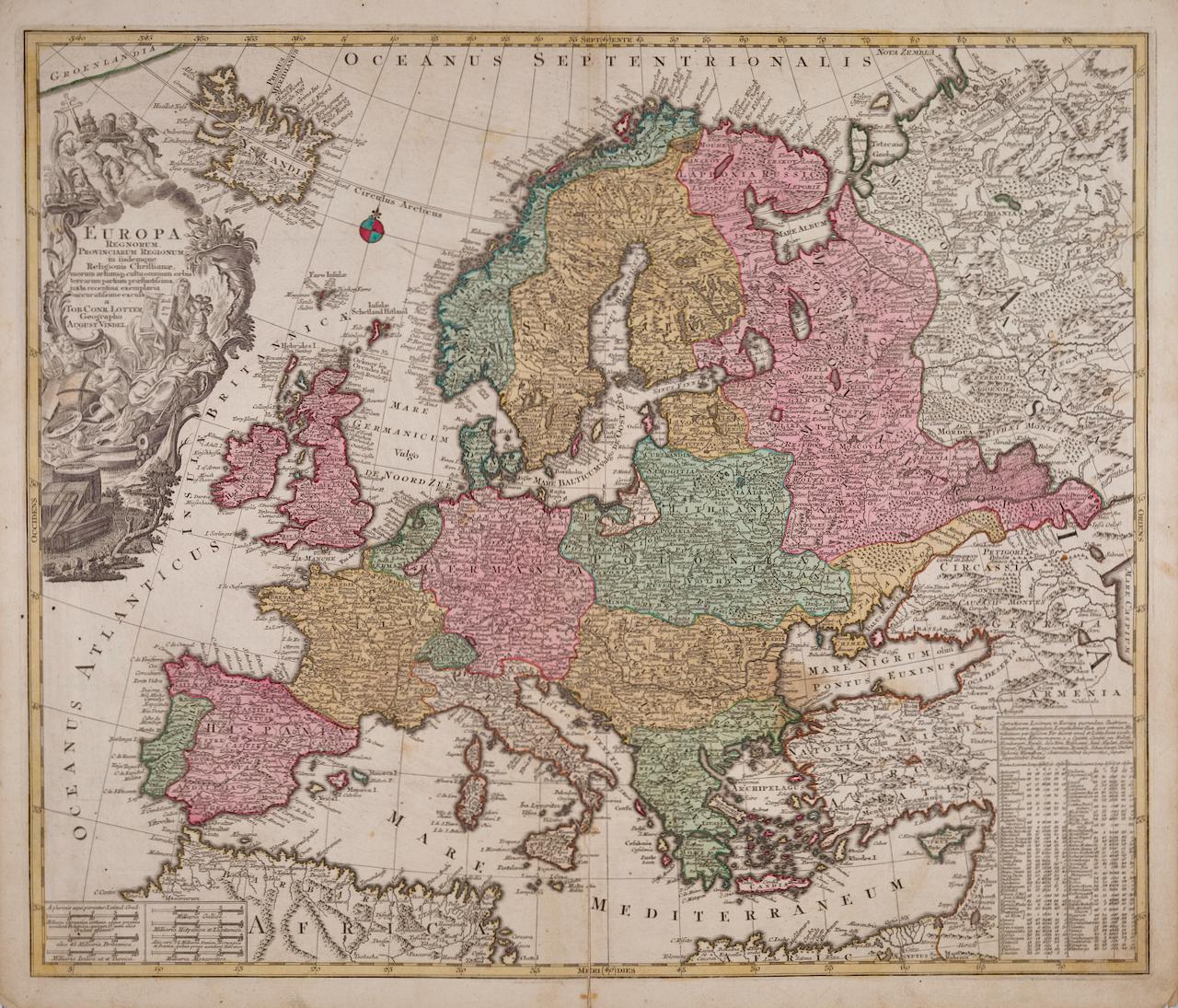
Europa Regnorum Provinciarum: 18th Century Hand-colored Map of Europe by Lotter
By Tobias Conrad Lotter
Located in Alamo, CA
This is an 18th century hand-colored copperplate engraved map entitled "Europa Regnorum Provinciarum Regionum" created by the German cartographer Tobias Conrad Lotter. It was publish...
Category
Mid-18th Century Landscape Prints
Materials
Engraving

Map of the Russian Empire: An Original 18th Century Hand-colored Map by E. Bowen
Located in Alamo, CA
This is an original 18th century hand-colored map entitled "A New & Accurate Map of The Whole Russian Empire, As Contain'd Both In Europe and Asia, Drawn from Authentic Journals, Sur...
Category
Mid-18th Century Old Masters Landscape Prints
Materials
Engraving

Mediterranean and Adriatic Seas: Original 18th Century Hand-colored Map by Bowen
Located in Alamo, CA
This is an original 18th century hand-colored map entitled "An Accurate Chart of The Mediterranean and Adriatic Sea's; with the Archipelago & Part of the Black Sea. Exhibiting all th...
Category
Mid-18th Century Old Masters Landscape Prints
Materials
Engraving

Southern & Eastern Europe: A Large 17th C. Hand-colored Map by Sanson & Jaillot
By Nicholas Sanson d'Abbeville
Located in Alamo, CA
This large hand-colored map entitled "Estats de L'Empire des Turqs en Europe, ou sont les Beglerbeglicz our Gouvernements" was originally created by Nicholas Sanson d'Abbeville and this version was published by Hubert Jaillot in "Atlas Nouveau" in Paris in 1692. It depicts the territories of the Ottoman Empire in Europe, predominantly Eastern Europe. Highlights include, the Mediterranean Sea, the Adriatic Sea, the Black Sea, the Dalmation Coast including present day Croatia, Bosnia and Herzegovina, Montenegro, Serbia, Slovenia, Italy, Greece, North Macedonia, Turkey, Romania, Hungary, Albania, Kosovo, Bulgaria, Transylvania, Moldova and southern portions of France, Switzerland, Germany, and Poland..
The map consists of two sheets joined as one along a vertical joint. The map has original hand-coloring. It is printed on antique hand-made laid, chain-linked paper with wide margins. The sheet measures 24.88" high and 38" wide. There is a central vertical joint, as issued. The map is in very good condition.
Nicholas Sanson d'Abbeville (1600-1667) was one of the greatest French cartographather of French cartography. Sanson opened his first printing business in Paris in 1638. The king recognized his skill and knowledge and made him the official geographer to the court. He eventually served two kings in this capacity. Sanson was succeeded by his sons and son...
Category
1690s Landscape Prints
Materials
Engraving

Great Britain, N. France: A Large 17th C. Hand-colored Map by Sanson and Jaillot
By Nicholas Sanson d'Abbeville
Located in Alamo, CA
This large hand-colored 17th century copperplate engraved map entitled "Le Royaume D Angleterre, distingué en ses Provinces. Par le Sr. Sanson. Geographe du Roy. Presenté A Monseigne...
Category
1690s Landscape Prints
Materials
Engraving

You May Also Like
Antique Map of Europe by Keizer & de Lat, 1788
Located in Langweer, NL
Antique map titled 'Kaartje van Europa (..)'. Uncommon original antique map of Europe. This map originates from 'Nieuwe Natuur- Geschied- en Handelkundige Zak- en Reisatlas' by Gerri...
Category
Antique Late 18th Century Maps
Materials
Paper

$383 Sale Price
20% Off
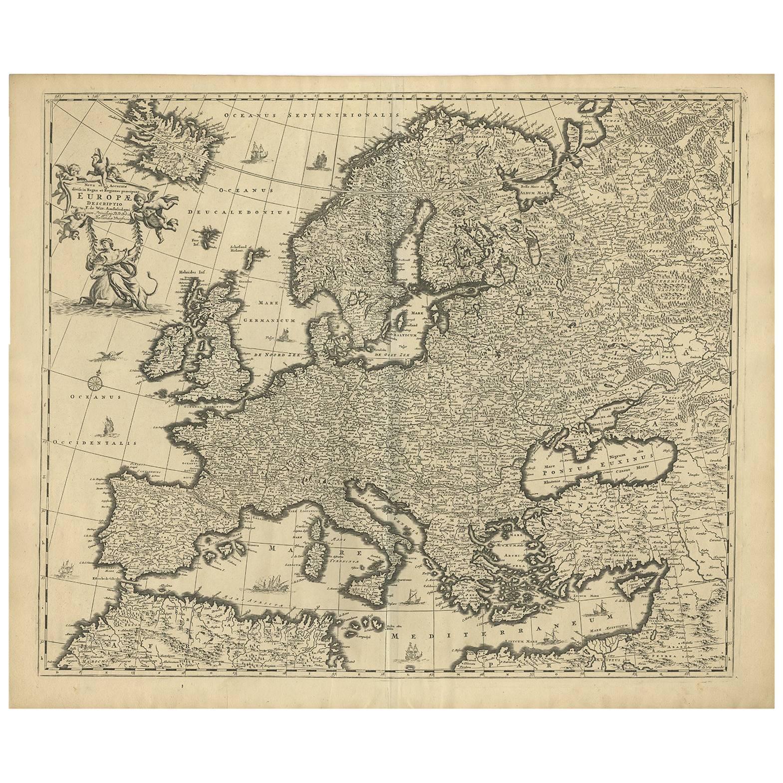
Grand Map of Europe by Frederick de Wit, Circa 1690: A Baroque Era Masterpiece.
Located in Langweer, NL
This is an attractive historical map of Europe created by Frederick de Wit, published around 1690. Here's a detailed description of the map and additional context about its creation:...
Category
Antique Late 17th Century Dutch Maps
Materials
Paper
Antique Map of Europe with Elaborate Title Cartouche, c.1750
Located in Langweer, NL
Antique map of Europe titled 'Europa Secundum legitimas Projectionis Stereographicae regulas et juxta recentissimas observationes aeque ac relationes… - L'Europe, dessinee suivant le...
Category
Antique 18th Century Maps
Materials
Paper
Antique Map of Europe by R. Bonne, 1780
Located in Langweer, NL
A fine example of Rigobert Bonne and Guilleme Raynal’s 1780 map of Europe. Drawn by R. Bonne for G. Raynal’s Atlas de Toutes les Parties Connues du Globe Terrestre, Dressé pour l'His...
Category
Antique Late 18th Century French Maps
Materials
Paper

$150 Sale Price
30% Off
Antique Map of Europe by Hederichs, circa 1740
Located in Langweer, NL
Antique map titled 'Europa Christiani Orbis Domina'. Rare miniature map of Europe. This map originates from 'Anleitung Zu den fürnehmsten Historischen Wissenschaften, Benanntlich Der...
Category
Antique Mid-18th Century Maps
Materials
Paper

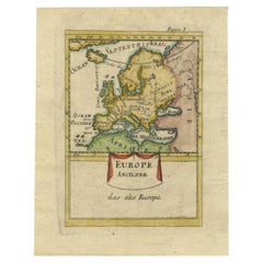
Antique Hand-Coloured Miniature Map of Ancient Europe, c.1685
Located in Langweer, NL
Antique map of Europe titled 'Europe Ancienne, Das alte Europa'. Hand-coloured miniature map with much detail. German subtitle.
Artists and Engravers: Alain Manneson Mallet (1630-...
Category
Antique 17th Century Maps
Materials
Paper
More Ways To Browse
18th Century Colored Engraving
African American Antique
Antique Maps Of North America
Antique Maps Of Britain
Iceland Antique
Icelandic Antique
King George Ii
Milton Glaser Signed
Palm Tree Lithograph
Peter Max Sun
Peter Max Sunrise
Peter Storm
Prints Central Park Harold Altman
Ruth Leaf Etching
Samivel Vintage Posters
Samuel Halpert
Tanna Kasimir Hoernes
The Cycles Of Life Salvador Dali