Items Similar to Windsor, Antique Map from "Civitates Orbis Terrarum"

Want more images or videos?
Request additional images or videos from the seller
Franz HogenbergWindsor, Antique Map from "Civitates Orbis Terrarum"1572-1617
1572-1617
About the Item
Braun G., Hogenberg F., "Vindesorium" or Windsor", from the collection "Civitates Orbis Terrarum", Cologne, T. Graminaeus, 1572-1617. Image Dim: cm 18 x 48 , Dim: cm 20.5 x 54.
Very Fine B/W Aquatint showing a Wonderful View on the Castel of Windsor,( seen from the North side),- today the main residence of English Royal Family.
The “Civitates Orbis Terrarum” (Atlas of Cities of the World) was the second oldest printed atlas in the history of world cartography and the first atlas totally dedicated to topographical views. The first volume of this collection was published in Cologne in 1572; the others following in 1575, 1581, 1588 and 1598. The sixth and final volume appeared in 1617, just before the extensive devastation wreaked by the Thirty Years’War.
“The most original and magnificent of all city-atlases, which drew on the work of accomplished topographical artists; and…reproduced it in pictorial compositions of great charm and individuality”. R.A.Skelton
This artwork is shipped from Italy. Under existing legislation, any artwork in Italy created over 70 years ago by an artist who has died requires a licence for export regardless of the work’s market price. The shipping may require additional handling days to require the licence according to the final destination of the artwork.
- Creator:Franz Hogenberg (1540 - 1590, Flemish)
- Creation Year:1572-1617
- Dimensions:Height: 8.08 in (20.5 cm)Width: 21.26 in (54 cm)Depth: 0.04 in (1 mm)
- Medium:
- Period:
- Condition:Insurance may be requested by customers as additional service, contact us for more information.
- Gallery Location:Roma, IT
- Reference Number:

Franz Hogenberg
Braun and Hogenberg's 'The Civitates Orbis Terrarum' was the second atlas of maps ever published and the first atlas of cities and towns of the world. It is one of the most important books published in the 16th century. Most of the maps in the atlas were engraved by Franz Hogenberg and the text, with its descriptions of the history and additional factual information of the cities, was written by a team of writers and edited by Georg Braun. The work contained 546 bird-eye views and map views of cities and towns from all over the world. It gave graphic representation of the main features of the illustrated cities and towns, including the buildings and streets. Although the ordinary buildings are stylized, the principal buildings are reproduced from actual drawings created on location. The principal landmarks and streets can still be recognized today. In addition, the maps often include the heraldic arms of the city, the nature of the surrounding countryside, the important rivers, streams and harbors, even depicting stone bridges, wooden pontoons, flat-bottomed ferries, ships and working boats, wharves and jetties, as well as land-based activities, including horsemen, pedestrians, wagons, coaches, and palanquins. Small vignettes are often included which illustrate the trade, occupations and habits of the local inhabitants, such as agriculture, paper-making and textiles, as well as local forms of punishment, such as gibbets, wheels, floggings etc. Large figures dressed in their local costume are often presented out of proportion in the foreground. The aim of the authors was to give as much information as possible in a pleasing visual form. They succeeded in creating maps that were both informative and decorative works of art. The atlas is a wonderful glimpse of life in medieval Europe. Georg Braun (1541-1622) was German Catholic cleric who was born and who died in Cologne, Germany. He was the principal editor of 'The Civitates Orbis Terrarum', acquiring the tables, hiring the artists, and composing the texts. Abraham Ortelius, whose Theatrum Orbis Terrarum of 1570 was the first atlas of maps ever published, assisted Braun in his compilation of the details and maps for the atlas. The Civitates was intended as a companion for the Ortellius' Theatrum, as suggested by the similarity in the titles. Braun was the only survivor of the original team to live to see the publication of last volume (VI) in 1617. Franz Hogenberg (1535-1590) was a Flemish and German painter, engraver, and mapmaker. He was born in Mechelen (also known as Malines) in Flanders, the son of an engraver. After being expelled from Antwerp by the Duke of Alva, he moved to London and then eventually to Cologne, Germany, where he met Georg Braun and Abraham Ortellius. He engraved most of the plates for Ortelius's Theatrum and the majority of those in the Civitates. Many believe that he was responsible for originating the Civitates project.
About the Seller
4.9
Platinum Seller
These expertly vetted sellers are 1stDibs' most experienced sellers and are rated highest by our customers.
1stDibs seller since 2017
6,771 sales on 1stDibs
Typical response time: 3 hours
- ShippingRetrieving quote...Ships From: Rome, Italy
- Return PolicyA return for this item may be initiated within 14 days of delivery.
More From This SellerView All
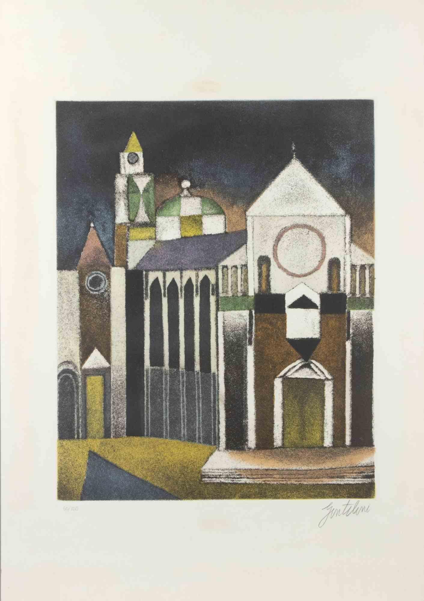
- Cathedral - Etching and Aquatint by Franco Gentilini - 1970sBy Franco GentiliniLocated in Roma, ITEtching and Aquatint. Edition 70/120. 65x45 cm. Excellent condition.Category
1970s Contemporary Figurative Prints
MaterialsAquatint, Etching
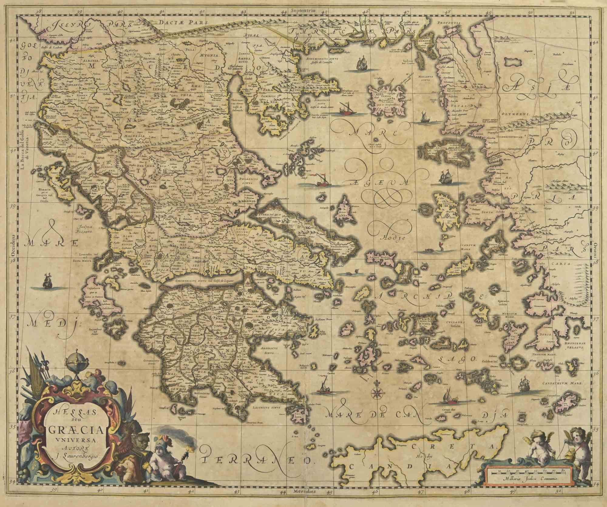
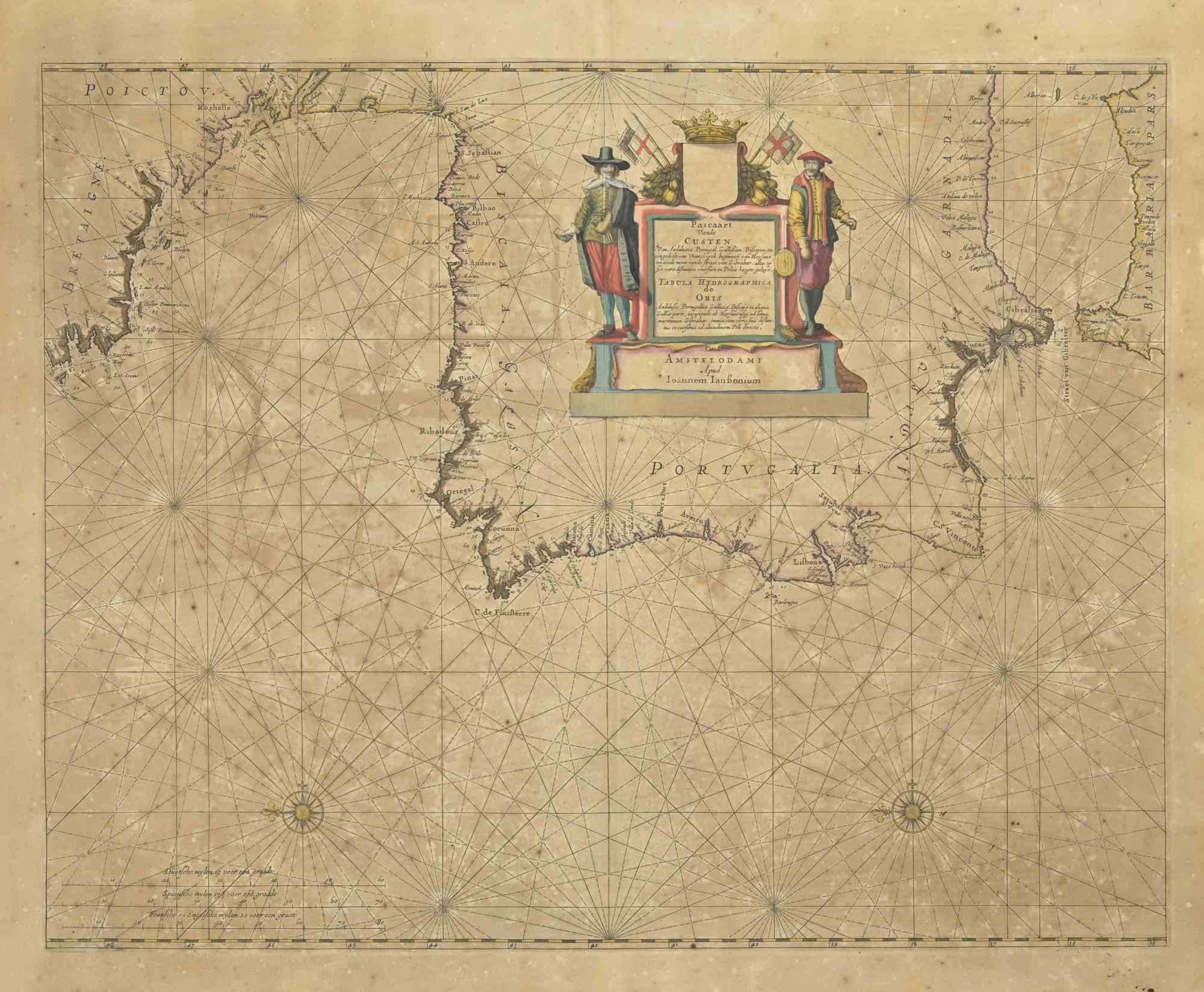
- Antique Map - Map of Greece - Etching by Johannes Janssonius - 1650sBy Johannes JanssoniusLocated in Roma, ITAntique Map of Greece - Graecia Vniversa is an antique map realized in 1650 by Johannes Janssonius (1588-1664). The Map is Hand-colored etching, with coeval watercoloring. Good co...Category
1650s Modern Figurative Prints
MaterialsEtching
- The Nursing - Etching by Eugène Burnand - Late 19th centuryLocated in Roma, ITNursing is an etching realized by Eugène Burnand (1850-1921) in the Late 19th century. Good conditions with foxing. The artwork is realized through s...Category
Late 19th Century Modern Figurative Prints
MaterialsEtching, Engraving
- Antique Map - Gallia - Etching by Johannes Janssonius - 1650sBy Johannes JanssoniusLocated in Roma, ITAntique Map - Gallia is an antique map realized in 1650 by Johannes Janssonius (1588-1664). The Map is Hand-colored etching, with coeval watercoloring. Good conditions with slight ...Category
1650s Modern Figurative Prints
MaterialsEtching
- Death in Venice - Etching by Gianpaolo Berto - 1974By Gianpaolo BertoLocated in Roma, ITDeath in Venice is an artwork realized by Gianpaolo Berto, 1974. Etching, 60 x 50 cm. Edition 28/40, Dated 74' in the lower left part. Very good condition. Gian Paolo Berto w...Category
1970s Contemporary Figurative Prints
MaterialsEtching
- Greenock - Etching by F. W. Topham - 1845Located in Roma, ITGreenock is an etching realized in 1845 by F. W. Topham. Signed on the plate. Titled on the lower center, from the series of "Ports of Great Britain" Good conditions with slight ...Category
1840s Modern Figurative Prints
MaterialsEtching


You May Also Like
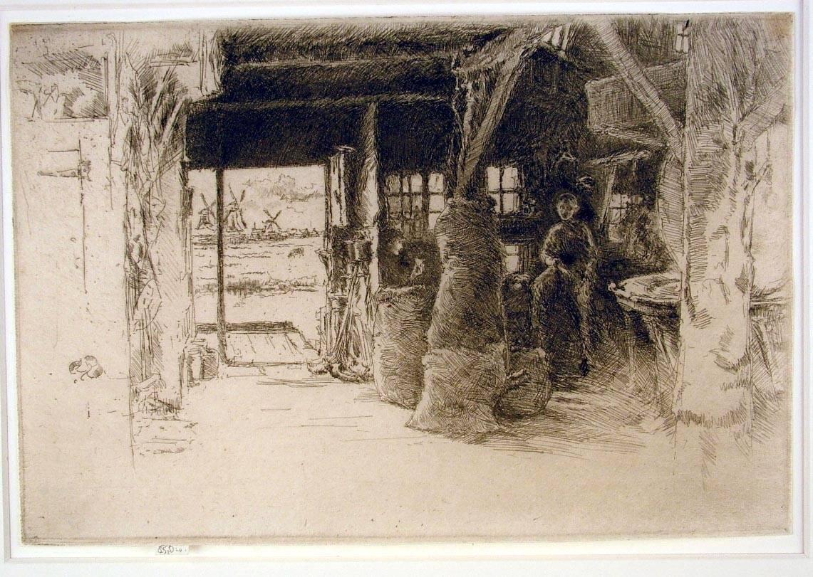
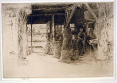
- The Mill, Amsterdam, 1889By James Abbott McNeill WhistlerLocated in New York, NYJames Whistler (1834-1903), The Mill, 1889, etching and drypoint, signed in pencil with the butterfly on the tab and inscribed “imp”, and inscribed “first state” (twice) and annotated “Wunderlich” and signed again with the butterfly verso. Reference: Kennedy 413, first state (of 5). Glasgow 457, second state (of 6; see discussion below) (cf. Margaret F. MacDonald, Grischka Petri, Meg Hausberg, and Joanna Meacock, James McNeill Whistler: The Etchings, a catalogue raisonné, University of Glasgow, 2011) On laid paper, in very good condition, trimmed just outside of the platemark all around except for the tab by the artist, 6 1/4 x 9 3/8 inches. A very fine impression of this great rarity, printed in black/brown ink with a slight veil of plate tone. provenance: H. Wunderlich & Co., New York Louis B. Dailey, New York (Lugt 4500) sale, Sotheby’s, New York, October 31, 2003, lot 69 literature; Neue Lagerliste 122: James McNeill Whistler – Etchings...Category
1880s Impressionist Landscape Prints
MaterialsDrypoint, Etching
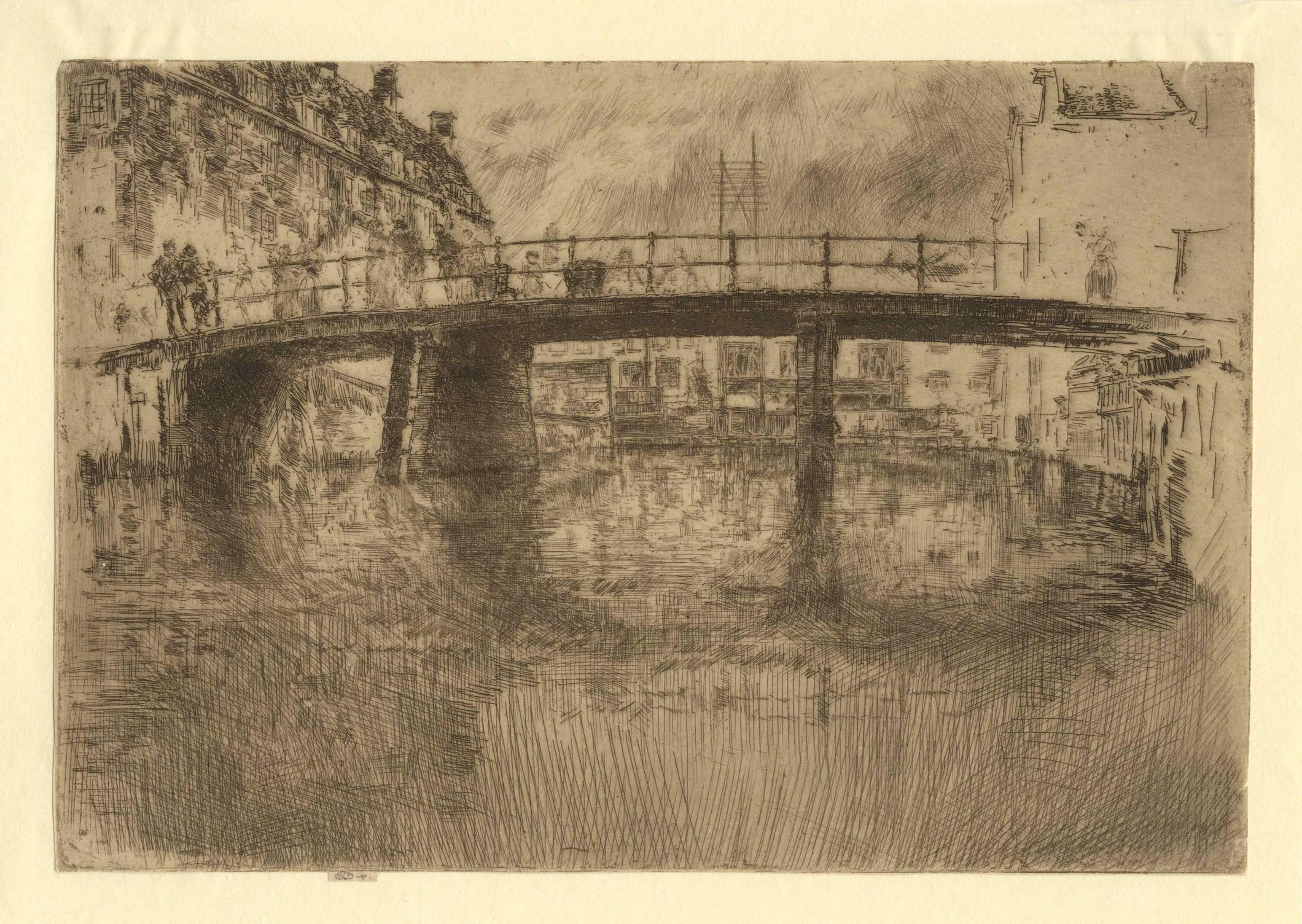
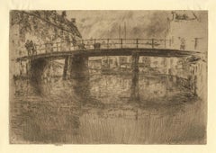
- Bridge, AmsterdamBy James Abbott McNeill WhistlerLocated in New York, NYJames McNeill Whistler (1834-1903), Bridge, Amsterdam, etching, 1889, printed in brown ink on thin laid paper, signed with the butterfly on the tab and annotated “imp”, also signed with the butterfly on the verso and numbered 11. References: Kennedy 409, Glasgow 447, fifth state (of 5). In very good condition (slight nicks at edges), trimmed by the artist on the plate mark apart from the tab, 6 1/2 x 9 1/2 inches. Provenance: Vivian and Meyer P. Potamkin, Philadelphia; sale, Sotheby’s, New York, May 11, 1989, lot 302 Samuel Josefowitz, Pully, Switzerland A very fine, shimmering impression of this great rarity. This impression is included in the Glasgow inventory, ID number K4090301; only about 11 lifetime impressions in all states are known (three were also printed posthumously by Nathaniel Sparks...Category
1880s Impressionist Landscape Prints
MaterialsEtching
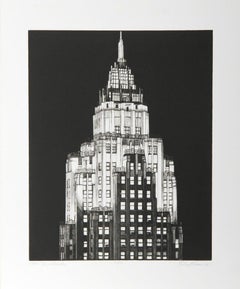
- City Service Building (70 Pine Street, Manhattan)By Richard HaasLocated in New York, NYRichard Haas City Service Building (70 Pine Street, Manhattan), 2005 Etching Signed, titled, dated and numbered 7/20 in pencil on the front 20 × 16 inches Unframed Rare print by Rich...Category
Early 2000s Realist Landscape Prints
MaterialsEtching, Pencil
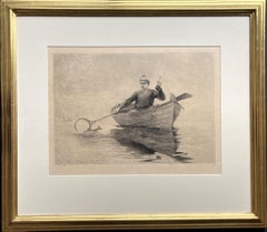
- Fly Fishing, Saranac LakeBy Winslow HomerLocated in Storrs, CTFly Fishing, Saranac Lake. 1889. Etching, aquatint and burnishing. Goodrich 104. 14 1/4 x 20 5/8; sheet 18 1/2 x 24 1/2. Edition unknown but quite possibly intended 100; highest numb...Category
Late 19th Century American Modern Figurative Prints
MaterialsEtching
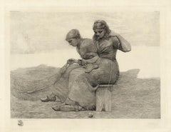
- Mending the TearsBy Winslow HomerLocated in New York, NYWinslow Homer created this etching entitled “MENDING THE TEARS” in 1888. This is a lifetime impression signed by Homer and printed by the famous New York etcher George W. H. Ritchie...Category
1880s American Impressionist Figurative Prints
MaterialsEtching
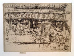
- J.H. Woods’ Fruit Shop, ChelseaBy James Abbott McNeill WhistlerLocated in New York, NYJames Whistler (1834-1903), J.H. Woods’ Fruit Shop, Chelsea, etching and drypoint, 1887-88. Signed with the butterfly on the tab and annotated “imp,” also signed with the butterfly in pencil verso and numbered “1”. References: Kennedy 265 second state (of 2), Glasgow 327 second state (of 4). Trimmed by the artist around the plate mark except for the tab, in excellent condition. Printed in black ink on ivory laid paper, 3 3/4 x 5 1/8 inches. A fine impression of this great rarity; the print was never published. Glasgow accounts for four impressions. watermark: partial arms of Amsterdam(cf. Spink/Stratis/Tedeschi, watermark nos. 12ff.) This is before the third state in which heavy shading was added around the woman at the center, and the heads of figures at right and left of the figure are defined. In Glasgow’s fourth state the shading and the figure were removed; no impression is known of this state, but the state is inferred from the cancelled plate. According to Glasgow “Joseph Henry Wood had a greengrocer’s shop at 1 Park Walk...Category
1880s Impressionist Landscape Prints
MaterialsEtching, Drypoint
Recently Viewed
View AllMore Ways To Browse
16th Century English
Antique Charms W
Maps War
War Map
16th Century English Antique
Map Etching
Windsor Antiques
Map Of Days
Pictorial Map
Terrarum Orbis
Antique War Maps
Original Etchings Map
Antique Topographic Maps
Antique War Map
Original Etching 16th Century
Frans Hogenberg On Sale
South Coast Tiffany
Tiffany Studios Clothing