War Map
5
to
78
583
434
499
328
235
187
116
104
98
80
77
74
71
63
61
58
58
45
34
31
28
28
22
22
21
21
18
14
14
13
12
12
11
11
8
8
7
6
5
4
4
4
3
3
3
3
3
2
2
2
1
1
1
1
1
1
1
66
42
42
33
16
Sort By
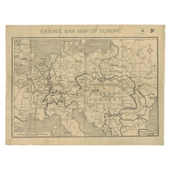
Eason's War Map of Europe, circa 1914
Located in Langweer, NL
Antique map titled 'Eason's War Map of Europe'. Printed in Ireland. Source unknown, to be
Category
20th Century Maps
Materials
Paper
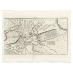
Antique War Map of the Region of Mons 'Bergen', Belgium, circa 1810
Located in Langweer, NL
Antique print titled 'Plate DLIV War'. Old print depicting a war map of the region of Mons (Bergen
Category
Antique 19th Century Prints
Materials
Paper
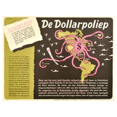
Original Vintage WWII Poster De Dollarpoliep The US Dollar Polyp Octopus War Map
Located in London, GB
Original vintage anti-American imperialism World War Two political propaganda poster - De
Category
Vintage 1940s Dutch Posters
Materials
Paper
H 17.72 in W 23.23 in D 0.04 in
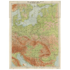
Antique European War Folding Map, ‘circa 1915’
Located in Langweer, NL
Antique folding map of the European War (1914-1915) titled 'The Eastern Campaign '. From Petrograd
Category
Early 20th Century Maps
Materials
Paper
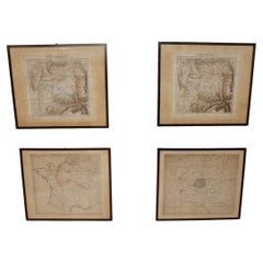
Set of 4 Antique Geographical Maps French-German War 1870-71
Located in Casale Monferrato, IT
Elegant late 19th century set of four antique geographical maps relating to the positioning of the
Category
Antique 1890s Italian Maps
Materials
Paper
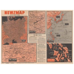
Antique Map of the War Situation in Europe and Asia, 1944
Located in Langweer, NL
, measuring nearly 4 feet by 3 feet, includes five inset maps of the war situation in both Europe and Asia
Category
20th Century Maps
Materials
Paper
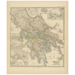
Original Antique Map of Greece and Epirus after the Persian Wars, Published 1880
Located in Langweer, NL
makes this map interesting:
1. **Historical Context**: The period after the Persian Wars was pivotal
Category
Antique 1880s Maps
Materials
Paper
Free Shipping
H 18.51 in W 15.56 in D 0 in
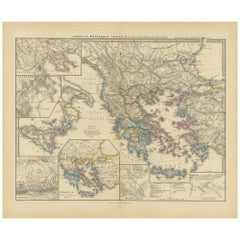
Map of Greece, Macedonia, Thrace from the time of the Peloponnesian War, 1880
Located in Langweer, NL
The map titled "GRAECIA, MACEDONIA, THRACIA et inde a bello Peloponnesiaco tempore," translates to
Category
Antique 1880s Maps
Materials
Paper
No Reserve
H 15.56 in W 18.51 in D 0 in
Old Map Showing Info Related to the Ottoman Wars including Conflict Dates, c1690
Located in Langweer, NL
& White
This is the northwestern sheet of Coronelli's six-sheet map following the course of the Danube
Category
Antique 1690s Maps
Materials
Paper
H 24.02 in W 17.8 in D 0 in
Mediterranean Encounters: From the Punic Wars to the Hannibalic War, 1880
Located in Langweer, NL
The map, with the title "MARE INTERNUM cum populis adiacentibus a bello Hannibalico usque ad
Category
Antique 1880s Maps
Materials
Paper
Free Shipping
H 15.56 in W 18.51 in D 0 in
1854 Map of Massachusetts, Connecticut and Rhode Island, Antique Wall Map
Located in Colorado Springs, CO
This striking wall map was published in 1854 by Ensign, Bridgman & Fanning and has both full
Category
Antique 19th Century American Maps
Materials
Paper
H 38.13 in W 45 in D 3.5 in
Civil War Panorama of the Seat of War by John Bachmann, Antique Print circa 1864
Located in Colorado Springs, CO
theaters of War" (Stephenson & McKee Virginia in Maps p.239). This view, taken from the apparent vantage
Category
Antique 1860s American Maps
Materials
Paper
H 33.5 in W 41.5 in D 2 in
Decorative Antique Map of Central Asia
Located in Langweer, NL
Antique map titled 'Carte de la Tartarie Indépendante (..)'. Decorative map of Central Asia
Category
Antique Late 18th Century Maps
Materials
Paper
A Decorative Detailed Map of the Crimea, with an Inset Map of Sebastopol, c 1851
Located in Langweer, NL
(London: London Publishing Co, 1858). This map was published at the time of the Crimean War with the main
Category
Antique 1850s Maps
Materials
Paper
H 10.83 in W 14.18 in D 0 in
Antique Map of the Coromandel Peninsula, 1754
Located in Langweer, NL
Antique map titled 'A map of Coromandel shewing the Seat of War on that coast'. Rare map of
Category
Antique 18th Century Maps
Materials
Paper
1814 Map of "Russian Empire" Ric.r032
Located in Norton, MA
1814 Map of
"Russian Empire"
Ric.r032
Russian Empire. Description: This is an 1814 John
Category
Antique 19th Century Unknown Maps
Materials
Paper
Curaçao map - C. van Baarsel en zoon
Located in UTRECHT, UT
working as an independent engraver and specialized mainly in engraving maps. His studio was probably
Category
Antique 1810s Dutch Other Maps
Materials
Paper
Antique County Map of Leicestershire, England, 1804
Located in Langweer, NL
Antique county map of Leicestershire first published c.1800. Villages, towns, and cities
Category
Antique Early 1800s Maps
Materials
Paper
Antique Map of Stavoren by Priorato, 1673
Located in Langweer, NL
Antique map titled 'Staveren'. Original antique map of the city of Stavoren, Friesland, the
Category
Antique 17th Century Maps
Materials
Paper
Antique Map of Stavoren by Priorato, 1673
Located in Langweer, NL
Antique map titled 'Staveren'. Original antique map of the city of Stavoren, Friesland, the
Category
Antique 17th Century Maps
Materials
Paper
Antique Decorative Coloured Map of North America, 1882
Located in Langweer, NL
This original antique map of North America is from the Blackie & Son Atlas published in 1882. Here
Category
Antique 1880s Maps
Materials
Paper
Antique Map of the North Sea and Dunkirk
Located in Langweer, NL
Untitled map of the North Sea, top left a large compass rose, bottom right Dunkirk (Duinkerke
Category
Antique Early 18th Century Maps
Materials
Paper
Antique Map of Juan Fernandez, Chile, c.1740
Located in Langweer, NL
Antique map titled 'l'Ile de Juan Fernandes dans la Mer du Sud (..)'.
This map depicts Juan
Category
Antique 18th Century Maps
Materials
Paper
Antique Decorative County Map of Lincolnshire, England, 1804
Located in Langweer, NL
Antique county map of Lincolnshire first published circa 1800 Cities illustrated include Grantham
Category
Antique Early 1800s Maps
Materials
Paper
Antique Decorative County Map of Huntingdonshire, England, 1804
Located in Langweer, NL
Antique county map of Huntingdonshire first published c.1800. Cities illustrated include Kimbolton
Category
Antique Early 1800s Maps
Materials
Paper
No Reserve
H 25.2 in W 21.26 in D 0 in
French Geographical, Statistical and Historical Map of Pensylvania, 1825
Located in Langweer, NL
1825 French Map of Pennsylvania, with a List of Prominent Rivers, Descriptions of Mountains, Climate
Category
Antique 1820s Maps
Materials
Paper
H 20.08 in W 25.99 in D 0 in
Antique Map of Fortification of Bellingwolderschans, The Netherlands, 1673
Located in Langweer, NL
Antique map titled 'Bellingwolderschans'. Original map of the fortification of Bellingwolderschans
Category
Antique 17th Century Maps
Materials
Paper
H 13.39 in W 9.45 in D 0 in
Antique Map of the Eastern Mediterranean and the Balkans
Located in Langweer, NL
Antique map titled 'La Turquie d'Europe et celle d'Asie'. Attractive double page map of the Eastern
Category
Antique Late 18th Century Maps
Materials
Paper
1865 "Johnson's Nebraska, Dakota, Colorado, Idaho & Kansas" Map, Johnson & Ward
Located in Colorado Springs, CO
timely snapshot of the United States just after the Civil War. In addition to the maps, the atlas had
Category
Antique Mid-19th Century Maps
Materials
Paper
H 18.5 in W 21.38 in D 0.75 in
1865 "Johnson's Missouri and Kansas" Map by Johnson and Ward
Located in Colorado Springs, CO
after the Civil War. In addition to the maps, the atlas had several pages of American history, recent
Category
Antique Mid-19th Century Maps
Materials
Paper
Antique Map of the French Coast at Boulogne and Picardy
Located in Langweer, NL
Antique map titled 'Les Costes du Boulenois et de la Picardie'. Map of the French coast at Boulogne
Category
Antique Early 18th Century Maps
Materials
Paper
1865 "Johnson's California, Utah, Nevada, Colorado, New Mexico, Arizona" Map
Located in Colorado Springs, CO
timely snapshot of the United States just after the Civil War. In addition to the maps, the atlas had
Category
Antique Mid-19th Century Maps
Materials
Paper
H 22.5 in W 30.5 in D 0.75 in
Antique Map of Southern Brazil by Bonne, c.1780
Located in Langweer, NL
"Antique map titled 'Carte de la Partie Méridionale du Bresil (..)'. This antique map of Brazil
Category
Antique 18th Century Maps
Materials
Paper
Antique Decorative Coloured Map of South Africa and Madagascar, 1882
Located in Langweer, NL
The map of South Africa is from the Blackie & Son Atlas, published in 1882. This historical map is
Category
Antique 1880s Maps
Materials
Paper
Free Shipping
H 14.97 in W 22.45 in D 0 in
Antique Map of Juan Fernandez Island, Chile, c.1750
Located in Langweer, NL
Antique map titled 'Plan de la Côte du N.E. de l 'Ile de Juan Fernandes'.
Map of the northeast
Category
Antique 18th Century Maps
Materials
Paper
Antique Map of South America by G. Anson, 1749
Located in Langweer, NL
Antique map titled 'Kaart van het Zuidelykste Gedeelte van Zuider Amerika (..) - Carte de la Partie
Category
Antique Mid-18th Century Dutch Maps
Materials
Paper
1866 Ensign & Bridgman's Rail Road Map of the United States
Located in Colorado Springs, CO
, just after the end of the Civil War. Starting on the eastern coast, the map extends to the western
Category
Antique 1860s American Late Victorian Maps
Materials
Paper
Antique Map of The United States of North America, 1882
Located in Langweer, NL
This is a historical map titled "The United States of North America, Central Part" from the 1882
Category
Antique 1880s Maps
Materials
Paper
Copper Engraved Grenada Map by John Thompson Published in 1810
Located in Langweer, NL
John Thomson's original antique map of Grenada, dating back to 1810 and hailing from Edinburgh
Category
Antique Early 19th Century Maps
Materials
Paper
Antique Map of the Siege of Gent by Dumont, 1729
By Dumont
Located in Langweer, NL
Antique map titled 'Plan of the Siege and Attacks of the City and Citadel of Ghent'. Large map
Category
Antique 18th Century Maps
Materials
Paper
Antique Map of the City of Oldenzaal by Orlers, 1615
Located in Langweer, NL
Antique map depicting the Siege of Oldenzaal, the Netherlands. The Siege of Oldenzaal was a short
Category
Antique 17th Century Maps
Materials
Paper
Antique Map of Coiba Island, Panama, South America, C.1740
Located in Langweer, NL
Antique map titled 'Plan de la partie orientale de l'Isle de Quibo'. Map of the eastside of Coiba
Category
Antique 18th Century Maps
Materials
Paper
Black Sea in Antiquity: Pontus Euxinus Map, Published in 1880
Located in Langweer, NL
This map, titled "PONTUS EUXINUS," depicts the Black Sea region, historically known as the Pontus
Category
Antique 1880s Maps
Materials
Paper
Free Shipping
H 15.56 in W 18.51 in D 0 in
Antique Map of the City of Leeuwarden by Priorato, 1673
Located in Langweer, NL
Antique map titled 'Leverden'. This map depicts the city of Leeuwarden (Friesland, The Netherlands
Category
Antique 17th Century Maps
Materials
Paper
Antique Decorative and Detailed County Map of Cumberland, England, 1804
Located in Langweer, NL
Antique county map of Cumberland first published c.1800. Villages, towns, and cities illustrated
Category
Antique Early 1800s Maps
Materials
Paper
Cortesi's Masterpiece: A Comprehensive and Authoritative Map of Uruguay, 1903
Located in Langweer, NL
of the great civil war, La Guerra Grande (1839-51). In 1903, the year the map was issued, José Batlle
Category
Early 20th Century Maps
Materials
Paper
Free Shipping
H 72.84 in W 50.79 in D 0.02 in
The World After the Battle of Corupedium: Hellenistic Kingdoms Map, 1880
Located in Langweer, NL
The map is titled "ORBIS TERRARUM post proelium Corupedinse," which translates to "The World after
Category
Antique 1880s Maps
Materials
Paper
Free Shipping
H 15.56 in W 18.51 in D 0 in
New Map of North America from the Latest Discoveries, 1763
Located in Philadelphia, PA
A fine antique 18th century map of the North American seaboard.
Entitled "A New Map of North
Category
Antique Mid-18th Century English Georgian Maps
Materials
Paper
Rare Large Etching of a Market of War Horses, Ca.1720
Located in Langweer, NL
Huchtenburg, J. van (1647-1733).
Impressive rare large etching of a 'War-" Horse-market. - This
Category
Antique 1720s Maps
Antique Map of the City of Alkmaar by Priorato, 1673
Located in Langweer, NL
Antique map titled 'Alcmaer'. Original map of the city of Alkmaar, the Netherlands. This map
Category
Antique 17th Century Maps
Materials
Paper
Antique Map of Juan Fernandez Island by Anson, c.1740
Located in Langweer, NL
Antique map titled 'Plan de la Côte du N.E. de l 'Ile de Juan Fernandes'.
Map of the northeast
Category
Antique 18th Century Maps
Materials
Paper
Plan of Hulst with its Forts and Outworks, Holland, War of Spanish Succession
Located in Langweer, NL
Antique map titled 'Plan of Hulst with its Forts and Outworks (..)' Plan of Hulst with its Forts
Category
Antique 18th Century Maps
Materials
Paper
H 14.57 in W 18.12 in D 0 in
Antique Map of the Coast of Acapulco by Anson, c.1740
Located in Langweer, NL
during the Seven Years' War.
We sell original antique maps to collectors, historians, educators and
Category
Antique 18th Century Maps
Materials
Paper
Antique Map of Fort Saint Louis and Santiago de Cuba, 1748
Located in Langweer, NL
Antique map titled 'A plan of the town, fort and harbour of St Louis in the Isle of Hispaniola, or
Category
Antique 18th Century Maps
Materials
Paper
Antique Map of the region near Annesley Bay by Wagner, 1870
Located in Langweer, NL
Antique print titled 'Map of the Country between Annesley Bay and Senafe'. Map of the region near
Category
Antique Mid-19th Century Maps
Materials
Paper
Antique Map of The Siege of Gennep, the Netherlands, c.1650
Located in Langweer, NL
Antique map titled 'Belagerung des Besten Schloss und Passes Gennep'. Old map of the Siege of
Category
Antique 17th Century Maps
Materials
Paper
Antique Map of Bohemia in the Present-Day Chech Repubic, 1730
Located in Langweer, NL
Antique map titled 'Nieuwe Kaart van t Koninkryk Bohemen t Hertogdom Silesien markgraafschap
Category
Antique 18th Century Maps
Materials
Paper
1847 Ornamental Map of the United States & Mexico by H. Phelps
Located in Colorado Springs, CO
Offered is an original 1847 ornamental map of the U.S. entitled "Ornamental Map of the United
Category
Antique 1840s American Maps
Materials
Paper
Antique Map of the Orange River Colony in South Africa, 1901
Located in Langweer, NL
Antique map titled 'Orange River Colony, northern part'. Lithograph of the northern part of the
Category
Early 20th Century Maps
Materials
Paper
1840 Map of the City of Washington Published by William M. Morrison
Located in Colorado Springs, CO
This map, printed in 1840, is a detailed representation of Washington, D.C. in the mid-19th century
Category
Antique 1840s American Federal Maps
Materials
Paper
- 1
- ...
Get Updated with New Arrivals
Save "War Map", and we’ll notify you when there are new listings in this category.
War Map For Sale on 1stDibs
Choose from an assortment of styles, material and more with respect to the war map you’re looking for at 1stDibs. A war map — often made from paper — can elevate any home. There are many kinds of the war map you’re looking for, from those produced as long ago as the 18th Century to those made as recently as the 20th Century. A well-made war map has long been a part of the offerings for many furniture designers and manufacturers, but those produced by Leslie MacDonald Gill are consistently popular.
How Much is a War Map?
A war map can differ in price owing to various characteristics — the average selling price 1stDibs is $1,393, while the lowest priced sells for $396 and the highest can go for as much as $7,800.
More Ways To Browse
Cortez Table
Pacific Iron Works
Original Cambridge Railway Poster
George Sherman
Serbia Antique Map
Danville Used Furniture
Antique Map Argentina
G Plan 62
Antique Map Of Argentina
Antique Minnesota Map
Thomas H Lee
Spanish Bullfight Poster
Antique Navigational Tools
Antique Navigation Tools
Antique Maps Rhode Island
Arthur Leipzig
Colonial Mfg
Lane Drum
