Items Similar to St. Christophe (St. Kitts): Bellin 18th Century Hand Colored Map
Want more images or videos?
Request additional images or videos from the seller
1 of 11
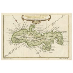
Jacques Nicolas BellinSt. Christophe (St. Kitts): Bellin 18th Century Hand Colored Map1746
1746
$460
$57520% Off
£351.72
£439.6620% Off
€402.90
€503.6320% Off
CA$648.79
CA$810.9820% Off
A$706.13
A$882.6620% Off
CHF 377.33
CHF 471.6620% Off
MX$8,527.33
MX$10,659.1720% Off
NOK 4,742.11
NOK 5,927.6420% Off
SEK 4,410.71
SEK 5,513.3920% Off
DKK 3,009.87
DKK 3,762.3420% Off
About the Item
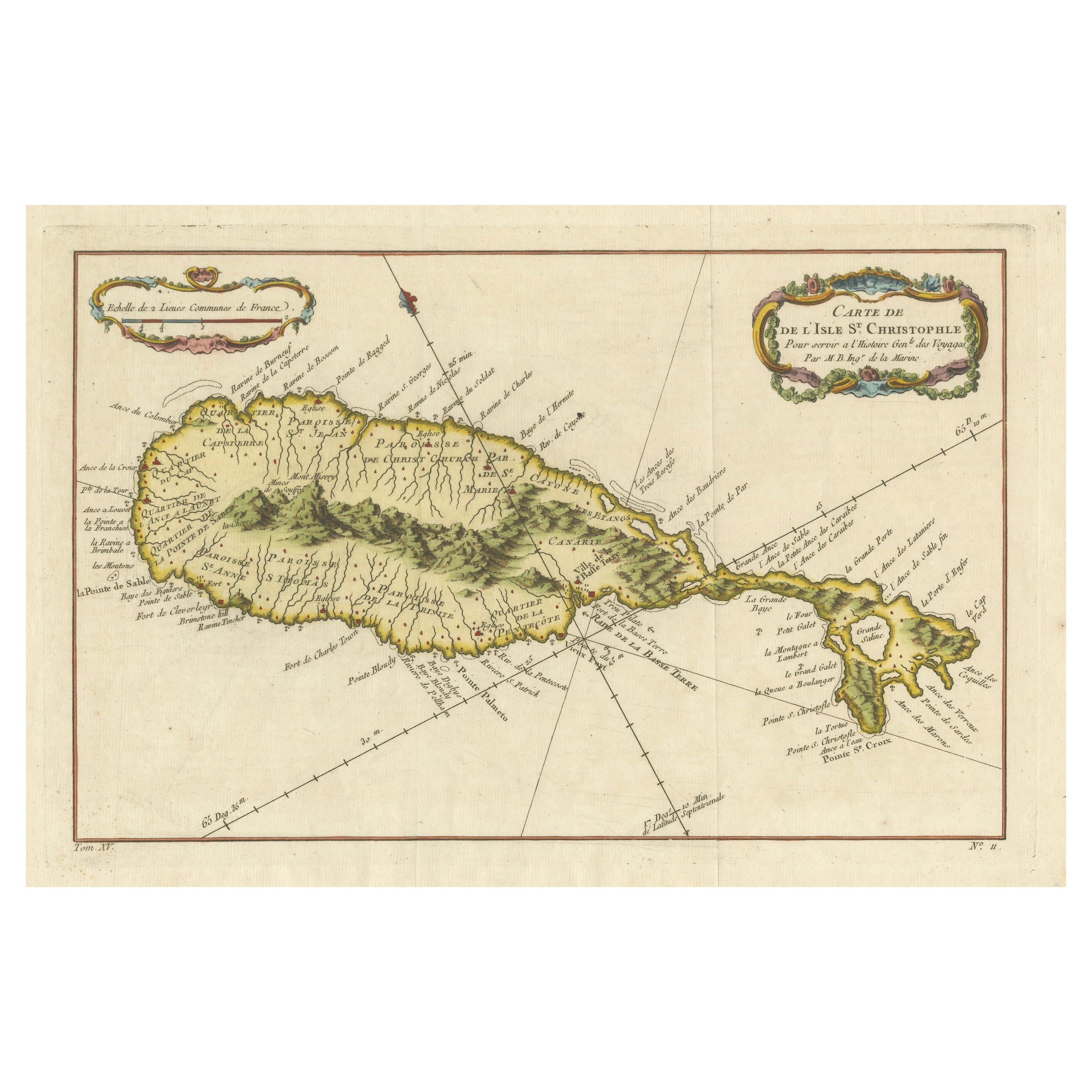
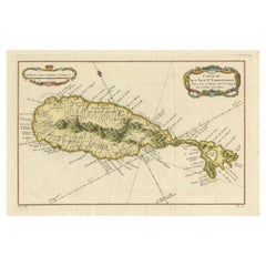
Jacques Bellin's copper-plate map of the Caribbean island of Saint Kitts entitled "Carte De De l'Isle St. Christophe Pour servir á l'Histoire Genle. des Voyages Par M. B. Ingr. de la Marine", published in Paris in Prevost's "L'Histoire Generale des Voyages".
The West Indies island of Saint Kitts was known in the 15th century as "San Cristóbal", as it was discovered by Christopher Columbus during his second voyage in 1493 and he named it in his own honor. It was called St. Christophe in the 18th century and later became St. Kitts. It is part of the arc of the Windward Islands, in the Lesser Antilles. It lies east of Puerto Rico, while Nevis is located to the south-east and the Dutch island of St. Eustatius is to the north-west. It was originally colonized by France and England, and to a lesser extent, the Netherlands. It is the largest island the federation it currently forms with Nevis, forming the State of St. Kitts and Nevis.
The map is printed on laid, chain-linked, watermarked paper. There are wide margins all around, particularly the right and lower margins, and two vertical folds, as issued. There is mild irregularity of the left edge and a few small spots, but the map is otherwise in excellent condition.
Two other Bellin maps are available on 1stDibs, including an unframed map of the southwest portion of Africa, "Partie de la Coste de Guinee" (Coast of Guinea, Sierra Leone, Africa), Reference # LU117328585822 and a map of St. Lucie framed in lucite, Reference: LU117324370471. These maps would make a striking display grouping. A discount is available for the purchase of two or more maps.
The map was prepared by Jacques Nicolas Bellin (1703–1772), who was one of the most important cartographers of the 18th century. He served for a number of years as map and chart maker, as well hydrographer to the King of France.
- Creator:Jacques Nicolas Bellin (1703 - 1772)
- Creation Year:1746
- Dimensions:Height: 10 in (25.4 cm)Width: 14.25 in (36.2 cm)
- Medium:
- Period:1740-1749
- Framing:Framing Options Available
- Condition:
- Gallery Location:Alamo, CA
- Reference Number:Seller: # 46151stDibs: LU117328585712
About the Seller
5.0
Platinum Seller
Premium sellers with a 4.7+ rating and 24-hour response times
Established in 2011
1stDibs seller since 2019
298 sales on 1stDibs
Typical response time: 1 hour
- ShippingRetrieving quote...Shipping from: Alamo, CA
- Return Policy
More From This Seller
View AllCaptain Cook's Exploration of Tahiti: 18th C. Hand-colored Map by Bellin
By Jacques-Nicolas Bellin
Located in Alamo, CA
This beautiful 18th century hand-colored copper plate engraved map is entitled "Carte de l'Isle de Taiti, par le Lieutenant J. Cook" was created by Jacques Nicolas Bellin and publish...
Category
Late 18th Century Landscape Prints
Materials
Engraving

Bermuda: An Early 17th Century Hand-colored Map by Henricus Hondius
By Henricus Hondius
Located in Alamo, CA
This attractive and interesting map of Bermuda by Henricus Hondius in 1633 is entitled "Mappa Aestivarum Insularum, Alias Barmudas". It is based on a ...
Category
Early 17th Century Old Masters Landscape Prints
Materials
Engraving

California: 18th Century Hand-colored Map by de Vaugondy
By Didier Robert de Vaugondy
Located in Alamo, CA
This is an 18th century hand-colored map of the western portions of North America entitled "Carte de la Californie et des Pays Nord-Ouest separés de l'Asie par le détroit d'Anian, ex...
Category
1770s Landscape Prints
Materials
Engraving

$700 Sale Price
20% Off
West Africa: 18th Century Hand-colored Homann Map Entitled "Guinea Propria"
By Johann Baptist Homann
Located in Alamo, CA
This is a scarce richly hand colored copper plate engraved map of Africa entitled "Guinea Propria, nec non Nigritiae vel Terrae Nigrorum Maxima Pars" by Johann Baptist Homann (1664-1...
Category
1740s Other Art Style Prints and Multiples
Materials
Engraving

West Coast of Africa; Guinea & Sierra Leone: Bellin 18th Century Map
Located in Alamo, CA
This is a Jacques Bellin copper-plate map entitled "Partie de la Coste de Guinee Dupuis la Riviere de Sierra Leona Jusquau Cap das Palmas", depicting the coast of Guinea and Sierra L...
Category
1740s Old Masters Landscape Prints
Materials
Engraving

Southern Greece: A Large 17th Century Hand-colored Map By Sanson and Jaillot
By Nicholas Sanson d'Abbeville
Located in Alamo, CA
This large original hand-colored copperplate engraved map of southern Greece and the Pelopponese Peninsula entitled "La Moree Et Les Isles De Zante, Cefalonie, Ste. Marie, Cerigo & C...
Category
1690s Landscape Prints
Materials
Engraving

You May Also Like
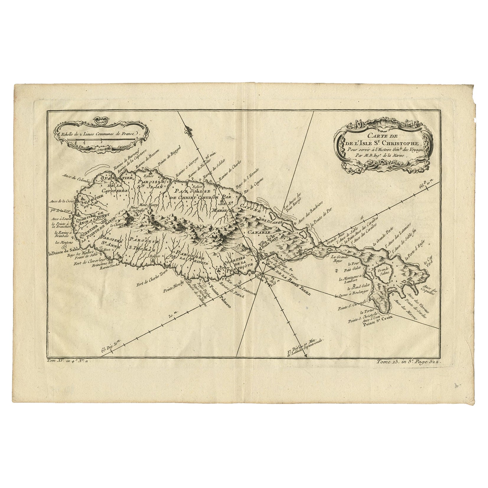
1758 Map of Saint Kitts – St. Christophe, Antique French Engraving
Located in Langweer, NL
Map of Saint Kitts (St. Christophe), circa 1758
This is an antique French map titled *Carte de l'Isle St. Christophe*, engraved by Jacques-Nicolas Bellin and published around 1758 f...
Category
Antique Mid-18th Century French Maps
Materials
Paper
Antique Map of the Caribbean Island of St Kitts, ca.1750
Located in Langweer, NL
Description: Antique map titled 'Carte de l'Isle St. Christophe pour Servir a l'Histoire Genle. des Voyages.'
Detailed map of the Island of St. Kitts, showing the Parishes, towns, ...
Category
Antique 1750s Maps
Materials
Paper
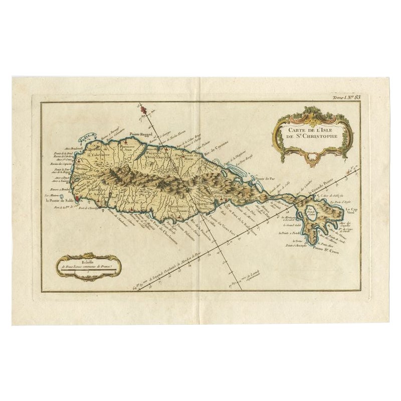
Old Map of the island of Saint Christopher or St. Kitts in the Caribbean, c.1765
Located in Langweer, NL
Antique map titled 'Carte de l'Isle de Saint-Christophe'.
A detailed map of the island of Saint Christopher or St. Kitts showing mountain ranges, port towns and parishes. This map ...
Category
Antique 18th Century Maps
Materials
Paper

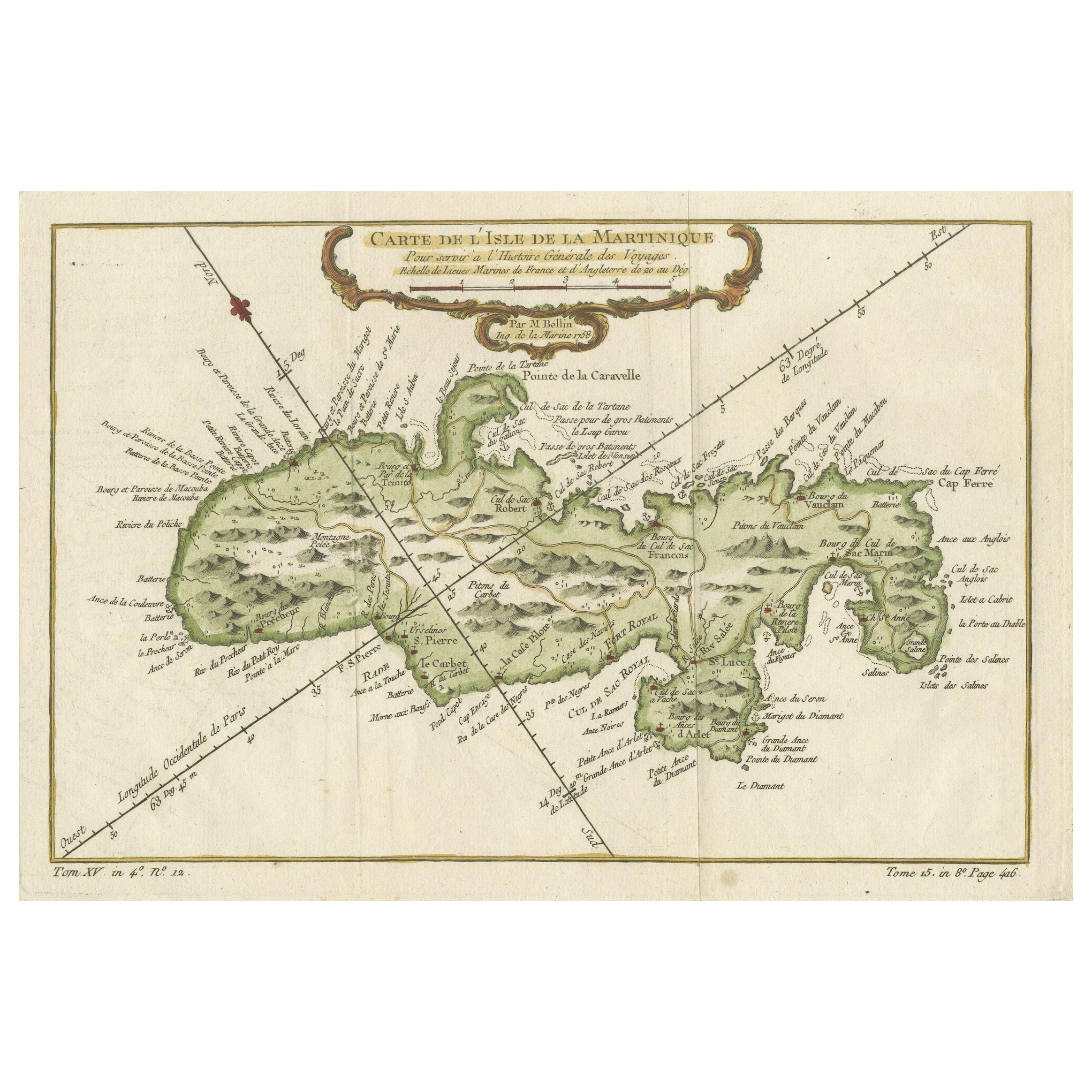
Martinique Island in the Caribbean by Bellin Original Original Antique Map, 1780
Located in Langweer, NL
This mid-18th century map, "Carte de l'Isle de la Martinique pour servir a l'historie generale des voyages," was issued in 1780 by M. Bellin in Paris. It presents a detailed and visually captivating depiction of the Island of Martinique within the context of the Caribbean and the Lesser Antilles.
**Title:** Carte de l'Isle de la Martinique pour servir a l'historie generale des voyages
**Issuer:** M. Bellin
**Date:** 1780
**Location Coverage:** North America, Caribbean, Martinique, Lesser Antilles
This engraved map is notable for its pleasing aesthetics, featuring lovely hand coloring that enhances its visual appeal. The inclusion of a scroll cartouche, an ornamental frame, and measurement lines adds a distinctive and visually appealing quality to the map.
Martinique, situated within the Lesser Antilles in the Caribbean, is presented with meticulous detail, showcasing geographical features, coastlines, settlements, and other notable landmarks. Bellin, known for his accuracy in cartography, crafted this map to serve as a geographical reference within the broader context of historical voyages and exploration.
The combination of detailed cartographic information and artistic embellishments, such as hand coloring and decorative elements, makes this map not only a valuable geographical document but also a visually pleasing piece of cartographic art...
Category
Antique Late 18th Century Maps
Materials
Paper
$266 Sale Price
20% Off
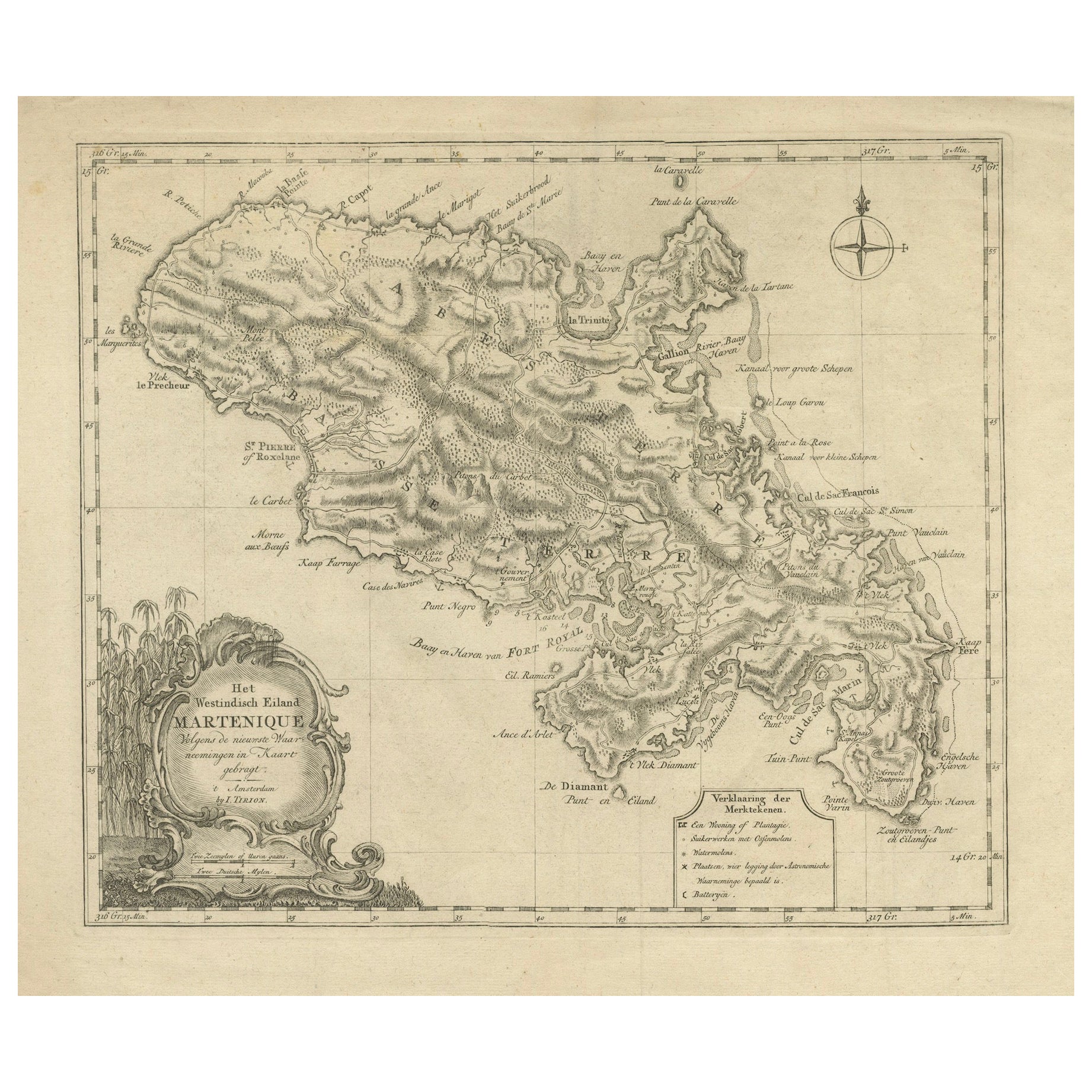
18th Century Original Dutch Map of Martinique in The West Indies by Isaak Tirion
Located in Langweer, NL
This is an 18th-century Dutch map of Martinique, titled *Het Westindisch Eiland Martinique*. The map was produced by Isaak Tirion, a renowned Dutch cartographer and publisher known for his precise and beautifully crafted maps. The cartouche in the lower left corner, adorned with decorative elements, adds to the aesthetic appeal of the map.
### Key Features:
- Martinique: The map offers detailed topographical information of the island, including mountains, rivers, and settlements.
- Geographical Details: Locations such as Fort Royal, Bay de St. Pierre, and Point de Cloche are marked, showcasing significant features of the island.
- Cartouche: The ornate cartouche, featuring tropical plants, reflects the importance of the island's agricultural production during the colonial period, particularly its sugar plantations.
This map captures Martinique during its time as a French colony and provides valuable insight into the island’s layout and strategic significance in the Caribbean. The attention to coastal detail highlights the importance of Martinique as a hub of maritime activity.
The map’s combination of aesthetic elegance and cartographic precision makes it a remarkable piece for collectors and those interested in Caribbean colonial...
Category
Antique 1760s Maps
Materials
Paper

$418 Sale Price
20% Off
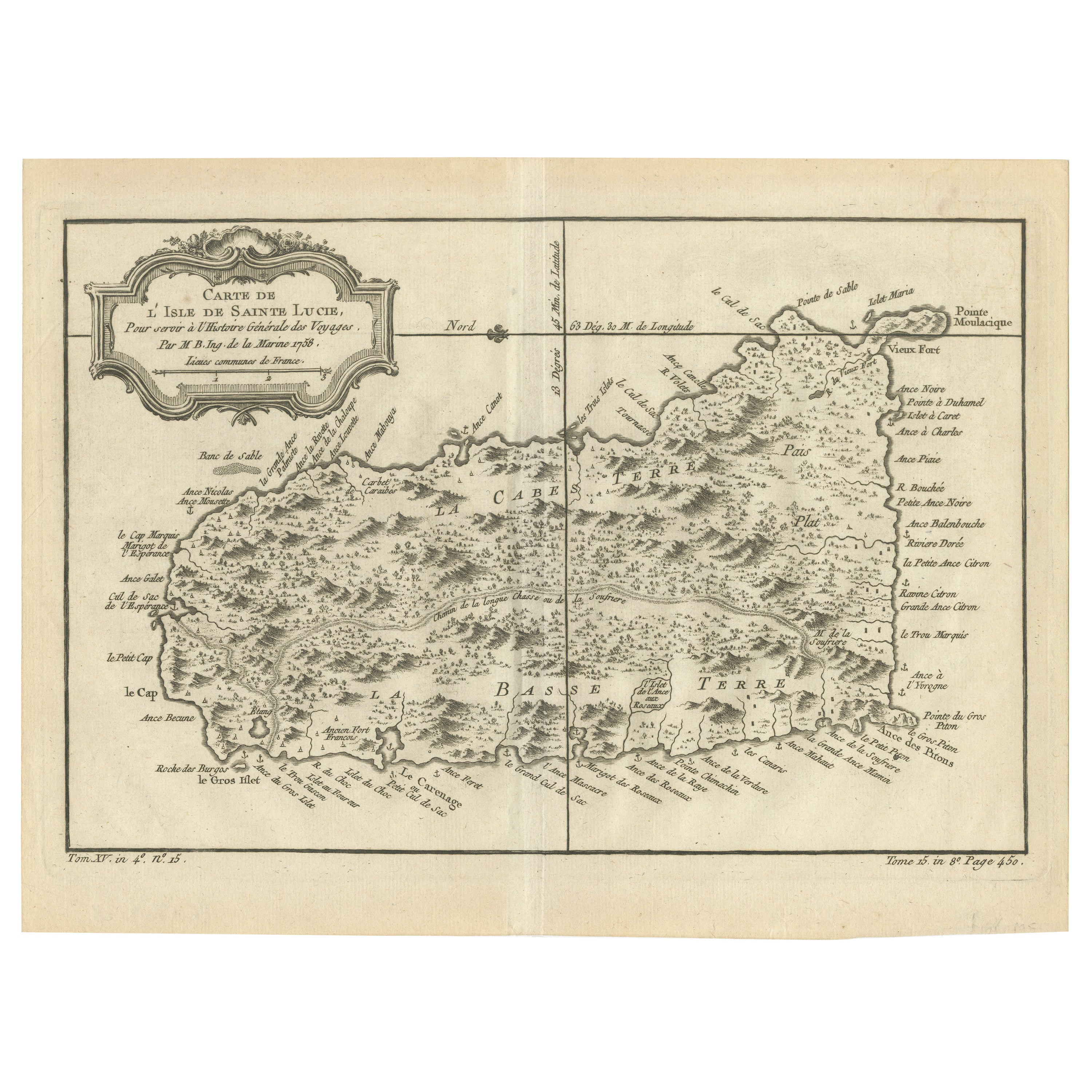
Original Engraved Map of Saint Lucia in the West Indies by Bellin, 1758
Located in Langweer, NL
The "Carte de L’Isle de Sainte Lucie" by Jacques Nicolas Bellin, a prominent figure as the Royal Hydrographer and engineer of the French Navy, is a remarkable antique map showcasing ...
Category
Antique 1750s Maps
Materials
Paper
$323 Sale Price
20% Off