Items Similar to Map of Northumberland by Joannem Janssonium 17th century

Want more images or videos?
Request additional images or videos from the seller
1 of 10
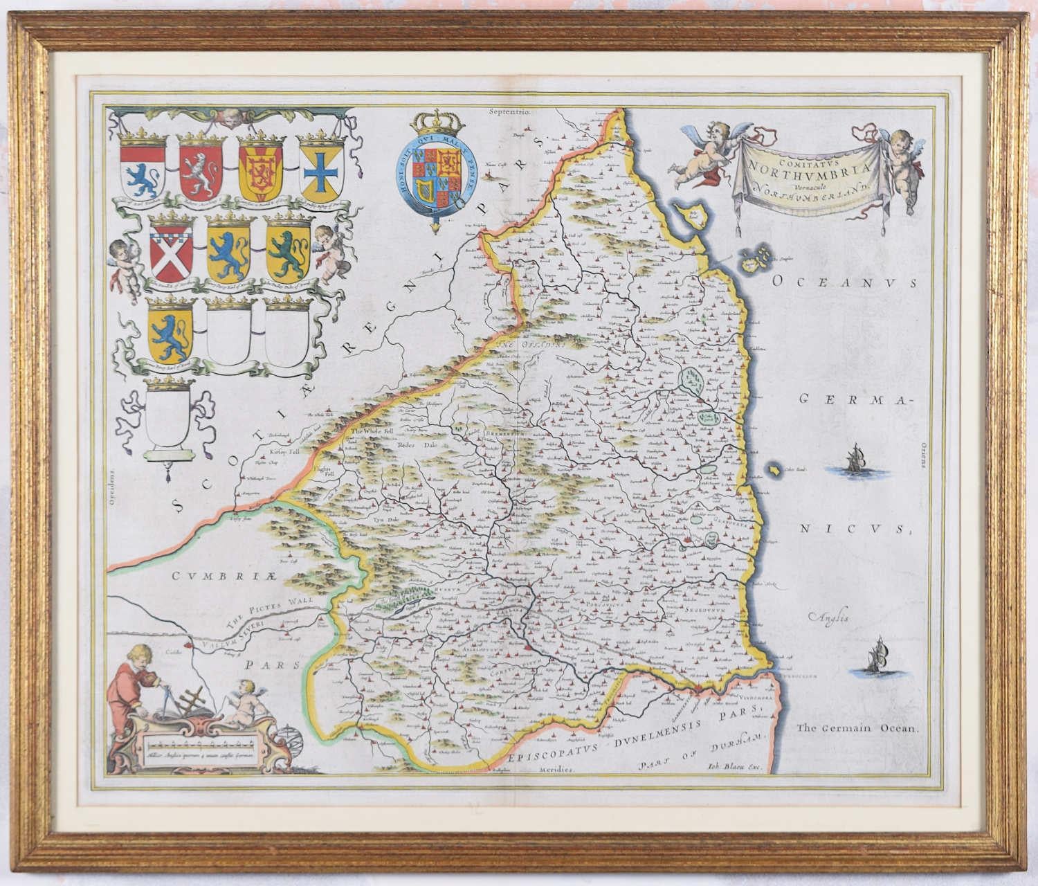
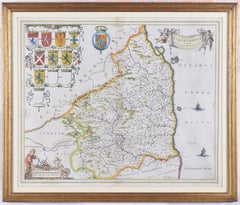
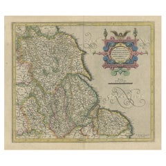
Joannem JanssoniumMap of Northumberland by Joannem Janssonium 17th century1646
1646
$1,023.04
£750
€871.15
CA$1,409.49
A$1,537.24
CHF 814.33
MX$18,429.36
NOK 10,370.92
SEK 9,483.43
DKK 6,508.34
About the Item
To see our other original maps, scroll down to "More from this Seller" and below it click on "See all from this Seller" - or send us a message if you cannot find the poster you want.
Joannem Janssonium (1588 - 1664)
Map of Northumberland (1646)
Engraving
41 x 50 cm
The 1646 Latin edition.
A decorative map of Northumberland by the noted Dutch mapmaker and publisher Joannem Janssonium.
- Creator:Joannem Janssonium (1588 - 1664, Dutch)
- Creation Year:1646
- Dimensions:Height: 16.15 in (41 cm)Width: 19.69 in (50 cm)
- Medium:
- Period:1640-1649
- Framing:Framing Options Available
- Condition:Very good; later hand coloured.
- Gallery Location:London, GB
- Reference Number:1stDibs: LU795313603372
About the Seller
4.8
Vetted Professional Seller
Every seller passes strict standards for authenticity and reliability
Established in 2014
1stDibs seller since 2017
362 sales on 1stDibs
Typical response time: 13 hours
- ShippingRetrieving quote...Shipping from: London, United Kingdom
- Return Policy
More From This Seller
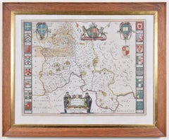
View AllMap of Northumberland by Joan Blaeu
By Joan (Johannes) Blaeu
Located in London, GB
To see our other original maps, scroll down to "More from this Seller" and below it click on "See all from this Seller" - or send us a message if you cannot find the poster you want....
Category
1660s Landscape Prints
Materials
Engraving
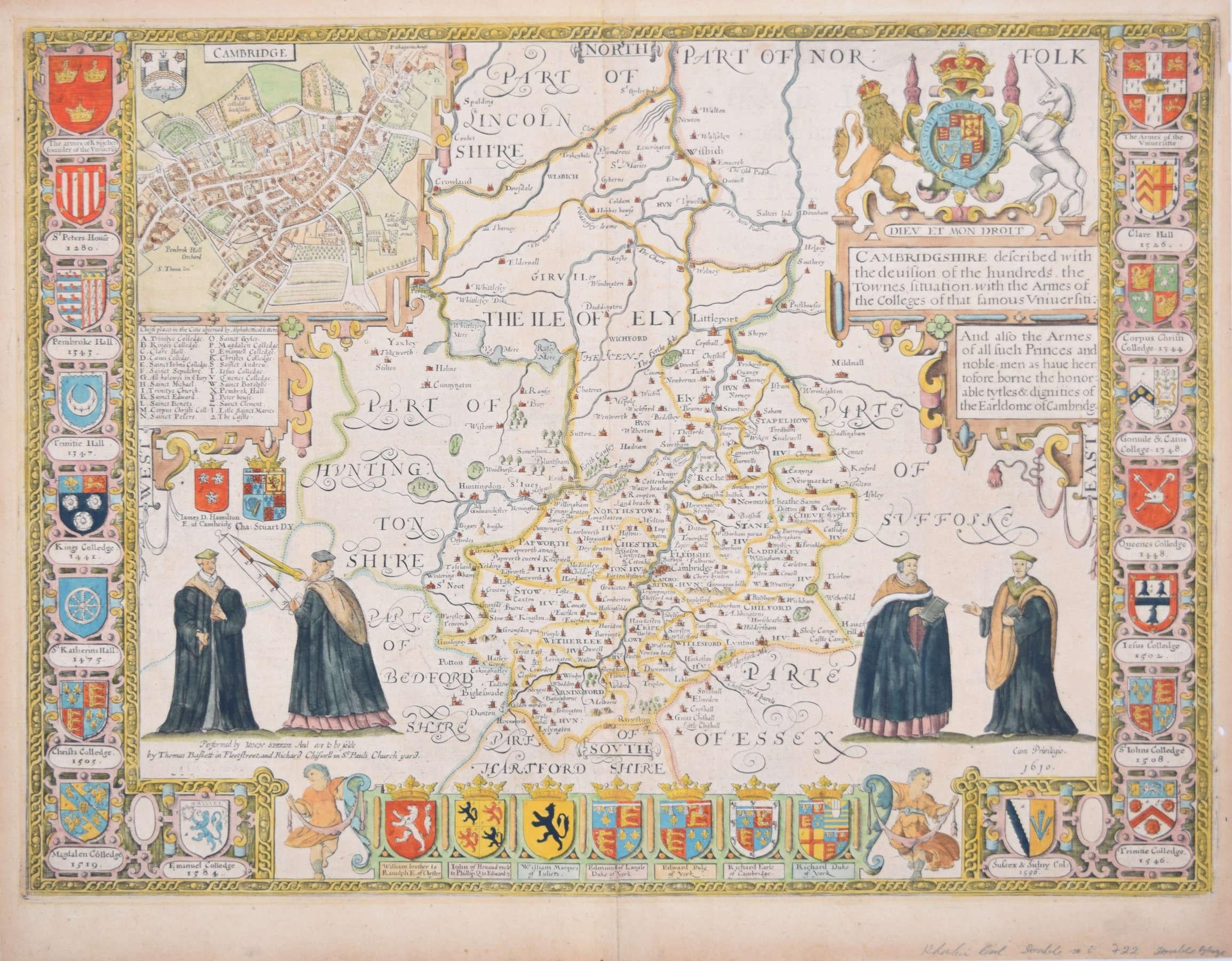
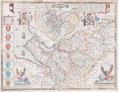
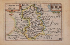
Cambridgeshire map 17th century engraving by John Speed
By John Speed
Located in London, GB
To see more, scroll down to "More from this Seller" and below it click on "See all from this Seller."
John Speed (1551 or 1552 - 1629)
Map of Cambridgeshire
Engraving with later hand colouring
39 x 53 cm
A beautifully coloured map of Cambridgeshire, with an antique description...
Category
1610s Landscape Prints
Materials
Engraving

Map of Oxfordshire by Joan Blaeu with college crests
By Joan (Johannes) Blaeu
Located in London, GB
To see our other original maps, scroll down to "More from this Seller" and below it click on "See all from this Seller" - or send us a message if you cannot find the poster you want....
Category
1660s Landscape Prints
Materials
Engraving
John Speede Map The Countye Palatine of Chester with that most ancient citie
By John Speed
Located in London, GB
To see our other views and maps of England - including London, Oxford and Cambridge, scroll down to "More from this Seller" and below it click on "See all from this Seller" - or send...
Category
17th Century Realist Landscape Prints
Materials
Engraving
Cambridge map 17th century engraving after John Speed
By John Speed
Located in London, GB
To see more, scroll down to "More from this Seller" and below it click on "See all from this Seller."
Pieter van den Keere (1571 - circa 1646) after John Speed (1551 or 1552 - 1629)
Map of Cambridgeshire
Engraving
8 x 12 cm
A beautifully coloured map of Cambridgeshire, with an antique description of the county to the reverse. The map, along with many others, was published in Speed's atlas, 'The Theatre of the Empire of Great Britaine', first published in 1611. This particular miniature edition of the 'Theatre' was published in miniature by George Humble in 1627, entitled 'England Wales Scotland and Ireland Described and Abridged With ye Historic Relation of things worthy memory from a farr larger Voulume. Done by John Speed.’ Speed's original map was likely engraved for this edition by Peter van den Keere. van den Keere's maps soon came to be known as "Miniature Speeds".
John Speed was an English cartographer, chronologer and historian. The son of a citizen and Merchant Taylor in London, he rose from his family occupation to accept the task of drawing together and revising the histories, topographies and maps of the Kingdoms of Great Britain as an exposition of the union of their monarchies in the person of King James I and VI. He accomplished this with remarkable success, with the support and assistance of the leading antiquarian scholars of his generation. He drew upon and improved the shire maps of Christopher Saxton, John Norden and others, being the first to incorporate the hundred-boundaries into them, and he was the surveyor and originator of many of the town or city plans inset within them. His work helped to define early modern concepts of British national identity. His Biblical genealogies were also formally associated with the first edition of the King James Bible...
Category
1620s Landscape Prints
Materials
Engraving
John Speede Map The Countye of Monmouth
By John Speed
Located in London, GB
To see our other views and maps of England - including London, Oxford and Cambridge, scroll down to "More from this Seller" and below it click on "See all from this Seller" - or send...
Category
17th Century Realist Landscape Prints
Materials
Engraving

You May Also Like
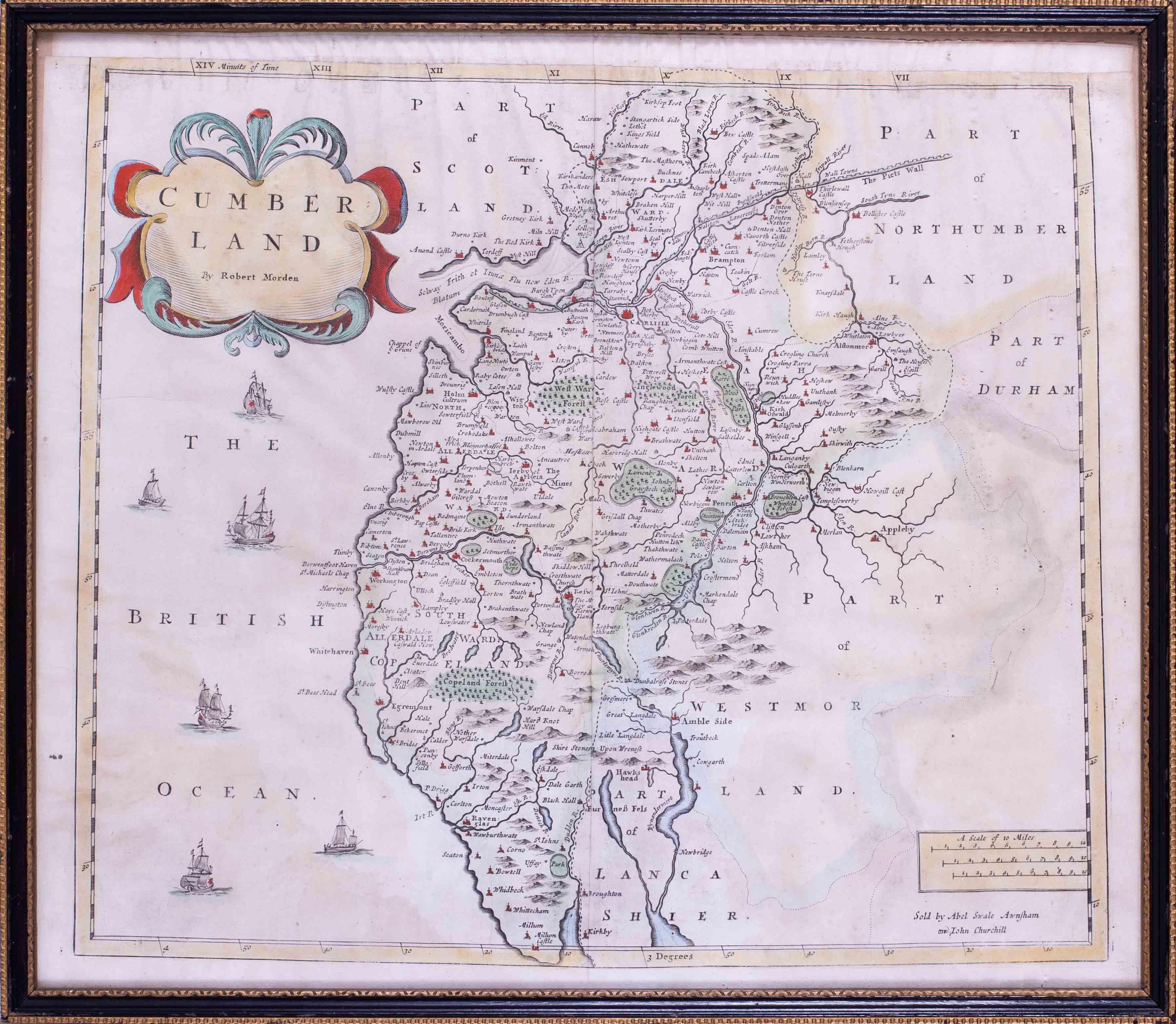
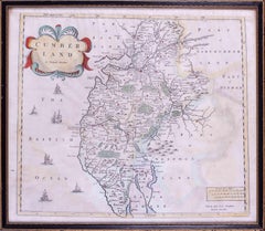
17th Century map of Cumberland, UK by Robert Morden
Located in Petworth, West Sussex
Robert Morden (British, circa 1650 – 1703)
A map of Cumberland with hand colouring
An engraving
14.1/4 x 16.5/8 in. (36.5 x 42.5 cm.)
Category
17th Century Academic Landscape Prints
Materials
Engraving
Antique Map of the Northeast of England by Mercator 'circa 1620'
Located in Langweer, NL
Antique map titled 'Eboracum Lincolnia, Derbia, Staffordia, Notinghamia, Lecestria, Rutlandia, et Norfolcia'. Decorative early map of the northeast of England, comprising the countie...
Category
Antique Early 17th Century Maps
Materials
Paper

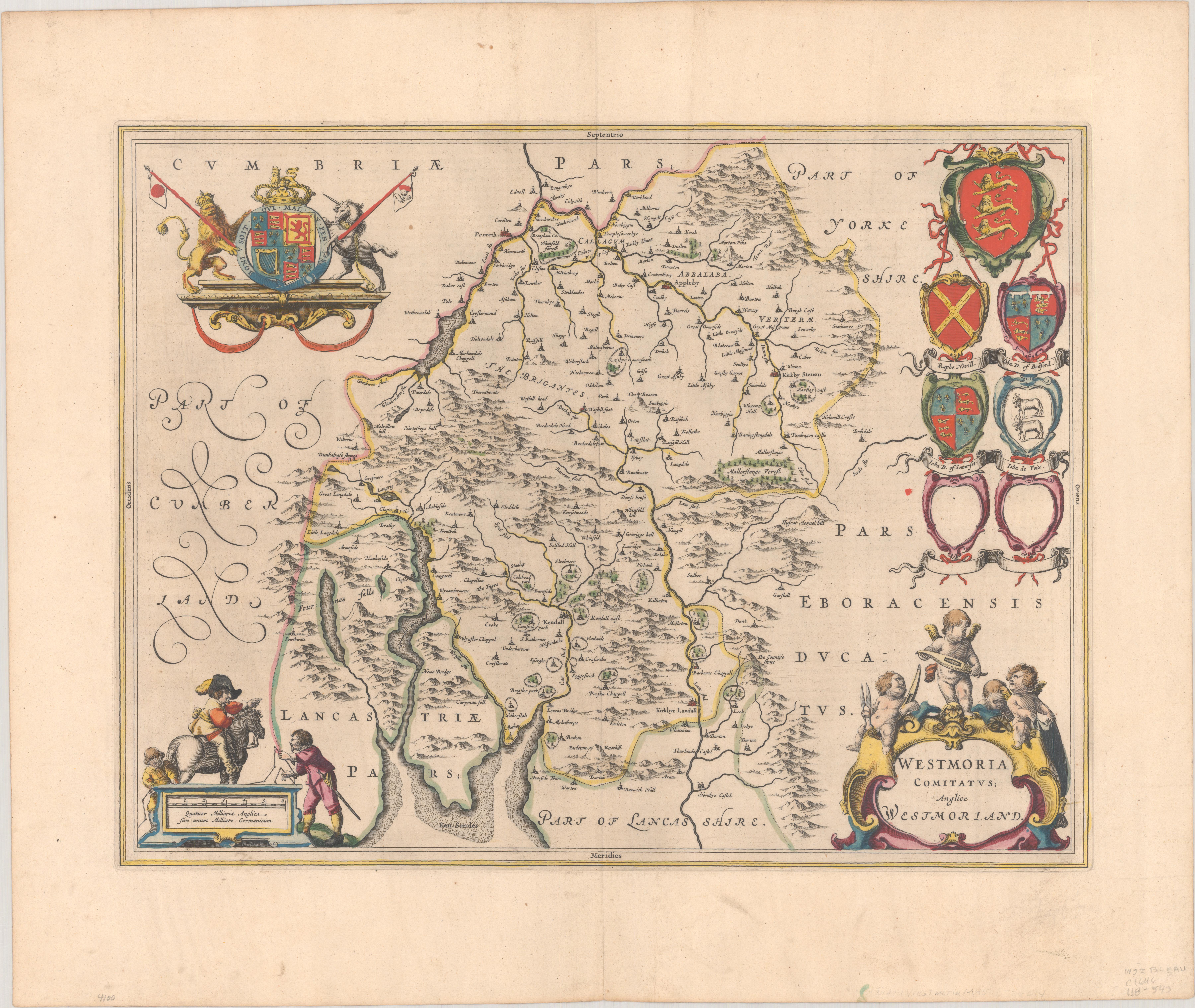
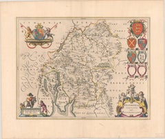
1645 Blaeu Map of Westmorland, Northern England – Hand Colored, Decorative
Located in Langweer, NL
This map, "Westmoria Comitatus; Anglice Westmorland", was created by the esteemed Dutch cartographer Willem Blaeu and was published around 1645 in 'Le Theatre du Monde ou Nouvel Atlas'. It provides a detailed look at Westmorland, a historic county in northern England, based on John Speed’s earlier map. The map features numerous place names, parks, and estates, including Brigster Park, Colnhead Park, Crosbye, and Midleton, along with a detailed depiction of Windermere (spelled Wynandermere) and the surrounding regions.
Additional Features:
- Hand-colored map, with vibrant and detailed colors that bring out the topographical and decorative features.
- Includes intricate cartouches, such as the royal coat of arms, a decorative title cartouche topped with putti (cherubic figures), and six coats of arms (two left blank).
- Depicts the region’s rich landscape, including the rolling hills and mountainous terrain of northern England.
- French text on the verso, indicative of the publication period from 1645-1648, part of Blaeu’s highly sought-after atlases.
- Map shows precise details of small towns, estates, and parks, such as Brigster Park, Colnhead Park, Crosbye, and Wynandermere (now Windermere Lake).
This map would be of particular interest to collectors of English county maps, antique maps of northern England, 17th-century cartography, and the decorative works of Willem Blaeu. Blaeu's maps are renowned for their accuracy, artistic beauty, and historical significance.
Keywords: Willem Blaeu, Westmorland map, northern England, 17th-century map, antique map, English county map, John Speed, Windermere, decorative cartography, hand-colored map, rare map, antique cartography...
Category
Antique 1640s Dutch Maps
Materials
Paper
$1,048 Sale Price
30% Off
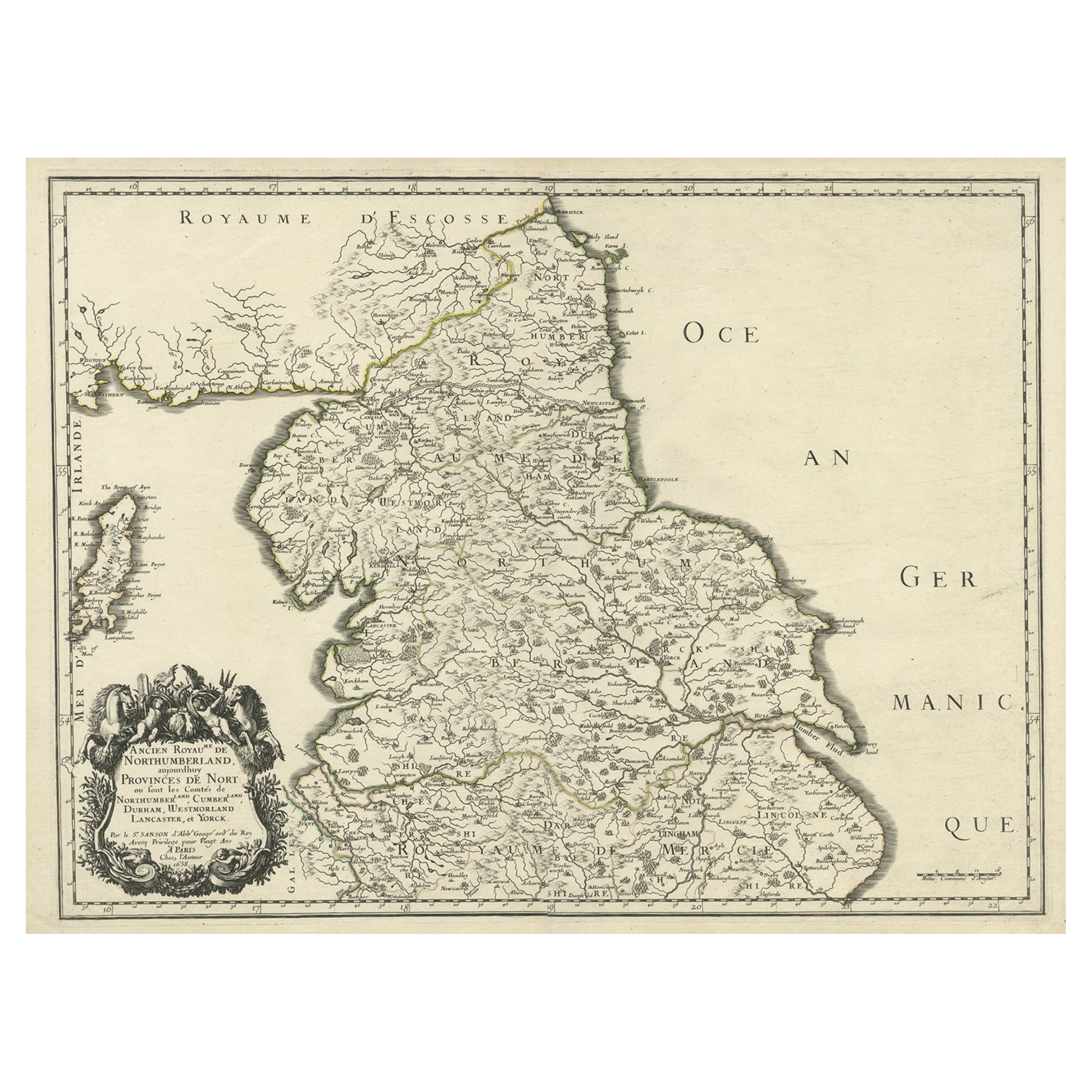
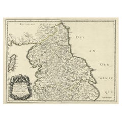
Engraved Map of Northern England, Focusing on Northumberland, 1658
Located in Langweer, NL
Antique map titled 'Ancien Royaume de Northumberland, aujourdhuy Provinces de Nort (..)'.
Engraved map of northern England, focusing on Northumber...
Category
Antique 1650s Maps
Materials
Paper
$421 Sale Price
20% Off
Decorative Early Hand-Colored Map of the Northeast of England, ca.1620
Located in Langweer, NL
Antique map titled 'Eboracum, Lincolnia, Derbia, Staffordia, Notinghamia, Lecestria, Rutlandia et Norfolcia'.
Decorative early map of the northeast of England, comprising the cou...
Category
Antique 1620s Maps
Materials
Paper
Ancient Map - Zeilan - Etching by Johannes Janssonius - 1650s
By Johannes Janssonius
Located in Roma, IT
Ancient Map - Zeilan is an ancient map realized in 1650 by Johannes Janssonius (1588-1664).
The Map is Hand-colored etching, with coeval watercoloring.
...
Category
1650s Modern Figurative Prints
Materials
Etching

More Ways To Browse
African American Poster
Altman Luxembourg Lithograph
Ana Popescu
Aquatint India
Bernard Buffet Canal
Bernard Cathelin On Sale
Camilla Vintage Prints
Charon Lithograph
Childe Hassam Etching
Christo Running Fence
Christo Surrounded Islands
Christo Wrapped Trees
Eyvind Earle Serigraph
Fairfield Porter Lithograph
Grant Wood Lithographs
Harold Altman Luxembourg
Hassam Etching
Joichi Hoshi Woodblock Prints