Items Similar to Theories of Planetary Orbits: A Framed 18th C. Celestial Map by Doppelmayr

Want more images or videos?
Request additional images or videos from the seller
1 of 10
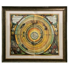
Johann Gabriel Doppelmayr 1Theories of Planetary Orbits: A Framed 18th C. Celestial Map by Doppelmayr1736
1736
$1,740
$2,17520% Off
£1,326.16
£1,657.7020% Off
€1,515.89
€1,894.8620% Off
CA$2,448.07
CA$3,060.0920% Off
A$2,681.78
A$3,352.2320% Off
CHF 1,411.59
CHF 1,764.4820% Off
MX$32,007.81
MX$40,009.7620% Off
NOK 17,994.16
NOK 22,492.7120% Off
SEK 16,449.38
SEK 20,561.7220% Off
DKK 11,323.40
DKK 14,154.2520% Off
About the Item
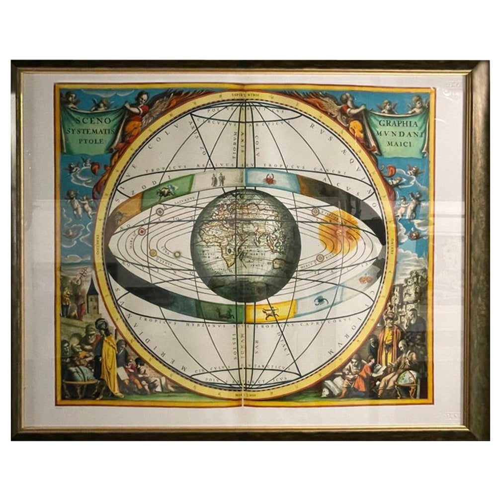
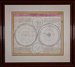
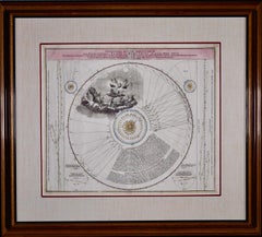
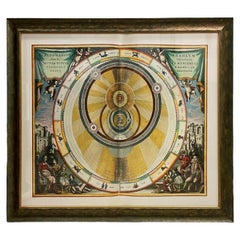
This 18th century hand-colored copperplate celestial map by Johann Doppelmayr entitled "Astronomia Comparativa in qua Planetarum Primaria Phaenomena" (Comparative Astronomy in which the Primary Phenomena of the Planets) was incorporated as plate 30 in 'Atlas Novus Coelestis in quo Mundus Spectabilis', first published in Nuremberg, Germany in 1735 in association with the famous and prolific cartographer and printer Johann Baptist Homann. 'Atlas Novus Coelestis in Quo Mundus spectabilis, et in Eodem Tam Errantium Quam Inerrantium Stellarum Phoenomena notabilia, Circa Ipsarum lumen, figuram, faciem, motum, Eclipses.secundum Nic. Copernici, et Ex Parte Tychonis De Brahe, Hypothesin' (The New Atlas of the Celestial World in which the World is to be Looked at, and the Phenomena Notable in the Same of the Errants and the Inerrant Stars, with respect to their light, shape, face, motion, and eclipses according to Nic. Copernicus and Tycho De Brahe: Hypothesis) includes diagrams illustrating the planetery systems of Copernicus, Tycho, and Riccioli; the elliptic theories of Kepler, Boulliau, Seth Ward, and Mercator; the lunar theories of Tycho, Horrocks, and Newton; and Halley's cometary theory. This plate and others were originally created by Doppelmayr for scientific publication by the academic society Academiae Caesareae Leopoldino-Carolinae Naturae Curiosorum to show the movements of Mars, Saturn, Jupiter, Mercury, Venus and Earth according to Tycho Brahe (1546-1601), who combined Copernican and Ptolemaic astronomical systems in his attempt to explain the universe through observed data, including the orbits of the known planets at the time.
The concentric circles appear to show the relative times when Saturn, Jupiter, and the zodiac can be observed. On the right within the concentric circles is a figural vignette of the God of the universe looking through a telescope while surrounded by winged personifications of stars and a standing figure of death with a sickle among the cloud filled heavens. The circles in three corners of the map are based on Tyche Brahe' concept of what an observer on Mars, Saturn, or Jupiter would see if they were stationary. The diagram in the lower right depicts the relative sizes of planets. Although fairly accurate, with the exception of Venus which appears larger than the earth (Terra).
This framed 18th century double page hand-colored engraved celestial map is printed on chain-linked laid paper. It is presented in an attractive polished medium brown-colored frame with contrasting black inner and outer trim. The frame measures 31.5" high by 34.94" wide by 1" in depth. There are small frame defects. The double mat consists of a beige fabric outer mat and a cranberry-colored inner mat. There is a central fold, as issued and an elongated crease that appears related to the paper's manufacture. There is one small spot in the upper right and two tiny spots in the upper right margin, but the visible portions of the print are otherwise in very good condition.
There are two other Doppelmayr/Homann celestial maps that are listed on our 1stdibs storefront that are presented in identical frames and maps. Two or three of these would make for an attractive and impressive display grouping. A discount will be extended for the purchase of multiple maps. Please reach out to us for more details about these striking and interesting celestial maps.
Johann Gabriel Doppelmayr (1677-1750) was a famous German geographer and astronomer, who was Professor of Mathematics at the Aegidien Gymnasium in Nuremberg, Germany. He wrote extensively on astronomy, geography, cartography, spherical trigonometry, sundials and mathematical and other scientific instruments and was involved in the production of terrestrial and celestial globes. He was a member of the Royal Society of London and the Berlin and St. Petersburg Academies of Sciences. In the early 1700s, Doppelmayr created astronomical and cosmological plates that were incorporated in atlases published by Johann Baptist Homann (1664-1724), and ones published after Homann's death by his heirs until 1848. Thirty of these plates were published in the Atlas Novus Coelestis in quo Mundus Spectabilis. Twenty of these plates focused on the cosmological systems of Copernicus and Tycho Brahe, as well as known details of the planets and other bodies in the solar system. The other ten plates focussed on constellations and the locations known stars and comets.
Johann Baptist Homann (1663-1724) was a mapmaker who founded a respected and prolific publishing company, which continued long after his death as Homann Heirs. Homann lived his entire life in Bavaria, particularly in Nuremberg. Initially, Johann trained to become a priest before converting to Protestantism and working as a notary. In 1702, Johann founded a publishing house that specialized in engravings. The firm flourished, becoming the leading map publisher in Germany and an important entity in the European map market. In 1715, Johann was named Imperial Geographer to the Holy Roman Empire by Charles VI and made a member of the Prussian Academy of Sciences. Most importantly for his business, his reputation and contacts gained him imperial printing privileges which protected his publications and recommended him to customers.
- Creator:Johann Gabriel Doppelmayr 1 (1677 - 1750, German)
- Creation Year:1736
- Dimensions:Height: 31.5 in (80.01 cm)Width: 34.94 in (88.75 cm)Depth: 1 in (2.54 cm)
- Medium:
- Period:
- Condition:
- Gallery Location:Alamo, CA
- Reference Number:Seller: # 40981stDibs: LU117329803402

Johann Gabriel Doppelmayr 1
Johann Gabriel Doppelmayr (1677-1750) was a famous German geographer and astronomer, who was Professor of Mathematics at the Aegidien Gymnasium in Nuremberg, Germany. He wrote extensively on astronomy, geography, cartography, spherical trigonometry, sundials and mathematical and other scientific instruments and was involved in the production of terrestrial and celestial globes. He was a member of the Royal Society of London and the Berlin and St. Petersburg Academies of Sciences. In the early 1700s, Doppelmayr created astronomical and cosmological plates that were incorporated in atlases published by Johann Baptist Homann (1664-1724), and ones published after Homann's death by his heirs until 1848. Thirty of these plates were published in the Atlas Novus Coelestis in quo Mundus Spectabilis. Twenty of these plates focused on the cosmological systems of Copernicus and Tycho Brahe, as well as known details of the planets and other bodies in the solar system. The other ten plates focussed on constellations and the locations known stars and comets. Johann Baptist Homann (1663-1724) was a mapmaker who founded a respected and prolific publishing company, which continued long after his death as Homann Heirs. Homann lived his entire life in Bavaria, particularly in Nuremberg. Initially, Johann trained to become a priest before converting to Protestantism and working as a notary. In 1702, Johann founded a publishing house that specialized in engravings. The firm flourished, becoming the leading map publisher in Germany and an important entity in the European map market. In 1715, Johann was named Imperial Geographer to the Holy Roman Empire by Charles VI and made a member of the Prussian Academy of Sciences. Most importantly for his business, his reputation and contacts gained him imperial printing privileges which protected his publications and recommended him to customers.
About the Seller
5.0
Platinum Seller
Premium sellers with a 4.7+ rating and 24-hour response times
Established in 2011
1stDibs seller since 2019
299 sales on 1stDibs
Typical response time: 1 hour
- ShippingRetrieving quote...Shipping from: Alamo, CA
- Return Policy
More From This Seller
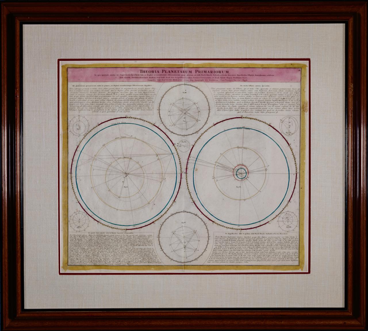
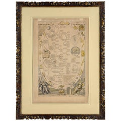
View AllTheories of Planetary Motion: An 18th C. Framed Celestial Map by Doppelmayr
By Johann Gabriel Doppelmayr 1
Located in Alamo, CA
This 18th century hand-colored copperplate celestial map by Johann Doppelmayr entitled "Theoria Planetarum Primariorum In qua ipsorum motus in Copernican...
Category
Early 18th Century Landscape Prints
Materials
Engraving
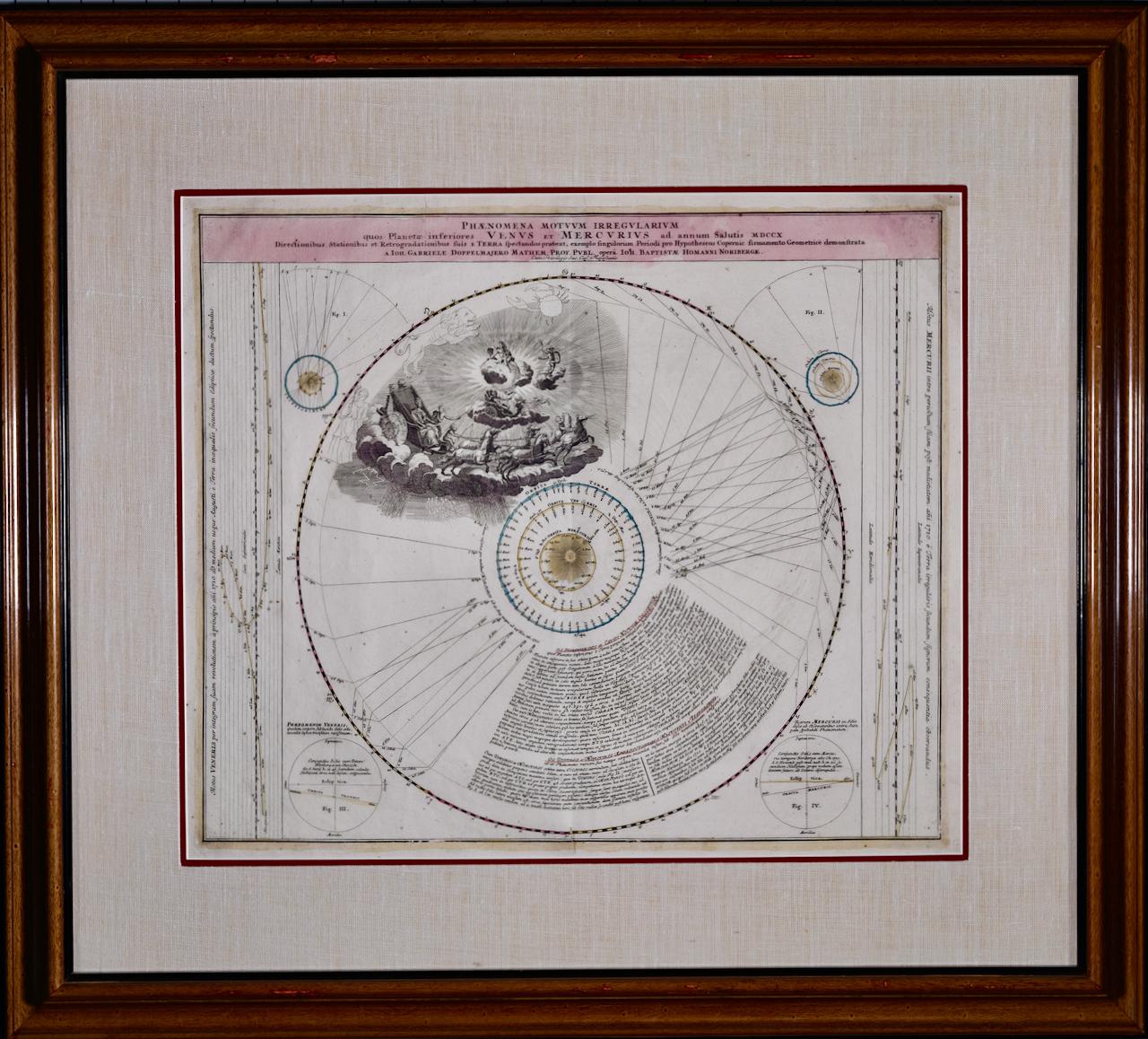
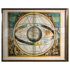
The Orbits of Venus and Mercury: An 18th C. Framed Celestial Map by Doppelmayr
By Johann Gabriel Doppelmayr 1
Located in Alamo, CA
This 18th century hand-colored copperplate celestial map by Johann Doppelmayr entitled "Phænomena Motuum Irregularium quos Planetar inferiores Venus et M...
Category
Early 18th Century Landscape Prints
Materials
Engraving
Map of the World: An Original 18th Century Hand-colored Map by E. Bowen
Located in Alamo, CA
This is an original 18th century hand-colored map entitled "A New & Correct Chart of All The Known World Laid down according to Mercator's Projection" by Emanuel Bowen. It was published in 1744 in London in John Harris's "Navigantium atque Itinerantium Bibliotheca" or "A Complete Collection of Voyages and Travels". This highly detailed and colorful map depicts the world. as it was known in the mid 18th century. A majority of the northern and central portions of Canada and America are left blank due to the purity of knowledge at the time this map was published.
The map is embellished with four Compass Roses in the lower left, lower center, lower right and center, along with many rhumb lines. There a is a decorative title cartouche in the upper left. This colorful, attractive, historical and interesting 1744 map presents the entire world on Mercator's projection as it was understood in the middle part of the 18th century, before the landmark explorations of Captain’s Cook, Vancouver, Wilkes and others. It is an example of a nautical chart, a type of map that was designed specifically for use by mariners. The map is centered on the equator and includes both the Eastern and Western Hemispheres. The continents of North America, South America, Europe, Africa, and Asia are depicted, as well as various islands in the Atlantic, Pacific, and Indian Oceans. The map is laid out according to the Mercator projection, a type of cylindrical map projection that was developed in the 16th century by Flemish cartographer Gerardus Mercator. This projection has the advantage of preserving angles and shapes, making it useful for navigation. The map presents a paucity of inland detail, particularly for the Americas, but major cities, geographical landmarks, and regions are included. Ocean currents and Tradewinds are identified, as well as the magnetic declination lines or magnetic variance, which refers to the difference between true north and compass north. The continents are color coded, enhancing the beauty of this map. The three compass roses indicate the directions of the cardinal points.
The depiction of the western coast of America, the Pacific and Australia are interesting. There was very little exploration of Australia between the navigations of William Damper in 1699 and Tobias Furneaux in 1773. Most of the maps detail relies on the 17th century Dutch expeditions to Australia's western coast, by Abel Tasman and William Janszoon. Van Diemen's Land (Tasmania) and New Guinea appear connected to the Australian continent. New Zealand appears as a single landmass. North of New Zealand there is a landmass labelled 'Ter d' St. Esprit' which probably represents the New Hebrides Islands. This map precedes the accurate exploration of the South Pacific and east coast of Australia by Captain James Cook later in the 18th century. The map includes ‘Drakes' Port,' the site where Sir Francis Drake supposedly landed in 1579 during his 1579 circumnavigation of the globe. Here he claimed territory for England, restocked, and repaired his vessels. Drake named the region New Albion. The exact location of Drake's Port is a cartographic mystery. Drake's Harbor is believed to be in the region of San Francisco Bay, Bodega Bay, San Pablo Bay...
Category
Mid-18th Century Old Masters Landscape Prints
Materials
Engraving

$1,020 Sale Price
20% Off
17th Century Dutch Map of the Holy Land at the Time of Jesus by Visscher
By Nicolaus Visscher
Located in Alamo, CA
This detailed Dutch map entitled "Het Beloofe de Landt Canaan door wandelt van onsen Salichmaecker Iesu Christo, nessens syne Apostelen" by Nicolaes Visscher (1610-1679), published i...
Category
1660s Prints and Multiples
Materials
Engraving

$1,020 Sale Price
20% Off
Meissen, Germany : A Large Framed 18th Century Map by Petrus Schenk
Located in Alamo, CA
This is a hand-colored 18th century map of the Meissen region of Germany, entitled "Geographischer Entwurff Derer Aemmter Meissen als Creys-Procuratur-Schul-und Stiffts-Ammt benebst ...
Category
Mid-18th Century Old Masters Landscape Prints
Materials
Engraving

L'Isle de France: A Hand-colored 17th Century Map by De Wit
By Frederick de Wit
Located in Alamo, CA
This colorful and detailed 17th century hand-colored copperplate map by Frederick De Wit was published in Amsterdam between 1666 and 1760. The map depicts the Île-de-France, which is one of the ancient provinces of France. Paris is located in the center of the map, with Versailles to the southwest The map extends from Rouen in the west to Reims in the east. The area around Paris, the Véxin Français, was the original domain of the king of France. Other areas were ruled by French feudal lords. For example, the Véxin Normand area was the domain of the Duke of Normandy...
Category
Early 18th Century Old Masters More Prints
Materials
Engraving

$940 Sale Price
20% Off
You May Also Like
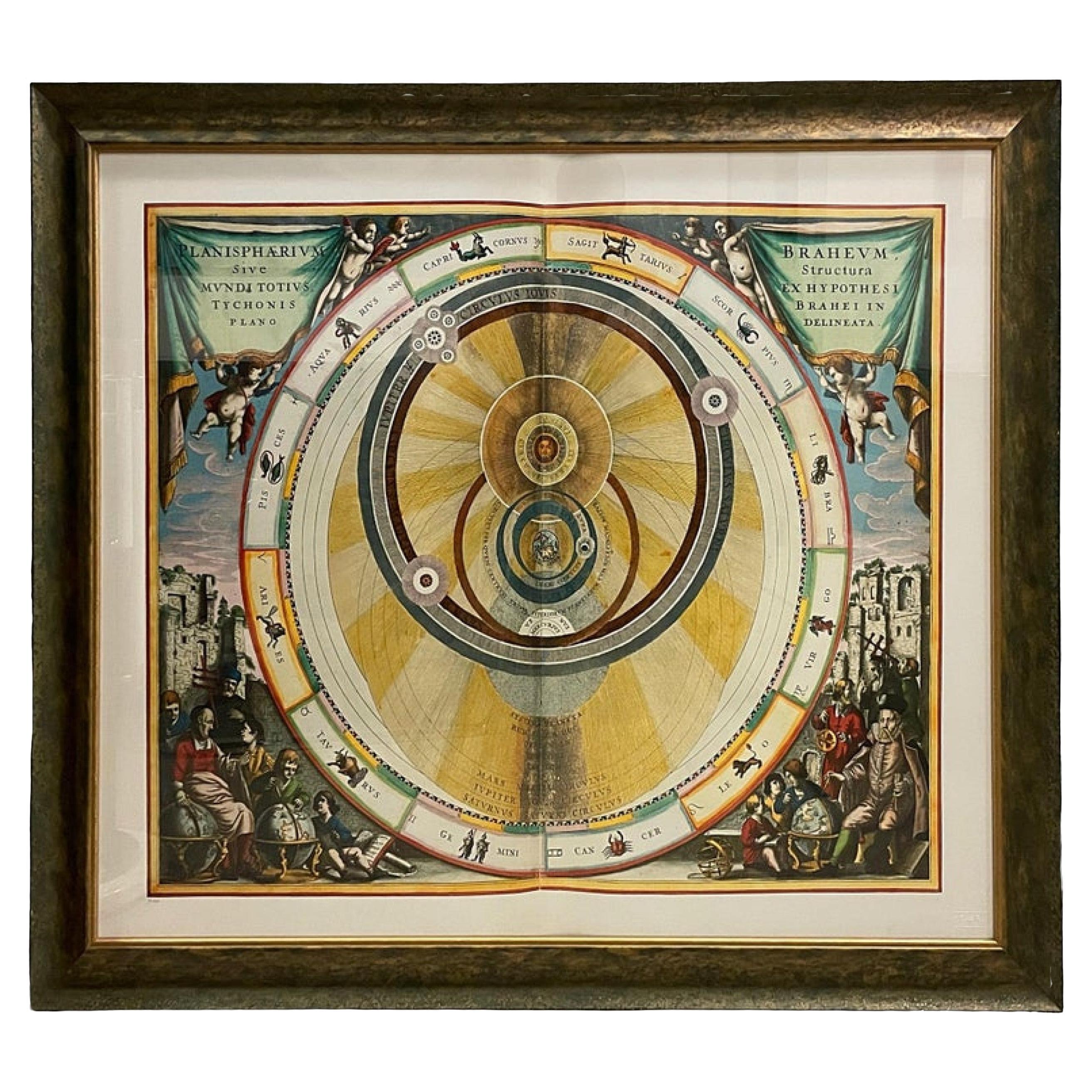
Italian Renaissance Style Framed Print Of A Celestial Map "Tychonic Planisphere"
Located in Queens, NY
Italian Renaissance style framed print of a celestial map depicting the beliefs of the Earth is stationary at the center of the planetary system with the Sun and Moon revolving the E...
Category
20th Century Italian Renaissance Paintings
Materials
Brass
Italian Renaissance Style Framed Print of Andreas Cellarius' Celestial Map, Titl
Located in Queens, NY
Italian Renaissance style framed print of a celestial map depicting how the Sun, Moon and other planets revolves around the Earth
Category
20th Century Italian Renaissance Paintings
Materials
Ceramic
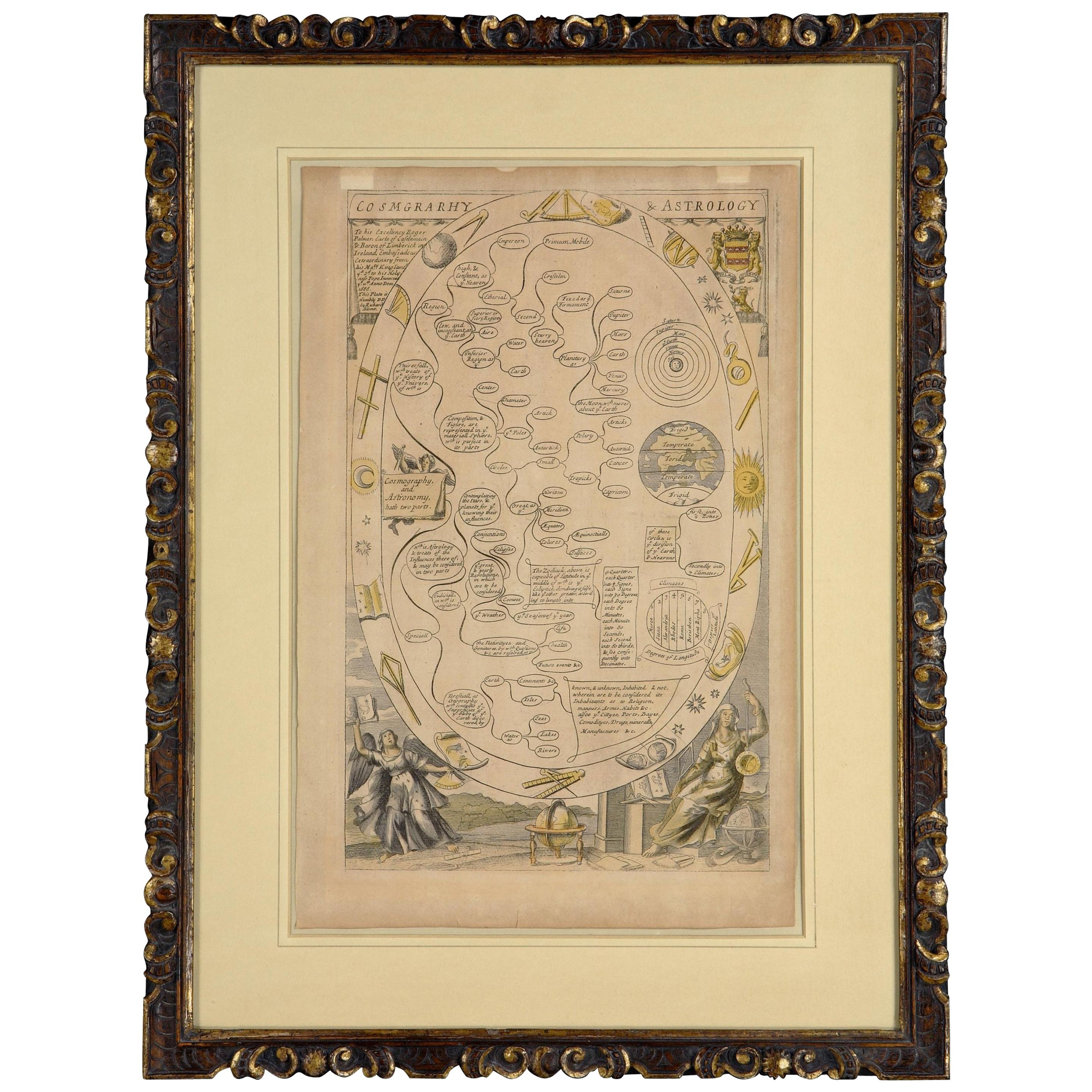
Cosmgraphy and Astrology, 1686 by Richard Blome from the First Edition
By Richard Blome
Located in BUNGAY, SUFFOLK
Cosmography & Astrology
Large oval engraved plate with inscriptions outlining the various parts of cosmography and astronomy; below, two emblematic figures with scientific instruments either side. Lettered with title, dedication, and various inscriptions. To his Excellency Roger Palmer, Earle of Castelmain and Baron of Limerick in Ireland, Embassador Extraordinary from his majesty King James II to his Holyness Pope Innocent 11th anno dom 1686. This plate is humbly DD by Richard Blome. On paper and retaining its original coloring.
Sheet width 26 ½ cm., 10 ½ in., height 41 ½ cm., 16 ½ in.,
In a part-gilded Sansovino frame...
Category
Antique 1680s English Charles II Decorative Art
Materials
Paper
Italian Renaissance Style Framed Print Of A Celestial Map
Located in Queens, NY
Italian Renaissance style framed print of a celestial map depicting the beliefs of the Earth is the center of the universe with the Sun and planet rotating around
Category
20th Century Renaissance Paintings
Materials
Ceramic
Antique Chart of the Passage of Comets in the Southern Sky, circa 1740
Located in Langweer, NL
Antique map titled 'Motus Comtarum in Hemispaerio Australi (..)'. This uncommon chart depicts the passage of comets in the southern sky between the years 1530-1704. Centered on the ecliptic poles and shows the constellation figures based on classical mythology, without showing the stars. The paths of dozens of comets are illustrated, eincluding those sighted by Tycho Brahe...
Category
Antique Mid-18th Century German Maps
Materials
Paper
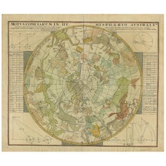
$2,239 Sale Price
25% Off
1730 Southern Hemisphere Celestial Chart with Zodiac Signs and Decorative Putti
Located in Langweer, NL
Title: 1730 Southern Hemisphere Celestial Chart with Zodiac Signs and Decorative Putti
Description: This stunning 1730 celestial map, "Hemisphaerium Coeli Australe," showcases the S...
Category
Antique 1730s Prints
Materials
Paper
More Ways To Browse
Antique Sickles
Antique Sundial
Antique Celestial Globe
Mars Venus
Antique Solar System
Antique Celestial Maps
Karen Daigle
Kaws Blue Companion
Kaws Clean Slate
Louise Brooks
Malta Painting
Mechanical Animal
Mexican Alebrijes
Nora Pineda
Odetta Vintage
Otter Sculpture
Painting Woman 1920s
Paris Scene Painting Signed Andrea