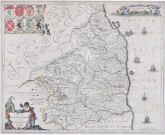
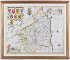
Items Similar to 17th Century map of Cumberland, UK by Robert Morden


Want more images or videos?
Request additional images or videos from the seller
1 of 11
Unknown17th Century map of Cumberland, UK by Robert Morden
$381.90
£280
€325.38
CA$526.25
A$574.12
CHF 303.99
MX$6,879.59
NOK 3,871.52
SEK 3,540.22
DKK 2,429.60
About the Item
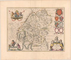
Robert Morden (British, circa 1650 – 1703)
A map of Cumberland with hand colouring
An engraving
14.1/4 x 16.5/8 in. (36.5 x 42.5 cm.)
- Dimensions:Height: 14.25 in (36.2 cm)Width: 16.63 in (42.25 cm)Depth: 1 in (2.54 cm)
- Medium:
- Movement & Style:
- Period:
- Condition:There is a lot of folding and unevenness which can be rectified with reframing. Colours are good overall, behind glass. In a black and gilt wood frame with minor abrasions.
- Gallery Location:Petworth, GB
- Reference Number:1stDibs: LU54039880062
About the Seller
4.9
Gold Seller
Premium sellers maintaining a 4.3+ rating and 24-hour response times
Established in 2010
1stDibs seller since 2017
277 sales on 1stDibs
Typical response time: 3 hours
- ShippingRetrieving quote...Shipping from: Petworth, United Kingdom
- Return Policy
More From This Seller
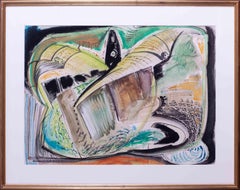
View All20th Century British ink landscape painting of a village in a valley
Located in Petworth, West Sussex
Graham Clarke (British, b. 1941)
The village in the valley
Ink and acrylic(?) on board
signed `Graham Clarke’ (lower right)
20.1/2 x 29.1/2 in. (52 x 75 cm.)
Category
20th Century Post-Impressionist Landscape Paintings
Materials
Ink, Acrylic, Board
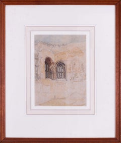
20th Century British watercolour of Cowdrey ruins, West Sussex by Muncaster
By Claude Muncaster
Located in Petworth, West Sussex
Claude Muncaster (British, 1903-1974)
Cowdray ruins, West Sussex
Pencil and watercolour
12.1/2 x 9 in. (31.7 x 22.8 cm.)
Provenance: Garton & Cooke, New Bond Street, London
Exhibitio...
Category
20th Century Academic Landscape Drawings and Watercolors
Materials
Watercolor, Pencil
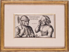
17th Century Dutch engraving 'Mein Greit; Mein Greit'
Located in Petworth, West Sussex
Julius Goltzius (Dutch c.1550-1595)
Mein Greit; Mein Greit
Engraving
6.5/8 x 11.3/8 in. (16.8 x 29 cm.) (measured to slip edge)
Christie’s have suggested this impression is from the ...
Category
17th Century Old Masters Figurative Prints
Materials
Engraving
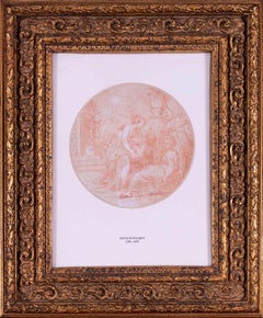
17th Century French sanguine drawing of maiden's harvesting flowers
By (Circle of) Nicolas Poussin
Located in Petworth, West Sussex
Circle of Nicolas Poussin (French, 1594-1665)
Maiden’s harvesting flowers
Sanguine on paper
8. ¾ in. (22 cm.) tondo
Category
17th Century Old Masters Figurative Drawings and Watercolors
Materials
Paper
British 20th Century abstract landscape 'A Rossendale Experience', mixed media
Located in Petworth, West Sussex
Peter Nicholas (British, 1934 – 2015)
A Rossendale experience
Mixed media
Signed, inscribed and dated ‘PWN… 88 / ‘A Rossendal experience’
21.1/4 x 29.1/2 in. (54 x 75 cm.)
Category
20th Century Modern Landscape Paintings
Materials
Mixed Media
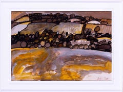
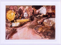
British, 20th Century landscape painting, ochres and browns by Graham Clarke
Located in Petworth, West Sussex
Graham Clarke (British, b. 1941)
The old farmstead
Ink and acrylic(?) on board
signed `Graham Clarke’ (lower right)
20.1/2 x 29.1/2 in. (52 x 75 cm.)
Category
20th Century Contemporary Landscape Paintings
Materials
Ink, Acrylic, Board
You May Also Like
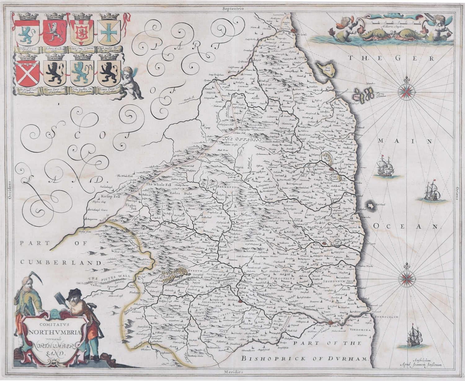
Map of Northumberland by Joannem Janssonium 17th century
Located in London, GB
To see our other original maps, scroll down to "More from this Seller" and below it click on "See all from this Seller" - or send us a message if you cannot find the poster you want....
Category
1640s Landscape Prints
Materials
Engraving
Framed 17th Century Map of Cumberland, England by John Speed, 1610
By John Speed
Located in Middleburg, VA
A fascinating and richly detailed antique map of Cumberland County in northwest England, drawn and published by the celebrated English cartographer John Spe...
Category
Antique Early 17th Century English British Colonial Maps
Materials
Copper, Gold Leaf

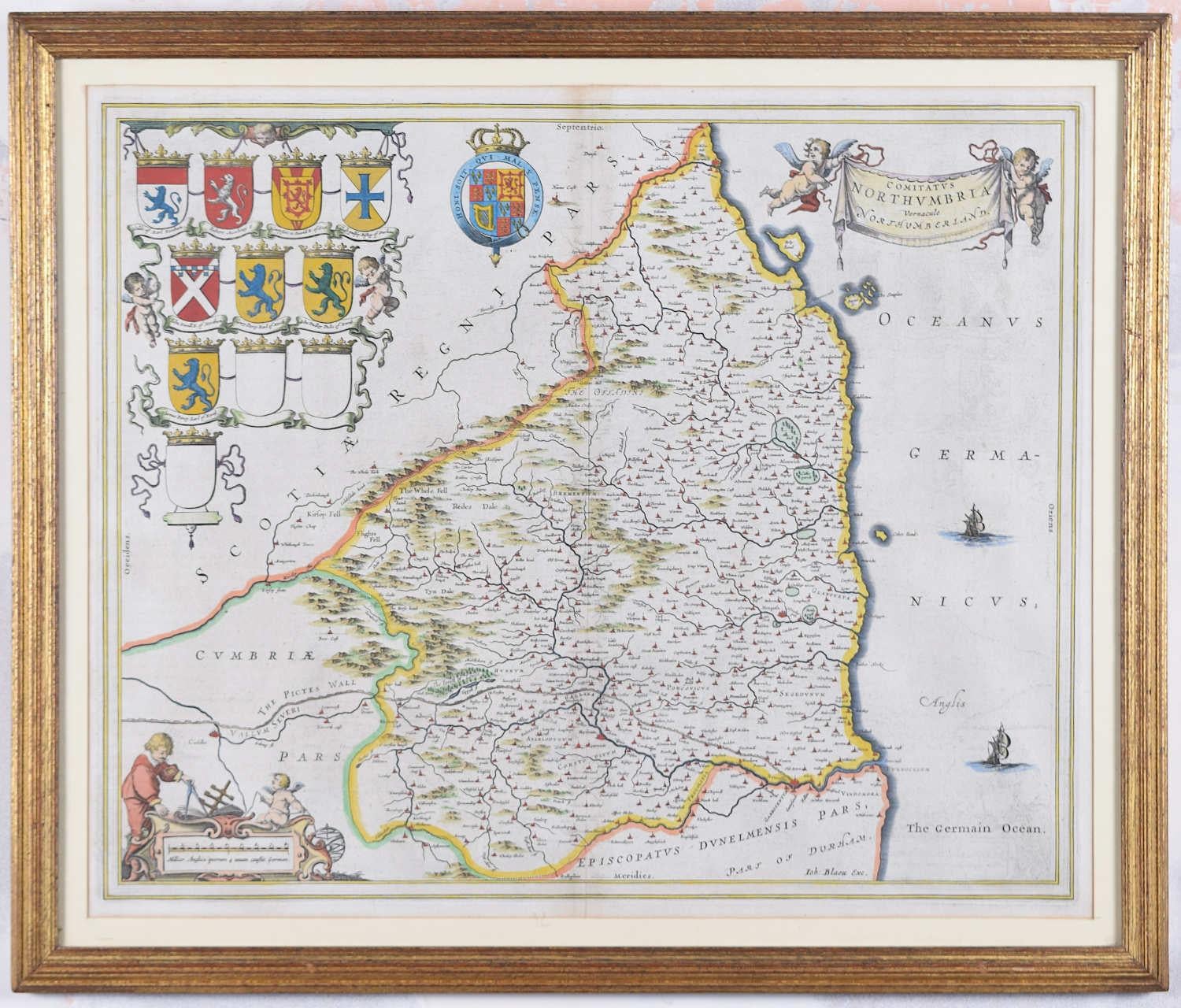
Map of Northumberland by Joan Blaeu
By Joan (Johannes) Blaeu
Located in London, GB
To see our other original maps, scroll down to "More from this Seller" and below it click on "See all from this Seller" - or send us a message if you cannot find the poster you want....
Category
1660s Landscape Prints
Materials
Engraving
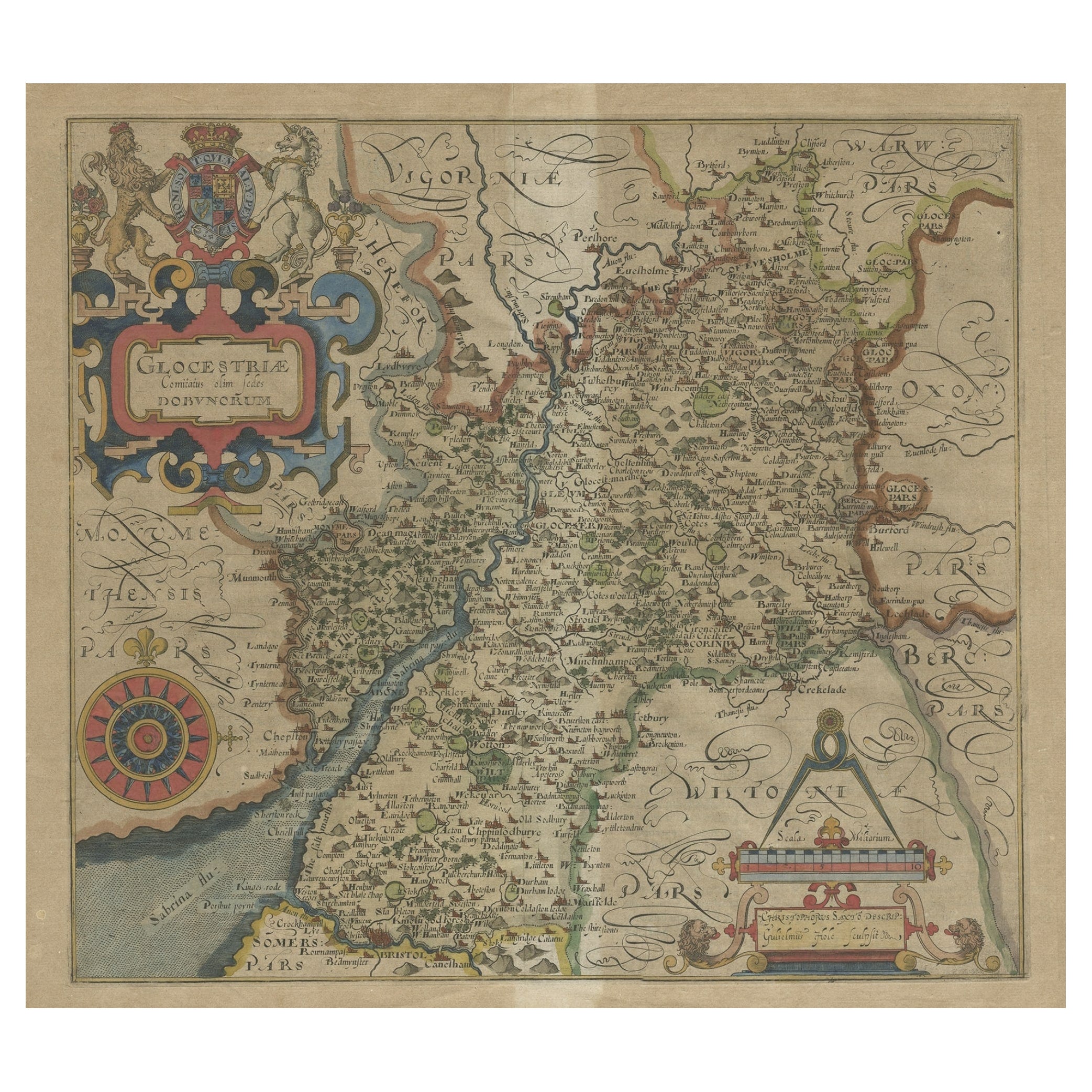
Antique Map of Gloucestershire by Camden, c.1607
Located in Langweer, NL
Antique map titled 'Glocestriae comitatus olim sedes Dobunorum'. Map of Gloucestershire, England. This map originates from Camden?s 'Britannia' ...
Category
Antique 17th Century Maps
Materials
Paper

Antique Map of the Northeast of England by Mercator 'circa 1620'
Located in Langweer, NL
Antique map titled 'Eboracum Lincolnia, Derbia, Staffordia, Notinghamia, Lecestria, Rutlandia, et Norfolcia'. Decorative early map of the northeast of England, comprising the countie...
Category
Antique Early 17th Century Maps
Materials
Paper

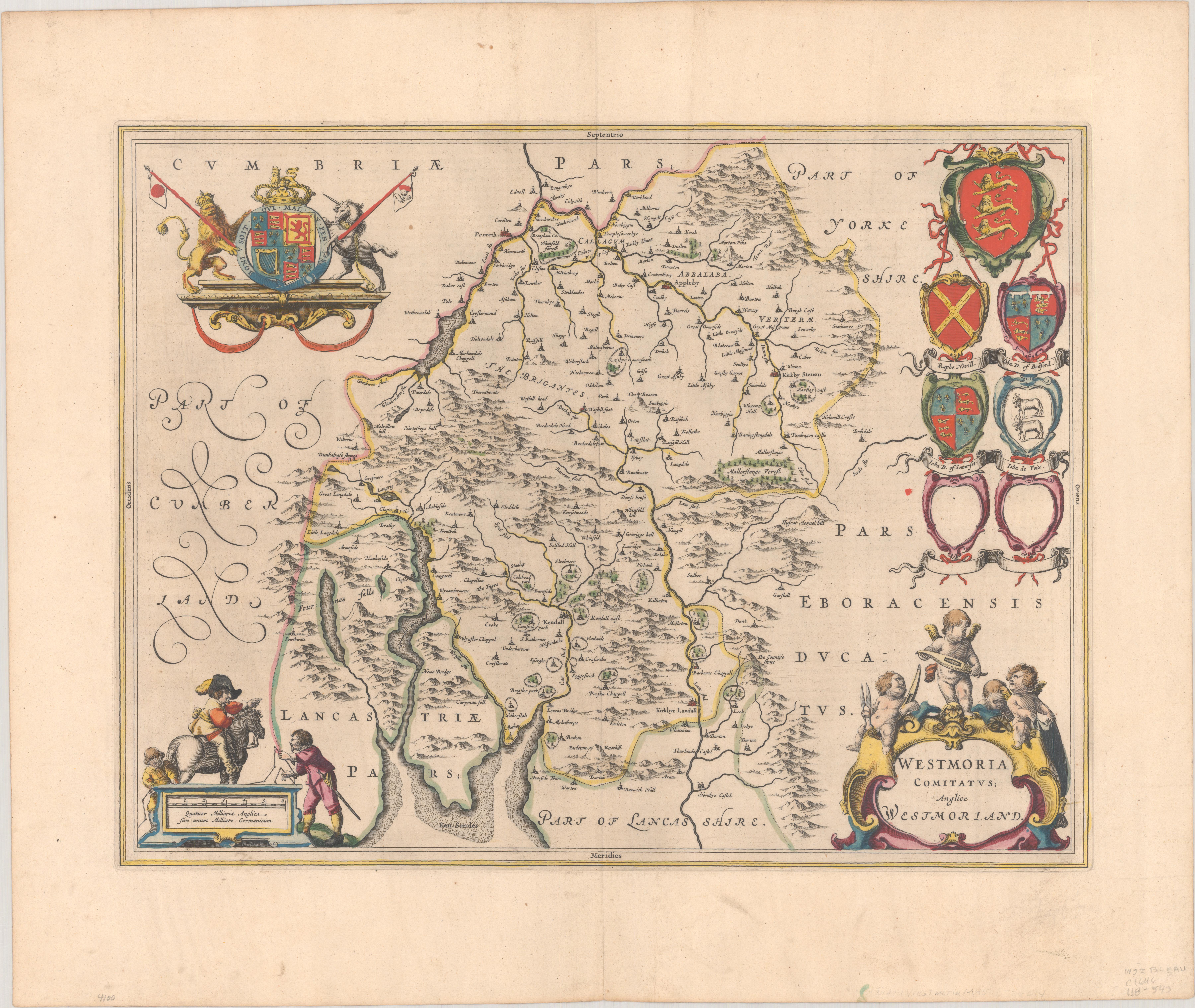
1645 Blaeu Map of Westmorland, Northern England – Hand Colored, Decorative
Located in Langweer, NL
This map, "Westmoria Comitatus; Anglice Westmorland", was created by the esteemed Dutch cartographer Willem Blaeu and was published around 1645 in 'Le Theatre du Monde ou Nouvel Atlas'. It provides a detailed look at Westmorland, a historic county in northern England, based on John Speed’s earlier map. The map features numerous place names, parks, and estates, including Brigster Park, Colnhead Park, Crosbye, and Midleton, along with a detailed depiction of Windermere (spelled Wynandermere) and the surrounding regions.
Additional Features:
- Hand-colored map, with vibrant and detailed colors that bring out the topographical and decorative features.
- Includes intricate cartouches, such as the royal coat of arms, a decorative title cartouche topped with putti (cherubic figures), and six coats of arms (two left blank).
- Depicts the region’s rich landscape, including the rolling hills and mountainous terrain of northern England.
- French text on the verso, indicative of the publication period from 1645-1648, part of Blaeu’s highly sought-after atlases.
- Map shows precise details of small towns, estates, and parks, such as Brigster Park, Colnhead Park, Crosbye, and Wynandermere (now Windermere Lake).
This map would be of particular interest to collectors of English county maps, antique maps of northern England, 17th-century cartography, and the decorative works of Willem Blaeu. Blaeu's maps are renowned for their accuracy, artistic beauty, and historical significance.
Keywords: Willem Blaeu, Westmorland map, northern England, 17th-century map, antique map, English county map, John Speed, Windermere, decorative cartography, hand-colored map, rare map, antique cartography...
Category
Antique 1640s Dutch Maps
Materials
Paper
$1,047 Sale Price
30% Off
More Ways To Browse
Antique 17th Century Map
Kaws Clean Slate
Louise Brooks
Malta Painting
Mechanical Animal
Mexican Alebrijes
Nora Pineda
Odetta Vintage
Otter Sculpture
Painting Woman 1920s
Paris Scene Painting Signed Andrea
Paul Bright
Persian Art Antique Framed
Red Piano
Red Tail Hawk
Red Tailed Hawk
Safari Painting
Southwest Indian Art