Items Similar to Valeriane (Valerian), French botanical medicinal herbal flower engraving, 1818

Want more images or videos?
Request additional images or videos from the seller
1 of 2
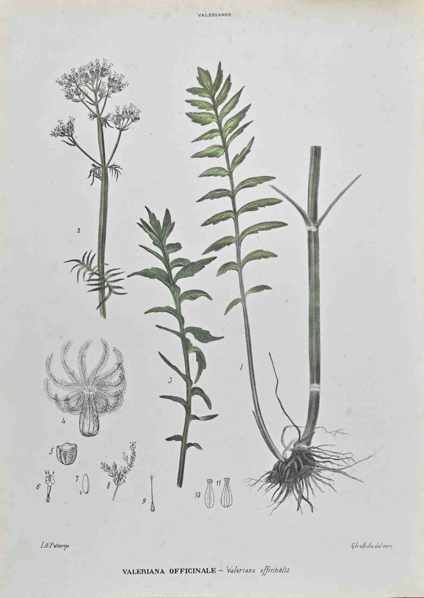
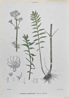
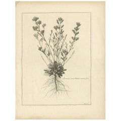
After Pierre TurpinValeriane (Valerian), French botanical medicinal herbal flower engraving, 18181818
1818
$75
£56.97
€65.61
CA$107.30
A$117.69
CHF 60.69
MX$1,405.72
NOK 769.73
SEK 722.09
DKK 490.27
About the Item
French botanical flower engraving, 1818.
Colour-printed stipple engraving by J Lambert after Pierre Turpin (1775-1840)
From Francois Pierre Chaumeton's 'Flore Medicale' which portrayed a variety of flowers, trees and herbs which could be used for treating illnesses. The engravings were produced during the great period of French colour printing using the stipple-engraving process pioneered by the great botanical artist Pierre-Jospeh Redoute. The artist is the celebrated Pierre Jean Francois Turpin (1775-1840), pupil of Redoute. He is considered one of the greatest floral and botanical illustrators during the Napoleonic Era and afterwards. The engraving is accompanied by the original French descriptive text.
210mm by 130mm (sheet)
PLEASE NOTE : If you are interested in more than one of these, let me know and I can list them together with one shipping cost.
- Creator:After Pierre Turpin (1775 - 1840)
- Creation Year:1818
- Dimensions:Height: 8.27 in (21 cm)Width: 5.12 in (13 cm)
- Medium:
- Movement & Style:
- Period:
- Condition:
- Gallery Location:Melbourne, AU
- Reference Number:Seller: BT62761stDibs: LU124426336542
About the Seller
5.0
Platinum Seller
Premium sellers with a 4.7+ rating and 24-hour response times
Established in 2005
1stDibs seller since 2019
617 sales on 1stDibs
Typical response time: <1 hour
- ShippingRetrieving quote...Shipping from: Melbourne, Australia
- Return Policy
Authenticity Guarantee
In the unlikely event there’s an issue with an item’s authenticity, contact us within 1 year for a full refund. DetailsMoney-Back Guarantee
If your item is not as described, is damaged in transit, or does not arrive, contact us within 7 days for a full refund. Details24-Hour Cancellation
You have a 24-hour grace period in which to reconsider your purchase, with no questions asked.Vetted Professional Sellers
Our world-class sellers must adhere to strict standards for service and quality, maintaining the integrity of our listings.Price-Match Guarantee
If you find that a seller listed the same item for a lower price elsewhere, we’ll match it.Trusted Global Delivery
Our best-in-class carrier network provides specialized shipping options worldwide, including custom delivery.More From This Seller
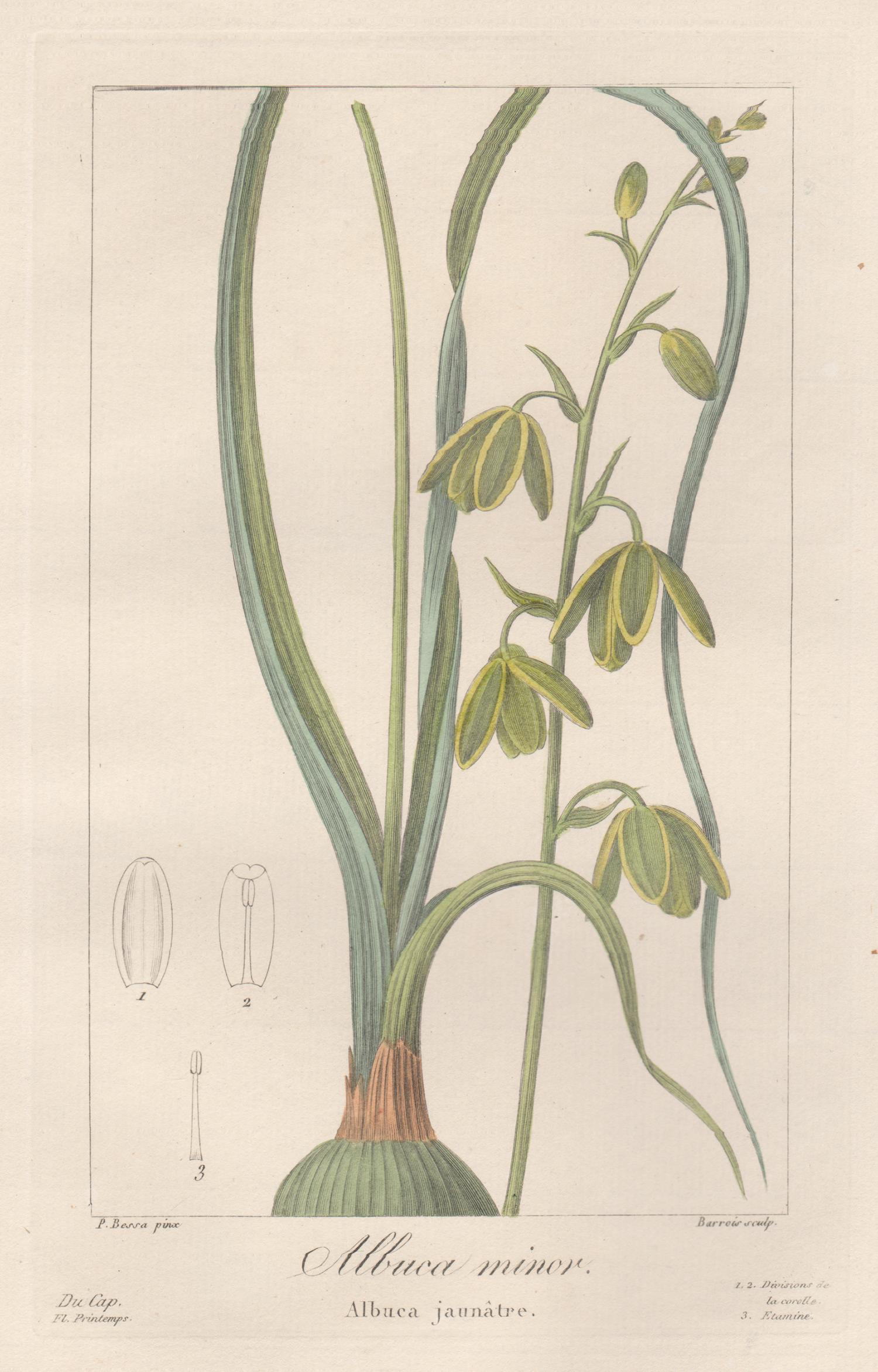
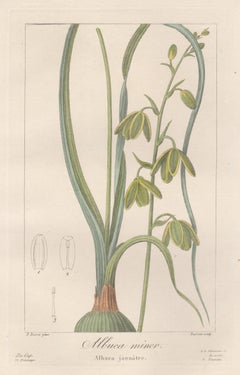
View AllAlbuca Minor - French botanical flower engraving by Bessa, c1830
By After Pancrace Bessa
Located in Melbourne, Victoria
'Albuca Minor'
Original copper-line engraving with original hand-colouring.
From 'Herbier general de l'amateur' by Jean Louis Auguste Loiseleur-Deslongchamps & Jean Claude Michel M...
Category
Early 19th Century Naturalistic Still-life Prints
Materials
Engraving
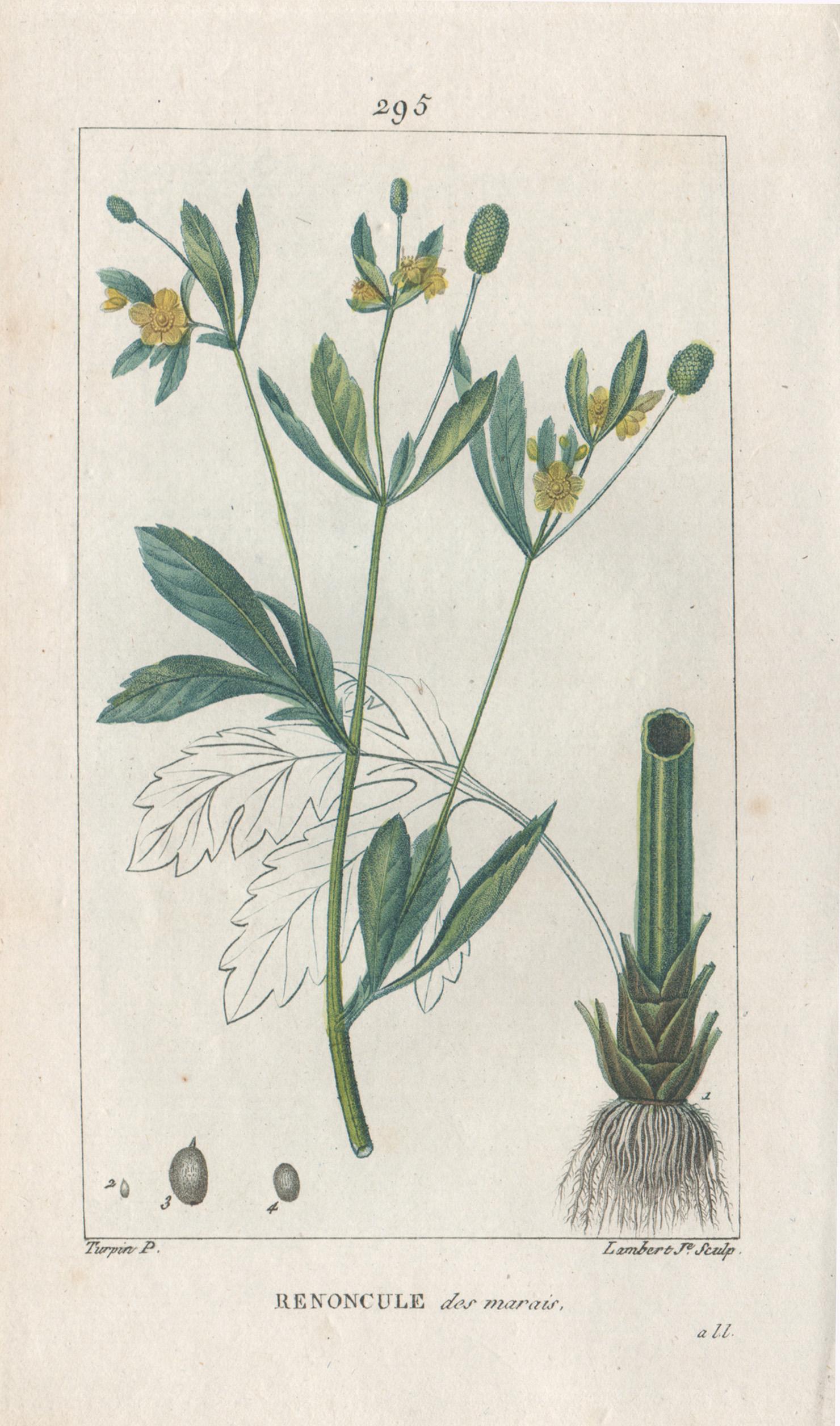
Renoncule des marais (Buttercup), French botanical flower engraving, 1818
By After Pierre Turpin
Located in Melbourne, Victoria
French botanical flower engraving, 1818.
Colour-printed stipple engraving by J Lambert after Pierre Turpin (1775-1840)
From Francois Pierre Chaumeton's 'Flore Medicale' which portrayed a variety of flowers, trees and herbs which could be used for treating illnesses. The engravings were produced during the great period of French colour printing using the stipple-engraving process pioneered by the great botanical artist Pierre-Jospeh Redoute. The artist is the celebrated Pierre Jean Francois Turpin...
Category
Early 19th Century Victorian More Prints
Materials
Engraving

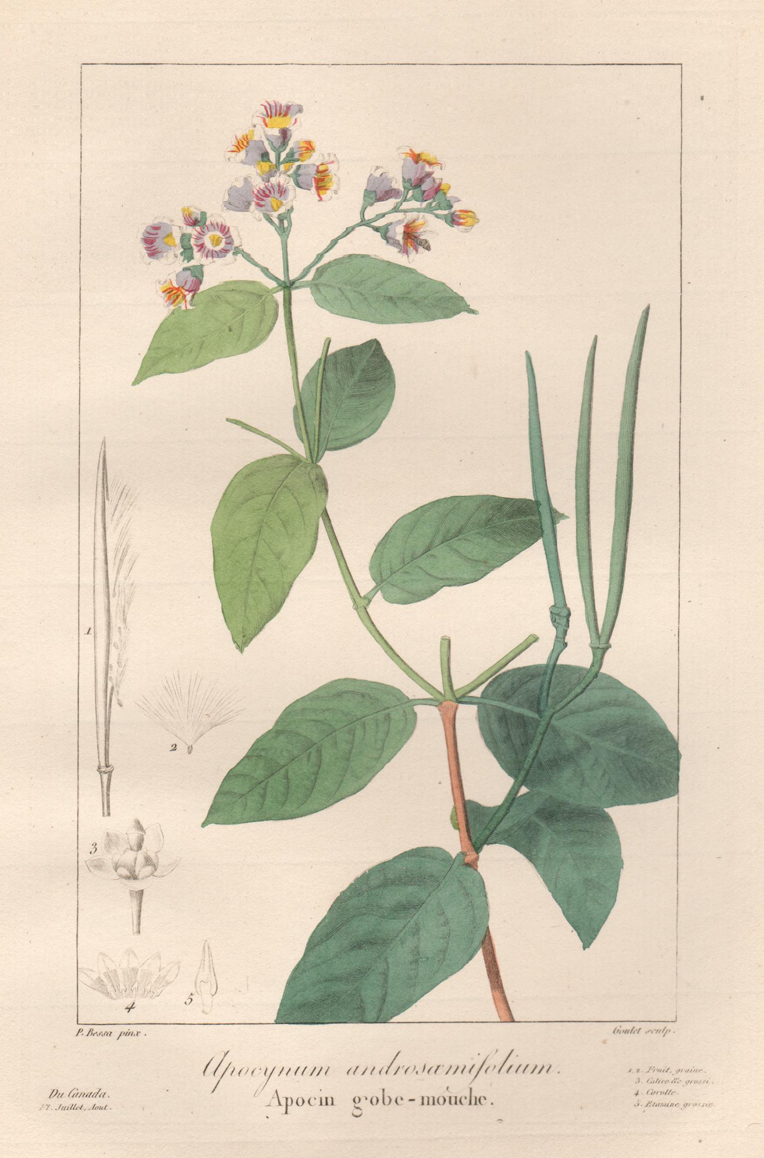
Apocynum androsamifolium - French botanical flower engraving by Bessa, c1830
By After Pancrace Bessa
Located in Melbourne, Victoria
'Apocynum androsamifolium' (Fly-trap dogbane or spreading dogbane)
Original copper-line engraving with original hand-colouring.
From 'Herbier general de l'amateur' by Jean Louis A...
Category
Early 19th Century Naturalistic Still-life Prints
Materials
Engraving

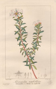
Adenandra umbellata - French botanical flower engraving by Bessa, c1830
By After Pancrace Bessa
Located in Melbourne, Victoria
'Adenandra umbellata'
Original copper-line engraving with original hand-colouring.
From 'Herbier general de l'amateur' by Jean Louis Auguste Loiseleur-Deslongchamps & Jean Claude M...
Category
Early 19th Century Naturalistic Still-life Prints
Materials
Engraving
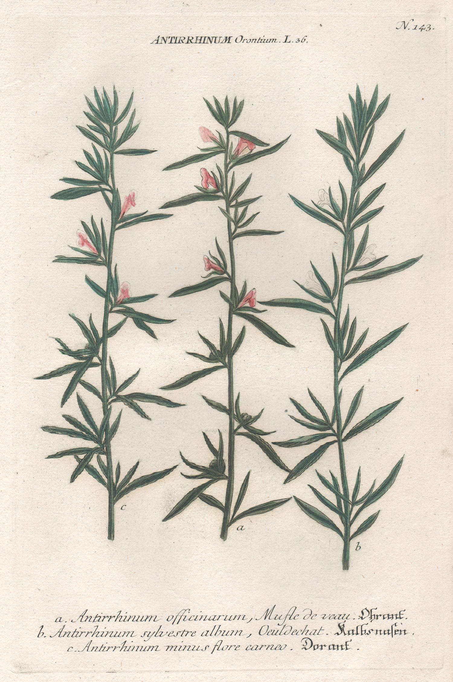
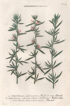
Antirrhinum Orontium - 18th century Weinmann botanical plant flower engraving
By Johann Wilhelm Weinmann
Located in Melbourne, Victoria
'Antirrhinum Orontium'
Mezzotint printed in colours. Circa 1740.
From Johann W Weinmann's Phytanthoza Iconographia, published in Regensburg 1737-45. The first botanical series to u...
Category
18th Century Naturalistic Still-life Prints
Materials
Engraving
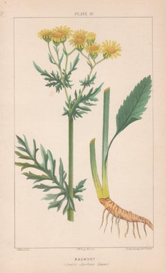
Ragwort (Senecio Jacobaea), antique botanical lithograph
Located in Melbourne, Victoria
'Ragwort (Senecio Jacobaea, Linne)
Colour lithograph, 1909.
Category
Early 20th Century Naturalistic More Prints
Materials
Lithograph
You May Also Like
Valerian Officinale - Lithograph by Vincenzo Tenore - 1870s
Located in Roma, IT
Lithograph hand watercolored.
Belongs to the Series "Atlante di Botanica popolare ossia Illustrazione di Piante Notevoli di ogni famiglia" (Atlas of popular botany or illustration o...
Category
1870s Modern Figurative Prints
Materials
Lithograph
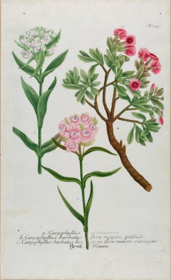
Flowering Sweet William Plant: 18th C. Hand-colored Weinmann Botanical Engraving
By Johann Wilhelm Weinmann
Located in Alamo, CA
This hand-colored botanical mezzotint and line engraving by Johann Wilhelm Weinmann (1683-1741) is entitled "a. Caryophyllus Arborescens, b. Caryophyllus Barbatus". It is plate 327 i...
Category
Mid-18th Century Naturalistic Still-life Prints
Materials
Engraving, Mezzotint
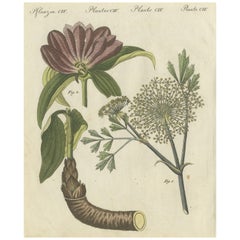
Galbanum and Hungarian Gentian: Rare Medicinal Plants Illustrated, 1805
Located in Langweer, NL
"Galbanum and Hungarian Gentian: Rare Medicinal Plants Illustrated, 1805"
This stunning hand-colored copperplate engraving depicts two remarkable plants: the Galbanum (*Ferula galba...
Category
Antique Early 1800s Prints
Materials
Paper
Antique Botany Print of a Limonium Flowering Plant, circa 1680
Located in Langweer, NL
Antique botany print titled 'Limonium minus Bellidis (..)'. Original antique print of a limonium flowering plant. This print originates from 'Me´moires pour servir a' l'histoire des ...
Category
Antique Late 17th Century Prints
Materials
Paper
$237 Sale Price
20% Off
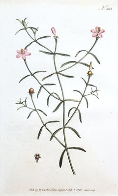
Chironia Baccifera Berry-Bearing Chironia /// English Botanical Flower Engraving
By William Curtis
Located in Saint Augustine, FL
Artist: William Curtis (English, 1746-1799)
Title: "Chironia Baccifera Berry-Bearing Chironia" (Vol. 7, Plate 233)
Portfolio: The Botanical Magazine; or, Flower-Garden Displayed
Year...
Category
1790s Victorian Still-life Prints
Materials
Watercolor, Engraving, Intaglio
Antique Botany Print of Galium Odoratum by Curtis, circa 1817
Located in Langweer, NL
Antique botany print titled 'Asperula Odorata'. Hand colored engraving of galium odoratum, also known as sweet-scented bedstraw. This print originates from 'Flora Londinensis' by Wil...
Category
Antique Early 19th Century Prints
Materials
Paper
$237 Sale Price
20% Off
More Ways To Browse
Antique French Engravings
Engravings 19th Century French
Victorian Botanical Prints
French Botanical Prints
Iran Poster
Italian Food Posters
Jaguar Car Poster
Jean Bradbury
Jean Choiselat
Jenny Holzer Postcard
Jose Morell
Joy Lane
Karl Klein
Kenneth Steel Art
Lake Garda Vintage Poster
Lela Bliss
Lennon Woman
Levi Andy Warhol