Items Similar to John Thomson (1777-1840) - 1830 Map Engraving, The Rivers of the World

Want more images or videos?
Request additional images or videos from the seller
1 of 6
John ThomsonJohn Thomson (1777-1840) - 1830 Map Engraving, The Rivers of the World1830
1830
$349.60
$43720% Off
£268.01
£335.0220% Off
€306.68
€383.3520% Off
CA$494.06
CA$617.5820% Off
A$537.03
A$671.2820% Off
CHF 287.48
CHF 359.3520% Off
MX$6,491.42
MX$8,114.2720% Off
NOK 3,622.80
NOK 4,528.5020% Off
SEK 3,341.16
SEK 4,176.4520% Off
DKK 2,290.42
DKK 2,863.0320% Off
About the Item
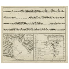
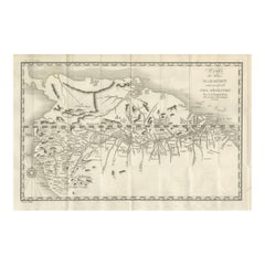
A fine engraved chart table showing the lengths of the principal rivers across the world, from the second edition of John Thomson's 'New General Atlas' published in 1830. On paper.
- Creator:John Thomson (1941 - 1840, American)
- Creation Year:1830
- Dimensions:Height: 20.08 in (51 cm)Width: 25.6 in (65 cm)
- Medium:
- Period:
- Condition:The condition is typical for a picture of this age including some discolouration, foxing and small tears and creases around the edges of the paper. The map is folded in half, down the centre.
- Gallery Location:Corsham, GB
- Reference Number:Seller: rx7171stDibs: LU881313959262
John Thomson
Thomson lives and paints in California, Mexico and the Caribbean. His paintings, drawings, prints, ceramics, and color photographs have been exhibited by many leading galleries and design firms throughout the United States, and abroad. Over 4000 of his abstract creations are represented in private, and public collections around the world. Thomson earned his BA in Arts, 1964 from Chico State College and MA in Painting, 1970, from Chico State University.
About the Seller
4.9
Gold Seller
Premium sellers maintaining a 4.3+ rating and 24-hour response times
Established in 2010
1stDibs seller since 2018
1,443 sales on 1stDibs
Typical response time: 2 hours
- ShippingRetrieving quote...Shipping from: Corsham, United Kingdom
- Return Policy
More From This Seller
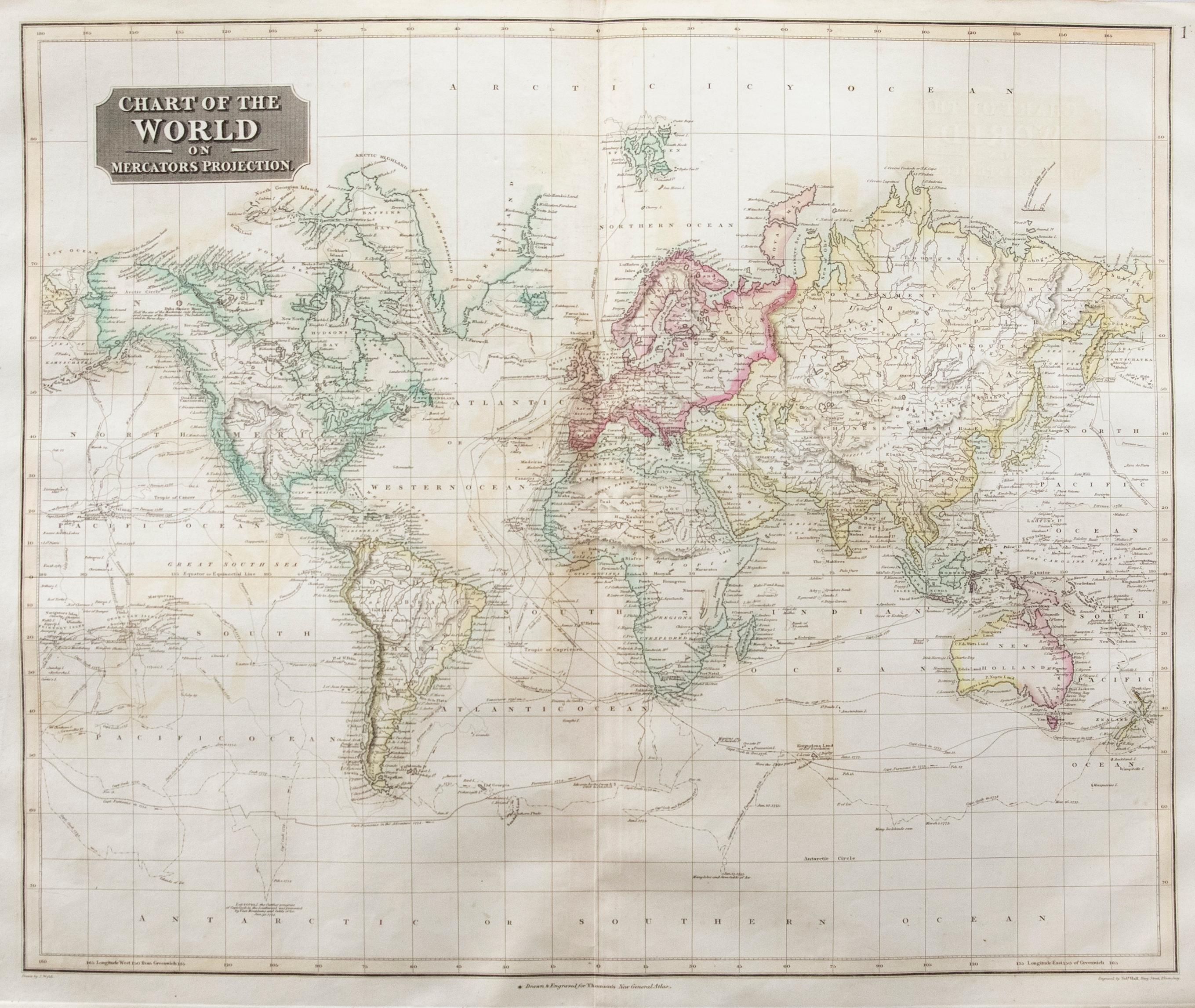
View AllJohn Thomson (1777-1840) - 1830 Map Engraving, Chart of the World
By John Thomson
Located in Corsham, GB
A fine engraved map of the world on Mercator's projection, from the second edition of John Thomson's 'New General Atlas' published in 1830. On paper.
Category
Early 19th Century More Prints
Materials
Engraving

$316 Sale Price
20% Off
18th Century Map Engraving - Plan of the Works of the City of Messina, Sicily
Located in Corsham, GB
A map of Messina, a harbour city in northeast Sicily. Inscribed with the title in plate to the lower edge, 'Plan of the Works of the City of Messina, one of the strongest and most co...
Category
18th Century More Prints
Materials
Engraving

$285 Sale Price
20% Off
Henri Liebaux and Guillaume De L'Isle - 1706 Engraving, Map Of The Moscovites
Located in Corsham, GB
A early 18th Century map showing a section of Muscovite Russia. This is the lower half of the complete original map, finished with hand colouring. The artist's names are engraved in ...
Category
18th Century More Prints
Materials
Engraving
After Johann B. Homann (1664-1724) - 19th C, General Map of Spain and Portugal
Located in Corsham, GB
General map of Spain and Portugal divided into its current provinces by D.T. Lopez, newly drawn by F. L. G. in Nuremberg at the Heret of Homann, 1782. A double-page engraved map with...
Category
19th Century More Prints
Materials
Engraving

Laurie and Whittle - 1794 Engraving, A General View of the City of Lisbon
Located in Corsham, GB
A vibrant and captivating print depicting an expansive view of Lisbon, with ships sailing in the foreground. Inscribed within the plate below the image. On paper.
Category
Early 18th Century Landscape Prints
Materials
Engraving
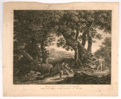
Johann Christian Reinhart (1761-1847) - 1807 Engraving, Balaam's Donkey
Located in Corsham, GB
A fine early 19th Century engraving, showing the Biblical scene of Balaam's Donkey. The artist has inscribed their name and date in plate at the lower edge, along with an inscription...
Category
Early 19th Century Landscape Prints
Materials
Engraving
You May Also Like
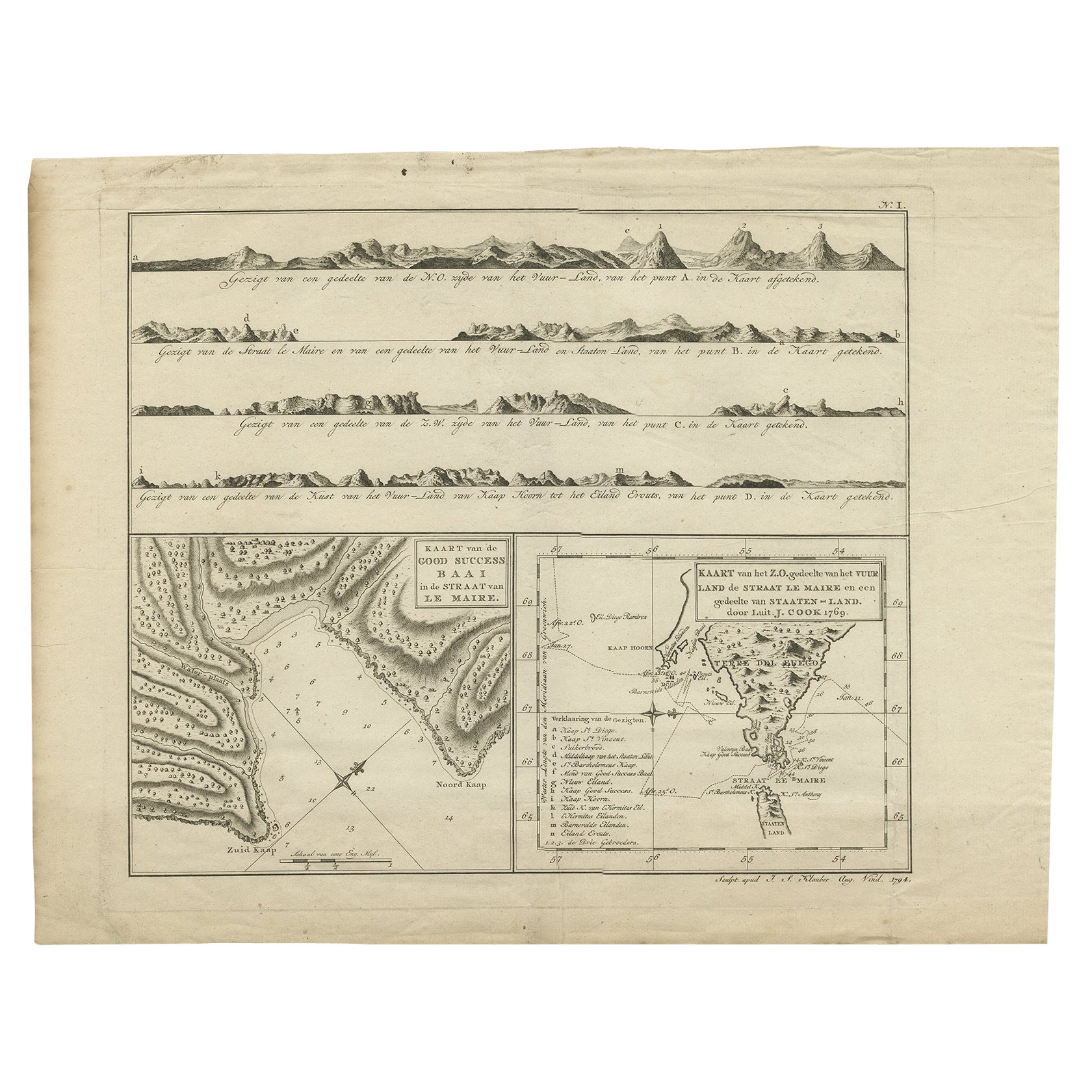
Antique Map of the Strait of Le Maire by Cook, 1803
Located in Langweer, NL
Antique map titled 'Kaart van de Good Success Baai in de Straat van Le Maire (..)'. Antique map of the Strait of Le Maire between Terra Fuego and Staten Island. On top, various coast...
Category
Antique 19th Century Maps
Materials
Paper

$597 Sale Price
20% Off
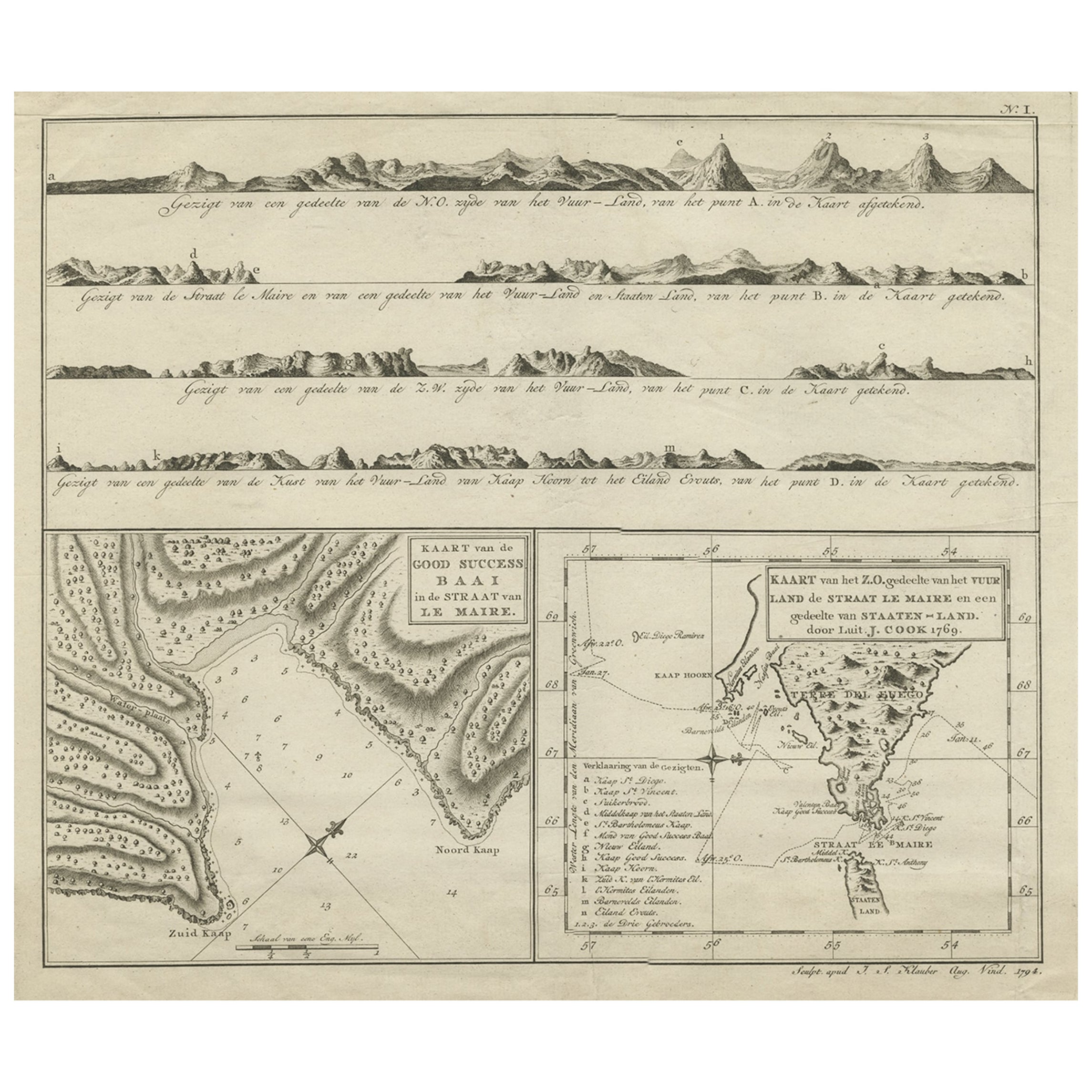
Antique Map of the Strait of Le Maire Between Terra Fuego & Staten Island, 1803
Located in Langweer, NL
Antique map titled 'Kaart van de Good Success Baai in de Straat van Le Maire (..)'.
Antique map of the Strait of Le Maire between Terra Fuego and Staten Island. On top, various c...
Category
Antique Early 1800s Maps
Materials
Paper
$597 Sale Price
20% Off
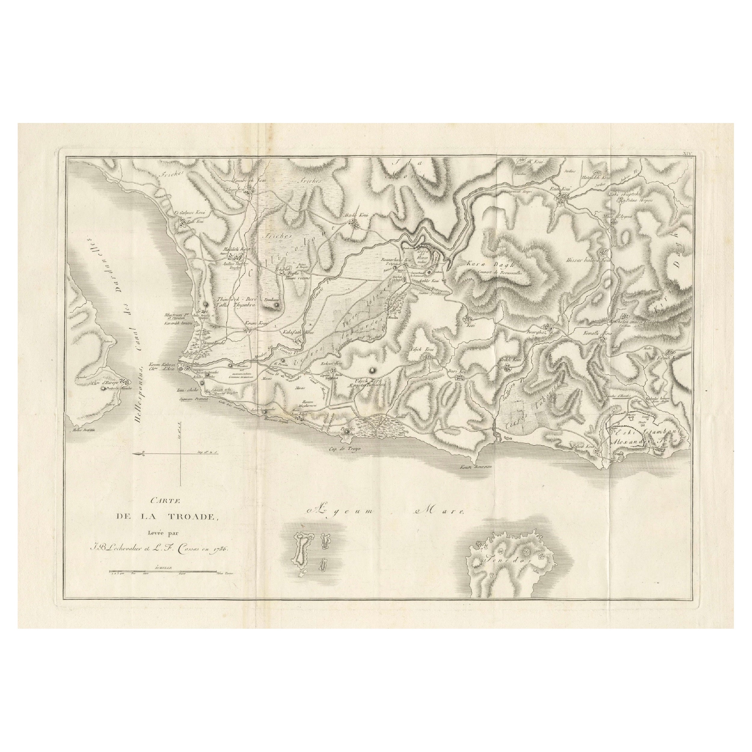
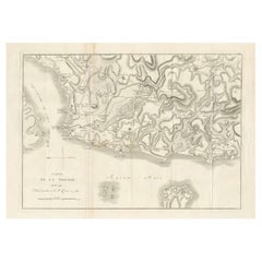
Circa 1802 Map of the Troad Region by Tardieu – From the Voyage de la Troade
Located in Langweer, NL
This is a large fold-out map titled *Carte de la Troade*, measuring approximately 53.5 x 68 cm, engraved by Tardieu, and extracted from the atlas of *Voyage de la Troade, fait dans l...
Category
Antique Early 1800s French Maps
Materials
Paper
$222 Sale Price
25% Off
Antique Map of South America by J. Cook (1775)
Located in Langweer, NL
Antique map titled 'Kaart van het Zuidlyk Eind van Amerika'. Map of the sourthern part of South America, focusing on Cook's tracks around the Cape Horn and Tierra del Fuego in 1775. ...
Category
Antique Late 18th Century Maps
Materials
Paper

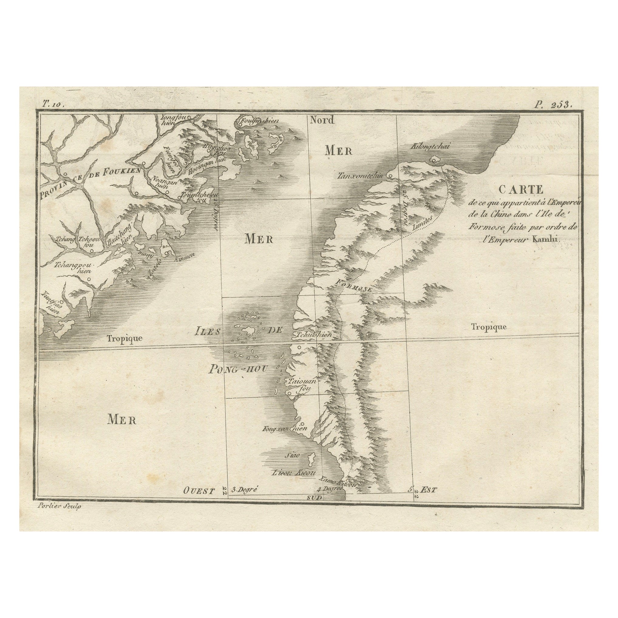
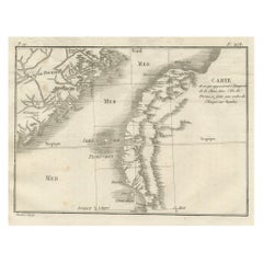
Map of Formosa and Pescadores – French Jesuit Engraving by Portier, c.1790
Located in Langweer, NL
Map of Formosa and Pescadores – French Jesuit Engraving by Portier, c.1790
This antique French map, engraved by Portier around 1790, depicts the island of Formosa (modern Taiwan), t...
Category
Antique Late 18th Century French Maps
Materials
Paper
Antique Map of the Amazon River – Maragnon or River of the Amazons, c.1760
Located in Langweer, NL
Map of the Amazon River – “Cours du Fleuve Maragnon autrement dit des Amazones”, c.1760
This 18th-century copperplate map, titled Cours du Fleuve Maragnon autrement dit des Amazones...
Category
Antique Mid-18th Century French Maps
Materials
Paper
More Ways To Browse
Antique Chart Table
Blah Blah Art
Botanical Print Plates
California Travel Poster
Campari Vintage Art Posters
Canadian National Posters Original
Carlingford Lough
Cccp Space Poster
Creole Dancer
Dali Fruit
David Shrigley The World
El Al Airlines
English Roses Prints
Ghibli Poster
Hans Unger
Japan Airlines Poster
John Lennon Imagine
Jungfrau Poster