
John Thomson Art

American, 1941-1840
Thomson lives and paints in California, Mexico and the Caribbean. His paintings, drawings, prints, ceramics, and color photographs have been exhibited by many leading galleries and design firms throughout the United States, and abroad. Over 4000 of his abstract creations are represented in private, and public collections around the world. Thomson earned his BA in Arts, 1964 from Chico State College and MA in Painting, 1970, from Chico State University.
(Biography provided by Robert Azensky Fine Art)
to
2
5
1
5
4
1
John Thomson (1777-1840) - 1830 Map Engraving, Northern Hemisphere
By John Thomson
Located in Corsham, GB
A fine engraved map of the Northern Hemisphere, from the second edition of John Thomson's 'New General Atlas' published in 1830. On paper.
Category

Early 19th Century John Thomson Art

Materials

Engraving

John Thomson (1777-1840) - 1830 Map Engraving, The Rivers of the World
By John Thomson
Located in Corsham, GB
A fine engraved chart table showing the lengths of the principal rivers across the world, from the second edition of John Thomson's 'New General Atlas' published in 1830. On paper.
Category

Early 19th Century John Thomson Art

Materials

Engraving

John Thomson (1777-1840) - 1830 Map Engraving, Eastern Hemisphere
By John Thomson
Located in Corsham, GB
A fine engraved map of the Eastern Hemisphere of Earth, from the second edition of John Thomson's 'New General Atlas' published in 1830. On paper.
Category

Early 19th Century John Thomson Art

Materials

Engraving

John Thomson (1777-1840) - 1830 Map Engraving, Chart of the World
By John Thomson
Located in Corsham, GB
A fine engraved map of the world on Mercator's projection, from the second edition of John Thomson's 'New General Atlas' published in 1830. On paper.
Category

Early 19th Century John Thomson Art

Materials

Engraving

Interesting Map of the Atlantic Showing Nelson's and Trade Routes, 1817
By John Thomson
Located in Langweer, NL
Antique map titled 'Chart of the North Atlantic Ocean with Tracks of the Shipping to West Indies, North America, &cc'. Large map of the Atlantic, showing the tracks of the ships trad...
Category

19th Century Antique John Thomson Art

Materials

Paper

China Patch Abstract
By John Thomson
Located in Soquel, CA
Compelling and vibrant oil abstract work by Monterey Bay artist and gallery owner John O. Thomson. Signed lower right. Signed on verso John O Thomson and titled "China Patch 6-5-11 S...
Category

21st Century and Contemporary Abstract Expressionist John Thomson Art

Materials

Canvas, Oil

Related Items
Large 17th Century Hand Colored Map of England and the British Isles by de Wit
By Frederick de Wit
Located in Alamo, CA
A large hand colored 17th century map of England and the British Isles by Frederick de Wit entitled "Accuratissima Angliæ Regni et Walliæ Principatus", published in Amsterdam in 1680. It is a highly detailed map of England, Scotland, the Scottish Isles...
Category

Late 17th Century Dutch Antique John Thomson Art

Materials

Paper

Original Antique Map of Italy. C.1780
Located in St Annes, Lancashire
Great map of Italy Copper-plate engraving Published C.1780 Unframed.
Category

Early 1800s English Georgian Antique John Thomson Art

Materials

Paper

Original Antique Map of Italy. C.1780
No Reserve
H 8.25 in W 12 in D 0.07 in
View of Pisaro, Italy: A 16th Century Hand-colored Map by Braun & Hogenberg
By Franz Hogenberg
Located in Alamo, CA
This is a 16th century original hand-colored copperplate engraved map of View of Pezaro (Pisaro), Italy entitled "Pisaurum vulgo Pezaro" by Georg Braun & Franz Hogenberg, from their famous city atlas "Civitates Orbis Terrarum", published in Augsberg, Germany in 1575. The map depicts a view of Pesaro, Italy from the west looking over the town to the Adriatic Sea. The River Foglia flows into the Adriatic in the foreground. The only identifiable building is the cathedral of San Domenico, which rises above the other roofs with its tall spire. Two women, dressed in styles of the 16th century are in conversation on a hill in the foreground on the left. Pesaro is in the province of Pesaro and Urbino and lies on the Adriatic and east of Florence. The city, which was founded by the Etruscans and named Pisaurum by the Romans, belonged from AD 754 onwards to the Papal States, and after 1285 was controlled by the princely families of Malatesta, Sforza and della Rovere. Today it is the capital of the province of Pesaro and Urbino and has a population of about 92,000. Pesaro's most famous resident, composer Gioacchino Rossini, was born here in 1792. The following is an English translation of an excerpt from Braun's description of the city: "We believe that the astonishingly short life of the inhabitants of Pesaro comes not only from the insalubrious air, but also from the great quantity of delectable and delicious fruits which they consume to excess. For this causes the production in their bodies of evil humours, which then lead to incurably fatal diseases. The area around the city is most charming and well planted with vineyards, fig trees, olive trees and other fruit-bearing trees." 
  References: Van der Krogt 4, 3369, state 1; Taschen, Braun and Hogenberg...
Category

16th Century Old Masters John Thomson Art

Materials

Engraving

Original Antique Map of Asia. C.1780
Located in St Annes, Lancashire
Great map of Asia Copper-plate engraving Published C.1780 Two small worm holes to right side of map Unframed.
Category

Early 1800s English Georgian Antique John Thomson Art

Materials

Paper

Original Antique Map of Asia. C.1780
No Reserve
H 8.75 in W 12.25 in D 0.07 in
Antique American Abstract Expressionist Vintage Framed New York School Painting
Located in Buffalo, NY
Antique American modernist abstract painting. Oil on canvas, circa 1940. Housed in a vintage frame. Image size, 18L x 24H.
Category

1940s Abstract Expressionist John Thomson Art

Materials

Canvas, Oil

View of Emden, Germany: A 16th Century Hand-colored Map by Braun & Hogenberg
By Franz Hogenberg
Located in Alamo, CA
This is a 16th century original hand-colored copperplate engraved map of a bird's-eye View of Embden, Germany entitled " Emuda, vulgo Embden vrbs Frisia orientalis primaria" by Georg Braun & Franz Hogenberg, in volume II of their famous city atlas "Civitates Orbis Terrarum", published in Cologne, Germany in 1575. This is a beautifully colored and detailed map of Emden, a seaport in northwestern Germany, along the Ems River and perhaps portions of over Dollart Bay, near the border with the Netherland. The map depicts a bird's-eye view of the city from the southwest, as well as a view of the harbor and an extensive system of canals. Numerous ships of various sizes, as well as two rowboats containing numerous occupants are seen in the main waterway in the foreground and additional boats line two canals in the center of the city. Two men and two women are shown on a hill in the foreground on the right, dressed in the 16th century style of nobility. Two ornate crests are included in each corner. A title strap-work cartouche is in the upper center with the title in Latin. The crest on the right including Engelke up de Muer (The Little Angel on the Wall) was granted by Emperor Maximilian I in 1495. This is an English translation of an excerpt of Braun's description of Embden: "In Emden, the capital of East Frisia, rich merchants live in very fine houses. The city has a broad and well-situated harbour, which in my opinion is unique in Holland. Frisia and the whole of the Netherlands, for the ships can anchor here right under the city walls. They have also extended the harbour as far as the New Town, so that up to 400 ships can now find shelter here when the sea is rough." The emphasis on the harbor and waterways within the city highlights the importance of Emden's place as a seaport at this time. Embden developed from a Dutch/Flemish trading settlement in the 7th-8th centuries into a city as late as late 14th century. In 1494 it was granted staple rights, and in 1536 the harbour was extended. In the mid-16th century Emden's port was thought to have the most ships in Europe. Its population then was about 5,000, rising to 15,000 by the end of the 16th century. The Ems River flowed directly under the city walls, but its course was changed in the 17th century by the construction of a canal. Emden has canals within its city limits, a typical feature of Dutch towns, which also enabled the extension of the harbor. In 1744 Emden was annexed by Prussia and is now part of Germany. It was captured by French forces in 1757 during the Seven Years' War, but recaptured by Anglo-German forces in 1758. During the Napoleonic French era, Emden and the surrounding lands of East Frisia were part of the short-lived Kingdom of Holland. References:Van der Krogt 4, 1230, State 2; Taschen, Braun and Hogenberg...
Category

16th Century Old Masters John Thomson Art

Materials

Engraving

Map of the World: An Original 18th Century Hand-colored Map by E. Bowen
Located in Alamo, CA
This is an original 18th century hand-colored map entitled "A New & Correct Chart of All The Known World Laid down according to Mercator's Projection" by Emanuel Bowen. It was published in 1744 in London in John Harris's "Navigantium atque Itinerantium Bibliotheca" or "A Complete Collection of Voyages and Travels". This highly detailed and colorful map depicts the world. as it was known in the mid 18th century. A majority of the northern and central portions of Canada and America are left blank due to the purity of knowledge at the time this map was published. The map is embellished with four Compass Roses in the lower left, lower center, lower right and center, along with many rhumb lines. There a is a decorative title cartouche in the upper left. This colorful, attractive, historical and interesting 1744 map presents the entire world on Mercator's projection as it was understood in the middle part of the 18th century, before the landmark explorations of Captain’s Cook, Vancouver, Wilkes and others. It is an example of a nautical chart, a type of map that was designed specifically for use by mariners. The map is centered on the equator and includes both the Eastern and Western Hemispheres. The continents of North America, South America, Europe, Africa, and Asia are depicted, as well as various islands in the Atlantic, Pacific, and Indian Oceans. The map is laid out according to the Mercator projection, a type of cylindrical map projection that was developed in the 16th century by Flemish cartographer Gerardus Mercator. This projection has the advantage of preserving angles and shapes, making it useful for navigation. The map presents a paucity of inland detail, particularly for the Americas, but major cities, geographical landmarks, and regions are included. Ocean currents and Tradewinds are identified, as well as the magnetic declination lines or magnetic variance, which refers to the difference between true north and compass north. The continents are color coded, enhancing the beauty of this map. The three compass roses indicate the directions of the cardinal points. The depiction of the western coast of America, the Pacific and Australia are interesting. There was very little exploration of Australia between the navigations of William Damper in 1699 and Tobias Furneaux in 1773. Most of the maps detail relies on the 17th century Dutch expeditions to Australia's western coast, by Abel Tasman and William Janszoon. Van Diemen's Land (Tasmania) and New Guinea appear connected to the Australian continent. New Zealand appears as a single landmass. North of New Zealand there is a landmass labelled 'Ter d' St. Esprit' which probably represents the New Hebrides Islands. This map precedes the accurate exploration of the South Pacific and east coast of Australia by Captain James Cook later in the 18th century. The map includes ‘Drakes' Port,' the site where Sir Francis Drake supposedly landed in 1579 during his 1579 circumnavigation of the globe. Here he claimed territory for England, restocked, and repaired his vessels. Drake named the region New Albion. The exact location of Drake's Port is a cartographic mystery. Drake's Harbor is believed to be in the region of San Francisco Bay, Bodega Bay, San Pablo Bay...
Category

Mid-18th Century Old Masters John Thomson Art

Materials

Engraving

A View of Scarborough, England: A Framed 19th C. Engraving After J. M. W. Turner
By J.M.W. Turner
Located in Alamo, CA
This beautiful 19th century framed engraving "Scarborough" by W. Chapman is based on an original painting by the renowned British artist J.M.W. Turner. It was published in London by ...
Category

Mid-19th Century Romantic John Thomson Art

Materials

Engraving

Ulysses Deriding Polyphemus: A Framed 19th C. Engraving After J. M. W. Turner
By J.M.W. Turner
Located in Alamo, CA
This beautiful 19th century framed hand-colored engraving/etching entitled "Ullyses Deriding Polyphemus" by Edward Goodall is based on an original 1829 painting by the renowned Briti...
Category

Mid-19th Century Romantic John Thomson Art

Materials

Engraving, Etching

The Fighting Temeraire: A Framed 19th C. Engraving After J. M. W. Turner
By J.M.W. Turner
Located in Alamo, CA
This beautiful 19th century framed engraving "The Fighting Temeraire" by James Tibbetts Willmore is based on an original painting by the renowned British artist J.M.W. Turner. It was published by James S. Virtue & Co. in London between 1859-1875. It depicts the once mighty British warship the HMS Temeraire being towed away down the river Thames by a much smaller steamboat to a ship-breaking yard to be broken up for scrap. The Temeraire was first launched in 1798 and represented the pinnacle of British ship-building. 180-feet long, constructed of English oak and armed with 98 guns, she was one of the largest warships of the period. The Temeraire became a symbol of British pride and military power that endured throughout the 19th century. The man-of-war served during the French Revolutionary and Napoleonic Wars and was among the last serving ships to have been at the Battle of Trafalgar in 1805. It became one of the many older ships put out of service in the 1830s and 1840s. The once mighty and feared ship symbolizes a once magnificent, but now obsolete, technology. Turner seems to lament her inglorious final journey, being towed by a less magnificent, but modern steam powered tugboat. The Turner painting was created in 1838 and is now held in the National Gallery in London. Willmore's engraving, created in 1859, captures the dramatic scene with great detail and skill. The image has become an iconic representation of the decline of Britain's naval power and the transition from sail to steam in the 19th century. The sunset in the background is symbolic of the sun going down on British naval power and tradition. The painting conveys profound and diverse themes that are central to the human experience: those of mortality and change, technology and progress, heroism and brutality. The painting demonstrates Turner’s skill as an artist. His ability to produce scenes of great beauty that are dramatic, but are also symbolic, stimulating both thoughtful analysis, as well as emotion. Turner's painting was voted by the British public in a 2005 BBC radio sponsored survey to be the British people's favorite painting of all time. In 2020 it was included on a new British banknote...
Category

Mid-19th Century Romantic John Thomson Art

Materials

Engraving

Original Antique Map of The World by Thomas Clerk, 1817
Located in St Annes, Lancashire
Great map of The Eastern and Western Hemispheres On 2 sheets Copper-plate engraving Drawn and engraved by Thomas Clerk, Edinburgh. Published by Mackenzie And Dent, 1817 ...
Category

1810s English Antique John Thomson Art

Materials

Paper

Original Antique Map of The World by Thomas Clerk, 1817
No Reserve
H 10.25 in W 8.25 in D 0.07 in
Antique 18th Century Map of the Province of Pensilvania 'Pennsylvania State'
Located in Philadelphia, PA
A fine antique of the colony of Pennsylvania. Noted at the top of the sheet as a 'Map of the province of Pensilvania'. This undated and anonymous map is thought to be from the Gentleman's Magazine, London, circa 1775, although the general appearance could date it to the 1760's. The southern boundary reflects the Mason-Dixon survey (1768), the western boundary is placed just west of Pittsburgh, and the northern boundary is not marked. The map has a number of reference points that likely refer to companion text and appear to be connected to boundaries. The western and southern boundaries are marked Q, R, S, for example. A diagonal line runs from the Susquehanna R to the Lake Erie P. A broken line marked by many letters A, B, N, O, etc., appears in the east. There are no latitude or longitude markings, blank verso. Framed in a shaped contemporary gilt wooden frame and matted under a cream colored matte. Bearing an old Graham Arader Gallery...
Category

18th Century British American Colonial Antique John Thomson Art

Materials

Paper

Previously Available Items
Historical Childs Toy Doll Plate, Indian Chiefs California Gold Rush, circa 1850
By John Thomson
Located in Philadelphia, PA
A circa 1850, pearlware historical childrens' miniature toy doll plate titled “Indian Chiefs,” one of a series of plates commemorating the California Gold Rush...
Category

Mid-19th Century Scottish Late Victorian Antique John Thomson Art

Materials

Pearlware

Antique Hand Colored Hemispheres by John Thomson
By John Thomson
Located in New York, NY
A pair of hand colored and engraved world maps depicting the eastern and western hemispheres. They are dated 1815 and were produced for John Thomson's New General Atlas (published i...
Category

19th Century British Antique John Thomson Art

Materials

Paper

John Thomson art for sale on 1stDibs.

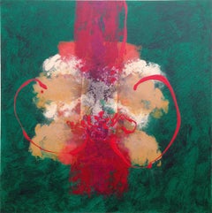
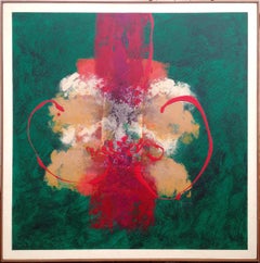
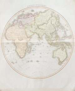
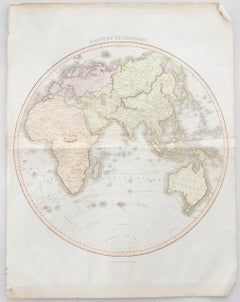
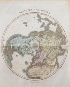
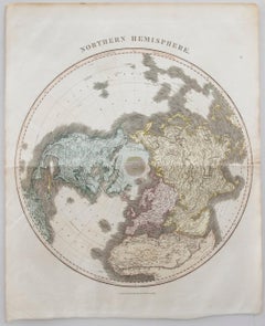
Find a wide variety of authentic John Thomson art available for sale on 1stDibs. If you’re browsing the collection of art to introduce a pop of color in a neutral corner of your living room or bedroom, you can find work that includes elements of blue and other colors. You can also browse by medium to find art by John Thomson in canvas, fabric, oil paint and more. Much of the original work by this artist or collective was created during the 21st century and contemporary and is mostly associated with the abstract style. Not every interior allows for large John Thomson art, so small editions measuring 41 inches across are available. Customers who are interested in this artist might also find the work of Leslie Luverne Anderson, Daniel David Fuentes, and Richard Huntington. John Thomson art prices can differ depending upon medium, time period and other attributes. On 1stDibs, the price for these items starts at $1,996 and tops out at $1,996, while the average work can sell for $1,996.

Artists Similar to John Thomson

Recently Viewed

View All