Items Similar to Robert Morden Map of Nottingham Shire 18th century Nottinghamshire
Want more images or videos?
Request additional images or videos from the seller
1 of 5
Robert MordenRobert Morden Map of Nottingham Shire 18th century Nottinghamshire18th century
18th century
$206.19
£150
€176.18
CA$287.57
A$311.51
CHF 164.02
MX$3,781.06
NOK 2,045.55
SEK 1,934.02
DKK 1,315.21
About the Item
Robert Morden (1650-1703)
Nottingham Shire (or Nottinghamshire)
Engraving with recent hand colouring
34x42cm
First published in 1695 for Camden's Britannica (1695-1772) and reprinted several times during the succeeding century.
- Creator:Robert Morden (1650 - 1703, British)
- Creation Year:18th century
- Dimensions:Height: 13.39 in (34 cm)Width: 16.54 in (42 cm)
- Medium:
- Movement & Style:
- Period:
- Condition:
- Gallery Location:London, GB
- Reference Number:1stDibs: LU79532716133
About the Seller
4.8
Vetted Professional Seller
Every seller passes strict standards for authenticity and reliability
Established in 2014
1stDibs seller since 2017
360 sales on 1stDibs
Typical response time: 6 hours
- ShippingRetrieving quote...Shipping from: London, United Kingdom
- Return Policy
Authenticity Guarantee
In the unlikely event there’s an issue with an item’s authenticity, contact us within 1 year for a full refund. DetailsMoney-Back Guarantee
If your item is not as described, is damaged in transit, or does not arrive, contact us within 7 days for a full refund. Details24-Hour Cancellation
You have a 24-hour grace period in which to reconsider your purchase, with no questions asked.Vetted Professional Sellers
Our world-class sellers must adhere to strict standards for service and quality, maintaining the integrity of our listings.Price-Match Guarantee
If you find that a seller listed the same item for a lower price elsewhere, we’ll match it.Trusted Global Delivery
Our best-in-class carrier network provides specialized shipping options worldwide, including custom delivery.More From This Seller
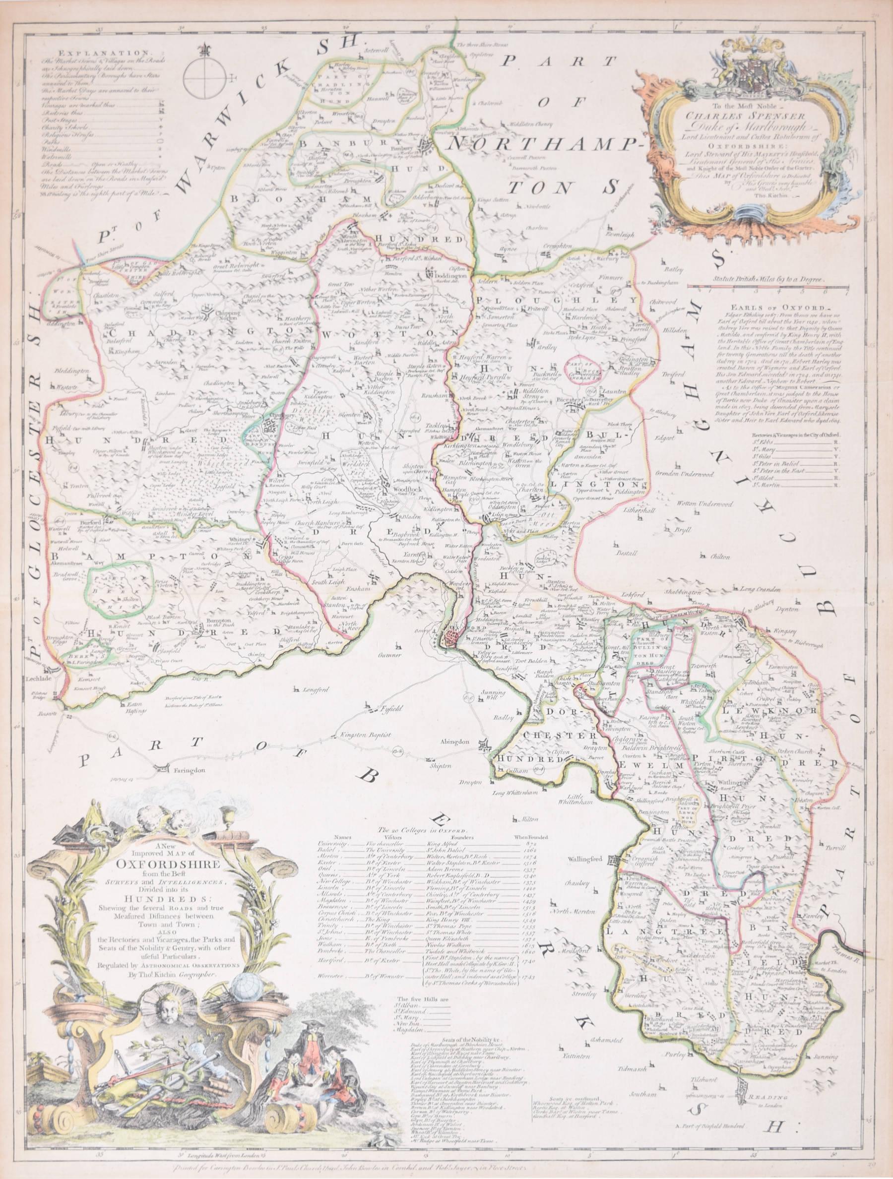
View AllMap of Oxfordshire coloured 18th century engraving by Thomas Kitchin
By Thomas Kitchin
Located in London, GB
To see our other original maps, scroll down to "More from this Seller" and below it click on "See all from this Seller" - or send us a message if you cannot find the poster you want....
Category
1760s Landscape Prints
Materials
Engraving

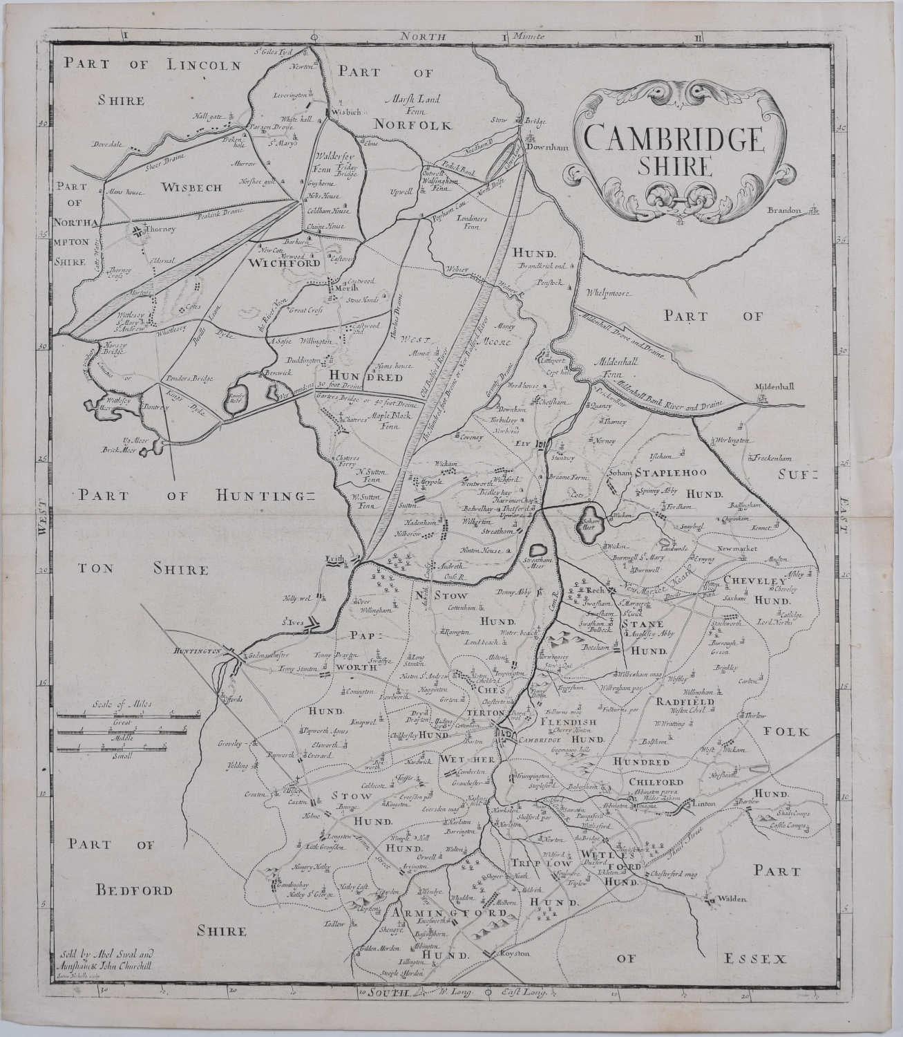
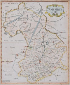
Map of Cambridgeshire, 18th century engraving by Sutton Nicholls
Located in London, GB
To see more, scroll down to "More from this Seller" and below it click on "See all from this Seller."
Sutton Nichols (1668 - 1729)
Map of Cambridgeshire
Engraving
43 x 36 cm
Signe...
Category
18th Century Landscape Prints
Materials
Engraving
Cambridgeshire map 17th century engraving by John Speed
By John Speed
Located in London, GB
To see more, scroll down to "More from this Seller" and below it click on "See all from this Seller."
John Speed (1551 or 1552 - 1629)
Map of Cambridgeshire
Engraving with later hand colouring
39 x 53 cm
A beautifully coloured map of Cambridgeshire, with an antique description...
Category
1610s Landscape Prints
Materials
Engraving

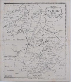
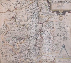
Map of Cambridge 18th century engraving by Sutton Nichols
Located in London, GB
To see more, scroll down to "More from this Seller" and below it click on "See all from this Seller."
Sutton Nichols (1668 - 1729)
Map of Cambridgeshire
Engraving
43 x 36 cm
Signed in plate lower left.
A beautifully coloured 18th century map engraving of Cambridgeshire. The map was produced by Robert Morden for publication in Edward Gibson's 1695 translation of William Camden's Britannia, a topographical and historical survey of Great Britain and Ireland produced to "restore antiquity to Britaine, and Britain to his antiquity" - a most noble aim.
William Camden (1551 - 1623) was an English antiquarian, historian, topographer, and herald, best known as the author of Britannia, the first chorographical survey of the islands of Great Britain and Ireland, and the Annales, the first detailed historical account of the Queen...
Category
18th Century Landscape Prints
Materials
Engraving
Cambridgeshire map 17th century engraving by Kip after Saxton
Located in London, GB
To see more, scroll down to "More from this Seller" and below it click on "See all from this Seller."
William Kip (active 1598 - 1610) after Christopher Saxton (1540 - 1610).
Map o...
Category
1630s Landscape Prints
Materials
Engraving
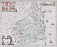
Map of Northumberland by Joannem Janssonium 17th century
Located in London, GB
To see our other original maps, scroll down to "More from this Seller" and below it click on "See all from this Seller" - or send us a message if you cannot find the poster you want....
Category
1640s Landscape Prints
Materials
Engraving
You May Also Like
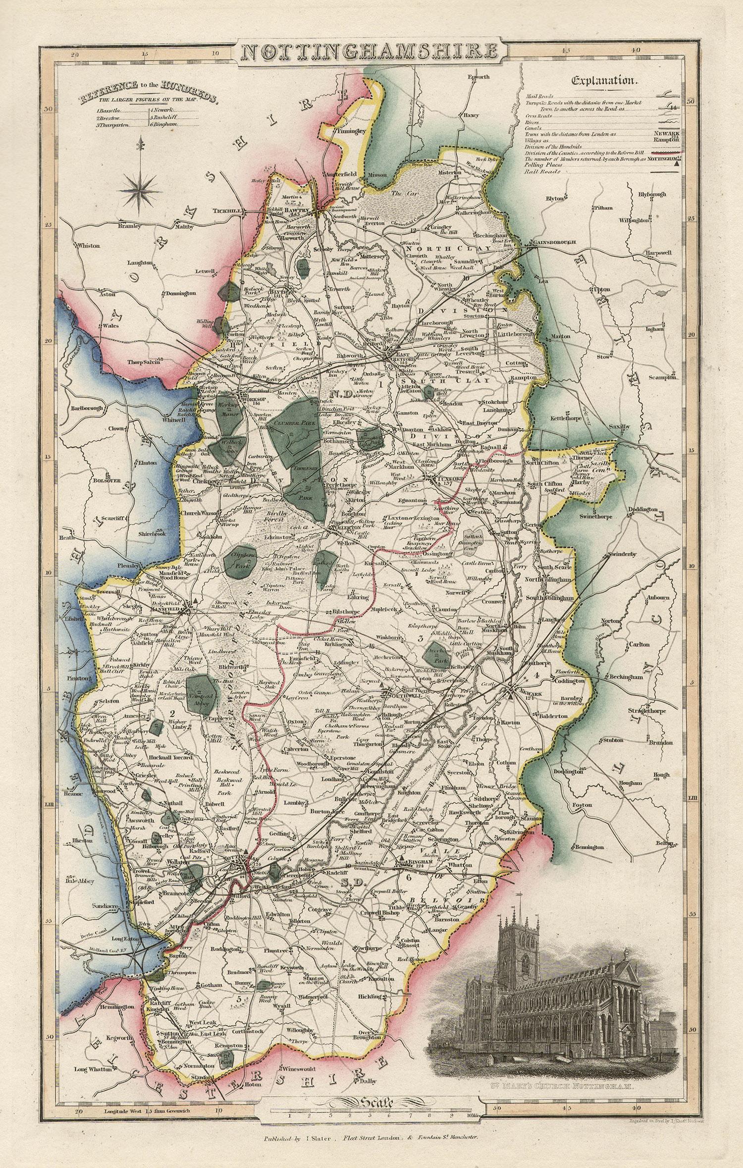
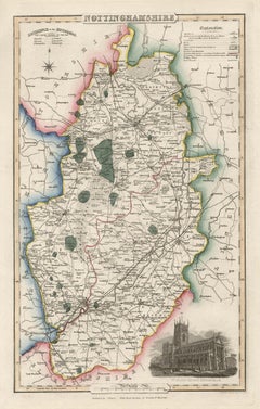
Nottinghamshire, English County Antique map, 1847
By Isaac Slater
Located in Melbourne, Victoria
Steel-engraved map with original outline colouring by Isaac Slater. A detailed engraved map of the English county with title, scale, and key. Decorated with an uncoloured engraved vi...
Category
19th Century Naturalistic Landscape Prints
Materials
Engraving
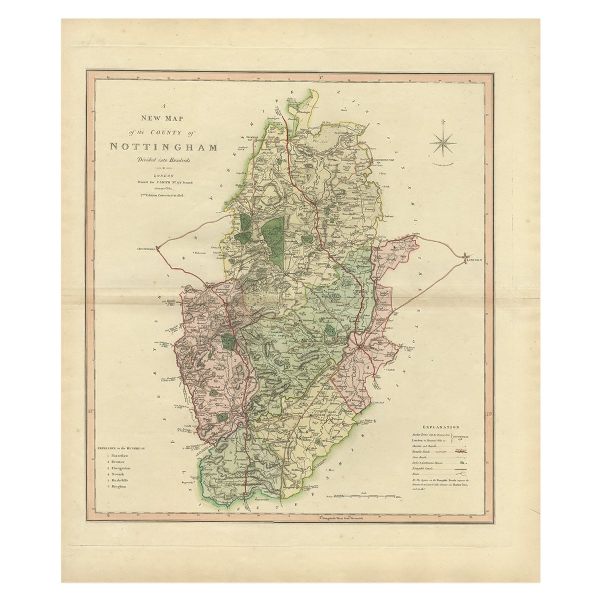
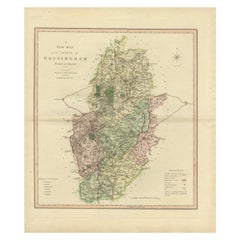
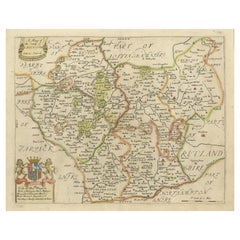
Antique Decorative Map of The County of Nottinghamshire, England, 1804
Located in Langweer, NL
Antique county map of Nottinghamshire first published c.1800. Villages, towns, and cities illustrated include Worksop, Neware, Tuxford, and Maplebe...
Category
Antique Early 1800s Maps
Materials
Paper
$310 Sale Price
20% Off
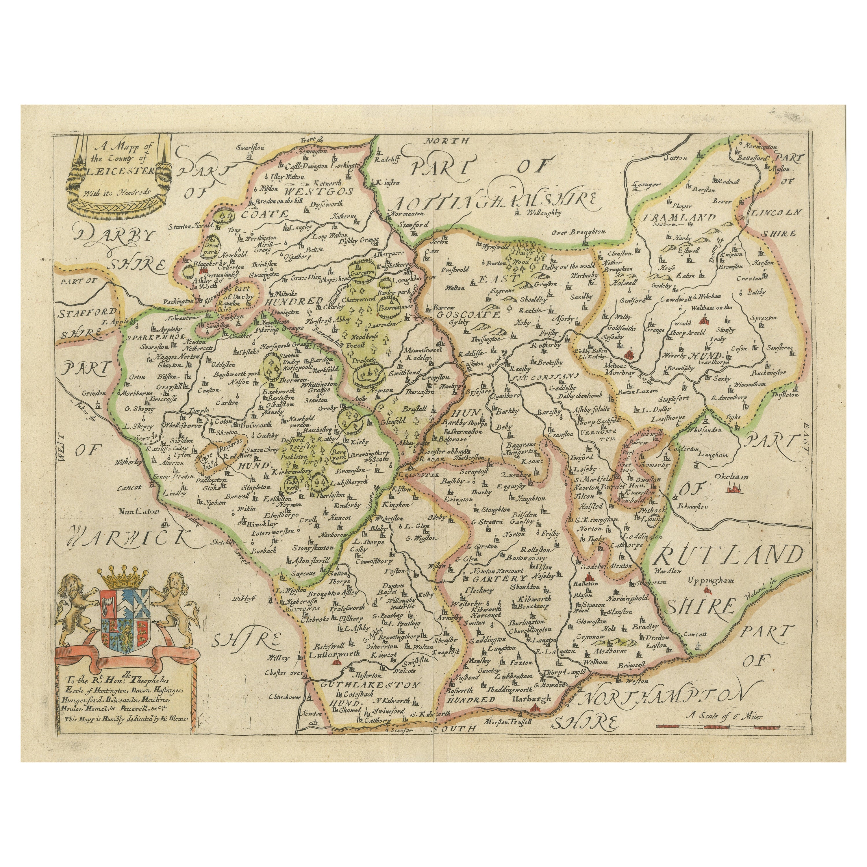
Leicestershire – Antique Map of Leicester by Richard Blome, Britannia 1673
Located in Langweer, NL
Leicestershire – Antique Map of Leicester by Richard Blome, Britannia 1673
This original antique map titled A Mapp of the Country of Leicester presents a detailed and decorative dep...
Category
Antique Late 17th Century English Maps
Materials
Paper
$420 Sale Price
20% Off
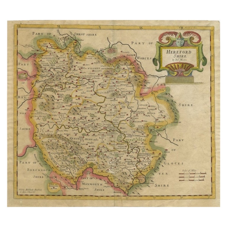
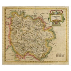
Antique Map of Herefordshire by Morden, c.1700
Located in Langweer, NL
Antique map titled 'Herefordshire'. Detailed map of the county of Herefordshire embellished with a decorative title cartouche. Three scales. Imprint of Abel Swale, Awnsham Churchill ...
Category
Antique 18th Century Maps
Materials
Paper
$382 Sale Price
20% Off
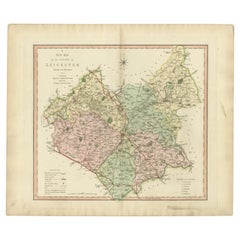
Antique County Map of Leicestershire, England, 1804
Located in Langweer, NL
Antique county map of Leicestershire first published c.1800. Villages, towns, and cities illustrated include Lutterworth, Ashby, Hinkley, and Marke...
Category
Antique Early 1800s Maps
Materials
Paper
$310 Sale Price
20% Off
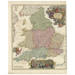
Rare 1690 Map of England by Nicolaes Visscher II – Heptarchy Depicted
Located in Langweer, NL
Map of England 1690 by Nicolaes Visscher II – Heptarchy and Counties Shown
Antique 1690 map of England by Nicolaes Visscher II, showing the Anglo-Saxon Heptarchy and detailed county...
Category
Antique Late 17th Century Dutch Maps
Materials
Paper
More Ways To Browse
Salvador Dali Pencil Signed
Sevilla Poster
Sevilla Vintage Poster
Shepard Fairey Vote
Sunday B Morning
Tokion Poster
Tuscany Vintage Travel Poster
Twa San Francisco
Ukrainian Propaganda Posters
Vintage 1960 Campers
Vintage Como Poster Original
Vintage Filipino Posters
Vintage Fitness Posters
Vintage Hockey Posters Prints
Vintage Posters Barcelona
Vintage Posters Wengen
Vintage Railway Carriages
Vintage Rolex Poster