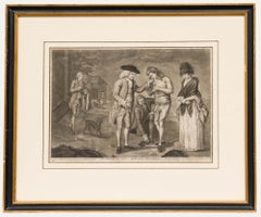
Items Similar to The Happy Consultation, or Modern Match

Want more images or videos?
Request additional images or videos from the seller
1 of 8
UnknownThe Happy Consultation, or Modern Match1769
1769
$325
$75056% Off
£251.94
£581.4056% Off
€285.17
€658.0956% Off
CA$465.14
CA$1,073.4156% Off
A$507.58
A$1,171.3356% Off
CHF 263.46
CHF 607.9956% Off
MX$6,072.72
MX$14,013.9656% Off
NOK 3,344.17
NOK 7,717.3256% Off
SEK 3,132.44
SEK 7,228.7156% Off
DKK 2,130.15
DKK 4,915.7456% Off
About the Item
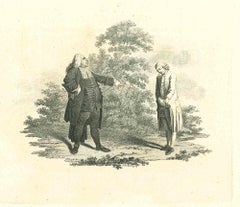
EIGHTEENTH CENTURY BRITISH CARICATURE
THE HAPPY CONSULTATION, or MODERN MATCH, 1769 (DG 4335)
Engraving, very good impression. Engraved by J Roberts, published as
act directs, 13 August 1869 in London by Robt. Sayer, Map & Print Seller.
Engraved by I. Roberts. Sheet 9 5/8 x13 ¾”. Margins trimmed, laid on
album page. $750
Legal, Caricature, Marriage, Lawyers. Legal
- Creation Year:1769
- Dimensions:Height: 9.625 in (24.45 cm)Width: 13.75 in (34.93 cm)
- Medium:
- Movement & Style:
- Period:1760-1769
- Condition:Beautiful impression, sheet trimmed.
- Gallery Location:Santa Monica, CA
- Reference Number:1stDibs: LU41131273883
About the Seller
5.0
Recognized Seller
These prestigious sellers are industry leaders and represent the highest echelon for item quality and design.
Platinum Seller
Premium sellers with a 4.7+ rating and 24-hour response times
Established in 1977
1stDibs seller since 2016
296 sales on 1stDibs
Typical response time: 1 hour
Associations
International Fine Print Dealers Association
- ShippingRetrieving quote...Shipping from: Santa Monica, CA
- Return Policy
More From This Seller
View AllAMERICA
By John Speed
Located in Santa Monica, CA
IMPORTANT AMERICAN MAP - ONE OF THE FIRST TO SHOW CALIFORNIA as an ISLAND
JOHN SPEED (1552-1629)
AMERICA - With Those Known Parts In That Unknown Worlde (sic),
1626-(76)
(Burden 217 iv/iv) Engraving, uncolored. Engraved by Abraham Goos and
published by Thomas Basset and Richard Chiswell - 4th state of 4 in 1676
15 1/8 x 20 1/2” From “A Prospect of the Most Famous Parts of the
World”. Generally good condition. A repaired split in lower centerfold. This
is the most common version of this important map...
Category
1620s Old Masters Landscape Prints
Materials
Engraving

$4,000 Sale Price
52% Off
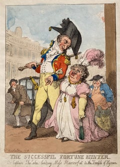
THE SUCCESSFUL FORTUNE HUNTER - Leading Miss Morrowfat to the Temple of Hyman
By Thomas Rowlandson
Located in Santa Monica, CA
THOMAS ROWLANDSON (1757 - 1827)
THE SUCCESSFUL FORTUNE HUNTER - Our Captain Shelalee Leading Miss Morrowfat to the Temple of Hyman, 1802 issued in 18...
Category
1810s English School Figurative Prints
Materials
Etching
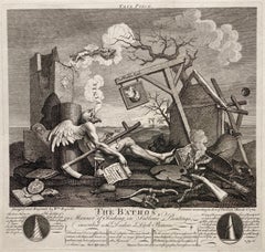
BATHOS / Tail PIece
By William Hogarth
Located in Santa Monica, CA
WILLIAM HOGRATH (1767- 1764)
THE BATHOS / Tail Piece 1764 (Paulson 1989: 216 I/I Paulson 1965/70: 216 I/I)
Engraving Plate 12 7/8 x 13 3/8, sheet 17 ¾ x 18 ¾ Designed & Engrav’d by Wm Hogarth at left and Published according to Act of Parliam’t March 3, 1764 at right. Good condition on thick laid paper Small bit of tape on the left & right sheet edges small stan lower sheet edge all on recto.
This Hogarth’s last print is fascinating as it is prophacy about death.
Various institutions have interesting commentaries - to wit:
Chicago Art Institute: Hogarth created The Bathos toward the end of his life. It is considered one of the bleakest artworks of the 18th century because it depicts the Apocalypse without an afterlife. The Angel of Death even collapses in exhaustion after having destroyed the world. In his hand is an execution decree and around him lies a mass of broken objects.
Princeton: Hogarth’s last print, The Bathos,….. is filled with all manner of images denoting the end of life as we know it. Entry no. 216 in Ronald Paulson’s catalogue raisonne Hogarth’s Graphic Works, 3rd revised edition says “This print is the culmination of such pessimistic images . . . . [taking] his general composition, the configuration of objects, and some of the particular items, from Dürer’s engraving, Melancholia; but he also recalls Salvator Rosa’s Democritus in Meditation (which derives from Dürer’s print) with a scroll at the bottom of the etching: ‘Democritus the mocker of all things, confounded by the ending of All Things’ (Antal, p.168).”
Newfields (Indianapolis Museum of Art): Hogarth intended this engraving to serve as the tailpiece to bound volumes of his collected engravings and, appropriately, it proved to be his last engraving. Father Time has died and his last will and testament has been witnessed by the three Fates. He is surrounded by a landscape of death, decay, and ruin. Hogarth aimed this print at dealers in “dark” Old Masters paintings who promoted the idea that ruins evoked sublime feelings in viewers—a sentiment, Hogarth wrote, that was reducing the world to ruin.
British Caricature...
Category
1760s Old Masters Figurative Prints
Materials
Woodcut
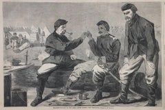
THANKSGIVING IN CAMP
By Winslow Homer
Located in Santa Monica, CA
AFTER - WINSLOW HOMER (1836-1910)
THANKSGIVING IN THE ARMY - After Dinner: the Wishbone, 1864
Original wood engraving as published by Harpers Weekly December 3, 1864, after a drawing by Winslow Homer. Image 9 3/4" x 14, Sheet 10 3.\/4 x 15 3/4" . Generally good condition, a small stain in the upper right margin.
Homer contributed drawings to Harper's Weekly from 1857 to 1875. They were converted to wood engravings by Harper's craftsman and published in Harper's Weekly. Although after his original drawings, they are now accepted as an important part of his body of work by museums and collectors. They were very large editions. As such, they occur often in the marketplace. Harper's published during the Civil War years as this was, were widely read and kept as people followed the war first hand and its aftermath over the years continuing today as both Homer and Civil War collectables
Category
1860s American Realist Figurative Prints
Materials
Woodcut
$175 Sale Price
53% Off
THE FIT YOURSELF SHOP
By Kyra Markham
Located in Santa Monica, CA
KYRA MARKHAM (1891 – 1967)
THE FIT YOURSELF SHOP, 1935
Lithograph, signed, titled, dedicated, dated and no 24/50 in pencil. 12 5/8 x 9 5/8”. Signed in ...
Category
1930s Modern Figurative Prints
Materials
Lithograph
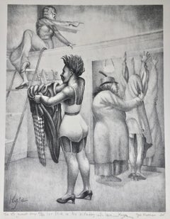
$780 Sale Price
20% Off
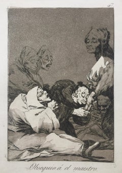
OBSEQUIO á el MAESTRO (‘A gift for the master’)
By Francisco Goya
Located in Santa Monica, CA
FRANCISCO de GOYA y LUCIENTES (1746 -1828)
OBSEQUIO á el MAESTRO (‘A gift for the master’) Plate 47 from the 1st edition of Los Caprichos (Blas, ...
Category
1790s Old Masters Figurative Prints
Materials
Etching, Aquatint
You May Also Like
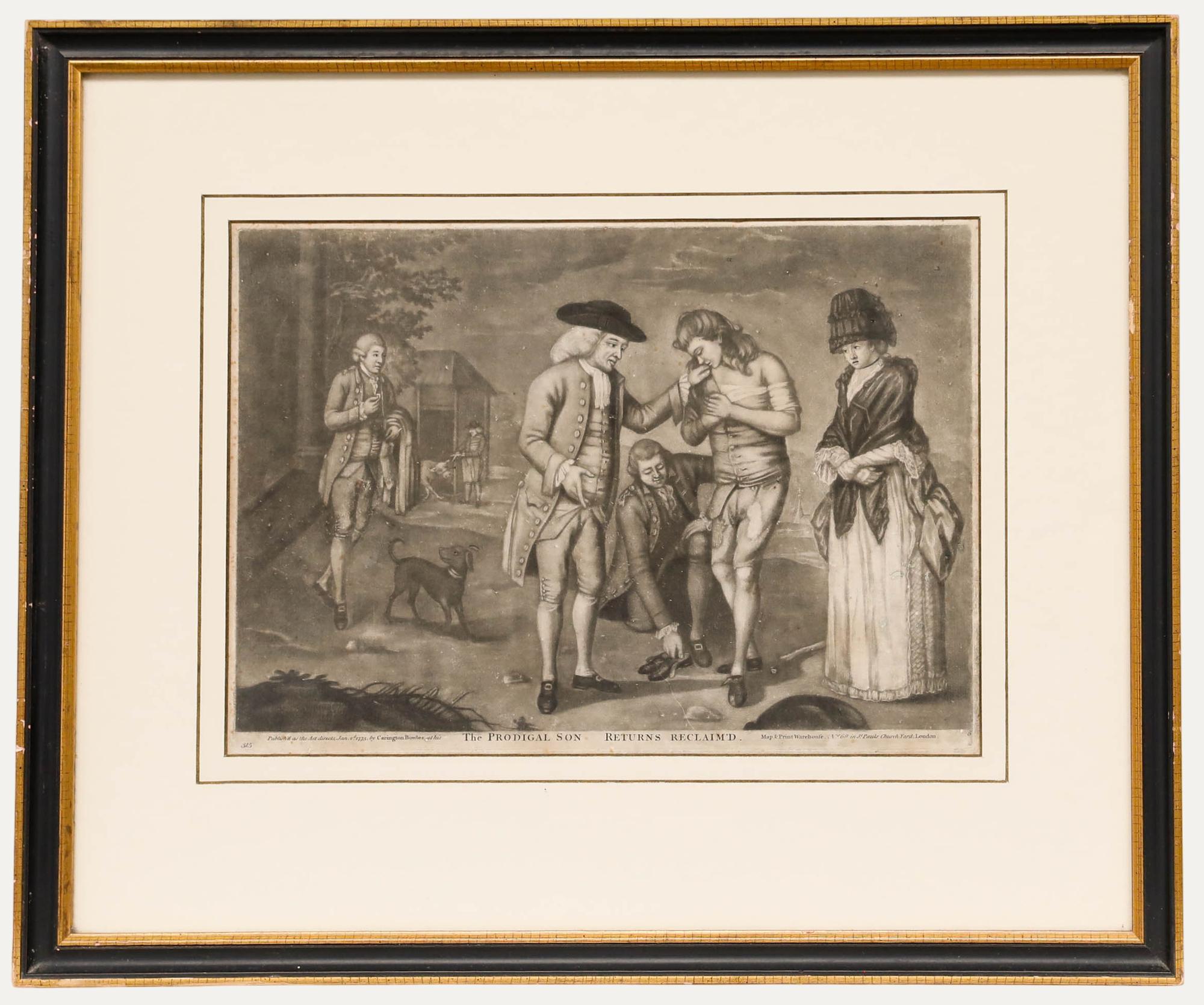
After Carington Bowles - 18th Century Engraving, The Prodigal Son Returns
Located in Corsham, GB
A charming engraving depicting the parable of the Prodigal Son in the Bible, found in Luke 15:11-32, after the original painting by Carington Bowles. Inscribed in plate. Presented in...
Category
Early 18th Century Figurative Prints
Materials
Engraving
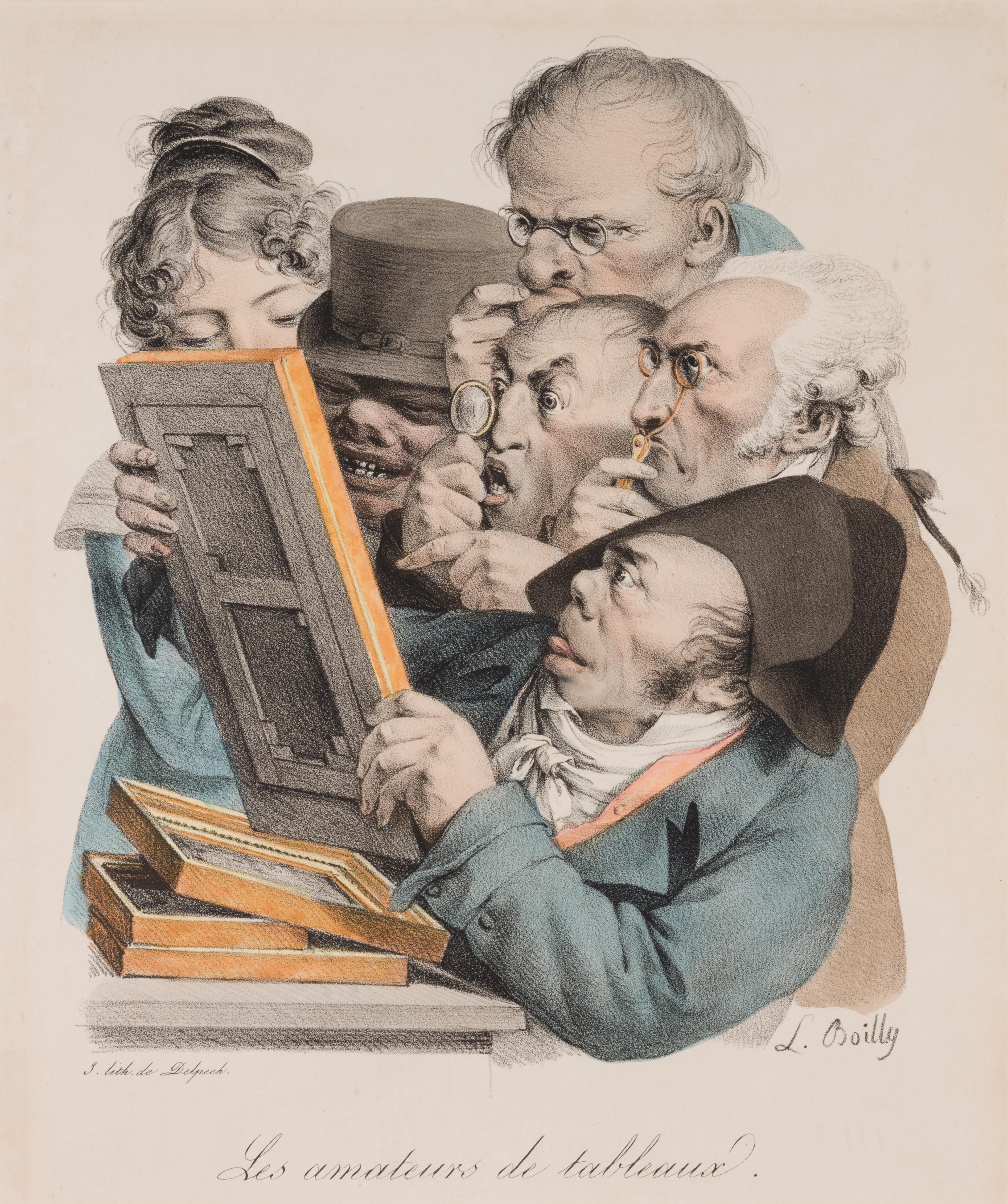
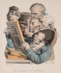
The Art Connoisseurs
Located in Douglas, Isle of Man
Louis - Leopold Boilly 1761 - 1845, was a French painter and draughtsman of portraits and genre subjects. His career spanned one of the most important eras of the French Revolution a...
Category
Early 19th Century Figurative Prints
Materials
Paper, Printer's Ink, Lithograph
Historical Scene - Etching by Thomas Holloway - 1810
By Thomas Holloway
Located in Roma, IT
Historical scene is an artwork realized by Thomas Holloway for Johann Caspar Lavater's "Essays on Physiognomy, Designed to promote the Knowledge and the Love of Mankind", London, Be...
Category
1810s Modern Figurative Prints
Materials
Etching
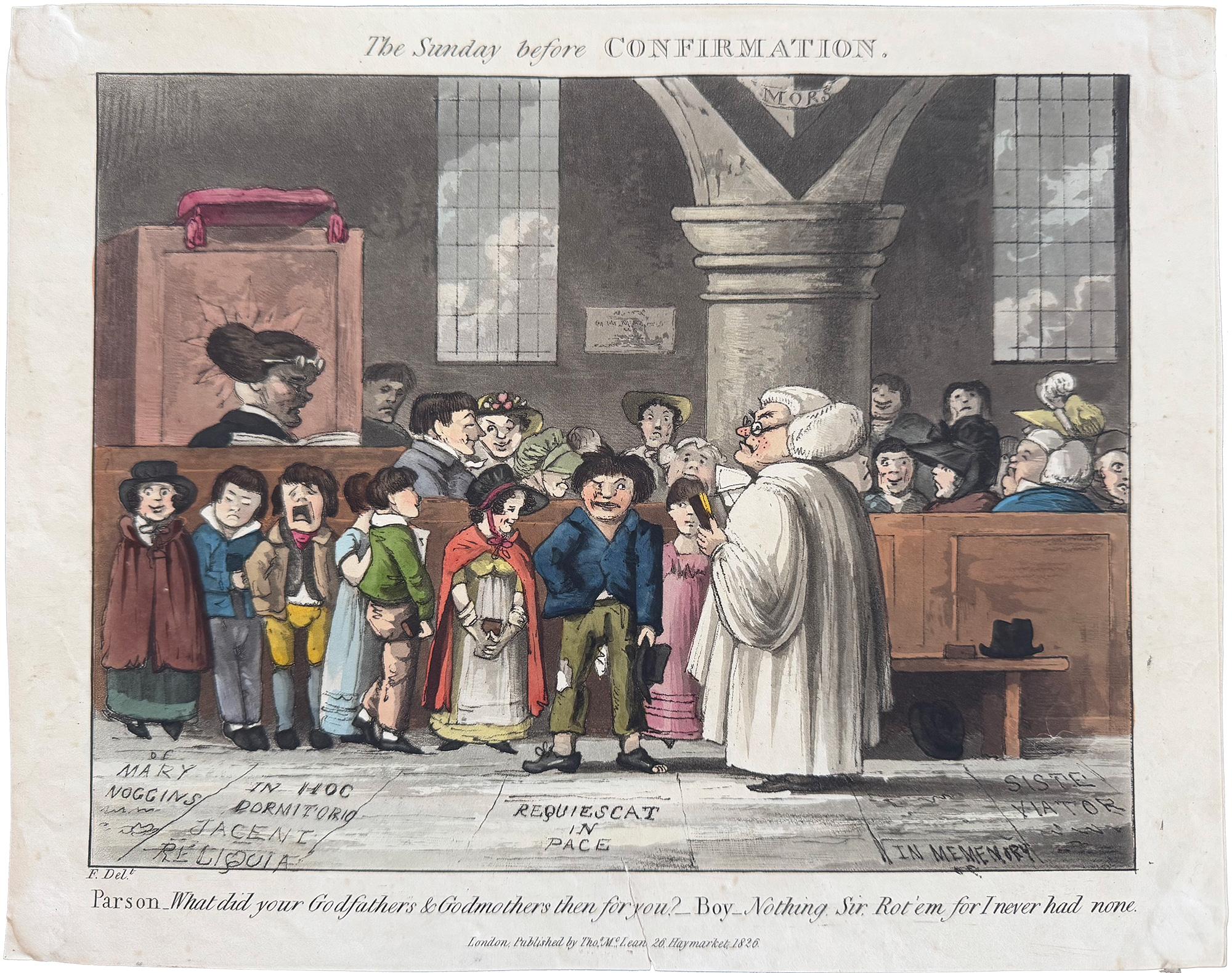
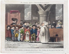
The Sunday Before Confirmation; Parson: What did your godfathers & godmothers...
Located in Middletown, NY
English School, 19th century
The Sunday Before Confirmation; Parson: What did your godfathers & godmothers then for you? Boy: Nothing sir, rot'em for I never had none.
London: Thoma...
Category
Mid-19th Century English School Figurative Prints
Materials
Watercolor, Handmade Paper, Engraving, Lithograph
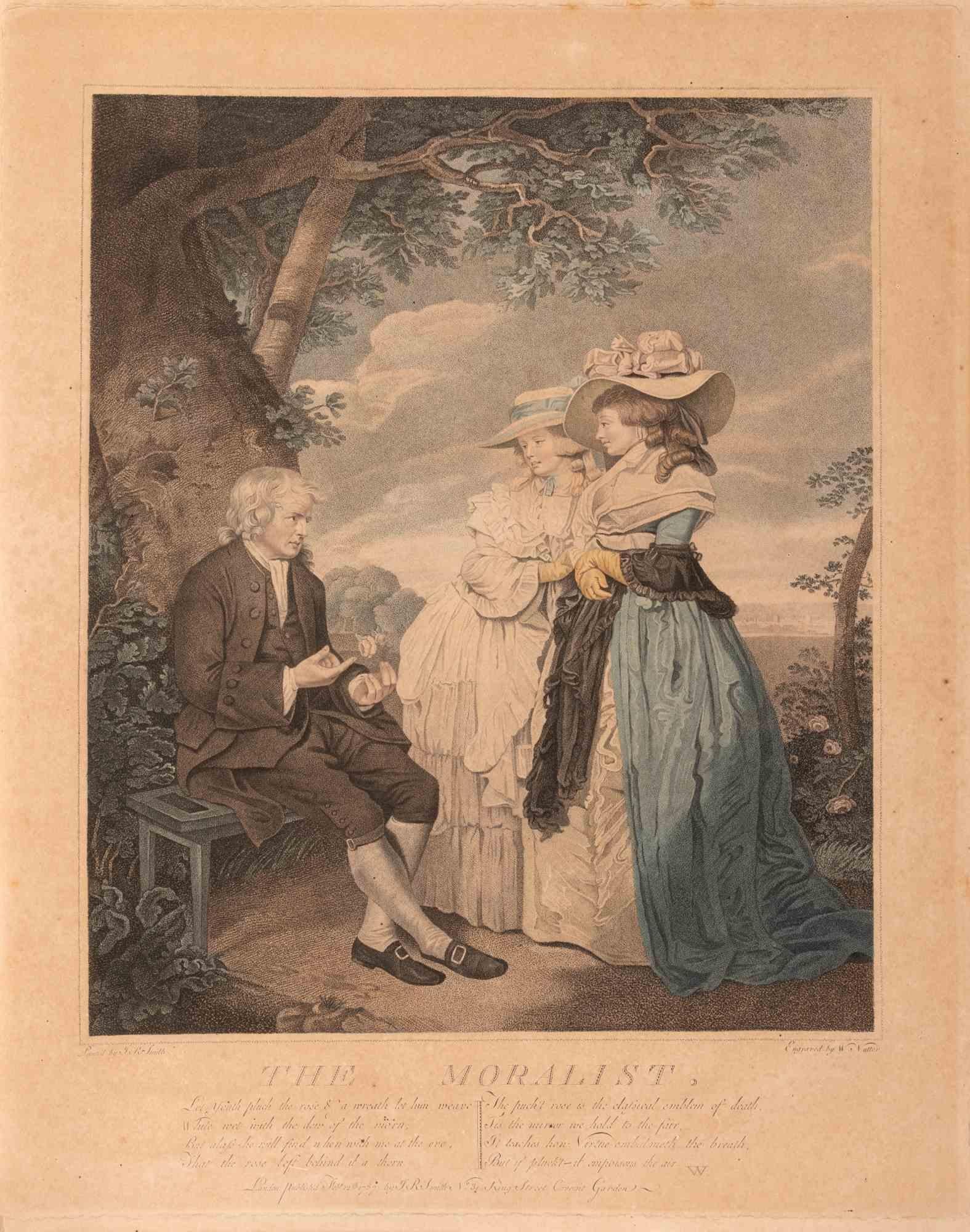
The Moralist - Etching by William Nutter - Late 18th Century
Located in Roma, IT
Mezzotint and etching with hand-colouring on paper realized by William Nutter (1750-1802) after J.R. Smith.
Not signed, as issued.
Very good condition.
An elderly clergyman or mor...
Category
Late 18th Century Modern Figurative Prints
Materials
Etching, Mezzotint

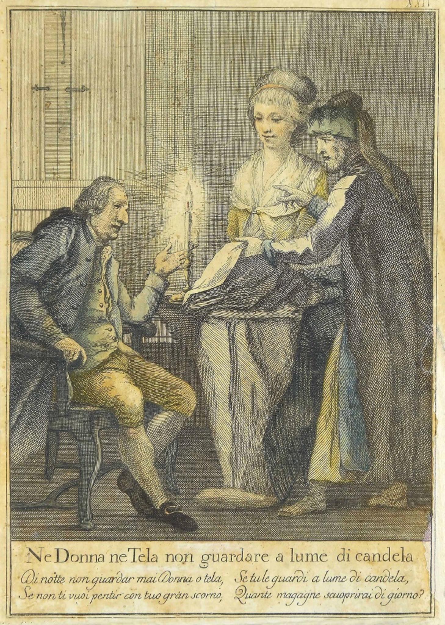
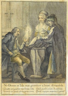
No Woman Neither Canvas - Original Etching - Late 19th Century
Located in Roma, IT
No Woman neither Canvas is an original modern artwork realized in the first decades of the 19th Century.
Original colored Etching on paper.
A long inscription is present on the low...
Category
Early 19th Century Modern Figurative Prints
Materials
Etching
More Ways To Browse
Antique Matches
London Antique Maps
Sun Valley Vintage Ski
Tate Gallery Poster
Tycho Brahe
Vintage Puerto Rico Poster
1980 Levi Poster Olympics
Air Afrique
Blah Blah Blah
Boccasile Vintage Posters
Bristol Vintage Poster
Chicago Travel Poster
Cruise Liner Poster
Deutsche Lufthansa
Dolomites Poster
Gregorian Chant
Hitler Signed
Jean Lucrat