Abraham Ortelius Holy Land

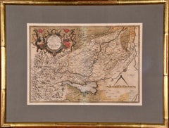
Northern Italy: A 16th Century Hand-colored Map by Abraham Ortelius
By Abraham Ortelius
Located in Alamo, CA
of the world in 1564. Ortelius also published a map of Egypt in 1565, a map of the Holy Land, a plan
Category

16th Century Old Masters Landscape Prints

Materials

Engraving

People Also Browsed

Paint Oil on canvas Landscape Italy Art18th Century Capriccio Architectural
Located in Riva del Garda, IT
Nicola Viso (active in Naples in the first half of the 18th century) Architectural capriccio with temple in ruins and scene of the rest of the Holy Family Neapolitan school of the e...
Category

18th Century Old Masters Paintings

Materials

Oil

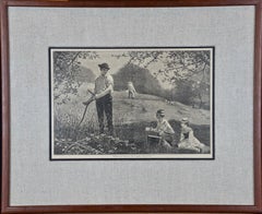
Winslow Homer 19th Century Woodcut Engraving "Making Hay"
By Winslow Homer
Located in Alamo, CA
This Winslow Homer woodcut engraving entitled "Making Hay", was published in Harper's Weekly in the July 6, 1872 edition. It depicts a two men hand cutting high grass on a hill. The ...
Category

1870s American Impressionist Landscape Prints

Materials

Engraving, Woodcut

Four 19th Century Hand Colored Engravings Depicting English Royal Residences
By Charles Wild
Located in Alamo, CA
Four hand colored etchings and aquatints depicting interiors within English royal residences, including "The Blue Velvet Room at Carlton House", "The Queen's Library at Frogmore", "T...
Category

1810s Academic Interior Prints

Materials

Engraving

AMERICAE - Sive Novi Orbis, Nova Descriptio
By Abraham Ortelius
Located in Santa Monica, CA
ABRAHAM ORTELIUS (1527 - 1598) AMERICAE SIVE NOVI ORBIS, NOVA DESCRIPTIO, 1587 (1603) (Van Den Broecke 11, Burden 64; Schwartz & Ehrenberg 69) Engraving. A very good, well printed...
Category

16th Century Old Masters Landscape Prints

Materials

Engraving

Frankfort, Germany: A 16th Century Hand-colored Map by Braun & Hogenberg
By Franz Hogenberg
Located in Alamo, CA
This is a 16th century original hand-colored copperplate engraved map of Frankfort, Germany entitled "Francenbergum, vel ut alij Francoburgum Hassiae Opp" by Georg Braun & Franz Hoge...
Category

16th Century Old Masters Landscape Prints

Materials

Engraving

Canterbury: An Original 16th C. Framed Hand-colored Map by Braun & Hogenberg
By Franz Hogenberg
Located in Alamo, CA
This is a framed 16th century map and city view of Canterbury, England entitled "Cantuarbury" by Braun & Hogenburg, from their famous landmark atlas of city views 'Civitates Orbis Te...
Category

16th Century Old Masters Landscape Prints

Materials

Engraving

View of Seravalle, Italy: A 16th Century Hand-colored Map by Braun & Hogenberg
By Franz Hogenberg
Located in Alamo, CA
This is an original 16th century copperplate originally hand-colored engraved map of View of Seravalle, Italy entitled "Seravallum Celeberrimum Marchiae Tarvisiniae in Agro Foro Juli...
Category

16th Century Old Masters Landscape Prints

Materials

Engraving

Four Framed Hogarth Engravings "Four Times of the Day"
By William Hogarth
Located in Alamo, CA
The four plates in this "Four Times of the Day" set were created utilizing both engraving and etching techniques by William Hogarth in 1738. Hogarth's original copper plates were ref...
Category

Mid-18th Century Old Masters Landscape Prints

Materials

Engraving, Etching

Southeastern England: A 17th Century Hand-Colored Map by Mercator and Hondius
By Gerard Mercator
Located in Alamo, CA
A 17th century copperplate hand-colored map entitled "The Sixt Table of England" by Gerard Mercator and Jodocus Hondius, published in Amsterdam in 1635 in 'Cosmographicall Descriptio...
Category

1630s Landscape Prints

Materials

Engraving

Northern Scotland: 16th Century Hand-colored Map by Mercator
By Gerard Mercator
Located in Alamo, CA
This is a framed hand-colored 16th century map of Northern Scotland by Gerard Mercator entitled "Scotiae pars Septentrionalis", published in Amsterdam in 1636. It is a highly detail...
Category

16th Century Other Art Style Landscape Prints

Materials

Engraving

Flowering Jasmine and Laurel Plants: A Besler Hand-colored Botanical Engraving
Located in Alamo, CA
This is a hand-colored copper-plate engraving entitled "Gelsiminum Catalonicum, Mairana Latifollia, Euphasiaramosa Pratensis Flore Albo, Euphasia Minus Ramosa Flore Excereruleo Purpu...
Category

1710s Academic Still-life Prints

Materials

Engraving

18th Century Engraving "Attack with a Battering Ram" by Montfaucon
Located in Alamo, CA
This early original copper-plate engraving entitled "Attaque avec le Belier" from 'L'antiquité expliquée et représentée en figures' (Antiquity Explained and Represented in Diagrams),...
Category

Early 18th Century Old Masters Landscape Prints

Materials

Engraving

England and the British Isles: A Large 17th Century Hand-colored Map by de Wit
By Frederick de Wit
Located in Alamo, CA
This is a large hand-colored 17th century map of England and the British Isles by Frederick de Wit entitled "Accuratissima Angliæ Regni et Walliæ Principatus", published in Amsterdam...
Category

Late 17th Century Other Art Style Landscape Prints

Materials

Engraving

A Group of Four 18th Century Engravings from Captain Cook's 3rd Voyage Journal
By John Webber
Located in Alamo, CA
A grouping of four framed engravings from the atlas of the official British Admirality sanctioned journal of Captain Cook's 3rd Voyage entitled "A Voyage to the Pacific Ocean Underta...
Category

1780s Other Art Style Landscape Prints

Materials

Engraving

Three Engravings Depicting Sailing Yachts Competing in 1885 America's Cup Trials
Located in Alamo, CA
Three woodcut engravings produced in 1885 to commemorate the sailing yacht trials competition to determine the team to represent the United States in the America's Cup races off the ...
Category

1880s Other Art Style Landscape Prints

Materials

Engraving

Europe: An Original 18th Century Hand-colored Map by E. Bowen
Located in Alamo, CA
This is an original 18th century hand-colored map entitled "A New & Accurate Map of Europe Drawn from the Best Authorities Assisted by the Most Improved Modern Charts and Maps." by E...
Category

Mid-18th Century Old Masters Landscape Prints

Materials

Engraving

Recent Sales

Abraham Ortelius (1527-1598) - 17th Century Engraving, Map of the Holy Land
By Abraham Ortelius
Located in Corsham, GB
An early 17th or late 16th century map showing the land of Canaan with an inset map depicting the
Category

18th Century More Prints

Materials

Engraving

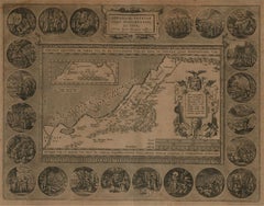
HOLY LAND Original Engraved Map
By Abraham Ortelius
Located in Santa Monica, CA
ABRAHAM ORTELIUS (1527 – 1598) ABRAHAMI PATRIAR:CHAE PEREGRINATIO, ET VITA. - 1608-12
Category

16th Century Old Masters Landscape Prints

Materials

Engraving

Abraham Ortelius Map of Greece Hand Colored Engraving Circa 1579
By Abraham Ortelius
Located in Atlanta, GA
: Theatrum Orbis Terrarum, Antwerpen, Gillis van den Rade, 1575. Abraham Ortelius (1527-1598) The maker of
Category

Antique 16th Century British Decorative Art

Materials

Paper

Get Updated with New Arrivals
Save "Abraham Ortelius Holy Land", and we’ll notify you when there are new listings in this category.

Abraham Ortelius for sale on 1stDibs

Abraham Ortelius is widely recognized as the inventor of the atlas and one of the most prominent geographers in history. He is one of the best known and most frequently collected of all sixteenth-century mapmakers, and today, hand-colored, copperplate-printed Abraham Ortelius maps continue to command avid interest.

Ortelius was the eldest of the three children of an Antwerp merchant. After his father's death when he was ten, he was raised by his uncle Jacob Van Meteren — a financier and printer of early English versions of the Bible. Ortelius entered the Guild of Saint Luke in 1547 to become a map copier and colorist, but his hobbies overshadowed his studies. 

Ortelius was better known as a student of history and a collector of books and old coins than a cartographer — only initially garnering modest praise for his skills at mapmaking. Gleaning what he learned from his uncle, he became a dealer in books and prints. In 1554 he attended the annual Frankfurt Book Fair, where he met the highly respected cartographer Gerardus Mercator.

Ortelius refocused his work in mapmaking after that fateful encounter. He eventually published Theatrum Orbis Terrarum (Theater of the World) — a comprehensive collection of maps that he bound into a book. It was the first of its kind and is now recognized as the first modern-day atlas. While creating his atlas, Ortelius observed that the coast of America shared geometrical similarities with the shores of Europe and Africa. When he lined up maps of the coastlines of the continents, they matched — much like pieces in a jigsaw puzzle. 

Some have argued that the concept of continental drift is at least partly rooted in Ortelius’s 16th-century-era suggestion that the continents had once been joined together as a single mass of land before the Americas were pulled away from Europe and Africa. Much later, in 1912, German meteorologist Alfred Wegener proposed in a lecture and an article that the continents had once been locked together based on data he collected. Wegener was widely ridiculed at the time, but the foundation of modern-day science of plate tectonics has its origins in his work.

On May 18, 2008, a Google Doodle celebrated the 300th anniversary of Ortelius’s atlas.

On 1stDibs, find original Abraham Ortelius prints, landscape prints and more.