World Map
to
265
742
609
561
391
364
279
246
220
132
102
99
93
83
65
62
52
47
44
37
36
31
23
23
22
22
19
18
16
15
14
12
12
9
9
8
8
8
8
8
7
7
7
6
6
5
5
5
5
5
5
4
3
3
3
2
2
2
1
1
1
1
1
1
1
136
23
22
20
14
Sort By
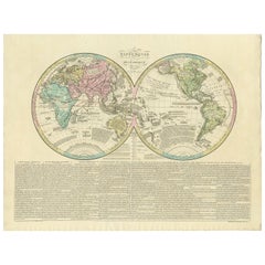
Antique World Map by Lesage, 1823
Located in Langweer, NL
Antique world map titled 'Mappe Monde Historique'. The map depicts both the Eastern and Western
Category
Antique Early 19th Century Maps
Materials
Paper
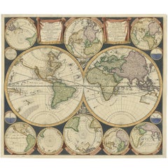
Antique World Map by P. Schenk '1706'
By Peter Schenk
Located in Langweer, NL
Aert-klooten (..)'. One of the earliest Dutch World Maps to focus on a more modern cartographic style
Category
Antique Early 18th Century Maps
Materials
Paper
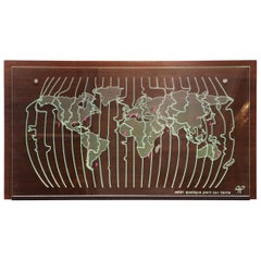
World Map Clock
Located in Paris, FR
Clock world map with natural solid wengue wood
back panel on which are placed different time zone
Category
21st Century and Contemporary French Wall Clocks
Materials
Glass, Wenge
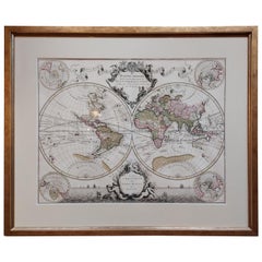
Original Antique Hand-colored World Map with or without Frame, '1696'
Located in Langweer, NL
Antique world map titled 'Mappe-Monde dressee sur les Observations de Mrs. de l'Academie Royale des
Category
Antique Late 17th Century Maps
Materials
Paper
$4,333 Sale Price
20% Off
H 28.75 in W 33.67 in D 1.58 in
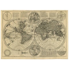
Antique Bible World Map by R. & J. Wetstein, 1743
Located in Langweer, NL
Antique world map titled 'De Werelt Caart'.
A scarce and richly detailed double hemisphere world
Category
Antique Mid-18th Century Maps
Materials
Paper
$2,407 Sale Price
20% Off
H 15.52 in W 21.26 in D 0.02 in
Two Impressive Huge Midcentury World Map Wall Globes, 95" Diameter, 1950s
Located in Vienna, AT
We proudly offer this outstanding pair of very large wall-mounted modernist globes / world maps
Category
Mid-20th Century Austrian Mid-Century Modern Maps
Materials
Aluminum, Iron
$23,000 / item
H 4 in Dm 95 in
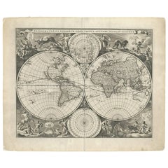
Gorgeous Antique World Map by the Dutch Mapmaker Visscher, published circa 1679
Located in Langweer, NL
example of Nicholas Visscher's World map, which appeared in his Atlas Minor after 1679.
The map is
Category
Antique Late 17th Century Maps
Materials
Paper
$7,944
H 20.79 in W 25.2 in D 0.02 in
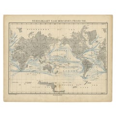
Antique Mercator Projection World Map by Petri, c.1873
Located in Langweer, NL
Antique world map titled 'Wereldkaart naar Mercator's Projectie'. Old map of the world. This map
Category
Antique 19th Century Maps
Materials
Paper
$120 Sale Price
20% Off
H 10.32 in W 12.84 in D 0 in
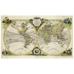
Rare Original Double Hemisphere World Map with Allegorical Figures, 1785
Located in Langweer, NL
hemisphere world map. Four allegorical figures in the corners represent Europe, Asia, Africa and America
Category
Antique 1780s Maps
Materials
Paper
$2,840 Sale Price
20% Off
H 17.05 in W 23.23 in D 0 in
Antique World Map before the Voyages of Christopher Columbus, 1880
Located in Langweer, NL
Antique world map titled 'Monde Connu des Anciens'. Antique map of the World and continents before
Category
Antique 19th Century Maps
Materials
Paper
$231 Sale Price
20% Off
H 13.59 in W 18.71 in D 0 in
8 Foot Framed World Map by Philips
Located in Norwell, MA
1951 map of the world by George Philip and Son. Large beautiful map as it was in 1951. Nice patina
Category
Vintage 1950s North American Maps
Materials
Paper
Small Antique World Map in Decorative Old Hand-Colouring, circa 1840
Located in Langweer, NL
Antique map titled 'Wereld Kaart'. Small and very decorative double hemisphere world map. Source
Category
Antique 19th Century Maps
Materials
Paper
$211 Sale Price
20% Off
H 6.19 in W 7.41 in D 0 in
World Map in Two Hemispheres: Eastern & Western - 1802 Tardieu Atlas
Located in Langweer, NL
Revolutionary Calendar)
**Geographical Scope:**
This antique map illustrates a double-hemisphere world map
Category
Antique Early 1800s Maps
Materials
Paper
$442 Sale Price
20% Off
H 16.34 in W 22.13 in D 0.01 in
Antique World Map in Hemispheres with Delicate Pastel Coloring, 1903
Located in Langweer, NL
Title: Antique World Map in Hemispheres with Delicate Pastel Coloring, 1903
Description:
This
Category
Early 20th Century Maps
Materials
Paper
$288
H 14.49 in W 18.9 in D 0.01 in
Decorative Ancient World Map with Large Parts of the World Still Unknown, c 1731
Located in Langweer, NL
Interesting ancient map of the world, based upon Strabo. The Southern tip of Africa is undiscovered
Category
Antique 1730s Maps
Materials
Paper
$433 Sale Price
20% Off
H 9.45 in W 14.57 in D 0 in
Vintage Cera "Old World Map" Pattern, Companion Serving Tray
Located in Nantucket, MA
Glassware "Old World Map" barware having an image of an antique style world map in tans and gold on a white
Category
Mid-20th Century American Mid-Century Modern Barware
Materials
Plastic
Antique World Map with Astronomical Spheres by Pierre Mortier, Amsterdam, c.1700
Located in Langweer, NL
Antique World Map with Astronomical Spheres by Pierre Mortier, Amsterdam, circa 1700
This
Category
Antique 17th Century French Maps
Materials
Paper
$884 Sale Price
25% Off
H 16.93 in W 20.08 in D 0 in
Chanel World Map Dark-silvery Metal Brooch, 2013
By Karl Lagerfeld for Chanel
Located in SAINT-OUEN-SUR-SEINE, FR
Chanel - (Made in France) Dark-silvery metal brooch enameled and representing a world map. 2013
Category
21st Century and Contemporary French Brooches
World Map II
Located in New York, NY
Leign Wen’s works reflect her personal and cultural histories. Having grown up on the island of Taiwan, she has a deep affinity for the elemental power of water and the forces of nat...
Category
2010s Mixed Media
Materials
Oil
World Map I
Located in New York, NY
Leign Wen’s works reflect her personal and cultural histories. Having grown up on the island of Taiwan, she has a deep affinity for the elemental power of water and the forces of nat...
Category
2010s Mixed Media
Materials
Oil
Set of 6 Cera Old World Map Double Rocks Glasses
By Cera
Located in Chapel Hill, NC
Set of 6 Cera Old World Map Double Rocks Glasses. These glasses are larger than rerocks glasses
Category
Mid-20th Century American Mid-Century Modern Barware
Materials
Glass
Pair of MCM Leather Wrapped World Map Bookends
Located in San Diego, CA
Classic pair of large leather wrapped bookends with a midcentury brass world map plaque embedded in
Category
Late 20th Century American Mid-Century Modern Bookends
Materials
Brass
Arthur Amour Hammered Aluminum "Mariners World Map" Wastepaper Basket, 1930s
By Arthur Armour
Located in Bainbridge, NY
Arthur Armour Hammered Aluminum Mariners World Map Trash Can, 1930s. Featuring a smooth hand
Category
Vintage 1930s American Art Deco Decorative Baskets
Materials
Aluminum
$1,500
H 10 in W 11 in D 7 in
Antique World Map on Mercator's Projection, Ocean Currents and Trade Routes 1903
Located in Langweer, NL
Title: Antique World Map on Mercator's Projection, 1903, Showing Ocean Currents and Trade Routes
Category
Early 20th Century Maps
Materials
Paper
$337
H 14.49 in W 18.9 in D 0.01 in
Silver Leaf Foil Wall World Map Engraving Based on the Original Moses Pitt, 1681
Located in West Sussex, Pulborough
We are delighted to offer for sale this lovely antique style pictorial silver leaf foil world map
Category
20th Century English Modern Maps
Materials
Silver Leaf
$308 Sale Price
20% Off
H 17.72 in W 21.66 in D 0.6 in
Ancient World Map: Europe, Africa & Asia - 1802 Tardieu Atlas
Located in Langweer, NL
Revolutionary Calendar)
Geographical Scope:
This antique map illustrates the "known world" of the ancients
Category
Antique Early 1800s Maps
Materials
Paper
$423 Sale Price
20% Off
H 16.3 in W 22.33 in D 0.01 in
WORLD MAP - Planisphaerium Terrestre Sive Terrarum Orbis... 1696
By Carel Allard
Located in Santa Monica, CA
)
Engraving, 20 ½ x 23 ½”, sheet 21 x 24 1/8". A stunning double hemisphere World Map with sphere projections
Category
17th Century Old Masters Landscape Prints
Materials
Engraving
$4,750
H 20.5 in W 23.5 in
Polychrome Ceramic World Map Catchall / Ashtray, Zaccagnini, Italy, 1940s
By Ugo Zaccagnini
Located in Firenze, IT
Polychrome ceramic world map catchall / ashtray
Zaccagnini Italy 1940s
Zaccagnini mark under
Category
Vintage 1940s Italian Art Deco Ashtrays
Materials
Ceramic
$782
H 1.97 in W 10.04 in D 10.04 in
Old World Map Featuring Captain Cook's Exploration Routes and Polar Views, 1787
Located in Langweer, NL
1786 World Map with Polar Projections - "Globo Terrestre" by Giovanni Maria Cassini
This 1786
Category
Antique 1860s Maps
Materials
Paper
$1,829 Sale Price
20% Off
H 17.13 in W 20.08 in D 0.01 in
Late 20th Century Gold Foil World Map Double Hemisphere
Located in Chula Vista, CA
Late 20th Century Gold Foil Ancient World Map Double Hemisphere
Gold Foil Old World Framed Map
Category
Late 20th Century English Mid-Century Modern Prints
Materials
Gold
Four Reproduction Vintage Panels of Air France World Map
Located in Los Angeles, CA
Reproduction of beautiful blue and green mid-century Air France world map on four individual panels
Category
21st Century and Contemporary French Prints
Materials
Paper, Wood
Curtis Jere World Map / Globe Wall Sculpture 'Two Piece'
By Curtis Jeré
Located in North Miami, FL
World Map was designed by American artist duo Curtis Jere. It is signed to base. A finely rendered
Category
Vintage 1980s American Mid-Century Modern Wall-mounted Sculptures
Materials
Brass
Four Reproduction Vintage Panels of Air France World Map
Located in Los Angeles, CA
Reproduction of a beautiful green and blue mid-century Air France world map on four individual
Category
21st Century and Contemporary French Prints
Materials
Wood, Paper
Glass & brass luminous world map by Paul Oestergaard for Colombus Verlag - 1950s
Located in Linkebeek, BE
Glass & brass luminous world map by Paul Oestergaard for Colombus Verlag - 1950s
World map - Mid
Category
Mid-20th Century German Mid-Century Modern Scientific Instruments
Materials
Brass
$1,179
H 16.15 in W 14.57 in D 14.57 in
Italian Mid-Century Modern World Map Globe Pipe Holder Stand
Located in Haddonfield, NJ
Super charming piper holder featuring a world map design and two indentations that hold the bowls
Category
Mid-20th Century Italian Mid-Century Modern Tobacco Accessories
Materials
Ceramic
Mid Century 'World Map' Military Campaign Coffee Table, C.1960, France
By Maison Jansen
Located in London, GB
Vintage World Map Military Campaign coffee table France, circa 1960.
Verre églomisé map image with
Category
Vintage 1960s French Coffee and Cocktail Tables
Materials
Brass
$1,542
H 16.15 in W 36.42 in D 17.92 in
Vintage Cera Old World Map, Book Form Cheese Board, World of Cheese
Located in Nantucket, MA
to the Cera Glassware "Old World Map" pattern barware. The folding, vinyl clad book has an 'antique
Category
Mid-20th Century American Mid-Century Modern Barware
Materials
Stainless Steel
Vintage Vinyl Clad Cheese Board with Old World Map Ceramic Tile Cutting Surface
Located in Nantucket, MA
mad to compliment the Cera Glassware Old World Map barware pattern, decorated with an antique style
Category
Mid-20th Century American Mid-Century Modern Barware
Materials
Ceramic, Plastic
$325
H 2.5 in W 15 in D 10 in
Little World Map Rome Peking - Olympic Games Beijing 2008
By Piero Pizzi Cannella
Located in Roma, IT
Little world map Rome Peking, Olympic Games Beijing 2008 is an original litography print realized
Category
Early 2000s Contemporary Figurative Prints
Materials
Lithograph
$586 Sale Price
25% Off
H 37.01 in W 27.56 in D 0.04 in
Vintage Cera Glass Highball Glasses With Old World Maps - Set of 8
By Cera
Located in Chapel Hill, NC
Set of 8 Vintage Cera Glass Highball Glasses With Old World Maps. Glasses measure 5 1/2" tall x 2 3
Category
Vintage 1970s Mid-Century Modern Barware
Materials
Glass
$495 / set
H 5.5 in W 2.75 in D 2.75 in
Ancient World Map of Europe, Asia & Northern Africa with Ancient Names, 1725
Located in Langweer, NL
ancient world depicting Europe, Asia, and northern Africa with ancient place names. This map originates
Category
Antique 1720s Maps
Materials
Paper
$1,129 Sale Price
24% Off
H 15.75 in W 18.51 in D 0 in
Mid-Century World Map Globe Table Light or Lamp
Located in Miami, FL
Good quality world map globe lamp.
If you are looking for stylish and beautiful quality item to
Category
Mid-20th Century French Mid-Century Modern Table Lamps
Materials
Chrome
Nest of Coffee & Side Tables Military Campaign with World Maps
Located in Pulborough, GB
We are delighted to offer for sale this stunning campaign decorative world map nest of tables.
A
Category
20th Century British Campaign Nesting Tables and Stacking Tables
Materials
Brass
$2,033 / set
H 17.92 in W 24.93 in D 18 in
Art Deco wool world map
Located in Bridgewater, CT
An interesting wall decoration.
Category
Vintage 1930s German Art Deco Tapestries
Materials
Wool
Pair of Prints Depicting Antique World Maps Framed in Burl Wood
Located in Dallas, TX
A pair of prints depicting antique world maps framed in burl wood. One picture contains a depiction
Category
20th Century American Prints
Materials
Paper
$475 / item
H 32.75 in W 32.5 in D 1 in
Contemporary Pair of Brass and Murano Glass World Map Style Lamps, Italy
Located in SAINT-OUEN, FR
Pair of table or bedside World Map style lamps in brass and purple Murano glass, black lacquered
Category
2010s Italian Mid-Century Modern Table Lamps
Materials
Brass
$5,777 / set
H 23.63 in W 15.75 in D 18.12 in
Sketch for World Map from the Peace Portfolio, Silkscreen by Oyvind Fahlstrom
By Oyvind Fahlstrom
Located in Long Island City, NY
Artist: Oyvind Fahlstrom, Swedish (1928 - 1976)
Title: Sketch for World Map from the Peace
Category
1970s Pop Art Figurative Prints
Materials
Screen
1937 Original planisphere by Lucien boucher - World map
By Lucien Boucher
Located in PARIS, FR
aesthetics. The poster features a stylized world map with Air France's global network intricately woven
Category
1930s Prints and Multiples
Materials
Linen, Lithograph, Paper
$2,648
H 24.81 in W 39.38 in
Vintage World Map Mirror Based on the Original by Johnson 1882 Military Campaign
Located in West Sussex, Pulborough
We are delighted to offer for sale this lovely Antique style pictorial plan map of the globe based
Category
20th Century English Campaign Maps
Materials
Mirror
$336 Sale Price
20% Off
H 18.9 in W 24.02 in D 0.79 in
Pave Diamond World Map Round Pendant in 14k Yellow Gold
Located in Chicago, IL
Pave Diamond World Map Pendant 14k Gold Round Pendant
Additional information:
Main Stone: Diamond
Category
2010s Indian Pendant Necklaces
Materials
Diamond, Yellow Gold, 14k Gold
6 Vintage Old World Map Highball Glasses with a Circular Vinyl Caddy
Located in Nantucket, MA
6 Vintage highball glasses by Cera Glassware decorated with an old world style map in tans and gold
Category
Mid-20th Century American Mid-Century Modern Barware
Materials
Glass
Labarge Campaign Mahogany and Brass Mounted Coffee Table With Old World Map Top
By LaBarge
Located in South Bend, IN
mounted mahogany, with old world map under a glass top.
Measures: 52.25"W x 27.25"D x 16"H.
Good
Category
Mid-20th Century American Campaign Coffee and Cocktail Tables
Materials
Brass
$1,895
H 16 in W 52.25 in D 27.25 in
Vintage Coffee & Side Table Nest of Tables Military Campaign with World Maps
Located in West Sussex, Pulborough
We are delighted to offer for sale this lovely nest of three side tables with world maps detailing
Category
20th Century English Campaign Nesting Tables and Stacking Tables
Materials
Brass
$1,346 Sale Price / set
20% Off
H 18.51 in W 25.01 in D 17.92 in
World Map Amethyst Emerald Peridot Aquamarine Rhodolite Citrine Wall Painting
By Vaibhav Dhadda
Located in Jaipur, Rajasthan
This gemstone world map is a celebration of exploration, curiosity, and the joy of learning
Category
21st Century and Contemporary Indian Contemporary Frames
Materials
Amethyst, Aquamarine, Citrine, Emerald, Iolite, Peridot, Rhodolite
$3,800
W 29.45 in D 0.99 in L 23.23 in
Stunning Coffee & Side Table Nest of Tables Military Campaign with World Maps
Located in West Sussex, Pulborough
We are delighted to offer this stunning campaign decorative world map nest of tables.
Each table
Category
20th Century British Coffee and Cocktail Tables
Materials
Hardwood
$1,065 Sale Price
20% Off
H 17.92 in W 24.93 in D 18 in
Rare Lovely Coffee & Side Table Nest of Tables Military Campaign with World Maps
Located in West Sussex, Pulborough
We are delighted to offer for sale this lovely nest of three side tables with world maps detailing
Category
20th Century English Campaign Nesting Tables and Stacking Tables
Materials
Brass
$1,626 Sale Price / set
20% Off
H 17.92 in W 25.01 in D 17.92 in
Coexist Ground Glass World Map in Nickel Plated Brass, Red version
By Gio Tirotto
Located in Roma, IT
Ground Glass World Map Globe invites observers to explore far-off places and the stars in a single glance
Category
21st Century and Contemporary Italian Globes
Materials
Brass
$5,055 / item
H 14.97 in W 11.82 in D 12.6 in
Wool Persian Balouchi Rug, World Map, Vehicle Motifs, 3' x 5'
Located in New York, NY
medallion encapsulating calligraphy. The calligraphy in the center says “The World Map” in Farsi. This
Category
Early 2000s Persian Tribal Persian Rugs
Materials
Wool
- 1
- ...
Get Updated with New Arrivals
Save "World Map", and we’ll notify you when there are new listings in this category.
World Map For Sale on 1stDibs
At 1stDibs, there are many versions of the ideal world map for your home. Frequently made of paper, wood and metal, every world map was constructed with great care. If you’re shopping for a world map, we have 153 options in-stock, while there are 6 modern editions to choose from as well. There are many kinds of the world map you’re looking for, from those produced as long ago as the 18th Century to those made as recently as the 21st Century. When you’re browsing for the right world map, those designed in Mid-Century Modern, Art Deco and Industrial styles are of considerable interest. Curtis Jere, George F. Cram and Karl-Heinz Feisst each produced at least one beautiful world map that is worth considering.
How Much is a World Map?
A world map can differ in price owing to various characteristics — the average selling price 1stDibs is $1,000, while the lowest priced sells for $40 and the highest can go for as much as $150,000.
