Basque Maps
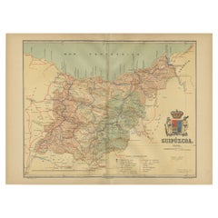
Gipuzkoa 1902: A Cartographic Snapshot of the Basque Coastline and Highlands
Located in Langweer, NL
the autonomous community of the Basque Country in northern Spain, as of the year 1902. The map
Category
Antique Early 1900s Maps
Materials
Paper
Free Shipping
H 14.77 in W 20.08 in D 0 in
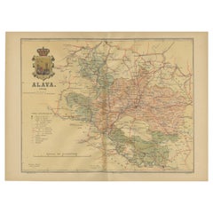
Álava in Northern Spain: The Geography of Basque Heritage and Terrain, 1902
Located in Langweer, NL
This original antique map is a historical depiction of the province of Álava (in Basque: Araba
Category
Antique Early 1900s Maps
Materials
Paper
Free Shipping
H 14.77 in W 20.08 in D 0 in
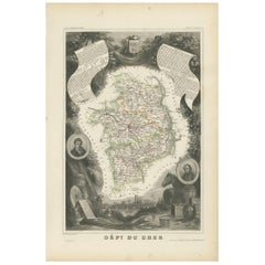
Antique Map of Cher in France, 1854
By Victor Levasseur
Located in Langweer, NL
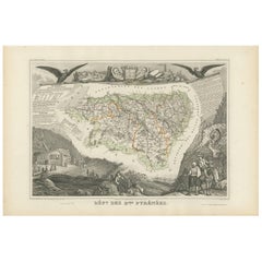
Antique map titled 'Dépt. des Bses. Pyrénées'. Map of the French department of Basses Pyrenees
Category
Antique Mid-19th Century Maps
Materials
Paper
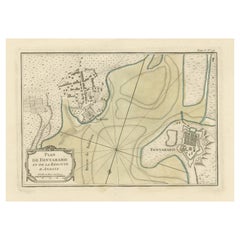
Antique Map of Hondarribia Near the Bidasoa River, France & Spain
Located in Langweer, NL
near the Bidasoa river, a river in the Basque Country of northern Spain and southern France. This map
Category
Antique Mid-18th Century Maps
Materials
Paper
Antique Map of Basses Pyrénées ‘France’ by V. Levasseur, 1854
By Victor Levasseur
Located in Langweer, NL
Antique map titled 'Dépt. des Bses. Pyrénées'. Map of the French department of Basses Pyrenees
Category
Antique Mid-19th Century Maps
Materials
Paper
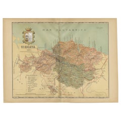
Cartographic Heritage: The 1901 Map of the Vizcaya Province in Spain
Located in Langweer, NL
This is a historical map of the province of Vizcaya (Biscay) in Spain, dated 1901. The title on the
Category
Antique Early 1900s Maps
Materials
Paper
Free Shipping
H 14.77 in W 20.08 in D 0 in
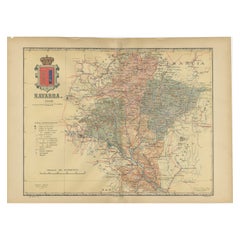
Navarra in Cartographic Detail: A 1902 Map of the Crossroads of Northern Spain
Located in Langweer, NL
The original antique map for sale shows the Spanish province of Navarra as it was in 1902. Here's a
Category
Antique Early 1900s Maps
Materials
Paper
Free Shipping
H 14.77 in W 20.08 in D 0 in
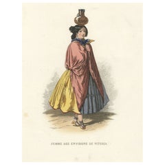
Woman from Vitoria, the Capital of the Spanish Basque Country and Alava
Located in Langweer, NL
antique maps to collectors, historians, educators and interior decorators all over the world. Our
Category
Antique 19th Century Prints
Materials
Paper
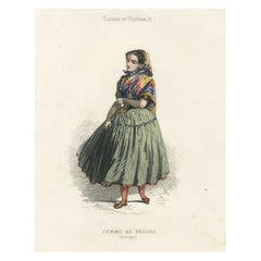
Antique Handcolored Print of a Female from Tolosa, Gipuzkoa, Basque, Spain, 1850
Located in Langweer, NL
: 1850
Overall size: 20,7 x 28,2 cm.
Image size: 11,5 x 22,6 cm.
We sell original antique maps to
Category
Antique 19th Century Prints
Materials
Paper
H 11.11 in W 8.15 in D 0 in
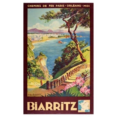
Original Vintage Poster Biarritz Basque Coast France Chemins De Fer Travel Art
Located in London, GB
distance, the text above and below with a small map of France marking Biarritz on the train route from
Category
Vintage 1930s French Posters
Materials
Paper
H 36.62 in W 24.81 in D 0.04 in
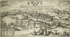
Bilbao, Antique Map from "Civitates Orbis Terrarum" - by F.Hogenberg - 1572-1617
By Franz Hogenberg
Located in Roma, IT
Basque Country, in its state around 1540's. Beautifully visible in the engraving the bridge ,St. Anthony
Category
16th Century Figurative Prints
Materials
Aquatint, Etching
H 15.75 in W 27.56 in D 0.04 in
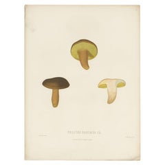
Antique Mycology Print of the Boletus Aereus by Fries, c.1860
By Elias Magnus Fries
Located in Langweer, NL
Boletaceae. The bolete is widely consumed in Spain (Basque Country and Navarre), France, Italy, Greece, and
Category
Antique 19th Century Prints
Materials
Paper
Epic of America by Jt Adams First Edition Re-Print
Located in Dallas, TX
Spanish(Basque) descent.
Adams took his bachelor’s degree from the New York University Tandon School of
Category
Early 20th Century American American Classical Books
Materials
Paper
Original Vintage Poster Biarritz Basque Coast France Chemins De Fer Travel Art
By E. Paul Champseix
Located in London, GB
distance, the text above and below with a small map of France marking Biarritz on the train route from
Category
1930s More Prints
Materials
Paper
People Also Browsed
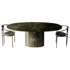
Vintage Nero Marquina Black Oval Marble Dining Table
Located in St Louis Park, MN
Striking Vintage Oval Dining Table in Nero Marquina Marble.
Nero Marquina is high quality stone that originates from the Basque Country North of Spain. This specific table has beau...
Category
Vintage 1970s Spanish Post-Modern Dining Room Tables
Materials
Marble
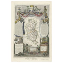
Map of Rhône: Culture and Commerce in Lyon's Silk and Wine Legacy, 1852
Located in Langweer, NL
This original hand-colored map is from the "Atlas National Illustré," a work by Victor Levasseur, a French geographer and cartographer known for his richly illustrated maps.
The map...
Category
Antique 1850s Maps
Materials
Paper
Original Vintage Poster Vignobles De France Vins Du Val De Loire Valley Wine Map
Located in London, GB
Original vintage drink advertising poster promoting French wines (one of a series issued by the Comite National de Propagande en Faveur du Vin national committee for the promotion of...
Category
Vintage 1950s French Posters
Materials
Paper
H 26.78 in W 33.27 in D 0.04 in
Oteyza Marble Design Dining Table Travertine Joaquín Moll Meddel
By Joaquín Moll, Meddel
Located in VALVERDE DEL MAJANO, CL
The OTEYZA dining table in travertine marble is designed by Joaquín Moll for Archivo Collection Meddel. A linear marble structure with a transparent glass surface. An artistic and sc...
Category
2010s Spanish Modern Dining Room Tables
Materials
Crystal, Marble
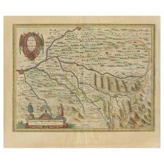
1644 Janssonius Original Wine Regions Map: The Ducal and Comital Burgundy
Located in Langweer, NL
This authentic handcolored map is a detailed 17th-century depiction of the Burgundy region, divided into the Duchy of Burgundy ("ducatus") and the County of Burgundy ("comitatus"), ...
Category
Antique 1640s Maps
Materials
Paper
Free Shipping
H 19.1 in W 22.84 in D 0 in
Old Map of the French Department of Ardèche, France
By Victor Levasseur
Located in Langweer, NL
Antique map titled 'Dépt. de l'Ardèche'. Map of the Department of Ardèche, France. This region is known for its fine wines, agriculture, distilled spirits, and cheese. The capital ci...
Category
Antique Mid-19th Century Maps
Materials
Paper
Old Map of the French department of Tarn, France
By Victor Levasseur
Located in Langweer, NL
Antique map titled 'Dépt. du Tarn'. Map of the French department of Tarn, France. This area produces a variety of traditional wines, including Cahors, Mauzac, Loin de l’Oeil and Onde...
Category
Antique Mid-19th Century Maps
Materials
Paper
Old Map of the French Department of L'ain, France
By Victor Levasseur
Located in Langweer, NL
Antique map titled 'Dépt. de l'Ain'. Map of the French department of l'Ain, France. This area of France is known for its Bugey wines, which are generally aromatic and white. It is al...
Category
Antique Mid-19th Century Maps
Materials
Paper
Hand Colored Antique Map of the Department of Aude, France
By Victor Levasseur
Located in Langweer, NL
Antique map titled 'Dépt. de l'Aude'. Map of the French department of Aude, France. This area of France is famous for its wide variety of vineyards and wine production. In the east a...
Category
Antique Mid-19th Century Maps
Materials
Paper
Hand Colored Antique Map of the Department of Vaucluse, France
By Victor Levasseur
Located in Langweer, NL
Antique map titled 'Dépt de Vaucluse'. Map of the French department of Vaucluse, France. Vaucluse is the center of wine production in the southern Rhone. Some of the smartest wines i...
Category
Antique Mid-19th Century Maps
Materials
Paper
Hand Colored Antique Map of the Department of Indre, France
By Victor Levasseur
Located in Langweer, NL
Antique map titled 'Dept. de l'Indre'. Map of the French department of Indre, France. Part of the Loire Valley wine region, this area is known for its production of Chinon wines, typ...
Category
Antique Mid-19th Century Maps
Materials
Paper
Old Map of the French Department of Loiret, France
By Victor Levasseur
Located in Langweer, NL
Antique map titled 'Dépt. du Loiret'. Map of the French department of Loiret, France. Surrounding the city of Orleans, Loiret is considered the heart of France and is a registered Un...
Category
Antique Mid-19th Century Maps
Materials
Paper
Old Map of the French Department of Nièvre, France
By Victor Levasseur
Located in Langweer, NL
Antique map titled 'Dept. de la Nièvre'. Map of the French department of Nievre, France. Part of the prestiegous Burgundy or Bourgogne wine region this area is known for its producti...
Category
Antique Mid-19th Century Maps
Materials
Paper
Hand Colored Antique Map of the Department of Ardèche, France
By Victor Levasseur
Located in Langweer, NL
Antique map titled 'Dépt. de l'Ardèche'. Map of the Department of Ardèche, France. This region is known for its fine wines, agriculture, distilled spirits, and cheese. The capital ci...
Category
Antique Mid-19th Century Maps
Materials
Paper
Hand Colored Antique Map of the Department of Gard, France
By Victor Levasseur
Located in Langweer, NL
Antique map titled 'Départ. Du Gard'. Map of the French department of Gard, France. This area of France is known mainly for its red wine and production of Bleu des Causses, a soft an...
Category
Antique Mid-19th Century Maps
Materials
Paper
Old Map of the French Department of Indre, France
By Victor Levasseur
Located in Langweer, NL
Antique map titled 'Dept. de l'Indre'. Map of the French department of Indre, France. Part of the Loire Valley wine region, this area is known for its production of Chinon wines, typ...
Category
Antique Mid-19th Century Maps
Materials
Paper
Recent Sales
Antique Map of the Béarn Region by Janssonius, circa 1640
By Johannes Janssonius
Located in Langweer, NL
Antique map titled 'Le Pais de Bearn'. Old map of the Béarn region, France. It is one of the
Category
Antique Mid-17th Century Maps
Materials
Paper
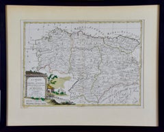
1779 Zatta Hand Colored Map of Northwestern Spain, Including Bilbao & Orviedo
Located in Alamo, CA
A hand colored map by Antonio Zatta entitled "Li Regni di Galizia, Asturies, Leon, Castiglia
Category
1770s Prints and Multiples
Materials
Engraving
H 17.25 in W 21.25 in D 0.75 in
1779 Zatta Hand Colored Map of Northwestern Spain, Including Bilbao & Orviedo
By Antonio Zatta
Located in Alamo, CA
A hand colored map by Antonio Zatta entitled "Li Regni di Galizia, Asturies, Leon, Castiglia
Category
Antique Late 18th Century Italian Maps
Materials
Paper
H 17.25 in W 21.25 in D 0.75 in
Get Updated with New Arrivals
Save "Basque Maps", and we’ll notify you when there are new listings in this category.
Basque Maps For Sale on 1stDibs
Find a variety of basque maps available on 1stDibs. Frequently made of paper, all basque maps available were constructed with great care. Basque maps have been produced for many years, with earlier versions available from the 18th Century and newer variations made as recently as the 20th Century. Basque maps bearing neoclassical hallmark is very popular at 1stDibs. Many basque maps are appealing in their simplicity, but Victor Levasseur produced popular basque maps that are worth a look.
How Much are Basque Maps?
The average selling price for at 1stDibs is $344, while they’re typically $155 on the low end and $3,440 highest priced.
More Ways To Browse
Levasseur A
Old French Map
Paris Antique Map
Poster Biarritz
Posters Biarritz
Venezuela Antique Map
Mid Century Maps
Victor De Winer
Map Of Connecticut
Antique Map Connecticut
Map Connecticut
Travel By Train Poster
Biarritz Vintage Poster
Winkler Prins
A Plan City And Castle Of Batavia
Very Large Map
John Speed Isle Of Wight Maps
Malacca Strait Map
