Gerard Mercator Maps
Flemish, German, 1512-1594
Gerard Mercator (1512-1594) was one of the most famous cartographers of the 16th century and, in fact, of all time. Mercator was known for his strict adherence to scientific methods of the day. He was responsible for advancing the technology of map making. For example his method of representing land masses in a cylindrical projection with north up and south down, first described in 1569, became the standard map projection for navigation. It is still referred to as The Mercator projection. to
3
4
3
7
7
7
4
4
7
7
7
13
104
63
29
24
Creator: Gerard Mercator
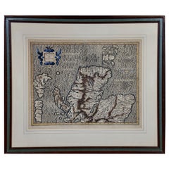
Northern Scotland: A 16th Century Hand-colored Map by Mercator
By Gerard Mercator
Located in Alamo, CA
A framed hand-colored 16th century map of Northern Scotland by Gerard Mercator entitled "Scotiae pars Septentrionalis", published in Amsterdam in 1636. It is a highly detailed map of the northern part of Scotland, with the northwest Highlands and the cities Inverness and Aberdeen, as well as the Orkney Islands and the Hebrides. There is a decorative title cartouche in the upper left corner.
The map is presented in an antiqued brown wood...
Category
16th Century Dutch Antique Gerard Mercator Maps
Materials
Paper
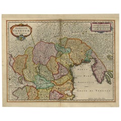
Antique Map of the Area Around Venice in Italy by H. Hondius, circa 1606
By Gerard Mercator, Jodocus Hondius
Located in Langweer, NL
Attractive and early map of the area around Venice, Italy. With South-Tirol in the North, areas of Krain (Slovenia), Croatia, Ferrara, Modena and Piacenza. In the east with areas aro...
Category
Early 17th Century Antique Gerard Mercator Maps
Materials
Paper
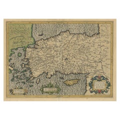
Original Antique Map of Turkey, Asia Minor and Cyprus
By Gerard Mercator
Located in Langweer, NL
Antique map titled 'Natoliae sive Asia Minor'. Original old map of Turkey, Asia Minor and Cyprus. Includes a decorative cartouches, sailing ship, sea mon...
Category
Early 17th Century Antique Gerard Mercator Maps
Materials
Paper
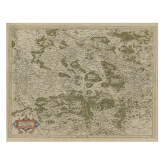
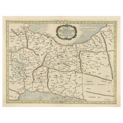
Antique Map of the Southern Lorraine Region by Mercator, c.1625
By Gerard Mercator
Located in Langweer, NL
Antique map titled 'Lotharingiae Ducatus'. Old map of the southern portion of the Lorraine region, France. Lorraine is a cultural and historical region in north-eastern France, now l...
Category
17th Century Antique Gerard Mercator Maps
Materials
Paper
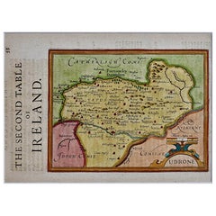
Southeastern Ireland: A 17th Century Hand Colored Map by Mercator and Hondius
By Gerard Mercator
Located in Alamo, CA
A 17th century copperplate hand-colored map entitled "The Second Table of Ireland, Udrone" by Gerard Mercator and Jodocus Hondius, published in Amsterdam in 1635 in 'Cosmographicall ...
Category
Mid-17th Century Dutch Antique Gerard Mercator Maps
Materials
Paper
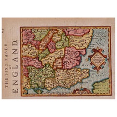
17th Century Hand-Colored Map of Southeastern England by Mercator and Hondius
By Gerard Mercator
Located in Alamo, CA
A 17th century copperplate hand-colored map entitled "The Sixt Table of England" by Gerard Mercator and Jodocus Hondius, published in Amsterdam in 1635 in 'Cosmographicall Descriptio...
Category
Mid-17th Century Dutch Antique Gerard Mercator Maps
Materials
Paper
Northern Scotland: A 17th Century Hand-colored Map by Mercator
By Gerard Mercator
Located in Alamo, CA
This is a framed hand-colored 17th century map of Northern Scotland by Gerard Mercator entitled "Scotiae pars Septentrionalis", published in Amsterdam in 1636. It is a highly detailed map of the northern part of Scotland, with the northwest Highlands and the cities Inverness and Aberdeen, as well as the Orkney Islands and the Hebrides. There is a decorative title cartouche in the upper left corner.
The map is presented in an antiqued brown wood...
Category
1630s Dutch Antique Gerard Mercator Maps
Materials
Paper
Related Items
Antique Map of Principality of Monaco
By Antonio Vallardi Editore
Located in Alessandria, Piemonte
ST/619 - "Old Geographical Atlas of Italy - Topographic map of ex-Principality of Monaco" -
ediz Vallardi - Milano -
A somewhat special edition ---
Category
Late 19th Century Italian Other Antique Gerard Mercator Maps
Materials
Paper
Original Antique Map of Ancient Greece, Achaia, Corinth, 1786
Located in St Annes, Lancashire
Great map of Ancient Greece. Showing the region of Thessaly, including Mount Olympus
Drawn by J.D. Barbie Du Bocage
Copper plate engraving by P.F Tardieu
Original hand color...
Category
1780s French Other Antique Gerard Mercator Maps
Materials
Paper
Original Antique Map of Spain and Portugal, circa 1790
Located in St Annes, Lancashire
Super map of Spain and Portugal
Copper plate engraving by A. Bell
Published, circa 1790.
Unframed.
Category
1790s English Other Antique Gerard Mercator Maps
Materials
Paper
16th Century Map of Saudi Arabia, the Persian Gulf and Red Sea, ca. 1574
Located in Langweer, NL
Ptolemaic map of the Arabian Peninsula based on the 1548 map of Giacomo Gastaldi. It covers nearly all of the peninsula, but does not include the head of the Red Sea. The coastlines ...
Category
16th Century Antique Gerard Mercator Maps
Materials
Paper
H 7.1 in W 9.8 in D 0.002 in
Original 16th Century Engraving of a Medieval Tournament, ca.1578
Located in Langweer, NL
Antique print titled 'Das rennen und stechen'.
Engraving of a Medieval tournament. This print originates from 'Thurnier Buch. Von Anfang, Ursachen, ursprung und herkommen (..)' b...
Category
16th Century Antique Gerard Mercator Maps
Materials
Paper
Original Antique Map of Ancient Greece- Boeotia, Thebes, 1787
Located in St Annes, Lancashire
Great map of Ancient Greece. Showing the region of Boeotia, including Thebes
Drawn by J.D. Barbie Du Bocage
Copper plate engraving by P.F T...
Category
1780s French Other Antique Gerard Mercator Maps
Materials
Paper
Original Hand-Colored Antique Map of America by Danckerts, circa 1680
Located in Langweer, NL
Antique map titled 'Novissima et Accuratissima Totius Americae Descriptio per I. Danckerts'. Striking map of America. California is shown as an island, Based Upon Sanson's model. The Great Lakes are shown with an open western coastline. No Northwestern Coast beyond 40 degrees. The seven cities of Cibola appear in the Southwestern US. The conception of the Mississippi River is still very vague and pushed far west of its true mouth. The large lake in the Southeastern US first seen on Le Moyne's map is still present. South America retains its excessively wide format. A hopeful extension from Button's Bay is shown portending a possible Northwest Passage. The map is richly embellished with two cartouches, 9 sailing vessels and elaborate vignettes of native villages, native warriors...
Category
Late 17th Century Antique Gerard Mercator Maps
Materials
Paper
H 20.48 in W 24.22 in D 0.02 in
Antique Detailed World Map Drawn on Mercator's Projection, 1700
Located in Langweer, NL
Antique world map titled 'Carte generale du monde, ou description du monde terrestre & Aquatique - Generale Waereld kaart, of beschryving van de land en water waereld'. This is Pierr...
Category
17th Century Antique Gerard Mercator Maps
Materials
Paper
Original Antique Map of Europe, Arrowsmith, 1820
Located in St Annes, Lancashire
Great map of Europe
Drawn under the direction of Arrowsmith.
Copper-plate engraving.
Published by Longman, Hurst, Rees, Orme and Brown, 1820
...
Category
1820s English Antique Gerard Mercator Maps
Materials
Paper
Original Antique Map of South East Asia by Thomas Clerk, 1817
Located in St Annes, Lancashire
Great map of South East Asia
Copper-plate engraving
Drawn and engraved by Thomas Clerk, Edinburgh.
Published by Mackenzie And Dent, 1817
Unframed.
Category
1810s English Antique Gerard Mercator Maps
Materials
Paper
Rare Original 16th Century Antique Map of Greece, 1598
Located in Langweer, NL
Beautiful and rare antique map of Greece with Albania, Mecedonia, Romania, Dalmatia and the peninsula of Salento to the Golf of Taranto. Also clearly shown the islands of the Aegaian...
Category
16th Century Antique Gerard Mercator Maps
Materials
Paper
Original Antique Map of Sweden, Engraved by Barlow, 1806
Located in St Annes, Lancashire
Great map of Sweden
Copper-plate engraving by Barlow
Published by Brightly & Kinnersly, Bungay, Suffolk. 1806
Unframed.
Category
Early 1800s English Antique Gerard Mercator Maps
Materials
Paper
Previously Available Items
Antique Ptolemaic Map of Modern-Day Iran, Iraq and Part of Armenia
By Gerard Mercator
Located in Langweer, NL
Antique map titled 'Tab. V. Asiae Repraesentans Mediam, Hyrcaniam, Assyriam, Susuanam ac Persidem'. Ptolemaic map of much of modern-day Iran, Iraq and part of Armenia. The map stretches from the Persian Gulf...
Category
Late 17th Century Antique Gerard Mercator Maps
Materials
Paper
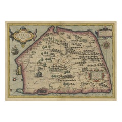
Stunning Antique Map of the Island Ceylon or Sri Lanka
By Gerard Mercator
Located in Langweer, NL
Antique map titled 'Ins. Ceilan quae incolis Tenarisin dicitur'. This exquisite, early map of Sri Lanka is shown with an unusual five-sided shape. North is oriented to the left by an...
Category
Early 17th Century Antique Gerard Mercator Maps
Materials
Paper
Florida and Virginia: A 17th Century Hand-colored Map by Hondius after Mercator
By Gerard Mercator
Located in Alamo, CA
This hand-colored early 17th century copper-plate map entitled "Virginia et Florida" was originally created as a larger map by Gerard Mercator and ...
Category
Early 17th Century Dutch Antique Gerard Mercator Maps
Materials
Paper
H 6.75 in W 8.63 in D 0.13 in
17th Century Hand-Colored Map of Valencia and Murcia, Spain by Mercator/Hondius
By Gerard Mercator
Located in Alamo, CA
A 17th century hand-colored map entitled "Regni Valentiae Typus, Valentia and Murcia" by Gerard Mercator and Joducus Hondius, published in Amsterdam in 1635 in 'Cosmographicall Descr...
Category
Mid-17th Century Dutch Antique Gerard Mercator Maps
Materials
Paper
H 12 in W 16 in D 0.13 in
Antique Map of the Peloponnesos peninsula by Mercator, circa 1620
By Gerard Mercator
Located in Langweer, NL
Antique map titled 'Morea olim Peloponnesus'. A beautiful and decorative map of the Peloponnesos peninsula in southern Greece. This region was called Morea well into the 19th century...
Category
Early 17th Century Antique Gerard Mercator Maps
Materials
Paper
Antique Map of Scotland by Mercator, circa 1605
By Gerard Mercator
Located in Langweer, NL
Antique map titled 'Scotia Regnum'. One of the earliest obtainable maps of Scotland. Published by G. Mercator, one of the most famous cartographers of all time.
Category
Early 17th Century Antique Gerard Mercator Maps
Materials
Paper
Gerard Mercator maps for sale on 1stDibs.
Gerard Mercator maps are available for sale on 1stDibs. These distinctive items are frequently made of paper and are designed with extraordinary care. There are many options to choose from in our collection of Gerard Mercator maps, although brown editions of this piece are particularly popular. If you’re looking for additional options, many customers also consider maps by Willem Blaeu, Nicolaes Visscher II, and F. Valentijn. Prices for Gerard Mercator maps can differ depending upon size, time period and other attributes — on 1stDibs, these items begin at $313 and can go as high as $1,175, while a piece like these, on average, fetch $675.
