Antoine Roux Maps
to
4
4
4
4
4
4
4
4
4
6
104
58
29
21
Creator: Antoine Roux
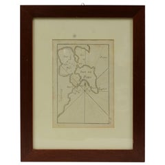
Antique Nautical Portolano of Isle De Poro by Antoine Roux, France, 1844
By Antoine Roux
Located in Milan, IT
Antique portolano, nautical map of Isle De Poro engraved on a copper plate by Antoine Roux, Marseille France 1844, from his work Recueil des principaux plans des ports et de Rades de...
Category
1840s French Antique Antoine Roux Maps
Materials
Paper
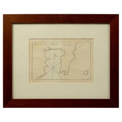
1844 French Antique Nautical Portolan of Plan du Port de Cherfe by Antoine Roux
By Antoine Roux
Located in Milan, IT
Antique portolano, nautical map of Plan du Port de Cherfe engraved on a copper plate by Antoine Roux, Marseille France 1844, from his work Recueil des principaux plans des ports et d...
Category
1840s French Antique Antoine Roux Maps
Materials
Paper
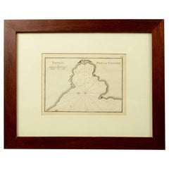
1844 French Nautical Portolano of Port De Chichimé Natolie by Antoine Roux
By Antoine Roux
Located in Milan, IT
Antique portolano, nautical map of Port De Chichimé Natolie engraved on a copper plate by Antoine Roux, Marseille France 1844, from his work Recueil des principaux plans des ports et...
Category
1840s French Antique Antoine Roux Maps
Materials
Paper
Antique Nautical Portolano of Port St. Antoine by Antoine Roux, France, 1844
By Antoine Roux
Located in Milan, IT
Antique portolano, nautical map of Port St. Antoine engraved on a copper plate by Antoine Roux, Marseille, France, 1844, from his work Recueil des principaux plans des ports et de Ra...
Category
1840s French Antique Antoine Roux Maps
Materials
Paper
Related Items
Framed Nautical Flag by Dettra
Located in Norwell, MA
Linen maritime flag with sturdy canvas hoist and stitched panels of yellow and red. The hoist is stamped Dettra Flag Company Incorporated. This is a US Na...
Category
1940s North American Vintage Antoine Roux Maps
Materials
Cotton
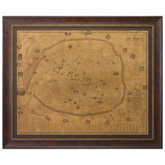
Plan of Paris, France, by A. Vuillemin, Antique Map, 1845
Located in Colorado Springs, CO
This large and detailed plan of Paris was published by Alexandre Vuillemin in 1845. The map conveys a wonderful amount of information and is decorated throughout with pictorial vigne...
Category
1840s American Antique Antoine Roux Maps
Materials
Paper
Russian Furniture: The Golden Age 1780-1840 1st Ed by Antoine Chenevière
By Antoine Cheneviere
Located in valatie, NY
Russian Furniture: The Golden Age, 1780-1840 by Antoine Chenevière. New York: Vendome Press, 1988. First edition hardcover with dust jacket. 312 pp. This beautiful book is a comprehensive and chronological study of the development of Russian furniture style during the late 18th and early 19th centuries. During the late 18th century there was a burst of palace and grandiose apartment construction that were filled with magnificent furniture...
Category
20th Century American Antoine Roux Maps
Materials
Paper
$189
H 11.75 in W 10.25 in D 1.25 in
Set of 5 Antique Prints of Ancient Buildings in Rome and its Vicinity, 1844
Located in Langweer, NL
Beautiful set off of 5 aquatint prints of old Rome, Italy, including the popular view of the Coliseum.
Matthew Dubourg (active 1786 – 1838)
From "Views of the Remains of Ancient Bu...
Category
Mid-19th Century European Antique Antoine Roux Maps
Materials
Paper
$875 Sale Price
30% Off
H 13 in W 16.54 in D 0 in
18th Century Antique Engraving of the Southern Hemisphere by G. de L'Isle
By Guillaume De L'Isle
Located in Langweer, NL
Antique map titled 'Hemisphere Meridional pour voir plus distinctement Les Terres Australes'. Hemispherical map of the southern hemisphere centered on ...
Category
Late 18th Century Antique Antoine Roux Maps
Materials
Paper
$1,191
H 21.58 in W 29.93 in D 0.02 in
Antique Exceptional Judaica Sterling Silver Torah Pointer/Yad 1844
Located in Doha, QA
This outstanding sterling silver Torah Pointer is 35 cm long and was found in Spain. Hand crafted with lots of details and very filigran in 1844 ,19th century.
On top there is a lit...
Category
19th Century Spanish Antique Antoine Roux Maps
Materials
Sterling Silver
$3,900
H 13.78 in W 1.19 in D 1.19 in
Framed Nautical Flag by Dettra
Located in Norwell, MA
Linen maritime flag with sturdy canvas hoist and stitched panels of yellow and blue. The hoist is stamped Dettra Flag Company Incorporated. This is a US N...
Category
1940s North American Vintage Antoine Roux Maps
Materials
Linen
Antique Plan of the City of Bayonne, France
Located in Langweer, NL
Antique map titled 'Plan de Bayonne'. Original old plan of the city of Bayonne, France. This map originates from 'Le Petit Atlas Maritime (..)' by J.N. Bellin. Published 1764.
Be...
Category
Mid-18th Century Antique Antoine Roux Maps
Materials
Paper
Pair of Nautical Brass Port & Starboard Sconce or Table Lights with Fresnel Lens
Located in Nantucket, MA
A fabulous pair of nautical and marine port and starboard brass running lights from a decommissioned ship. These were originally wall/side mounted and can be used that way as a scon...
Category
Mid-20th Century Mid-Century Modern Antoine Roux Maps
Materials
Brass
$2,700 / set
H 10 in Dm 8 in
Brass and Glass Port and Starboard Nautical Lanterns Mounted as Sconces, a Pair
Located in Miami, FL
Brass and Glass Port and Starboard Nautical Lanterns Mounted as Sconces, a Pair
Offered for sale is a pair of brass and glass port and starboard nautical lanterns mounted as sconces...
Category
20th Century Antoine Roux Maps
Materials
Brass
$695 / set
H 16 in W 5.75 in D 5 in
Beautiful 17th Century Map of Paris and Isle de France by Templeux, c.1650
Located in Langweer, NL
Map of Isle de France by D. de Templeux, ca. 1650, Hand-Colored and Decorative
This richly detailed antique map titled *Le Gouvernement de L'Isle de France* was engraved by Daniel d...
Category
1650s Antique Antoine Roux Maps
Materials
Paper
$766
H 18.9 in W 22.45 in D 0.01 in
1758 Map of Saint Kitts – St. Christophe, Antique French Engraving
Located in Langweer, NL
Map of Saint Kitts (St. Christophe), circa 1758
This is an antique French map titled *Carte de l'Isle St. Christophe*, engraved by Jacques-Nicolas Bellin and published around 1758 f...
Category
Mid-18th Century French Antique Antoine Roux Maps
Materials
Paper
$514
H 10.04 in W 14.97 in D 0.01 in
Antoine Roux maps for sale on 1stDibs.
Antoine Roux maps are available for sale on 1stDibs. These distinctive items are frequently made of paper and are designed with extraordinary care. There are many options to choose from in our collection of Antoine Roux maps, although beige editions of this piece are particularly popular. If you’re looking for additional options, many customers also consider maps by J. Migeon, and Nicolas Sanson. Prices for Antoine Roux maps can differ depending upon size, time period and other attributes — on 1stDibs, these items begin at $485 and can go as high as $485, while a piece like these, on average, fetch $485.
