J. Laurent Maps
Jean Laurent was born on 23rd July 1816, Garchizy, France. Laurent was a French photographer who mostly worked in Spain. He first moved to Spain in 1843 and settled in Madrid. Laurent died on 24th November 1886 in Madrid, Spain.
to
1
1
1
1
1
1
1
1
1
104
58
29
21
Creator: J. Laurent
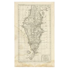
Antique Map of the Kamchatka Peninsula by Bellin, 1757
By J. Laurent
Located in Langweer, NL
Antique map titled 'Carte du Kamtchatka'. Antique map of the Kamchatka Peninsula. The map includes the island of Ouiakous Atch ou Anfinogen, Schoumctchou, and Sirinki ou Dilkon. Orig...
Category
18th Century Antique J. Laurent Maps
Materials
Paper
$155 Sale Price
20% Off
Related Items
Original Antique Map of The London Underground. 1911
Located in St Annes, Lancashire
Superb map of The London Underground
Published by Ward Lock, 1911
Folding map. Printed on paper
Unframed.
Good condition/ Minor repair to an edge tear on right edge ( shown in ...
Category
1910s English Vintage J. Laurent Maps
Materials
Canvas, Paper
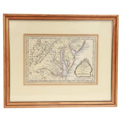
Antique Map of Virginia & the Chesapeake Bay by Jacques-Nicolas Bellin, c. 1750
By Jacques-Nicolas Bellin
Located in Philadelphia, PA
A fine antique 18th century French map of North America.
By Jacques-Nicolas Bellin.
On laid paper with polychrome highlights.
Depicting Virginia, the Chesapeake Bay, and the nearb...
Category
18th Century French Baroque Antique J. Laurent Maps
Materials
Paper
$895
H 15.13 in W 18.63 in D 1.13 in
History of the War in the Peninsula by W.F.P. Napier with Lord Elgin Provenance
By W.F.P. Napier, C.B.
Located in valatie, NY
A complete set of "History of the War in the Peninsula" by W.F.P. Napier, in 6 volumes, numbered 1-6. London: Thomas & William Boone all volumes are published in different years from 1828-1840 and are all 1st Ed's. 3/4 leather and marbled board hard covers. The history of the war in the Iberian Peninsula and in the South of France, from 1807 to the 1846 written by W.F.P. Napier, C.B., Colonel H.P. Forty-Third Regiment, and a member of the Royal Swedish Academy of Military Sciences. The wars describe the military conflict between Napoleon's Empire and Bourbon Spain. The United Kingdom of Great Britain and Ireland allied with the Kingdom of Portugal, for control of the Iberian Peninsula during the Napoleonic wars. The volumes have illustrated fold out maps portraying various battles.
The set was owned originally by Colonel Thomas Bruce (Lord Elgin) the 7th Earl of Elgin. He sold the "Elgin Marbles" taken from the Parthenon to the British government in 1816. The books were later owned by George Woods...
Category
Early 19th Century English Antique J. Laurent Maps
Materials
Paper
$4,500 / set
H 8.5 in W 7.75 in D 5.75 in
Original Antique Map of The World by Dower, circa 1835
Located in St Annes, Lancashire
Nice map of the World
Drawn and engraved by J.Dower
Published by Orr & Smith. C.1835
Unframed.
Free shipping
Category
1830s English Antique J. Laurent Maps
Materials
Paper
Original Antique Map of the American State of Kentucky, 1903
Located in St Annes, Lancashire
Antique map of Kentucky
Published By A & C Black. 1903
Original colour
Good condition
Unframed.
Free shipping
Category
Early 1900s English Antique J. Laurent Maps
Materials
Paper
Original Antique Map of the American State of Maine, 1903
Located in St Annes, Lancashire
Antique map of Maine
Published By A & C Black. 1903
Original colour
Good condition
Unframed.
Free shipping
Category
Early 1900s English Antique J. Laurent Maps
Materials
Paper
Original Antique Map of the American State of Louisiana, 1903
Located in St Annes, Lancashire
Antique map of Louisiana
Published By A & C Black. 1903
Original colour
Good condition
Unframed.
Free shipping
Category
Early 1900s English Antique J. Laurent Maps
Materials
Paper
Original Antique Map of The World by Thomas Clerk, 1817
Located in St Annes, Lancashire
Great map of The Eastern and Western Hemispheres
On 2 sheets
Copper-plate engraving
Drawn and engraved by Thomas Clerk, Edinburgh.
Published by Mackenzie And Dent, 1817
...
Category
1810s English Antique J. Laurent Maps
Materials
Paper
Original Antique Map of the American State of Mississippi, 1903
Located in St Annes, Lancashire
Antique map of Mississippi
Published By A & C Black. 1903
Original colour
Good condition
Unframed.
Free shipping
Category
Early 1900s English Antique J. Laurent Maps
Materials
Paper
Original Antique Map of the American State of Pennsylvania, 1889
Located in St Annes, Lancashire
Great map of Pennsylvania
Drawn and Engraved by W. & A.K. Johnston
Published By A & C Black, Edinburgh.
Original colour
Unframed.
Repair to a minor tear on bottom edge.
Category
1880s Scottish Victorian Antique J. Laurent Maps
Materials
Paper
Large Original Antique Map of the The Windward Islands. 1894
Located in St Annes, Lancashire
Superb Antique map of The Windward Islands
Published Edward Stanford, Charing Cross, London 1894
Original colour
Good condition
Unframed.
Free shipping
Category
1890s English Antique J. Laurent Maps
Materials
Paper
Original Antique Map of The Philippines. C.1900
Located in St Annes, Lancashire
Fabulous map of The Philippines
Original color.
Engraved and printed by the George F. Cram Company, Indianapolis.
Published, C.1900.
Unframed.
Free shipping.
Category
1890s American Antique J. Laurent Maps
Materials
Paper
J. Laurent maps for sale on 1stDibs.
J. Laurent maps are available for sale on 1stDibs. These distinctive items are frequently made of paper and are designed with extraordinary care. There are many options to choose from in our collection of J. Laurent maps, although beige editions of this piece are particularly popular. If you’re looking for additional options, many customers also consider maps by Schreiber, G. A. Rizzi-zannoni, and Jacques-Nicolas Bellin. Prices for J. Laurent maps can differ depending upon size, time period and other attributes — on 1stDibs, these items begin at $180 and can go as high as $180, while a piece like these, on average, fetch $180.


