Nicolaus Visscher More Prints
1618-1679
The Visscher family were one of the great cartographic families of the 17th century. Begun by Claes Jansz Visscher (1587-1652) and continued by his son Nicolaes (1618-1679), grandson Nicolaes II (1649-1702) and then by his grandson’s widow, Elizabeth until her death in 1726. The Visschers were prolific publishers, producing individual maps and also atlases made up to their customers’ specifications. They are commonly regarded as second only to the Blaeu family, among Dutch mapmakers, for the high quality of engraving and decoration, and the geographical accuracy of their many maps.(Biography provided by Timeless Intaglio)
to
2
1
1
2
2
Overall Height
to
Overall Width
to
2
4
543
413
150
141
2
Artist: Nicolaus Visscher
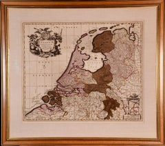
Belgium and the Netherlands: A Hand-colored 17th Century Map by Visscher
By Nicolaus Visscher
Located in Alamo, CA
This is an original hand-colored 17th century map of Belgium by Nicolaus (Nicolas) Visscher II entitled "Belgium Foederatum emendate auctum et novissime editum", published in Amsterdam in 1678. The map shows the seven provinces comprising the Belgium federation or the Republic of the Seven United Netherlands or the Dutch Republic as it was also known. The republic was formed when an alliance of seven Dutch provinces in the Spanish Netherlands revolted against rule by Spain in 1579 (the Union of Utrecht) and declared their independence in 1581 (the Act of Abjuration). The seven provinces were Groningen, Frisia, Overijssel, Guelders, Utrecht, Holland and Zeeland. This was a predecessor state to the Netherlands and the first fully independent Dutch nation state. Amsterdam, Delft, Rouen, Utrecht, Brugge, Ghent, and Antwerp are all included on the map. A small inset map in the lower right depicts the course of the Maas River from Maastricht to Wessem. There is a decorative cartouche in the upper left corner and a distance scale cartouche in the lower right corner.
The map is presented in an attractive antiqued medium brown-colored wood frame with gold-colored inner and outer trim and a light tan-colored fabric mat. The frame measures 26.63" high by 30" wide by 0.75" deep. There is some darkening of the red areas in the map, presumably related to oxidation of the original iron containing pigment over time. There are also a few scattered spots. The map is otherwise in very good condition.
The Visscher family were one of the great cartographic families of the 17th century. Begun by Claes Jansz Visscher...
Category
Late 17th Century Other Art Style Nicolaus Visscher More Prints
Materials
Engraving
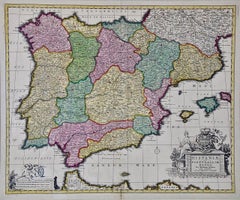
Spain and Portugal: A Hand-colored 17th/18th Century Map by Visscher
By Nicolaus Visscher
Located in Alamo, CA
This is an early 18th century map of Spain and Portugal, with attractive original hand-coloring, entitled "Hispaniae et Portugalliae Regna per Nicolaum Visscher cum Privilegio Ordinum Hollandiae et Westfrisiae" first published by Nicolaes Visscher II (1649-1702) in 1688, and later re-published from Visscher's original copper plate by Peter Schenk, Junior in Amsterdam in 1725. The cartouche in the right lower corner depicts a coat of arms representing one combined kingdom of Spain and Portugal before their break-up. Putti hold up the coat-of-arms of Phillip II on the right and a queen reaches for it on the left. There is a scale cartouche in the lower left corner surmounted by two putti and a wheel. This is an outstanding depiction of the Iberian peninsula, showing Spain and Portugal and Balearic Islands. The map includes portions of North Africa and the Strait of Gibralter.
This copperplate engraved map is presented in a cream-colored mat. It is printed on fine chain-linked, laid paper. The mat measures 26.5" high by 30" wide and the sheet measures 21.75" high by 26.375" wide. There is a central fold, as issued. The lower portion of the fold is reinforced on the verso. There is a small paper defect at the lower edge of the fold and another at the edge of the right corner, as well as a few small tears along the lower edge; none affecting the map and all covered by the mat. There are a few small faint spots in the upper margin and on the left. The map is otherwise in very good condition.
The Visscher family were one of the great art and cartographic printing families of the 17th century. Begun by Claes Jansz Visscher...
Category
Late 17th Century Other Art Style Nicolaus Visscher More Prints
Materials
Engraving
Related Items
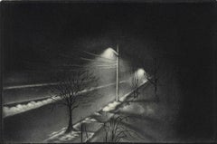
Foggy Night (the way home or a Stephen King setting)
By Carol Wax
Located in New Orleans, LA
This impression is #22
Carol Wax originally trained to be a classical musician at the Manhattan School of Music but fell in love with printmaking. Soon after she began engraving mez...
Category
2010s American Modern Nicolaus Visscher More Prints
Materials
Engraving, Mezzotint
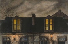
Lafitte's Blacksmith House (a bar named for a pirate on Bourbon St, New Orleans)
By Frederick Mershimer
Located in New Orleans, LA
Lafitte's Blacksmith Shop is a New Orleans landmark at 941 Bourbon St. Like most New Orleans legends, history of Lafitte's Blacksmith Shop is a gumbo of tru...
Category
Early 2000s Contemporary Nicolaus Visscher More Prints
Materials
Mezzotint, Aquatint
Cranes and Concrete (in the 80s, a boom saw buildings racing into the sky?
By Frederick Mershimer
Located in New Orleans, LA
"Cranes and Concrete" is Frederick Mershimer's mezzotint of the construction scene on Broadway between 13th and 14th streets. Mershimer is no strang...
Category
1980s Contemporary Nicolaus Visscher More Prints
Materials
Mezzotint
Slope w.five trees
By Robert Kipniss
Located in New York, NY
“Slope w/five trees” is a drypoint engraving created by Robert Kipniss in 2020. The paper size is 12.50 x 10.50 inches and the printed image size is 6.75 x ...
Category
21st Century and Contemporary Modern Nicolaus Visscher More Prints
Materials
Engraving, Drypoint
India William Hodges 'The East End of the Fort of Mongheer' India Engraving
By William Hodges
Located in Norfolk, GB
Aquatint with soft ground etching from the seminal publication, Selected Views in India, drawn on the Spot, in the Years 1780, 1781, 1782 and 1783, and Executed in Aquatint in 1786 -...
Category
Late 18th Century Other Art Style Nicolaus Visscher More Prints
Materials
Engraving
Here They Come !
By Frank W. Benson
Located in New York, NY
This impression of "Here They Come !" is from the fourth state of eight. There are six known impressions of the fourth state. Edition 150 (final state). It is signed in pencil in the lower left and inscribed "D-1". The image size 13 7/8 x 11 3/4" (34.6 x 28.8 cm) and sheet size 16 3/4 x 14 5/8" (42.8 x 37.1 cm).
FRANK W. BENSON (1862-1951)
Frank Weston Benson, well known for his American impressionist paintings, also produced an incredible body of prints - etchings, drypoints, and a few lithographs. Born and raised on the North Shore of Massachusetts, Benson, a natural outdoorsman, grew up sailing, fishing, and hunting. From a young age, he was fascinated with drawing and birding – this keen interest continued throughout his life.
His first art instruction was with Otto Grundman at the Museum of Fine Arts in Boston, and then in 1883 in Paris at the Academie Julian where he studied the rigorous ‘ecole des beaux arts’ approach to drawing and painting for two years.
During the early 1880’s Seymour Haden visited Boston giving a series of lectures on etching. This introduction to the European etching...
Category
1920s American Impressionist Nicolaus Visscher More Prints
Materials
Drypoint
Persiae, Armeniae, Natoliae et Arabiae Descriptio per Frederick deWit 1666 map
Located in Paonia, CO
Map of Persiae, Armeniae, Natoliae et Arabiae Descriptio per F de Wit 1688 engraving from: Atlas Contractus Orbis Terrarum Praecipuas ac Novissimas Complectens Tabulas. Amsterdam, N. Visscher, 1656-77. (Koeman III, Vis5-8) This highly decorative map of the Middle East is by the Dutch engraver, publisher, and map seller...
Category
1660s Realist Nicolaus Visscher More Prints
Materials
Engraving
Restaurant in Mott Street
By Charles Frederick William Mielatz
Located in New Orleans, LA
The image depicts a restaurant on New York's Mott Street with ornamental iron work on the balconies. There are six figures in the scene in various stages of contrast. Mott Street is considered the unofficial Main Street of New York's Chinatown. Ella Fitzgerald sang it best: “And tell me what street compares with Mott Street in July? Sweet pushcarts gently gliding by.”
CFW Mielatz was an early influence on the drypoints and etchings of Martin Lewis. This piece was created in 1906 and it is signed in pencil. It is part of the collection of New York's Metropolitan Museum of Art
C.F.W. Mielatz
American, 1860-1919
Born in Bredding, Germany in 1864, Mielatz emigrated to the United States as a young boy and studied at the Chicago School of Design. Mostly self-taught, his first prints were large New England landscapes reminiscent of the painter-etcher school of American Art. Around 1890 he started to produce prints of New York City and by the time of his death, the number totaled over ninety images. He was a master technician in the field of etching, reworking many of his plates to get the exact feeling he was seeking. Mielatz was a member of the New York Etching...
Category
Early 20th Century American Modern Nicolaus Visscher More Prints
Materials
Etching, Drypoint
Overlooking Wadi, Saudi Arabia - Signed Lithograph, Royal Art, Mountains, Asir
Located in Knowle Lane, Cranleigh
Overlooking Wadi, Asir Province, Kingdom Of Saudi Arabia by His Majesty King Charles III, (created when he was HRH The Prince of Wales) - ...
Category
Early 2000s Academic Nicolaus Visscher More Prints
Materials
Lithograph
H 23.23 in W 20.87 in D 1.19 in
India William Hodges 'A View of the Ravines at Etana' Early India Engraving
By William Hodges
Located in Norfolk, GB
William Hodges
Plate 27 'A View of the Ravines at Etawa'
Published 20th May 1787 by J Wells, 22 Charing Cross.
Page size, 16.5” x 22.5”, image 11.25 x 18”
Aquatint with soft gro...
Category
Early 2000s Other Art Style Nicolaus Visscher More Prints
Materials
Engraving
Girders (rainy night view of artist's former studio in Washington Heights
By Craig McPherson
Located in New Orleans, LA
"Griders" is Craig McPherson's rainy night scene showing the view from his former studio in Washington Heights in NYC. The image is the companion pi...
Category
1980s Contemporary Nicolaus Visscher More Prints
Materials
Mezzotint
Carte Particular Des Costes De Bretagne Depuis le Cap de Frehel, Jusques a Perros
By Pierre Mortier
Located in Paonia, CO
Carte Particulaire Des Costes De Bretagne Depuis Le Cap de Frehel, Jusques a Perros, & L’Isle Tome. This large sea scale chart shows part of the northwestern co...
Category
1690s Nicolaus Visscher More Prints
Materials
Engraving
Nicolaus Visscher more prints for sale on 1stDibs.
Find a wide variety of authentic Nicolaus Visscher more prints available for sale on 1stDibs. You can also browse by medium to find art by Nicolaus Visscher in engraving and more. Not every interior allows for large Nicolaus Visscher more prints, so small editions measuring 30 inches across are available. Customers who are interested in this artist might also find the work of Nicholas Sanson d'Abbeville, Gerard Mercator, and Frans Hogenberg. Nicolaus Visscher more prints prices can differ depending upon medium, time period and other attributes. On 1stDibs, the price for these items starts at $1,020 and tops out at $1,180, while the average work can sell for $1,100.


