Pierre François Tardieu Maps
French, 1711-1771
Pierre François Tardieu was a very well-known map engraver, geographer and illustrator. Tardieu was born on December 24, 1711, in Paris. He was awarded a bronze medal by King Louis-Phillipe for the accuracy and beauty of his map-making. Tardieu produced many fine works, including maps of Louisiana, Mexico, Russia and Asia in addition to his illustrations of French provinces. Additionally, the mapmaker was the first to engrave steel rather than copper. Overall, he was widely celebrated for his skilled combination of research, detail and technical talent. Tardieu died on January 15, 1771, in Paris.
to
2
2
1
3
2
1
3
1
1
3
3
3
2
104
58
29
21
Creator: Pierre François Tardieu
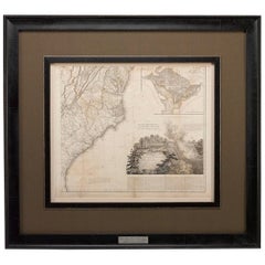
1812 United States Map, by Pierre Tardieu, Antique French Map Depicting the U.S.
By Pierre François Tardieu
Located in Colorado Springs, CO
1812 "United States of Nth America -- Carte des Etats-Unis De L'Amerique Septentrionale" Two-Sheet Map by Tardieu
This attractive map, published in Paris in 1812, is one of the most rare large format maps from the period. It features a view of the East Coast of the U.S. from Maryland to just below South Carolina. Additionally, Ellicott’s plan for the City of Washington D.C. is included at the top right and an illustration of Niagara Falls is shown at the bottom right with a description in both French and English. This extremely detailed map not only depicts the mountainous regions of the southeastern U.S., but also includes names of regions, rivers, and towns.
Based on the first state of Arrowsmith’s 4-sheet map of the United States, this map is completely engraved by Tardieu in Paris and showcases high quality engravings. This detailed map of the recently independent United States includes one of the largest and earliest examples of the Ellicott plan of Washington DC.
The artist, Pierre François Tardieu (PF Tardieu) was a very well-known map engraver, geographer, and illustrator. Awarded a bronze medal by King Louis-Phillipe for the accuracy and beauty of his map-making, Tardieu produced many fine works including maps of Louisiana...
Category
1810s French Antique Pierre François Tardieu Maps
Materials
Paper
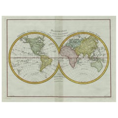
Original Engraved Antique Map of the World, Colorful and Decorative, C.1780
By Pierre François Tardieu
Located in Langweer, NL
Antique map titled 'Mappemonde en Deux Hemispheres ou l'on a Indique les Nouvelles Decouvertes' - This handsome double hemisphere map presents a ...
Category
18th Century Antique Pierre François Tardieu Maps
Materials
Paper
$450 Sale Price
20% Off
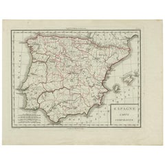
Antique Map of Spain by P.F. Tardieu, circa 1798
By Pierre François Tardieu
Located in Langweer, NL
Antique map titled 'Espagne carte comparative', showing river systems, the modern states of Spain and Portugal and the Roman provinces of Lusitania, Beatica & Hispania Tarraconensis....
Category
Late 18th Century Antique Pierre François Tardieu Maps
Materials
Paper
$167 Sale Price
20% Off
Related Items
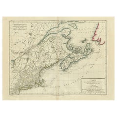
Antique Map of the Northeastern United States and Canada by Tardieu, 1802
Located in Langweer, NL
This antique map titled "Carte de la Partie Septentrionale des Etats Unis," created by Pierre Antoine Tardieu, depicts the northeastern part of the United States and parts of Canada....
Category
Early 1800s Antique Pierre François Tardieu Maps
Materials
Paper
$537 Sale Price
20% Off
H 16.34 in W 22.25 in D 0.01 in
Small Map of the United States, circa 1870
Located in Langweer, NL
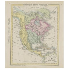
Antique map titled 'Amérique septe. Physique'. Small map of the United States. lithographed by C. Callewaert brothers in Brussels circa 1870.
Category
Mid-19th Century Belgian Antique Pierre François Tardieu Maps
Materials
Paper
Antique Map of Principality of Monaco
By Antonio Vallardi Editore
Located in Alessandria, Piemonte
ST/619 - "Old Geographical Atlas of Italy - Topographic map of ex-Principality of Monaco" -
ediz Vallardi - Milano -
A somewhat special edition ---
Category
Late 19th Century Italian Other Antique Pierre François Tardieu Maps
Materials
Paper
Original Antique Map of The London Underground. 1911
Located in St Annes, Lancashire
Superb map of The London Underground
Published by Ward Lock, 1911
Folding map. Printed on paper
Unframed.
Good condition/ Minor repair to an edge tear on right edge ( shown in ...
Category
1910s English Vintage Pierre François Tardieu Maps
Materials
Canvas, Paper
Antique Map of The United States of North America, Pacific States, 1882
Located in Langweer, NL
The map is from the same 1882 Blackie Atlas and focuses on the Pacific States of the United States of America during that period. Here are some details and historical context about t...
Category
1880s Antique Pierre François Tardieu Maps
Materials
Paper
$239 Sale Price
20% Off
H 14.97 in W 11.03 in D 0 in
Original Antique Map of Ancient Greece, Achaia, Corinth, 1786
Located in St Annes, Lancashire
Great map of Ancient Greece. Showing the region of Thessaly, including Mount Olympus
Drawn by J.D. Barbie Du Bocage
Copper plate engraving by P.F Tardieu
Original hand color...
Category
1780s French Other Antique Pierre François Tardieu Maps
Materials
Paper
Antique Map of the United States by Titus '1871'
Located in Langweer, NL
Antique map titled 'The United States of America'. Original antique map of the United States. This map originates from 'Atlas of Prebl...
Category
Late 19th Century Antique Pierre François Tardieu Maps
Materials
Paper
$767 Sale Price
20% Off
H 16.54 in W 26.78 in D 0.02 in
Antique Map of the United States by Balbi '1847'
Located in Langweer, NL
Antique map titled 'Etats-Unis'. Original antique map of the United States. This map originates from 'Abrégé de Géographie (..)' by Ad...
Category
Mid-19th Century Antique Pierre François Tardieu Maps
Materials
Paper
$191 Sale Price
20% Off
H 9.06 in W 11.23 in D 0.02 in
Original Antique Map of The World by Dower, circa 1835
Located in St Annes, Lancashire
Nice map of the World
Drawn and engraved by J.Dower
Published by Orr & Smith. C.1835
Unframed.
Free shipping
Category
1830s English Antique Pierre François Tardieu Maps
Materials
Paper
Original Antique Map of Sweden, Engraved by Barlow, 1806
Located in St Annes, Lancashire
Great map of Sweden
Copper-plate engraving by Barlow
Published by Brightly & Kinnersly, Bungay, Suffolk. 1806
Unframed.
Category
Early 1800s English Antique Pierre François Tardieu Maps
Materials
Paper
Set of 2 Antique Maps of the United States by W. G. Blackie, 1859
Located in Langweer, NL
Antique map titled 'The United States of North America, Atlantic States and Valley of the Mississippi'. Original antique map of the United States of North America, Atlantic States an...
Category
Mid-19th Century Antique Pierre François Tardieu Maps
Materials
Paper
$707 / set
H 14.57 in W 21.26 in D 0.02 in
Antique Map of The United States Southern Section by A & C. Black, 1870
Located in Langweer, NL
Antique map titled 'United States Southern Section'. Original antique map of Map of The United States Southern Section. This map originates from ‘Black's General Atlas of The World’....
Category
Late 19th Century Antique Pierre François Tardieu Maps
Materials
Paper
$239 Sale Price
20% Off
H 17.52 in W 23.63 in D 0.02 in
Pierre François Tardieu maps for sale on 1stDibs.
Pierre François Tardieu maps are available for sale on 1stDibs. These distinctive items are frequently made of paper and are designed with extraordinary care. There are many options to choose from in our collection of Pierre François Tardieu maps, although black editions of this piece are particularly popular. If you’re looking for additional options, many customers also consider maps by Nicolas Sanson, and J. Migeon. Prices for Pierre François Tardieu maps can differ depending upon size, time period and other attributes — on 1stDibs, these items begin at $123 and can go as high as $5,750, while a piece like these, on average, fetch $521.
