Theodore R. Davis Landscape Prints
to
1
1
1
Overall Width
to
Overall Height
to
2
184
169
147
131
2
2
1
1
1
1
1
1
1
1
1
2
Artist: Theodore R. Davis
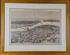
1870 View of Proposed Brooklyn Bridge and New York City
By Theodore R. Davis
Located in Alamo, CA
This framed engraving entitled "Birds-eye View of the Southern End of New York and Brooklyn, Showing the Projected Suspension-Bridge Over the East River, From the Western Terminus in Printing-House Square, New York" by Theodore R. Davis (1840–1894) was published as a supplement of Harper's Weekly, November 19, 1870.
The print is presented in a maple frame and a double mat. The frame measures 23.5" high, 29" wide and 0.75" deep. There is a vertical center fold and additional vertical lines, where wood engraving blocks were joined for the printing process. It is in excellent condition.
This framed image depicting New York in 1870 was a centerfold for the November 19, 1870 issue of Harper's Weekly. It includes the site and eventual appearance of the East River New York-Brooklyn Bridge; the name later shortened to the Brooklyn Bridge. The print was issued eleven months after the start of construction of the bridge on January 2, 1870, which would take another 12.5 years to complete. When this view was drawn, work on the bridge was all below ground, constructing the supports for the bridge’s towers. Labels in the upper portion of the print identify locations in the background including "Light Ship...
Category
Late 19th Century Naturalistic Theodore R. Davis Landscape Prints
Materials
Woodcut
$460 Sale Price
20% Off
Late 19th century color cityscape Milwaukee trees figures lake churches
By Theodore R. Davis
Located in Milwaukee, WI
"View of the City of Milwaukee" from "Harper's Weekly" is an original hand-colored wood engraving by Theodore R. Davis. It depicts an aerial view of the Wisconsin lakeside city in 1882.
9" x 13 3/8" art
17 5/8" x 21 3/4" frame
Theodore R. Davis (1840–1894) was a 19th-century American artist, who made numerous drawings of significant military and political events during the American Civil War and its aftermath. As a child, Theodore R. Davis was taken to Washington D.C. where he graduated from Rittenhouse Academy. When he was fifteen, he moved to New York where studied art under Henry W. Herrick and James Walker.
The Training Theodore Davis received under James Walker was informal. Davis typified certain artists as "special artists" was hired by popular magazines and newspapers. He was hired by them to illustrate the Civil War. He was hired by Harpers Weekly in 1861.[
During the Civil War, he served as a captain in the 15th Connecticut Volunteer Infantry. After the war, he became a companion of the New York Commandery of the Military Order of the Loyal Legion of the United States.
Some of these drawings include the Battle of Champion Hill, and the most significant sketch of General Joseph E. Johnston and General William T. Sherman meeting at the Bennett Farm near Durham Station to discuss the surrender terms of the remaining Confederate armies in the Southeast.
After the war when the Cyclorama in Atlanta was being painted, Davis was asked for his ideas having traveled with Sherman's army. He was later added to the painting.
Theodore Davis was a staff artist at Harper's Weekly.
Many of his drawings were published as wood engravings in Harper's Weekly.
Theodore R. Davis was chosen to create the Haye's China with a chance meeting. Mr. Davis suggested using flora and fauna of the American decor...
Category
1880s Other Art Style Theodore R. Davis Landscape Prints
Materials
Engraving
Related Items
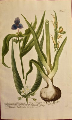
Spider Lily: An Original 18th C. Hand-colored Botanical Engraving by J. Weinmann
By Johann Wilhelm Weinmann
Located in Alamo, CA
This colored botanical mezzotint and line engraving finished with hand coloring by Johann Wilhelm Weinmann (1683-1741) is entitled "A. Ephemerum Virginianu flore Purpureo, B. Ephemer...
Category
Mid-18th Century Naturalistic Theodore R. Davis Landscape Prints
Materials
Engraving, Mezzotint
$620 Sale Price
20% Off
H 15.75 in W 9.5 in
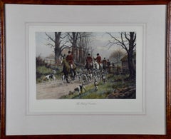
Engraving of a British Fox Hunting Scene "The Pink Of Condition"
By George Wright
Located in Alamo, CA
The engraving "The Pink Of Condition" by George Wright was published in London in 1909. It depicts the beginning of a British fox hunting scene. The ...
Category
Early 1900s Naturalistic Theodore R. Davis Landscape Prints
Materials
Engraving
$860 Sale Price
20% Off
H 23.63 in W 28.75 in D 0.88 in
"A Dance in Otaheite" (Tahiti), Engraving from Captain Cook's 3rd Voyage
By John Webber
Located in Alamo, CA
"A Dance in Otaheite" (Tahiti) is an engraving created by William Sharp (1749-1824), from a drawing by John Webber (1752-1793), who was the artist on Captain James Cook's 3rd and final voyage of discovery. It is a plate in the atlas of "A Voyage to the Pacific Ocean Undertaken by the Command of His Majesty, for Making Discoveries in the Northern Hemisphere", the official British Admirality sanctioned journal published upon completion of the voyage in London in 1784 by Strahan & Cadell.
Two women and two men wearing ceremonial costumes, performing a dance outdoors standing on a mat. Three men are playing the drums in the background, in front of a thatched roof building. An audience of men are sitting on both sides of the stage. By the time Webber arrived in Tahiti, 'south sea' imagery had become familiar. Webber gave concentrated attention to dance. He had the opportunity to distinguish the Tahitian dance from the more formalized dancing of Tonga. Whereas they seem to have called to mind the more formal dances of antiquity, the Tahitian dancing aroused memories of peasant and folk dancing.
This engraving is professionally framed in Koa wood. Koa wood is legendary in Hawaii. Not only is this amazing wood native to Hawaii, but it is known for the deep rich colors and varied grain pattern. Koa has an honored heritage in Hawaii and is highly revered and sacred. The word “koa” means “warrior” in Hawaiian. The warriors of King Kamehameha the Great, created canoes and weapons from a wood plentiful on the Big Island of Hawaii. This wood became synonymous with the warriors themselves, and it became known as koa.
The print is in excellent condition.
There are three other engravings listed from the official journal of Captain Cook's 3rd voyage available that are presented in identical Koa wood frames and double mats (LU117324682432, LU117324684052, LU117324684062). They would make a wonderful grouping for a display of 2, 3 or 4 prints. A discount is available for a grouping depending on the number of items included.
Hawaii was discovered by Captain Cook during this voyage. Hawaii was originally called The Sandwich Islands in honor of The Earl of Sandwich...
Category
1780s Realist Theodore R. Davis Landscape Prints
Materials
Engraving
$1,900 Sale Price
20% Off
H 21.75 in W 23.75 in D 0.88 in
Four Koa Wood Framed 18th C. Engravings from Captain Cook's 3rd Voyage Journal
By John Webber
Located in Alamo, CA
A grouping of four framed engravings of Hawaii, Tahiti, Tonga and Vancouver Island from the atlas of the official British Admiralty sanctioned journal of Captain Cook's 3rd Voyage entitled "A Voyage to the Pacific Ocean Undertaken by the Command of His Majesty, for Making Discoveries in the Northern Hemisphere", published upon completion of the voyage in London in 1784 by Strahan & Cadell. These engravings were made from drawings by John Webber (1752-1793), who was the artist on Captain James Cook's 3rd and final voyage of discovery. The set of engravings includes: "A Canoe of the Sandwich Islands, the Rowers Masked", Plate 65 in the atlas; "A Dance in Otaheite" (Tahiti), Plate 28; "King of the Friendly Islands" (Tonga), plate 20; "Inside of a House in Nootka Sound" (Canada), plate 42.
These engravings are professionally framed in Koa wood, the same wood as was used to make the canoes of the ancient Hawaiians. Koa wood is legendary in Hawaii. Not only is this amazing wood native to Hawaii, but it is known for the deep rich colors and varied grain pattern. Koa has an honored heritage in Hawaii and is highly revered and sacred. The word “koa” means “warrior” in Hawaiian. The warriors of King Kamehameha the Great, created canoes and weapons from a wood plentiful on the Big Island of Hawaii. This wood became synonymous with the warriors themselves, and it became known as koa.
These four engravings would make a wonderful grouping for a display of 2, 3 or 4 prints. They may be purchased separately or in groups on 1stDibs. Their listing Reference #'s are: LU117324682432, LU117324682022, LU117324684052 and LU117324684062. A discount is available for a grouping depending on the number of items included.
Hawaii was discovered by Captain Cook (1728-1779) during this voyage. Hawaii was originally called The Sandwich Islands in honor of The Earl of Sandwich...
Category
1780s Other Art Style Theodore R. Davis Landscape Prints
Materials
Engraving
$7,660 Sale Price
20% Off
H 20.75 in W 26.75 in D 0.88 in
Venice Beach Seascape, Long Wave, Nautical Scene in Blue Tones, Limited Edition
By Kind of Cyan
Located in Barcelona, ES
This is an exclusive handprinted limited edition cyanotype.
This beautiful cyanotype is titled "Long Wave in Venice Beach" and it shows an outstanding wave in one of the most iconic ...
Category
2010s Realist Theodore R. Davis Landscape Prints
Materials
Paper, Emulsion, Watercolor, Engraving, Etching, Monotype
Equestrian Scene
Located in Belgrade, MT
This lithograph is a piece from my private collection of 20th Century School of Paris era artists. It is hand signed by the artist and numbered, Guilde de la Gravure, and is in very ...
Category
Early 20th Century Contemporary Theodore R. Davis Landscape Prints
Materials
Oil, Engraving, Lithograph
Nature Morte Harvest scene
By Maurice Savin
Located in Belgrade, MT
This lithograph is part of my private collection. It is original and pencil signed an numbered by the artist.
It is one of a kind in black and white.
Category
Mid-20th Century Abstract Expressionist Theodore R. Davis Landscape Prints
Materials
Engraving, Lithograph
Her Majesty's Stag Hounds on Ascot, A Colored 19th Century British Hunting Scene
Located in Alamo, CA
"The Meeting of Her Majesty's Stag Hounds on Ascot Heath" is a large colorful mezzotint engraving of an extensive British hunting scene. It was created by Sir Francis Grant...
Category
1830s Theodore R. Davis Landscape Prints
Materials
Engraving, Mezzotint
Francis Grant Her Majesty's Stag Hounds on Ascot, A Colored 19th Century British Hunting Scene, 1839
$1,340 Sale Price
20% Off
H 29 in W 38.88 in D 1.25 in
"Dawn Inside the Yoshiwara" Utagawa Hiroshige, Japanese Landscape, Ukiyo-e
By Utagawa Hiroshige
Located in New York, NY
Utagawa Hiroshige
Dawn Inside the Yoshiwara, circa 1857
Woodblock print
11 x 7 inches
Utagawa Hiroshige is recognized as a master of the ukiyo-e woodblock printing tradition, havin...
Category
1850s Naturalistic Theodore R. Davis Landscape Prints
Materials
Paper, Ink, Woodcut
Nature Morte country side farming scene
By Maurice Savin
Located in Belgrade, MT
This lithograph is part of my private collection. It is original and pencil signed and numbered by the artist.
Category
20th Century Abstract Expressionist Theodore R. Davis Landscape Prints
Materials
Engraving, Lithograph
$320 Sale Price
30% Off
H 10.5 in W 7.5 in
Ancient Roman Architecture: Original Framed 18th C. Etching by G. Piranesi
By Giovanni Battista Piranesi
Located in Alamo, CA
"Veduta del Sepolcro della Famiglia Plauzia per la Strada Che Conduce da Roma a Tivoli vicino a Ponte Lugano" from "Le Antichità Romane" (Roman Antiquities), one of the most famous works by Piranesi. "Antichita" illustrates the tombs along the Appian Way...
Category
Early 18th Century Old Masters Theodore R. Davis Landscape Prints
Materials
Etching, Engraving, Drypoint
$3,100 Sale Price
20% Off
H 24.38 in W 31.75 in D 0.75 in
Flowering Dragonmouth: 18th Century Hand-colored Weinmann Botanical Engraving
By Johann Wilhelm Weinmann
Located in Alamo, CA
An 18th century hand colored botanical engraving by Johann Wilhelm Weinmann (1683-1741) depicting the following flowering sage plants:...
Category
Mid-18th Century Naturalistic Theodore R. Davis Landscape Prints
Materials
Engraving, Mezzotint
$420 Sale Price
20% Off
H 17 in W 10.25 in
Theodore R. Davis landscape prints for sale on 1stDibs.
Find a wide variety of authentic Theodore R. Davis landscape prints available for sale on 1stDibs. You can also browse by medium to find art by Theodore R. Davis in engraving, woodcut print and more. Not every interior allows for large Theodore R. Davis landscape prints, so small editions measuring 22 inches across are available. Customers who are interested in this artist might also find the work of William Curtis, John James Audubon, and Cynthia MacCollum. Theodore R. Davis landscape prints prices can differ depending upon medium, time period and other attributes. On 1stDibs, the price for these items starts at $460 and tops out at $950, while the average work can sell for $705.
Artists Similar to Theodore R. Davis
John Gould and Henry Constantine Richter


