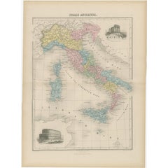
Antique Map of Ancient Italy with Inset of the Colosseum in Rome, 1880
View Similar Items


Want more images or videos?
Request additional images or videos from the seller
1 of 7
Antique Map of Ancient Italy with Inset of the Colosseum in Rome, 1880
About the Item
- Dimensions:Height: 18.71 in (47.5 cm)Width: 13.59 in (34.5 cm)Depth: 0 in (0.01 mm)
- Materials and Techniques:
- Period:
- Date of Manufacture:1880
- Condition:
- Seller Location:Langweer, NL
- Reference Number:Seller: BG-11793-61stDibs: LU3054325992652
About the Seller
5.0
Platinum Seller
These expertly vetted sellers are 1stDibs' most experienced sellers and are rated highest by our customers.
Established in 2009
1stDibs seller since 2017
1,947 sales on 1stDibs
More From This SellerView All
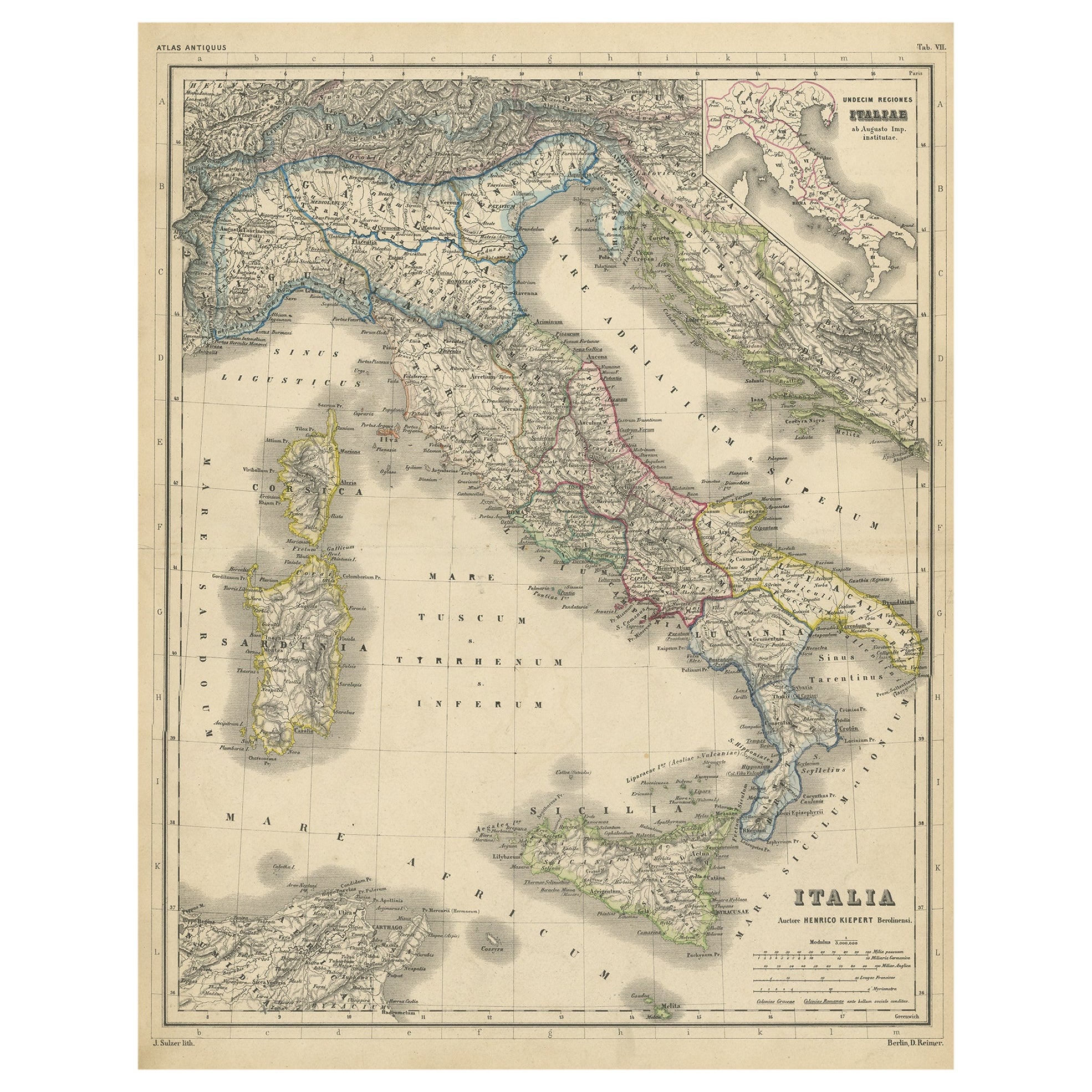
- Attractive Antique Map of Italy with Inset of Maps Showing The Regions, c.1870Located in Langweer, NLAntique map titled 'Italia'. Old map of Italy, with a small inset map depicting the various regions. This map originates from 'Atlas Antiquus, tw...Category
Antique 19th Century Maps
MaterialsPaper
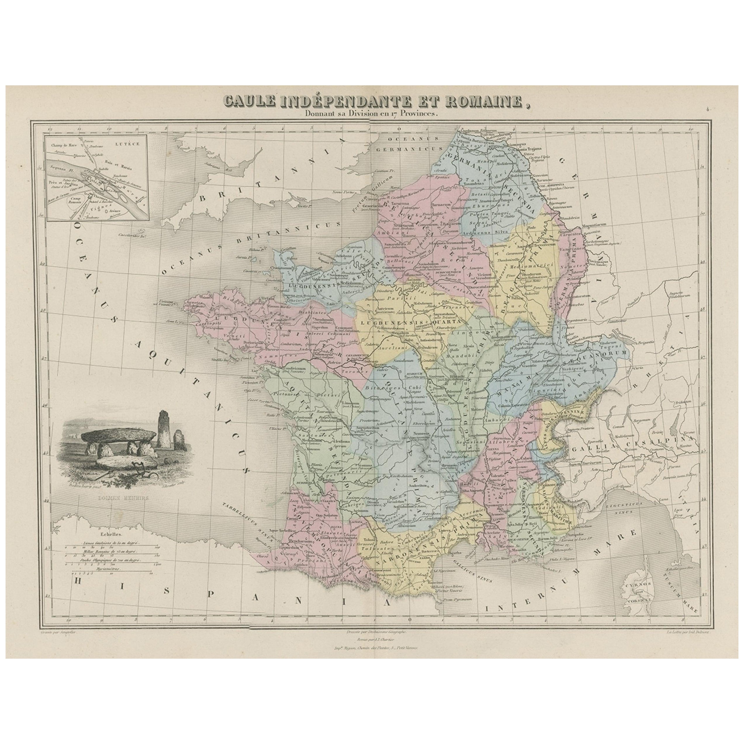
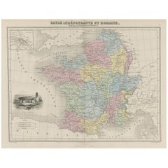
- Antique Map of France in Ancient Roman Times, 1880Located in Langweer, NLAntique map titled 'Gaule indépendante et Romaine'. Old map of Gaul or France in ancient Roman times. The map covers from the southern part of England (Britannia) to the north of S...Category
Antique 19th Century Maps
MaterialsPaper
- Antique Map of the Eastern United States with Inset Map of TexasLocated in Langweer, NLAntique map titled 'Verein-Staaten von Nord-America mit Ausnahme Florida's und der Westlichen Territorien'. This map extends as far west as Louisiana and only includes the northern p...Category
Antique Mid-19th Century Maps
MaterialsPaper
 $474 Sale Price20% Off
 - Antique Map of North Carolina, with inset map of the western partLocated in Langweer, NLAntique map titled 'North Carolina'. Original antique map of North Carolina, United States. With inset map of the western part of North Carolina....Category
Antique Late 19th Century Maps
MaterialsPaper
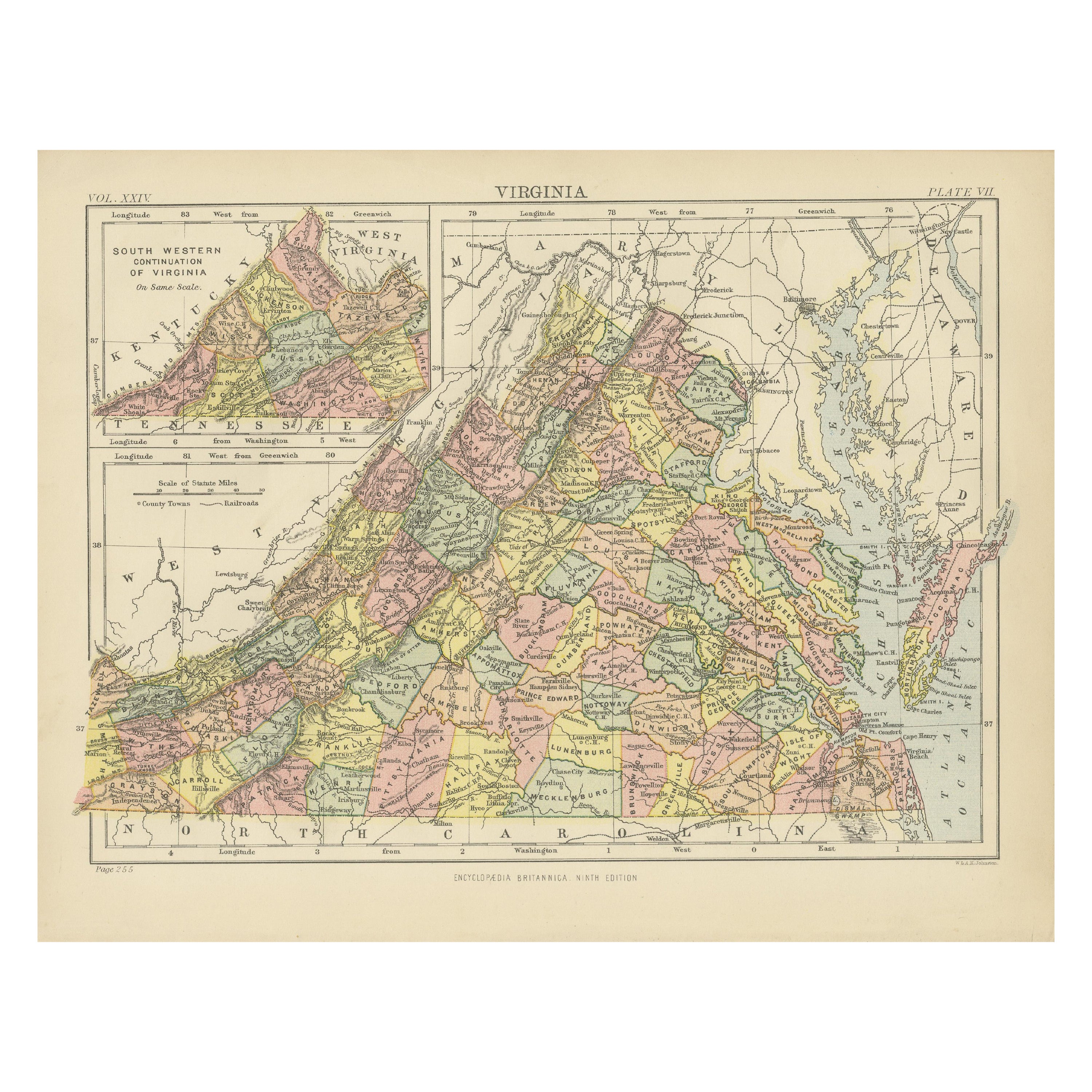
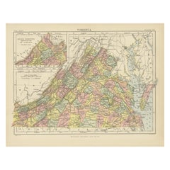
- Antique Map of Virginia, with Inset Map of the South Western ContinuationLocated in Langweer, NLAntique map titled 'Virginia'. Original antique map of Virginia, United States. With inset map of the south western continuation of Virginia. T...Category
Antique Late 19th Century Maps
MaterialsPaper
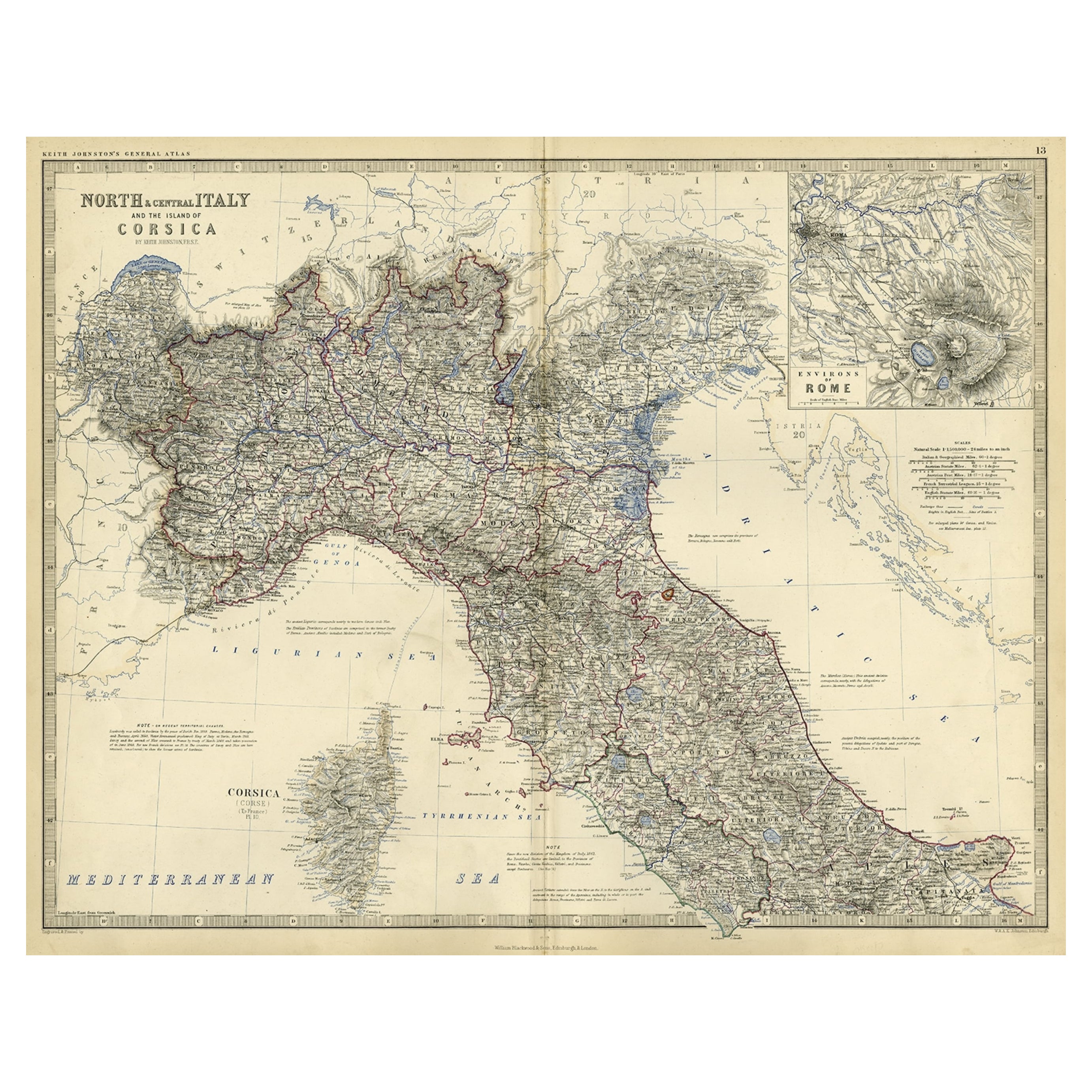
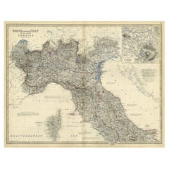
- Old Coloure Map of North & Central Italy & Corsica with an Inset of Rome, c.1860Located in Langweer, NLAntique map titled 'North & Central Italy and the Island of Corsica'. Old map of North and Central Italy, and the island of Corsica. With an inset map of the region of Rome. Orig...Category
Antique 1860s Maps
MaterialsPaper


You May Also Like
- Original Antique Map of Ancient Greece- Boeotia, Thebes, 1787Located in St Annes, LancashireGreat map of Ancient Greece. Showing the region of Boeotia, including Thebes Drawn by J.D. Barbie Du Bocage Copper plate engraving by P.F T...Category
Antique 1780s French Other Maps
MaterialsPaper
- Original Antique Map of Ancient Greece, Achaia, Corinth, 1786Located in St Annes, LancashireGreat map of Ancient Greece. Showing the region of Thessaly, including Mount Olympus Drawn by J.D. Barbie Du Bocage Copper plate engraving by P.F Tardieu Original hand color...Category
Antique 1780s French Other Maps
MaterialsPaper
- Original Antique Map of Ancient Greece, Phocis, Gulf of Corinth, 1787Located in St Annes, LancashireGreat map of Ancient Greece. Showing the region of Phocis, including the Gulf of Corinth Drawn by J.D. Barbie Du Bocage Copper plate engraving by P.F Tardieu Original hand c...Category
Antique 1780s French Other Maps
MaterialsPaper
- Original Antique Map of Italy. C.1780Located in St Annes, LancashireGreat map of Italy Copper-plate engraving Published C.1780 Unframed.Category
Antique Early 1800s English Georgian Maps
MaterialsPaper

- Original Antique Map of Italy. Arrowsmith. 1820Located in St Annes, LancashireGreat map of Italy Drawn under the direction of Arrowsmith Copper-plate engraving Published by Longman, Hurst, Rees, Orme and Brown, 1820 Unframed.Category
Antique 1820s English Maps
MaterialsPaper

- Antique Map of Italy by Andriveau-Goujon, 1843By Andriveau-GoujonLocated in New York, NYAntique Map of Italy by Andriveau-Goujon, 1843. Map of Italy in two parts by Andriveau-Goujon for the Library of Prince Carini at Palazzo Carini i...Category
Antique 1840s French Maps
MaterialsLinen, Paper
 $3,350 / set


Recently Viewed
View AllMore Ways To Browse
Ancient Italy
Ancient Italian
Antique Furniture Rome
Ancient Maps
Ancient Map
Antique Italian Maps
Antique Italy Maps
Antique Maps Italy
Antique Map Italy
Antique Italian Map
Antique Italy Map
Italy Antique Map
Italy Map Antique
Antique Maps Of Italy
Antique Map Of Italy
Map Of Italy Antique
Book Of Antique Maps
Temple Rome Antique