
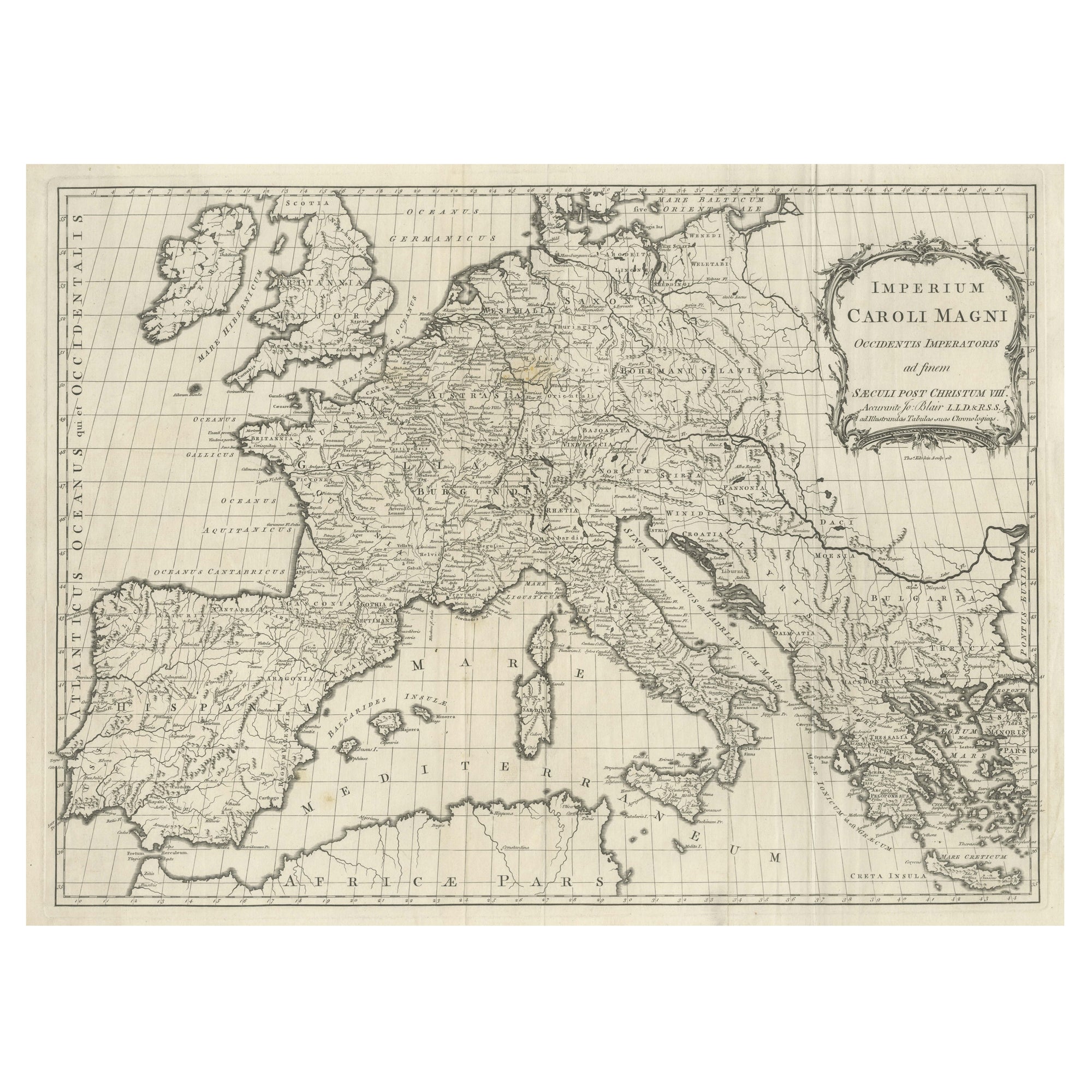
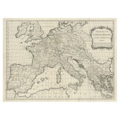
Antique Map of the Charlemagne Empire 'c.1860'
View Similar Items


Want more images or videos?
Request additional images or videos from the seller
1 of 5
Antique Map of the Charlemagne Empire 'c.1860'
About the Item
- Dimensions:Height: 24.02 in (61 cm)Width: 33.08 in (84 cm)Depth: 0.02 in (0.5 mm)
- Materials and Techniques:
- Period:
- Date of Manufacture:circa 1860
- Condition:General age-related toning. Original folding line. Blank verso. Please study image carefully.
- Seller Location:Langweer, NL
- Reference Number:Seller: BG-12996-41stDibs: LU3054324424892
About the Seller
5.0
Platinum Seller
These expertly vetted sellers are 1stDibs' most experienced sellers and are rated highest by our customers.
Established in 2009
1stDibs seller since 2017
1,933 sales on 1stDibs
More From This SellerView All
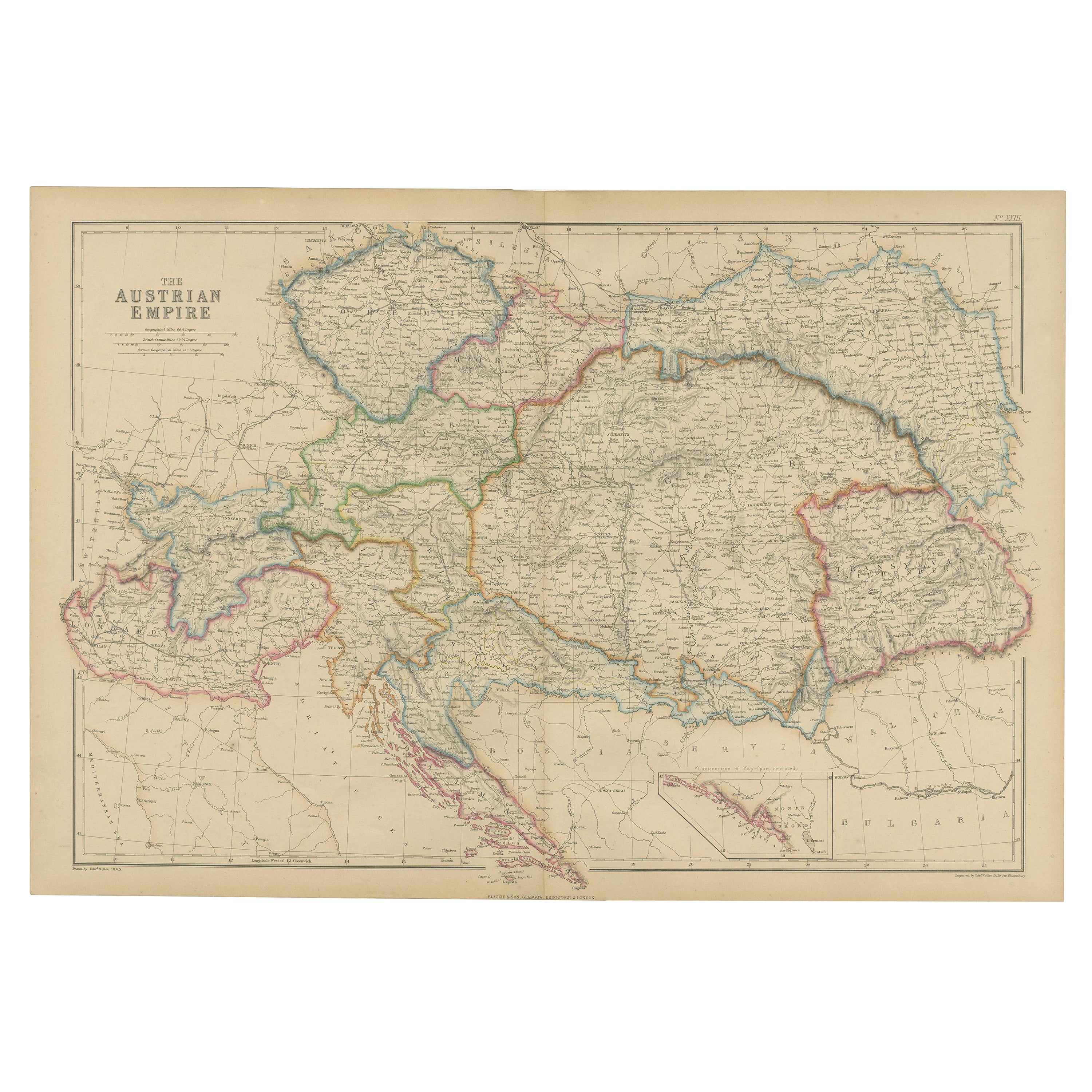
- Large Antique Map of Europe, Showing the Empire of CharlemagneLocated in Langweer, NLAntique map titled 'Imperium Caroli Magni (..)'. Large antique map of Europe, showing the Empire of Charlemagne in the 8th Century. Engraved by T. Kitchin. Published J. Blair, circa ...Category
Antique Late 18th Century Maps
MaterialsPaper
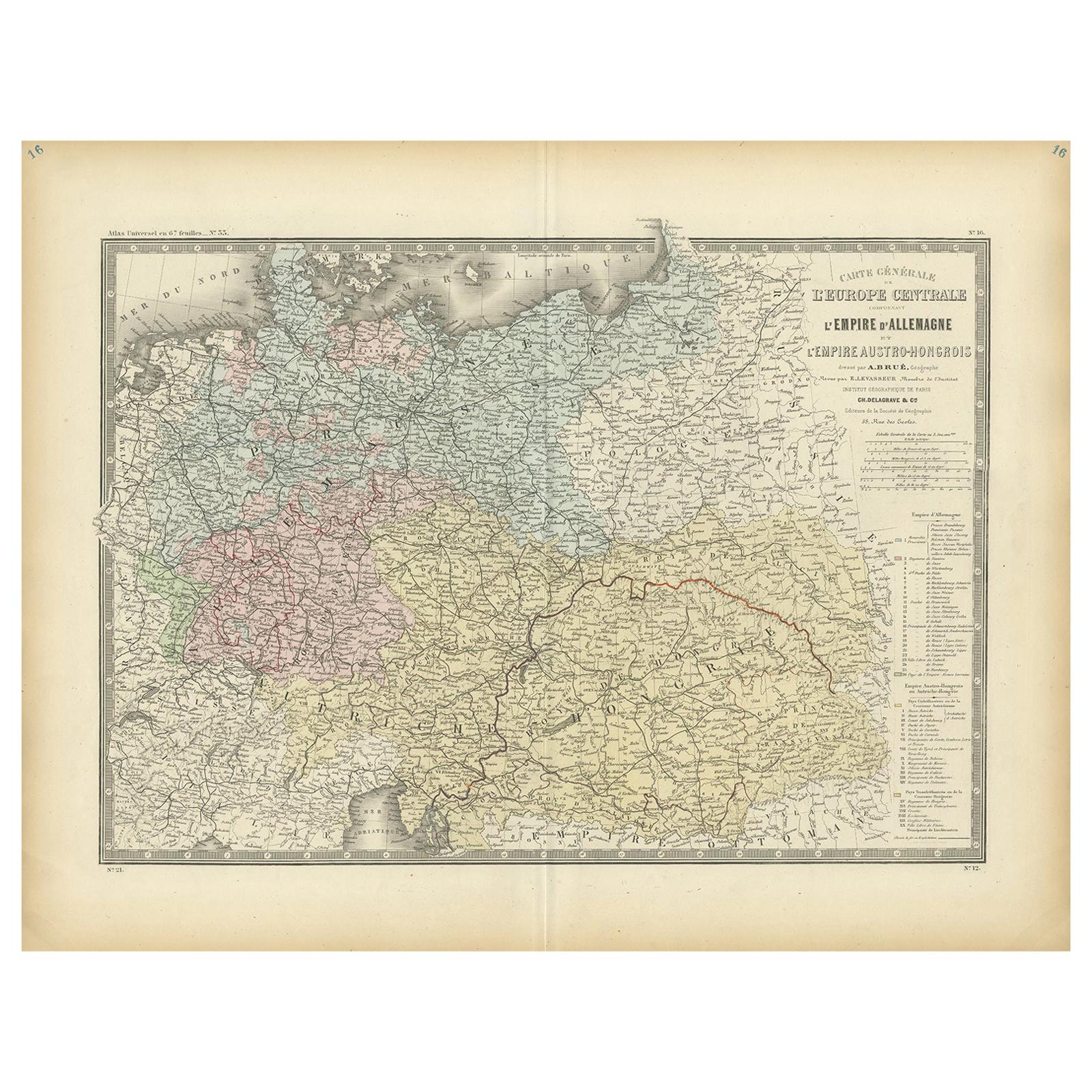
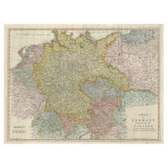
- Large Antique Map of the German EmpireLocated in Langweer, NLAntique map titled 'A Map of Germany (..)'. Large antique map of the German Empire, highly detailed. Engraved by T. Kitchin. Published J. Blair, cir...Category
Antique Late 18th Century Maps
MaterialsPaper
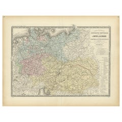
- Antique Map of the German Empire by Levasseur, '1875'Located in Langweer, NLAntique map titled 'Carte générale de l'Europe Centrale (..)'. Large map of the German Empire. This map originates from 'Atlas de Géographie Moderne Phys...Category
Antique Late 19th Century Maps
MaterialsPaper
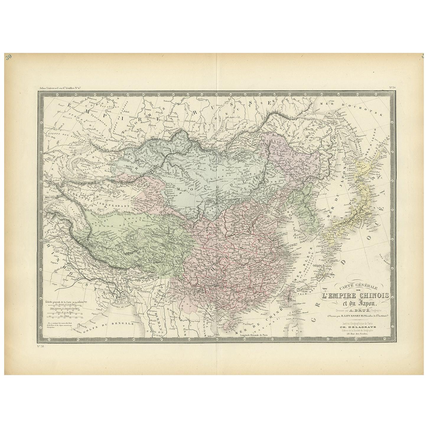
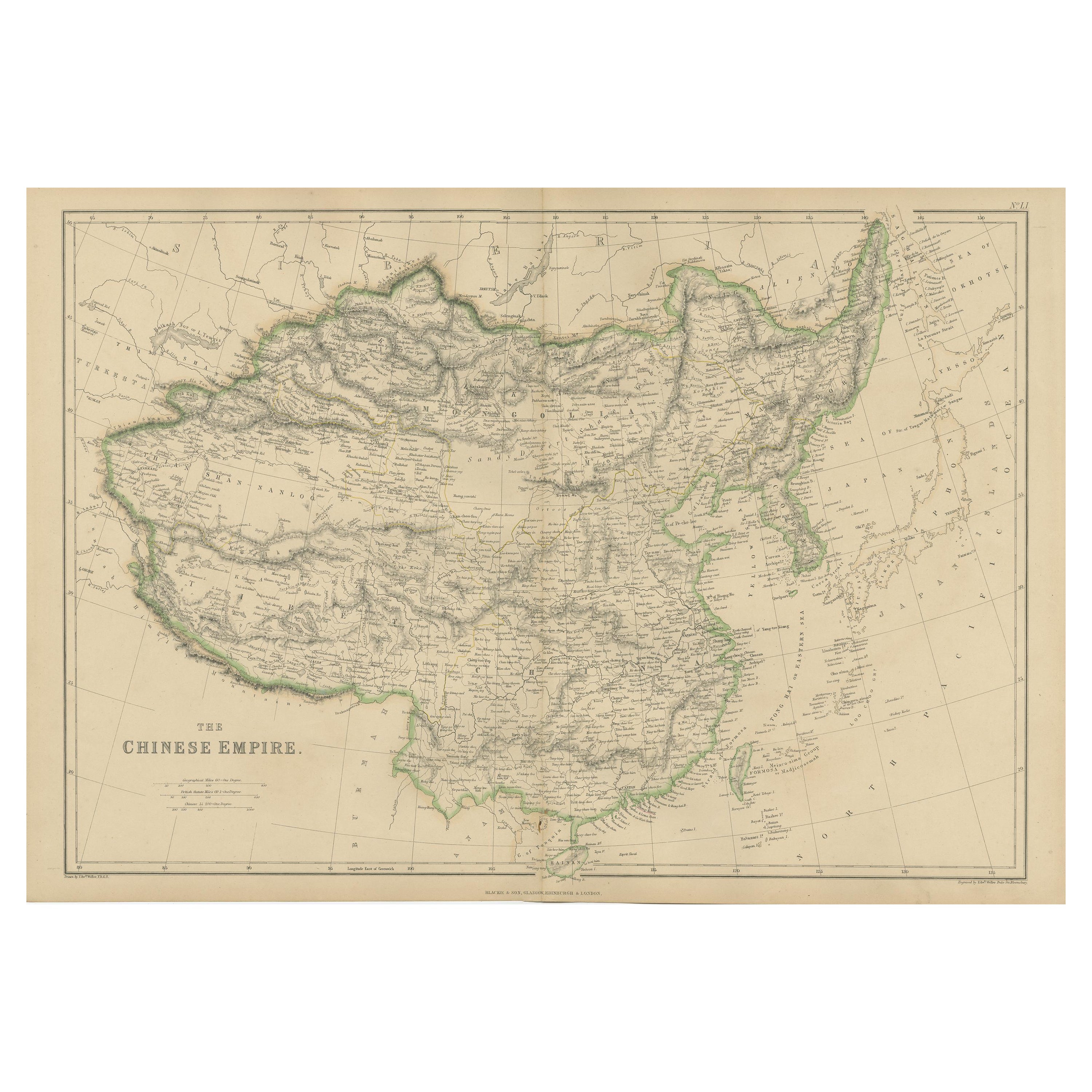
- Antique Map of the Chinese Empire and Japan, '1875'Located in Langweer, NLAntique map titled 'Carte générale de l'Empire Chinois et du Japon'. Large map of the Chinese Empire and Japan. This map originates from 'Atlas de Géographie Moderne Physique et Poli...Category
Antique Late 19th Century Maps
MaterialsPaper
 $351 Sale Price20% Off
 - Antique Map of the Turkish Empire by Tirion 'c.1760'Located in Langweer, NLAntique map titled 'Nieuwe Kaart van het Turksche Ryk gelegen in Europa, Asia en Africa'. Original antique map of the Turkish Empire. The map is centered on the Mediterranean Sea but...Category
Antique Mid-18th Century Maps
MaterialsPaper
 $1,229 Sale Price20% Off
 - Antique Map of the Burmese Empire by Wyld, '1845'Located in Langweer, NLAntique map titled 'Map of Burman Empire, Siam, Cochin China and Ton-King'. Original antique map of the Burmese Empire. This map originates from 'An Atlas of the World, Comprehending...Category
Antique Mid-19th Century Maps
MaterialsPaper
 $219 Sale Price20% Off
You May Also Like
- Map of the Republic of GenoaLocated in New York, NYFramed antique hand-coloured map of the Republic of Genoa including the duchies of Mantua, Modena, and Parma. Europe, late 18th century. Dimension: 25...Category
Antique Late 18th Century European Maps
- Antique Map of Principality of MonacoBy Antonio Vallardi EditoreLocated in Alessandria, PiemonteST/619 - "Old Geographical Atlas of Italy - Topographic map of ex-Principality of Monaco" - ediz Vallardi - Milano - A somewhat special edition ---Category
Antique Late 19th Century Italian Other Prints
MaterialsPaper
 $228 Sale Price74% Off
 - Original Antique Map of The World by Thomas Clerk, 1817Located in St Annes, LancashireGreat map of The Eastern and Western Hemispheres On 2 sheets Copper-plate engraving Drawn and engraved by Thomas Clerk, Edinburgh. Published by Mackenzie And Dent, 1817 ...Category
Antique 1810s English Maps
MaterialsPaper
- Antique 18th Century Map of the Province of Pensilvania 'Pennsylvania State'Located in Philadelphia, PAA fine antique of the colony of Pennsylvania. Noted at the top of the sheet as a 'Map of the province of Pensilvania'. This undated and anonymous map is thought to be from the Gentleman's Magazine, London, circa 1775, although the general appearance could date it to the 1760's. The southern boundary reflects the Mason-Dixon survey (1768), the western boundary is placed just west of Pittsburgh, and the northern boundary is not marked. The map has a number of reference points that likely refer to companion text and appear to be connected to boundaries. The western and southern boundaries are marked Q, R, S, for example. A diagonal line runs from the Susquehanna R to the Lake Erie P. A broken line marked by many letters A, B, N, O, etc., appears in the east. There are no latitude or longitude markings, blank verso. Framed in a shaped contemporary gilt wooden frame and matted under a cream colored matte. Bearing an old Graham Arader Gallery...Category
Antique 18th Century British American Colonial Maps
MaterialsPaper
- Map "Estuary- Mouth of the Thames"Located in Alessandria, PiemonteST/426 - Antique French Map of the estuary of the Thames, map dated 1769 - "Mape of the entrance of the Thames. Designed by filing of Navy cards fo...Category
Antique Mid-18th Century French Other Prints
MaterialsPaper
 $966 Sale Price20% Off
 - Original Antique Map of The Netherlands, Sherwood, Neely & Jones, Dated 1809Located in St Annes, LancashireGreat map of The Netherlands Copper-plate engraving by Cooper Published by Sherwood, Neely & Jones. Dated 1809 Unframed.Category
Antique Early 1800s English Maps
MaterialsPaper


Recently Viewed
View AllMore Ways To Browse
Asian Centric World Map
Jackson Hole Map
Map Of German
Vintage Map World
Vintage Maps World
Antique Map Copenhagen
Scan Globe
Antique Maps Singapore
Johannes Janssonius On Sale
Antique Maps Of Ukraine
Ukraine Antique Map
Antique Map Nova Scotia
Ecuador Antique Map
Antique Chinese Rob
Map Of Puerto Rico
Map Oxford England
Papua New Guinea Antique Map
Antique Arizona Map