1940s Maps
3
to
2
1
3
3
3
2,891
2,124
411
5
227
31
11
84
7
56
7
3
3
4
5
2
3
1
1
1
2
2
1
1
1
Period: 1940s
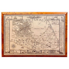
Vintage Map of Nantucket Town by Ruth Haviland Sutton, 1946
Located in Nantucket, MA
Vintage Map of Nantucket Town by Ruth Haviland Sutton, 1946, a classic vintage tourist map of Nantucket Island showing historic landmarks and geogr...
Category
American Other Vintage 1940s Maps
Materials
Paper
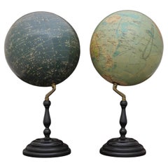
Pair of Philip & Son Globes, circa 1946
Located in London, GB
A wonderful set of Terrestrial and Celestial 12 inch globes by George Philip and Son. Presented on brass inclined plain mounts attached to original turned ebonized wooden bases and uprights with axes secured at the top by brass acorn finials. Unusually, the terrestrial globe has a copyright date shown under the cartouche, 1946.
The celestial globe is printed in beige against a dark blue background and shows the constellations and many named stars. Solid lines connect the stars within constellations rather than illustrating them as mythological and other figures.? A cartouche is present that includes the title and maker's address.
When looking at the stars from Earth the viewpoint is effectively inside a celestial sphere. The surface of a celestial globe shows the star field as a projection viewed from the outside and is therefore reversed, with the constellations appearing as their mirror images.
The terrestrial globe is printed in several colours and comprises of twelve coated lithographic paper gores with polar calottes over a twelve inch card sphere. The age of the globe has been confirmed by the political borders and named cities displayed. The globe is nicely detailed and has a grid network of parallels and meridians. It shows all the continents and countries as they were at the time it was printed and also indicates all the principal steamship routes with distances in nautical miles. The globe also has a printed Analemma - a diagram showing the declination of the Sun for every day in the year and the equation of time. The Analemma therefore shows the position of the Sun in the sky as seen from a fixed location on Earth at the same mean solar time, as the sun's position varies over the course of a year. A cartouche is present that includes the title and maker's address.
Dimensions of each globe: 30.5 cm/12 inches (diameter) x 59 cm/23 1/4 inches (max height).
George Philip, (1800–1882) was a cartographer and map publisher. He founded George Philip & Sons in 1834 in Liverpool primarily as a bookseller and stationer, but rapidly expanding to become a publisher of primarily maps, atlases and educational works. He had one son, also George (1823–1902), who was admitted to the business in 1848.
George senior was born in Huntly, Aberdeenshire and by 1819 he had become assistant to the Liverpool bookseller, William Grapel before going on to start his own business. He used cartographers (such as John Bartholomew the elder, August Petermann, and William Hughes) to produce maps on copper plates. Philip then had these printed and hand-coloured by his women tinters. The business expanded rapidly and by the time he produced his county maps of 1862 he was using machine...
Category
British Vintage 1940s Maps
Materials
Brass
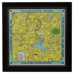
1948 "A Hysterical Map of Yellowstone National Park" by Jolly Lindgren, 2nd Ed.
Located in Colorado Springs, CO
Presented is a second edition printing of Jolly Lindgren’s “Hysterical Map of Yellowstone National Park.” This comical pictorial map highlights the famous Yellowstone National Park. ...
Category
American Vintage 1940s Maps
Materials
Paper
Related Items
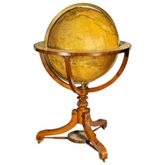
Large and Extremely Rare Terrestrial Globe by Newton
By Newton Globes - Planer & Newton
Located in Lymington, Hampshire
A large and extremely rare 24-inch terrestrial globe by Newton
Our most magnificent and rare globes were a pair of 24-inch Newton globes.
These too were updated in 1852 (terre...
Category
English Antique 1940s Maps
Materials
Mahogany
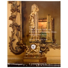
Collection of Evelyn Annenberg Hall, 640 Park Ave Christie's, NY, 2006, 1st Ed
Located in valatie, NY
Collection of Evelyn Annenberg Hall from 640 Park Ave: Christie's, New York, 17 May, 2006. Louis XIV, XV and XVI Furniture, Chinese Porcelains, 18th & 19th c bronzes, antique rugs an...
Category
American 1940s Maps
Materials
Paper
H 10.5 in W 8.25 in D 0.5 in
18-inch Globe, Cary's, London, 1840
By Cary’s
Located in Milano, IT
John and William Cary
Updated by George and John Cary
Terrestrial Globe
London, 1840
lb 22 (kg 10)
Slight surface abrasions due to use. A small crack on the horizon circle.
The globe rests in its original Dutch style stand with four supporting turned wood columns.
It measures 26 in in height x 23.6 in in diameter with the diameter of the sphere measuring 18 in; 66 cm in height x 60 cm in diameter with the diameter of the sphere measuring 45.72 cm.
The 18 inch...
Category
English Early Victorian Antique 1940s Maps
Materials
Wood, Paper
Antique World Globe From Fleet Street London 1923 on Wooden Stand
Located in High Wycombe, GB
Antique Terrestrial Geographia of Fleet Street London 12"inch World Globe on handcrafted Wooden Three Legged Base 1923
Made 55 Fleet Street, London
Beautiful desktop globe, sho...
Category
British Art Deco Vintage 1940s Maps
Materials
Wood, Paper
World Globe With Wooden Foot, and Brass 20th Century
Located in Mombuey, Zamora
Beautiful and elegant ball of the world to decorate any studio, living room or bedroom, it is small, with the base about 26 cm high and 10 wide.
Category
Italian Other 1940s Maps
Materials
Brass
19th Century German Miniature Pocket Terrestrial Globe
Located in Essex, MA
A miniature 19th century 3.5 inch diameter pocket terrestrial globe by C. Abel-Klinger, Nuremberg, Germany, in English for the English speaking markets. Signed with cartouche reading...
Category
German Antique 1940s Maps
Materials
Brass
Fine Pair of Floor Globes by J & G Cary, Dated 1820 and 1833
Located in Lymington, Hampshire
A fine pair of 15 inch floor globes by J & G Cary, dated 1820 and 1833, each set into a mahogany stand with a vase shaped support and three legs centred on a compass, one with a labe...
Category
English Regency Antique 1940s Maps
Materials
Mahogany
Floor Standing Globe On A Turned Hardwood & Brass Stand Model No 16
By Cram's
Located in High Wycombe, GB
Crams Imperial World Globe
Floor Standing Globe On A Turned Hardwood & Brass Stand Model No 16
Manufactured by George F Cram Co. Indiana, U.S.A
Sizes are guesstimates
Category
American Victorian 1940s Maps
Materials
Brass
H 34.26 in W 15.75 in D 14.97 in
1970s Vintage Town and Country Surfboard by Ed Angulo
Located in Haleiwa, HI
1979 Town & Country surfboard made by Ed Angulo. Features a gorgeous red tinted deck/rails with dual T&C laminates and boxed single fin setup. A remarkable example of a 1970s surfboard made under the iconic Town and Country surfboards...
Category
American Vintage 1940s Maps
Materials
Fiberglass, Foam, Softwood
Terrestrial World Globe on Iron Stand by George F. Cram and Co. circa 1946
Located in Dallas, TX
Decorate an office or a study with this elegant antique globe. Crafted in Indianapolis, Indiana circa 1946, the collectible piece sits on a bronze painted cast iron tripod base decor...
Category
American 1940s Maps
Materials
Iron
Antique Hammond's 6-Inch Terrestrial Globe on Stand
Located in Philadelphia, PA
Offered here for your consideration is, A fine antique 6-inch terrestrial globe.
Additional Details:
By C.S. Hammond & Co.
The globe likely dates from 1927 to 1930 due to the ...
Category
Unknown Art Deco 1940s Maps
Materials
Wood, Paper
1990s Vintage Town & Country shortboard by Ned McMann
Located in Haleiwa, HI
1994 Town & Country (T&C) surfboard shaped by Ned McMann. Features uncommon Hawaiiana T&C logos with matching artwork along the rails. Glassed-on thruster (tri-fins). Comes with the original Town & Country surfboard sock and leg leash. A superb example of a well cared for vintage surfboard in original condition, shaped under the iconic Town & Country surfboards label.
Town & Country Surf Designs (also known as T&C) is a world famous manufacturer of surfboards. T&C started in 1971 with a single store founded by Craig Sugihara in Pearl City, Hawaii. T&C would later expand into a world recognized brand featuring a full line of surf wear and accessories with retail stores across the globe, in countries such as Australia, Japan, and Brazil. The golden age for T&C was the 1980s. During this time, team riders Christian...
Category
American 1940s Maps
Materials
Fiberglass, Foam
Previously Available Items
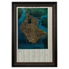
1945, "Supervue of New York City"
Located in Colorado Springs, CO
This bird’s eye view of New York City was published in 1945 by the Supervue Map and Guide Organization. The map shows the roads and major points of interest, which, coupled with a detailed index surrounding the map, helped tourists locate key attractions, historical sites, steamship piers, parks and squares, and bridges.
The map was originally issued folded into printed paper covers with black and white photographic images of the city. On the verso of the map are small black and white maps...
Category
American Vintage 1940s Maps
Materials
Paper
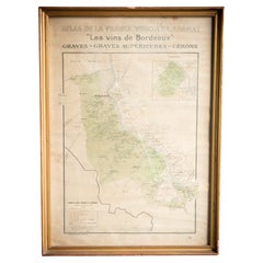
Gilt Framed Vintage French Bordeaux Wine Region Poster 1943
Located in Alton, GB
Framed Champagne region wine map from 1944. The print has been removed to clean the glass, the frame has minor damage in places but nothing that detracts from its beauty, if anything...
Category
French Vintage 1940s Maps
Materials
Paper
Gilt Framed Vintage French Champagne Wine Region Poster 1944
Located in Alton, GB
Framed Champagne region wine map from 1944. The print has been removed to clean the glass, the frame has minor damage in places but nothing that detracts from its beauty, if anything...
Category
French Vintage 1940s Maps
Materials
Paper
Set of Four Framed French Wine Region Posters Dated 1949
Located in Alton, GB
Set of four French wine region posters dated 1949 from Paris in original frames, the prints have been removed to clean glass, the frames have minor ...
Category
French Vintage 1940s Maps
Materials
Paper
Old Map Chest
Located in Eindhoven, NL
Old oak chest of drawers especially for maps and/o drawings. Cabinet consists of 2 parts. Entirely in perfect condition.
Origin: England
Period: Approx. 1940
Size 95cm x 68cm x H....
Category
English Vintage 1940s Maps
Materials
Oak
Old Map Chest
Located in Eindhoven, NL
Old oak chest of drawers especially for maps and/o drawings. Cabinet consists of 2 parts. Entirely in perfect condition.
Origin: England
Period: Approx. 1940
Size 116cm x 78cm x H...
Category
English Vintage 1940s Maps
Materials
Oak
Vintage World Globe on Mahogany Stand
Located in Lambertville, NJ
Handsome Scholarly world globe with a Regency style mahogany base. The globe is 16 inches in diameter, circa 1940, Chicago. Perfect addition to a library or study.
Category
American Regency Vintage 1940s Maps
Materials
Mahogany
"Geographically Correct Map of the United States" Vintage Map, circa 1940
Located in Colorado Springs, CO
This large map of the United States was issued by Rand McNally and Company on behalf of the Union Pacific Railroad. The map embraces the whole of the United States, illustrating the ...
Category
American Vintage 1940s Maps
Materials
Paper
20th Century French Bar World Globe, 1940s
Located in LEGNY, FR
Very nice and original 20th century French rolling bar world globe from the 1940s.
Wooden structure covered by a paper world map. Opening top to store bottles.
The inside is covere...
Category
French Vintage 1940s Maps
Materials
Wood
Map of United States, World War II Vintage Pictorial Map, circa 1943
Located in Colorado Springs, CO
A striking pictorial map by Stanley Turner, published in 1943. The map presents the United States during World War II and is so titled “United States at War.” Around the map’s edges ...
Category
Canadian Vintage 1940s Maps
Materials
Paper
Hammond's Map of the Mediterranean, Europe, and Africa, circa 1941
Located in Colorado Springs, CO
This is an original WWII folding folio map of the Mediterranean, Europe, and Africa. The map was one of six foldout maps in a color lithographic folio titled "Battle Maps: Covering All War Fronts", published between 1941 and 1944.
The map is incredibly detailed and indicates Naval and Air bases, vital military resources, air raids, supply lines, and tracks mileages between key cities...
Category
Vintage 1940s Maps
1948 Official "Texas Brags" Vintage Map of North America
Located in Colorado Springs, CO
This is a uniquely Texas-centered, tongue-in-cheek map of the United States, published in 1948. The map reflects a massive Texas, prominently occupying the center and south of the United States, with all other states squeezed to the northeast and northwest. In fact, the Northeastern states are humorously shown as "unannexed territory" and the western states as "ceded territory."
The map is populated with decorative accents and colorful, humorous pictographs. They include a tornado, called "interpanhandle wheat harvester", the “orneriest rattlesnakes", and a rodeo cowboy described as “the man that couldn't be throw'd and the horse that couldn't be rode." The pictographs boast the best of everything in Texas: "prickliest pears," "most cantankerous coyotes," “unloansome pines,” and similar. Along the border illustrations are depictions of Texas life and history, including The Alamo and San Jacinto Monument as well as more modern skyscrapers. The map is drawn to a scale of “1 inch = 5 Texas Grapefruit.”
The map was published in Texas by John Randolph with Mark Storm...
Category
American Vintage 1940s Maps
Materials
Paper
Recently Viewed
View AllMore Ways To Browse
Sea Chart Map
Antique Classroom
Antique Nautical Map
Antique Mexican Maps
Antique Map Box
Antique Nautical Maps
Mexican Antique Map
Antique Nautical Charts
King Charles I Of England
17th Century Corpus
Antique Celestial Maps
Antique Celestial Map
Celestial Maps Antique
Antique Map Middle East
Vintage Wooden Roller
Middle East Antique Map
Topographical Plate
Central America Map
