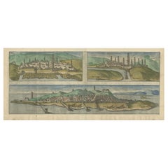
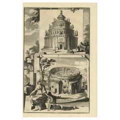
Very Old Engraving of Casablanca (Anfa), Azemmour (Azamor) and Diu, 1574
View Similar Items
Want more images or videos?
Request additional images or videos from the seller
1 of 6
Very Old Engraving of Casablanca (Anfa), Azemmour (Azamor) and Diu, 1574
About the Item
- Dimensions:Height: 8.86 in (22.5 cm)Width: 19.69 in (50 cm)Depth: 0 in (0.02 mm)
- Materials and Techniques:
- Period:
- Date of Manufacture:1574
- Condition:Condition: Good, lower margin trimmed and extended. Latin text on verso. Please study image.
- Seller Location:Langweer, NL
- Reference Number:Seller: BGJC-2861stDibs: LU3054326822342
About the Seller
5.0
Platinum Seller
These expertly vetted sellers are 1stDibs' most experienced sellers and are rated highest by our customers.
Established in 2009
1stDibs seller since 2017
1,916 sales on 1stDibs
More From This SellerView All
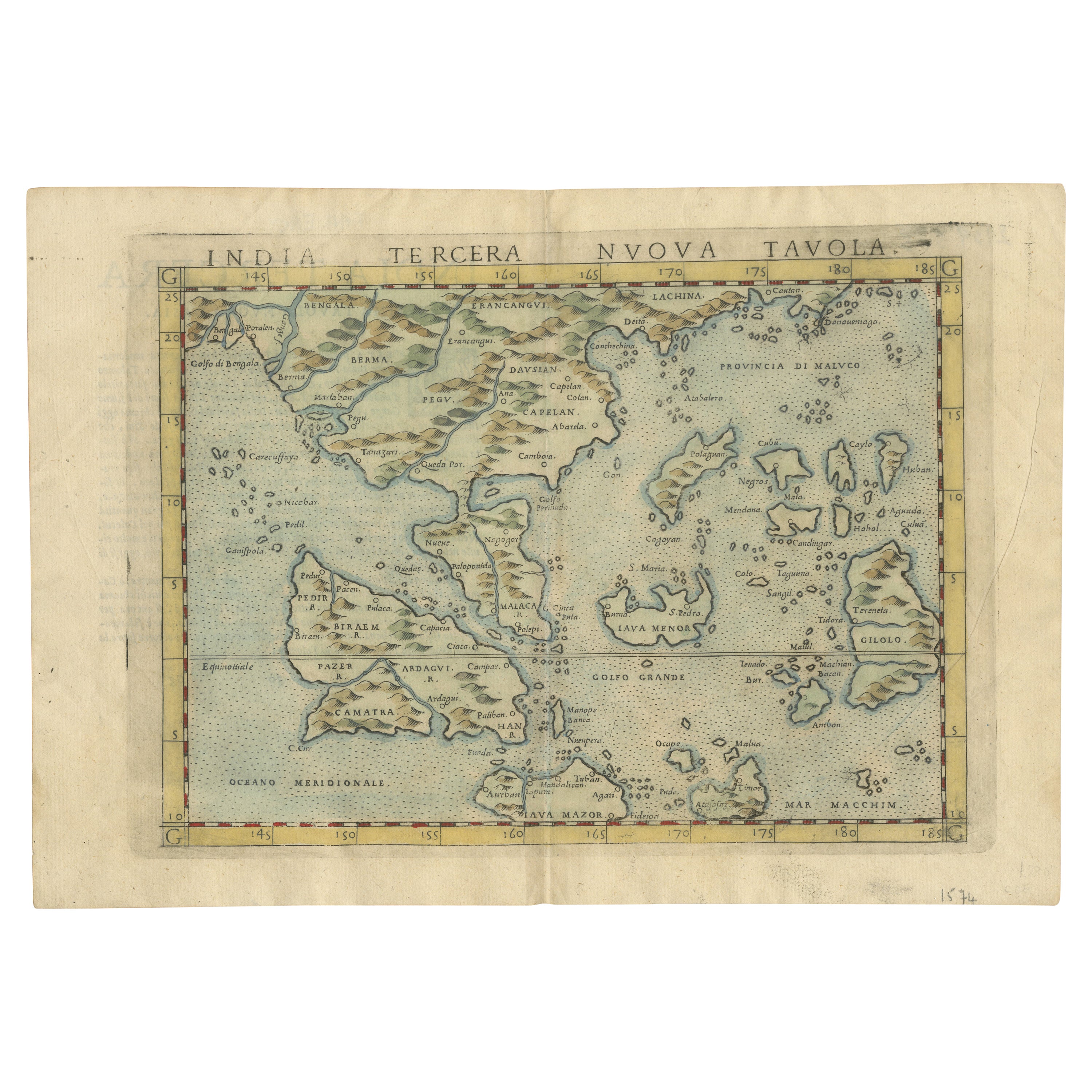
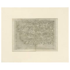
- Rare and Very Old Antique Map of South East Asia, Published circa 1574Located in Langweer, NLA very fine impression of this map of the Malay Peninsula, Sumatra, Java, with Singapore denoted as 'Cinca Pula'. Highly distorted and inaccurate map by Girolamo Ruscelli after J...Category
Antique 16th Century Maps
MaterialsPaper
 $1,050 Sale Price20% OffFree Shipping
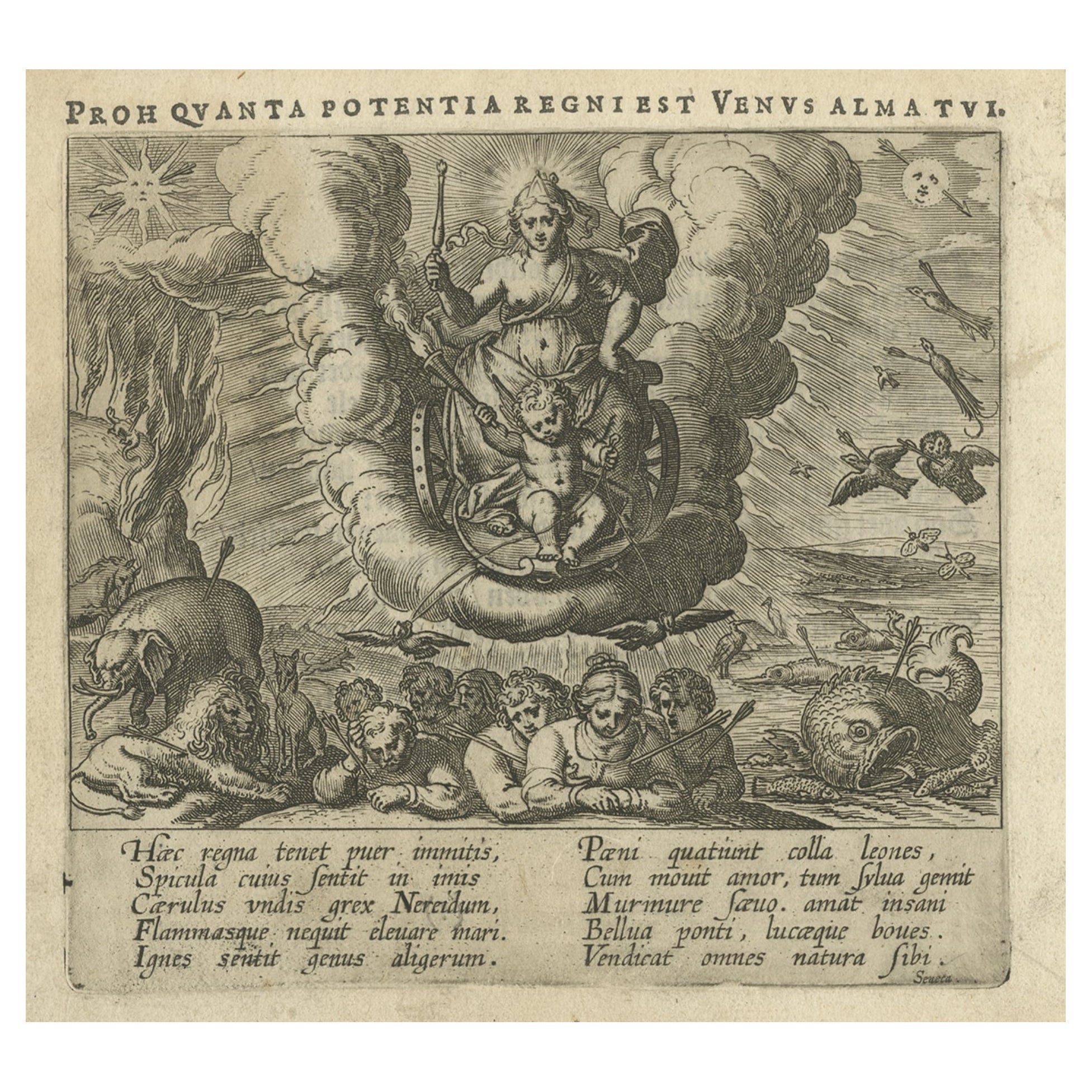
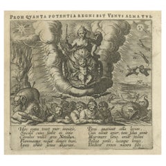
 - Very Old Original Antique Engraving of a Print of the Triumph of Venus, 1608Located in Langweer, NLAntique print titled 'Proh quanta potentatia regni est Venus'. Print of the Triumph of Venus. This print originates from 'Amorum Emblemata', this work includes engravings of Cupids encountering the various trials of Love. The emblematic illustrations include verses in Latin, Dutch and French. Artists and Engravers: Otto van Veen...Category
Antique Early 1600s Prints
MaterialsPaper
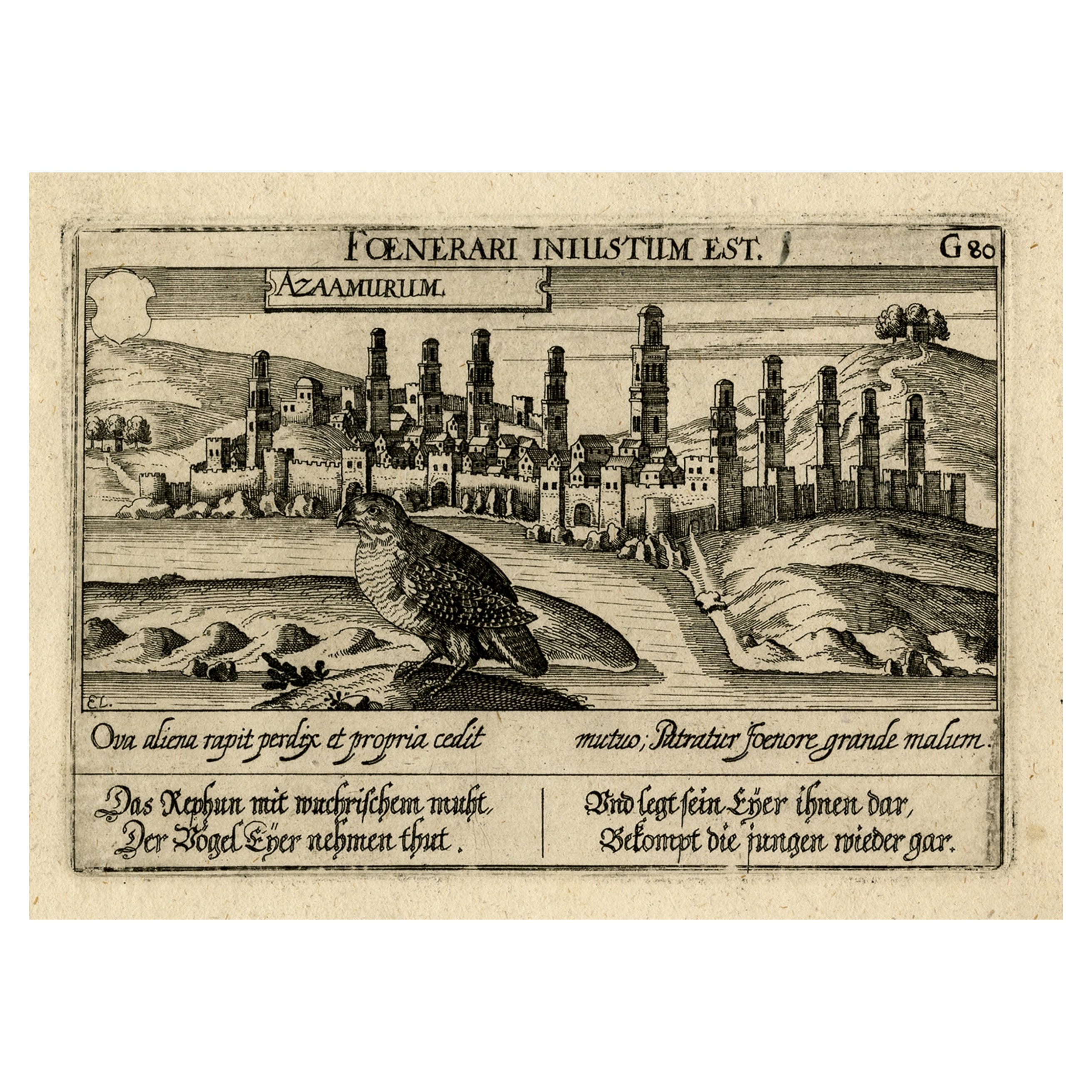
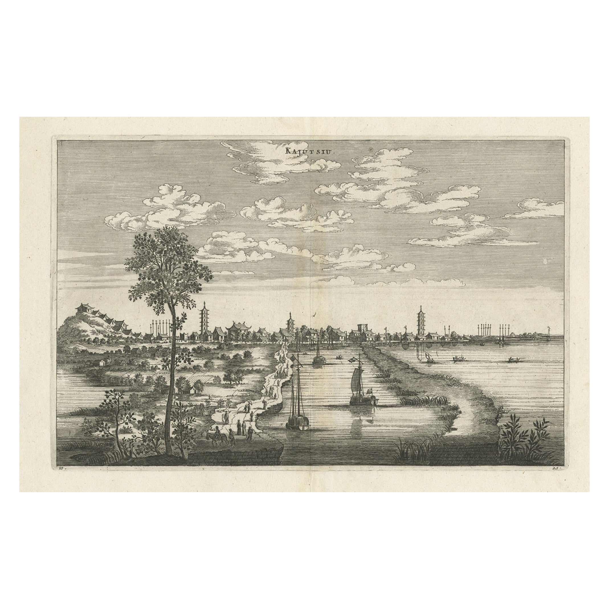
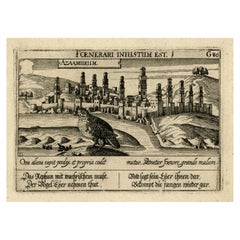
- Old Print of a Partridge in Front of The Walled City of Azemmour, Morocco, c1630Located in Langweer, NLAntique print, titled: 'Azaamurum.' - Caption in the top reads: 'Foenerari iniustum est'. A partridge in the foreground, with the walled city (Azemmour...Category
Antique 1630s Maps
MaterialsPaper
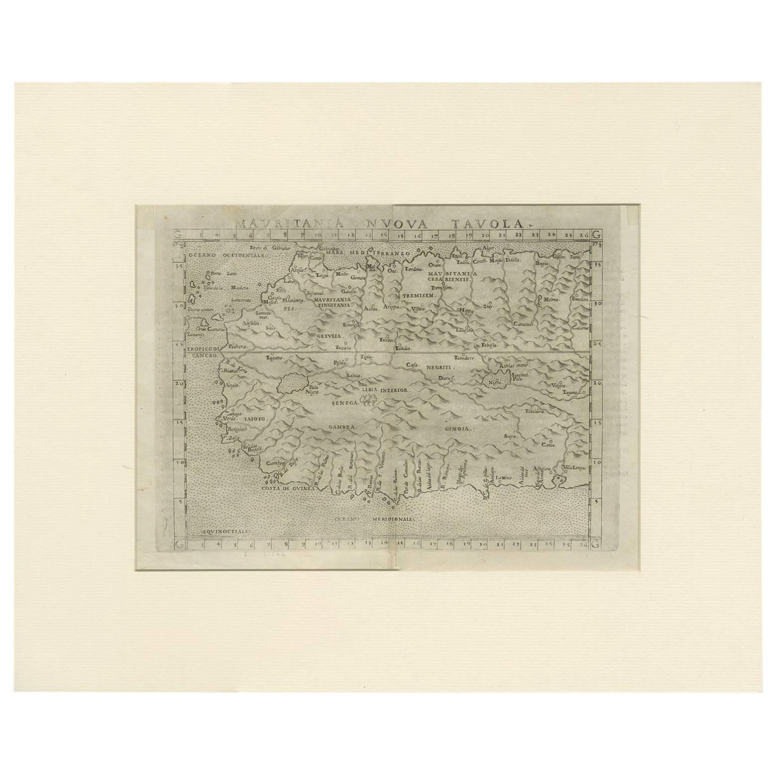
- Antique Map of Mauritania 'Africa' by G. Ruscelli, 1574Located in Langweer, NLA very rare mid-16th century black and white map of North and West Africa called Mauritania by the Italian cartographic editor Girolamo Ruscelli. T...Category
Antique 16th Century Maps
MaterialsPaper
 $300 Sale Price21% Off
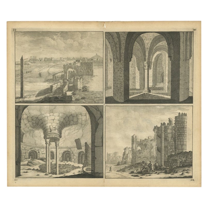
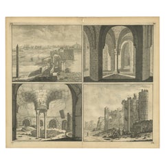
 - Old Engraving of the Ruins of the Palace of Cleopatra in Old Egypt, AfricaLocated in Langweer, NLThis plate shows views of the ruins of the Palace of Cleopatra, Egypt. Source unknown, to be determined. Artists and Engravers: Cornelis de Bruijn (also spelled Cornelius de Bruyn, p...Category
Antique 18th Century Prints
MaterialsPaper
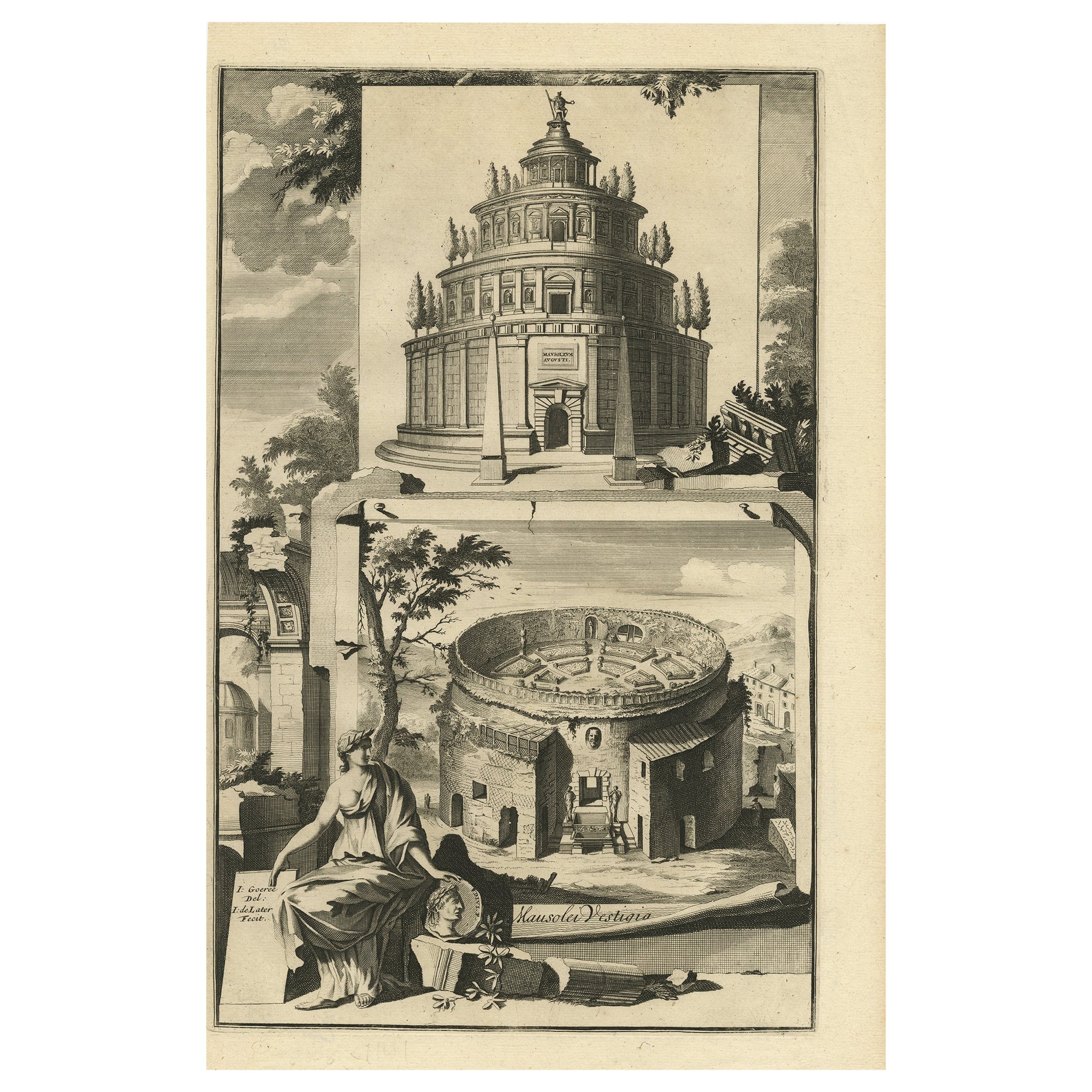
- Old Engraving of The Mausoleum of Augustus and its remnants in Rome, ItalyLocated in Langweer, NLAntique print, titled: 'Mausoleum Augusti - Mausoleum Vestigia' - This original old antique print shows the Mausoleum of Augustus and its remnants in Rome, Italy. This original old antique print / plate originates from: 'Beschryving van Oud en Nieuw Rome. Verdeelt in drie Deelen. In 't Fransch beschreven door den Heer Francois Desseine. En in 't Nederduitsch vertaalt.', by Francois Desseine and published by Francois Halma in 1704, first published in French in 1690. Copies of this work are rarely complete as the maps and engravings are of high quality matching the work of Piranesi. Artists and Engravers: Made by 'J. De Later' after 'Jan Goeree'. Made by J .de Later after Jan Goeree. Jan Goeree (1670-1731) was a Dutch engraver and poet. He was the son of the Middelburg bookseller Willem Goeree. Born in Middelburg, but soon they moved to Amsterdam. Initially he focussed on painting, assumably a student of Gerard de Lairesse. But he is best known for his engraving skills, depicting mosttly emblematic and historic scenes. In 1705 he was commisioned by the Mayor of Amsterdam to design the drawings for the ceiling paintings for the grand hall of the old city hall...Category
Antique 18th Century Prints
MaterialsPaper
You May Also Like
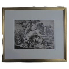
- Framed Johann Elias Ridinger Engraving, 18th Stag EngravingLocated in Perth, GBFine 18th century engraving of a stag, after the hunt, with a magnificient dog at rest, in a country scene, beautifully depicted.Category
Antique 18th Century Prints
MaterialsPaper
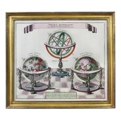
- Framed Engraving By Matthaus Seutter Of Sphaerae ArtificialesLocated in Essex, MACartographer from Germany 1678-1757. Hand colored. Gilt wood frame. Estate of William Hodgins.Category
Antique Early 1700s German Prints
MaterialsPaper
- 1876 "Gettysburg, The Repulse of Longstreet's Assault." EngravingLocated in Colorado Springs, COPresented here is an 1876 engraving of John B. Bachelder and James Walker’s Gettysburg. The Repulse of Longstreet’s Assault. The engraved scene depicts the decisive battle on the final day of the Battle of Gettysburg. Researched by the photographer and topographer John B. Bachelder and painted by James Walker, the original painting was created in 1870. This detailed engraving was done by H. B. Hall Jr. and published by James Drummond Ball. Otherwise called Pickett’s Charge, the battle occurred on July 3, 1863. Pickett’s corp commander, Lieutenant General James Longstreet was placed in charge of the attack despite his hesitations. Longstreet’s central role led to the title of the work, Repulse of Longstreet’s Assault. In an attempt to gain control of an important supply route, nine Confederate brigades charged across three-quarters of a mile of open ground against cannon fire to take Cemetery Ridge from the defending Union Army. Despite their overwhelming numbers, the Confederate forces were repelled with considerable casualties marking not only a decisive victory for the Union, but also the beginning of the slow defeat of Lee’s Army. The furthest the charging forces advanced before being repulsed would forever be known as the “High Water Mark of the Confederacy.” The Confederate army never recovered from the losses at Gettysburg and it effectively ended Lee’s campaign into Pennsylvania. The engraving gives the perspective from the Union rear, one that encompasses most of the battlefield, from Big Round Top on the left to the northern reaches of Cemetery Ridge on the right. The Confederate lines at Seminary Ridge are in the far distance, partially obscured by bursting shells. The image centers on the main Confederate assault, in the vicinity of what today are known as "The Copse" and "The Bloody Angle." The composition has elemen...Category
Antique 1870s American Prints
MaterialsPaper
- Old Nautical Map of CorsicaLocated in Alessandria, PiemonteST/556/1 - Old map of Corsica isle, surveyed by Captain Hell, of the French Royal Navy in 1824, engraved and published on 1874, with additions and corre...Category
Antique Early 19th Century English Other Prints
MaterialsPaper
 $350 Sale Price20% Off
 - Old Horizontal Map of EnglandBy TassoLocated in Alessandria, PiemonteST/520 - Old rare Italian map of England, dated 1826-1827 - by Girolamo Tasso, editor in Venise, for the atlas of M.r Le-Sage.Category
Antique Early 19th Century Italian Other Prints
MaterialsPaper
 $236 Sale Price20% Off
 - “The Restaurant of the House of Representatives” Engraving by Harper's WeeklyLocated in Colorado Springs, COThis original wood engraving is titled “The Restaurant of the House of Representatives, Washington, DC.” It was published as a double-page image, in the August 12, 1893 issue of the famous 19th century newspaper Harper’s Weekly. The print was illustrated by Charles Stanley Reinhardt. The House Restaurant, a unique part of life in the Capitol, has been in the same location since the 1857 Capitol Expansion. Congressional members’ busy work schedule made the availability of food on site a necessity. But the restaurant also served as an informal meeting spot for members to continue conversations and deal making. This 1893 print illustrates the convivial atmosphere. Details including elegantly dressed tables...Category
Antique 1890s American Prints
MaterialsPaper