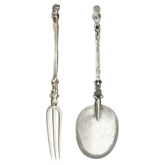
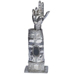
The Earliest Silver from the United States, New Amsterdam 'NYC' circa 1672
View Similar Items


Want more images or videos?
Request additional images or videos from the seller
1 of 4
The Earliest Silver from the United States, New Amsterdam 'NYC' circa 1672
$120,000List Priceper set
About the Item
- Dimensions:Height: 6.5 in (16.5 cm)Width: 1.78 in (4.5 cm)Depth: 0.6 in (1.5 cm)
- Sold As:Set of 2
- Style:American Colonial (Of the Period)
- Materials and Techniques:
- Place of Origin:
- Period:1670-1679
- Date of Manufacture:1672
- Condition:Repaired: An old repair to the stem of the fork. Wear consistent with age and use.
- Seller Location:Amsterdam, NL
- Reference Number:1stDibs: LU5458224033152
About the Seller
5.0
Recognized Seller
These prestigious sellers are industry leaders and represent the highest echelon for item quality and design.
Established in 1985
1stDibs seller since 2020
23 sales on 1stDibs
Typical response time: 5 hours
Authenticity Guarantee
In the unlikely event there’s an issue with an item’s authenticity, contact us within 1 year for a full refund. DetailsMoney-Back Guarantee
If your item is not as described, is damaged in transit, or does not arrive, contact us within 7 days for a full refund. Details24-Hour Cancellation
You have a 24-hour grace period in which to reconsider your purchase, with no questions asked.Vetted Professional Sellers
Our world-class sellers must adhere to strict standards for service and quality, maintaining the integrity of our listings.Price-Match Guarantee
If you find that a seller listed the same item for a lower price elsewhere, we’ll match it.Trusted Global Delivery
Our best-in-class carrier network provides specialized shipping options worldwide, including custom delivery.More From This Seller
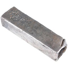
View AllColonial Silver VOC 'East-India Company' Ingot
Located in Amsterdam, NL
A silver 'V.O.C. AMSTERDAM' ingot
circa 1738, with monogram and the assay mark of the Amsterdam Grill family
With V.O.C. monogram and the A for Amsterdam.
L. approx. 15.5 cm
Weight approx. 2000 grams
Note:
The ingots were salvaged in 2004 from the wreck of the VOC indiaman Rooswijk, equipped by the Amsterdam VOC Chamber. The Rooswijk sank on its second voyage to the Dutch East Indies off the English coast on the Goodwin Sands...
Category
Antique 18th Century Dutch Historical Memorabilia
Materials
Sterling Silver
Rare 17th Century Silver Reliquary Arm Monstrance
Located in Amsterdam, NL
A rare silver reliquary arm with relic bone, with the coat-of-arms of Cosme Roger (1671-1710), bishop of Lombez, France, with original bone relic
Poss...
Category
Antique Late 17th Century Italian Renaissance Religious Items
Materials
Sterling Silver
A pair of silver fibulae from the Atlas Mountains of Morocco
Located in Amsterdam, NL
Atlas Mountains, Morocco, Early 20th century
The usage of the fibula, an ancient piece of jewelry that holds capes and other clothing in place, is unique to North African Berber cos...
Category
Early 20th Century Moroccan Collectible Jewelry
Materials
Silver
Rare Dutch Caribbean Silver Water-Scoop Curaçao, circa 1873
Located in Amsterdam, NL
A rare Dutch Caribbean silver water-scoop
Curaçao, circa 1873, indistinctly marked, engraved with initials G R P
Measures: L 35 cm, weight 221 gr...
Category
Antique 19th Century Caribbean Dutch Colonial Sterling Silver
Materials
Silver

Dutch Colonial Silver Dish with the Von Pfeffel Coat-of-arms, 17th Century
Located in Amsterdam, NL
An unusual Indonesian lobbed silver dish
Jakarta (Batavia) or Coromandel coast, third quarter 17th century, apparently unmarked
The eight lobbed dish exuberantly decorated with floral motifs, with the middle section replaced, consisting of indistinctly marked German silver from the early 19th century, bearing the coat-of-arms of the Von Pfeffel family.
Diam. 30.5 cm
Weight 461 grams
Note:
Lobbed silver dishes with exuberant floral decorations were characteristic of the decorative arts in the Netherlands in the first half of the 17th century. This style of floral decoration was adopted by silversmiths as well as by furniture makers working on the Coromandel Coast and in Batavia, often by workers who had fled the Coromandel Coast because of war and famine. In Batavia this style was known as “Custwerck” (work from the Bengal coast).
These lobbed dishes are seldom marked. Only after 1667 the use of the town mark became obligatory in Batavia but only for silver made in Batavia not for silver imported in Batavia from other VOC settlements. The engraved coat of arms in the centre is a replacement of the original centre.
The coat of arms can be identified as those of Christian Hubert von Pfeffel (1765- 1834). As a diplomat, statesman, ambassador of Bavaria in London and Saxony and councillor to the King of Bavaria, he was made “Freiherr” in 1828 and since then used this coat of arms. His son Karl Maximilian Friederich Hubert Freiherr von Pfeffel (1811-1890) in 1836 married Karoline Adelheid Pauline von Rottenburg (1805-1872), the natural daughter of Prins Paul von Württemberg (1785-1852) and his mistress Margrethe Porth. Paul was the jounger brother of the King Wilhelm I of Württemberg (1781-1864). The heraldic motto of the von Pfeffels Vur Schande habe den Huot means as much as “Beware of Shame”. Christian Hubert Theodoor Marie Karl von Pfeffel Karl Maximilian’s grandson was the last male in the von Pfeffel line. His daughter, Marie Louise (Paris in 1882 - Cornwall 1944), born and grown-up in France, changed her name in de Pfeffel. She was the great grandmother of Boris Alexander de Pfeffel Johnson, the present British Secretary of State. None of the members of the von Pfeffel family had any direct links with the Dutch East Indies but indirectly by way of the Royal House of Württemberg they did.
Sophia Frederika Mathilda von Württemberg (1818-1877), daughter of Wilhelm I King of Württemberg, in 1839 married Willem III...
Category
Antique Late 17th Century Indonesian Dutch Colonial Sterling Silver
Materials
Silver
Fabulous Indonesian Yogya-Silver Plate
Located in Amsterdam, NL
An Indonesian Yogya-silver plate
Yogyakarta or Kotagede, 1935-1940, marked, (alloy) 800 and maker’s mark PH (Prawirohardjo, act. from 1935)
Diam. 27.2 cm Weight 454 grams
Th...
Category
Early 20th Century Indonesian Art Deco Sterling Silver
Materials
Silver
You May Also Like
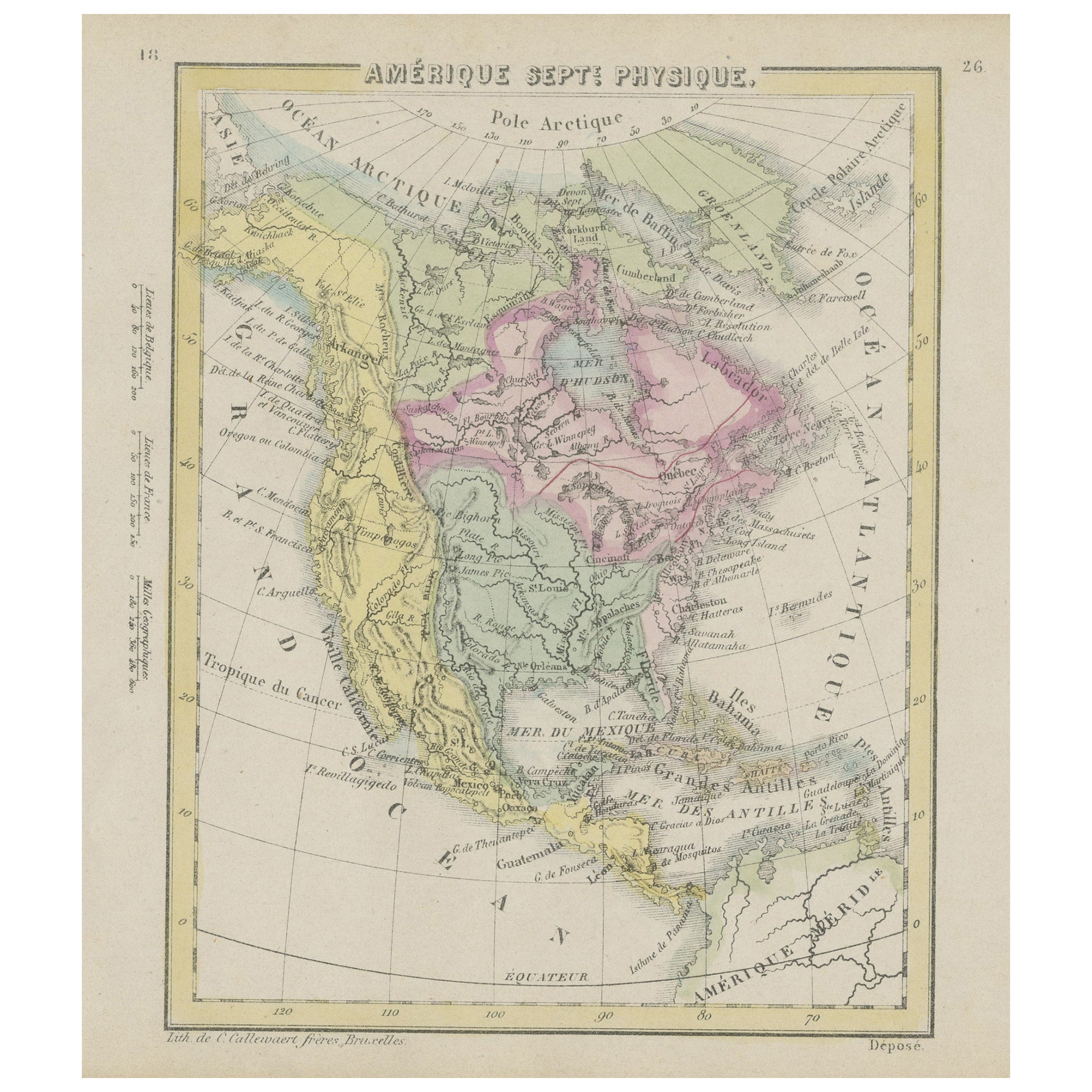
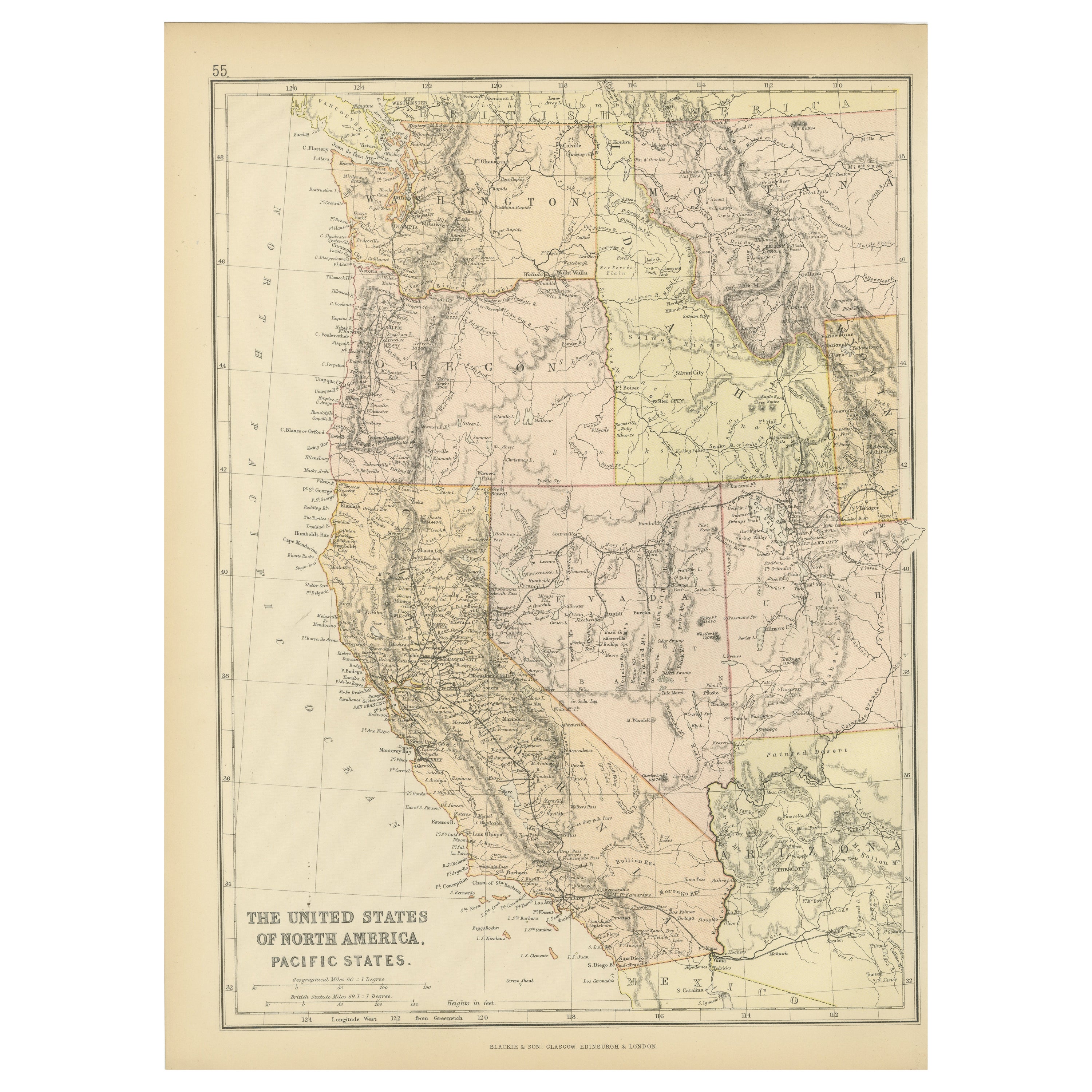
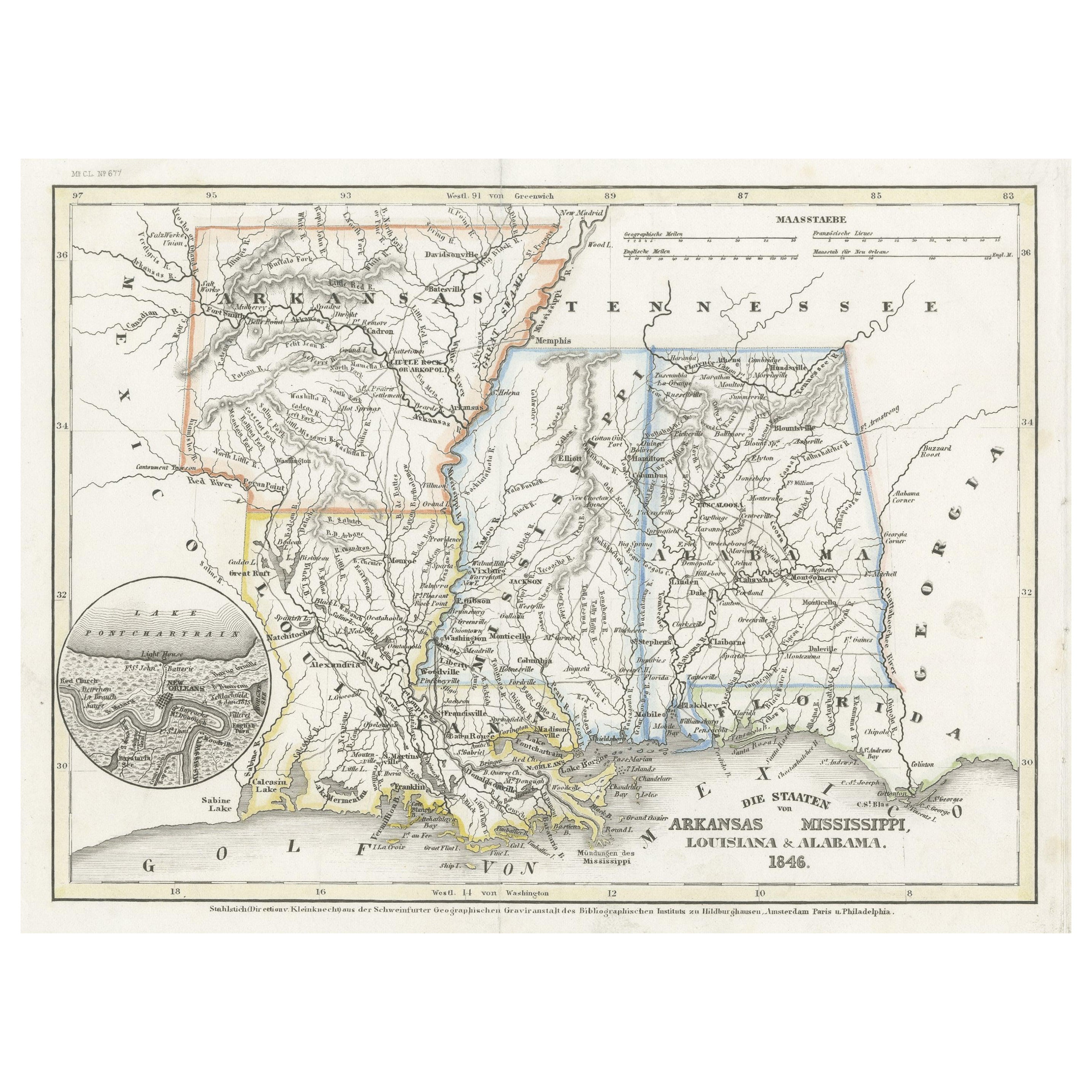
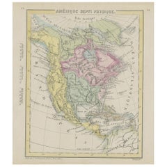
Small Map of the United States, circa 1870
Located in Langweer, NL
Antique map titled 'Amérique septe. Physique'. Small map of the United States. lithographed by C. Callewaert brothers in Brussels circa 1870.
Category
Antique Mid-19th Century Belgian Maps
Materials
Paper
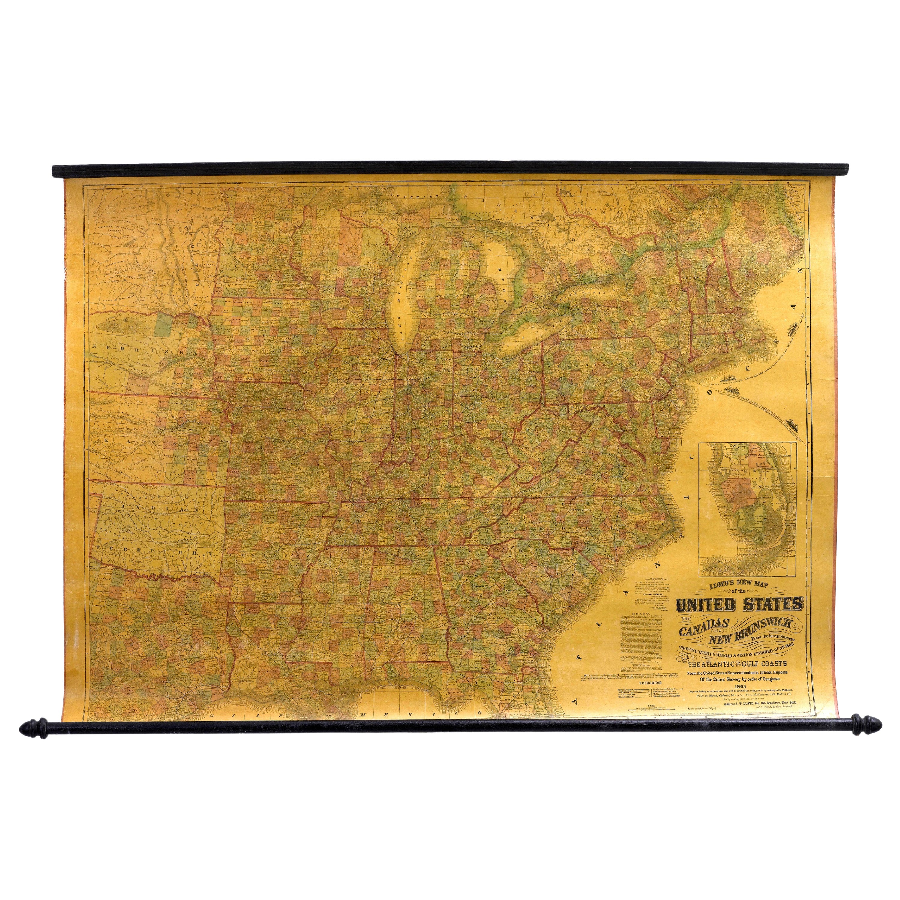
1863 "Lloyd's New Map of the United States, the Canadas, and New Brunswick"
Located in Colorado Springs, CO
Presented is “Lloyd's New Map of the United States, the Canadas and New Brunswick, From the latest Surveys, Showing Every Railroad & Station Finished to June 1863, and the Atlantic and Gulf Coasts.” A large, Civil War-era hanging map of the United States and adjacent territories, this map covers the area from the Atlantic Ocean and extends as far west as the 103 meridian, to “Dacotah,” Nebraska, Kansas, "Indian Territory," and Texas. The southern continuation of Florida is shown in an inset map along the right margin. This map was published by J. T. Lloyd, in New York, in 1863. According to the publisher’s marking at lower right, this map was originally issued in two states: "in Sheets, Colored" for 50 cents, and "Varnished nicely, with Rollers" for $1.
Throughout the map, the counties are colored and the towns and cities well labeled. A reference key in the bottom margin provides symbols for railroads, turnpikes and wagon roads, state capitals, cities and towns, and village post offices. As emphasized in the map’s title, this map is especially notable for the countless railway lines and stations depicted, with distances noted between points, listing “every railroad and finished station to June 1863.” Additionally, two shipping agents and their routes are drawn out of New York City. The map includes details of the steamship routes into New York and Philadelphia from Liverpool and on to California and Oregon via an overland Nicaraguan trek, presumably to assist gold rush emigrants.
This expansive and impressive map depicts the eastern half of the United States in the third year of the Civil War. In order not to recognize the legitimacy of the Confederate States of America, each state is shown in the same manner as the Union states. The only indication that the American Civil War was in progress when this map was published is a printed notice that Gideon Wells, Secretary of the Navy, wishes to acquire a quote on 100 copies of Lloyd’s Mississippi River map...
Category
Antique 1860s American Maps
Materials
Linen, Wood, Paper

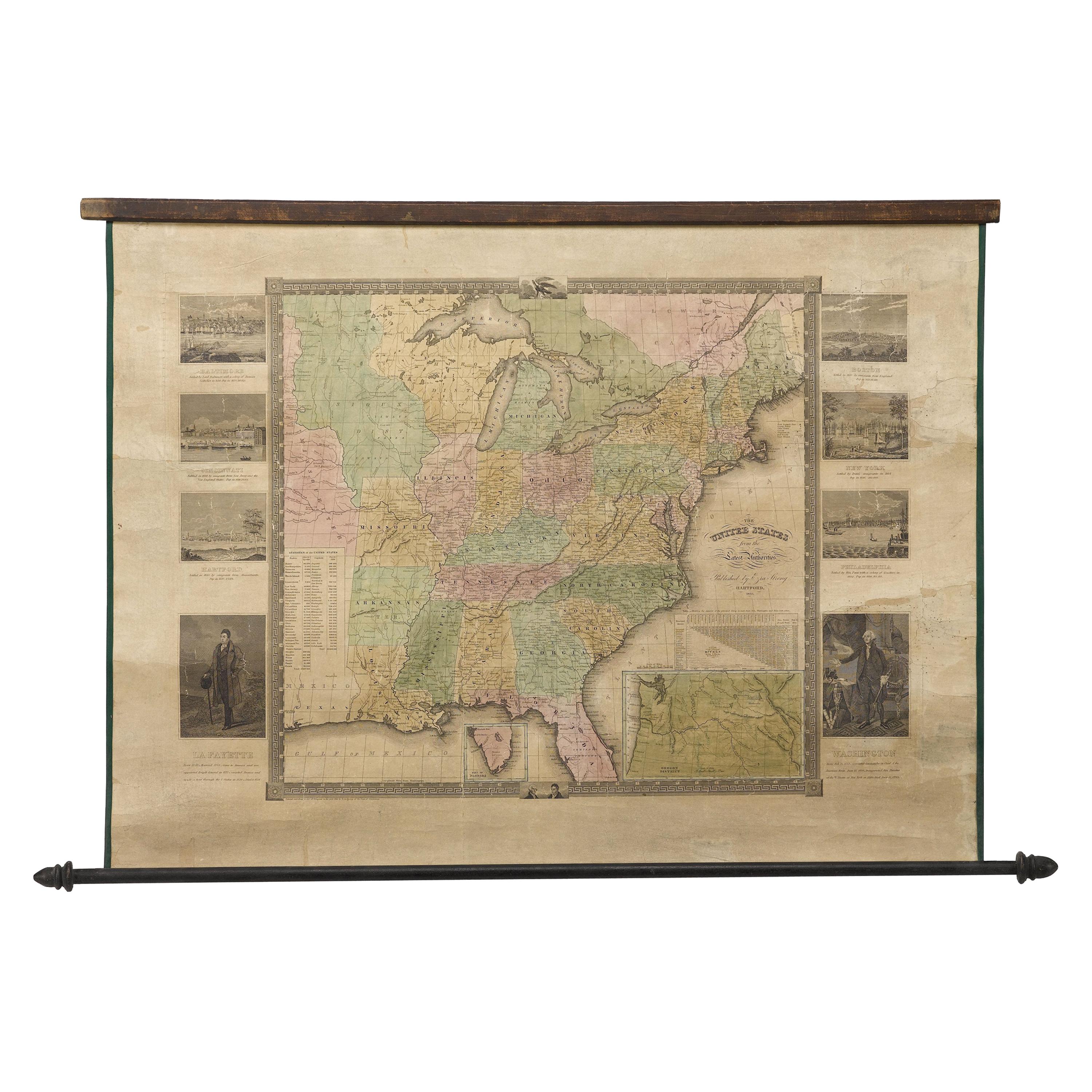
"The United States from the Latest Authorities" Antique Wall Map, 1835
Located in Colorado Springs, CO
This is a 1835 map of “The United States from the Latest Authorities” by Ezra Strong. A hand-colored engraved wall map of the eastern half of the United States, this map has a large inset of the "Oregon District" and several engraved city views and two portraits.
The primary map extends to Mexico Texas and the Missouri Territory, showing the course of the Missouri River to Ft. Mandan and Old Ft. Mandan, and noting many forts along the river. The territories to the east of Missouri Territory are separately delineated as Sioux District and Huron District. The western details of the map are very good for a map of this time period, with many Native American settlements, villages, forts and other details noted.
The map is bordered with vignettes of Boston, New York, Philadelphia, Hartford, Cincinnati, and Baltimore. Each vignette notes the date settled, primary settler, and the population as of 1830. Two portraits of LaFayette and George Washington are presented in full length with related biographical information.
A large inset map at lower right shows the Oregon District, centered on the Columbia River and extending to the Rocky Mountains. This is one of the earliest commercial appearances of a separate map of Oregon...
Category
Antique 1830s American Maps
Materials
Paper

Old Decorative Pictorial Map of the United States, circa 1953
Located in Langweer, NL
Antique map titled 'A Pictorial Map of the United States of America Showing Principal Regional Resources, Products, and Natural Features'.
This information-packed map was create by the General Drafting Company for the New Jersey Bell Telephone Company. The main map features over 700 drawings in full color including points of interest, natural resources, and agricultural products. At bottom are inset maps showing railroad lines, air routes, telephone lines, as well as a pictorial map of New Jersey...
Category
20th Century Maps
Materials
Paper

$717 Sale Price
20% Off
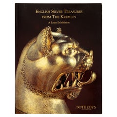
English Silver Treasures from the Kremlin: a Loan Exhibition by Sotheby's
Located in valatie, NY
English Silver Treasures From the Kremlin: A Loan Exhibition by Sotheby's. Exhibition softcover catalog January 1st-28th 1991. "The Armoury Museum in ...
Category
1990s English Books
Materials
Paper
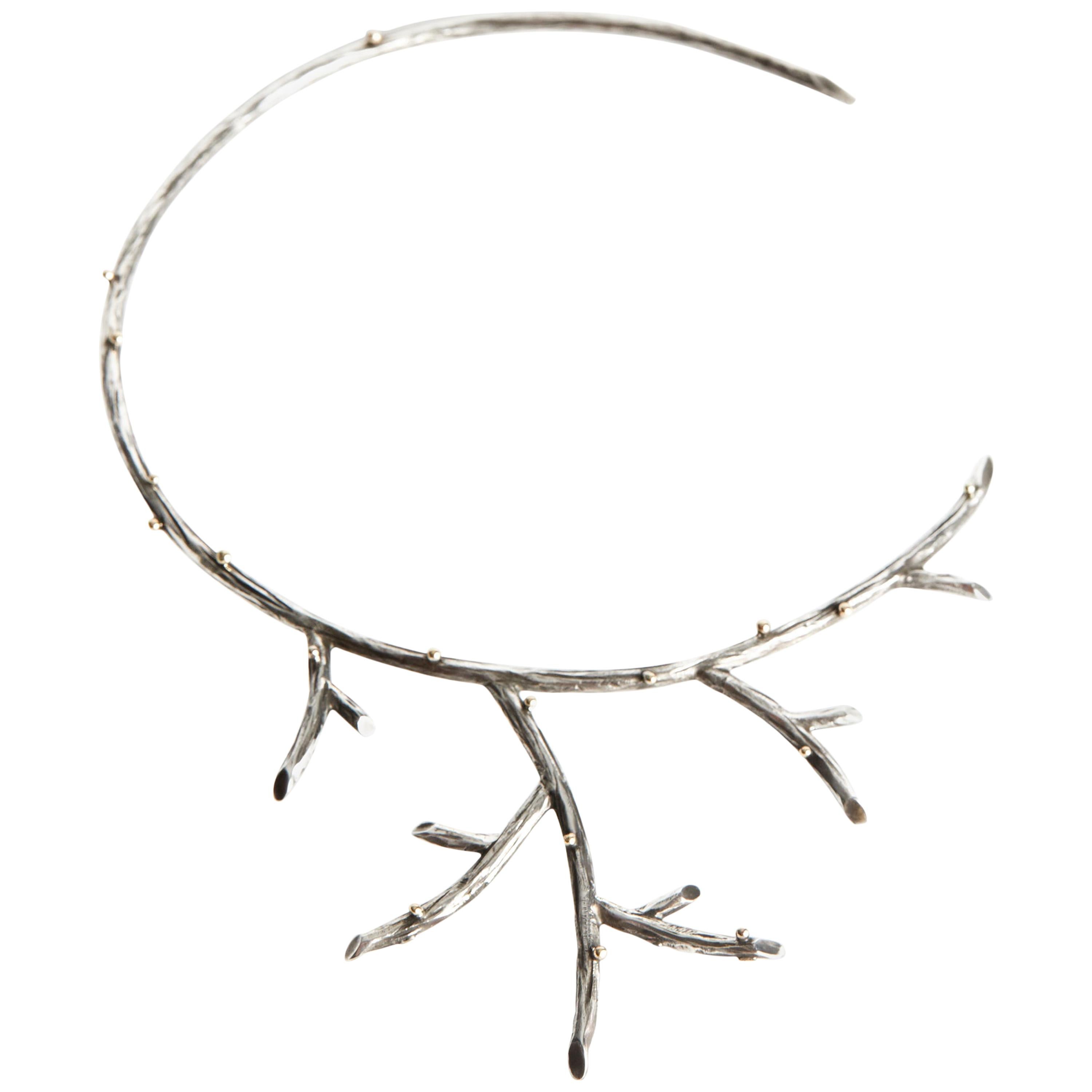
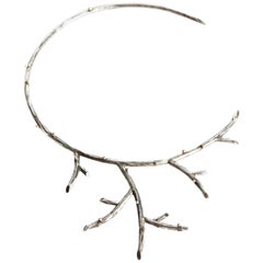
Audrey Werner, Sterling Silver Branch Necklace, United States, 2002
By Audrey Werner
Located in New York, NY
Seamlessly mixing influences from around the world, Werner works with oft-overlooked materials--including her signature black iron--to create bold pieces of striking beauty. "I am am...
Category
Early 2000s North American Collectible Jewelry
Materials
Sterling Silver
Recently Viewed
View AllMore Ways To Browse
Wooden Sleds
German Santa Claus
Antique Hand Crank
Antique Artillery Shells
German Christmas Santa
Buzz Aldrin
Dwight Eisenhower
Flag Pole
Royal Flag
Admiral Lord Nelson
Antique Metal Shoe
Antique Military Memorabilia
Antique Santa Claus
Antique Advertising Collectibles
Queen Elizabeth Coronation
Gavel Used
Alfa Romeo Vintage
Anders Aldrin