Items Similar to 1573 Ortelius Map: First to Name California, Spanning Tartary to North America

Want more images or videos?
Request additional images or videos from the seller
1 of 9
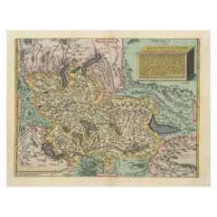
1573 Ortelius Map: First to Name California, Spanning Tartary to North America
$2,271.56
$2,839.4520% Off
£1,726.76
£2,158.4520% Off
€1,920
€2,40020% Off
CA$3,192.33
CA$3,990.4220% Off
A$3,471.73
A$4,339.6720% Off
CHF 1,828.99
CHF 2,286.2320% Off
MX$42,164.86
MX$52,706.0820% Off
NOK 22,994.06
NOK 28,742.5820% Off
SEK 21,555.08
SEK 26,943.8420% Off
DKK 14,703.11
DKK 18,378.8820% Off
About the Item
"1573 Abraham Ortelius Map of Tartary, Japan, and Western North America"
Description of the Map:
This is an outstanding example of Abraham Ortelius' map titled "Tartariae Sive Magni Chami Regni typus," from the groundbreaking "Theatrum Orbis Terarrum," the world's first modern atlas. Published around 1573, this map is significant for being the earliest obtainable map that names California and includes the Strait of Anian, thought to represent today's Bering Strait, depicting a possible Northwest Passage to Asia.
Geographic and Cartographic Features:
- Coverage: The map spans from the Caspian Sea in the west across Tartary (Central and East Asia), including China and Japan, to the west coast of North America. It depicts California and the mythical Strait of Anian distinctly.
- Japan and California: Japan is portrayed horizontally, reflecting the cartographic conventions of the time, while California is represented as a peninsula.
- Tartar Kingdom: It extends over a vast area showing various topographic details, cities, and other geographical features.
Artistic Elements:
- Cartouches: The map includes two richly decorated cartouches; one in the top right corner features the title amidst exotic birds and floral arrangements, and the other in the bottom left shows figures possibly representing local inhabitants, adorned with a narrative about the region.
- Decorative Imagery: The map is further embellished with ships, a large fish in the ocean, and other maritime symbols that enhance its visual appeal.
Historical and Cultural Significance:
- Early Depictions: This map is pivotal for its early depiction of Northeast Asia and North America, influencing the European understanding and imagination of these regions during the 16th century.
- Innovations: It reflects the adoption of the Strait of Anian, aligning with the era's quests for a Northwest Passage, and integrates myths like the Kingdom of Prester John and references to Marco Polo's travels.
- Textual Annotations: Extensive Latin texts provide insights into the region's perceived history and geography, including references to biblical tribes, ancient kingdoms, and historical figures like the Great Khan.
Printing History:
- States of the Map: The map underwent several changes through its states from its first print in ca. 1570 to adjustments in the coastline, ship details, and cartographic embellishments in subsequent versions until about 1609.
Collector's Value:
As one of the first maps to include such significant geographical myths and real locations in tandem with artistic mastery, this map holds tremendous value for collectors interested in the evolution of cartographic techniques, early Asian and North American geography, and the history of exploration. Its place in the first modern atlas further cements its status as a collectible artifact of major historical importance.
- Dimensions:Height: 15.75 in (40 cm)Width: 21.26 in (54 cm)Depth: 0 in (0.02 mm)
- Materials and Techniques:Paper,Engraved
- Period:
- Date of Manufacture:1573
- Condition:Condition: Very good, given age. General age-related toning and/or occasional minor defects from handling. Strong paper and vivid colors. Along the fold foxing and two wormholes covered up but not disturbing. Please study scan carefully.
- Seller Location:Langweer, NL
- Reference Number:Seller: BG-136511stDibs: LU3054341306502
About the Seller
5.0
Recognized Seller
These prestigious sellers are industry leaders and represent the highest echelon for item quality and design.
Platinum Seller
Premium sellers with a 4.7+ rating and 24-hour response times
Established in 2009
1stDibs seller since 2017
2,696 sales on 1stDibs
Typical response time: <1 hour
- ShippingRetrieving quote...Shipping from: Langweer, Netherlands
- Return Policy
Authenticity Guarantee
In the unlikely event there’s an issue with an item’s authenticity, contact us within 1 year for a full refund. DetailsMoney-Back Guarantee
If your item is not as described, is damaged in transit, or does not arrive, contact us within 7 days for a full refund. Details24-Hour Cancellation
You have a 24-hour grace period in which to reconsider your purchase, with no questions asked.Vetted Professional Sellers
Our world-class sellers must adhere to strict standards for service and quality, maintaining the integrity of our listings.Price-Match Guarantee
If you find that a seller listed the same item for a lower price elsewhere, we’ll match it.Trusted Global Delivery
Our best-in-class carrier network provides specialized shipping options worldwide, including custom delivery.More From This Seller
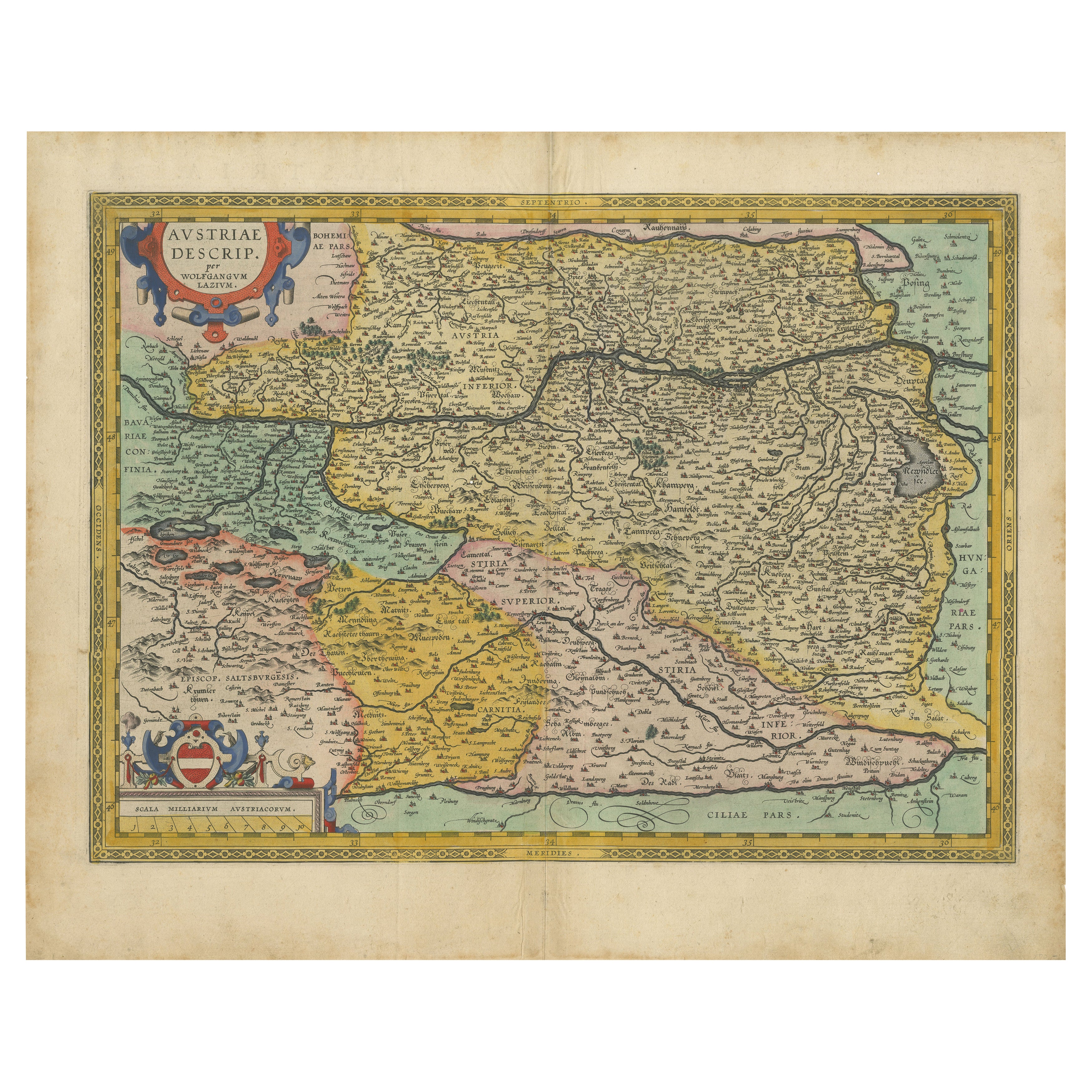
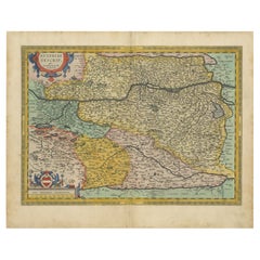
View AllAustria by Wolfgang Lazius – A Magnificent 16th-Century Map from Ortelius, 1592
Located in Langweer, NL
Title:
Avstriae Descrip – Wolfgang Lazius’ Map of Austria, 16th Century
Description:
This extraordinary map of Austria pays homage to the Austrian humanist and cartographer Wo...
Category
Antique 16th Century Austrian Maps
Materials
Paper
Antique Map of Southeast Asia by Ortelius '1587'
By Abraham Ortelius
Located in Langweer, NL
Antique map titled 'Indiae Orientalis Insularumque Adiacientium Typus'. Ortelius includes early European depictions of both Japan and China and is the first to name Formosa (Taiwan). The Philippines and East Indies or Spice Islands are shown based upon Portuguese and Spanish sources, and before their penetration by the Dutch. Japan is shown in kite form, as a large oval island...
Category
Antique 16th Century Maps
Materials
Paper

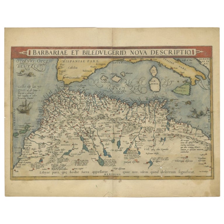
Antique Map of North Africa by Ortelius, c.1600
Located in Langweer, NL
Antique map titled 'Barbariae et Biledulgerid nova descriptio'.
Old map of coastal North Africa and the Mediterranean. The map extends from Morocco and the Sahara to Libya and sh...
Category
Antique 17th Century Maps
Materials
Paper
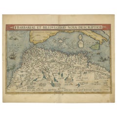
$354 Sale Price
20% Off
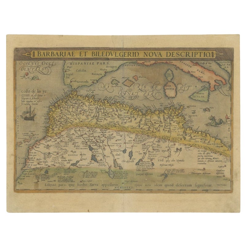
Antique Map of North Africa by Ortelius, c.1580
Located in Langweer, NL
Antique map titled 'Barbariae et Biledulgerid Nova Descriptio'. Original antique map of North Africa. The map covers the regions of Barbaria and Biledulgerid, essentially the territo...
Category
Antique 16th Century Maps
Materials
Paper
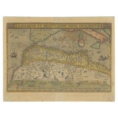
$339 Sale Price
20% Off
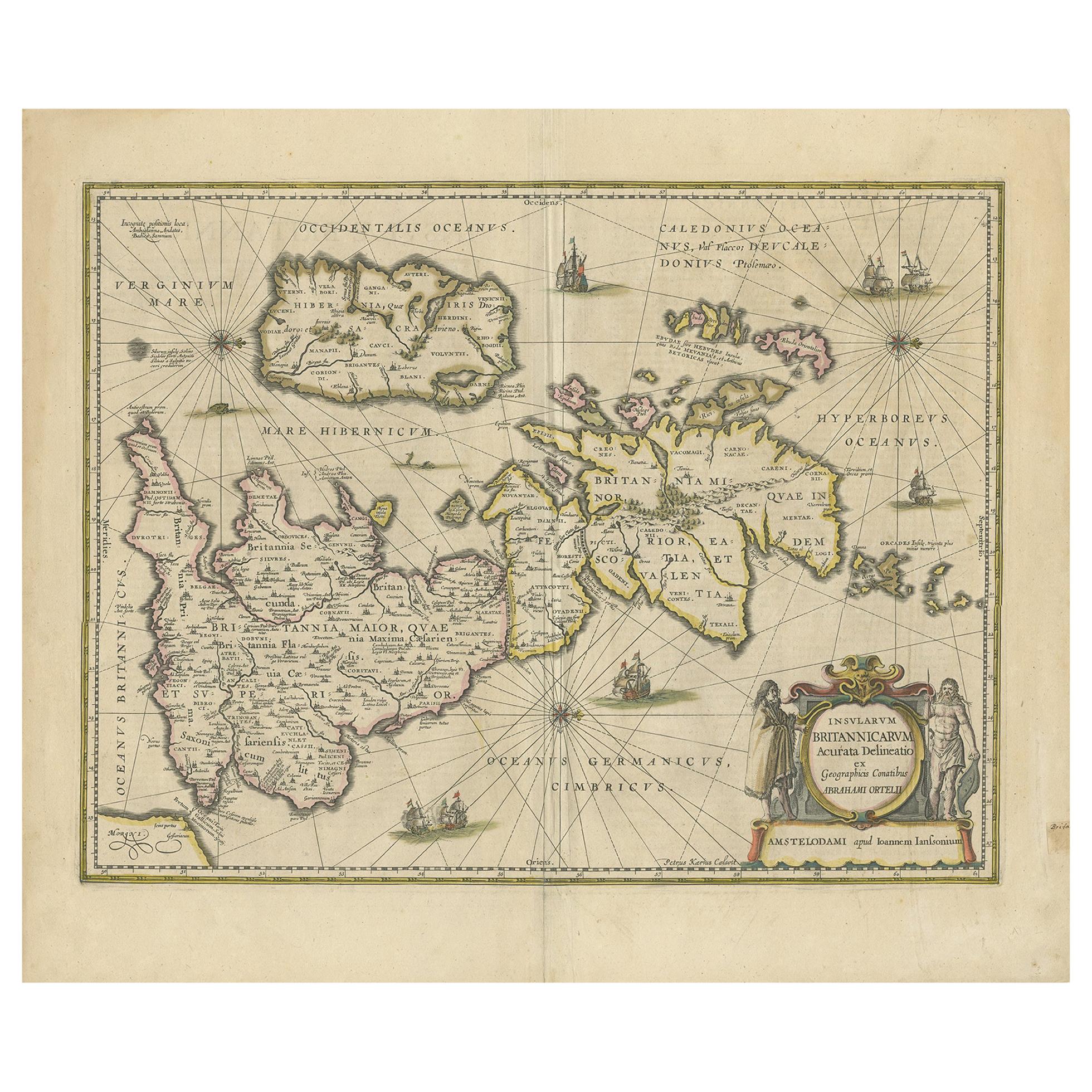
Antique Map of the Ancient British Isles by Janssonius, circa 1640
Located in Langweer, NL
Antique map titled 'Insularum Britannicarum Acurata Delineatio'. Original antique map of the ancient British Isles. England and Wales are labelled as B...
Category
Antique Mid-17th Century Dutch Maps
Materials
Paper

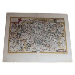
1584 Ortelius Map of Switzerland: A Cartographic Reversal
Located in Langweer, NL
This is a fine example of Ortelius' map of Switzerland from his *Theatrum Orbis Terrarum*, recognized as the first modern atlas of the world. The map is oriented with south at the top, which reverses the typical north-up orientation seen in most modern maps. It highlights significant geographical features such as Lake Geneva (Lemanus Lacus) to the right of the map and the Rhine river entering Switzerland near the center.
The *Theatrum Orbis Terrarum*, first published in 1570 by Abraham Ortelius in Antwerp, was groundbreaking as it compiled uniform maps with supporting text in a single volume, marking a departure from earlier collections of maps that were custom-assembled on demand. This atlas included a wealth of sixteenth-century cartographic knowledge, reflecting the extensive global explorations occurring after the discovery of America...
Category
Antique 16th Century Maps
Materials
Paper
$910 Sale Price
30% Off
You May Also Like
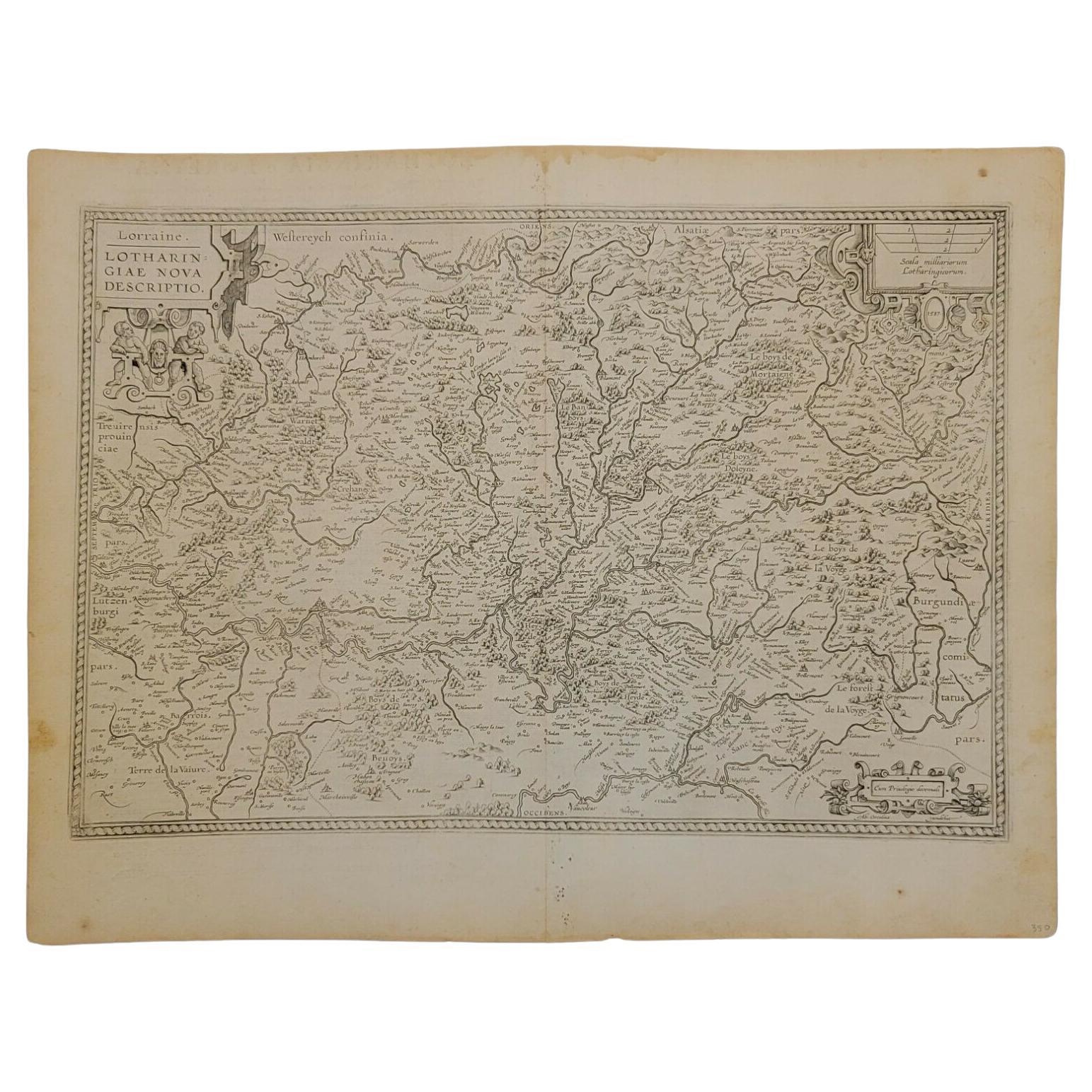
1592 Abraham Ortelius Map "Lorraine: Lotharingiae Nova Descripti, Ric.A005
Located in Norton, MA
1592 Abraham Ortelius map entitled
"Lorraine: Lotharingiae Nova Descripti
Ric.a005
Description: Ortelius is best known for producing the atlas from which this map comes from, "...
Category
Antique 16th Century Dutch Maps
Materials
Paper

1612 Abraham Ortelius, Entitled "Lorraine, Lotharingiae, Nova Desciptio, " Ric008
Located in Norton, MA
1612 Abraham Ortelius, entitled
"Lorraine, Lotharingiae, Nova Desciptio,"
Hand Colored
Description:
Artists and Engravers: Ortelius is the best known for producing the atla...
Category
Antique 17th Century Dutch Maps
Materials
Paper
Northern Italy: A 16th Century Hand-colored Map by Abraham Ortelius
By Abraham Ortelius
Located in Alamo, CA
This is a framed 16th century hand-colored copperplate map of northern Italy entitled "Veronae Urbis Territorium a Bernardo Bragnolo Descriptium" by Abraham Ortelius from his atlas "Theatrum Orbis Terrarum", which was the first modern atlas of the world, with the first volume published in 1570. This map was part of a subsequent volume, published in Antwerp in 1584. It was based on an earlier map by Bernardo Brognoli.
This beautiful map of northern Italy is focussed on Verona and its environs, including Mantua. Lake Garda and the South Tyrol mountains are prominently depicted. There is a very large striking cartouche in the upper left and a decorative distance scale in the lower right.
This striking hand-colored map of northern Italy is presented in a gold-colored wood frame and an olive green-colored mat. It is glazed with UV conservation glass. All mounting materials used are archival. The frame measures 21.5" high by 28" wide by 0.75" deep. There is a central vertical fold, as issued, with slight separation of the lower portion of the fold. There are faint spots in the upper and right margins, but the map is otherwise in very good condition.
Abraham Ortelius (also known as Ortels, Orthellius, and Wortels) (1527-1598) was a Dutch cartographer, geographer, and cosmographer. He began his career as a map colorist. In 1547 he entered the Antwerp guild of St Luke as an "illuminator of maps". He had an affinity for business from an early age and most of his journeys before 1560, were for business. He was a dealer in antiques, coins, maps, and books.
His business income allowed him to acquire an extensive collection of medals, coins, and antiques, as well as a large library of books...
Category
16th Century Old Masters Landscape Prints
Materials
Engraving

1590 Ortelius Map of Calais and Vermandois, France and Vicinity Ric.a014
Located in Norton, MA
1590 Ortelius map of
Calais and Vermandois, France and Vicinity
Ric.a014
Two rare regional Abraham Ortelius maps on a single folio sheet. Left map, entitled Caletensium, depic...
Category
Antique 16th Century Dutch Maps
Materials
Paper

1597 Abraham Ortelius Map Burgundy, France Entitled "Bvrgvndiae dvcatvs Ric.a010
Located in Norton, MA
1597 Abraham Ortelius map of Burgundy, France entitled
"Bvrgvndiae dvcatvs
Ric.a010
Description: Ortelius is best known for producing the atla...
Category
Antique 16th Century Dutch Maps
Materials
Paper

One of the most influential maps of America ever made, 17th Century Willem Blaeu
By Willem Blaeu
Located in ZWIJNDRECHT, NL
A rare and important 17th Century Italian Engraving of Willem Blaeu's Great Wall Map of America, "America quarta pars orbis quam plerunq, nuvum orbem apellitant primo detecta est ann...
Category
Antique 17th Century Dutch Dutch Colonial Maps
Materials
Paper, Linen
$88,732
Free Shipping
More Ways To Browse
Marco Polo
Antique Furniture California
Collectible Artifacts
Goblets
Mid Century Modern Yellow Chair
Paulin Pierre
Used Pianos Pianos
18th Century Engravings
Antique Carved Wood Chair
Black Scandinavian Modern Dining Chairs
Dutch Mid Century Modern Table
Gold Modern Coffee Table
Iconic Modern Furniture
Japanese Metal
Midcentury Modern Gray Glass Vase
Round Glass Coffee Tables
Vintage Cave
18th Century Wood Side Tables