Items Similar to 1720 Weigel Engraving of Jerusalem: A Biblical View from Josephus' Perspective

Want more images or videos?
Request additional images or videos from the seller
1 of 6
1720 Weigel Engraving of Jerusalem: A Biblical View from Josephus' Perspective
$415.03
£308.40
€350
CA$574.42
A$639.66
CHF 333.98
MX$7,750.68
NOK 4,211.86
SEK 3,974.23
DKK 2,664.96
About the Item
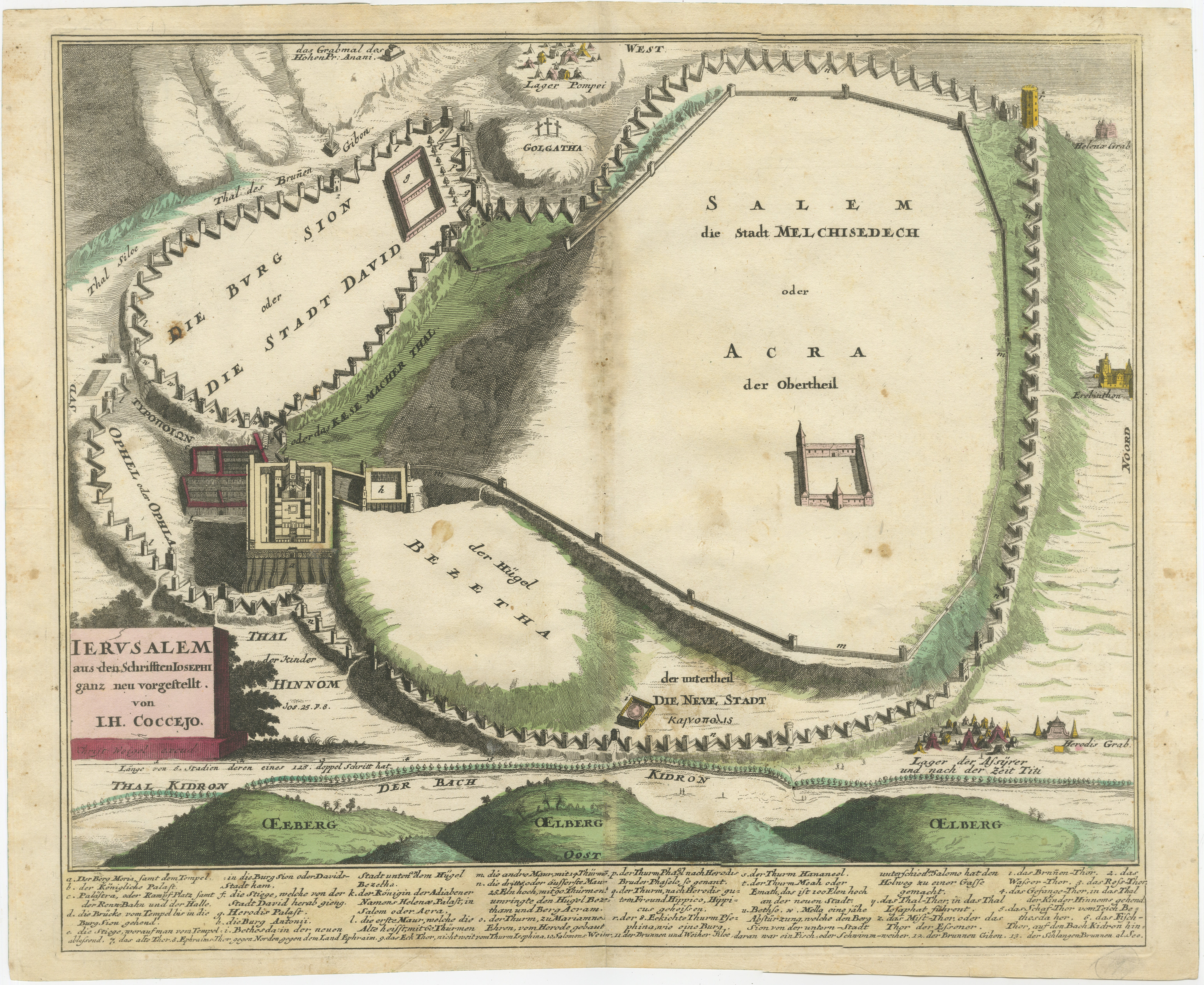
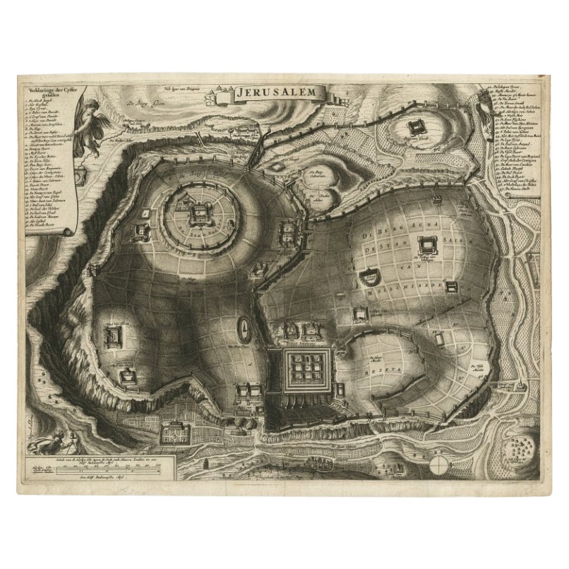
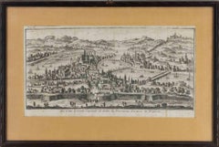
1720 Weigel Map of Jerusalem Based on Josephus' Writings
This intricate 1720 bird's-eye view map of ancient Jerusalem by I.H. Coccejo, engraved by Christoph Weigel, offers a fascinating glimpse into the sacred city's historical and biblical significance. The map is based on the accounts of Josephus, the renowned 1st-century Romano-Jewish historian, and vividly represents key sites and monuments of the ancient world.
Central to the map are the cities of Melchizedek and David, surrounded by prominent landmarks such as the hills of Betheza and Golgotha, the Mount of Olives, and Herod's tomb. The outskirts feature sites of great historical importance, including the encampments of the Assyrians and Pompeii. The attention to detail is further enhanced by letter and number keys in the legend, identifying major sites and adding context to this richly illustrated piece.
The map’s use of original hand-coloring brings its intricate details to life, distinguishing the city’s divisions and natural features. With a perspective that combines topographical precision and artistic flair, this map offers collectors an engaging depiction of Jerusalem, serving as both a historical document and a work of art.
Published in Nuremberg in 1720, the map is a rare and valuable artifact for collectors of Judaica, biblical cartography, or 18th-century engravings. Its historical connections to Josephus and Jerusalem's ancient past make it a standout piece for any collection.
Condition Report:
Original hand-coloring; overall minor age toning with minor spotting. Margins and engraving are well-preserved, with no significant damage affecting the visual appeal.
Framing and Matting Tips:
Use an archival-quality mat in a soft cream or light gray tone to enhance the map’s historical aesthetic. Pair it with a dark wooden or antique-style gold frame for an elegant display. UV-protective glass is recommended to preserve the delicate hand-coloring and prevent fading. Adding a descriptive plaque or label can further emphasize its historical context.
- Dimensions:Height: 13.86 in (35.2 cm)Width: 17.13 in (43.5 cm)Depth: 0.01 in (0.2 mm)
- Materials and Techniques:Paper,Engraved
- Period:1720-1729
- Date of Manufacture:circa 1720
- Condition:Original hand-coloring; overall age toning with minor spotting. Margins and engraving are well-preserved, with no significant damage affecting the visual appeal. Study the images carefully.
- Seller Location:Langweer, NL
- Reference Number:Seller: BG-14040-41stDibs: LU3054343437542
About the Seller
5.0
Recognized Seller
These prestigious sellers are industry leaders and represent the highest echelon for item quality and design.
Platinum Seller
Premium sellers with a 4.7+ rating and 24-hour response times
Established in 2009
1stDibs seller since 2017
2,589 sales on 1stDibs
Typical response time: <1 hour
- ShippingRetrieving quote...Shipping from: Langweer, Netherlands
- Return Policy
Authenticity Guarantee
In the unlikely event there’s an issue with an item’s authenticity, contact us within 1 year for a full refund. DetailsMoney-Back Guarantee
If your item is not as described, is damaged in transit, or does not arrive, contact us within 7 days for a full refund. Details24-Hour Cancellation
You have a 24-hour grace period in which to reconsider your purchase, with no questions asked.Vetted Professional Sellers
Our world-class sellers must adhere to strict standards for service and quality, maintaining the integrity of our listings.Price-Match Guarantee
If you find that a seller listed the same item for a lower price elsewhere, we’ll match it.Trusted Global Delivery
Our best-in-class carrier network provides specialized shipping options worldwide, including custom delivery.More From This Seller
View AllOriginal Antique Map of Jerusalem Based on Josephus' Writings by Weigel, ca.1720
Located in Langweer, NL
1720 Weigel Map of Jerusalem Based on Josephus' Writings
This intricate 1720 bird's-eye view map of ancient Jerusalem by I.H. Coccejo, engraved by Christoph Weigel, offers a fasc...
Category
Antique 1720s Maps
Materials
Paper

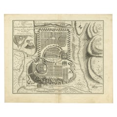
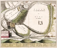
Spectacular Antique Original Engraving of a Town Plan of Jerusalem, 1708
Located in Langweer, NL
Description: Antique map titled 'Erster Abriss der Stadt Jerusalem wie sie Furnemblich zur Zeit des Hernn Christi beschaffen (..).'
Spectacular town plan...
Category
Antique Early 1700s Maps
Materials
Paper

$1,282 Sale Price
20% Off
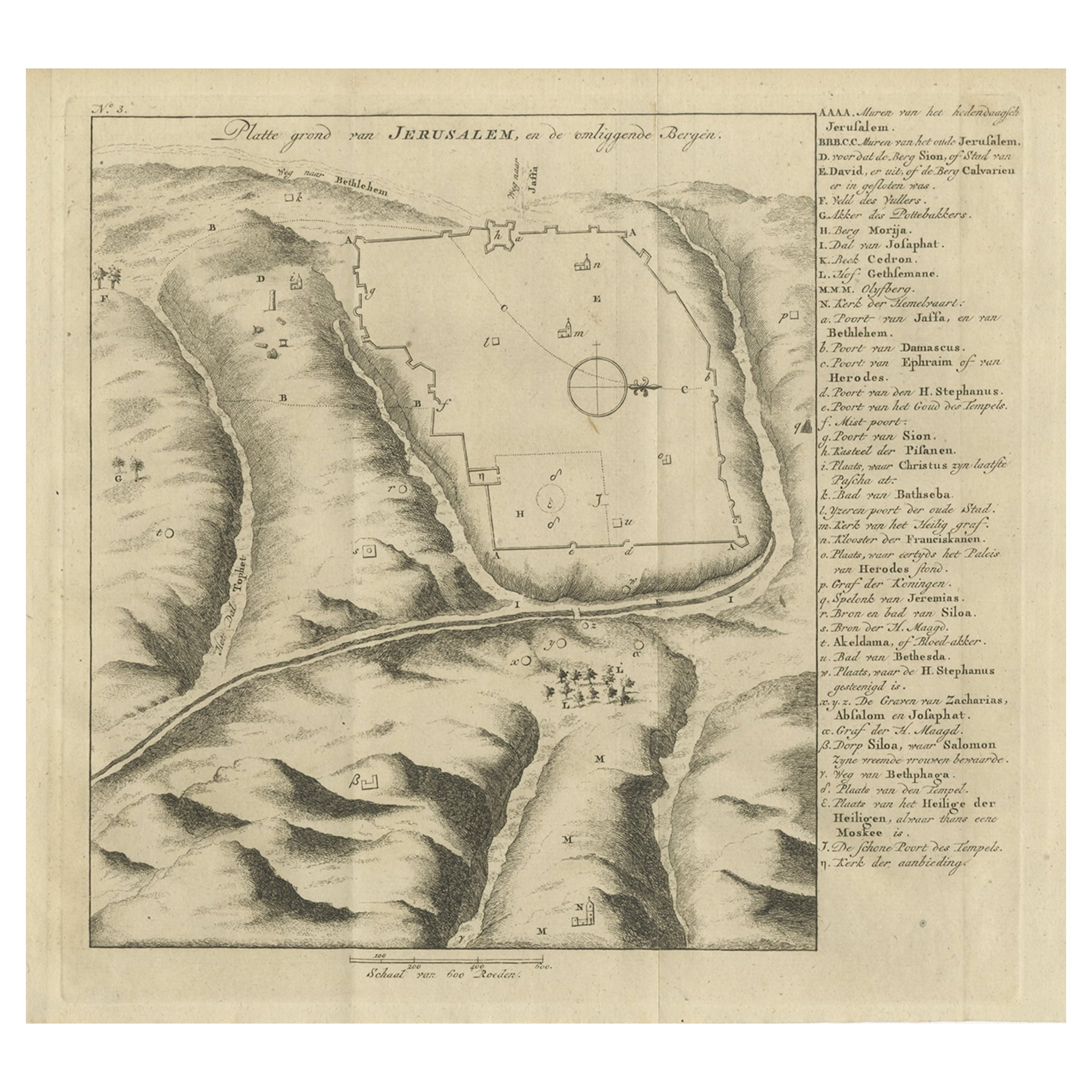
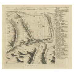
Antique Engraving of a Map or Plan of Jerusalem and Surrounding Mountains, 1773
Located in Langweer, NL
Antique map titled 'Platte grond van Jerusalem, en de omliggende Bergen'. Plan of the city of Jerusalem, with surrounding mountains. Originates from the first Dutch editon of an inte...
Category
Antique 18th Century Maps
Materials
Paper
$256 Sale Price
20% Off
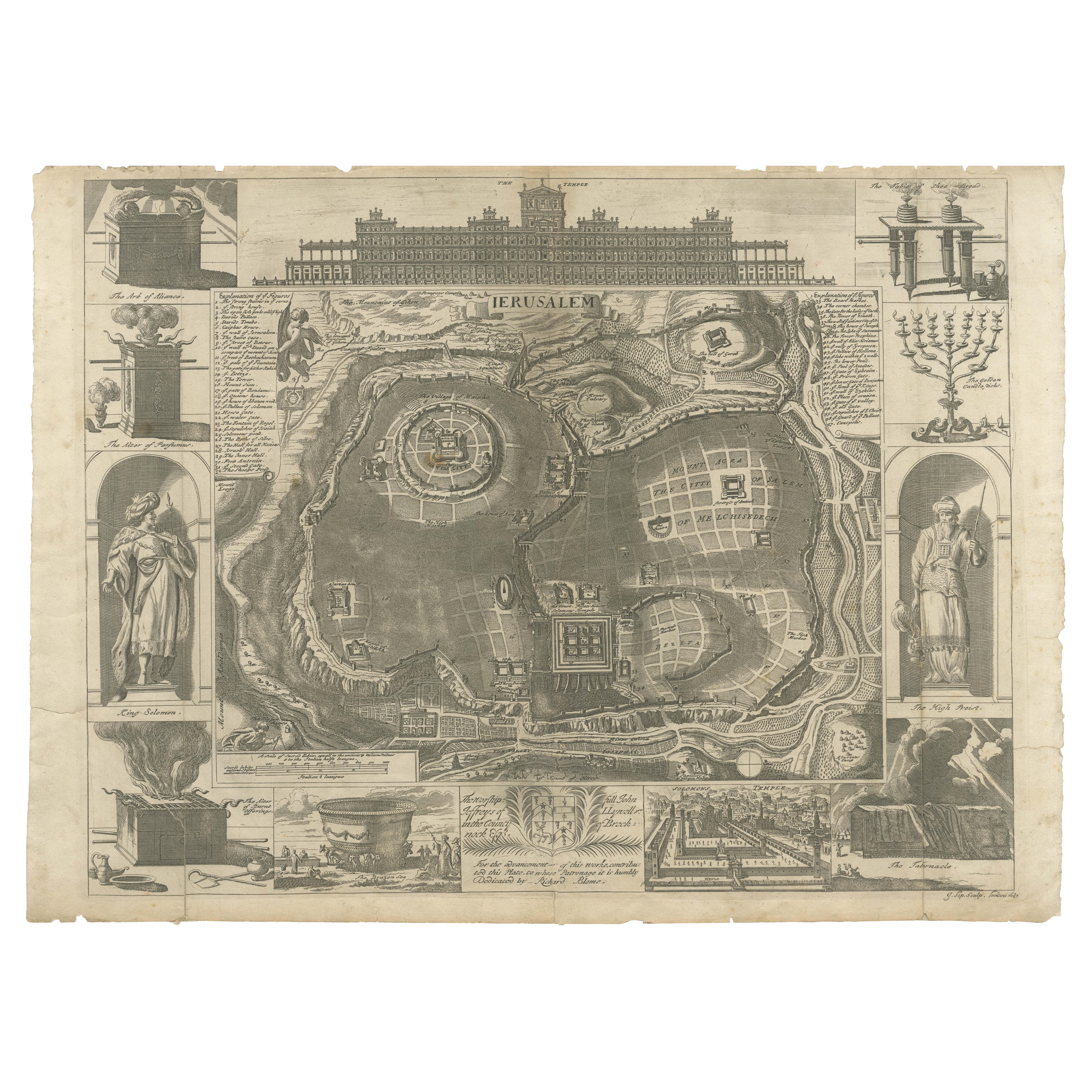
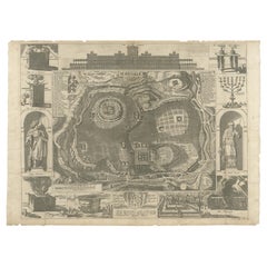
Jerusalem and Temple Imaginary Map by Blome, Published London 1689
Located in Langweer, NL
Imaginary Plan of Jerusalem by Blome after Villalpando, 1689
This impressive antique engraving presents an imaginary plan of Jerusalem by Richard Blome, published in 1689. The engra...
Category
Antique Late 17th Century English Maps
Materials
Paper
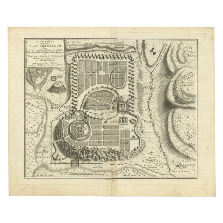
Bird's-Eye Plan of Jerusalem in Israël, a Rare Original Engraving, 1750
Located in Langweer, NL
Antique map titled 'De VIIde Landkaart Verbeeldende de Stad Jerusalem Beneven de daar Omgelegen Bergen en Dalen (..).'
Bird's-eye plan of Jerusalem in Israel. This map shows the mo...
Category
Antique 18th Century Maps
Materials
Paper
$712 Sale Price
20% Off
Antique Detailed Map of Jerusalem in Israël with Extensive Key and Scale, 1698
Located in Langweer, NL
Antique map titled 'Jerusalem.'
Plan of the ancient city of Jerusalem. With extensive key and scale. Source unknown, to be determined.
Artists and Engravers: Made by 'Cornelis de...
Category
Antique 17th Century Maps
Materials
Paper

$617 Sale Price
20% Off
You May Also Like
18th Century French Map and City View of Joppe/Jaffa (Tel Aviv) by Sanson
By Nicholas Sanson d'Abbeville
Located in Alamo, CA
An original antique engraving entitled "Joppe; in ’t Hebreeusch by ouds Japho; hedendaags Japha, of Jaffa; volgens d’aftekening gedaan 1668", by Nicholas Sanson d'Abbeville (1600 - 1667). This is a view of the city of Joppe (in Hebrew Japho), now called Japha or Jaffa, the harbor portion of modern day Tel Aviv, Israel as it appeared in 1668 . It depicts a very busy harbor with numerous boats. A large ship on the left appears to be firing its canons and a small ship on the right appears to be sitting very low in the water, either heavily loaded with cargo or sinking. The town is seen on the far shore with a fortress on a hill across in the background. The map is printed from the original Sanson copperplate and was published in 1709 by his descendants.
The map is presented in an ornate brown wood frame embellished by gold-colored leaves and gold inner trim with a double mat; the outer mat is cream-colored and the inner mat is black. There is a central vertical fold, as issued. There are two small spots in the lower margin and one in the upper margin, as well as two tiny spots adjacent to the central fold. 1717 is written below the date 1668 in the inscription. The map is otherwise in very good condition.
Another map of the "Holy Land" (by Claes Visscher in 1663), with an identical style frame and mat is available. This pair of maps would make a wonderful display grouping. Please see Reference #LU117324709892.
Artist: Nicholas Sanson d'Abbeville (1600 - 1667) and his descendents were important French cartographer's active through the 17th century. Sanson started his career as a historian and initially utilized cartography to illustrate his historical treatises. His maps came to the attention of Cardinal Richelieu and then King Louis XIII of France, who became a supporter and sponsor. He subsequently appointed Sanson 'Geographe Ordinaire du Roi' the official map maker to the king. Sanson not only created maps for the king, but advised him on geographical issues and curated his map collection...
Category
Early 1700s Prints and Multiples
Materials
Engraving

Ancient View of Lyon - Etching - 1748
Located in Roma, IT
Etching on paper realized in 1748.
Very good condition except for some minor foxing.
Includes a wooden frame cm. 27.5x41.5
Category
1740s Modern Figurative Prints
Materials
Etching
Map of Biblical Jerusalem
Located in New York, NY
Original copper engraving hand-colored at the time of publication. Nuremberg, 1720.
Category
1720s Prints and Multiples
Materials
Paper
17th-18th Century Siege of Graves Mapping Engraving By Willian III
Located in Kingston, NY
RARE French 17th-18th Century Enhanced Siege of Graves Mapping Engraving BY William III, also widely known as William of Orange,
The Siege of Grave in Dutch Brabant started by Monsie...
Category
Antique 17th Century French Prints
Materials
Paper

17th Century Topographical Map of Cote D'azur, Avignon, Frejus by Iohan Peeters
Located in New York, NY
Fine topographical 17th century map by Iohan Peeters of the towns of Avignon and Frejus in the Cote d'Azur-Provence-Alpes Region of Southeastern France.
Beautifully suited decorativ...
Category
Antique 17th Century Dutch Maps
Materials
Paper

Moscow /Moscovia Antique Map, Civitates Orbis Terrarum by Braun and Hogenberg
By Franz Hogenberg
Located in Roma, IT
Hand colored Etching from Civitates Orbis Terrarum. One of the first printed views of Moscow, and the first of Braun and Hogenberg,The table shows ...
Category
17th Century Landscape Prints
Materials
Watercolor, Etching
More Ways To Browse
Jerusalem Furniture
Mount Of Olives
Antique Ancient Key
Carlo Scarpa 1934 Chairs
Christofle Marly
1900 Antique Chairs
Glass Table Italian Round
Alvar Aalto Poster
Geometric Metal Table
Post Modern High Chairs
Vintage Vine Rug
Cancel An Order
Antique Framing Square
Silver Metal Chair
Swedish Kilim
Vintage Scandanavian Chairs
Vintage Tropical Furniture
19th Century Red Glass