Items Similar to 1763 Batavia: A Detailed Bird's-Eye View of Jakarta in the Dutch Colonial Era
Want more images or videos?
Request additional images or videos from the seller
1 of 6
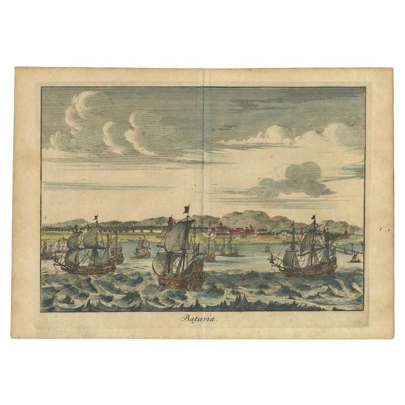
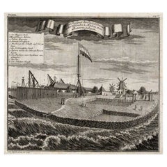
1763 Batavia: A Detailed Bird's-Eye View of Jakarta in the Dutch Colonial Era
About the Item
This is a bird's-eye view plan of Batavia, the historical name for Jakarta, Indonesia, dating back to 1763.
The map was crafted by J van der Schley / P de Hondt and is a fine example of cartographic detail and artistry from the 18th century. It depicts the city's layout and fortifications with precision, offering insight into the urban design and colonial fortifications of the time. The map is hand-colored and showcases the geographical features and man-made structures with clear demarcations. The streets, buildings, and city walls are illustrated from an elevated perspective, providing a comprehensive overview of Batavia as it existed in the mid-1700s, during the period when it was a bustling hub under Dutch colonial rule.
- Dimensions:Height: 11.03 in (28 cm)Width: 13 in (33 cm)Depth: 0 in (0.02 mm)
- Materials and Techniques:Paper,Engraved
- Period:1760-1769
- Date of Manufacture:1763
- Condition:Good condition. Minor wear and light fading due to age and handling, but mostly out of the plate-mark. One vertical flattened folding line.
- Seller Location:Langweer, NL
- Reference Number:Seller: BG-13484-91stDibs: LU3054337747772
About the Seller
5.0
Platinum Seller
These expertly vetted sellers are 1stDibs' most experienced sellers and are rated highest by our customers.
Established in 2009
1stDibs seller since 2017
1,947 sales on 1stDibs
Typical response time: <1 hour
- ShippingRetrieving quote...Ships From: Langweer, Netherlands
- Return PolicyA return for this item may be initiated within 14 days of delivery.
More From This SellerView All
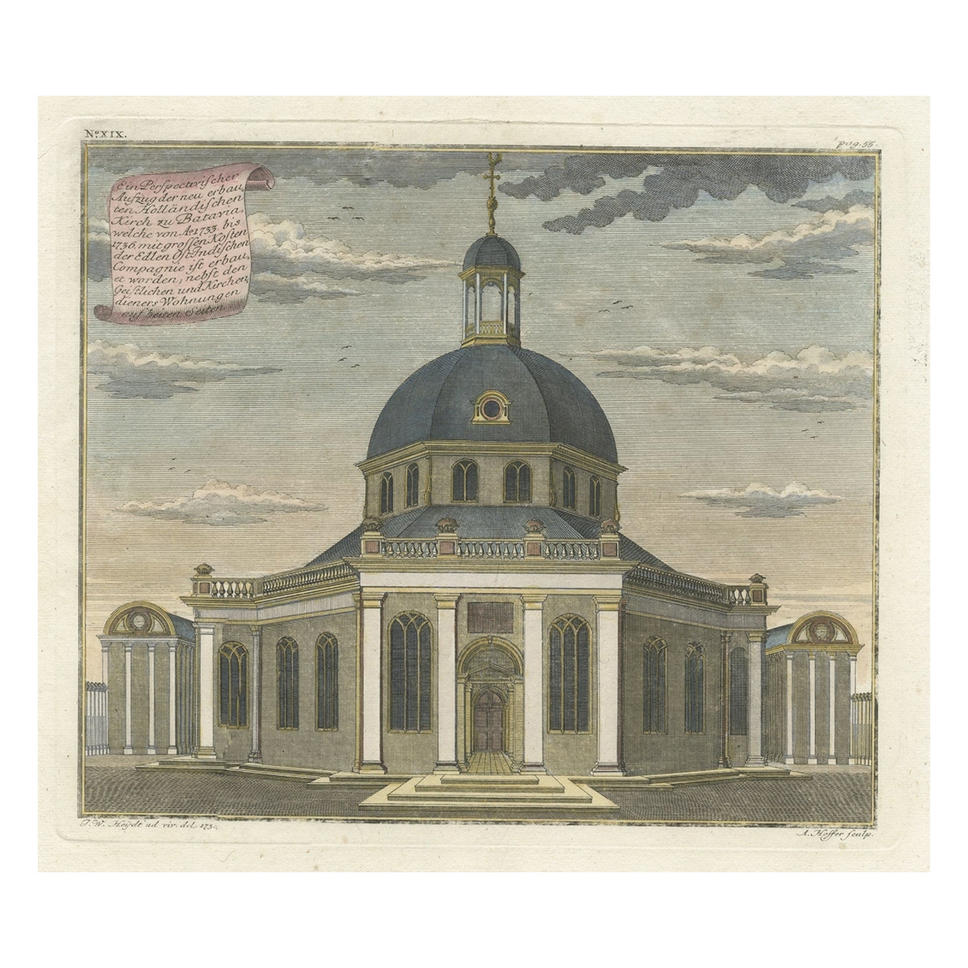
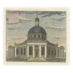
- Old Print with a View of the Dutch Church in Batavia 'Jakarta, Indonesia', 1738Located in Langweer, NLAntique print titled 'Ein Perspectivischer Aufzug der neu erbauten Holländischen Kirch zu Batavia, welche von Ao. 1733. bis 1736. mit grossen Kosten der Ed;en Ost-Indischen Compagnie...Category
Antique 1730s Maps
MaterialsPaper
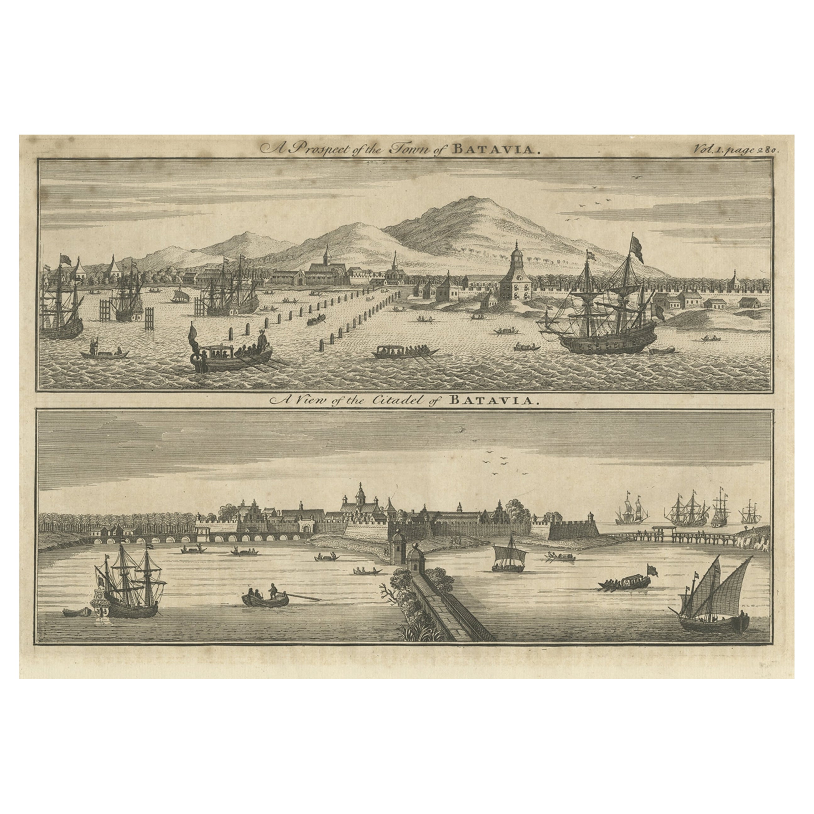
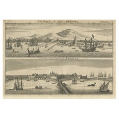
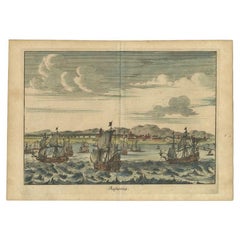
- Antique Print of Batavia 'Jakarta', in the Dutch East Indies, 1744Located in Langweer, NLTwo views on one plate titled 'A Prospect of The Town of Batavia (and) A View of the Citadel of Batavia'. Beautiful views of Batavia (Jakarta), Indonesia. The upper view shows the ci...Category
Antique 18th Century Prints
MaterialsPaper
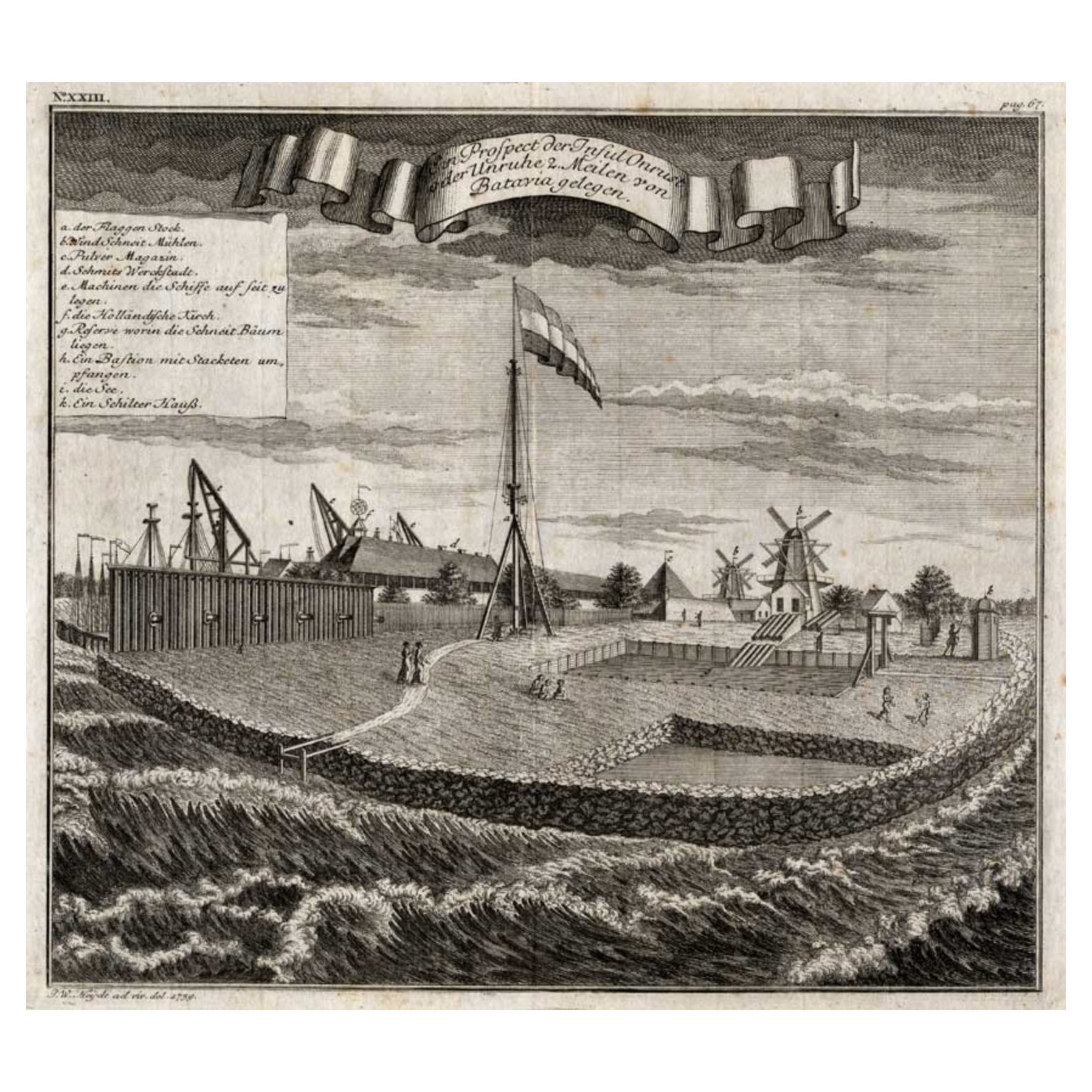
- View of the Island Onrust Near Batavia 'Jakarta', Indonesia, 1739Located in Langweer, NLAntique print titled 'Ein Prospect der Insul Onrust oder Unruhe 2 Meilen von Batavia gelegen.' (View of the island ' Onrust' near Batavia.) Onrust Island also known as Pulau Onrust or Pulau Kapal (ship island) is an Indonesian island off the coast of Jakarta. It measures about 3.5 km2 (1.4 sq mi) and is part of the Thousand Islands. The town on the island had houses and warehouses, but it also had a gunpowder magazine, a storage for water transported from Batavia, general warehouses, and a lot of warehouses specifically meant to store pepper. Specific to the shipyard were the reservoirs for trees. Sawing windmills processed these trees to make planks for the shipyards. There was also a smithy that served the shipyard. Near the waterfront there were special installations to easily pull ships on their side. Sometimes ships for local use were built at the island. The VOC employees were only allowed to leave the island two times a year. In 1911 Onrust Island was turned into a quarantine station for pilgrims returning from the Hajj. The island had the advantage of being completely isolated. Furthermore, it was so small that it was possible to make it malaria free by the only method known at the time. This was done by filling up all the small ponds and other fresh water instances on the island and by removing most vegetation. Later a sanatorium for lung diseases was established on the island, because of the very much improved health situation. From 1933 it was used to lock up the mutineers of the 1933 mutiny on the HNLMS De Zeven Provinciën (1909). In 1940 German nationals were interned on Onrust. In May 1940 the Netherlands were attacked by Germany. In the Dutch East Indies thousands of Germans, Hungarians, Czechs, Italians, Dutchmen with a German family name, and members of the National Socialist Movement in the Netherlands were arrested and locked up at Onrust and in Ngawai. After war with Japan broke out on 8 December 1941 a small part of these prisoners was evacuated to Suriname. The Japanese also used Onrust as a prison. On 23 January 1950 Raymond Westerling attempted the APRA coup d'état. It failed, and most of the APRA military were seized by the Dutch troops that were still on Java. The Dutch military...Category
Antique 1730s Maps
MaterialsPaper
- Antique Print of Batavia 'Jakarta' in the Dutch East Indies in Asia, 1705Located in Langweer, NLAntique print Indonesia titled 'Batavia'. Beautiful view of Batavia, Indonesia. This print originates from 'Algemeene weereld-beschryving, nae de rechte verdeeling der landschappen (...Category
Antique 18th Century Prints
MaterialsPaper
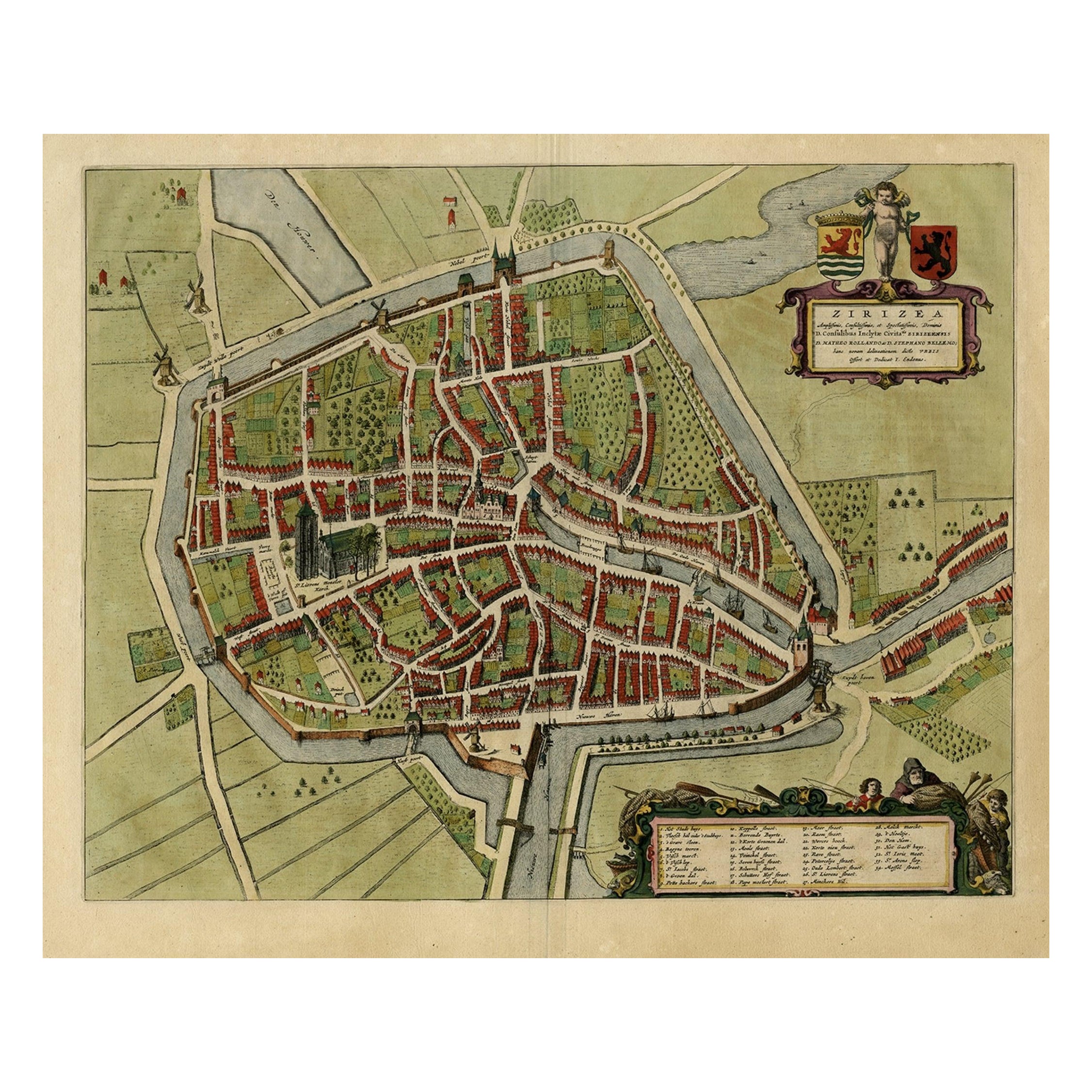
- Antique Bird's-eye View Plan of Zierikzee in Zeeland, The Netherlands, 1649Located in Langweer, NLAntique print, titled: 'Zirizea.' - A bird's-eye view plan of Zierikzee in The Netherlands, with key to locations and coats of arms. After Matheo Rollando and Stephano Bellemo. Latin tekst on verso. From the city Atlas: 'Toneel der Steeden' published by Joan Blaeu...Category
Antique 1640s Maps
MaterialsPaper
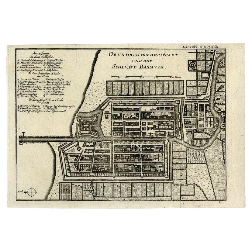
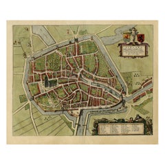
- Antique Plan of Batavia and the Castle in the Dutch East Indies, 1763Located in Langweer, NLAntique map titled 'Grundriss von der Stadt und dem Schlosse Batavia.' Plan of the city and the castle of Batavia in the Dutch East Indies / Indonesia. From 'Algemeine Welthistorie (...Category
Antique 18th Century Maps
MaterialsPaper

You May Also Like
- Golf Inspired Chess Set in White Bird's-Eye Maple by AgrestiBy AgrestiLocated in New York, NYWhite bird's-eye maple and erable. Hand-painted golf chessmen.Category
21st Century and Contemporary Italian Modern Games
MaterialsBirdseye Maple
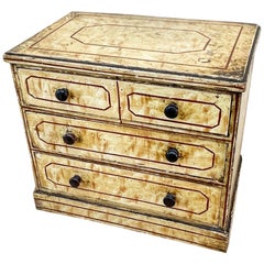
- Mid-19th Century Bird's-Eye Maple Simulated Miniature ChestLocated in Bedfordshire, GBA charming mid-19th century simulated bird's-eye Maple miniature chest of three long drawers With original turned wooden knobs raised On original plinth (There is often debate ...Category
Antique Mid-19th Century English Victorian Models and Miniatures
MaterialsBirdseye Maple
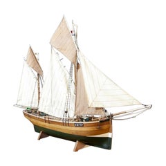
- Detailed Model of Dutch Sailing Ship From the 1930s-1940sLocated in Opole, PLDetailed Model of Dutch Sailing Ship From the 1930s-1940s A faithfully reproduced model of a vessel dating back to the Interwar Period of the 20th ...Category
Early 20th Century Dutch Models and Miniatures
MaterialsWood
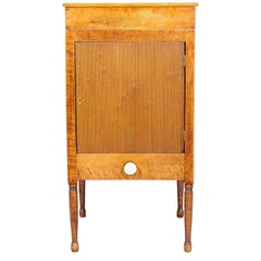
- American Bird's-Eye Maple CabinetLocated in Buchanan, MIVery clean and sculptural American bird's-eye maple cabinet finished on all four sides with bone handle, early 19th century.Category
Antique 19th Century American Night Stands
MaterialsBirdseye Maple, Bone
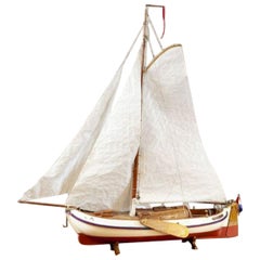
- Detailed Model of Dutch Sailing Ship Circa 1930s-1940sLocated in Opole, PLDetailed Model of Dutch Sailing Ship Circa 1930s-1940s A faithfully reproduced model of a vessel dating back to the Interwar Period of the 20th century. In particularly good condition.Category
Early 20th Century Dutch Models and Miniatures
MaterialsWood
- New Map of North America from the Latest Discoveries, 1763Located in Philadelphia, PAA fine antique 18th century map of the North American seaboard. Entitled "A New Map of North America from the Latest Discoveries 1763". By the Cartographer/Engraver - John Spil...Category
Antique Mid-18th Century English Georgian Maps
MaterialsPaper

Recently Viewed
View AllMore Ways To Browse
Map Of Lebanon
Bad Bentheim
Wenceslas Hollar
English County Maps By Blaeu
Von Meer
Minature Map
Anguilla Map
James Calvert Smith
Herefordshire Antique Map
Hertfordshire Antique Map
Antique Map Of Alabama
Australasia Antique Map
Huntingdonshire Antique Map
Moldova Antique Map
Montreal Map
Tennessee Map
Antique Furniture Perth Australia
Antique Maps Perth