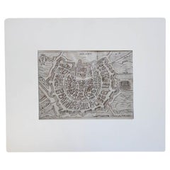
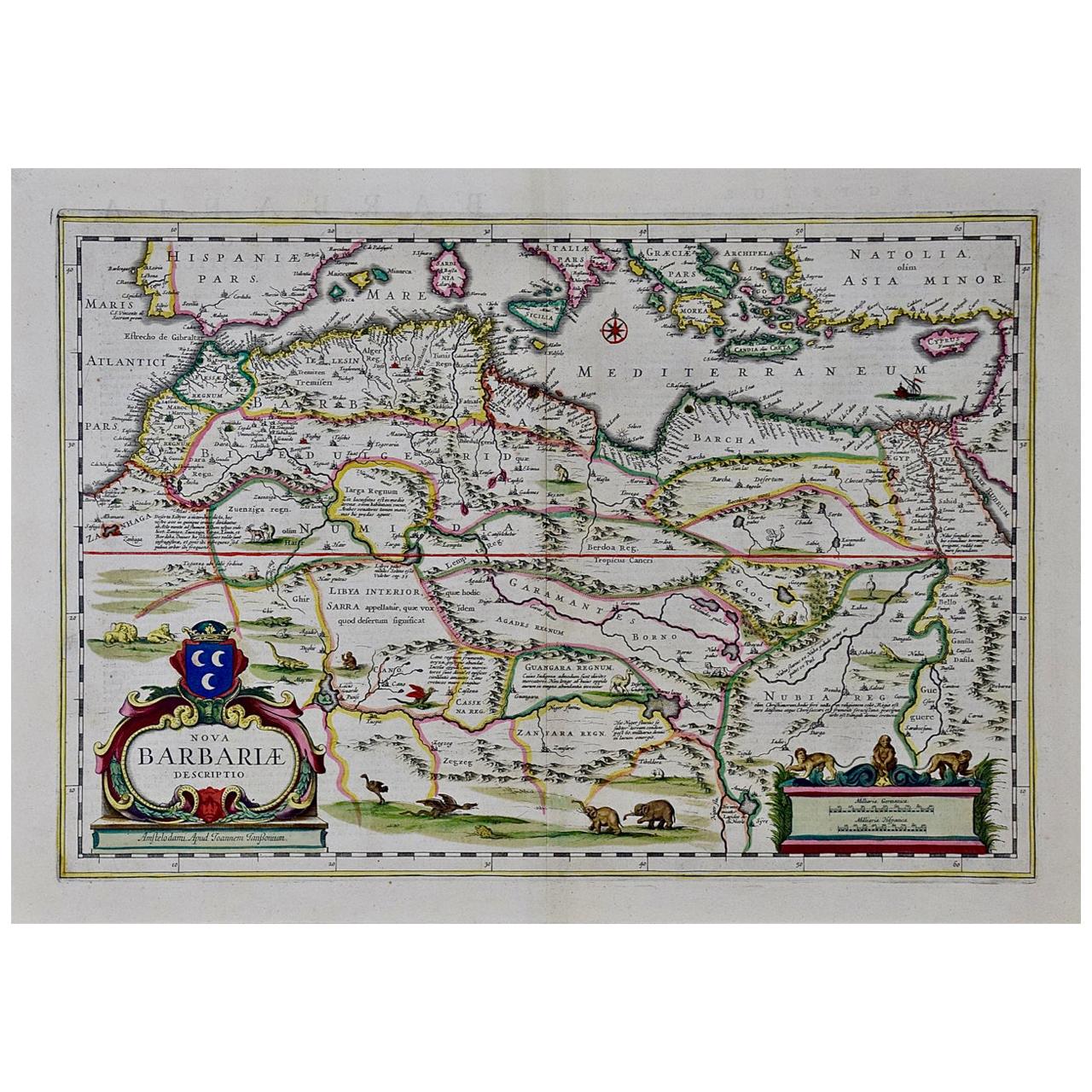
17th Century Miniature Map of Milan
View Similar Items


Want more images or videos?
Request additional images or videos from the seller
1 of 7
17th Century Miniature Map of Milan
About the Item
- Dimensions:Height: 9.85 in (25 cm)Width: 12.21 in (31 cm)Depth: 0.04 in (1 mm)
- Materials and Techniques:Parchment Paper,Etched
- Place of Origin:
- Period:1670-1679
- Date of Manufacture:circa 1670
- Condition:
- Seller Location:Roma, IT
- Reference Number:1stDibs: LU8425236534462
About the Seller
5.0
Gold Seller
These expertly vetted sellers are highly rated and consistently exceed customer expectations.
Established in 2019
1stDibs seller since 2023
24 sales on 1stDibs
Typical response time: 5 hours
More From This SellerView All
- 1880s Map of The Italian Alps from Milan to Lake GardaLocated in Roma, ITGeographical Map of the Profile and Elevation of the Italian Alps from Milano to Lake Garda. The map features the name of each peak and key cities including Monza, Brescia and Bergam...Category
Antique 1880s Italian Maps
MaterialsParchment Paper
- Pair of 17th Century Italian Travertine MantlesLocated in Roma, ITA pair of 300 year old travertine mantles salvaged from a 17th century church in Le Marche. The stone is absolutely beautiful and the pieces have aged allowing for us still to see th...Category
Antique 17th Century Italian Abstract Sculptures
MaterialsTravertine
- Italian Parchment Map of the City of Pisa Dated, 1640By Matthäus Merian the ElderLocated in Roma, ITAn antique map of the Tuscan city of Pisa engraved for The 'Itinerarium Italiæ Nov-antiquæ' by Matthäus Merian the Elder and printed in 1640....Category
Antique 1640s Italian Maps
MaterialsPaper
- Antique Italian Map of Viaggio da Roma a Napoli 1775Located in Roma, ITAn original print from 1775 showing an early route map of the journey from Rome to Naples. This route map was part of a collection of travellers routes published in a book translated...Category
Antique 1770s Italian Maps
MaterialsParchment Paper
- Set of six large blue 1950s Empoli water glassesLocated in Roma, ITA set of six hand-blown amazing Empoli water glasses in vibrant blue. They are quite large (13cm tall) making them the perfect size for water glasses. Made in Empoli in the 1950s, they were found alongside a very few remaining pieces of Empoli glassware...Category
Vintage 1950s Italian Glass
MaterialsBlown Glass
- Pair of 1960s Fontana Vetri Arte Turquoise Geometric BowlsBy Fontana ArteLocated in Roma, ITAn exceptional pair of Turquoise geometric bowls by Max Ingrand for Fontana Arte. Fontana Arte was the design house co-founded by Gio Ponti in Milan in the 1930s. These rare original...Category
Vintage 1960s Italian Glass
MaterialsGlass, Art Glass, Blown Glass


You May Also Like
- 17th Century Nicolas Visscher Map of Southeastern EuropeLocated in Hamilton, OntarioA beautiful, highly detailed map of southeastern Europe by Nicolas Visscher. Includes regions of Northern Italy (showing the cities Bologna, Padua, and Venice), Bohemia, Austria (sho...Category
Antique 17th Century Dutch Maps
MaterialsPaper
 $1,350 Sale Price38% Off
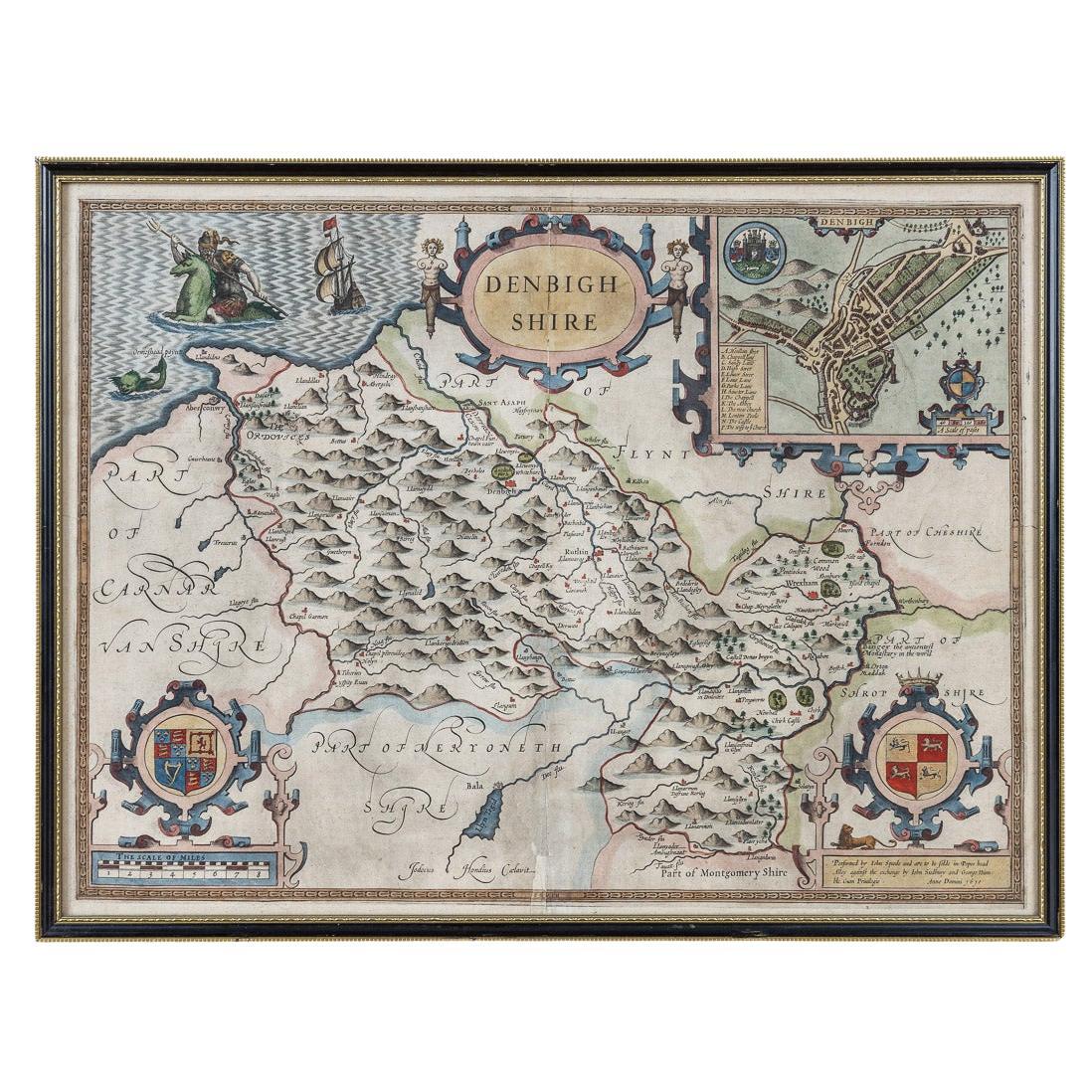
 - 17th Century John Speed Map of Denbighshire, c.1610By John SpeedLocated in Royal Tunbridge Wells, KentAntique early 17th century British very rare and original John Speed, hand coloured map of Denbighshire, dated 1610, by John Sunbury and George Humble. John...Category
Antique 17th Century British Maps
MaterialsWood, Paper
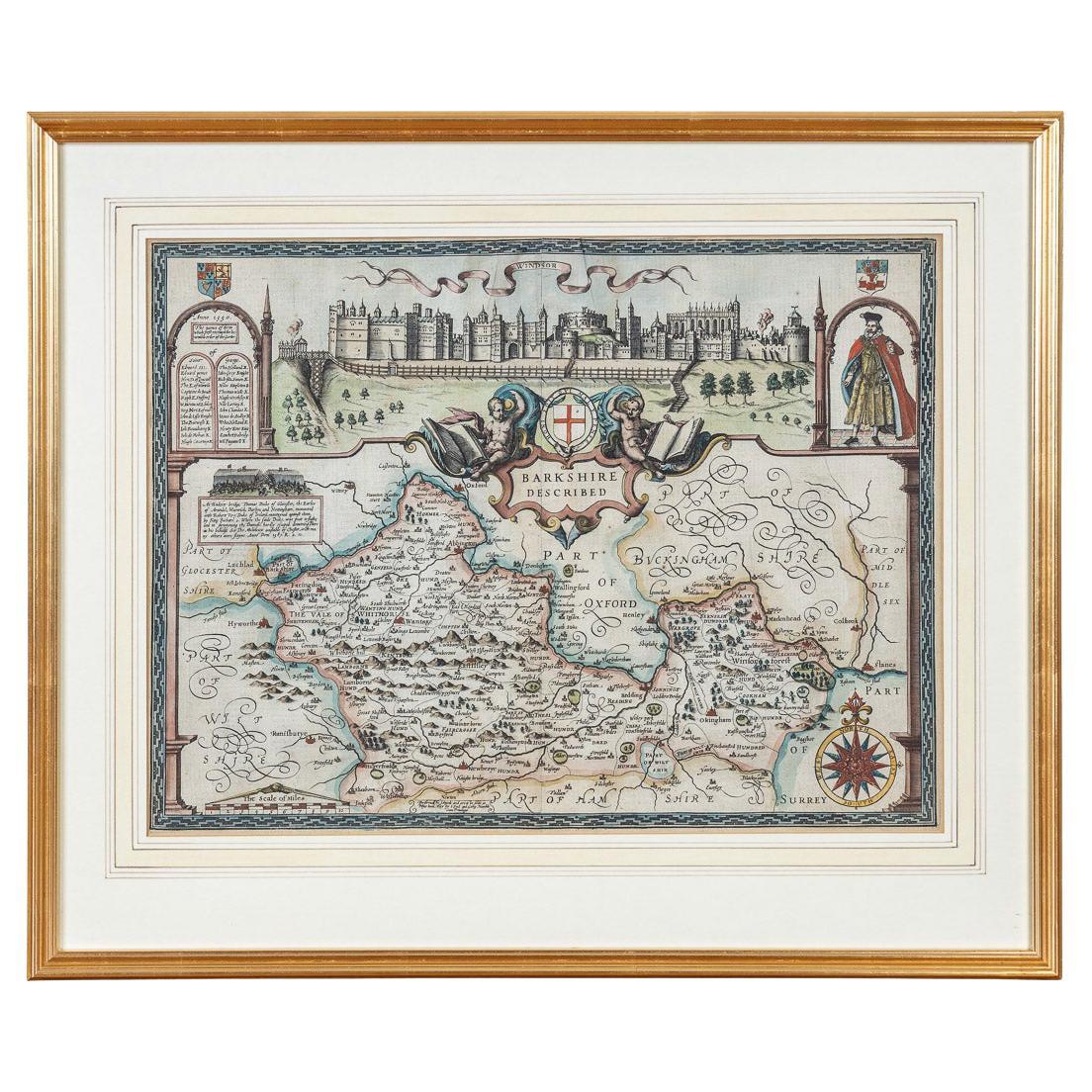
- 17th Century John Speed Map of the Barkshire Described, c.1616By John SpeedLocated in Royal Tunbridge Wells, KentAntique 17th century British very rare and original John Speed (1551-1629) map of the Barkshire Described, J. Sud and Georg Humble, publication (1616 or lat...Category
Antique 17th Century British Maps
MaterialsPaper

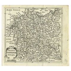
- Antique Map of Germany from a 17th Century Pocket Atlas, 1685Located in Langweer, NLAntique map titled 'Nova Totius Germaniae descriptio.' Miniature map of Germany, from the pocket atlas 'Introductionis in Universam Geographiam tam Veterem...Category
Antique 17th Century Maps
MaterialsPaper
- Vintage Reproduction 17th Century Map of Europe, American, Cartography, BlaeuwLocated in Hele, Devon, GBThis is a vintage reproduction map of Europe. An American, paper stock cartography print in frame after the work by Blaeuw, dating to the late 20t...Category
Late 20th Century Central American Mid-Century Modern Maps
MaterialsGlass, Wood, Paper
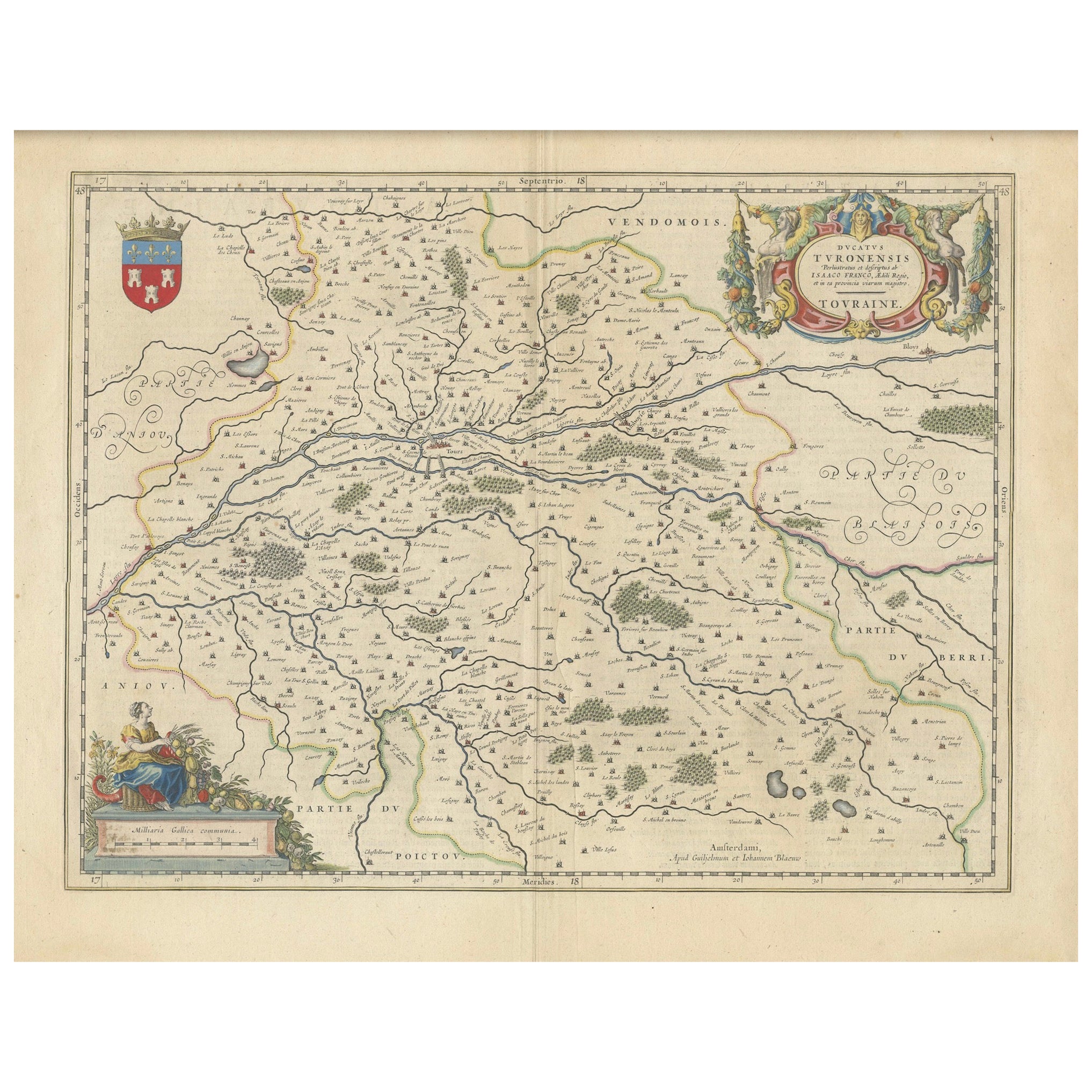
- Cartographic Elegance of Touraine: A 17th-Century Map Showing French HeritageLocated in Langweer, NL"Ducatus Turonensis - Touraine," is a original antique historical map of the Touraine region, which is located in the heart of France, centered...Category
Antique 1630s Maps
MaterialsPaper


Recently Viewed
View AllMore Ways To Browse
Tam Austria
Ethiopia Antique Map
Maps Balkans
Maps Oregon
Thomas Harley
Ottoman Empire Map
Map Of Louisiana
Ottoman Map
Victor Levasseur On Sale
Vintage Bartholomew Maps
Vintage Bartholomews Maps
Arkansas Map
Congo Antique Map
Map Of Arkansas
Papua New Guinea Antique Map
Vintage Map Holder
Antique Chinese Rob
Cannon Authentic