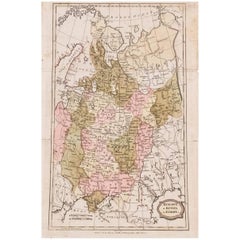
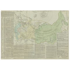
1806 Brightly and Kinnersley Map of Euro Russia
View Similar Items

1 of 3
1806 Brightly and Kinnersley Map of Euro Russia
About the Item
- Dimensions:Height: 14 in (35.56 cm)Width: 8.38 in (21.29 cm)Depth: 0.01 in (0.26 mm)
- Place of Origin:
- Period:
- Date of Manufacture:1806
- Condition:Wear consistent with age and use. There is slight toning and fold marks in one area.
- Seller Location:Pataskala, OH
- Reference Number:Seller: DM170021stDibs: LU305039057763
You May Also Like
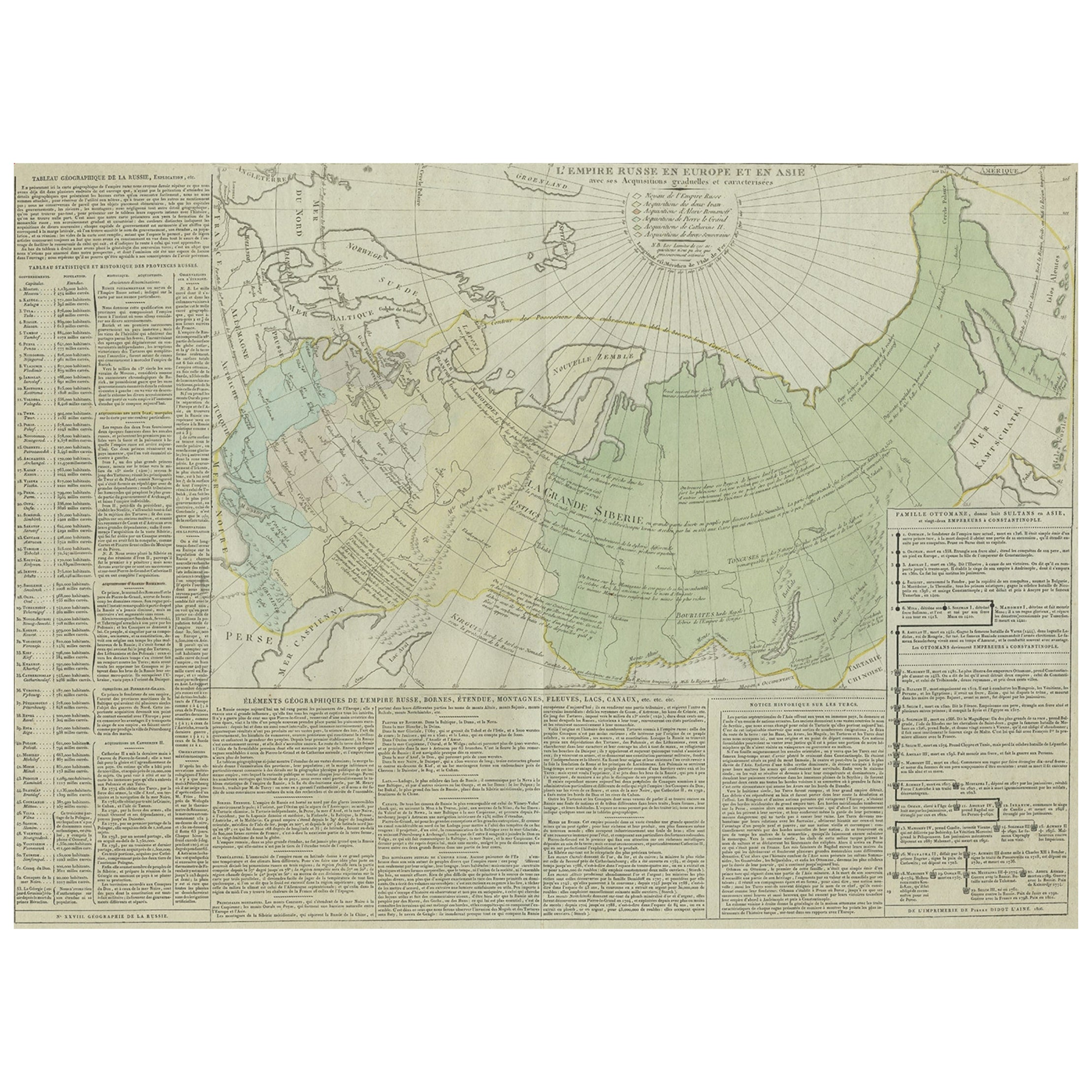
- Antique Map of the Extension of the Russian Empire in the XIXth Century, 1806Located in Langweer, NLAntique map titled 'L'Empire Russe en Europe et en Asie'. Map showing the extension of the Russian Empire at the beginning of the XIXth century. Several letterpress notations are...Category
Antique Early 1800s Maps
MaterialsPaper
 $489 Sale Price20% Off
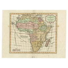
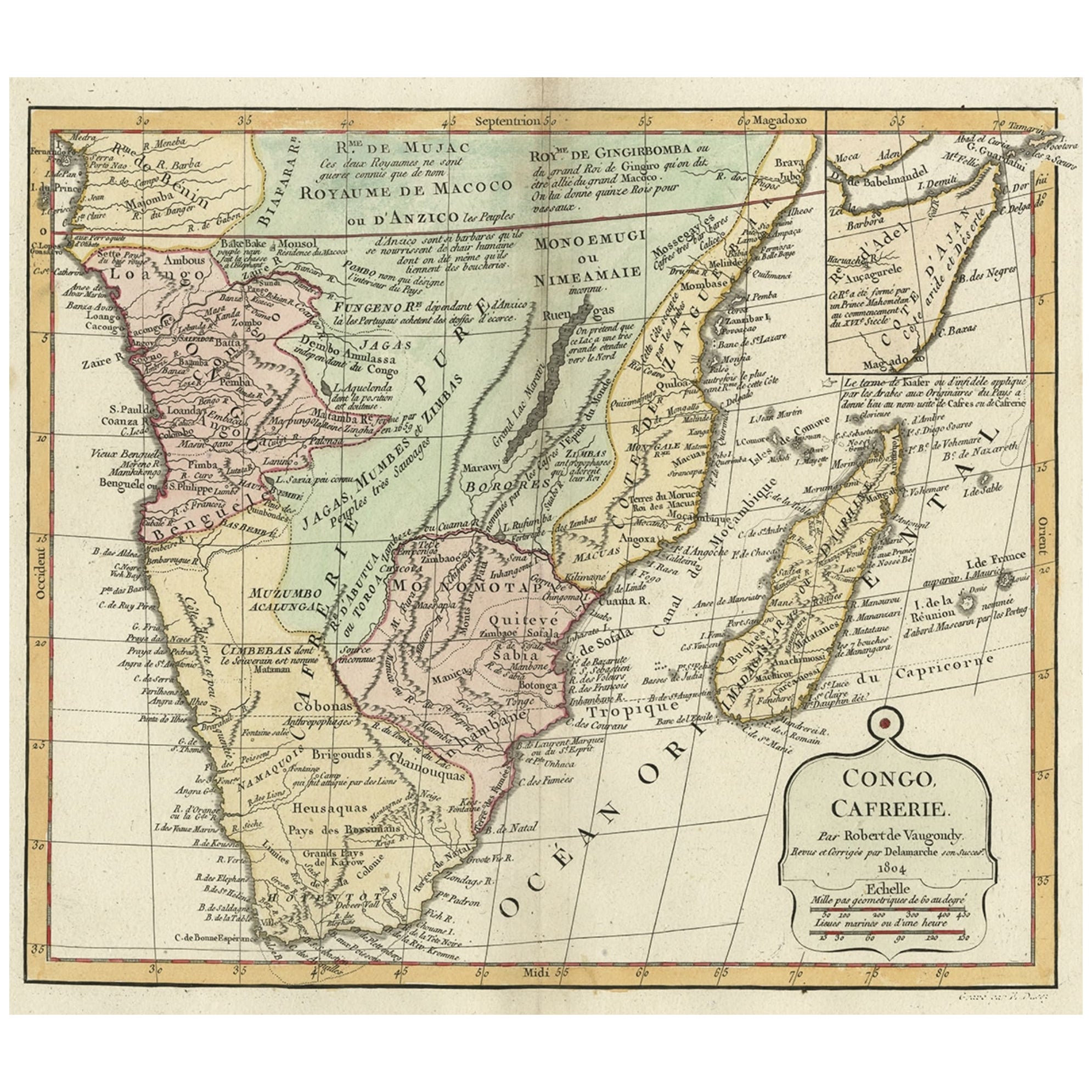
 - Antique Map of Africa by Delamarche, 1806Located in Langweer, NLAntique map titled 'L'Afrique'. Decorative map of Africa by Robert de Vaugondy, revised and published by Delamarche. Source unknown, to be determined. Artists and Engravers: Charl...Category
Antique 19th Century Maps
MaterialsPaper
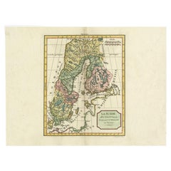
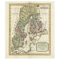
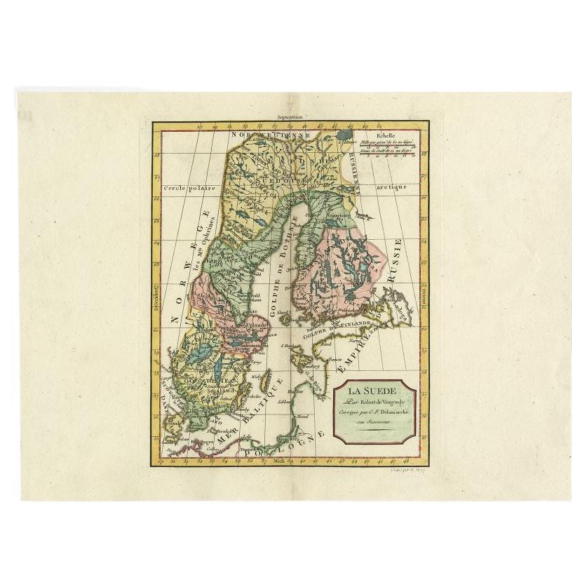
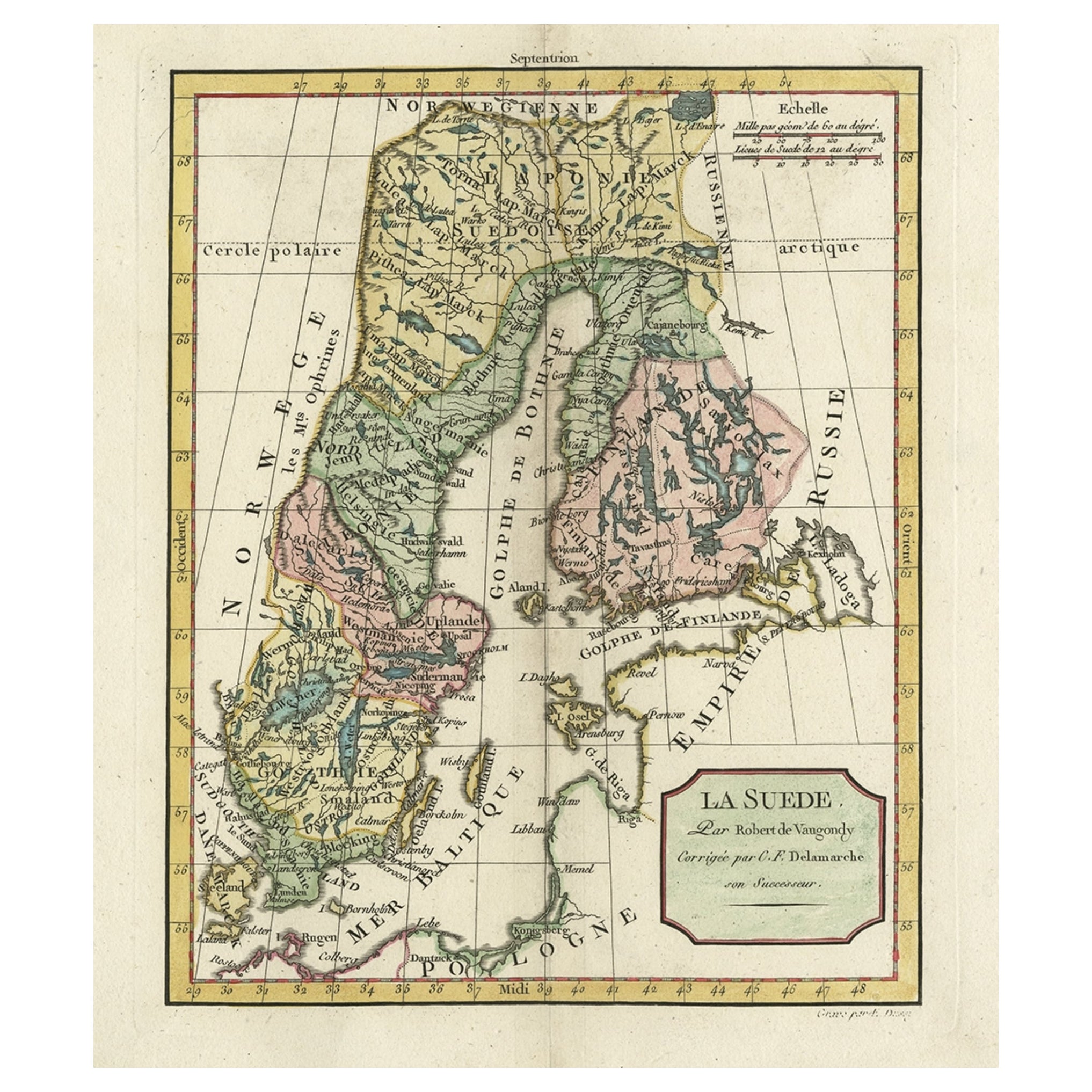
- Antique Map of Sweden by Delamarche, 1806Located in Langweer, NLAntique map titled 'La Suede.' Decorative map of Sweden and part of Finland by Robert de Vaugondy, revised and published by Delamarche. Source unknown, t...Category
Antique 19th Century Maps
MaterialsPaper
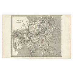
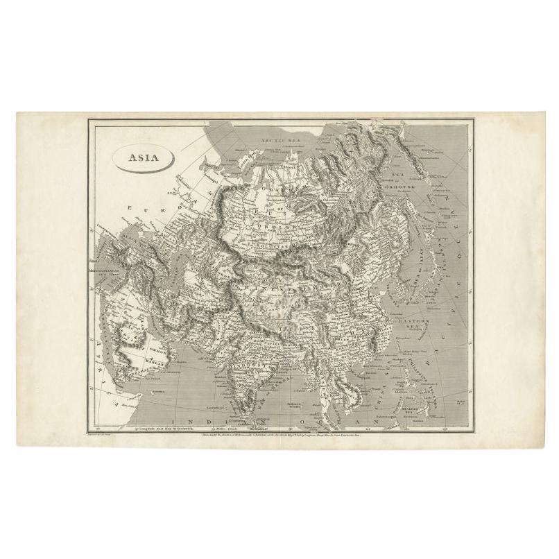
- Antique Map of Asia including Arabia, 1806Located in Langweer, NLAntique map titled 'Asia'. Original antique map of the Asian continent engraved by E. Jones. Artists and Engravers: Drawn under the direction of Mr. Arrowsmith. Published in 1806...Category
Antique 19th Century Maps
MaterialsPaper
- Decorative Antique Map of Sweden and Part of Finland, 1806Located in Langweer, NLAntique map titled 'La Suede.' Decorative map of Sweden and part of Finland by Robert de Vaugondy, revised and published by Delamarche. Source unknown, to be determined. Artists and Engravers: Made by 'Charles Francois Delamarche' after an anonymous artist. Charles Francois Delamarche (1740-1817) founded the important and prolific Paris based Maison Delamarche map publishing firm in the late 18th century. A lawyer by trade Delamarche entered the map business with the acquisition from Jean-Baptiste Fortin of Robert de Vaugondy's map plates...Category
Antique Early 1800s Maps
MaterialsPaper
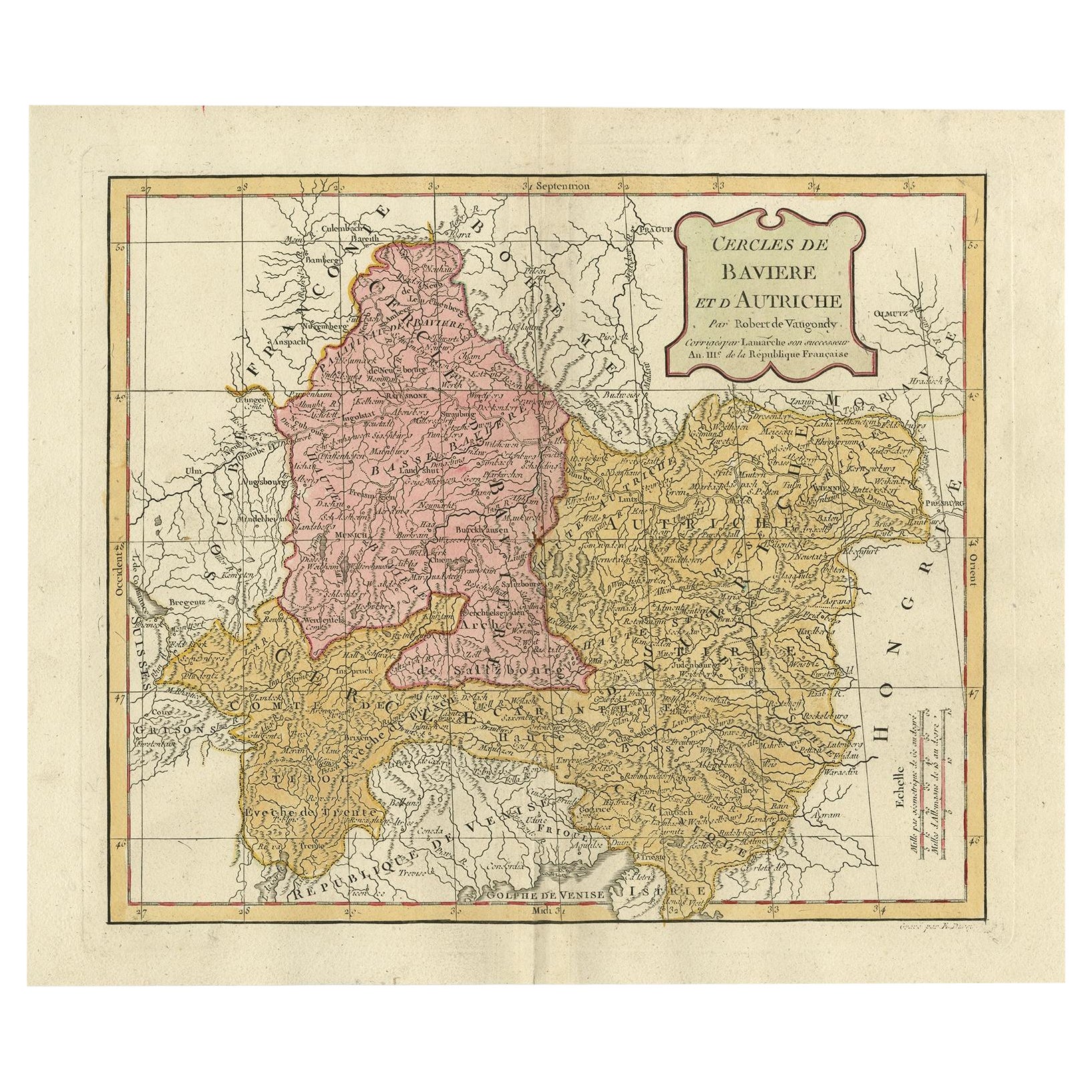
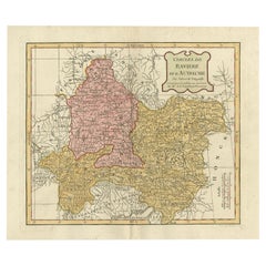
- Antique Map of Bavaria in Southern Germany and Austria, 1806Located in Langweer, NLAntique map titled 'Cercles de Baviere et d'Autriche.' This map shows Bavaria in southern Germany and Austria. By Robert de Vaugondy, revised and published by Delamarche. Source unkn...Category
Antique 19th Century Maps
MaterialsPaper
 $305 Sale Price20% Off