1864 Johnson's Map of New York City and Adjacent Cities
View Similar Items


Want more images or videos?
Request additional images or videos from the seller
1 of 6
1864 Johnson's Map of New York City and Adjacent Cities
About the Item
- Dimensions:Height: 17.13 in (43.5 cm)Width: 26.78 in (68 cm)Depth: 0 in (0.02 mm)
- Materials and Techniques:
- Period:
- Date of Manufacture:1864
- Condition:Good condition, considering age, with some yellowing that is typical of maps from this period. Some soiling and small tears along the edges, due to handling. Study the images carefully.
- Seller Location:Langweer, NL
- Reference Number:Seller: BG-13952-21stDibs: LU3054342419272
About the Seller
5.0
Recognized Seller
These prestigious sellers are industry leaders and represent the highest echelon for item quality and design.
Gold Seller
Premium sellers maintaining a 4.3+ rating and 24-hour response times
Established in 2009
1stDibs seller since 2017
2,467 sales on 1stDibs
Typical response time: 1 hour
Authenticity Guarantee
In the unlikely event there’s an issue with an item’s authenticity, contact us within 1 year for a full refund. DetailsMoney-Back Guarantee
If your item is not as described, is damaged in transit, or does not arrive, contact us within 7 days for a full refund. Details24-Hour Cancellation
You have a 24-hour grace period in which to reconsider your purchase, with no questions asked.Vetted Professional Sellers
Our world-class sellers must adhere to strict standards for service and quality, maintaining the integrity of our listings.Price-Match Guarantee
If you find that a seller listed the same item for a lower price elsewhere, we’ll match it.Trusted Global Delivery
Our best-in-class carrier network provides specialized shipping options worldwide, including custom delivery.More From This Seller
View All1864 Johnson's Map of New York State with City Insets
Located in Langweer, NL
Title: 1864 Johnson's Map of New York State with City Insets
Description: This 1864 map, titled "Johnson's New York," was published by Johnson and Ward and features a detailed depic...
Category
Antique 1860s Maps
Materials
Paper

$263 Sale Price
20% Off
1862 Johnson's Map of New York State by Johnson & Browning
Located in Langweer, NL
Title: 1862 Johnson's Map of New York State by Johnson & Browning
Description:This is an 1862 map of New York State, titled "Johnson's New York," created by Johnson & Browning. The ...
Category
Antique 1860s Maps
Materials
Paper

$263 Sale Price
20% Off
1864 Johnson's Map of the West Indies and Bermuda
Located in Langweer, NL
Title: 1864 Johnson's Map of the West Indies and Bermuda
Description: This is an 1864 map titled "Johnson's West Indies," published by Johnson and Ward. The map provides a detailed ...
Category
Antique 1860s Maps
Materials
Paper
$298 Sale Price
20% Off
1864 Johnson's Map of Virginia, Delaware, and Maryland with Fort Monroe Inset
Located in Langweer, NL
Title: 1864 Johnson's Map of Virginia, Delaware, and Maryland with Fort Monroe Inset
Description: This 1864 map titled "Johnson's Virginia, Delaware, and ...
Category
Antique 1860s Maps
Materials
Paper
$282 Sale Price
20% Off
Antique Map of New York by Johnson '1872'
Located in Langweer, NL
Antique map titled 'Johnson's New York'. Original map showing New York, with an inset map of Long Island. This map originates from 'Johnson's New Il...
Category
Antique Late 19th Century Maps
Materials
Paper

$235 Sale Price
20% Off
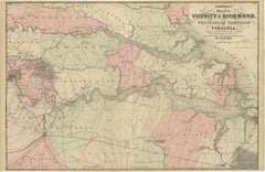
1862 Johnson's Map of the Vicinity of Richmond & Peninsular Campaign, Virginia
Located in Langweer, NL
Title: 1862 Johnson's Map of the Vicinity of Richmond & Peninsular Campaign, Virginia
Description: This 1862 map titled "Johnson's Map of the Vicinity of Richmond and Peninsular Cam...
Category
Antique 1860s Maps
Materials
Paper
$300 Sale Price
20% Off
You May Also Like
1864 Johnson's Map of the World on Mercator's Projection, Ric.B009
Located in Norton, MA
An 1864 Johnson's map of
the World on Mercator's Projection
Ric.b009
About this Item
"This antique map came from Johnson's New Illustrated (Steel Plate) Family Atlas, publ...
Category
Antique 19th Century Dutch Maps
Materials
Paper

Antique Map of American Cities, Vignette of New York City, circa 1920
Located in St Annes, Lancashire
Great maps of American Cities
Unframed
Original color
By John Bartholomew and Co. Edinburgh Geographical Institute
Published, circa 1920
Category
Vintage 1920s British Maps
Materials
Paper

1840 "New Map of the City of New York With Part of Brooklyn & Williamsburg"
Located in Colorado Springs, CO
Presented is a hand-colored, engraved folding map titled "New Map of the City of New York With Part of Brooklyn & Williamsburg" by J. Calvin Smith. The map was issued bound in the bo...
Category
Antique 1840s American Maps
Materials
Paper

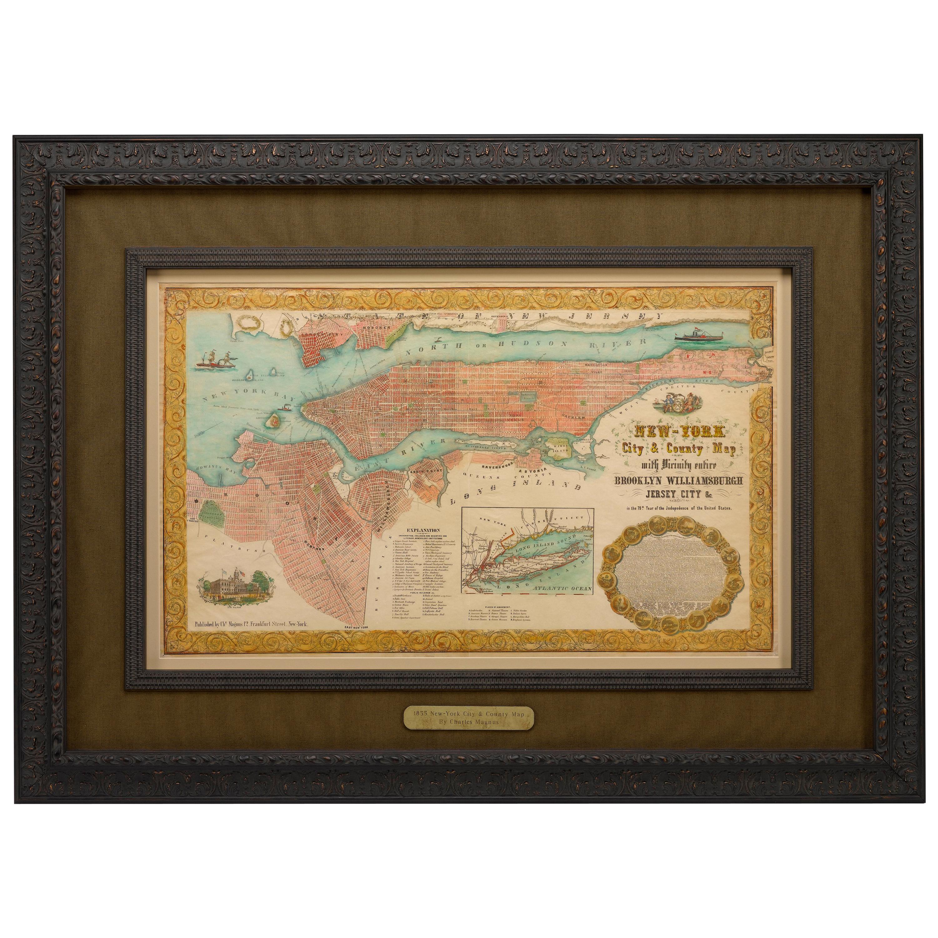
1855 "New-York City & County Map" by Charles Magnus
By Charles Magnus
Located in Colorado Springs, CO
This is a beautiful hand-colored map titled “New York City & County Map with Vicinity entire Brooklyn, Williamsburgh, Jersey City &c.” The work was published in 1855 by Charles Magnu...
Category
Antique 1850s American Maps
Materials
Paper

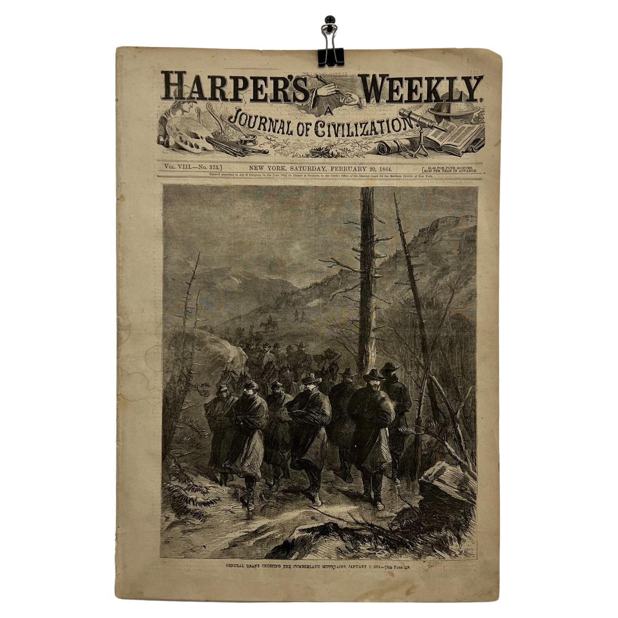
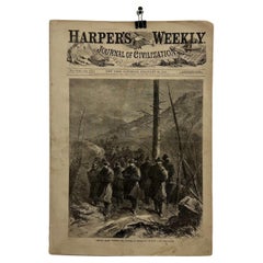
Vintage Harper's Weekly Journal of Civilization New York 1864
Located in Chula Vista, CA
Antique Vintage Harper's Weekly Journal of Civilization New York, 1864.
Measures: 15.75 x 11
Total 8 sheets.
Preowned vintage unrestored antique condi...
Category
Antique 1860s American Victorian Historical Memorabilia
Materials
Paper
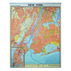
Vintage Wall Chart New York City Urban Map, USA 1950s
Located in Stockholm, SE
A classical wall chart showing a map of the city of New York. published by Westermann and with English text. Used as teaching material in Swedish schools. colorful print on paper rei...
Category
Vintage 1950s German Maps
Materials
Metal
Recently Viewed
View AllMore Ways To Browse
Art Deco Tea Cart
Art Nouveau Ice Bucket
Art Nouveau Metal Armchairs
Art Nouveau Wooden Pedestal
Asparagus Tureen
Atomic Coat Rack
Australian Daybill Movie Posters
Austrian Majolica Plates
Automata
Avocado Chair
Axel Larsen
Baccarat Crystal Ice Bucket
Baccarat Ice Bucket
Baccarat Swans
Bagues Console Table
Baker Desk Chair
Baker Faux Bamboo Chair
Baker French Dining Chairs