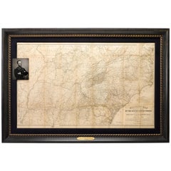
1865 Military Map Showing the Marches of the U.S. Forces under W. T. Sherman
View Similar Items


Want more images or videos?
Request additional images or videos from the seller
1 of 5
1865 Military Map Showing the Marches of the U.S. Forces under W. T. Sherman
About the Item
- Dimensions:Height: 39 in (99.06 cm)Width: 57 in (144.78 cm)Depth: 2.25 in (5.72 cm)
- Materials and Techniques:
- Place of Origin:
- Period:
- Date of Manufacture:1865
- Condition:Wear consistent with age and use.
- Seller Location:Colorado Springs, CO
- Reference Number:Seller: M0831stDibs: LU909711814713
About the Seller
4.9
Platinum Seller
Premium sellers with a 4.7+ rating and 24-hour response times
Established in 2010
1stDibs seller since 2011
452 sales on 1stDibs
Typical response time: 1 hour
Authenticity Guarantee
In the unlikely event there’s an issue with an item’s authenticity, contact us within 1 year for a full refund. DetailsMoney-Back Guarantee
If your item is not as described, is damaged in transit, or does not arrive, contact us within 7 days for a full refund. Details24-Hour Cancellation
You have a 24-hour grace period in which to reconsider your purchase, with no questions asked.Vetted Professional Sellers
Our world-class sellers must adhere to strict standards for service and quality, maintaining the integrity of our listings.Price-Match Guarantee
If you find that a seller listed the same item for a lower price elsewhere, we’ll match it.Trusted Global Delivery
Our best-in-class carrier network provides specialized shipping options worldwide, including custom delivery.More From This Seller
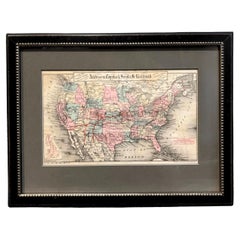
View All1879 Map of the United States, Showing the Santa Fe Railroad by GW & CB Colton
By G.W. & C.B. Colton
Located in Colorado Springs, CO
Presented is an original "General Map of the United States Showing the Lines of the Atchison, Topeka & Santa Fe Railroad and Its Connections with the Sea Ports". Undated, this map wa...
Category
Antique 1870s American High Victorian Maps
Materials
Paper
1812 United States Map, by Pierre Tardieu, Antique French Map Depicting the U.S.
By Pierre François Tardieu
Located in Colorado Springs, CO
1812 "United States of Nth America -- Carte des Etats-Unis De L'Amerique Septentrionale" Two-Sheet Map by Tardieu
This attractive map, published in Paris in 1812, is one of the most rare large format maps from the period. It features a view of the East Coast of the U.S. from Maryland to just below South Carolina. Additionally, Ellicott’s plan for the City of Washington D.C. is included at the top right and an illustration of Niagara Falls is shown at the bottom right with a description in both French and English. This extremely detailed map not only depicts the mountainous regions of the southeastern U.S., but also includes names of regions, rivers, and towns.
Based on the first state of Arrowsmith’s 4-sheet map of the United States, this map is completely engraved by Tardieu in Paris and showcases high quality engravings. This detailed map of the recently independent United States includes one of the largest and earliest examples of the Ellicott plan of Washington DC.
The artist, Pierre François Tardieu (PF Tardieu) was a very well-known map engraver, geographer, and illustrator. Awarded a bronze medal by King Louis-Phillipe for the accuracy and beauty of his map-making, Tardieu produced many fine works including maps of Louisiana...
Category
Antique 1810s French Maps
Materials
Paper

1856 U.S. Coast Survey Map of Chesapeake Bay and Delaware Bay
Located in Colorado Springs, CO
Presented is U.S. Coast Survey nautical chart or maritime map of Chesapeake Bay and Delaware Bay from 1856. The map depicts the region from Susquehanna, Maryland to the northern Outer Banks in North Carolina. It also shows from Richmond and Petersburg, Virginia to the Atlantic Ocean. The map is highly detailed with many cities and towns labeled throughout. Rivers, inlets, and bays are also labeled. Various charts illustrating more specific parts of the region are marked on the map using dotted lines. The lines form boxes, and the corresponding chart number and publication date are given. Extensive triangulation surveys were conducted the length of Chesapeake Bay and are illustrated here. Hampton Roads, Virginia is labeled, along with the James, York, and Rappahannock Rivers, which were all extensively surveyed.
The chart was published under the supervision of A. D. Bache, one of the most influential and prolific figures in the early history of the U.S. Coast Survey, for the 1856 Report of the Superintendent of the U.S. Coast Survey. Alexander Dallas Bache (1806-1867) was an American physicist, scientist, and surveyor. Bache served as the Superintendent of the U.S. Coast Survey from 1843 to 1865. Born in Philadelphia, Bache toured Europe and composed an important treatise on European Education. He also served as president of Philadelphia's Central High School and was a professor of natural history and chemistry at the University of Pennsylvania. Upon the death of Ferdinand Rudolph Hassler, Bache was appointed Superintendent of the United States Coast Survey.
The Office of the Coast Survey, founded in 1807 by President Thomas Jefferson and Secretary of Commerce Albert Gallatin...
Category
Antique 1850s American Maps
Materials
Paper

1904 "Nell's Topographical Map of the State of Colorado"
Located in Colorado Springs, CO
This highly detailed pocket map is a topographical map of the state of Colorado by Louis Nell from 1904. The map "has been compiled from all available...
Category
Antique Early 1900s American Maps
Materials
Leather, Paper

1859 "Map of the United States of America..." by J. H. Colton
By J.H. Colton
Located in Colorado Springs, CO
Presented is an 1859 “Map of the United States of America, the British Provinces, Mexico, the West Indies and Central America with Part of...
Category
Antique 1850s American Maps
Materials
Paper

Army Air Forces Poster, "See the Job Through" by Baskerville, WWII Poster, 1945
By Charles Baskerville
Located in Colorado Springs, CO
This 1945 color poster features an American pilot and a ground crew Staff Sergeant shaking hands and the words “Seeing the Job Through! Enlist in the Regular Army Air...
Category
Vintage 1940s American Historical Memorabilia
Materials
Paper

You May Also Like
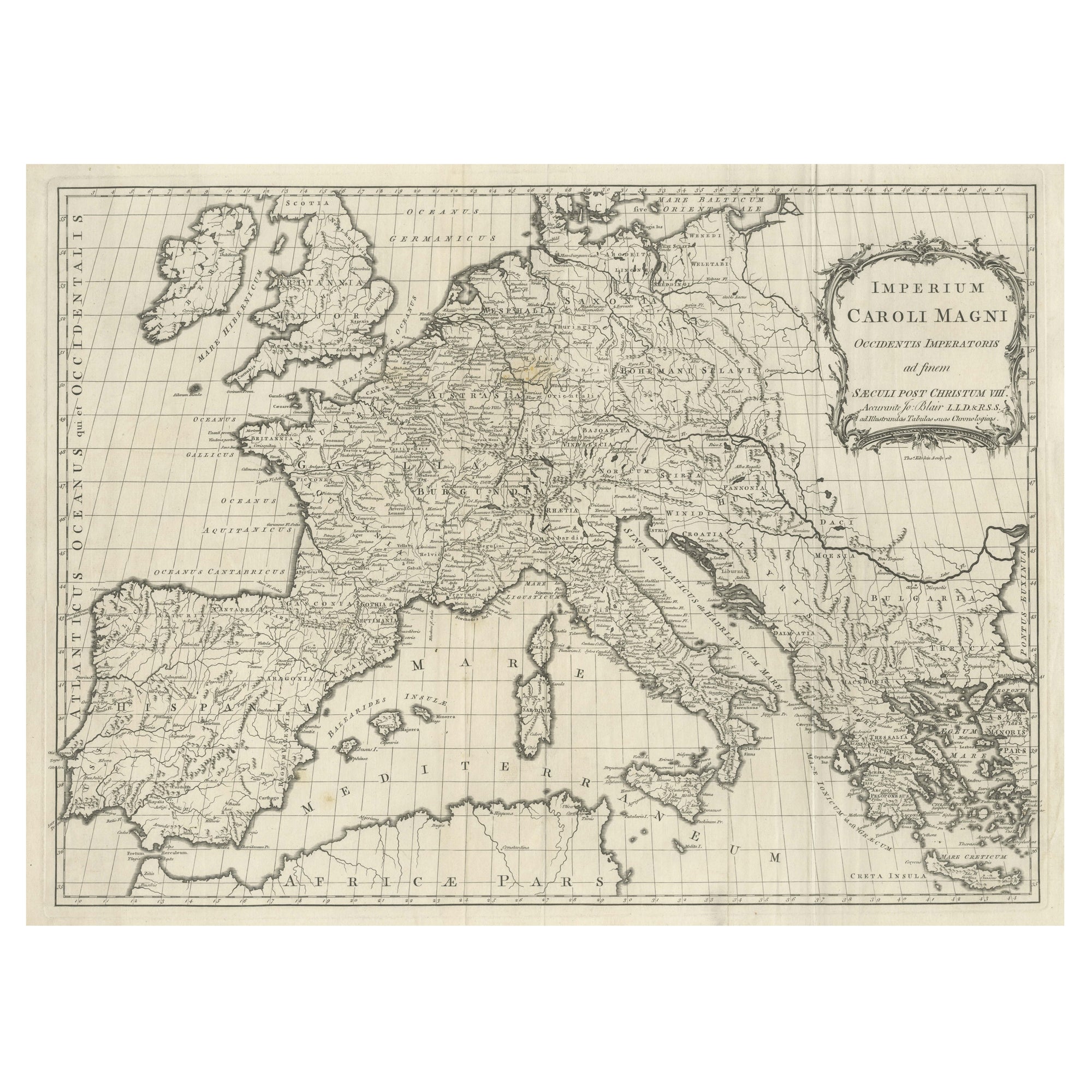
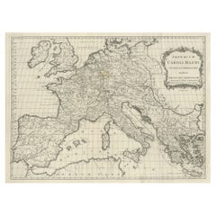
Large Antique Map of Europe, Showing the Empire of Charlemagne
Located in Langweer, NL
Antique map titled 'Imperium Caroli Magni (..)'. Large antique map of Europe, showing the Empire of Charlemagne in the 8th Century. Engraved by T. Kitchin. Published J. Blair, circa ...
Category
Antique Late 18th Century Maps
Materials
Paper
$426 Sale Price
20% Off
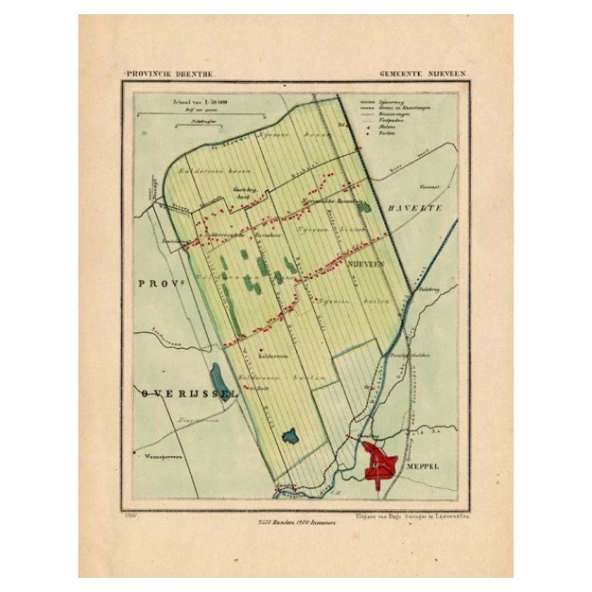
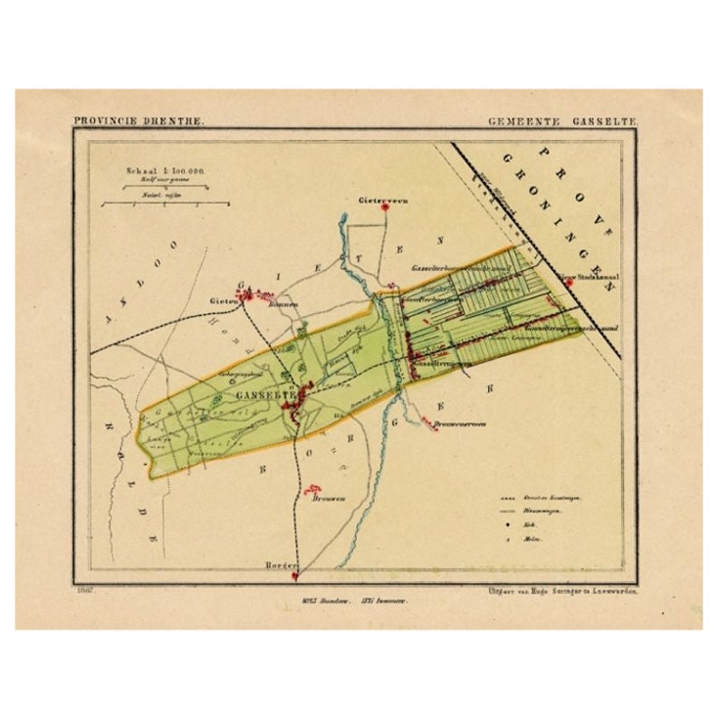
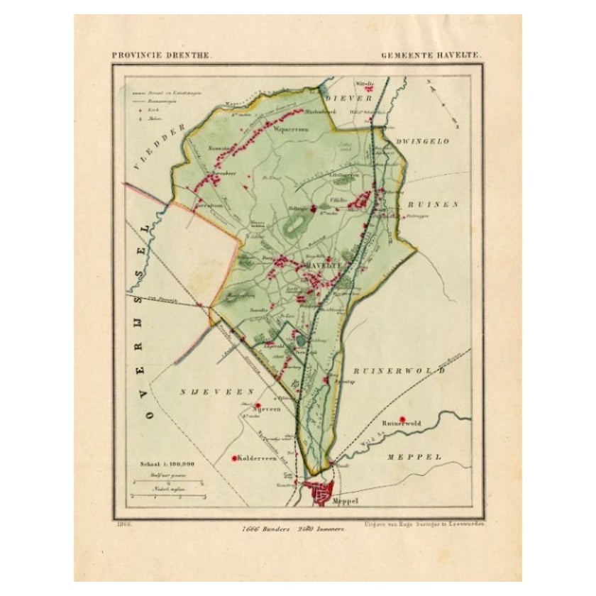
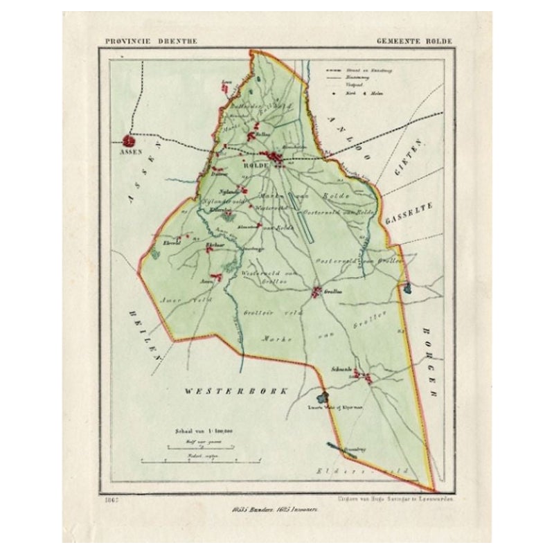
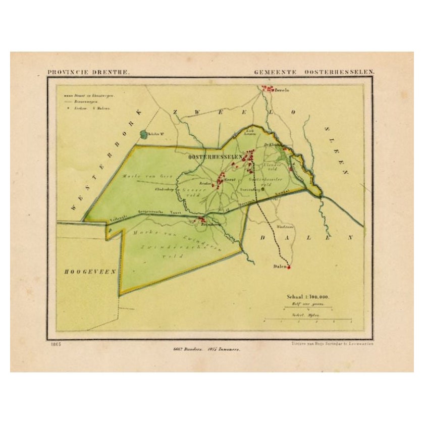
Antique Map of the Township of Nijeveen in The Netherlands, 1865
Located in Langweer, NL
Drenthe: Gemeente Nijeveen, Kolderveen. These scarse detailed maps of Dutch Towns originate from the 'Gemeente-atlas' of Jacob Kuyper. This atlas of all towns in the Netherlands was ...
Category
Antique 19th Century Maps
Materials
Paper

$176 Sale Price
20% Off
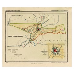
Antique Map of the Township of Coevorden in The Netherlands, 1865
Located in Langweer, NL
Drenthe - Gemeente Coevorden, Padhuis, Wijnhars. These scarse detailed maps of Dutch Towns originate from the 'Gemeente-atlas' of Jacob Kuyper. This atlas of all towns in the Netherl...
Category
Antique 19th Century Maps
Materials
Paper
$139 Sale Price
20% Off
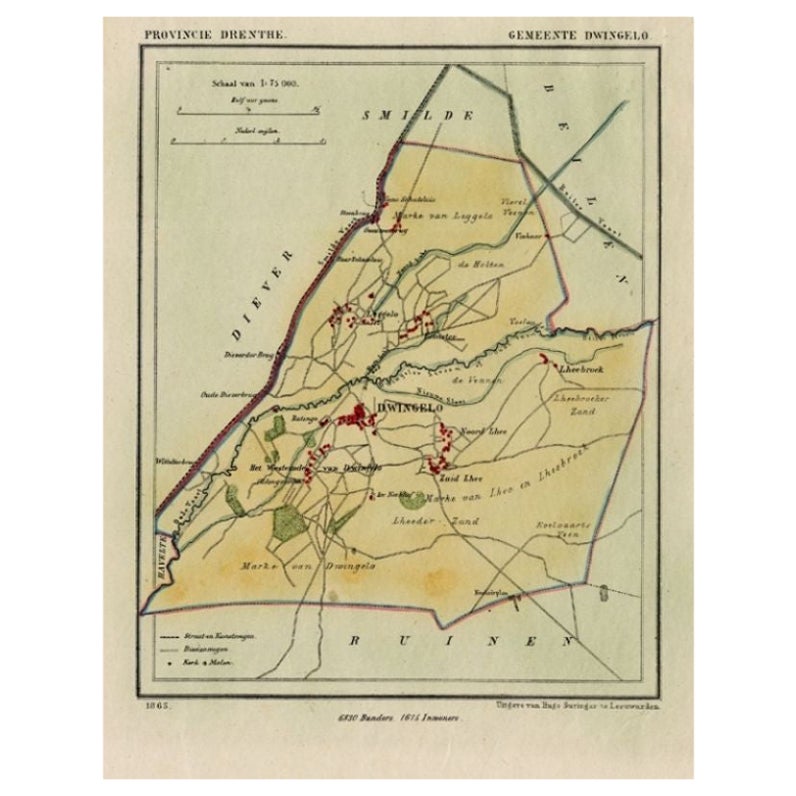
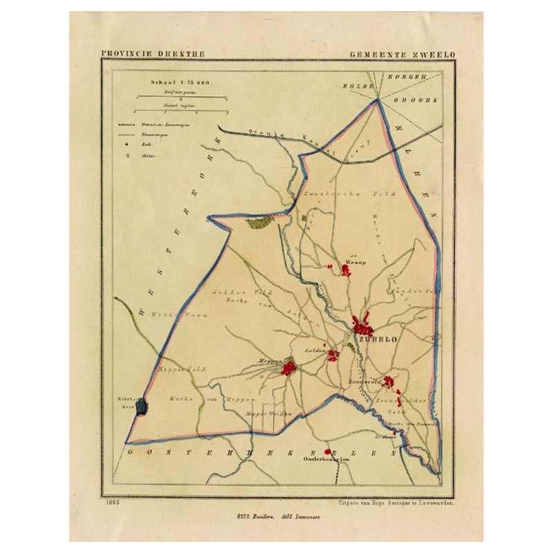
Antique Map of the Township of Dwingelo in The Netherlands, 1865
Located in Langweer, NL
Drenthe: Gemeente Dwingelo, Eemster, Lhee. These scarse detailed maps of Dutch Towns originate from the 'Gemeente-atlas' of Jacob Kuyper. This atlas of all towns in the Netherlands w...
Category
Antique 19th Century Maps
Materials
Paper
$157 Sale Price
20% Off
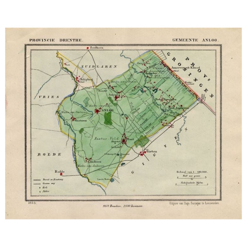
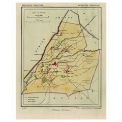
Antique Map of the Township of Gieten in the Netherlands, 1865
Located in Langweer, NL
Drenthe: Gemeente Gieten, Gieterveen, De Hilte. These scarse detailed maps of Dutch Towns originate from the 'Gemeente-atlas' of Jacob Kuyper. This atlas of all towns in the Netherla...
Category
Antique 19th Century Maps
Materials
Paper
$176 Sale Price
20% Off
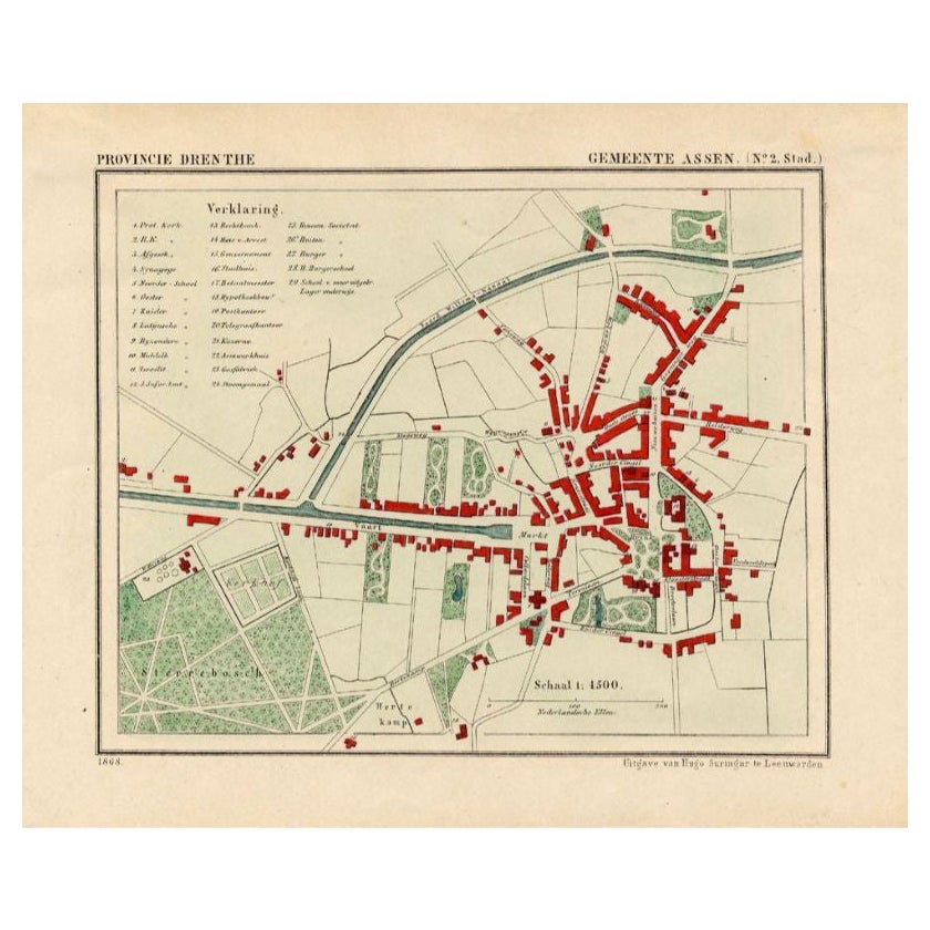
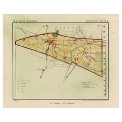
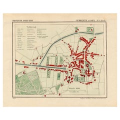
Antique Map of the City of Assen in The Netherlands, 1865
Located in Langweer, NL
Drenthe - Gemeente Assen. (no 2, Stad). These scarse detailed maps of Dutch Towns originate from the 'Gemeente-atlas' of Jacob Kuyper. This atlas of all towns in the Netherlands was ...
Category
Antique 19th Century Maps
Materials
Paper
$268 Sale Price
20% Off
Recently Viewed
View AllMore Ways To Browse
Military Bell
Map Railroad
J Johnston
Tennessee Antiques
Map Of Arabia
New Zealand Map
Map Tibet
Antique Map Of Egypt
British Empire Map
18th Century French Globe
Antique Map Ortelius
Antique Nautical Maps
Roman Empire Map
Voc Ship
16th Century Globe
Map Of Singapore
Antique Map Of Middle East
Hand Painted Antique Map