Items Similar to 1882 Map of Denmark, Schleswig, and Holstein Highlighting Geographical Details

Want more images or videos?
Request additional images or videos from the seller
1 of 7
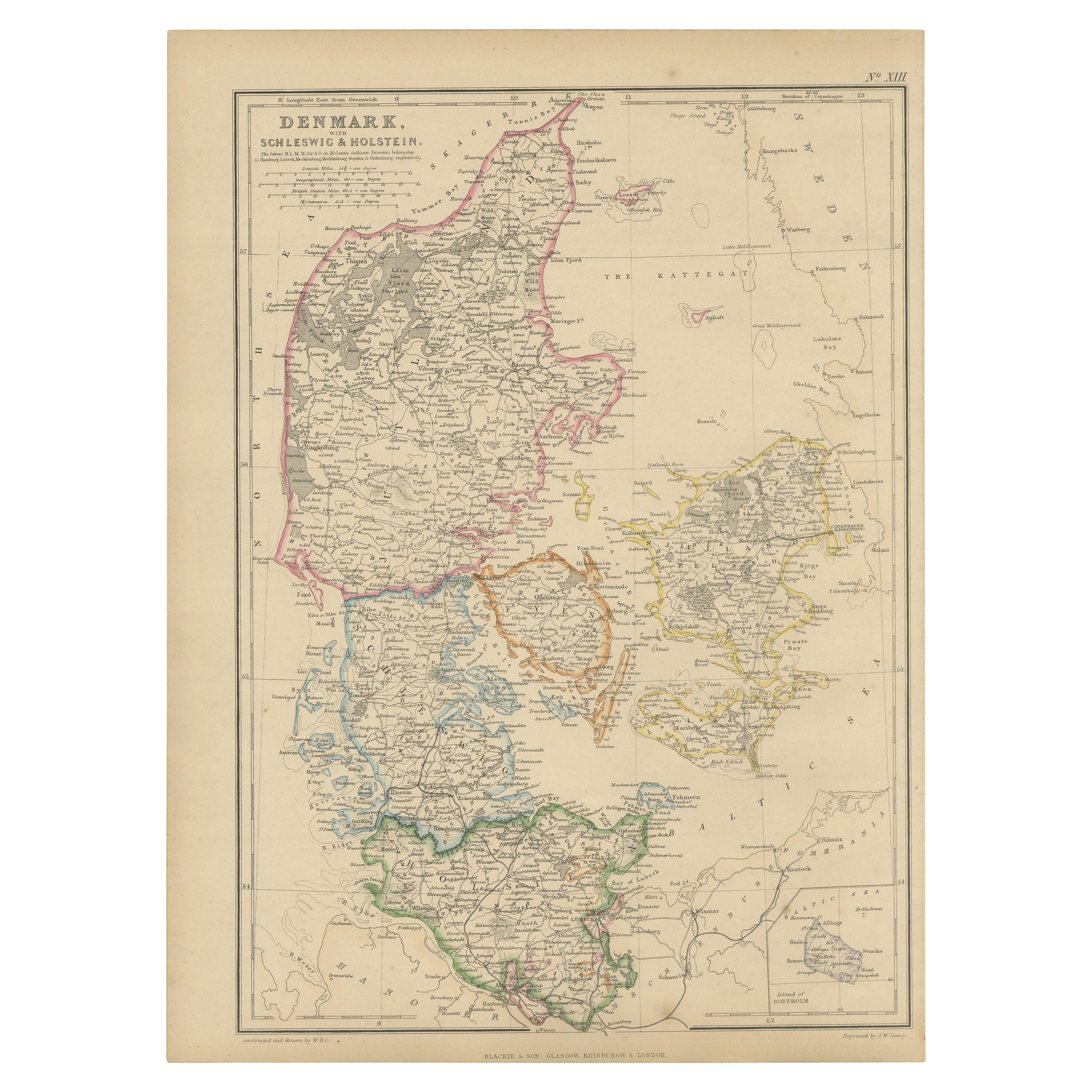
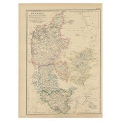
1882 Map of Denmark, Schleswig, and Holstein Highlighting Geographical Details
$225.26
£168.59
€190
CA$310.77
A$345.59
CHF 181.51
MX$4,225.18
NOK 2,261.80
SEK 2,132.27
DKK 1,446.37
About the Item
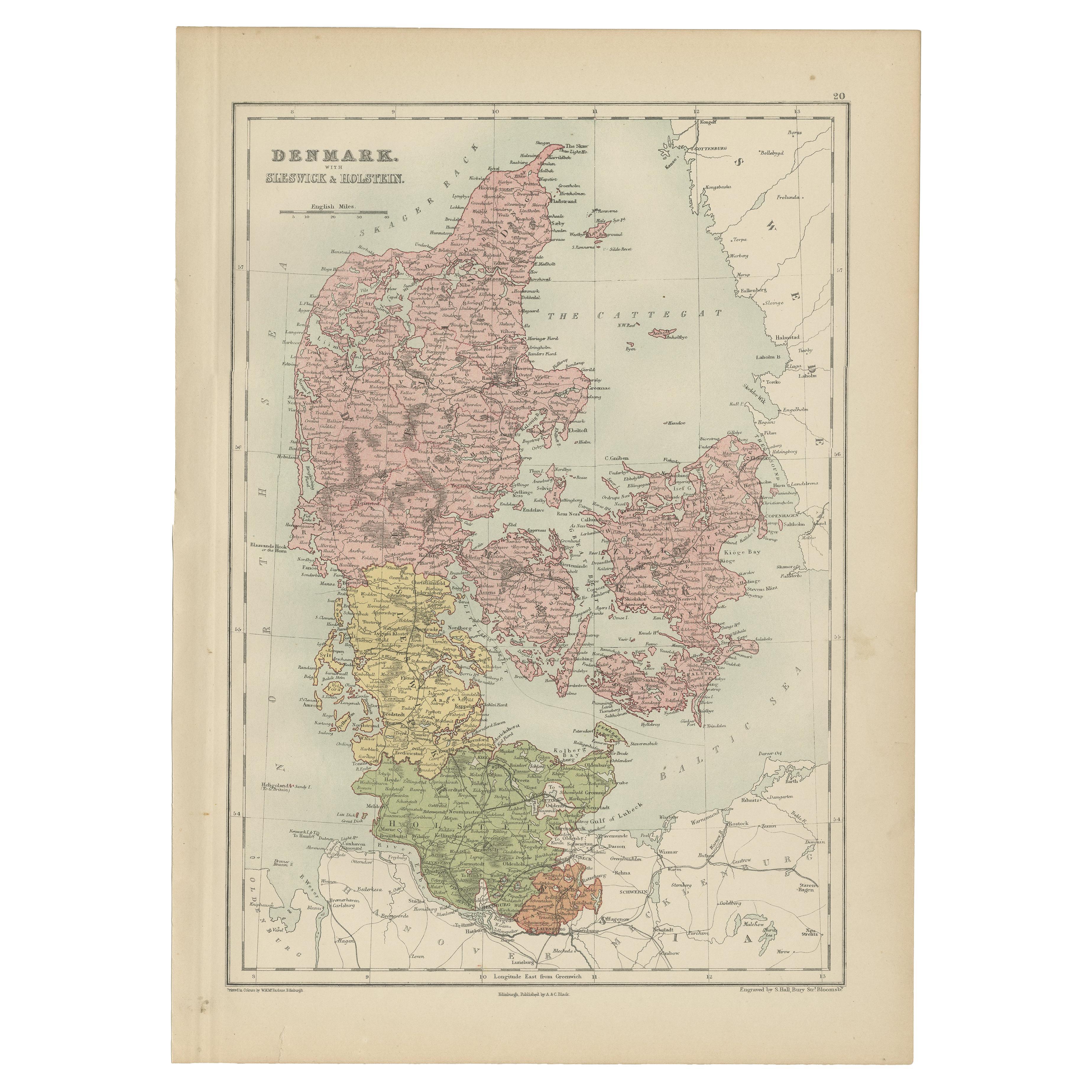
This 1882 map of Denmark, Schleswig, and Holstein, published by Blackie and Son as part of the 'Comprehensive Atlas and Geography of the World,' provides a detailed representation of the region's political and geographic features during the late 19th century. The map showcases Denmark's distinctive geography, including the Jutland Peninsula and its surrounding islands, as well as the areas of Schleswig and Holstein, which were historically significant in European politics. Key cities such as Copenhagen, Aarhus, and Kiel are prominently labeled, along with smaller towns and settlements.
Topographical details, including rivers, fjords, and coastal features, are intricately illustrated, emphasizing Denmark's maritime nature and its connection to the North and Baltic Seas. The map also highlights transportation networks, such as roads and railways, reflecting the infrastructure development of the era. Subtle pastel coloring delineates political boundaries, adding both clarity and visual appeal to the cartography.
Condition report: The map is in good condition with light age-related toning and minor spotting. The engraving remains sharp, and the colors are vibrant. There are no tears or repairs, and the paper is strong and intact.
Framing tips: Use a classic wooden frame with a natural or antique finish, such as walnut or mahogany, to complement the historical character of the map. A double mat with an inner cream or off-white layer and an outer mat in soft blue or light beige will enhance the map’s tones. Opt for UV-protective glass to prevent fading and preserve the map's condition for long-term display.
- Dimensions:Height: 14.97 in (38 cm)Width: 11.03 in (28 cm)Depth: 0 in (0.02 mm)
- Materials and Techniques:
- Period:
- Date of Manufacture:1882
- Condition:Condition report: The map is in good condition with minimal edge wear. Slight toning consistent with its age. The engraving remains sharp, and the colors are well-preserved.
- Seller Location:Langweer, NL
- Reference Number:Seller: BG-13601-2-231stDibs: LU3054343556522
About the Seller
5.0
Recognized Seller
These prestigious sellers are industry leaders and represent the highest echelon for item quality and design.
Platinum Seller
Premium sellers with a 4.7+ rating and 24-hour response times
Established in 2009
1stDibs seller since 2017
2,607 sales on 1stDibs
Typical response time: <1 hour
- ShippingRetrieving quote...Shipping from: Langweer, Netherlands
- Return Policy
Authenticity Guarantee
In the unlikely event there’s an issue with an item’s authenticity, contact us within 1 year for a full refund. DetailsMoney-Back Guarantee
If your item is not as described, is damaged in transit, or does not arrive, contact us within 7 days for a full refund. Details24-Hour Cancellation
You have a 24-hour grace period in which to reconsider your purchase, with no questions asked.Vetted Professional Sellers
Our world-class sellers must adhere to strict standards for service and quality, maintaining the integrity of our listings.Price-Match Guarantee
If you find that a seller listed the same item for a lower price elsewhere, we’ll match it.Trusted Global Delivery
Our best-in-class carrier network provides specialized shipping options worldwide, including custom delivery.More From This Seller
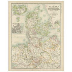
View AllAntique Map of Denmark with Schleswig & Holstein by A & C. Black, 1870
Located in Langweer, NL
Antique map titled 'Denmark with Schleswig & Holstein'. Original antique map of Denmark with Schleswig & Holstein. This map originates from ‘Black's General Atlas of The World’. Publ...
Category
Antique Late 19th Century Maps
Materials
Paper

$124 Sale Price
40% Off
Antique Map of Denmark by Johnston '1909'
Located in Langweer, NL
Antique map titled 'Denmark'. Original antique map of Denmark. With inset maps of Iceland, Faroe Island, and Copenhagen. This map originates from the ‘Royal Atlas of Modern Geography...
Category
Early 20th Century Maps
Materials
Paper
$237 Sale Price
20% Off
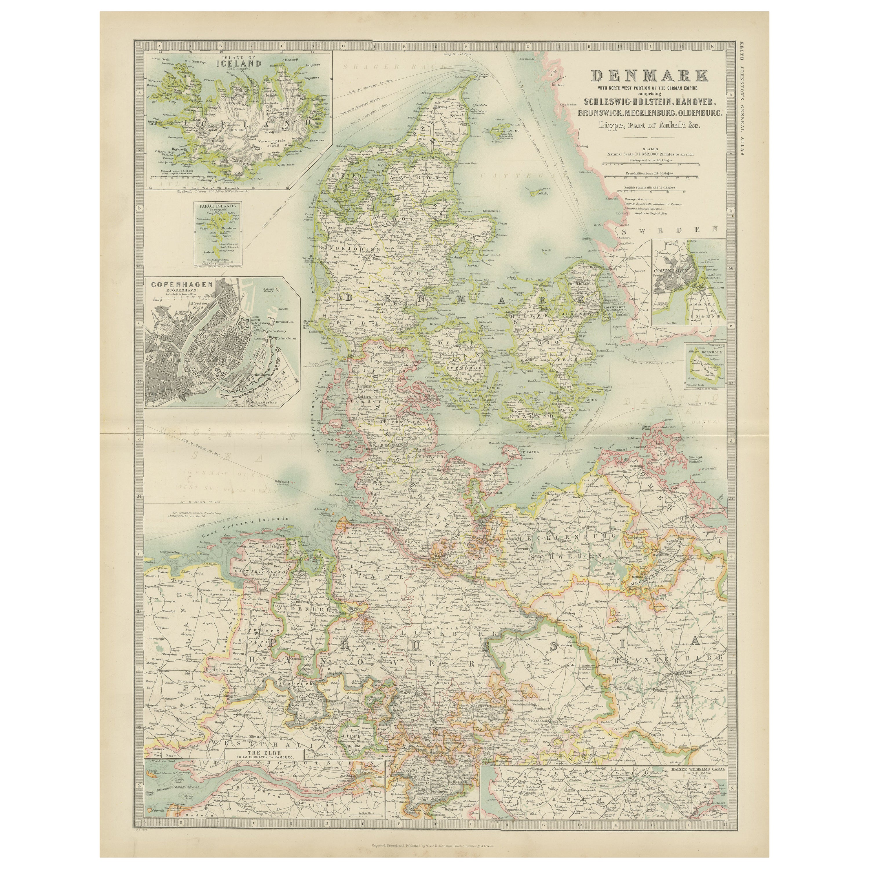
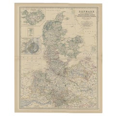
Denmark & German Empire – Antique Map by A.K. Johnston, 1882 Atlas Edition
Located in Langweer, NL
Denmark & German Empire – Antique Map by A.K. Johnston, 1882 Atlas Edition
This detailed antique map titled Denmark with North-West portion of the German Empire comprising Schleswig...
Category
Antique 19th Century English Maps
Materials
Paper
$227 Sale Price
20% Off
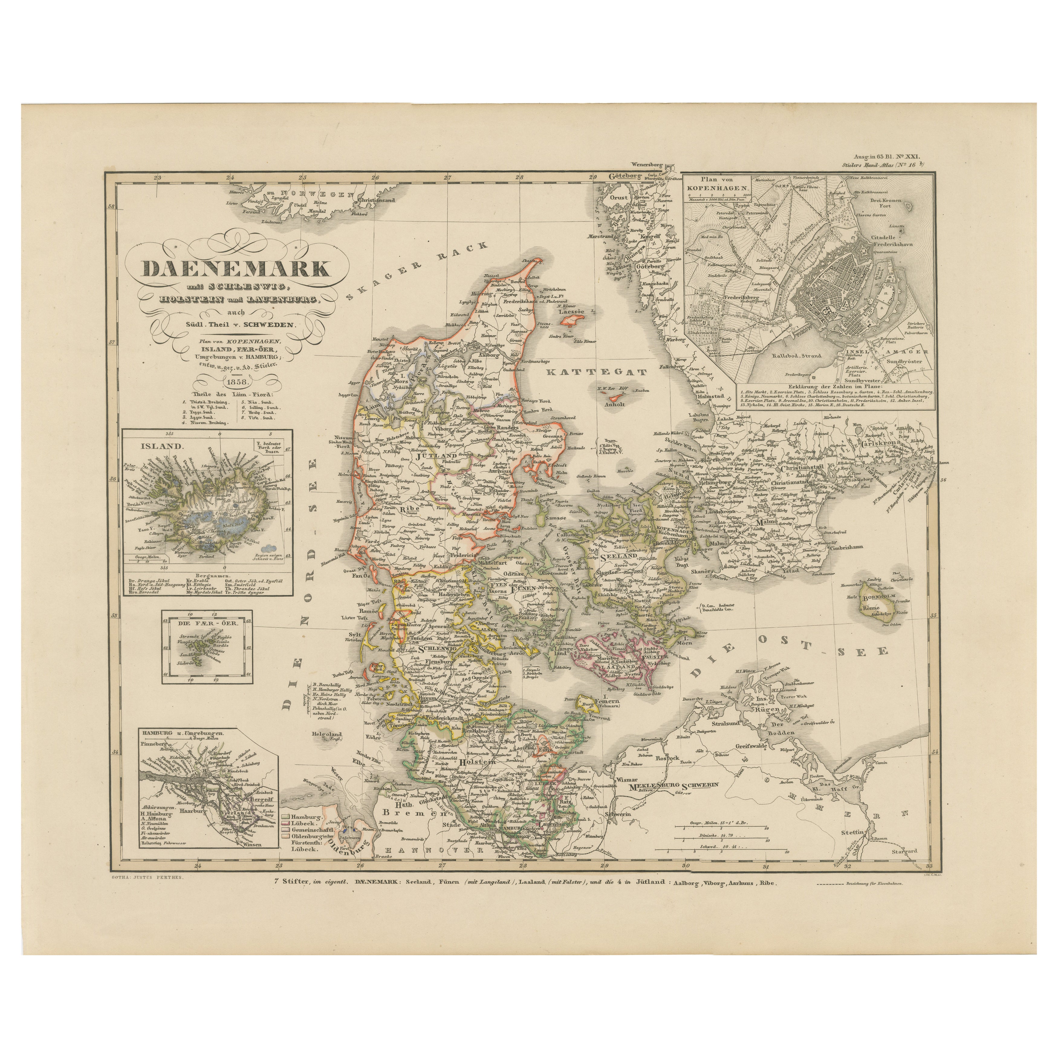
Antique Map of Denmark 1858 – Includes Iceland & Copenhagen Plan
Located in Langweer, NL
Antique Map of Denmark 1858 – Includes Iceland & Copenhagen Plan
This finely detailed antique map of Denmark was published in 1858 by Justus Perthes in Gotha, as part of the renowne...
Category
Antique Mid-19th Century German Maps
Materials
Paper
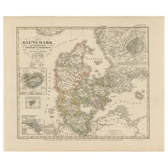
1859 Denmark and Schleswig-Holstein Map: A Historical View from Blackie's Atlas
Located in Langweer, NL
The "Antique Map of Denmark with Schleswig & Holstein" from 'The Imperial Atlas of Modern Geography', published by W. G. Blackie in 1859, is a valuable historical document that provi...
Category
Antique Mid-19th Century Maps
Materials
Paper
Antique Map of the Kingdom of Denmark by Wyld '1845'
Located in Langweer, NL
Antique map titled 'Kingdom of Denmark'. Original antique map of the Kingdom of Denmark. This map originates from 'An Atlas of the World, Comprehending Separate Maps of its Various C...
Category
Antique Mid-19th Century Maps
Materials
Paper
$154 Sale Price
35% Off
You May Also Like
Denmark. Century Atlas antique vintage map
Located in Melbourne, Victoria
'The Century Atlas. Denmark'
Original antique map, 1903.
Inset maps of 'Faroe Islands', 'Iceland' and 'Copenhagen'.
Central fold as issued. Map name and number printed on the reve...
Category
Early 20th Century Victorian More Prints
Materials
Lithograph

Large Original Vintage Map of Sweden and Norway circa 1920
Located in St Annes, Lancashire
Great map of Sweden and Norway
Original color. Good condition
Published by Alexander Gross
Unframed.
Category
Vintage 1920s English Victorian Maps
Materials
Paper

1832 Large Map "Russian & Poland" Ric. R0012
Located in Norton, MA
Large map 1832
"Russian & Poland"
Ric.r0012
Russia & Poland, by J. Arrowsmith. London, pubd. 15 Feby. 1832 by J. Arrowsmith, 35 Essex Street, Strand., ...
Category
Antique 19th Century Unknown Maps
Materials
Paper

1853 Map of "Russia in Europe Including Poland" Ric.r016
Located in Norton, MA
Description
Russia in Europe incl. Poland by J Wyld c.1853
Hand coloured steel engraving
Dimension: Paper: 25 cm W x 33 cm H ; Sight: 22 cm W x 28 cm H
Condition: Good ...
Category
Antique 19th Century Unknown Maps
Materials
Paper

German Empire, Northern Part. Century Atlas antique vintage map
Located in Melbourne, Victoria
'The Century Atlas. German Empire, Northern Part.'
Original antique map, 1903.
Central fold as issued. Map name and number printed on the reverse corne...
Category
Early 20th Century Victorian More Prints
Materials
Lithograph

Original Antique Map of Sweden, Engraved by Barlow, 1806
Located in St Annes, Lancashire
Great map of Sweden
Copper-plate engraving by Barlow
Published by Brightly & Kinnersly, Bungay, Suffolk. 1806
Unframed.
Category
Antique Early 1800s English Maps
Materials
Paper

More Ways To Browse
Railway Map
Schleswig Holstein
Kiel Furniture
Post Modern High Chairs
Vintage Vine Rug
Silver Metal Chair
Swedish Kilim
Vintage Scandanavian Chairs
Vintage Tropical Furniture
19th Century Red Glass
Antique French Console Table Tables
French 50s
Rusted Metal Art
Silver Bowl Large
Antique French Silk
Down Couch
Cobalt Blue Glass
Used Lighter Art