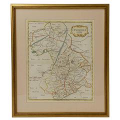
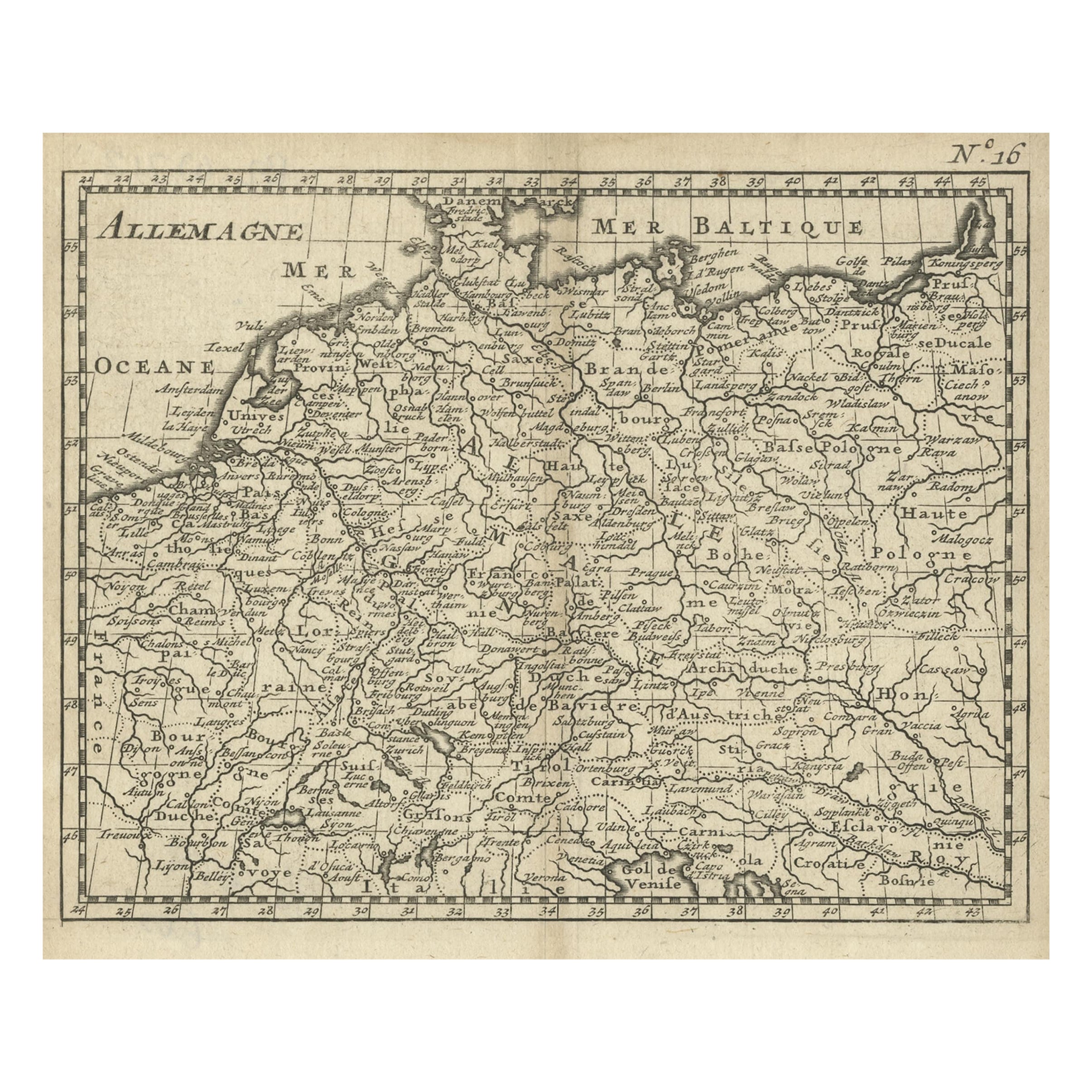
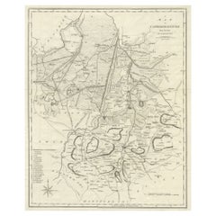
18th Century Map of Cambridgeshire
View Similar Items


Want more images or videos?
Request additional images or videos from the seller
1 of 7
18th Century Map of Cambridgeshire
Price:$895
About the Item
- Dimensions:Height: 23.75 in (60.33 cm)Width: 21 in (53.34 cm)Depth: 0.5 in (1.27 cm)
- Materials and Techniques:
- Place of Origin:
- Period:
- Date of Manufacture:18th Century
- Condition:Wear consistent with age and use. Excellent antique condition - Wear commensurate with age and use.
- Seller Location:Austin, TX
- Reference Number:Seller: R14851stDibs: LU8827824226
About the Seller
5.0
Vetted Professional Seller
Every seller passes strict standards for authenticity and reliability
Established in 1987
1stDibs seller since 2009
887 sales on 1stDibs
Typical response time: 1 hour
Authenticity Guarantee
In the unlikely event there’s an issue with an item’s authenticity, contact us within 1 year for a full refund. DetailsMoney-Back Guarantee
If your item is not as described, is damaged in transit, or does not arrive, contact us within 7 days for a full refund. Details24-Hour Cancellation
You have a 24-hour grace period in which to reconsider your purchase, with no questions asked.Vetted Professional Sellers
Our world-class sellers must adhere to strict standards for service and quality, maintaining the integrity of our listings.Price-Match Guarantee
If you find that a seller listed the same item for a lower price elsewhere, we’ll match it.Trusted Global Delivery
Our best-in-class carrier network provides specialized shipping options worldwide, including custom delivery.More From This Seller
View AllFrench Velocipede or Child's Horse Tricycle from the 19th Century
Located in Austin, TX
A fine French velocipede or child's toy horse tricycle from the 19th century, featuring a body of carved wood with brushed steel face-plate and glass ey...
Category
Antique 19th Century French Toys and Dolls
Materials
Steel, Iron, Brass
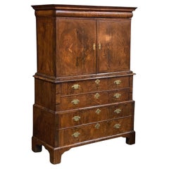
French Armoire of Burled Elm from the 18th Century
Located in Austin, TX
A handsome French armoire (or bookcase display cabinet) of burled or burr elm from the 18th century, featuring a moulded crown above two framed doors (each with decorative brass escu...
Category
Antique 18th Century French French Provincial Wardrobes and Armoires
Materials
Elm, Burl, Wood
George I Cabinet on Chest of Figured Walnut from the 18th Century
Located in Austin, TX
A fine large English period George I cabinet on chest of patinated walnut from the 18th century.
Featuring burr walnut-figured veneers and attractive brass hardware throughout.
The...
Category
Antique 18th Century English George I Secretaires
Materials
Metal, Brass
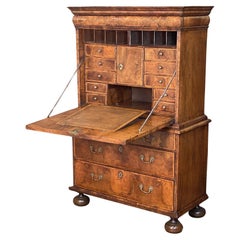
George I Secretary Bureau or Escritoire of Figured Walnut from the 18th Century
Located in Austin, TX
A fine English period George I large secretary bureau escritoire - or scriptor - of patinated walnut from the 18th century.
Featuring burr walnut-fig...
Category
Antique 18th Century English George I Secretaires
Materials
Metal, Brass
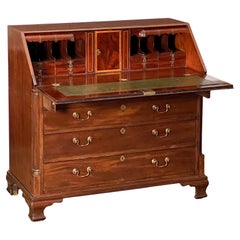
George III Bureau Desk or Secretary Chest of Mahogany from the 18th Century
Located in Austin, TX
A fine George III slant top desk or bureau secretary chest of patinated mahogany, c.1770 - an inlaid slant front drops to reveal a series of small drawers and document compartments, ...
Category
Antique 18th Century English George III Secretaires
Materials
Metal, Brass
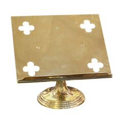
English Lectern or Book Stand of Brass
Located in Austin, TX
A fine English table top lectern, missal or book stand of brass, featuring a reading top with pierced quatrefoils at each corner. The revolving recta...
Category
Early 20th Century English Religious Items
Materials
Metal, Brass
You May Also Like
Large Antique County Map of Cambridgeshire, England
Located in Langweer, NL
Antique map titled 'A Map of Cambridgeshire from the best Authorities'. Original old county map of Cambridgeshire, England. Engraved by John Cary. Originates from 'New British Atlas'...
Category
Antique Early 19th Century Maps
Materials
Paper
$219 Sale Price
20% Off
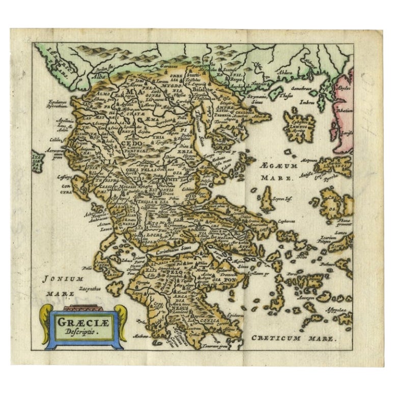
Charming 18th Century Miniature Map of Greece, 1685
Located in Langweer, NL
Antique map titled 'Graeciae Descriptio.' Charming miniature map of Greece from the pocket atlas 'Introductionis in Universam Geographiam tam Veterem qu...
Category
Antique 17th Century Maps
Materials
Paper
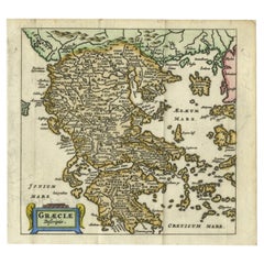
$333 Sale Price
20% Off
Antique 18th Century Map of the Province of Pensilvania 'Pennsylvania State'
Located in Philadelphia, PA
A fine antique of the colony of Pennsylvania.
Noted at the top of the sheet as a 'Map of the province of Pensilvania'.
This undated and anonymous map is thought to be from the Gentleman's Magazine, London, circa 1775, although the general appearance could date it to the 1760's.
The southern boundary reflects the Mason-Dixon survey (1768), the western boundary is placed just west of Pittsburgh, and the northern boundary is not marked.
The map has a number of reference points that likely refer to companion text and appear to be connected to boundaries. The western and southern boundaries are marked Q, R, S, for example. A diagonal line runs from the Susquehanna R to the Lake Erie P. A broken line marked by many letters A, B, N, O, etc., appears in the east.
There are no latitude or longitude markings, blank verso.
Framed in a shaped contemporary gilt wooden frame and matted under a cream colored matte.
Bearing an old Graham Arader Gallery...
Category
Antique 18th Century British American Colonial Maps
Materials
Paper

Original Antique English County Map, Cambridgeshire, J & C Walker, 1851
Located in St Annes, Lancashire
Great map of Cambridgeshire
Original colour
By J & C Walker
Published by Longman, Rees, Orme, Brown & Co. 1851
Unframed.
Category
Antique 1850s English Other Maps
Materials
Paper

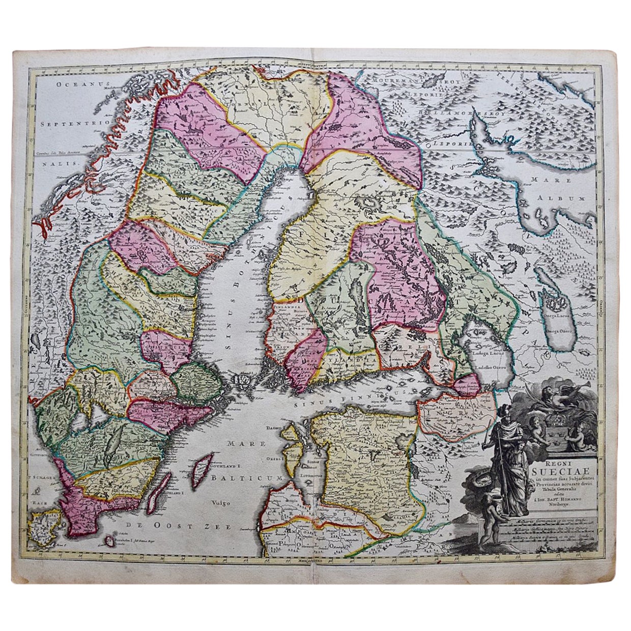
Scandinavia & Portions of Eastern Europe: 18th Century Hand-Colored Homann Map
By Johann Baptist Homann
Located in Alamo, CA
An early 18th century hand-colored copper-plate map entitled "Regni Sueciae in omnes suas Subjacentes Provincias accurate divisi Tabula Generalis" by Johann Baptist Homann (1663-1724...
Category
Antique Early 18th Century German Maps
Materials
Paper

18th Century Hand Colored Map of Spain and Portugal by Visscher
By Nicolaes Visscher II
Located in Alamo, CA
This is an early 18th century map of Spain and Portugal, with attractive original hand-coloring, entitled "Hispaniae et Portugalliae Regna per Nicolaum Visscher cum Privilegio Ordinu...
Category
Antique Early 18th Century Dutch Maps
Materials
Paper
