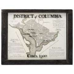
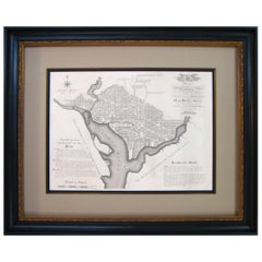
1900 Plan of the City of Washington Antique Map
View Similar Items


Want more images or videos?
Request additional images or videos from the seller
1 of 6
1900 Plan of the City of Washington Antique Map
About the Item
- Dimensions:Height: 21.5 in (54.61 cm)Width: 28 in (71.12 cm)Depth: 22 in (55.88 cm)
- Materials and Techniques:Paper,Engraved
- Place of Origin:
- Period:
- Date of Manufacture:1900-1930
- Condition:Wear consistent with age and use.
- Seller Location:Colorado Springs, CO
- Reference Number:Seller: M0081stDibs: LU90976104273
About the Seller
4.9
Platinum Seller
These expertly vetted sellers are 1stDibs' most experienced sellers and are rated highest by our customers.
Established in 2010
1stDibs seller since 2011
400 sales on 1stDibs
More From This SellerView All
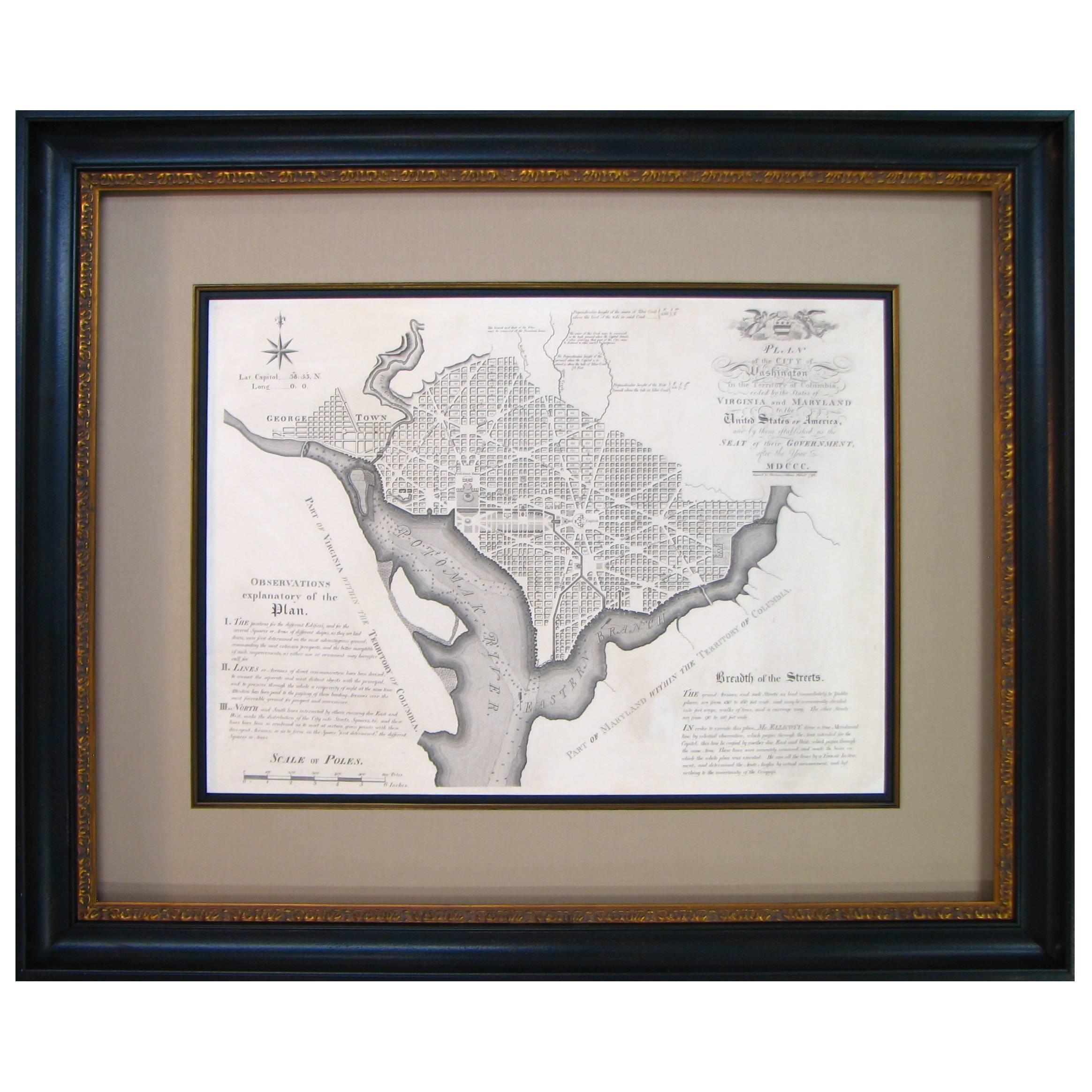
- Plan for the City of Washington by Andrew Ellicott, Antique Print, 19th CenturyLocated in Colorado Springs, COBy Andrew Ellicott (1754-1820) and Pierre Charles L'Enfant (1754-1825). Plan of the City of Washington. Published by Thackara & Vallance, Philadelphia, 1792. Later impression printed on 19th century wove paper. This is a fine 19th century printing of the "official" plan of Washington, D.C. First printed in 1792 by the original publishers, Thackara & Vallance in Philadelphia, this is a later 19th century printing of the fifth recorded engraving of the L’Enfant / Ellicott city plan. The first three issues of this city plan were in published in periodicals, making the fifth edition only the second separately-issued engraving of the plan. In full, the title reads, “Plan of the City of Washington in the Territory of Columbia, ceded by the States of Virginia and Maryland to the United States of America and by them established as the Seat of their Government after the year 1800.” The national capital city is laid out according to a plan originally proposed by Pierre Charles L'Enfant and modified by Andrew Ellicott. L'Enfant was born in Paris, where he trained to be an architect. He came to America in 1777, and served under George Washington as an engineer during the Revolutionary War. In 1791, Washington asked L'Enfant to design the new capital city in the District of Columbia. However, trouble arose between the city and L'Enfant. The City Commissioner needed a finished, printed copy of the plan in order to sell building lots but L'Enfant worked slowly and released only incomplete plans, and proved to be quite obstinate. On instruction from President Washington...Category
Antique Late 19th Century American Maps
MaterialsPaper
 $11,900 Sale Price20% Off
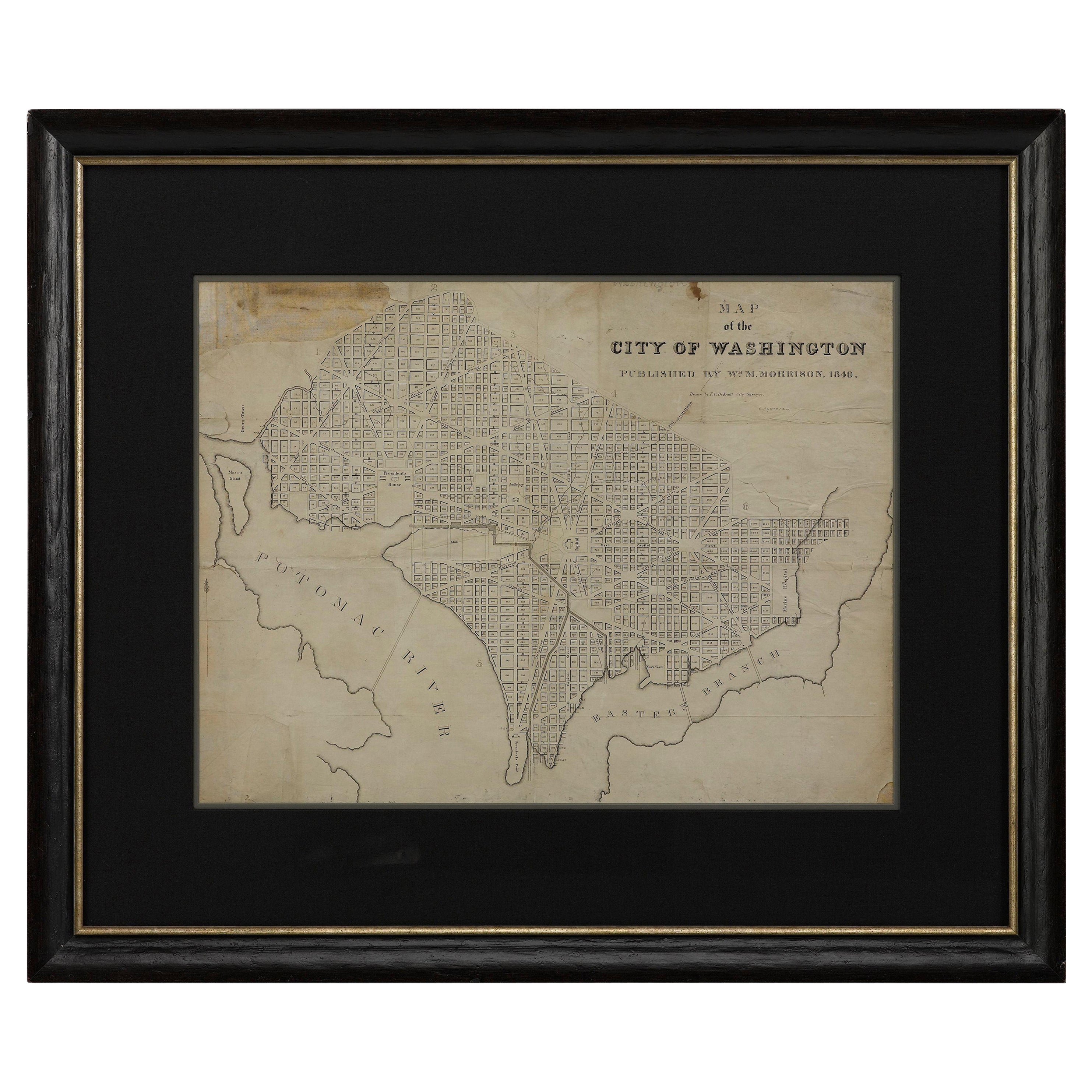
 - 1840 Map of the City of Washington Published by William M. MorrisonLocated in Colorado Springs, COThis map, printed in 1840, is a detailed representation of Washington, D.C. in the mid-19th century. The map shows block numbers, wards, and government buildings as well as details o...Category
Antique 1840s American Federal Maps
MaterialsPaper
- Plan of Paris, France, by A. Vuillemin, Antique Map, 1845Located in Colorado Springs, COThis large and detailed plan of Paris was published by Alexandre Vuillemin in 1845. The map conveys a wonderful amount of information and is decorated throughout with pictorial vigne...Category
Antique 1840s American Maps
MaterialsPaper
- 1861 Topographical Map of the District of Columbia, by Boschke, Antique MapLocated in Colorado Springs, COPresented is an original map of Albert Boschke's extremely sought-after "Topographical Map of the District of Columbia Surveyed in the Years 1856 ...Category
Antique 1860s American Historical Memorabilia
MaterialsPaper
- 1840 "New Map of the City of New York With Part of Brooklyn & Williamsburg"Located in Colorado Springs, COPresented is a hand-colored, engraved folding map titled "New Map of the City of New York With Part of Brooklyn & Williamsburg" by J. Calvin Smith. The map was issued bound in the bo...Category
Antique 1840s American Maps
MaterialsPaper
- N.E. View of the United States Capitol, Washington, DC Antique Proof Print 1858Located in Colorado Springs, COThis engraved print shows a view of the United States Capitol Building, in Washington, D.C. The print depicts the neoclassical building from the northeast orientation, with a bustling street scene in front. The steel engraving is a proof printing, drawn and engraved by Henry Sartain and published in 1858. Plans began in May 1854 to build a new cast-iron dome for the United States Capitol. The then-architect of the Capitol Thomas Walter and his team were sold on the aesthetics of a new dome, as well as the utility of a fire-proof one. A year later, on March 3, 1855, President Franklin Pierce...Category
Antique 1850s American Prints
MaterialsPaper


You May Also Like
- Antique Plan of the City of Bayonne, FranceLocated in Langweer, NLAntique map titled 'Plan de Bayonne'. Original old plan of the city of Bayonne, France. This map originates from 'Le Petit Atlas Maritime (..)' by J.N. Bellin. Published 1764. Be...Category
Antique Mid-18th Century Maps
MaterialsPaper
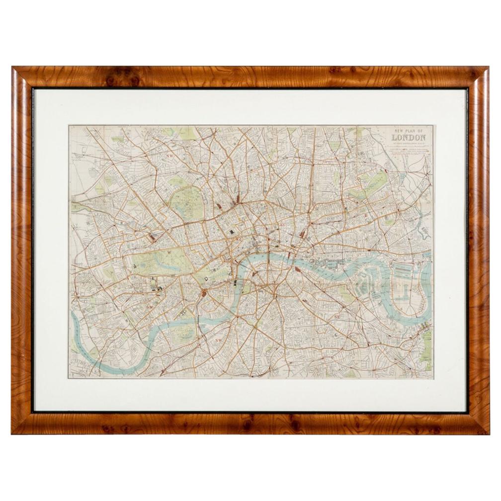
- Antique "New Plan of London" Map by John Bartholomew, 1900Located in Bridgeport, CTProduced for the W.H. Smith guide, folded in the original. The map here is unfolded and framed flat, with transportation routes shown and color details. sight 22 x 32" (original ful...Category
Antique Early 1900s English Victorian Maps
MaterialsPaper
- Original Antique Map / City Plan of Brussels by Tallis, circa 1850Located in St Annes, LancashireGreat map of Brussels. Steel engraving. Published by London Printing & Publishing Co. (Formerly Tallis), C.1850 Free shipping.Category
Antique 1850s English Maps
MaterialsPaper
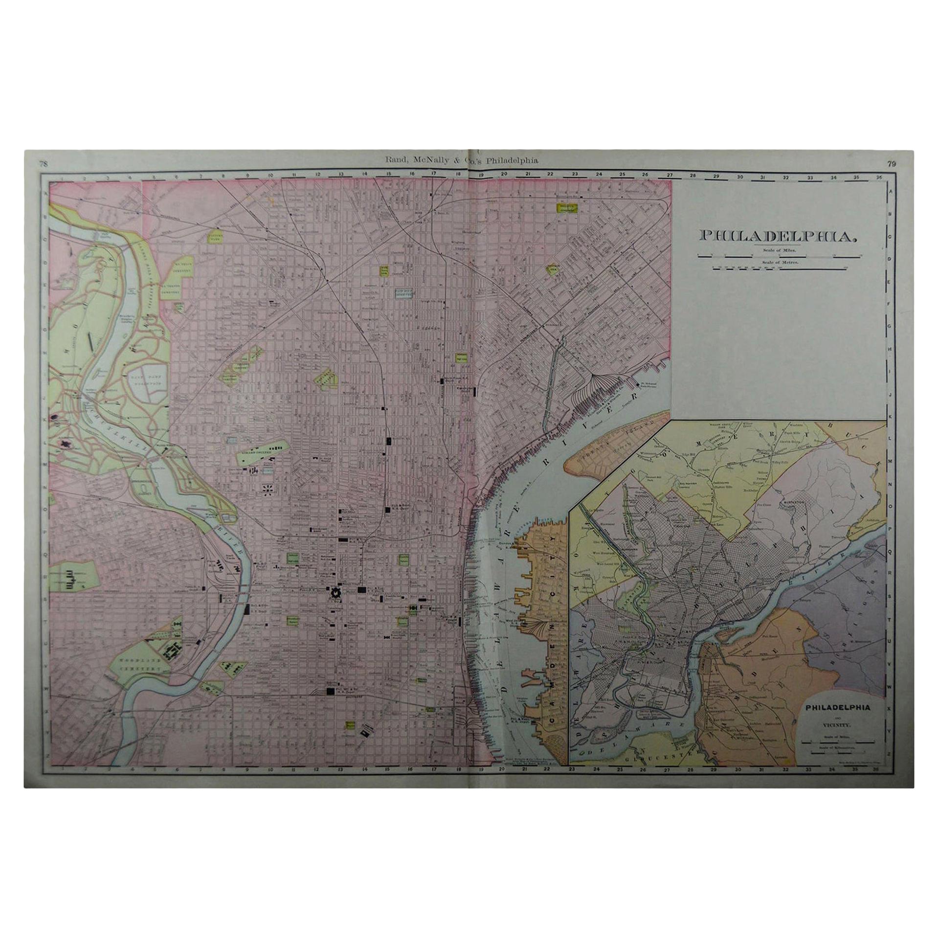
- Large Original Antique City Plan of Philadelphia, USA, circa 1900By Rand McNally & Co.Located in St Annes, LancashireFabulous colorful map of Philadelphia Original color By Rand, McNally & Co. Published, circa 1900. Unframed Free shipping.Category
Antique Early 1900s American Maps
MaterialsPaper
- Large Original Antique City Plan of Montreal, Canada, circa 1900By Rand McNally & Co.Located in St Annes, LancashireFabulous colorful map of Montreal Original color By Rand, McNally & Co. Published, circa 1900 Unframed Free shipping.Category
Antique Early 1900s American Maps
MaterialsPaper
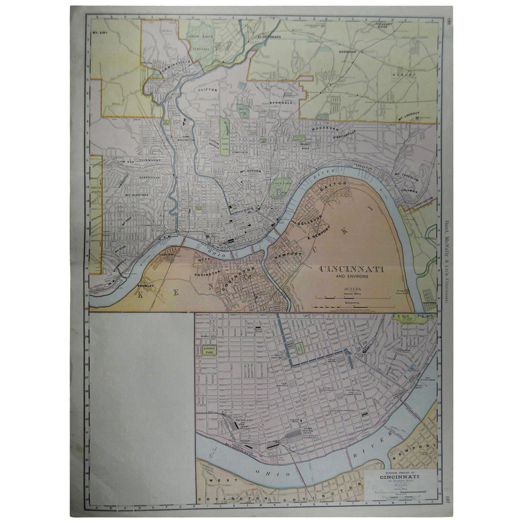
- Large Original Antique City Plan of Cincinnati, USA, circa 1900By Rand McNally & Co.Located in St Annes, LancashireFabulous colorful map of Cincinnati, Ohio. Original color By Rand, McNally & Co. Published, circa 1900 Unframed Free shipping.Category
Antique Early 1900s American Maps
MaterialsPaper


