Maps
to
1,936
2,521
131
2,657
79
18
9
6
5
4
4
4
3
1
1
2,936
2,181
476
3
289
34
10
127
7
35
9
2
5
4
4
2
2,579
92
35
30
30
329
228
143
126
112
2,657
2,657
2,657
104
29
9
8
7
Maps For Sale
Period: 20th Century
Period: 19th Century
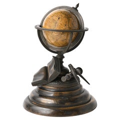
Miniature Terrestrial Globe Newton & Son London, Post 1833, Ante 1858
Located in Milano, IT
Miniature Terrestrial Globe
Newton & Son
London, post 1833, ante 1858
Paper, papier-mâché, bronze and wood
It measures: sphere diameter 2.95 in (7.6 cm); diameter of the wooden base 6.02 in (15.3 cm); height 8.36 in (21.24 cm).
Weight: 2,067 lb.
State of conservation: the globe still bears its original paint, but has various small gaps, abrasions and stains on the surface.
The globe is hinged with two pins at the meridian circle, which is in turn inserted perpendicular to the horizon circle; this is supported by four semi-arches connected at the bottom by a small goblet-shaped foot, resting on a wooden bell-shaped base.
Apart from the wooden base, the entire support structure is made of bronze; on the foot there are the scale reproductions of a compass, a telescope and an open book.
The sphere is made of papier-mâché and is covered with twelve printed paper gores.
In the North Pacific Ocean the globe bears a cartouche with the inscription (about 30% of the writing is illegible, but the missing parts can be easily integrated based on the rest):
NEWTON’S
New & Improved
TERRESTRIAL
Globe
Published by Newton & Son
66 Chancery Lane
LONDON
On the globe, much of central Africa is empty and the great lakes Tanganyika and Victoria are not marked (Europeans would begin to explore the area after 1858). Canada is called "British Territory" and Alaska "Russian Territory" (it would become part of the United States in 1867). Australia already bears its modern name (until 1829 it had been called New Holland) and its coasts are completely designed; Tasmania is listed as an island (Matthew Flinders circumnavigated it in 1798). The routes of Cook's various voyages are plotted; both the route followed by Biscoe in 1831 and the "Land of Enderby" which he discovered on the coast of Antarctica, south of Africa, are marked.
Bibliography
P. Van der Krogt, Old Globes...
Category
1840s English Early Victorian Antique Maps
Materials
Bronze
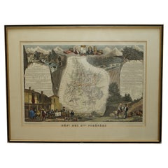
Fine French Antique 1856 Hand Watercolour Map of Dept Des Hautes Pyrenees
Located in West Sussex, Pulborough
We are delighted to offer for sale this stunning 1856 hand watercolour map of the Austrian Alps titled Dept Des Hautes Pyrenees taken from the Atlas Nat...
Category
1850s French Early Victorian Antique Maps
Materials
Paper
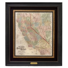
1873 "Map of the States of California and Nevada" by Chas. Drayton Gibbes
Located in Colorado Springs, CO
Presented is Warren Holt and Charles Drayton Gibbes' 1873 “Map of California and Nevada.” This map is considered to be one of the finest large-scale ...
Category
1870s American Antique Maps
Materials
Paper
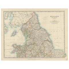
Antique Map of England and Wales, 1903, with Detailed Counties and Railways
Located in Langweer, NL
Title: Antique Map of England and Wales, 1903, with Detailed Counties and Railways
Description:
This beautifully detailed antique map, titled "England and Wales," was engraved and p...
Category
Early 20th Century Maps
Materials
Paper
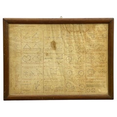
1852 Geometrical Constructions Chart by C. W. Knudsen
Located in Garnerville, NY
Twenty two (22) meticulously rendered hand written and drawn geometrical constructions by C. W. Knudsen, circa 1952. The piece is inscribed in red lower left, C. W. Knudsen, August 1...
Category
1850s American Schoolhouse Antique Maps
Materials
Glass, Wood, Paper, Parchment Paper
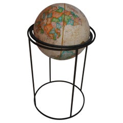
1970's rotating replogle world globe
Located in Los Angeles, CA
An elegant world globe by Paul Mc Cobb, the brass patina is much nicer in person
Category
1970s American Mid-Century Modern Vintage Maps
Materials
Brass
Antique Map of Turkey in Asia (Asia Minor and Transcaucasia), 1903
Located in Langweer, NL
Antique Map of Turkey in Asia (Asia Minor and Transcaucasia), 1903, with Intricate Provincial Borders
This antique map, titled "Turkey in Asia (Asia Minor) and Transcaucasia," was e...
Category
Early 20th Century Maps
Materials
Paper
1889 Map of Italy in 3D Relief
Located in Weesp, NL
Introducing a true gem for collectors and history enthusiasts alike: this rare 1889 *"Italia in Rilievo"* map by L. Roux & Co. from Torino, a masterpiece of craftsmanship and cartogr...
Category
1880s European Antique Maps
Materials
Paper
Antique Map of the Mediterranean Basin, 1903, with Detailed Coastal and Inland
Located in Langweer, NL
Title: Antique Map of the Mediterranean Basin, 1903, with Detailed Coastal and Inland Geography
Description: This antique map, titled "Basin of the Mediterranean," was engraved and ...
Category
Early 20th Century Maps
Materials
Paper
1876 Map of the United States: Detailing the Railroads and Unsettled Territories
Located in Langweer, NL
Stanford’s Smaller Railway Map of the United States, 1876
This original 1876 map, titled "Stanford's Smaller Railway Map of the United States Distinguishing the Unsettled Territorie...
Category
1870s Antique Maps
Materials
Paper
"Atlas to Accompany Monograph XXXII on the Geology of Yellowstone National Park"
By United States Geological Survey
Located in Colorado Springs, CO
This is an original 1904 "Atlas to Accompany Monograph XXXII on the Geology of the Yellowstone National Park" by Arnold Hague. Published by the Department of the Interior, the Atlas ...
Category
Early 1900s American Antique Maps
Materials
Leather, Fabric, Paper
19th Century Lithograph Map of Lower Manhattan, New York
Located in Haddonfield, NJ
1859 hand colored map of Lower Manhattan or New Amsterdam by George H. Moore.
Category
19th Century English Folk Art Antique Maps
Materials
Paper
Rare Set of 3 Map Samplers by A Charles. Italy, Spain & France
Located in Chelmsford, Essex
Set of 3 Map Samplers by A Charles. All depict countries, cities, seas and landmarks of the respective countries. The first entitled, 'SPAIN and PORTUGAL'. The second, 'MAP OF FRANCE...
Category
Early 19th Century English Antique Maps
Materials
Linen
1842 Wall Map of the United States by J. H. Young, Published by S. A. Mitchell
Located in Colorado Springs, CO
Presented is an 1842 hanging “Map of the United States,” engraved by J. H. Young and published by Samuel Augustus Mitchell, Philadelphia. This is a beautiful example of the rare 1842...
Category
1840s American Antique Maps
Materials
Paper
Vintage "View of the Center of Paris Taken from the Air" Lithograph Map
Located in San Diego, CA
A very stylish "View of the Center of Paris Taken from the Air" lithograph map published by the Paris Ministry of Tourism, circa early 1950s. The piece measures 27" x 43" and shows...
Category
20th Century French Mid-Century Modern Maps
Materials
Paper
Antique Map of South America by Wyld, circa 1850
By J. Wyld
Located in Langweer, NL
Beautiful folding map of South America titled 'Colombia Prima or South America Drawn from the Large Map in Eight Sheets by Louis Stanislas D ' Arcy Delarochette'. Three insets in the...
Category
Mid-19th Century British Antique Maps
Materials
Paper
20thC Leather Cased Collection Of Bartholomew Maps Of Great Britain c.1920
Located in Royal Tunbridge Wells, Kent
Antique 20th Century leather-cased collection of Bartholomew British road maps by Edward Stanford Ltd of London. One volume features a map of the entire British Isles, divided into n...
Category
20th Century British Other Maps
Materials
Leather, Paper
Original Antique Map of the South Part of Italy with an Inset of Malta, 1882
Located in Langweer, NL
Embark on a captivating journey through the southern part of Italy with an original Antique Map from the esteemed 'Comprehensive Atlas and Geography of the World,' meticulously craft...
Category
1880s Antique Maps
Materials
Paper
1866 Ensign & Bridgman's Rail Road Map of the United States
Located in Colorado Springs, CO
Presented is an 1866 issue of “Ensign & Bridgeman’s Rail Road Map of the United States, showing Depots & Stations.” First published in 1856, this is the third edition, following anot...
Category
1860s American Late Victorian Antique Maps
Materials
Paper
Antique 1830 Map of Munster, Ireland with Limerick, Cork, Kerry and Tipperary
Located in Langweer, NL
Title: Antique 1830 Map of Munster, Ireland with Limerick, Cork, Kerry, and Tipperary
Description: This 1830 German-language map, titled Britisches Reich – C. Kon: Ireland, focu...
Category
1830s Antique Maps
Materials
Paper
Rare 1864 Civil War Era Map of Arkansas, Mississippi, and Louisiana
Located in Langweer, NL
Title: Rare 1864 Civil War Era Map of Arkansas, Mississippi, and Louisiana
Description: This captivating antique map, titled "Johnson's Arkansas, Mississippi, and Louisiana," was pu...
Category
1860s Antique Maps
Materials
Paper
Pl. 88 Antique Print of Decorative Art in the 18th Century by Racinet, 1869
Located in Langweer, NL
Old print of decorative art in the 18th century. This print originates from 'L'Ornement polychrome'. A beautiful work containing about 2000 patterns of all the styles of Art old and ...
Category
19th Century Antique Maps
Materials
Paper
Rare 1864 Civil War Era Map of Massachusetts, Connecticut, and Rhode Island
Located in Langweer, NL
Title: Rare 1864 Civil War Era Map of Massachusetts, Connecticut, and Rhode Island
Description: This exquisite antique map, titled "Johnson's Massachusetts, Connecticut, and Rhode I...
Category
1860s Antique Maps
Materials
Paper
Large Antique County Map of Huntingdonshire, England
Located in Langweer, NL
Antique map titled 'A Map of Huntingdonshire from the best Authorities'. Original old county map of Huntingdonshire, England. Engraved by John Cary. Originates from 'New British Atla...
Category
Early 19th Century Antique Maps
Materials
Paper
Large Antique County Map of Nottinghamshire, England
Located in Langweer, NL
Antique map titled 'A Map of Nottinghamshire from the best Authorities'. Original old county map of Nottinghamshire, England. Engraved by John Cary. Originates from 'New British Atla...
Category
Early 19th Century Antique Maps
Materials
Paper
Large Antique County Map of Essex, England
Located in Langweer, NL
Antique map titled 'A Map of Essex from the best Authorities'. Original old county map of Essex, England. Engraved by John Cary. Originates from 'New Brit...
Category
Early 19th Century Antique Maps
Materials
Paper
Large Antique County Map of Somersetshire, England
Located in Langweer, NL
Antique map titled 'A Map of Somersetshire from the best Authorities'. Original old county map of Somersetshire, England. Engraved by John Cary. Originates from 'New British Atlas' b...
Category
Early 19th Century Antique Maps
Materials
Paper
Large Antique County Map of Ruthlandshire, England
Located in Langweer, NL
Antique map titled 'A Map of Ruthlandshire from the best Authorities'. Original old county map of Ruthlandshire, England. Engraved by John Cary. Originates from 'New British Atlas' b...
Category
Early 19th Century Antique Maps
Materials
Paper
Large Antique County Map of Suffolk, England
Located in Langweer, NL
Antique map titled 'A Map of Suffolk from the best Authorities'. Original old county map of Suffolk, England. Engraved by John Cary. Originates from 'New British Atlas' by John Stock...
Category
Early 19th Century Antique Maps
Materials
Paper
Large Antique County Map of Cumberland, England
Located in Langweer, NL
Antique map titled 'A Map of Cumberland from the best Authorities'. Original old county map of Cumberland, England. Engraved by John Cary. Originates...
Category
Early 19th Century Antique Maps
Materials
Paper
Large Antique County Map of Durham, England
Located in Langweer, NL
Antique map titled 'A Map of Durham from the best Authorities'. Original old county map of Durham, England. Engraved by John Cary. Originates from 'New ...
Category
Early 19th Century Antique Maps
Materials
Paper
1837 Mitchell's "Tourist's Pocket Map of the State of Virginia" by J.H. Young
Located in Colorado Springs, CO
This is J. H. Young's pocket map of the Virginia, which shows county development current to 1835. The map was engraved by E. Yeager and F. Dankworth and published by S. A. Mitchell. ...
Category
1830s American Antique Maps
Materials
Paper
Antique Map of the Old World Projection, Entitled Orbis Terrarum Ad Mentem, 1825
Located in Langweer, NL
Antique map titled 'Orbis Terrarum ad Mentem (..)'. Old map of the world originating from 'Atlas der Oude Wereld'.
Artists and Engravers: Published by C. Ph. Funke and W. van Boe...
Category
19th Century Antique Maps
Materials
Paper
Early 19th Century Hand Coloured Map of North America by Aaron Arrowsmith
By Aaron Arrowsmith
Located in Hamilton, Ontario
Hand coloured map in French by English cartographer Aaron Arrowsmith (1750–1823) titled "Amerique Septentionale" (North America).
Map size: 9.5" x 8"
Mat size: 20.5" x 14.25".
Category
Early 19th Century English Antique Maps
Materials
Paper
"San Francisco, Upper California” 1851 Antique Map of San Francisco
Located in Colorado Springs, CO
This is a pictorial lettersheet view of the city and harbor of San Francisco. This lithograph was printed on grey wove paper, across a double sheet, by famed lithographers Britton & ...
Category
1850s American Antique Maps
Materials
Paper
Early 19th Century Original Framed Land Indenture, England, 1810
Located in Lambertville, NJ
A large hand written land indenture document England, 1810, framed. The beautifully hand written document mounted on board with a red velvet border and ...
Category
1810s English Regency Antique Maps
Materials
Glass, Giltwood, Parchment Paper
Antique Print of Oedidee, a Native from Bora Bora, 1803
Located in Langweer, NL
Antique print titled 'Oedidee Jongman van Bolabola'.
Antique print of Oedidee, a native from Bora Bora. Originates from 'Reizen Rondom de Waereld door James Cook (..)'.
Artis...
Category
Early 1800s Antique Maps
Materials
Paper
Antique Map of the Kingdom of Denmark by Wyld '1845'
Located in Langweer, NL
Antique map titled 'Kingdom of Denmark'. Original antique map of the Kingdom of Denmark. This map originates from 'An Atlas of the World, Comprehending Separate Maps of its Various C...
Category
Mid-19th Century Antique Maps
Materials
Paper
Map of United States Central Sheet 1903 – Railroads, States, and Topography
Located in Langweer, NL
Map of United States Central Sheet 1903 – Railroads, States, and Topography
This is a finely engraved and beautifully colored map titled "United States of North America (Central She...
Category
Early 20th Century Maps
Materials
Paper
Antique Map of Australia by Levasseur, '1875'
Located in Langweer, NL
Antique map titled 'Carte générale de l'Australie'. Large map of Australia. This map originates from 'Atlas de Géographie Moderne Physique et Politiq...
Category
Late 19th Century Antique Maps
Materials
Paper
Antique Map of Siberia by Levasseur '1875'
Located in Langweer, NL
Antique map titled 'Carte de la Russie d'Asie Sibérie'. Large map of Siberia. This map originates from 'Atlas de Géographie Moderne Physique et Politique' by A. Levasseur. Published ...
Category
Late 19th Century Antique Maps
Materials
Paper
Antique Map of the Northeast USA - Vibrant 1903 Cartographic Detail
Located in Langweer, NL
Map of the Northeastern United States of North America, 1903
This striking antique map titled “United States of North America (North Eastern Sheet)” was created by the renowned Scot...
Category
Early 20th Century Maps
Materials
Paper
Canada Dominion Map 1903 - A Detailed View of Eastern Canada and Newfoundland
Located in Langweer, NL
North America, 1903 - A Colorful Historical Map with Detailed Borders
This attractive map of North America was engraved, printed, and published by W. & A.K. Johnston in 1903. A wond...
Category
Early 20th Century Maps
Materials
Paper
Antique Map of Calvados ‘France’ by V. Levasseur, 1854
Located in Langweer, NL
Antique map titled 'Dépt. du Calvados'. Map of the French department of Calvados, France. This area of France is known for its production of Calvados, the world's fines apple brandy....
Category
Mid-19th Century Antique Maps
Materials
Paper
Maitland Smith Globe on Stand
Located in Norwell, MA
World globe with brass horizon band. Intricately carved pedestal base with ball and claw feet. Quite detailed. By the famous Maitland Smith, globe itself is from Replogle. 62" H x 26...
Category
1970s North American Vintage Maps
Materials
Wood
Victorian Visions of the New World: A Detailed Tallis Map of North America, 1851
Located in Langweer, NL
The map presented here is an intricate example from the series of maps produced by John Tallis & Company. Tallis maps are known for their detailed and elaborate style, often includin...
Category
1850s Antique Maps
Materials
Paper
Abyssinia and Upper Nubia, 1903 - Detailed Map of the Horn of Africa Region
Located in Langweer, NL
Title: Abyssinia and Upper Nubia, 1903 - Detailed Map of the Horn of Africa Region
This fascinating map titled "Abyssinia and Upper Nubia" was engraved, printed, and published by W....
Category
Early 20th Century Maps
Materials
Paper
Oil Lamp with an Illuminating Globe Shade, circa 1885
Located in London, GB
A rare late 19th century oil lamp with a globe shade and base decorated with a castle set in a rural scene, circa 1885.
Northern Europe...
Category
Late 19th Century European Antique Maps
Materials
Glass
1950's Glass Globe Lamp, Denmark
Located in New York, NY
Danish Glass Globe Lamp, c. 1950's.
Can be lit with inner bulb.
Category
1950s Danish Mid-Century Modern Vintage Maps
Materials
Glass, Wood
Vintage Afghan Pictorial Map Rug
Located in New York, NY
A vintage Afghan Pictorial map rug from the mid-20th century.
Measures: 3' 0" x 4' 10"
Category
Mid-20th Century Afghan Folk Art Maps
Materials
Wool
1901 Nautical Chart Showing Woods Hole, Mass
Located in Norwell, MA
Rare 1901 chart of Woods Hole, Mass., showing Buzzards Bay, Penzance Point, Nonamesset Island, Downtown Woods Hole, Parker Neck, Nobska Head, Vineyard Sound, Woods Hole Golf Club, Ra...
Category
Early 1900s North American Antique Maps
Materials
Paper
Antique Map of China, Taiwan, Korea, Hong-Kong and Japan, 1903
Located in Langweer, NL
Antique Map of China, Taiwan, Korea, Hong-Kong and Japan, 1903
Description: This antique map, titled "India (Southern Sheet) and the South Eastern Provinces," was engraved and publi...
Category
Early 20th Century Maps
Materials
Paper
Early 20th Century American Library Globe
Located in Norwell, MA
Fine library globe with makers logo from Atlas School Supply Co., Chicago. Hardwood base with rich finish and nice detail. Celestial globe with equ...
Category
1920s North American Vintage Maps
Materials
Wood
Antique Map of South Australia, New South Wales, Victoria and Queensland, 1903
Located in Langweer, NL
Title: Antique Map of South Australia, New South Wales, Victoria, and Queensland, 1903
Description:
This antique map, titled "South Australia, New South Wales, Victoria, and Queensl...
Category
Early 20th Century Maps
Materials
Paper
1855 "New-York City & County Map" by Charles Magnus
By Charles Magnus
Located in Colorado Springs, CO
This is a beautiful hand-colored map titled “New York City & County Map with Vicinity entire Brooklyn, Williamsburgh, Jersey City &c.” The work was published in 1855 by Charles Magnu...
Category
1850s American Antique Maps
Materials
Paper
Large Scale Map of the London Metropolis
Located in Dallas, TX
The product is a large scale map of the London Metropolis, specifically focusing on the city in intricate detail. It would be a valuable collectible for those interested in maps and ...
Category
Mid-20th Century English Maps
Materials
Paper
Antique Map of Switzerland and the Alps of Savoy & Piedmont, 1903 Edition
Located in Langweer, NL
Title: Antique Map of Switzerland and the Alps of Savoy & Piedmont, 1903, with Intricate Topographical Detail
Description:
This beautifully engraved antique map, titled "Switzerland...
Category
Early 20th Century Maps
Materials
Paper
Antique Map of Turkey in Europe, 1903, with Delicate Pastel Coloration
Located in Langweer, NL
Title: Antique Map of Turkey in Europe, 1903, with Delicate Pastel Coloration
Description:
This antique map, titled "Turkey in Europe," was engraved and published in 1903 by the dis...
Category
Early 20th Century Maps
Materials
Paper
