Maps
to
234
418
56
476
16
6
4
4
3
2
2,926
2,181
476
3
289
34
10
127
7
35
9
2
5
3
4
2
436
27
21
18
12
108
85
69
42
32
476
476
476
5
2
2
1
1
Maps For Sale
Period: 20th Century
Period: 1940s
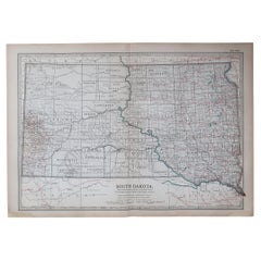
Original Antique Map of the American State of South Dakota, 1903
Located in St Annes, Lancashire
Antique map of South Dakota
Published By A & C Black. 1903
Original colour
Good condition
Unframed.
Free shipping
Category
Early 1900s English Antique Maps
Materials
Paper
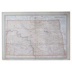
Original Antique Map of the American State of North Dakota, 1903
Located in St Annes, Lancashire
Antique map of North Dakota
Published By A & C Black. 1903
Original colour
Good condition
Unframed.
Free shipping
Category
Early 1900s English Antique Maps
Materials
Paper
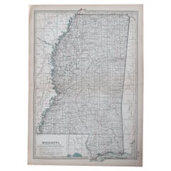
Original Antique Map of the American State of Mississippi, 1903
Located in St Annes, Lancashire
Antique map of Mississippi
Published By A & C Black. 1903
Original colour
Good condition
Unframed.
Free shipping
Category
Early 1900s English Antique Maps
Materials
Paper
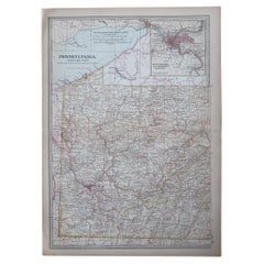
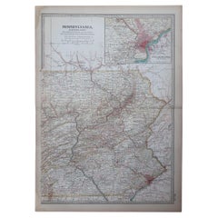
Original Antique Map of the American State of Pennsylvania( Western Part ), 1903
Located in St Annes, Lancashire
Antique map of Pennsylvania ( Western part )
Published By A & C Black. 1903
Original colour
Good condition
Unframed.
Free shipping
Category
Early 1900s English Antique Maps
Materials
Paper
Original Antique Map of the American State of Pennsylvania( Eastern Part ), 1903
Located in St Annes, Lancashire
Antique map of Pennsylvania ( Eastern part )
Published By A & C Black. 1903
Original colour
Good condition
Unframed.
Free shipping
Category
Early 1900s English Antique Maps
Materials
Paper
Original Antique Map of the American State of New York ( Northern Part ) 1903
Located in St Annes, Lancashire
Antique map of New York ( Northern Part )
Published By A & C Black. 1903
Original colour
Good condition
Unframed.
Free shipping
Category
Early 1900s English Antique Maps
Materials
Paper
Original Antique Map of the American States of Vermont & New Hampshire, 1903
Located in St Annes, Lancashire
Antique map of Vermont and New Hampshire
Published By A & C Black. 1903
Original colour
Good condition
Unframed.
Free shipping
Category
Early 1900s English Antique Maps
Materials
Paper
Pl. XXV Villa Marguerite a Houlgate, Chabat, c.1900
Located in Langweer, NL
Antique print titled 'Villa Marguerite a Houlgate, Mr. E.M. Auburtin, Architecte'. This print depicts the design of a villa in France. Originates from 'La Brique et La Terre Cuite' b...
Category
20th Century Maps
Materials
Paper
Vintage Print of the Lady of Stavoren by Voskuijl, 1946
Located in Langweer, NL
Vintage lithograph titled 'Vrouwtje van Stavoren'. Lithograph of the Lady of Stavoren, a folk tale from the Netherlands which originated in the 16th century. Published 1946.
Arti...
Category
20th Century Maps
Materials
Paper
Large Original Vintage Map of Switzerland, circa 1920
Located in St Annes, Lancashire
Great map of Switzerland
Original color.
Good condition
Published by Alexander Gross
Unframed.
Category
1920s English Vintage Maps
Materials
Paper
Old French Architectural Print of École Nationale Professionnelle d'Armentières
Located in Langweer, NL
Antique print titled 'École Nationale Professionnelle d'Armentières Pavillon de l'Escalier, Mr. Charles Chipiez Architecte'. This print depicts the design o...
Category
20th Century Maps
Materials
Paper
Large Original Vintage Map of New Zealand, South Island, circa 1920
Located in St Annes, Lancashire
Great map of South Island, New Zealand
Original color.
Good condition / repair to a minor tear on right edge
Published by Alexander Gross
Unframed.
Category
1920s English Edwardian Vintage Maps
Materials
Paper
Heliograph of Tin Mining in Tronoh, Perak and Tambun in Sabah, Malaysia, 1907
Located in Langweer, NL
Three views of the Mining Industry in Malaysia around 1907.
1. Lankshuts at Tronoh, Perak
2. Puddling Machinery, Tambun in Sabah
3. Shaking Machinery at Red Hill
This helio...
Category
Early 1900s Antique Maps
Materials
Paper
Antique Map of West Kalimantan (Schwaner Mountains), Borneo, Indonesia, 1900
Located in Langweer, NL
Antique map of West Kalimantan, Borneo. It shows the region of the Schwaner Mountains. This map originates from 'Atlas van Nederlandsch Oost- en West-Indië' by I. Dornseiffen.
Arti...
Category
20th Century Maps
Materials
Paper
Antique Map of Part of Java, Indonesia, 1900
Located in Langweer, NL
Antique map of West Java. This map originates from 'Atlas van Nederlandsch Oost- en West-Indië' by I. Dornseiffen.
Artists and Engravers: Published by Seyffardt's Boekhandel, Amste...
Category
20th Century Maps
Materials
Paper
Architectural Print of Ecuries Avenue Raphaël, Paris by Chabat, c.1900
Located in Langweer, NL
Antique print titled 'Ecuries Avenue Raphaël Paris, Mr. A. Feine Architecte'. This print depicts the design of a building in France. Originates from 'La Brique et La Terre Cuite' by ...
Category
20th Century Maps
Materials
Paper
Antique Map of Zuid-Holland and Utrecht in The Netherlands, 1902
Located in Langweer, NL
Antique map titled 'Zuid-Holland en Utrecht'. Lithographed map of the provinces of Zuid-Holland and Utrecht, the Netherlands. This map originates from 'Atlas van Nederland'.
Artist...
Category
20th Century Maps
Materials
Paper
Antique Map of Sulawesi by Winkler Prins, c.1900
Located in Langweer, NL
Antique map titled 'Celebes.' (Sulawesi .) This map shows the Indonesian island of Sulawesi, one of the Sunda islands. With inset maps of South-west Sulawesi and Semenanjung Minahassa. Legend and scale. This map originates from 'De Grote Winkler Prins...
Category
20th Century Maps
Materials
Paper
Architectural Print of French Villa de la Hutte A Deauville by Chabat, c.1900
Located in Langweer, NL
Antique print titled 'Villa de la Hutte A Deauville, Mr. E. Saintin Architecte'. This print depicts the design of a building in France. Originates from 'La Brique et La Terre Cuite' ...
Category
20th Century Maps
Materials
Paper
Pl. XXVI Villa Marguerite a Houlgate, Chabat, c.1900
Located in Langweer, NL
Antique print titled 'Villa Marguerite a Houlgate, Mr. E.M. Auburtin, Architecte'. This print depicts the design of a villa in France. Originates from 'La Brique et La Terre Cuite' b...
Category
20th Century Maps
Materials
Paper
Antique Map of the War Situation in Europe and Asia, 1944
Located in Langweer, NL
Antique map titled 'Newsmap for the Armed Forces'. This "newsmap" was issued on Monday, December 18, 1944, and covers the news from December 6-13, 1945 - the 275th week of the war. T...
Category
20th Century Maps
Materials
Paper
Pl. XXIV Villa Marguerite a Houlgate, Chabat, c.1900
Located in Langweer, NL
Antique print titled 'Villa Marguerite a Houlgate, Mr. E.M. Auburtin, Architecte'. This print depicts the design of a villa in France. Originates from 'La Brique et La Terre Cuite' b...
Category
20th Century Maps
Materials
Paper
Four Rare Heliograph Views of Mining Near Sungei Bessi River in Malaysia, 1907
Located in Langweer, NL
Four views of early Mining operations in Malaysia at the beginning of the 20th century. Published in 1907.
1) A Sand-Lake of Residue (Sungai of Sungei Bessi)
2) Chinese Smelting...
Category
Early 1900s Antique Maps
Materials
Paper
Pl. XL Beuzeval 'Calvados', Chabat, c.1900
Located in Langweer, NL
Antique print titled 'Villa Brodu, Beuzeval (Calvados) Mr. Baumier, Architecte'. This print depicts the design of a villa in Calvados, France. Originates from 'La Brique et La Terre ...
Category
20th Century Maps
Materials
Paper
Architectural Print of French Pavillon de la Grande Tuilerie, Chabat, c.1900
Located in Langweer, NL
Antique print titled 'Pavillon de la Grande Tuilerie de Bourgogne (de Montghanin) Exposition Universelle de 1889, Mrs. Wulliam et Farge Architectes'. This print depicts the design of...
Category
20th Century Maps
Materials
Paper
Antique Map of the Region of Tokyo and Nagasaki in Japan, 1922
Located in Langweer, NL
Antique map of Japan titled 'Japan - Environs of Tokio & Nagasaki'. Old map of Japan, includes inset maps of Tokyo, Nagasaki and surroundings. This map or...
Category
20th Century Maps
Materials
Paper
Large Original Vintage Map of New Zealand, North Island, circa 1920
Located in St Annes, Lancashire
Great map of North Island, New Zealand
Original color.
Good condition / minor foxing to right edge
Published by Alexander Gross
Unframed.
Category
1920s English Edwardian Vintage Maps
Materials
Paper
Pl. XII Villa a Houlgate, Chabat, c.1900
Located in Langweer, NL
Antique print titled 'Villa a Houlgate Mr. E. Papinot Architecte'. This print depicts the design of a villa in France. Originates from 'La Brique et La Terre Cuite' by P. Chabat. Art...
Category
20th Century Maps
Materials
Paper
Antique Map of Northwest Africa by Bartholomew, 1922
Located in Langweer, NL
Antique map of Africa titled 'North-West Africa'. Old map of north-west Africa depicting Morocco, Algeria, Tunis and surroundings. This map originates from 'The Times' atlas. Artists...
Category
20th Century Maps
Materials
Paper
Architectural Print From France of the Galerie des Machines, Chabat, c.1900
Located in Langweer, NL
Antique print titled 'Gallerie des Machines Exposition Universelle de 1889, Mr. F. Dufert Architecte'. This print depicts the design of a building in France. Originates from 'La Briq...
Category
20th Century Maps
Materials
Paper
Antique Map of Noord-Holland, Province of The Netherlands, 1902
Located in Langweer, NL
Antique map titled 'Noord-Holland'. Lithographed map of the province of Noord-Holland, the Netherlands. This map originates from 'Atlas van Nederland'. Artists and Engravers: Publish...
Category
20th Century Maps
Materials
Paper
Pl. XX Villa Mon Caprice, Chabat, c.1900
Located in Langweer, NL
Antique print titled 'Villa mon Caprice Villers-Sur-Mer. Mr. E. Macé, Architecte'. This print depicts the design of a building in France. Originates from 'La Brique et La Terre Cuite...
Category
20th Century Maps
Materials
Paper
Architectural Building Design Print of Ecuries in France, Chabat, c.1900
Located in Langweer, NL
Antique print titled 'Ecuries Rue Cros (Paris) Mr. L. Lethorel Architecte'. This print depicts the design of buildings in France. Originates from 'La Brique et La Terre Cuite' by P. ...
Category
20th Century Maps
Materials
Paper
Antique Map of New Zealand by Johnston '1909'
Located in Langweer, NL
Antique map titled 'New Zealand'. Original antique map of New Zealand. With inset maps of Chatham, Auckland, Wellington, Dunedin, and New Gu...
Category
Early 20th Century Maps
Materials
Paper
Antique Map of New Zealand by G.F. Cram, 'circa 1906'
Located in Langweer, NL
Antique map titled 'New Zealand'. Large map of New Zealand with a small legend of the Chatham Islands. On the verso, a map of the North Polar regions and a map of Tasmania can be fou...
Category
20th Century Maps
Materials
Paper
Antique Map of Batavia and Surabaya by Winkler Prins, 1905
Located in Langweer, NL
Antique map titled 'Batavia en Soerabaja'. Detailed plan of Batavia (Jakarta) and Soerabaja (Surabaya), Indonesia. The plans include important places like Tandjoeng Priok, Oedjong, W...
Category
20th Century Maps
Materials
Paper
Architectural Print of 'Ecole Rue Madame' in France by Chabat, c.1900
Located in Langweer, NL
Antique print titled 'Ecole Rue Madame (Paris) Mr. H. Errard Architecte'. This print depicts the design of a school in Paris, France. Originates from 'La Brique et La Terre Cuite' by...
Category
20th Century Maps
Materials
Paper
Architectural Impression of Villa a Pont a Mousson in France, Chabat, c.1900
Located in Langweer, NL
Antique print titled 'Villa Weber, Mr. Paul Sédille Architecte'. This print depicts the design of a building in France. Originates from 'La Brique et La Terre Cuite' by P. Chabat. Ar...
Category
20th Century Maps
Materials
Paper
German Antique Map of China And Japan by Meyer, 1902
Located in Langweer, NL
Antique map titled 'China und Japan.' (Map of China and Japan). This attractive original old antique print / plate / map originates from the 6th edition of a famous German encycloped...
Category
20th Century Maps
Materials
Paper
Antique Map of Padang, Sumatra, Indonesia, 1900
Located in Langweer, NL
Antique map titled 'De Padangsche Beneden-en Bovenlanden van de Koninginnedbaai tot Fort de Kock'. Old map of Padang, Sumatra. This map originates from 'Atlas van Nederlandsch Oost- ...
Category
20th Century Maps
Materials
Paper
Vintage Etching of the Lebuinus Church in Deventer, the Netherlands, 1978
Located in Langweer, NL
Vintage etching of 'Deventer-Lubuïnus'. Etching of the Lebuinus church in Deventer, the Netherlands. Published 1978.
Artists and Engravers: Signed Maarten Langbroek (1918-1985).
Condition: Very good, passepartout/matting included. Please study image carefully.
Date: 1978
Overall size: 24 x 30 cm
We sell original antique maps to collectors, historians, educators and interior decorators all over the world. Our collection includes a wide range of authentic antique maps...
Category
20th Century Maps
Materials
Paper
Architectural Design Print of the French Villa Cocqueville, Chabat, c.1900
Located in Langweer, NL
Antique print titled 'Villa Cocqueville Mr. Robert de Massy, Architecte'. This print depicts the design of a building in France. Originates from 'La Brique et La Terre Cuite' by P. C...
Category
20th Century Maps
Materials
Paper
Antique Map of Germany by Johnston '1909'
Located in Langweer, NL
Antique map titled 'Empire of Germany'. Original antique map of Germany. With inset maps of Frankfurt and Munich. This map originates from the ‘...
Category
Early 20th Century Maps
Materials
Paper
Large Original Antique City Plan of Minneapolis and St Paul, USA, circa 1900
Located in St Annes, Lancashire
Fabulous colorful map of Minneapolis and St Paul, Minnesota.
Original color
By Rand, McNally & Co.
Published, circa 1900
Unframed
Minor edge tears
Free shipping.
Category
Early 1900s American Antique Maps
Materials
Paper
Antique Map of Aceh in Sumatra, Indonesia, 1900
Located in Langweer, NL
Antique map titled 'Groot-Atjeh en aangrenzende Kuststaten'. Old map of Aceh, with surrounding coastal regions. This map originates from 'Atlas van Nederlandsch Oost- en West-Indië' ...
Category
20th Century Maps
Materials
Paper
Old Map of The Frisian City of Workum in Holland, 1916
Located in Langweer, NL
Antique map Workum titled 'Workum'. Antique map depicting the Frisian city of Workum, the Netherlands.
Artists and Engravers: Lithograph by J. Smulders & Co, Den Haag.
Condi...
Category
20th Century Maps
Materials
Paper
Antique Map of New Zealand and Tasmania, 1904
Located in Langweer, NL
This large antique map is taken from; 'Andrees Allgemeiner Handatlas in 126 Haupt-Und 139 Nebenkarten', Bielefeld; Leipzig: Velhagen & Klasing 1899. Andrees Allgemeiner Handatlas was...
Category
20th Century Maps
Materials
Paper
Antique Map of Persia and Afghanistan by Johnston '1909'
Located in Langweer, NL
Antique map titled 'Persia and Afghanistan'. Original antique map of Persia and Afghanistan. This map originates from the ‘Royal Atlas o...
Category
Early 20th Century Maps
Materials
Paper
Antique Map of the United States of North America by Johnston '1909'
Located in Langweer, NL
Antique map titled 'United States of North America'. Original antique map of United States of North America ( South West Sheet ). With inset maps of Chicago...
Category
Early 20th Century Maps
Materials
Paper
Antique Map of Austria- Hungary by Johnston, '1909'
Located in Langweer, NL
Antique map titled 'Austria- Hungary'. Original antique map of Austria- Hungary. This map originates from the ‘Royal Atlas of Modern Geography’....
Category
Early 20th Century Maps
Materials
Paper
Original Antique Map of England and Wales from the 1909 Royal Atlas
Located in Langweer, NL
The antique map titled 'England and Wales' is a historical cartographic representation of these two nations. This original antique map of England...
Category
Early 20th Century Maps
Materials
Paper
Antique Map of the United States ' North East ' by Johnston '1909'
Located in Langweer, NL
Antique map titled 'United States of North America'. Original antique map of United States of North America ( North East ). This map orig...
Category
Early 20th Century Maps
Materials
Paper
Antique Map of the East Indies by Dornseiffen, 1900
Located in Langweer, NL
Title page of 'Atlas van Nederlandsch Oost- en West-Indië' by I. Dornseiffen. It shows the regions of the various maps included in this atlas. Included are the Dutch East Indies and ...
Category
20th Century Maps
Materials
Paper
Large Topographical and Geological Map of the Teshio Oil Field, '1936'
Located in Langweer, NL
Topographical and geological map of the Teshio oil field. Shows location of oil well, oil sand, natural gas, coal, Sulphur spring, anticlinal axis, prof...
Category
20th Century Maps
Materials
Linen, Paper
Large Sea Chart of the British Islands, 1918
Located in Langweer, NL
Antique map titled 'The British Islands'.
Large sea chart of the British Islands. It shows Ireland, Scotland, England, the Shetland Islands and part of Fra...
Category
1910s Vintage Maps
Materials
Paper
1939 "A Good-Natured Map of the United States" by Greyhound
Located in Colorado Springs, CO
Presented is an original 1939 map, titled “A Good-Natured Map of the United States Setting Forth the Services of the Greyhound Lines and a Few Principal Connecting Bus Lines.” This brightly colored pictographic map was one of several similar United States maps...
Category
1930s American Art Deco Vintage Maps
Materials
Paper
Pl. XLI Villa A Villemonble, Chabat, c.1900
Located in Langweer, NL
Antique print titled 'Villa A Villemonble'. This print depicts the design of a villa in France. Originates from 'La Brique et La Terre Cuite' by P. Chabat. Artists and Engravers: P. ...
Category
20th Century Maps
Materials
Paper
Antique Map of the Nias Archipelago, Sumatra, Indonsia, 1900
Located in Langweer, NL
Antique map of Nias Island and surrounding islands including the Banyak islands, Pini island and Simeulue Island. This map originates from 'Atlas van Nederlandsch Oost- en West-Indië...
Category
20th Century Maps
Materials
Paper
