Maps
to
234
418
56
476
16
6
4
4
3
2
2,926
2,181
476
3
289
34
10
127
7
35
9
2
5
3
4
2
436
27
21
18
12
108
85
69
42
32
476
476
476
5
2
2
1
1
Maps For Sale
Period: 20th Century
Period: Early 1900s
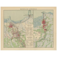
Antique Map of Batavia and Surabaya by Winkler Prins, 1905
Located in Langweer, NL
Antique map titled 'Batavia en Soerabaja'. Detailed plan of Batavia (Jakarta) and Soerabaja (Surabaya), Indonesia. The plans include important places like Tandjoeng Priok, Oedjong, W...
Category
20th Century Maps
Materials
Paper
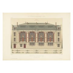
Architectural Print of 'Ecole Rue Madame' in France by Chabat, c.1900
Located in Langweer, NL
Antique print titled 'Ecole Rue Madame (Paris) Mr. H. Errard Architecte'. This print depicts the design of a school in Paris, France. Originates from 'La Brique et La Terre Cuite' by...
Category
20th Century Maps
Materials
Paper
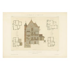
Architectural Impression of Villa a Pont a Mousson in France, Chabat, c.1900
Located in Langweer, NL
Antique print titled 'Villa Weber, Mr. Paul Sédille Architecte'. This print depicts the design of a building in France. Originates from 'La Brique et La Terre Cuite' by P. Chabat. Ar...
Category
20th Century Maps
Materials
Paper
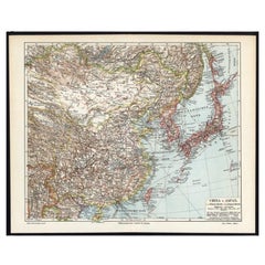
German Antique Map of China And Japan by Meyer, 1902
Located in Langweer, NL
Antique map titled 'China und Japan.' (Map of China and Japan). This attractive original old antique print / plate / map originates from the 6th edition of a famous German encycloped...
Category
20th Century Maps
Materials
Paper
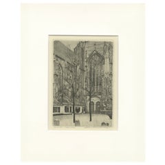
Vintage Etching of the Lebuinus Church in Deventer, the Netherlands, 1978
Located in Langweer, NL
Vintage etching of 'Deventer-Lubuïnus'. Etching of the Lebuinus church in Deventer, the Netherlands. Published 1978.
Artists and Engravers: Signed Maarten Langbroek (1918-1985).
Condition: Very good, passepartout/matting included. Please study image carefully.
Date: 1978
Overall size: 24 x 30 cm
We sell original antique maps to collectors, historians, educators and interior decorators all over the world. Our collection includes a wide range of authentic antique maps...
Category
20th Century Maps
Materials
Paper
Architectural Design Print of the French Villa Cocqueville, Chabat, c.1900
Located in Langweer, NL
Antique print titled 'Villa Cocqueville Mr. Robert de Massy, Architecte'. This print depicts the design of a building in France. Originates from 'La Brique et La Terre Cuite' by P. C...
Category
20th Century Maps
Materials
Paper
Antique Map of Germany by Johnston '1909'
Located in Langweer, NL
Antique map titled 'Empire of Germany'. Original antique map of Germany. With inset maps of Frankfurt and Munich. This map originates from the ‘...
Category
Early 20th Century Maps
Materials
Paper
Large Original Antique City Plan of Minneapolis and St Paul, USA, circa 1900
Located in St Annes, Lancashire
Fabulous colorful map of Minneapolis and St Paul, Minnesota.
Original color
By Rand, McNally & Co.
Published, circa 1900
Unframed
Minor edge tears
Free shipping.
Category
Early 1900s American Antique Maps
Materials
Paper
Antique Map of Aceh in Sumatra, Indonesia, 1900
Located in Langweer, NL
Antique map titled 'Groot-Atjeh en aangrenzende Kuststaten'. Old map of Aceh, with surrounding coastal regions. This map originates from 'Atlas van Nederlandsch Oost- en West-Indië' ...
Category
20th Century Maps
Materials
Paper
Old Map of The Frisian City of Workum in Holland, 1916
Located in Langweer, NL
Antique map Workum titled 'Workum'. Antique map depicting the Frisian city of Workum, the Netherlands.
Artists and Engravers: Lithograph by J. Smulders & Co, Den Haag.
Condi...
Category
20th Century Maps
Materials
Paper
Antique Map of the United States of North America by Johnston '1909'
Located in Langweer, NL
Antique map titled 'United States of North America'. Original antique map of United States of North America ( South West Sheet ). With inset maps of Chicago...
Category
Early 20th Century Maps
Materials
Paper
Antique Map of Austria- Hungary by Johnston, '1909'
Located in Langweer, NL
Antique map titled 'Austria- Hungary'. Original antique map of Austria- Hungary. This map originates from the ‘Royal Atlas of Modern Geography’....
Category
Early 20th Century Maps
Materials
Paper
Original Antique Map of England and Wales from the 1909 Royal Atlas
Located in Langweer, NL
The antique map titled 'England and Wales' is a historical cartographic representation of these two nations. This original antique map of England...
Category
Early 20th Century Maps
Materials
Paper
Antique Map of the United States ' North East ' by Johnston '1909'
Located in Langweer, NL
Antique map titled 'United States of North America'. Original antique map of United States of North America ( North East ). This map orig...
Category
Early 20th Century Maps
Materials
Paper
Antique Map of the East Indies by Dornseiffen, 1900
Located in Langweer, NL
Title page of 'Atlas van Nederlandsch Oost- en West-Indië' by I. Dornseiffen. It shows the regions of the various maps included in this atlas. Included are the Dutch East Indies and ...
Category
20th Century Maps
Materials
Paper
Large Topographical and Geological Map of the Teshio Oil Field, '1936'
Located in Langweer, NL
Topographical and geological map of the Teshio oil field. Shows location of oil well, oil sand, natural gas, coal, Sulphur spring, anticlinal axis, prof...
Category
20th Century Maps
Materials
Linen, Paper
Large Sea Chart of the British Islands, 1918
Located in Langweer, NL
Antique map titled 'The British Islands'.
Large sea chart of the British Islands. It shows Ireland, Scotland, England, the Shetland Islands and part of Fra...
Category
1910s Vintage Maps
Materials
Paper
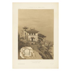
Pl. XLI Villa A Villemonble, Chabat, c.1900
Located in Langweer, NL
Antique print titled 'Villa A Villemonble'. This print depicts the design of a villa in France. Originates from 'La Brique et La Terre Cuite' by P. Chabat. Artists and Engravers: P. ...
Category
20th Century Maps
Materials
Paper
Antique Map of the Nias Archipelago, Sumatra, Indonsia, 1900
Located in Langweer, NL
Antique map of Nias Island and surrounding islands including the Banyak islands, Pini island and Simeulue Island. This map originates from 'Atlas van Nederlandsch Oost- en West-Indië...
Category
20th Century Maps
Materials
Paper
Antique Map of the Java Sea by Dornseiffen, 1900
Located in Langweer, NL
Antique map of the Java Sea. Also depicts Bilitung, the Karimata Islands and Sukadana, Borneo. This map originates from 'Atlas van Nederlandsch Oost- en West-Indië' by I. Dornseiffen...
Category
20th Century Maps
Materials
Paper
French Pavillon de la Grande Tuilerie, Chabat, Architectural Print, c.1900
Located in Langweer, NL
Antique print titled 'Pavillon de la Grande Tuilerie de Bourgogne (de Montghanin) Exposition Universelle de 1889, Mrs. Wulliam et Farge Architectes'. This print depicts the design of...
Category
20th Century Maps
Materials
Paper
Pl. XLII Villa a Fontenay-Sous-Bois, Chabat, C.1900
Located in Langweer, NL
Antique print titled 'Villa A Fontenay-Sous-Bois, Mr. Ed. Jandelle-Ramier, Architecte'. This print depicts the design of a villa in France. Originates from 'La Brique et La Terre Cui...
Category
20th Century Maps
Materials
Paper
Pl. XXVIII Ecuries, Chabat, c.1900
Located in Langweer, NL
Antique print titled 'Ecuries (Boulevard Beauséjour) Mr. Pierre Chabat Architecte'. This print depicts the design of buildings in France. Originates from 'La Brique et La Terre Cuite...
Category
20th Century Maps
Materials
Paper
Antique Map of the Region of Utingeradeel by Meijer & Schaafsma, 1906
Located in Langweer, NL
Antique map titled 'Gemeente Friesland. Gemeente Utingeradeel'. This map illustrates part of Friesland (The Netherlands) depicting Akkrum, Terkaple, Lekkerterp, Oldeboorn and more. Published by Tresling & Co, Amsterdam.
Artists and Engravers: Tresling and Co., Dutch Lithographers...
Category
20th Century Maps
Materials
Paper
Pl. VIII Villa a Luzarches, Chabat, c.1900
Located in Langweer, NL
Antique print titled 'Villa à Luzarches, Mr. Tronquois, Architecte'. This print depicts the design of a villa in France. Originates from 'La Brique et La Terre Cuite' by P. Chabat. A...
Category
20th Century Maps
Materials
Paper
Antique Architectural Print of Villa a Deauville in France, Chabat, c.1900
Located in Langweer, NL
Antique print titled 'Villa a Deauville, Mr. H. Blondel Architecte, Mr. Breney Architecte'. This print depicts the design of a building in France. Originates from 'La Brique et La Te...
Category
20th Century Maps
Materials
Paper
Architectural Building Design Print of Lycée Lakanal in France, Chabat, c.1900
Located in Langweer, NL
Antique print titled 'Lycée Lakanal a Sceaux (Seine) Mr. A. de Baudot Architecte'. This print depicts the design of a school in France. Originates from 'La Brique et La Terre Cuite' ...
Category
20th Century Maps
Materials
Paper
Pl. XLIV Maison A Neuilly 'Seine', Chabat, c.1900
Located in Langweer, NL
Antique print titled 'Maison A Neuilly (Seine) Mr. Paul Sédille, Architecte'. This print depicts the design of a building in France. Originates from 'La Brique et La Terre Cuite' by ...
Category
20th Century Maps
Materials
Paper
Pl. X Villa au Vésinet, Chabat, c.1900
Located in Langweer, NL
Antique print titled 'Villa au Vésinet (Seine et Oise) Mr. Héret Architecte'. This print depicts the design of a villa in France. Originates from 'La Brique et La Terre Cuite' by P. ...
Category
20th Century Maps
Materials
Paper
Antique Map of the Region of Banjarmasin, Indonesia 1900
Located in Langweer, NL
Antique Map of the Region of Banyuasin, Sumatra. Also depicting Bangka/Banka island. This map originates from 'Atlas van Nederlandsch Oost- en West-Indië' by I. Dornseiffen.
Artist...
Category
20th Century Maps
Materials
Paper
French Architectural Print of Souches de Cheminées - Chabat, c.1900
Located in Langweer, NL
Antique print titled 'Souches de Cheminées'. This print depicts the design of a building in France. Originates from 'La Brique et La Terre Cuite' by P. Chabat. Artists and Engravers:...
Category
20th Century Maps
Materials
Paper
Architectural Print of Villa Boulevard de Boulogne in France by Chabat, c.1900
Located in Langweer, NL
Antique print titled 'Villa Boulevard de Boulogne (Seine) Mr. L. Magne, Architecte'. This print depicts the design of a villa in France. Originates from 'La Brique et La Terre Cuite'...
Category
20th Century Maps
Materials
Paper
Set of 11 Antique Maps of Japan Originating from a Japanese Atlas, 1906
Located in Langweer, NL
Set of 11 antique maps depicting various regions of Japan. These maps originate from a Japanese atlas, dated 1906. All text is in Japanese.
Category
20th Century Maps
Materials
Paper
8 Foot Framed World Map by Philips
Located in Norwell, MA
1951 map of the world by George Philip and Son. Large beautiful map as it was in 1951. Nice patina mounted to a sturdy wood frame. Overall good condition. Very large in size. 90" W x...
Category
1950s North American Vintage Maps
Materials
Paper
Antique Map of Denmark by Johnston '1909'
Located in Langweer, NL
Antique map titled 'Denmark'. Original antique map of Denmark. With inset maps of Iceland, Faroe Island, and Copenhagen. This map originates from the ‘Royal Atlas of Modern Geography...
Category
Early 20th Century Maps
Materials
Paper
Antique Map of Turkey in Europe with Bulgaria by Johnston '1909'
Located in Langweer, NL
Antique map titled 'Turkey in Europe with Bulgaria'. Original antique map of Turkey in Europe with Bulgaria. With inset maps of The Bosporus & Constantinople, and Crete (or Candia). ...
Category
Early 20th Century Maps
Materials
Paper
Antique Map of Central Java Depicting The Karimun Islands, Indonesia, 1900
Located in Langweer, NL
Antique map of Central Java, also depicting the Karimun Islands. This map originates from 'Atlas van Nederlandsch Oost- en West-Indië' by I. Dornseiffen. ...
Category
20th Century Maps
Materials
Paper
Original Old Map of Eastern China, Also Depicting Taiwan 'Formosa', 1922
Located in Langweer, NL
Large map of China titled 'China - Peking'. Old map of eastern China depicting Kiangsi, Chekiang, Fukien, Kwangtung, Taiwan (Formosa) and surroundings. With inset map of Peking. This...
Category
20th Century Maps
Materials
Paper
Antique Map of the Dutch Provinces Groningen and Friesland, 1902
Located in Langweer, NL
Antique map titled 'Groningen en Friesland'. Lithographed map of the provinces of Groningen and Friesland, the Netherlands. This map originates from 'Atlas van Nederland'. Artists an...
Category
20th Century Maps
Materials
Paper
Antique Map of Canada by Johnston '1909'
Located in Langweer, NL
Antique map titled 'Dominion of Canada'. Original antique map of Canada. With inset map of Newfoundland. This map originates from the ‘Royal Atla...
Category
Early 20th Century Maps
Materials
Paper
Vintage Road Map of the Netherlands '1928'
Located in Langweer, NL
Vintage map titled 'Volgens het vijfjarig Werkplan te verbeteren Rijkswegen en nieuw aan te leggen wegen welke voorkomen op het Rijkswegenplan'. Map of the Netherlands...
Category
20th Century Maps
Materials
Paper
Antique Map of Abyssinia with Upper Nubia by Johnston, '1909'
Located in Langweer, NL
Antique map titled 'Abyssinia with Upper Nubia'. Original antique map of Abyssinia with Upper Nubia. This map originates from the ‘Royal Atlas of Modern Geography’. Published by W. &...
Category
Early 20th Century Maps
Materials
Paper
Antique Map of Turkey in Asia by Johnston '1909'
Located in Langweer, NL
Antique map titled 'Turkey Asia ( Asia Minor )'. Original antique map of Turkey in Asia. This map originates from the ‘Royal Atlas of Modern Geog...
Category
Early 20th Century Maps
Materials
Paper
Antique Map of Central Asia by Johnston '1909'
Located in Langweer, NL
Antique map titled 'Central Asia'. Original antique map of Central Asia. This map originates from the ‘Royal Atlas of Modern Geography’. Published by W. & A.K. Johnston, 1909.
Category
Early 20th Century Maps
Materials
Paper
Antique Map of the German Empire by Johnston, '1909'
Located in Langweer, NL
Antique map titled 'Empire of Germany'. Original antique map of the German Empire. With inset maps of Berlin and Potsdam. This map originates from the ‘R...
Category
Early 20th Century Maps
Materials
Paper
Antique Map of France by Johnston (1909)
Located in Langweer, NL
Antique map titled 'France'. Original antique map of France. With inset maps of France in provinces, part of the Riviera and Corsica. This map or...
Category
Early 20th Century Maps
Materials
Paper
Antique Map of the Baltic Sea by Johnston, '1909'
Located in Langweer, NL
Antique map titled 'Basin of the Baltic'. Original antique map of Baltic Sea. With inset maps of Kiel, Stettin, Danzig and St Petersburg. This map originate...
Category
Early 20th Century Maps
Materials
Paper
Antique Map of Asia by Johnston '1909'
Located in Langweer, NL
Antique map titled 'Asia'. Depicting China, Japan, Indonesia, India, Arabia and more. This map originates from the ‘Royal Atlas of Modern Geography’. Published by W. & A.K. Johnston,...
Category
Early 20th Century Maps
Materials
Paper
Antique Chart of the World by Johnston '1909'
Located in Langweer, NL
Antique map titled 'Chart of the World on Mercator's Projection Showing the directions of the Oceans Currents with the Routes and Distances Between Principal Ports'. Detailed map of ...
Category
Early 20th Century Maps
Materials
Paper
Antique Map of Egypt, Arabia Petraea and Lower Nubia by Johnston '1909'
Located in Langweer, NL
Antique map titled 'Egypt, Arabia Petraea and Lower Nubia'. Original antique map of Egypt, Arabia Petraea and Lower Nubia. With inset maps of Alexandriam Cairo and the Suez Canal...
Category
Early 20th Century Maps
Materials
Paper
Antique Map of Belgium and the Netherlands by Johnston 'c.1920'
Located in Langweer, NL
Antique map titled 'Belgium and the Netherlands'. Original antique map of Belgium and the Netherlands. Published by W. & A.K. Johnston, circa 1920.
Category
20th Century Maps
Materials
Paper
Art Deco Cartoon Style Map of Paris possibly by Arthur Zaindenberg circa 1930's
By Arthur Zaidenberg
Located in New York, NY
Art Deco cartoon style map of Paris possibly by Arthur Zaidenberg. The map depicts witty references to Parisians lifestyle, along with drawings of notable landmarks, circa 1930's. T...
Category
1930s American Art Deco Vintage Maps
Materials
Paper
Antique Map of the Orange River Colony in South Africa, 1901
Located in Langweer, NL
Antique map titled 'Orange River Colony, northern part'. Lithograph of the northern part of the Orange River Colony, Africa. The Orange River Colony was the British colony created af...
Category
Early 20th Century Maps
Materials
Paper
Vintage Framed United States Map
Located in Queens, NY
Vintage aged paper map of the United States mounted on particle board and framed in a simple wooden frame.
Category
20th Century American Mid-Century Modern Maps
Materials
Wood, Paper
1918 American Frohse Anatomical Chart, A. J. Nystrom, Max Brodel Illustrator
By A.J. Nystrom & Co, Max Brödel
Located in Buffalo, NY
Antique American Frohse Anatomical pull down chart, by A. J. Nystrom, ,revised and augmented by Max Brodel illustrator... Amazing color, patina, age appropriate wear. dated 1918..
Max (Paul Heinrich) Brödel
1870-1941
Brödel, an illustrator and the first director of the Art as Applied to Medicine program at Johns Hopkins...
Category
1910s American Steampunk Vintage Maps
Materials
Wood, Paper
Huge Europe and Asia Vintage Wall Map
Located in San Diego, CA
A huge Europe and Asia vintage wall map, circa 1950s. The map is in fair vintage condition and measures 78"W x 73"H". #2863
Category
Mid-20th Century American Maps
Materials
Paper
Antique Webber Costello Globe on Metal Tripod Base c 1900 / 1920's
Located in New York, NY
Rare floor model globe made by Weber Costello, circa 1900. The 12" globe rests on a folding metal base. This example is in very good, original condition, showing only light wear, nor...
Category
Early 20th Century American Industrial Maps
Materials
Metal
Massive Vintage Wall Map of the Soviet Union 'Sowjetunion' by Karl Wenschow
Located in San Diego, CA
A massive vintage wall map of the Soviet Union (Sowjetunion) published by Karl Wenschow in Munich, Germany, circa 1950s. The map was distributed by De...
Category
Mid-20th Century American Maps
Materials
Paper, Wood
