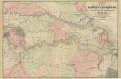
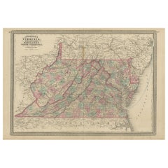
Antique Civil War Map of Virginia, "Seat of War in Virginia Sheet 2" 1862
View Similar Items


Want more images or videos?
Request additional images or videos from the seller
1 of 5
Antique Civil War Map of Virginia, "Seat of War in Virginia Sheet 2" 1862
About the Item
- Dimensions:Height: 23 in (58.42 cm)Width: 17.88 in (45.42 cm)Depth: 1.25 in (3.18 cm)
- Materials and Techniques:
- Place of Origin:
- Period:
- Date of Manufacture:1862
- Condition:Wear consistent with age and use. This sheet has original color. The paper is healthy with only minor toning and a minor tear at bottom. The map is uniquely housed in an antique windowpane frame, with hand painted script identifying the title, original publish date, and key battles.
- Seller Location:Colorado Springs, CO
- Reference Number:Seller: M1451stDibs: LU909717766182
About the Seller
4.9
Platinum Seller
Premium sellers with a 4.7+ rating and 24-hour response times
Established in 2010
1stDibs seller since 2011
452 sales on 1stDibs
Authenticity Guarantee
In the unlikely event there’s an issue with an item’s authenticity, contact us within 1 year for a full refund. DetailsMoney-Back Guarantee
If your item is not as described, is damaged in transit, or does not arrive, contact us within 7 days for a full refund. Details24-Hour Cancellation
You have a 24-hour grace period in which to reconsider your purchase, with no questions asked.Vetted Professional Sellers
Our world-class sellers must adhere to strict standards for service and quality, maintaining the integrity of our listings.Price-Match Guarantee
If you find that a seller listed the same item for a lower price elsewhere, we’ll match it.Trusted Global Delivery
Our best-in-class carrier network provides specialized shipping options worldwide, including custom delivery.More From This Seller
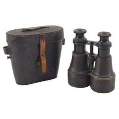
View AllAntique Civil War Binoculars, Used by Col. Francis L. Lee
Located in Colorado Springs, CO
Presented is an original pair of Civil War-used binoculars, with their original leather carrying case. The binoculars were used by Colonel Francis L. Lee of Massachusetts during the ...
Category
Antique 1860s Unknown Historical Memorabilia
Materials
Brass
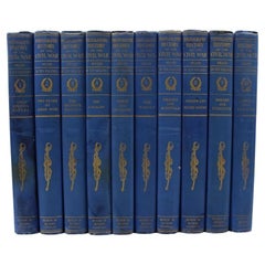
The Photographic History of the Civil War in Ten Volumes, by Francis T. Miller
Located in Colorado Springs, CO
Miller, Francis Trevelyan (editor). The Photographic History of the Civil War in Ten Volumes. New York: The Review of Reviews Co., 1912. Quarto, ten volume set, in original blue cloth gilt bindings. Illustrated with thousands of photographs, plus maps.
This is an important 10-volume photographic history of the Civil War, edited by Francis Trevelyan Miller. The set was first published in 1911, the 50 year anniversary of the start of the Civil War. This 1912 edition contains “thousands of scenes photographed 1861-65, with text by many special authorities.”
This mammoth work contains written contributions from over 39 academics, writers, veteran officers of both Union and Confederate forces, and President William H. Taft. A number of the photographs are from the collections of private individuals, as well as the extensive Eldridge Collection of Mathew Brady Civil War photographs...
Category
Vintage 1910s American Books
Materials
Fabric, Paper
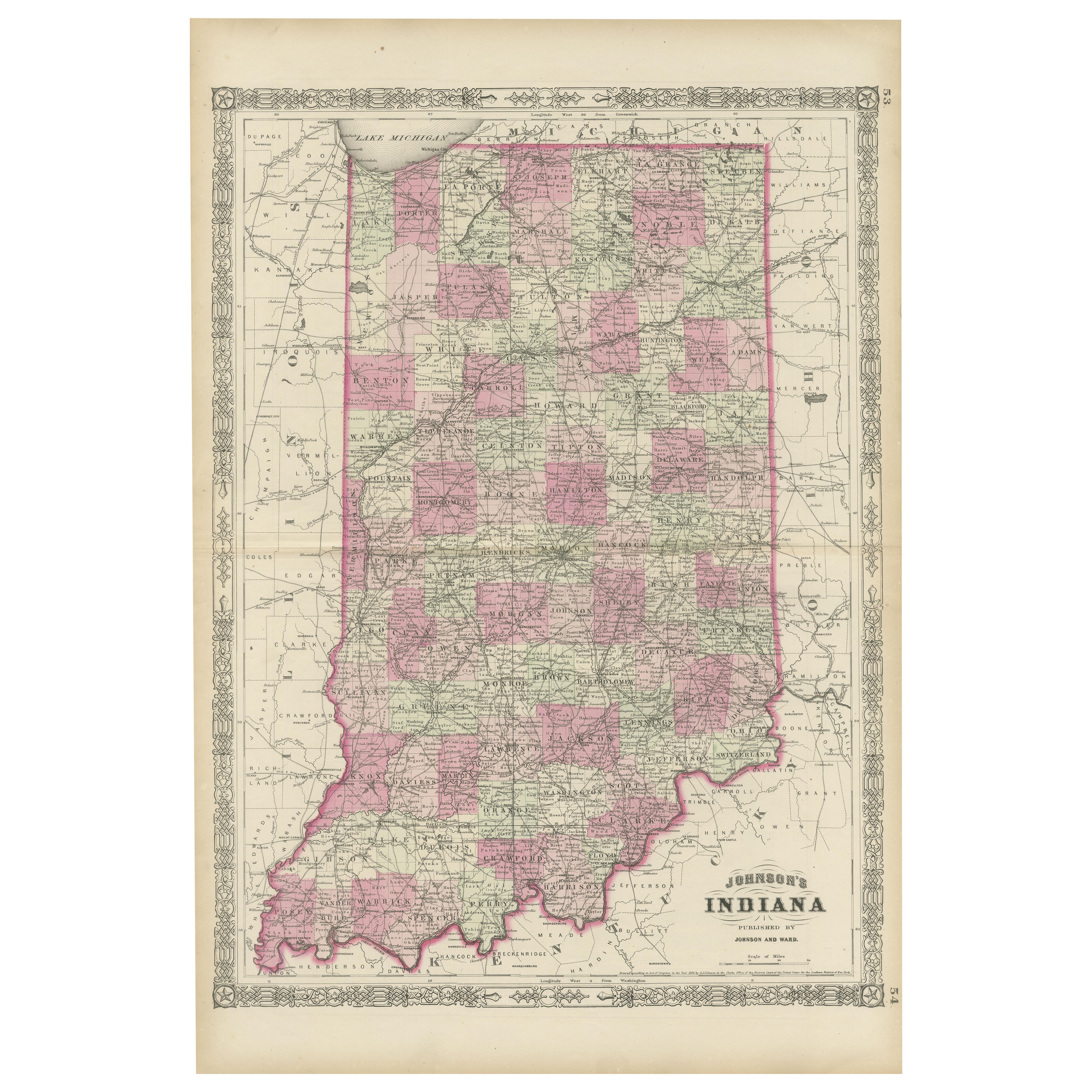
1837 Mitchell's "Tourist's Pocket Map of the State of Virginia" by J.H. Young
Located in Colorado Springs, CO
This is J. H. Young's pocket map of the Virginia, which shows county development current to 1835. The map was engraved by E. Yeager and F. Dankworth and published by S. A. Mitchell. ...
Category
Antique 1830s American Maps
Materials
Paper

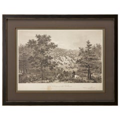
"Army of the Potomac" by John Bachelder, Civil War Era Lithograph, circa 1863
Located in Colorado Springs, CO
Fully-entitled: Army of the Potomac. The Wagon Trains of the Army of the Potomac en Route from Chickahominy to James River VA. During the Seven...
Category
Antique 19th Century American Prints
Materials
Paper
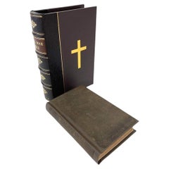
Civil War Bible, Presented to James Robberts, of 1st Maryland Vol. Group, 1864
Located in Colorado Springs, CO
The New Testament of our Lord and Saviour Jesus Christ: Translated out of the Original Greek and with the Former Translations Diligently Compared and Revised. New York: American Bibl...
Category
Antique 1860s American Historical Memorabilia
Materials
Leather, Fabric, Paper
1854 Map of Massachusetts, Connecticut and Rhode Island, Antique Wall Map
Located in Colorado Springs, CO
This striking wall map was published in 1854 by Ensign, Bridgman & Fanning and has both full original hand-coloring and original hardware. This impression is both informative and highly decorative.
The states are divided into counties, outlined in red, green, and black, and subdivided into towns. Roads, canals, and railroad lines are prominently depicted, although they are not all labeled. The mapmakers also marked lighthouses, banks, churches, and prominent buildings, with a key at right. The map is an informative and comprehensive overview of the infrastructural development of New England prior to the Civil War. Physical geographies depicted include elevation, conveyed with hachure marks, rivers and lakes. The impression features an inset map of Boston...
Category
Antique 19th Century American Maps
Materials
Paper

You May Also Like
1862 Johnson's Map of the Vicinity of Richmond & Peninsular Campaign, Virginia
Located in Langweer, NL
Title: 1862 Johnson's Map of the Vicinity of Richmond & Peninsular Campaign, Virginia
Description: This 1862 map titled "Johnson's Map of the Vicinity of Richmond and Peninsular Cam...
Category
Antique 1860s Maps
Materials
Paper
$293 Sale Price
20% Off
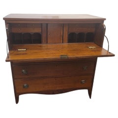
American Hepplewhite Virginian Secretary Chest with Civil War Provenance
By George Hepplewhite
Located in Dallas, TX
PRESENTING a FANTASTIC and HISTORIC Early 19C American Hepplewhite Virginian Secretary Chest with OUTSTANDING Provenance.
This Secretary Chest was made in Virginia in the Early 19th Century, circa 1810.
It is made of cherry, walnut and maple and is most definitely in the Hepplewhite Style of the period, with it’s original Hepplewhite brass drawer pulls.
IT IS A REALLY INTRIGUING AND HISTORIC PIECE, ESPECIALLY, WHEN VIEWED IN CONTEXT WITH IT”S AMAZING PROVENANCE!
This piece was originally owned by Major William Alexander Obenchain who ‘hailed’ from the State of Virginia.
He was an engineer and was in the Virginia Corps of Engineers during the Civil War and served on General Robert E. Lee’s staff. It was acquired by him before the Civil War and we believe that this piece was on campaign with him during the War. We know for a fact that he fought at the Richmond Campaign in 1864, as we have, in our Collection, his original Field Map for that Campaign which ended the War.
It has remained in family ownership ever since.
It has come directly from the Family Estate, together with other VERY IMPORTANT items belonging to Major Obenchain and other IMPORTANT items that belonged to his wife, Eliza Calvert Hall-Obenchain. ALL these items contained in the Collection, are listed/posted individually on our Website.
The top drawer is on retractable curved side hinge supports and pulls outwards and drops to reveal a secretary and writing area.
The Bureau/Secretary Gallery has 6 drawers and 6 cubbies, a central tabernacle door with another drawer and 2 cubbies and this is flanked by 2 secret pull out compartments.
The central tabernacle door has it’s original key and working lock.
Closed, it is almost ‘flush’ like the rest of the drawers, with some very minor bowing through age.
The 3 drawers underneath are graduated in size and it ends with a serpentine shaped base and sits on four hand carved legs with original metal casters, marked ‘Universal 3’.
It has it’s original brasses and hardware throughout, save the addition to 2 contemporary replacement brass hinges to the drop down desk front, as the original hinges were broken, could not be repaired and were not supporting the weight of the drop down leaf.
Some minor repairs but not noticeable.
Otherwise, the piece is in it’s entirely, ORIGINAL condition!
What makes this piece even MORE INTRIGUING and APPEALING HISTORICALLY, are the 2 ‘historic’ circular holes on the piece:-
(1) in the back of the piece as seen in the photos. This hole is not symmetrical or fully round and appears to serve no purpose to the piece whatsoever. Sometimes, pieces have holes for wiring for lighting, put in them over the years, but this one never had such lighting or, indeed, any such explanation for this hole, AND
(2) the rear hole is replicated, in the corner portion of the bottom drawer and someone (a very long time ago) has used a tin can top, to cover the hole in the back of the drawer. The tin can top is period to the Civil War Era and is embossed “Minimum Volume 1 Pint”.
Our conclusion, is that (whilst we are, by no means ballistic experts) that these holes were created by musket balls, fired during one of the Major’s campaigns in the Civil War. It is entirely conceivable that this piece, being strapped into a covered wagon for carriage, would have been on it’s side. We are of the opinion that both holes, were caused or created by a musket ball entered the chest trough the base and back. We also believe that ‘the Major’, used what he had at his disposal on the battlefield, namely, a tin can lid to repair the hole in the drawer.
SO THIS PIECE IS A VERY SPECIAL PIECE OF US HISTORY, INDEED!
NOT ONLY IS IT AN EARLY 19th CENTURY AMERICAN PIECE, WITH A CONNECTION TO THE STATE OF VIRGINIA, THE CIVIL WAR, HISTORIC & IMPORTANT FIGURES IN THAT WAR AND IMPECCABLE PROVENANCE AND HISTORY!
IT IS TRULY UNIQUE!
William Alexander Obenchain. Born April 27, 1841 at Buchanan, Botetourt Co., Virginia.
Parents: Thomas Jefferson Obenchain and Elizabeth Ann Sweetland.
Entered VMI on July 18, 1859 as a member of the VMI (Virginia Military Institute...
Category
Antique Early 19th Century American American Classical Historical Memora...
Materials
Brass
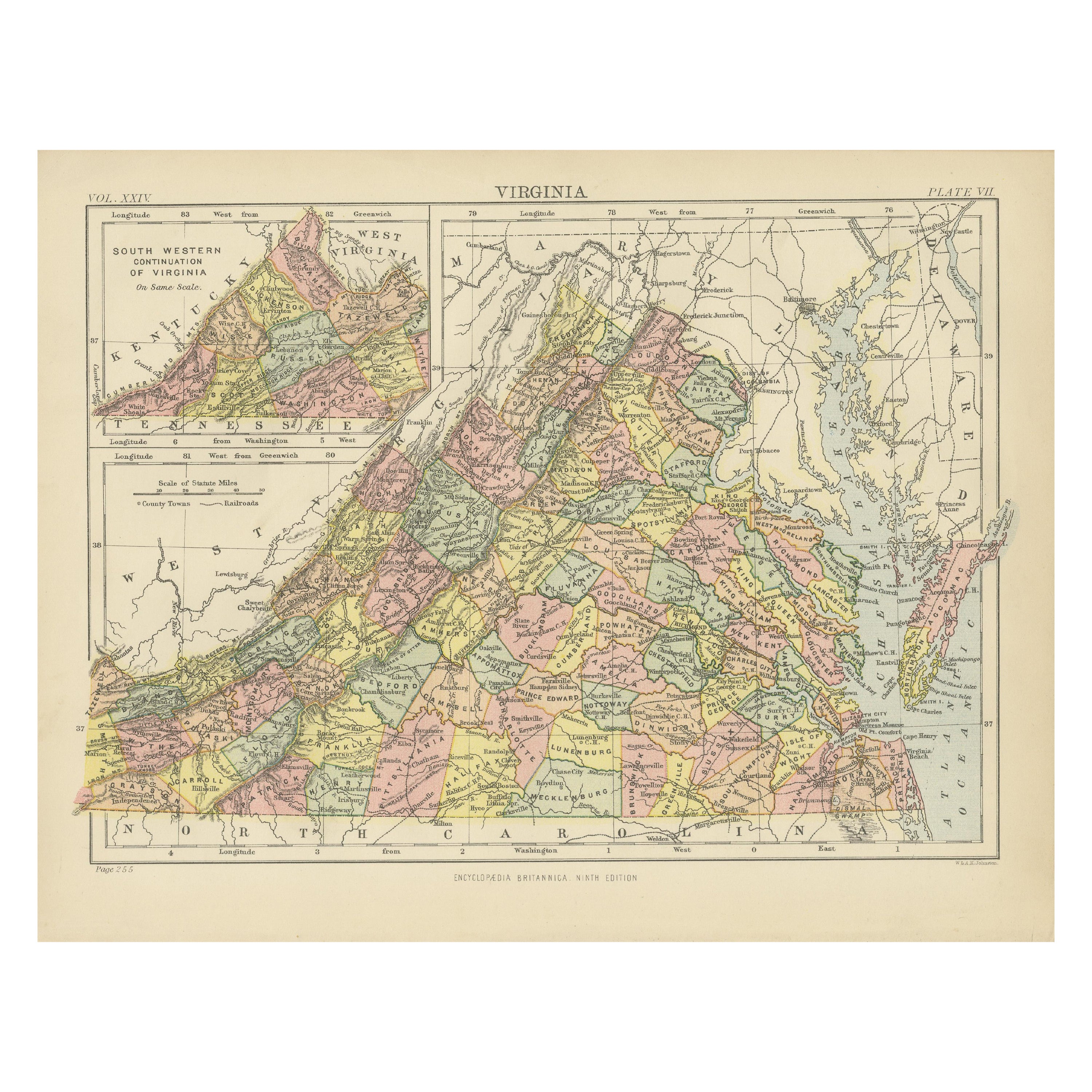
Antique Map of Virginia, Delaware, Maryland & West Virginia by Johnson, 1872
Located in Langweer, NL
Antique map titled 'Johnson's Viriginia (..). Original map of Virginia, Delaware, Maryland and West Virginia. This map originates from 'Johnson's New I...
Category
Antique Late 19th Century Maps
Materials
Paper
$229 Sale Price
20% Off
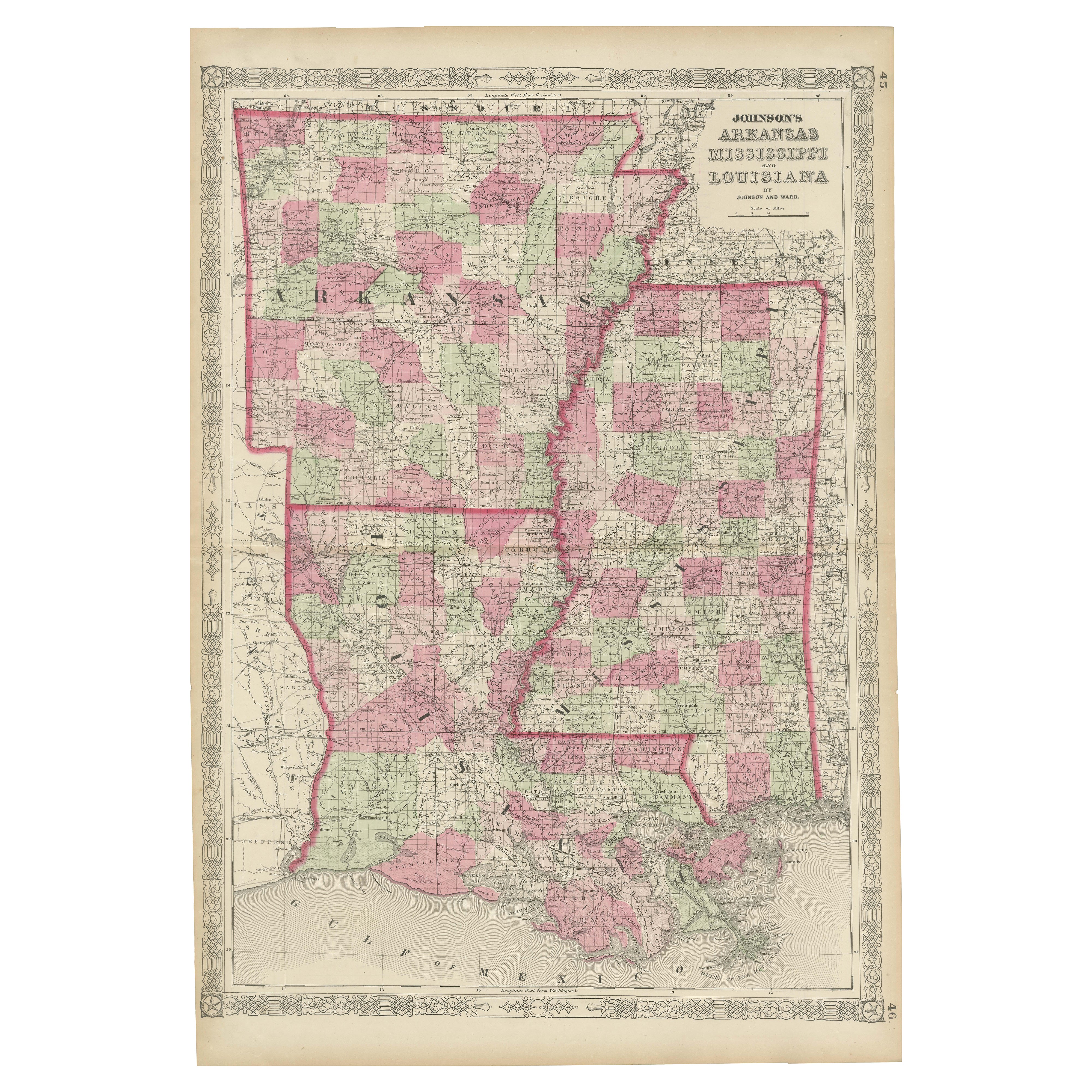
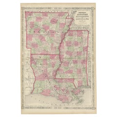
Rare 1864 Civil War Era Map of Arkansas, Mississippi, and Louisiana
Located in Langweer, NL
Title: Rare 1864 Civil War Era Map of Arkansas, Mississippi, and Louisiana
Description: This captivating antique map, titled "Johnson's Arkansas, Mississippi, and Louisiana," was pu...
Category
Antique 1860s Maps
Materials
Paper
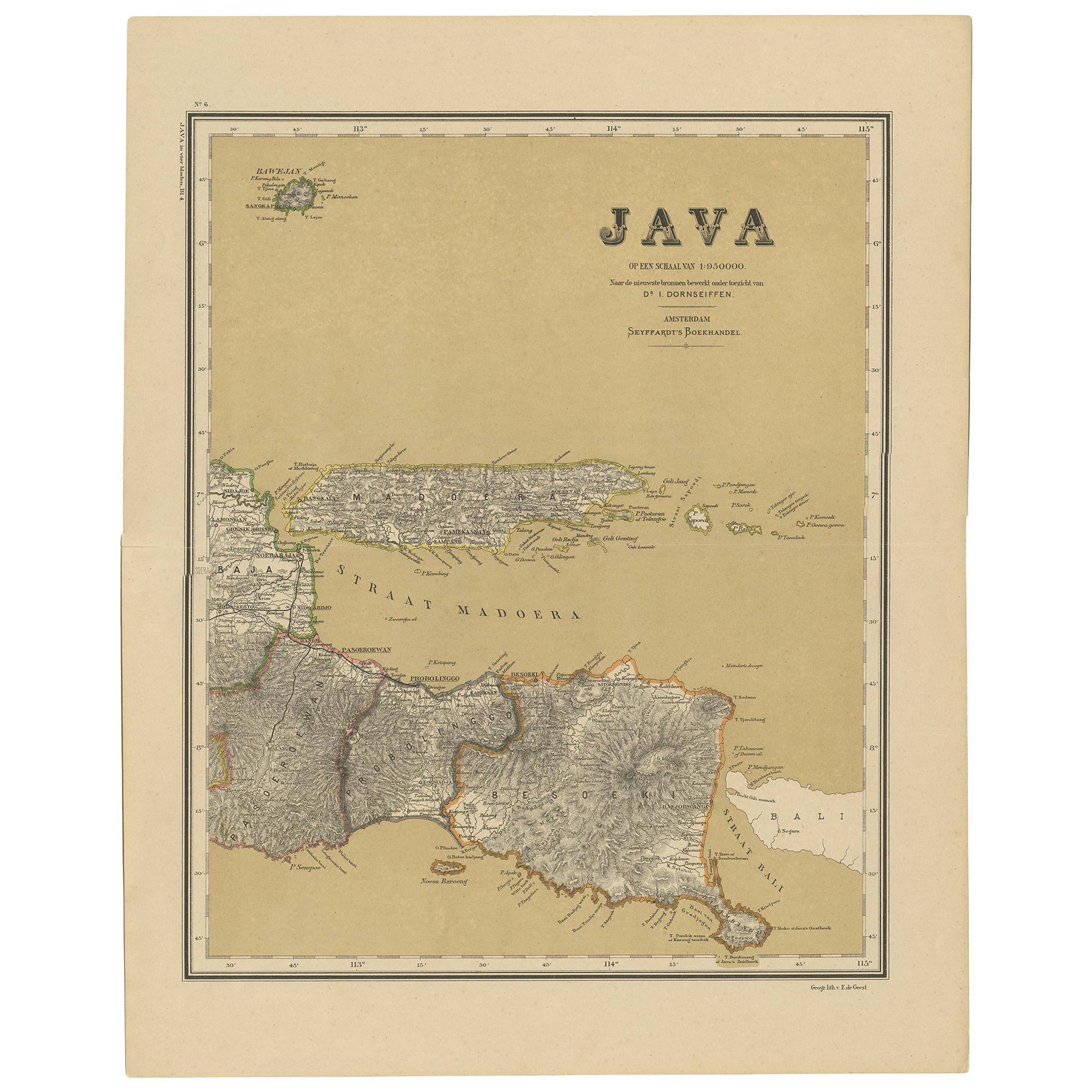
Antique Map of Java in 4 sheets by Dornseiffen, 1884
Located in Langweer, NL
Detailed map of Java in 4 sheets, with an inset map of Batavia (Jakarta). This map originates from 'Atlas van Nederlandsch Oost- en West-Indie' by Dr. I. Dornseiffen. Published by Se...
Category
Antique Late 19th Century Maps
Materials
Paper

$596 Sale Price
20% Off
Antique Map of the World in two sheets, 1852
Located in Langweer, NL
Antique map titled 'The World on Mercator's Projection'. Two individual sheets of the world. This map originates from 'Lowry's table Atlas constructed and engraved from the most rece...
Category
Antique Mid-19th Century Maps
Materials
Paper

$229 Sale Price / set
20% Off