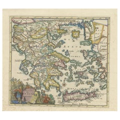
Antique Hand Colored Map of Greece, 1697
View Similar Items


Want more images or videos?
Request additional images or videos from the seller
1 of 6
Antique Hand Colored Map of Greece, 1697
About the Item
- Dimensions:Height: 12.6 in (32 cm)Width: 13 in (33 cm)Depth: 0 in (0.02 mm)
- Materials and Techniques:Paper,Engraved
- Period:1690-1699
- Date of Manufacture:1697
- Condition:The map is showing signs of ageing with small brown spots - mostly in the lower margin. Original fold lines as issued. Brightly coloured. Study the image carefully.
- Seller Location:Langweer, NL
- Reference Number:Seller: BG-13199-41stDibs: LU3054329547922
About the Seller
5.0
Platinum Seller
These expertly vetted sellers are 1stDibs' most experienced sellers and are rated highest by our customers.
Established in 2009
1stDibs seller since 2017
1,933 sales on 1stDibs
More From This SellerView All
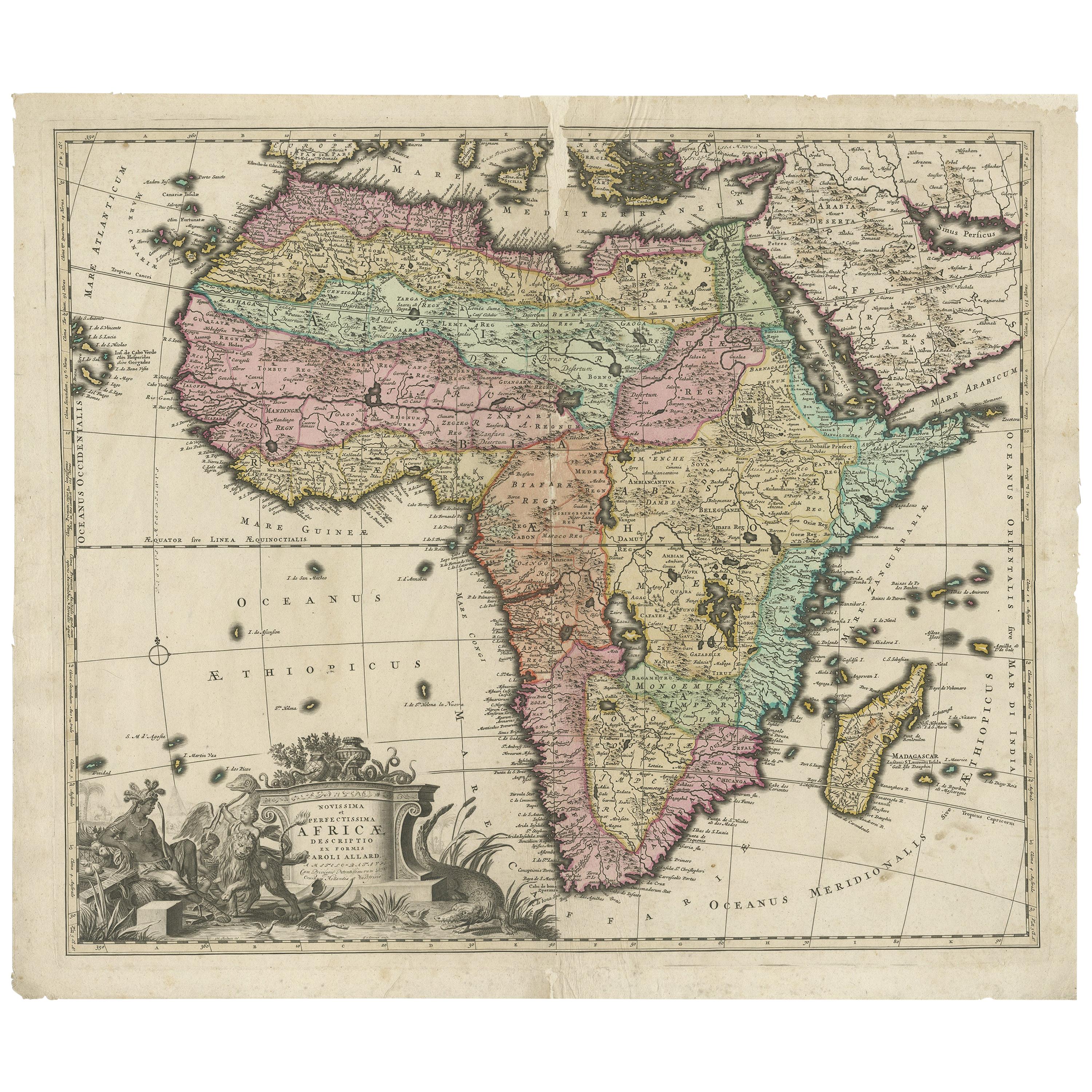
- Original Antique Hand- Map of Africa by Allard '1697'Located in Langweer, NLAntique map titled 'Novissima et Perfectissima Africae (..)'. Beautiful large map of Africa. This is the 3rd state of the map, with climate notation add...Category
Antique Late 17th Century Maps
MaterialsPaper
 $1,232 Sale Price25% Off
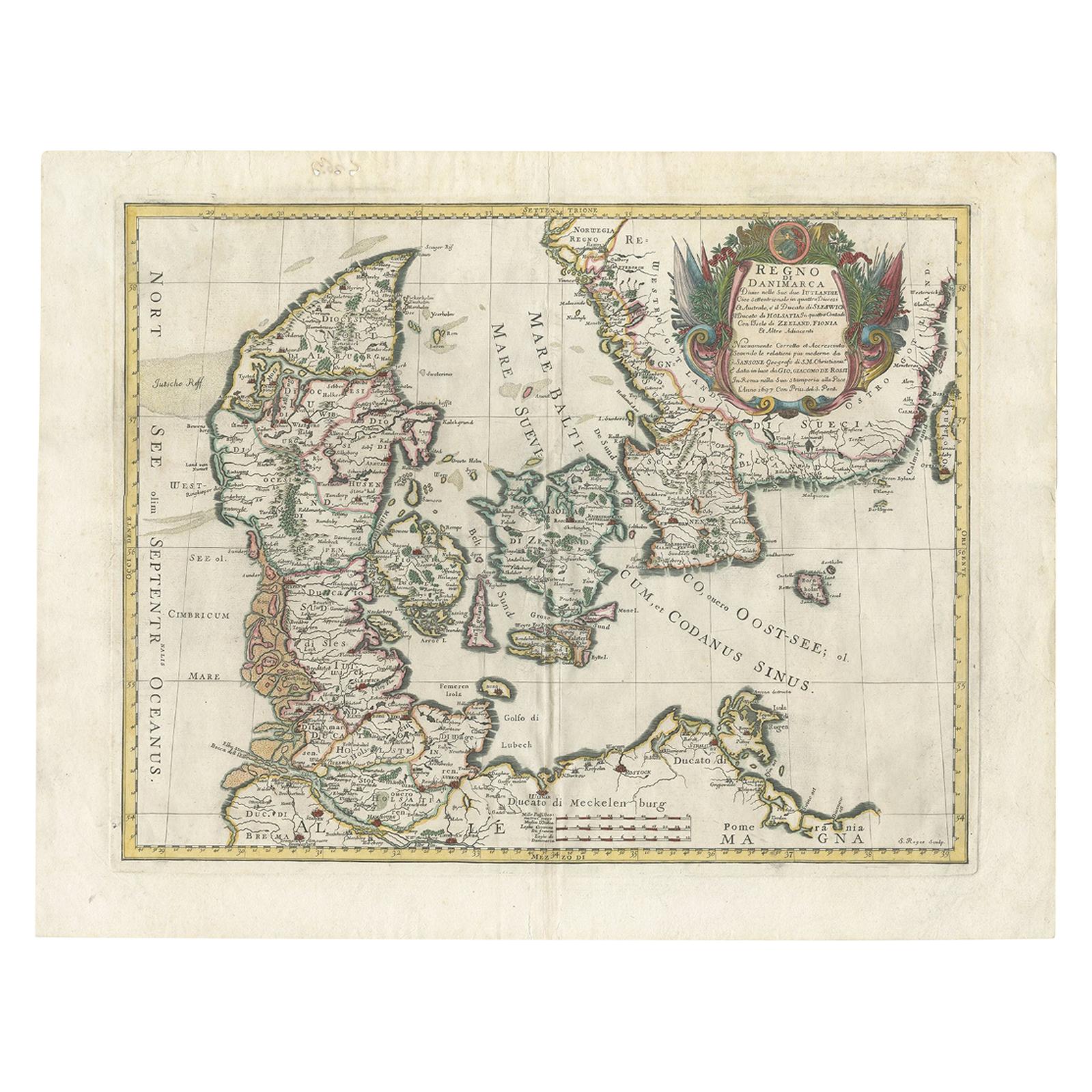
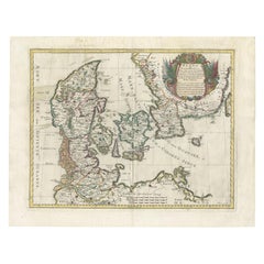
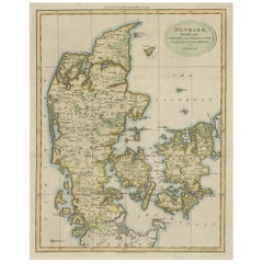
 - Antique Map of Denmark by De Rossi (1697)Located in Langweer, NLAntique map of Denmark titled 'Regno di Danimarca'. Old map of Denmark showing Jutland, Funen, Zealand, Lolland-Falster, Bornholm, etc. This map was engraved by S. Roges and publishe...Category
Antique Late 17th Century Maps
MaterialsPaper
 $394 Sale Price40% Off
 - Antique Hand-Colored Engraved Map of Denmark, 1790Located in Langweer, NLPublished by Russell (J. C.). Denmark. Divided into Dioceses and Prefectures compiled from the best Authorities, 1790, hand-coloured engraved map on handmade paper with watermark. 41...Category
Antique 1790s Maps
MaterialsPaper
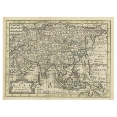
- Rare Hand-Colored Antique Map of Asia, 1788Located in Langweer, NLAntique map titled 'Kaartje van Asia'. Original antique map of Asia. This map originates from 'Nieuwe Natuur- Geschied- en Handelkundige Zak- en Reisatlas' by N.T. Gravius, 1788....Category
Antique 1780s Maps
MaterialsPaper
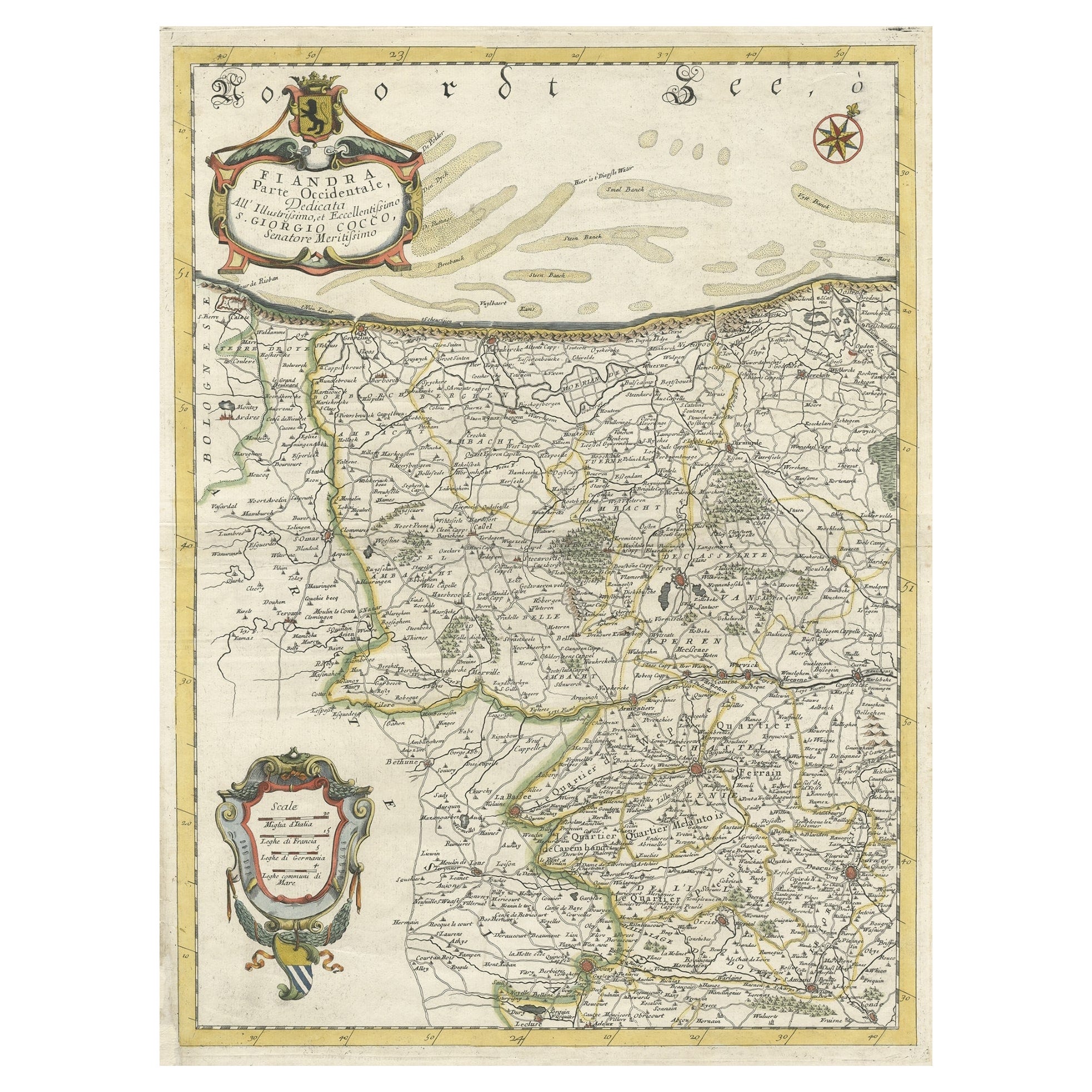
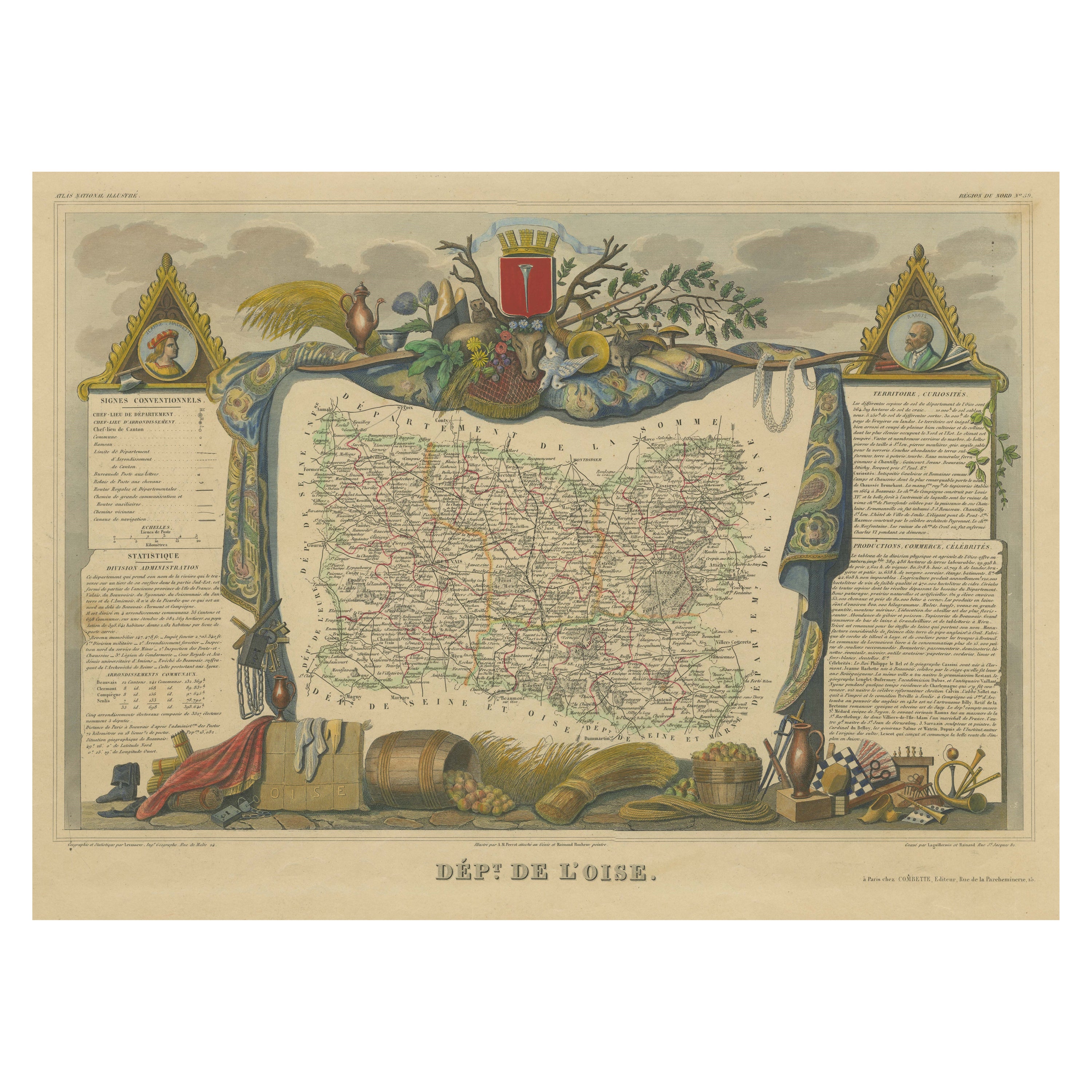
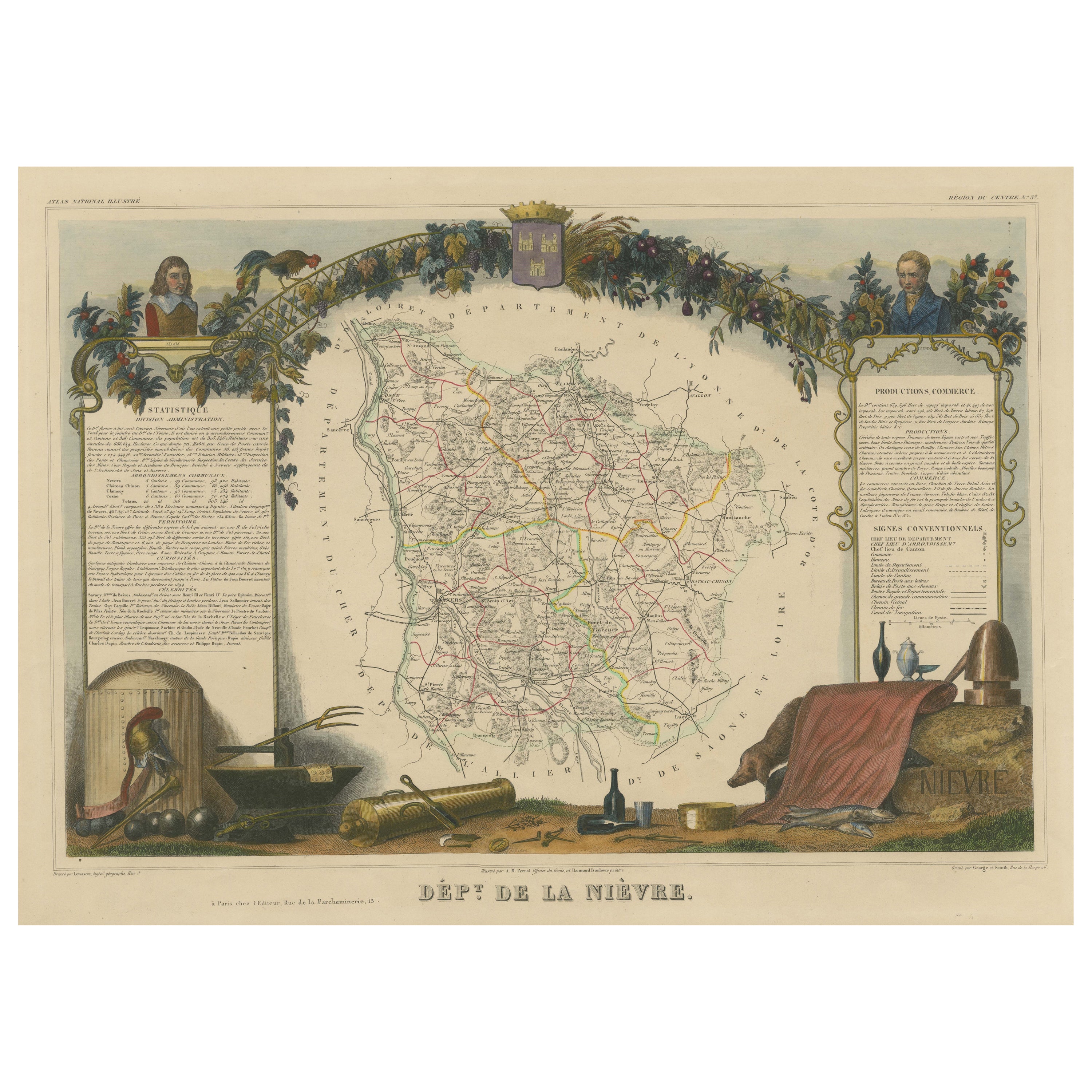
- Decorative Original Antique Map of the North of Flanders, Belgium, 1697Located in Langweer, NLAntique map titled 'Fiandra Parte Occidentale (..)'. Depicts northern part of Flanders, from North Sea, extends through the northern region of France to the cities of Douai and V...Category
Antique 1690s Maps
MaterialsPaper
 $806 Sale Price20% Off
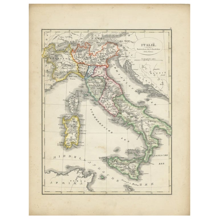
 - Antique Map of Italy with Hand-Colored Borders, 1852Located in Langweer, NLAntique map titled 'Italië'. Map of Italy. This map originates from 'School-Atlas van alle deelen der Aarde' by Otto Petri. Artists and Engravers: Published by A. Baedeker (Otto Petr...Category
Antique 19th Century Maps
MaterialsPaper

You May Also Like
- Hand-Colored 18th Century Homann Map of the Danube, Italy, Greece, CroatiaBy Johann Baptist HomannLocated in Alamo, CA"Fluviorum in Europa principis Danubii" is a hand colored map of the region about the Danube river created by Johann Baptist Homann (1663-1724) in his 'Atlas Novus Terrarum', publish...Category
Antique Early 18th Century German Maps
MaterialsPaper
- Greece, "Graeciae Antiquae"" A 17th Century Hand-colored Map by SansonBy Nicolas SansonLocated in Alamo, CAThis is an original 17th century hand colored copperplate engraved map of Greece entitled "Graeciae Antiquae Tabula Hanc Geographicam" by Nicolas d'Abbeville Sanson, engraved and pub...Category
Antique Mid-17th Century French Maps
MaterialsPaper
- Southern Greece: A Large 17th C. Hand-colored Map by Sanson and JaillotBy Nicolas SansonLocated in Alamo, CAThis large original hand-colored copperplate engraved map of southern Greece and the Pelopponese Peninsula entitled "La Moree Et Les Isles De Zante, Cefalonie, Ste. Marie, Cerigo & C...Category
Antique 1690s French Maps
MaterialsPaper
- Original Antique Map of Ancient Greece, Achaia, Corinth, 1786Located in St Annes, LancashireGreat map of Ancient Greece. Showing the region of Thessaly, including Mount Olympus Drawn by J.D. Barbie Du Bocage Copper plate engraving by P.F Tardieu Original hand color...Category
Antique 1780s French Other Maps
MaterialsPaper
- Original Antique Map of Ancient Greece- Boeotia, Thebes, 1787Located in St Annes, LancashireGreat map of Ancient Greece. Showing the region of Boeotia, including Thebes Drawn by J.D. Barbie Du Bocage Copper plate engraving by P.F T...Category
Antique 1780s French Other Maps
MaterialsPaper
- Original Antique Map of Ancient Greece, Phocis, Gulf of Corinth, 1787Located in St Annes, LancashireGreat map of Ancient Greece. Showing the region of Phocis, including the Gulf of Corinth Drawn by J.D. Barbie Du Bocage Copper plate engraving by P.F Tardieu Original hand c...Category
Antique 1780s French Other Maps
MaterialsPaper


Recently Viewed
View AllMore Ways To Browse
Antique Crete
Ancient Greek Map
Map Of Ancient Greece
Antique Maps Of Ancient Greece
Used Nautical Charts
Antique World Chart
Antique Char
Map Of Great Britain
Hand Painted Antique Map
Antique Furniture Depot
Antique Map Mexico
Hemisphere Antiques
Antique Mexico Map
17th Century Scottish
Antique Road Maps
Antique Road Map
Antique Map Of Mexico
Antique Maps Of Mexico