Items Similar to Antique Map of Asia Minor, Egypt & Carthage – Ortelius Theatrum 1572


Want more images or videos?
Request additional images or videos from the seller
1 of 10
Antique Map of Asia Minor, Egypt & Carthage – Ortelius Theatrum 1572
$818.20
£608.27
€690
CA$1,133.88
A$1,264.05
CHF 659.26
MX$15,285.33
NOK 8,287.17
SEK 7,841.31
DKK 5,253.15
About the Item
Antique Map of Asia Minor, Egypt & Carthage – Ortelius Theatrum 1572
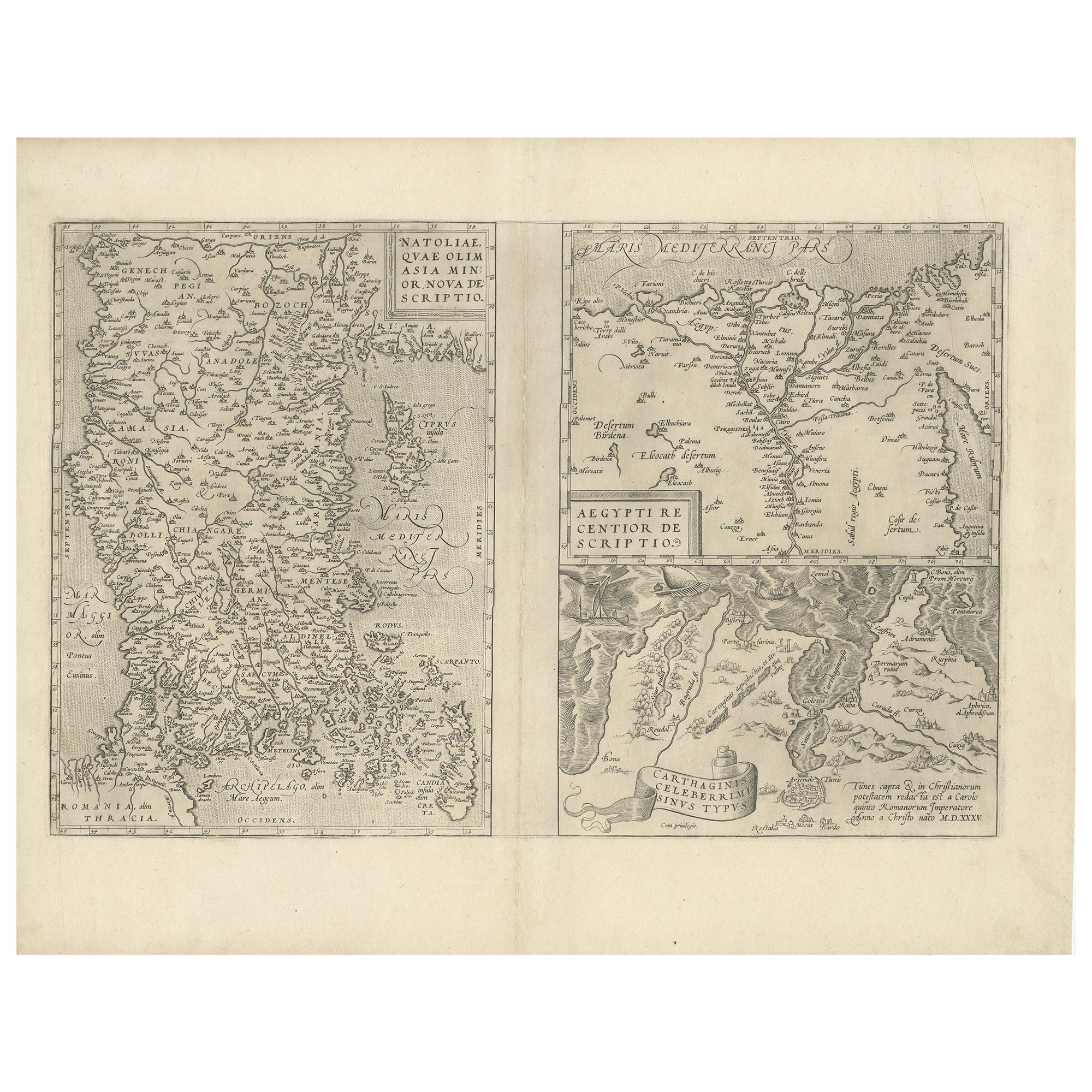
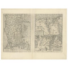
This rare and beautifully hand-colored map sheet originates from Abraham Ortelius’s groundbreaking atlas, Theatrum Orbis Terrarum, first published in 1570 and considered the first true modern atlas. Dated 1572, the sheet features three distinct maps, each reflecting Ortelius’s meticulous effort to bring together the classical world and contemporary cartographic knowledge.
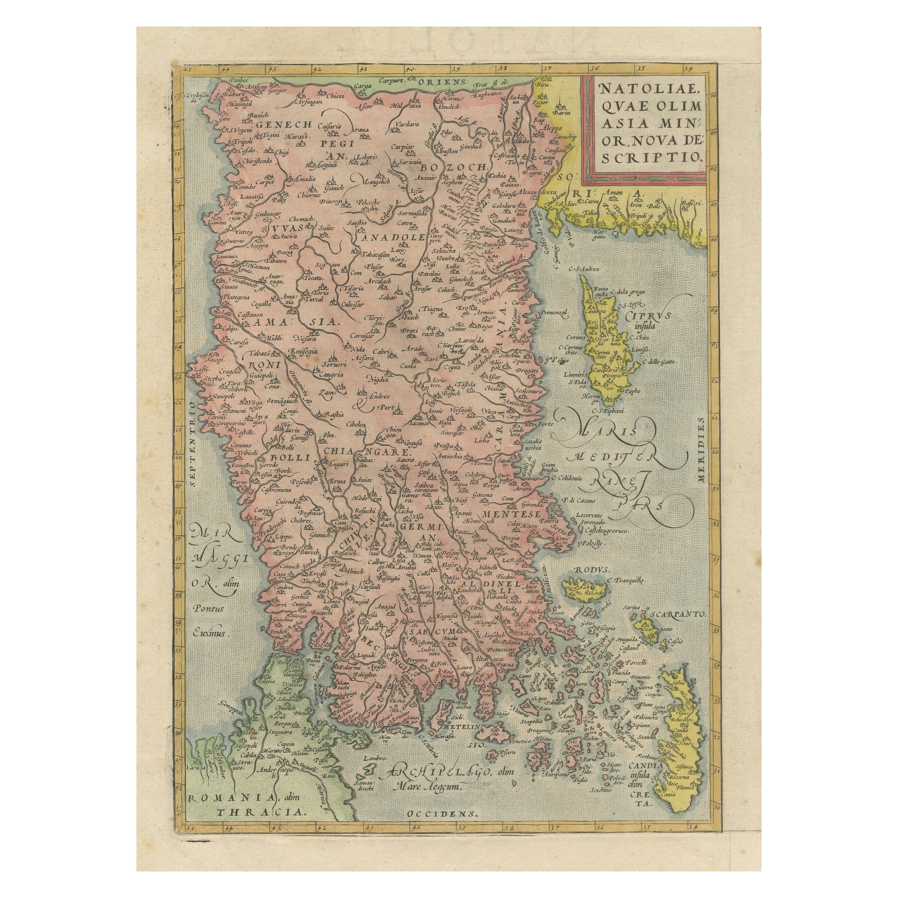
On the left is Natoliae, quae olim Asia Minor, a map of Asia Minor (modern-day Turkey), covering the regions of Lydia, Bithynia, Cappadocia, Cilicia, and surrounding territories. Place names recall both ancient geography and Ortelius’s Renaissance sources, bridging antiquity with the knowledge of his time. Coastal outlines, rivers, and mountain ranges are carefully depicted, with adjacent islands such as Rhodes and Cyprus included.
At the top right is Aegypti recentior descriptio, a detailed map of Egypt. The course of the Nile dominates the composition, extending from the Mediterranean coast deep into the interior. Numerous settlements along the river are shown, and the map reflects both classical references and Renaissance interest in the fertile land of the Nile.
Below Egypt, the sheet includes *Carthaginis celeberrimi sinus typus*, an evocative map of the Bay of Tunis and the remains of ancient Carthage. Here Ortelius pays tribute to one of the most important sites of classical history, illustrating the harbor and surrounding coastal features.
Together, these three maps highlight Ortelius’s humanist approach to geography, where classical heritage and new discoveries met. The sheet was engraved by Frans Hogenberg, Ortelius’s main collaborator, whose crisp engraving and elegant lettering bring clarity and beauty to the maps. Early hand coloring, applied soon after publication, enhances the visual appeal with soft tones of green, ochre, and red.
Condition report: Good and authentic condition for a 16th-century map. Some toning and light foxing consistent with age. Minor centerfold reinforcement visible, as issued. The hand coloring is well-preserved. Wide margins remain intact. Plate marks clearly visible around the maps.
Framing tips: This map sheet would benefit from a dark wood or walnut frame with a cream or light beige mat to balance the warm hand coloring. A double mat with a subtle green inner border would enhance the river and coastal tones, creating a distinguished presentation.
Technique: Copperplate engraving with original hand color
Maker: Abraham Ortelius, Antwerp, 1572
- Dimensions:Height: 12.72 in (32.3 cm)Width: 19.49 in (49.5 cm)Depth: 0 in (0.02 mm)
- Materials and Techniques:Paper,Engraved
- Place of Origin:
- Period:
- Date of Manufacture:1572
- Condition:Repaired: Archival repairs to centerfold separations at top and bottom and a few short edge tears. A nice impression with full contemporary color on a sturdy, watermarked sheet with light soiling, dampstains in the top corners of the sheet.
- Seller Location:Langweer, NL
- Reference Number:Seller: BG-135461stDibs: LU3054335459442
About the Seller
5.0
Recognized Seller
These prestigious sellers are industry leaders and represent the highest echelon for item quality and design.
Platinum Seller
Premium sellers with a 4.7+ rating and 24-hour response times
Established in 2009
1stDibs seller since 2017
2,589 sales on 1stDibs
Typical response time: <1 hour
- ShippingRetrieving quote...Shipping from: Langweer, Netherlands
- Return Policy
Authenticity Guarantee
In the unlikely event there’s an issue with an item’s authenticity, contact us within 1 year for a full refund. DetailsMoney-Back Guarantee
If your item is not as described, is damaged in transit, or does not arrive, contact us within 7 days for a full refund. Details24-Hour Cancellation
You have a 24-hour grace period in which to reconsider your purchase, with no questions asked.Vetted Professional Sellers
Our world-class sellers must adhere to strict standards for service and quality, maintaining the integrity of our listings.Price-Match Guarantee
If you find that a seller listed the same item for a lower price elsewhere, we’ll match it.Trusted Global Delivery
Our best-in-class carrier network provides specialized shipping options worldwide, including custom delivery.More From This Seller
View AllAntique Map of Asia Minor, Region of the Nile and Region of the City of Carthage
Located in Langweer, NL
Three antique maps on one sheet titled 'Natoliae quae olim Asia Minor [with] Aegypti recentior descriptio [with] Carthaginis Celeberrimisinus Typus'. The first map covers Asia Minor,...
Category
Antique 16th Century Maps
Materials
Paper
$474 Sale Price
20% Off
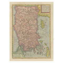
Asia Minor – Antique Map of Natolia by Ortelius, Theatrum Orbis Terrarum c.1600
Located in Langweer, NL
Asia Minor – Antique Map of Natolia by Ortelius, Theatrum Orbis Terrarum c.1600
This beautifully hand-colored antique map titled Natoliae quae olim Asia Minor nova descriptio presen...
Category
Antique Early 17th Century European Maps
Materials
Paper
$417 Sale Price
20% Off
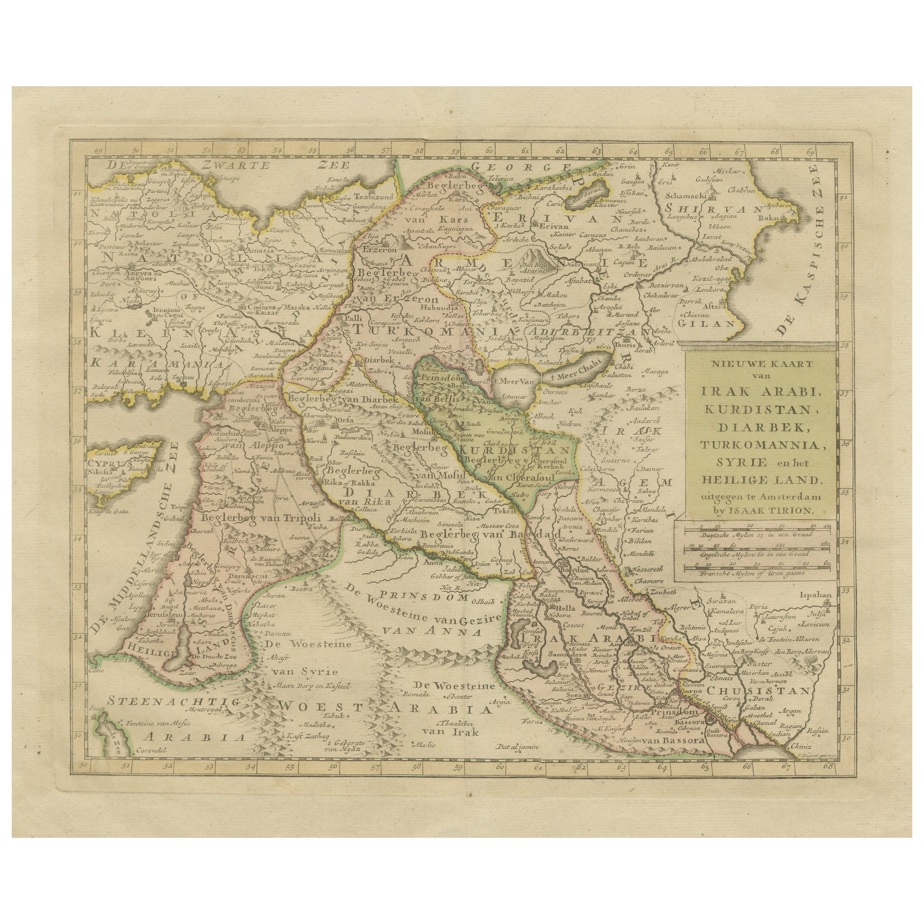
Antique Map of Eastern Turkey, Caucasus, Israel through Iraq and part of Arabia
Located in Langweer, NL
Antique map titled 'Nieuwe Kaart van Irak Arabia, Kurdistan, Diarbek, Turkomannia, Syrie en het Heilige Land'. Beautiful map including eastern Turkey, the Caucasus, Israel through Ir...
Category
Antique Mid-18th Century Maps
Materials
Paper

$436 Sale Price
20% Off
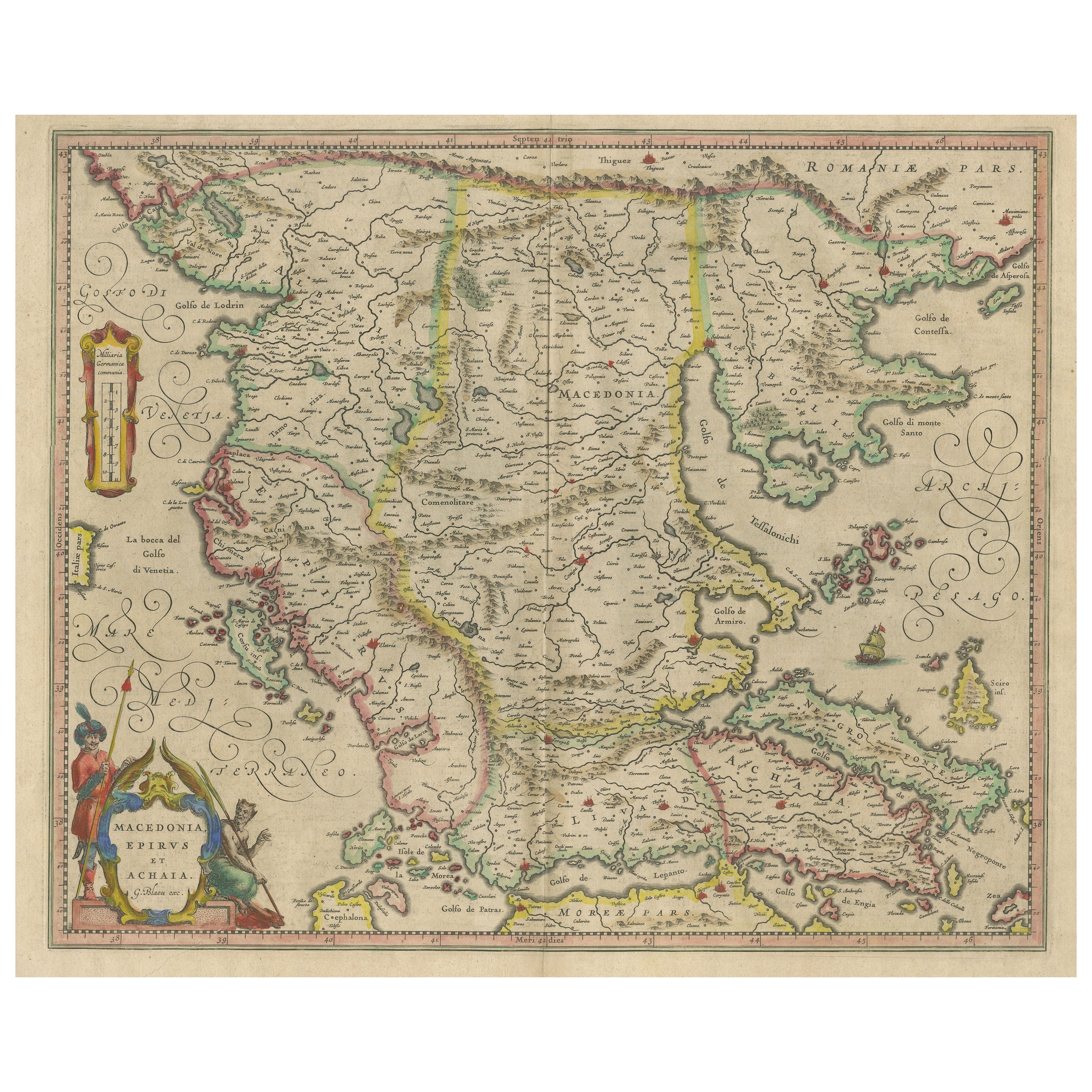
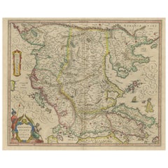
Antique Map of Macedonia, Northern Greece and part of Turkey in Europe
Located in Langweer, NL
Antique map titled 'Macedonia Epirus et Achaia'. Original old map of Macedonia, northern Greece, and part of Turkey in Europe. Published by W.J. Blaeu, circa 1640.
Willem Janszoon ...
Category
Antique Mid-17th Century Maps
Materials
Paper
$758 Sale Price
20% Off
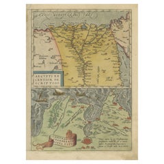
Antique Map of the Region Around the Nile and the City of Carthage
Located in Langweer, NL
Antique map titled 'Aegypti recentior descriptio - Carthaginis Celeberrimi sinus typus'. Two detailed regional maps by Ortelius. One map shows the region around the Nile, as far as A...
Category
Antique 16th Century Maps
Materials
Paper
$550 Sale Price
20% Off
Rare and Very Old Antique Map of South East Asia, Published circa 1574
Located in Langweer, NL
A very fine impression of this map of the Malay Peninsula, Sumatra, Java, with Singapore denoted as 'Cinca Pula'.
Highly distorted and inaccurate map by Girolamo Ruscelli after J...
Category
Antique 16th Century Maps
Materials
Paper

$1,138 Sale Price
20% Off
Free Shipping
You May Also Like
Antique 1803 Italian Map of Asia Including China Indoneseia India
Located in Amsterdam, Noord Holland
Antique 1803 Italian Map of Asia Including China Indoneseia India
Very nice map of Asia. 1803.
Additional information:
Type: Map
Country of Manufacturing: Europe
Period: 19th centu...
Category
Antique 19th Century European Maps
Materials
Paper

$584 Sale Price
20% Off
Antique French Map of Asia Including China Indoneseia India, 1783
Located in Amsterdam, Noord Holland
Very nice map of Asia. 1783 Dedie au Roy.
Additional information:
Country of Manufacturing: Europe
Period: 18th century Qing (1661 - 1912)
Condition: Overall Condition B (Good Used)...
Category
Antique 18th Century European Maps
Materials
Paper

$648 Sale Price
20% Off
1627 Hendrik Hondius Map Entitled "Vltoniae Orientalis Pars, " Ric.a009
Located in Norton, MA
1627 Hendrik Hondius map entitled
"Vltoniae orientalis pars,"
Ric.a009
Title:
Vltoniae orientalis : pars
Title (alt.) :
Ultoniae orientalis pars
Creator:
Mercator, Gerh...
Category
Antique 17th Century Dutch Maps
Materials
Paper

1718 Ides & Witsen Map "Route D'amsterdam a Moscow Et De La Ispahan Et Gamron
Located in Norton, MA
1718 Ides & Witsen map, entitled
"Route D'Amsterdam A Moscow Et De La Ispahan Et Gamron,"
Ric.b005
Subject: Eastern Europe and Central Asia
Period: 1718 (published)
Publicati...
Category
Antique Early 18th Century Dutch Maps
Materials
Paper

Original Antique Map of Ancient Greece, Achaia, Corinth, 1786
Located in St Annes, Lancashire
Great map of Ancient Greece. Showing the region of Thessaly, including Mount Olympus
Drawn by J.D. Barbie Du Bocage
Copper plate engraving by P.F Tardieu
Original hand color...
Category
Antique 1780s French Other Maps
Materials
Paper

1590 Mercator Map Entitled "France Picardie Champaigne, Ric.0001
Located in Norton, MA
Description: Published in Amsterdam by Mercator/Hondius ca. 1590.
Ric.0001
Artists and Engravers: Map : 'France Picardie Champaigne cum regionibus adiacentibus'. (Map of the french provinces of Picardie and Champagne.) Copper engraved map of the french provinces of Picardie and Champagne, showing the cities of Caen, Paris, Melun, Auxerre, Verdun, etc. Copperplate engraving on verge type hand laid paper with watermark. Description: Published in Amsterdam by Mercator/Hondius ca. 1600.Artists and Engravers: Mercator was born in Rupelmonde in Flanders and studied in Louvain under Gemma Frisius, Dutch writer, astronomer and mathematician. The excellence of his work brought him the patronage of Charles V, but in spite of his favor with the Emperor he was caught up in the persecution of Lutheran protestants and charged with heresy, fortunately without serious consequences. No doubt the fear of further persecution influenced his move in 1552 to Duisburg, where he continued the production of maps, globes and instruments. Mercator's sons and grandsons, were all cartographers and made their contributions in various ways to his atlas. Rumold, in particular, was responsible for the complete edition in 1595. The map plates...
Category
Antique 16th Century Dutch Maps
Materials
Paper

More Ways To Browse
Antique Crete
Folio Stand
Carthage Antique
Ancient Carthage
Playful Chair
Giacometti Chairs
Antique Rug Wool Navy Blue Red
Bauhaus Flower Stand
French Table With Drawers
North Carolina Furniture
Antique Silver Platter
Boat Blueprint
Cream Plates
Vintage Art Deco Rugs
Vintage Serving Forks
Brewery Signs
Herati Rug
Venice Wood