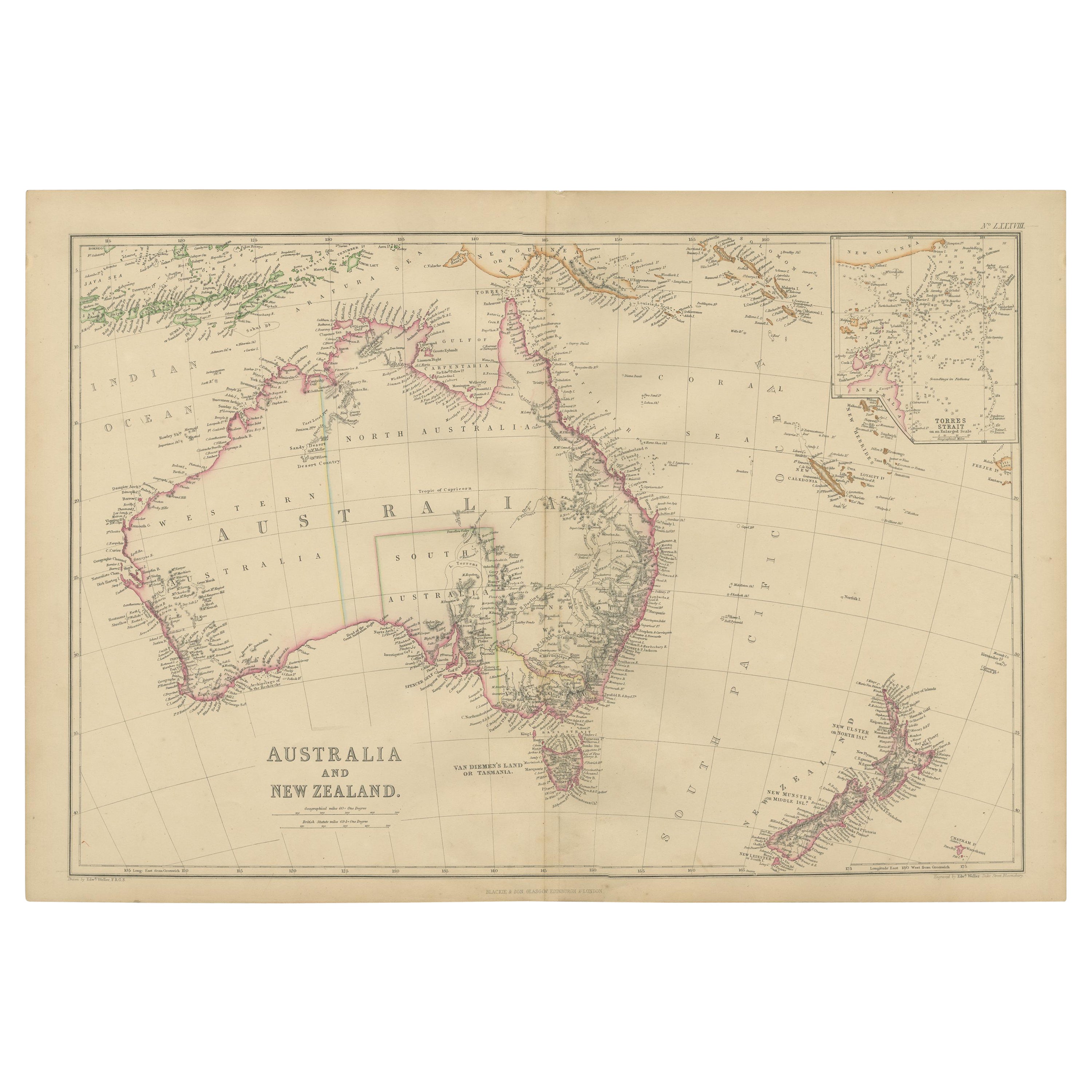
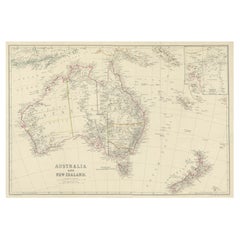
Antique Map of Australia and New Zealand by H. Kiepert, 1874
View Similar Items


Want more images or videos?
Request additional images or videos from the seller
1 of 5
Antique Map of Australia and New Zealand by H. Kiepert, 1874
About the Item
- Dimensions:Height: 19.1 in (48.5 cm)Width: 23.63 in (60 cm)Depth: 0.02 in (0.5 mm)
- Materials and Techniques:
- Period:
- Date of Manufacture:1874
- Condition:Please study image carefully.
- Seller Location:Langweer, NL
- Reference Number:Seller: BG-100271stDibs: LU3054310794073
About the Seller
5.0
Platinum Seller
These expertly vetted sellers are 1stDibs' most experienced sellers and are rated highest by our customers.
Established in 2009
1stDibs seller since 2017
1,949 sales on 1stDibs
More From This SellerView All
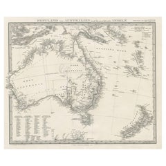
- Antique Map of Australia by H. Kiepert, 1875Located in Langweer, NLAntique map titled 'Australien'. Large and detailed map of Australia and New Zealand. With color key in lower left. The map is prepared by H. Kiepert...Category
Antique Late 19th Century Maps
MaterialsPaper
 $181 Sale Price40% Off
 - Antique Map of Australia and New Zealand, c.1860Located in Langweer, NLAntique map titled 'Australia and New Zealand'. Unusual edition of this map of Australia and New Zealand, on very thin paper and multiple folding lines. Source unknown, to be determi...Category
Antique 19th Century Maps
MaterialsPaper
 $123 Sale Price20% Off
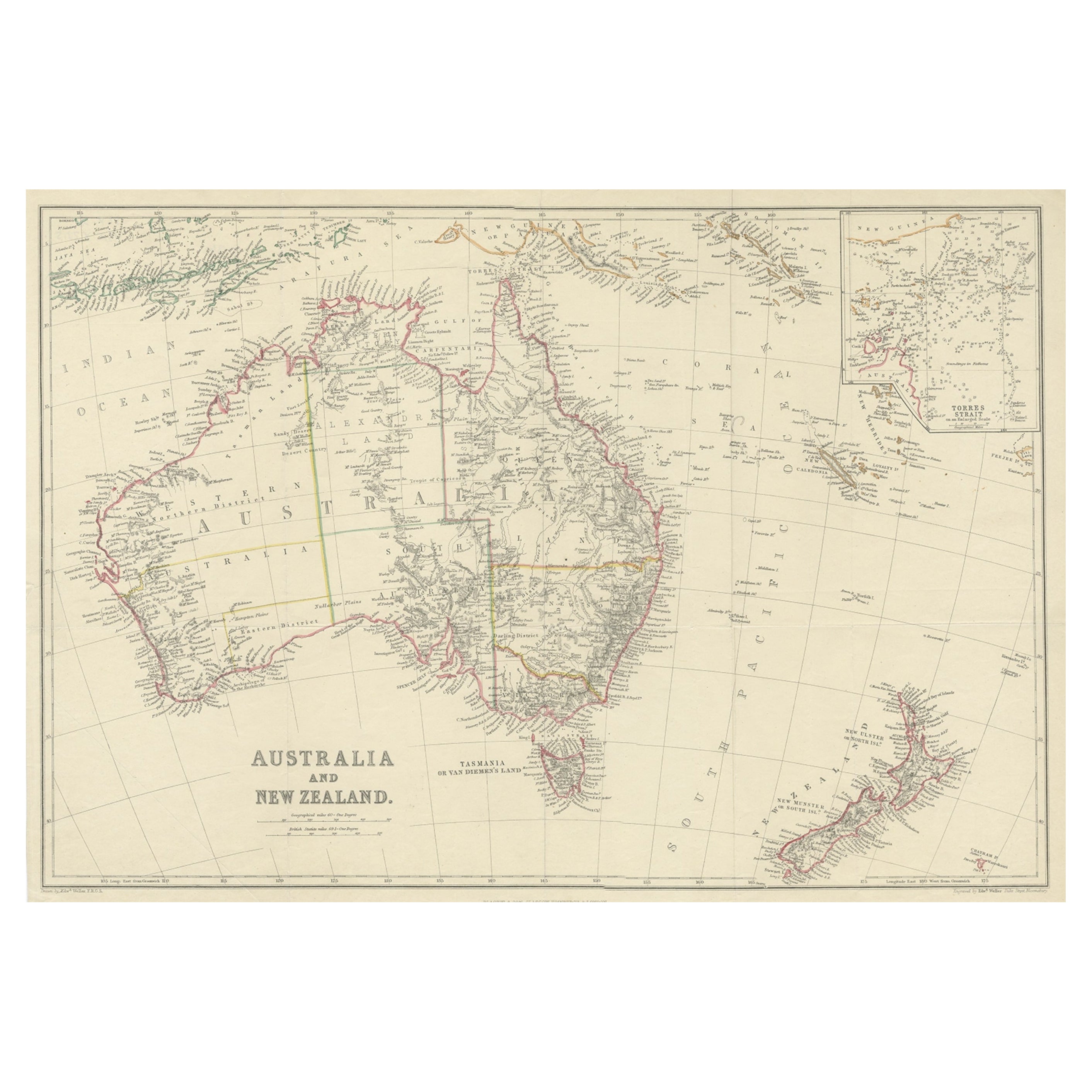
 - Antique Map of Australia and New Zealand by W. G. Blackie, 1859Located in Langweer, NLAntique map titled 'Australia and New Zealand'. Original antique map of Australia and New Zealand with inset map of the Torres Strait. This map originates from ‘The Imperial Atlas of...Category
Antique Mid-19th Century Maps
MaterialsPaper
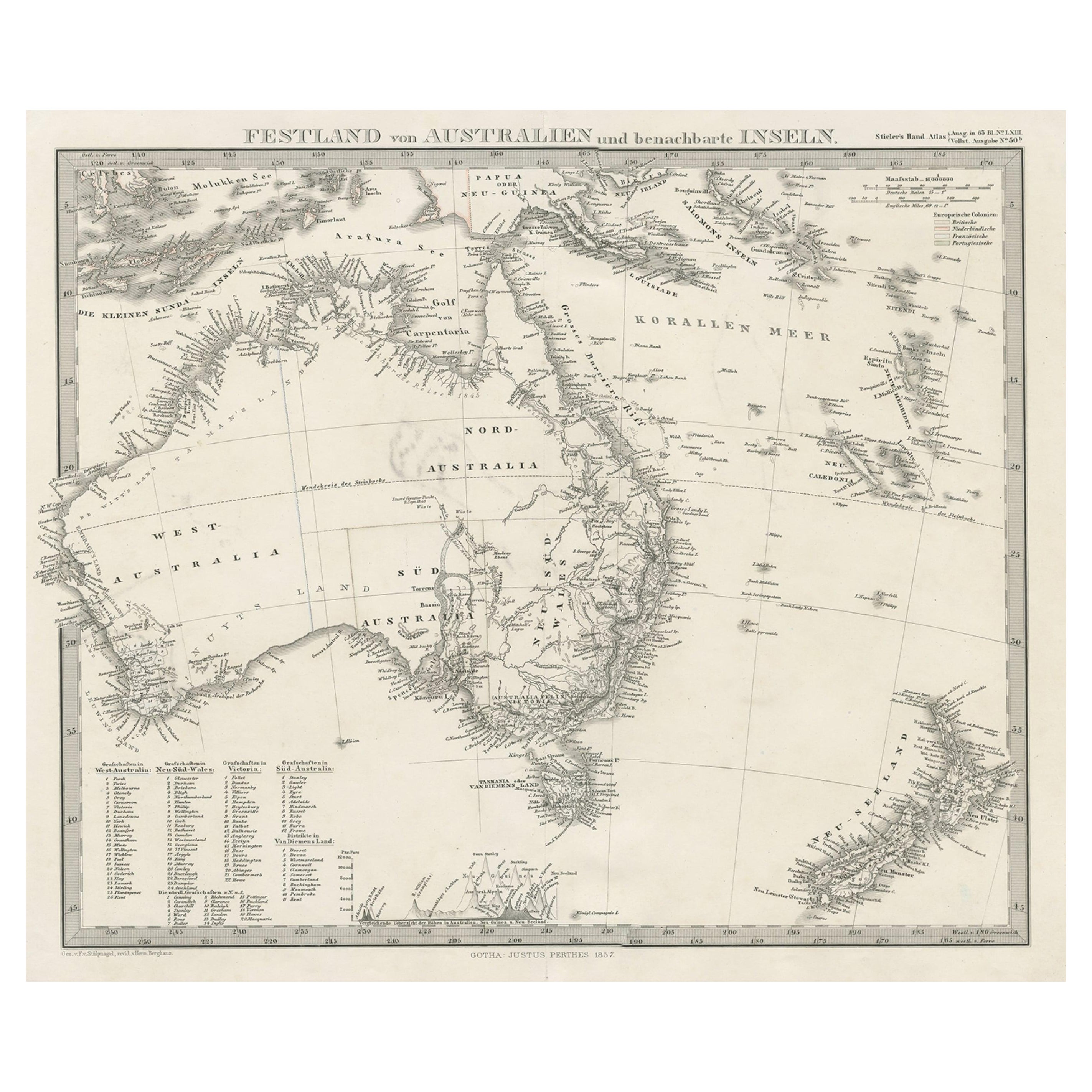
- German Antique Map of Australia and New Zealand, 1857Located in Langweer, NLAntique map Australia titled 'Festland von Australien und benachbarte Inseln'. Detailed map of Australia and New Zealand, including excellent det...Category
Antique 19th Century Maps
MaterialsPaper
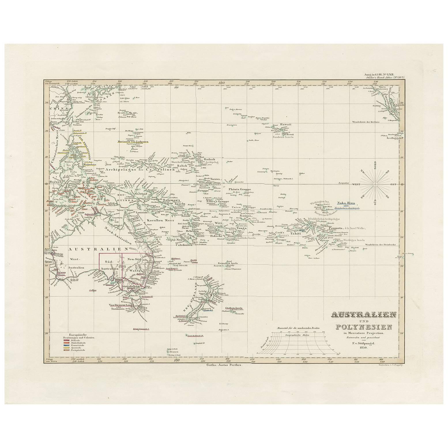
- Antique Map of Australia, New Zealand and Oceania by F. von Stülpnagel, 1850Located in Langweer, NLAntique map titled 'Australien und Polynesien in Mercators Projection'. A map of Australia, New Zealand and Oceania. This includes Fiji, Tahiti and several other island groups in the...Category
Antique Mid-19th Century Maps
MaterialsPaper
 $169 Sale Price30% Off
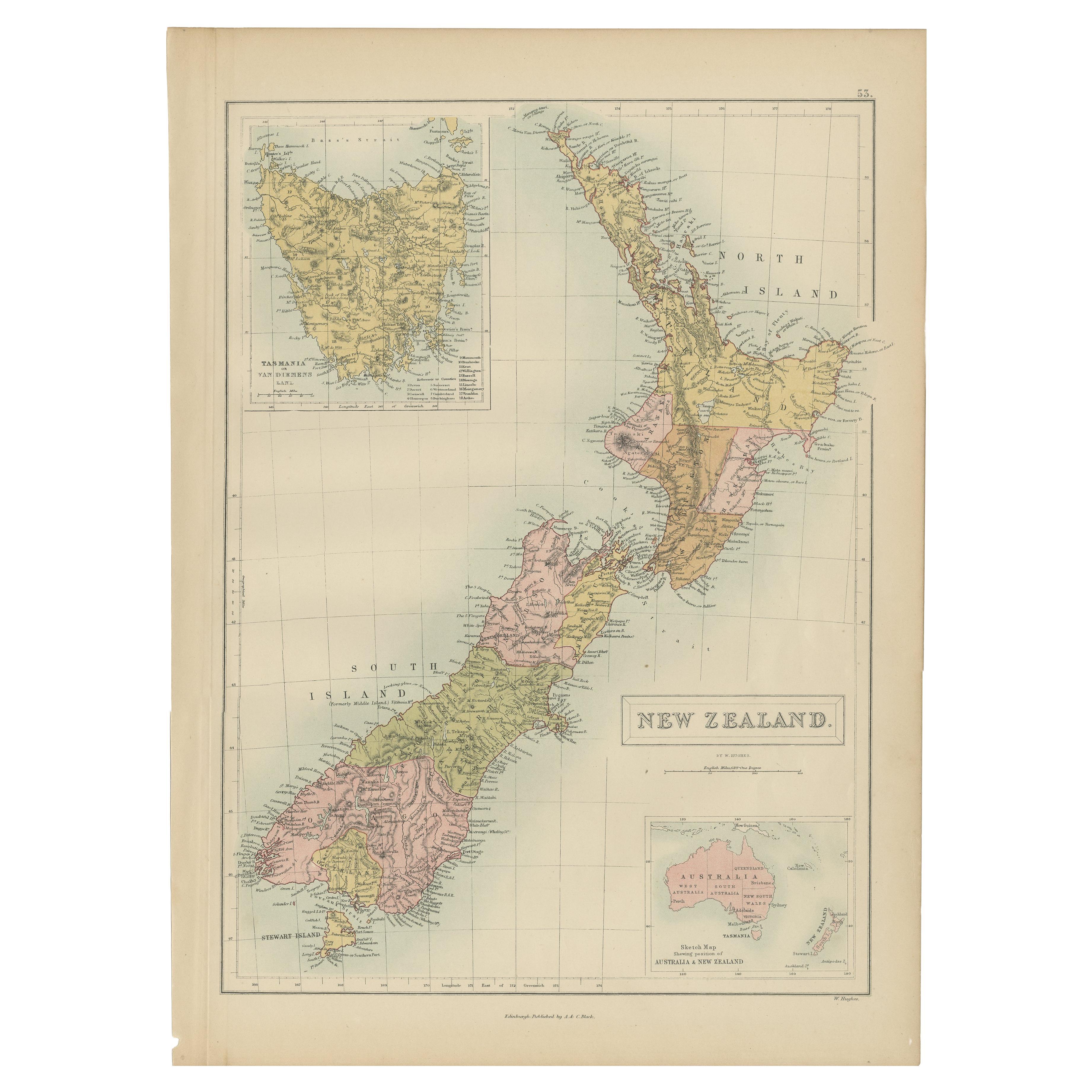
 - Antique Map of New Zealand by A & C. Black, 1870Located in Langweer, NLAntique map titled 'New Zealand'. Original antique map of New Zealand with inset Maps of Australia, New Zealand and Tasmania. This map origi...Category
Antique Late 19th Century Maps
MaterialsPaper


You May Also Like
- Antique Map of Italy by Andriveau-Goujon, 1843By Andriveau-GoujonLocated in New York, NYAntique Map of Italy by Andriveau-Goujon, 1843. Map of Italy in two parts by Andriveau-Goujon for the Library of Prince Carini at Palazzo Carini i...Category
Antique 1840s French Maps
MaterialsLinen, Paper
 $3,350 / set
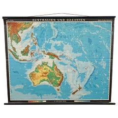
 - Vintage Mural Map Rollable Wall Chart Poster Australia New Zealand IndonesiaLocated in Berghuelen, DEVintage Mural Map Rollable Wall Chart Poster Australia New Zealand Indonesia The vintage pull-down map shows Australia and Oceania, published by Haack-Painke Justus Perthes Darmstadt. Colorful print on paper reinforced with canvas. This wallchart is a wonderful holiday memory decoration item. Measurements: Width 122 cm (48.03 inch) Height 100 cm (39.37 inch) The measurements shown refer just to the canvas and do not include the poles. Background information on the history of school wall charts: The idea to upgrade every day school life by using pictures was supported in the late 18th century by Johann Bernhard Basedow. In 1774 he published a four-volume book "Elementarwerk" which combined pictures, text and information with merely hundred copperplates. Modern printing methods enabled the spread from rich private schools to rural grade schools...Category
Vintage 1970s German Country Posters
MaterialsCanvas, Wood, Paper
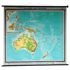
- Map Mural Rollable Poster Vintage Wall Chart Australia New Zealand PolynesiaLocated in Berghuelen, DEMap Mural Rollable Poster Vintage Wall Chart Australia New Zealand Polynesia A beautiful vintage school map illustrating the popular region of Aust...Category
Vintage 1970s German Country Posters
MaterialsCanvas, Wood, Paper
- Antique Map of Principality of MonacoBy Antonio Vallardi EditoreLocated in Alessandria, PiemonteST/619 - "Old Geographical Atlas of Italy - Topographic map of ex-Principality of Monaco" - ediz Vallardi - Milano - A somewhat special edition ---Category
Antique Late 19th Century Italian Other Prints
MaterialsPaper
 $228 Sale Price74% Off
 - Antique 1901 National Publishing Company's Road Map of New Jersey GeologicalLocated in Dayton, OHThe National Publishing Company's road map of New Jersey, showing all county and township divisions, cities villages and post-offices, railroads, ste...Category
Antique Early 1900s Victorian Prints
MaterialsPaper
- Original Antique Map of Russia By Arrowsmith. 1820Located in St Annes, LancashireGreat map of Russia Drawn under the direction of Arrowsmith Copper-plate engraving Published by Longman, Hurst, Rees, Orme and Brown, 1820 Unframed.Category
Antique 1820s English Maps
MaterialsPaper