Items Similar to Antique Map of the Austro-Hungarian Monarchy, 1903, with Colorful Borderlines

Want more images or videos?
Request additional images or videos from the seller
1 of 10
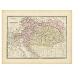
Antique Map of the Austro-Hungarian Monarchy, 1903, with Colorful Borderlines
$369.50
£273.60
€310
CA$508.11
A$565.07
CHF 295.79
MX$6,893.16
NOK 3,716.68
SEK 3,496.02
DKK 2,360.23
About the Item
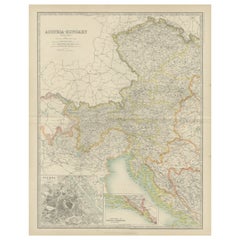
Title: Antique Map of the Austro-Hungarian Monarchy, 1903, with Colorful Provincial Borders
Description:
This antique map, titled "Austro-Hungarian Monarchy," was engraved and published in 1903 by the renowned W. & A.K. Johnston in Edinburgh and London. It offers a detailed and colorful depiction of the Austro-Hungarian Empire at the height of its power, just before the sweeping changes of the early 20th century reshaped the region.
The map elegantly delineates the complex mosaic of provinces within the empire, including Austria, Hungary, Bohemia, Galicia, Dalmatia, and many others, each highlighted in soft pastel shades of pink, green, yellow, and blue. Major cities like Vienna, Budapest, Prague, and Trieste are clearly marked, along with rivers, mountain ranges, and railways that knit the diverse regions together.
One of the map’s standout features is the inset map of the Adriatic coastline, titled "Continuation of Dalmatia," showcasing the maritime and strategic importance of the empire’s coastal territories. The precision and artistry of the engraving bring to life the rich cultural and geographical diversity that made the Austro-Hungarian Monarchy one of Europe’s great powers.
For collectors and history enthusiasts, this map is a window into the final decades of a multi-ethnic empire that played a central role in European affairs. It’s a reminder of a world on the verge of dramatic political upheaval, beautifully captured in the refined craftsmanship of Johnston’s cartography.
Condition report:
This map is in very good antique condition, with minimal foxing and slight edge toning typical for its age. The colors remain vibrant and the paper is well-preserved.
Framing tips:
A dark wooden frame in walnut or cherry will enhance the soft pastel tones and add a sense of warmth and sophistication. Pair it with a cream or off-white matting to highlight the detailed engraving and create a refined and timeless focal point for any home, library, or study.
- Dimensions:Height: 14.49 in (36.8 cm)Width: 18.51 in (47 cm)Depth: 0.01 in (0.2 mm)
- Materials and Techniques:
- Period:
- Date of Manufacture:1903
- Condition:This map is in very good antique condition, showing only slight toning and minor foxing typical for its age. The colors remain vibrant and the paper stable and clear. Two folding lines as issued.
- Seller Location:Langweer, NL
- Reference Number:Seller: BG-13577-181stDibs: LU3054345242852
About the Seller
5.0
Recognized Seller
These prestigious sellers are industry leaders and represent the highest echelon for item quality and design.
Platinum Seller
Premium sellers with a 4.7+ rating and 24-hour response times
Established in 2009
1stDibs seller since 2017
2,594 sales on 1stDibs
Typical response time: <1 hour
- ShippingRetrieving quote...Shipping from: Langweer, Netherlands
- Return Policy
Authenticity Guarantee
In the unlikely event there’s an issue with an item’s authenticity, contact us within 1 year for a full refund. DetailsMoney-Back Guarantee
If your item is not as described, is damaged in transit, or does not arrive, contact us within 7 days for a full refund. Details24-Hour Cancellation
You have a 24-hour grace period in which to reconsider your purchase, with no questions asked.Vetted Professional Sellers
Our world-class sellers must adhere to strict standards for service and quality, maintaining the integrity of our listings.Price-Match Guarantee
If you find that a seller listed the same item for a lower price elsewhere, we’ll match it.Trusted Global Delivery
Our best-in-class carrier network provides specialized shipping options worldwide, including custom delivery.More From This Seller
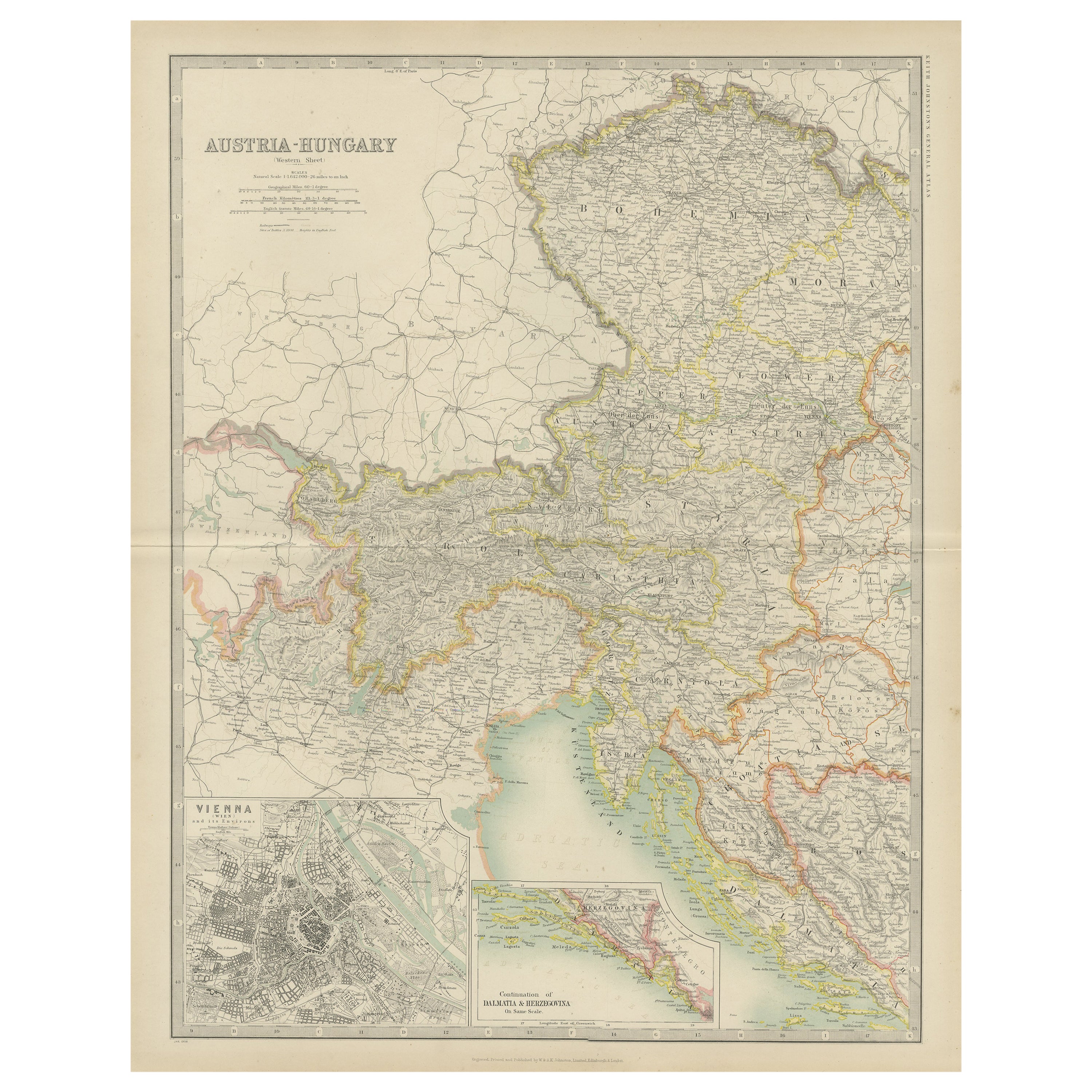
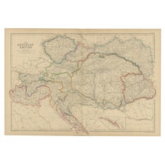
View AllAntique Map of Austria- Hungary by Johnston '1909'
Located in Langweer, NL
Antique map titled 'Austria- Hungary'. Original antique map of Austria- Hungary. With inset maps of Vienna, Dalmatia and Herzegovina. This map o...
Category
Early 20th Century Maps
Materials
Paper
$238 Sale Price
20% Off
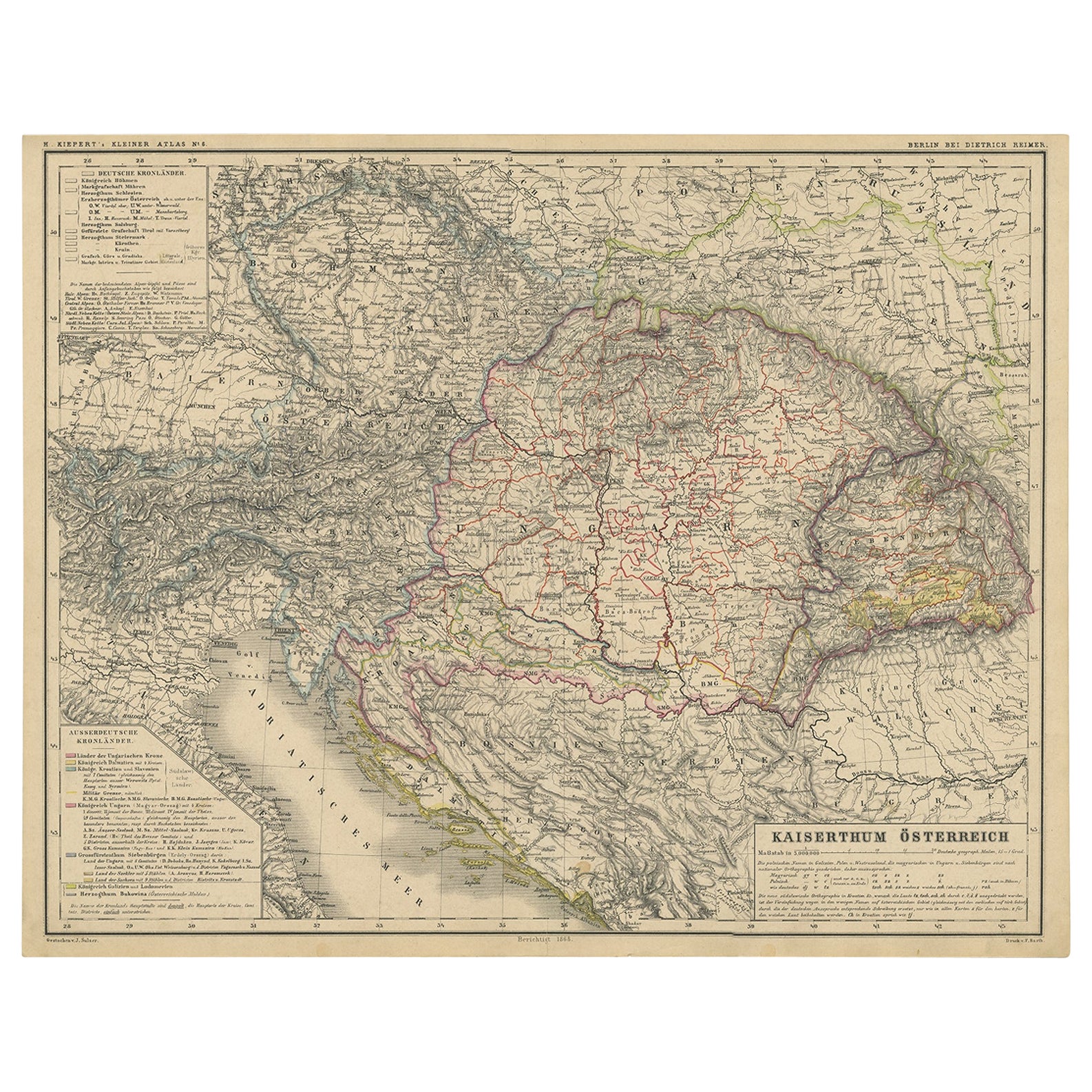
Old German Map of the Austrian Empire, ca.1870
Located in Langweer, NL
Antique map titled 'Kaiserthum Österreich'.
Old map of the Austrian Empire. This map originates from 'H. Kiepert's Kleiner Atlas der Neueren Geographie für Schule und Haus'.
Arti...
Category
Antique 1870s German Maps
Materials
Paper
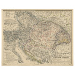
$276 Sale Price
20% Off
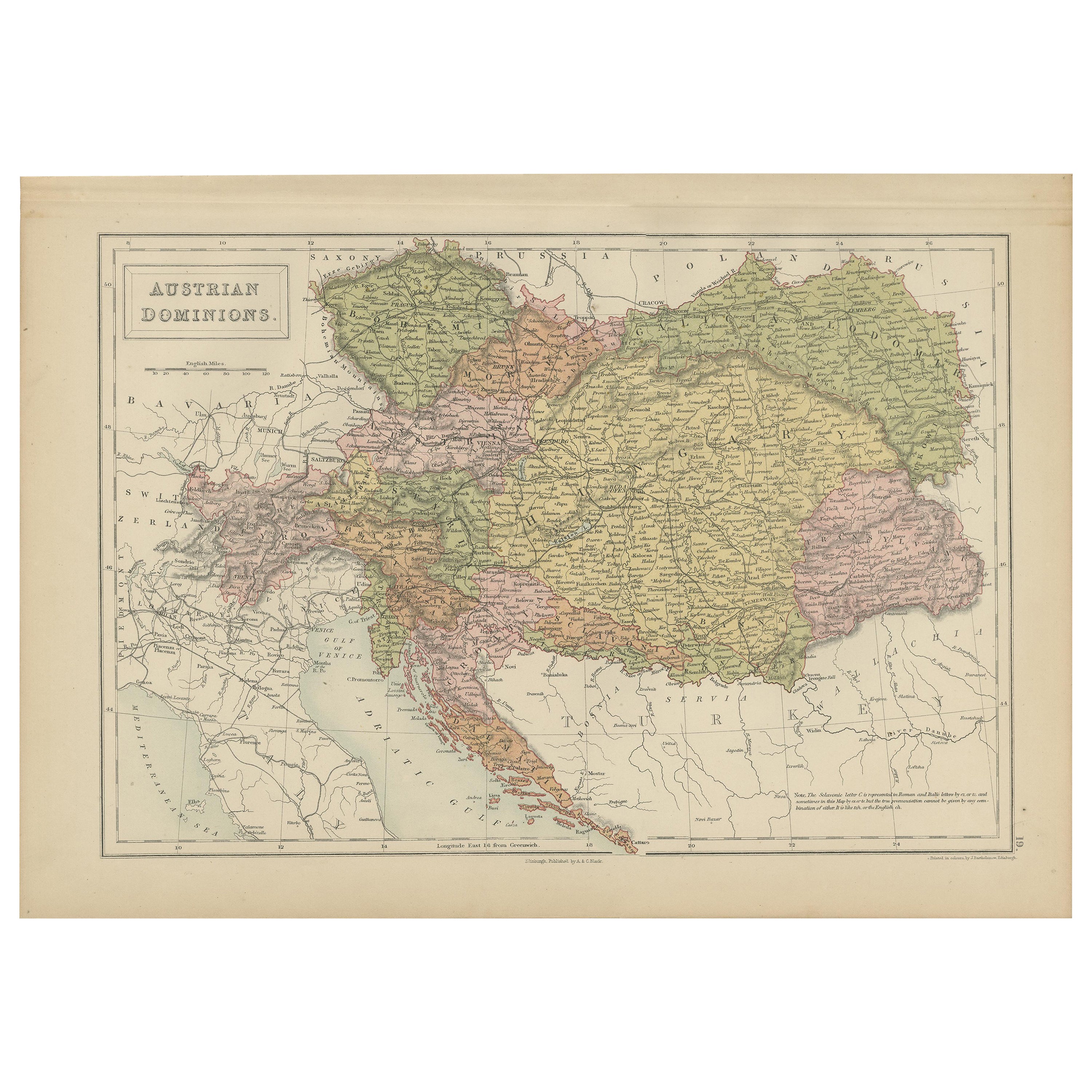
Antique Map of Austrian Dominions by A & C. Black, 1870
Located in Langweer, NL
Antique map titled 'Austrian Dominions'. Original antique map of Austrian Dominions. This map originates from ‘Black's General Atlas of The Worl...
Category
Antique Late 19th Century Maps
Materials
Paper
$166 Sale Price
20% Off
Antique Map of Austria-Hungary by Levasseur, '1875'
Located in Langweer, NL
Antique map titled 'Carte générale de la Monarchie Austro-Hongroise (..)'. Large map of Austria-Hungary. This map originates from 'Atlas de Géographie M...
Category
Antique Late 19th Century Maps
Materials
Paper
$309 Sale Price
35% Off
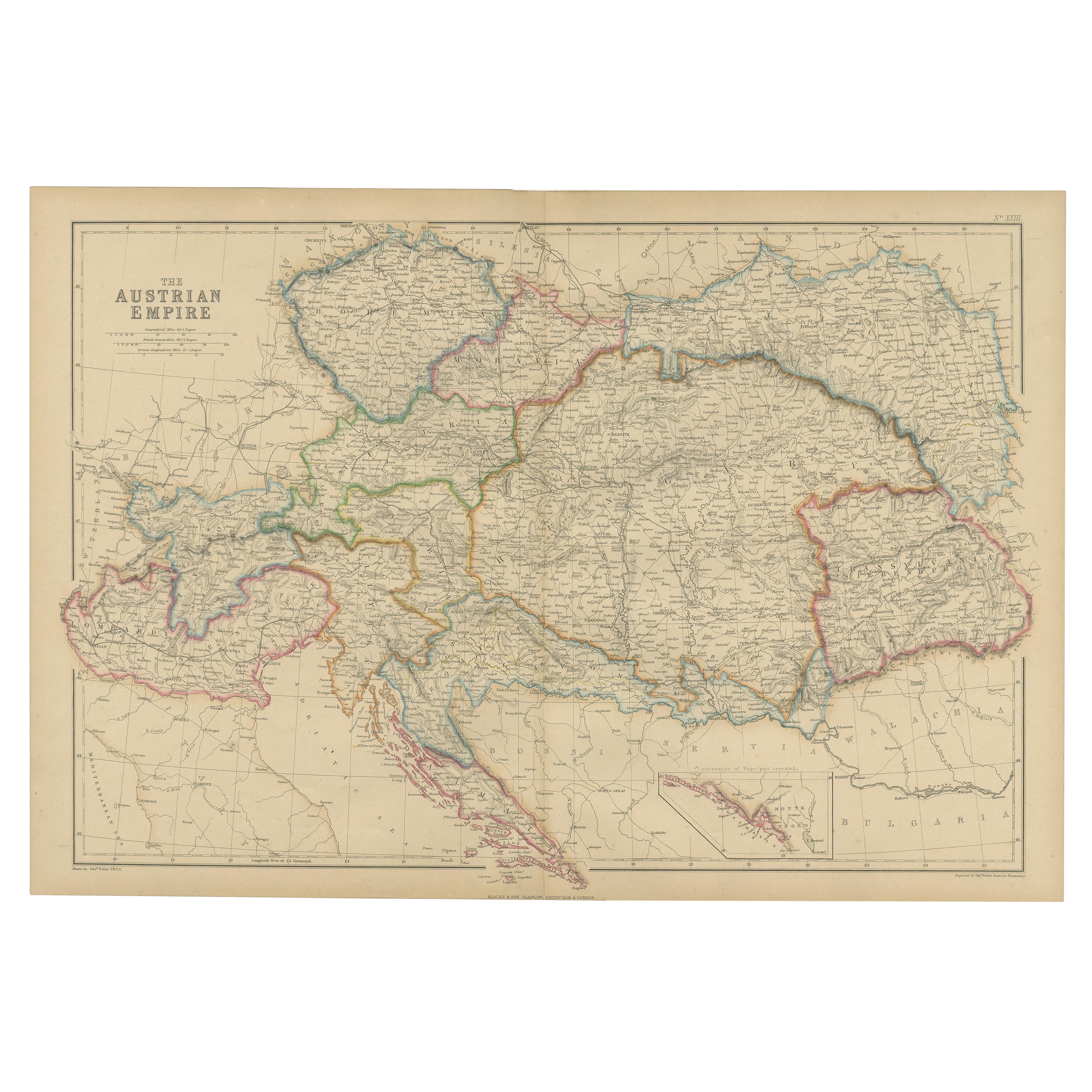
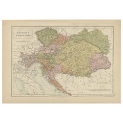
Antique Map of the Austrian Empire by W. G. Blackie, 1859
Located in Langweer, NL
Antique map titled 'The Austrian Empire'. Original antique map of the Austrian Empire with inset map of Montenegro. This map originates from ‘The Imperial Atlas of Modern Geography’....
Category
Antique Mid-19th Century Maps
Materials
Paper
$208 Sale Price
30% Off
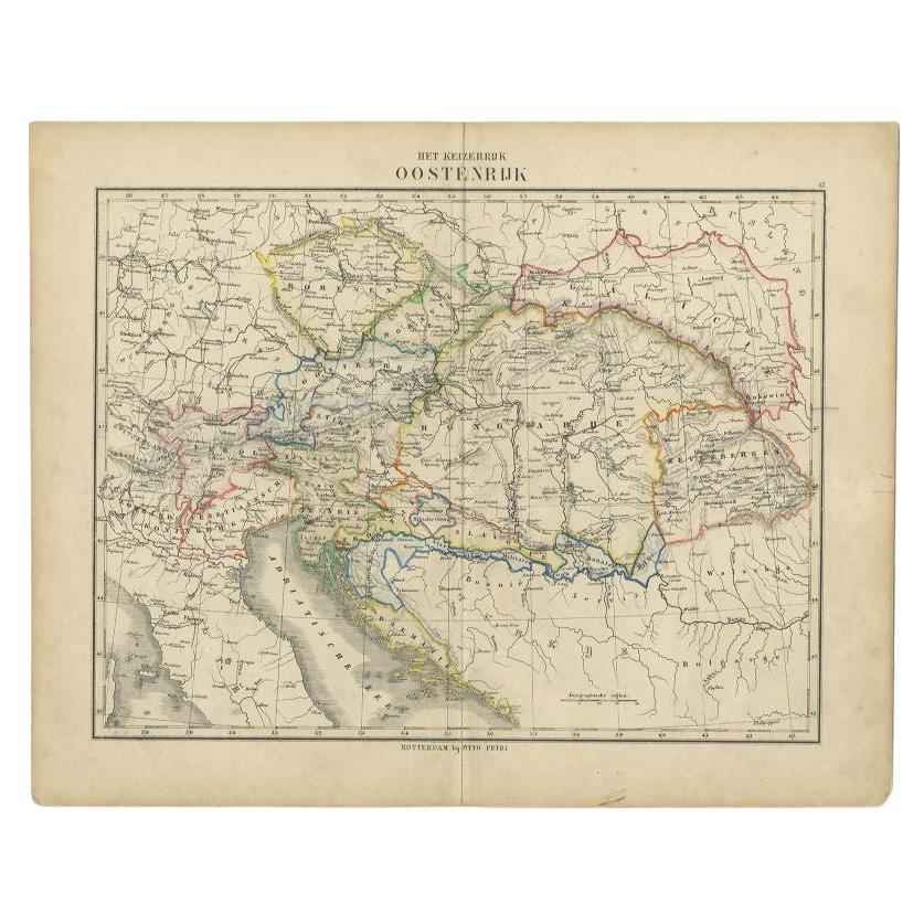
Antique Map of the Austrian Empire by Petri, c.1873
Located in Langweer, NL
Antique map titled 'Het Keizerrijk Oostenrijk'. Old map depicting the Austrian Empire. This map originates from 'School-Atlas van alle Deelen der Aarde'. Artists and Engravers: Publi...
Category
Antique 19th Century Maps
Materials
Paper
$88 Sale Price
20% Off
You May Also Like
Austria-Hungary, Western Part. Century Atlas antique vintage map
Located in Melbourne, Victoria
'The Century Atlas. Austria-Hungary, Western Part'
Original antique map, 1903.
Central fold as issued. Map name and number printed on the reverse corners.
Sheet 40cm by 29.5cm.
Category
Early 20th Century Victorian More Prints
Materials
Lithograph

German Empire, Southwestern Part. Century Atlas antique vintage map
Located in Melbourne, Victoria
'The Century Atlas. German Empire, Southwestern Part'
Original antique map, 1903.
Central fold as issued. Map name and number printed on the reverse co...
Category
Early 20th Century Victorian More Prints
Materials
Lithograph

Map of Eastern Roman Empire -Vintage Offset Print - Early 20th Century
Located in Roma, IT
This map of Eastern Roman Empire is a vintage offset print realized in the early 20th Century.
The state of preservation of the artwork is aged with dif...
Category
Early 20th Century Figurative Prints
Materials
Offset

Russia in Europe with Poland and Finland. Century Atlas antique vintage map
Located in Melbourne, Victoria
'The Century Atlas. Russia in Europe with Poland and Finland'
Original antique map, 1903.
Central fold as issued. Map name and number printed on the reverse corners.
Sheet 40cm by ...
Category
Early 20th Century Victorian More Prints
Materials
Lithograph

German Empire, Northern Part. Century Atlas antique vintage map
Located in Melbourne, Victoria
'The Century Atlas. German Empire, Northern Part.'
Original antique map, 1903.
Central fold as issued. Map name and number printed on the reverse corne...
Category
Early 20th Century Victorian More Prints
Materials
Lithograph

Russia, Western and Southern Part. Century Atlas antique vintage map
Located in Melbourne, Victoria
'The Century Atlas. Russia, Western and Southern Part'
Original antique map, 1903.
Inset map tilted 'St Petersburg and Environs'.
Central fold as issued. Map name and number printe...
Category
Early 20th Century Victorian More Prints
Materials
Lithograph
