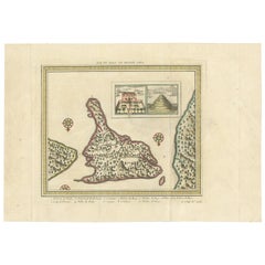
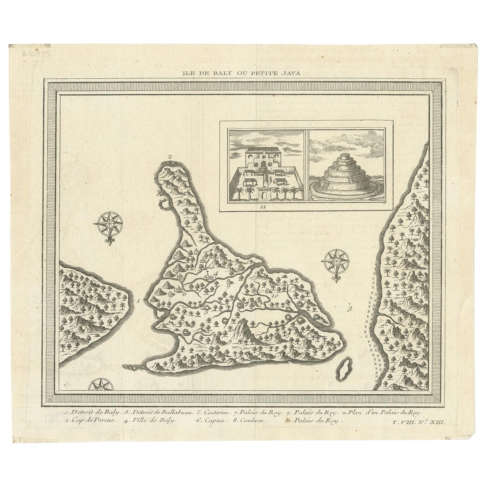
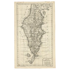
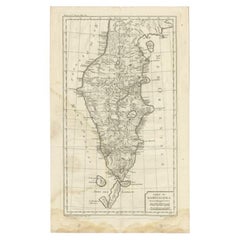
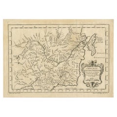
Antique Map of Bali 'Indonesia' by Bellin '1757'
View Similar Items


Want more images or videos?
Request additional images or videos from the seller
1 of 5
Antique Map of Bali 'Indonesia' by Bellin '1757'
About the Item
- Dimensions:Height: 10.04 in (25.5 cm)Width: 14.38 in (36.5 cm)Depth: 0.02 in (0.5 mm)
- Materials and Techniques:
- Period:
- Date of Manufacture:1757
- Condition:
- Seller Location:Langweer, NL
- Reference Number:Seller: BGJC-363-31stDibs: LU3054317572301
About the Seller
5.0
Platinum Seller
These expertly vetted sellers are 1stDibs' most experienced sellers and are rated highest by our customers.
Established in 2009
1stDibs seller since 2017
1,950 sales on 1stDibs
More From This SellerView All
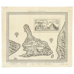
- Antique Map of Bali 'Indonesia' by Bellin, 'c.1750'Located in Langweer, NLAntique map titled 'Ile de Baly ou petite Java'. Map of Bali, Indonesia. The map depicts the island from the north with Java to the right and Lombok to the...Category
Antique Mid-18th Century Maps
MaterialsPaper
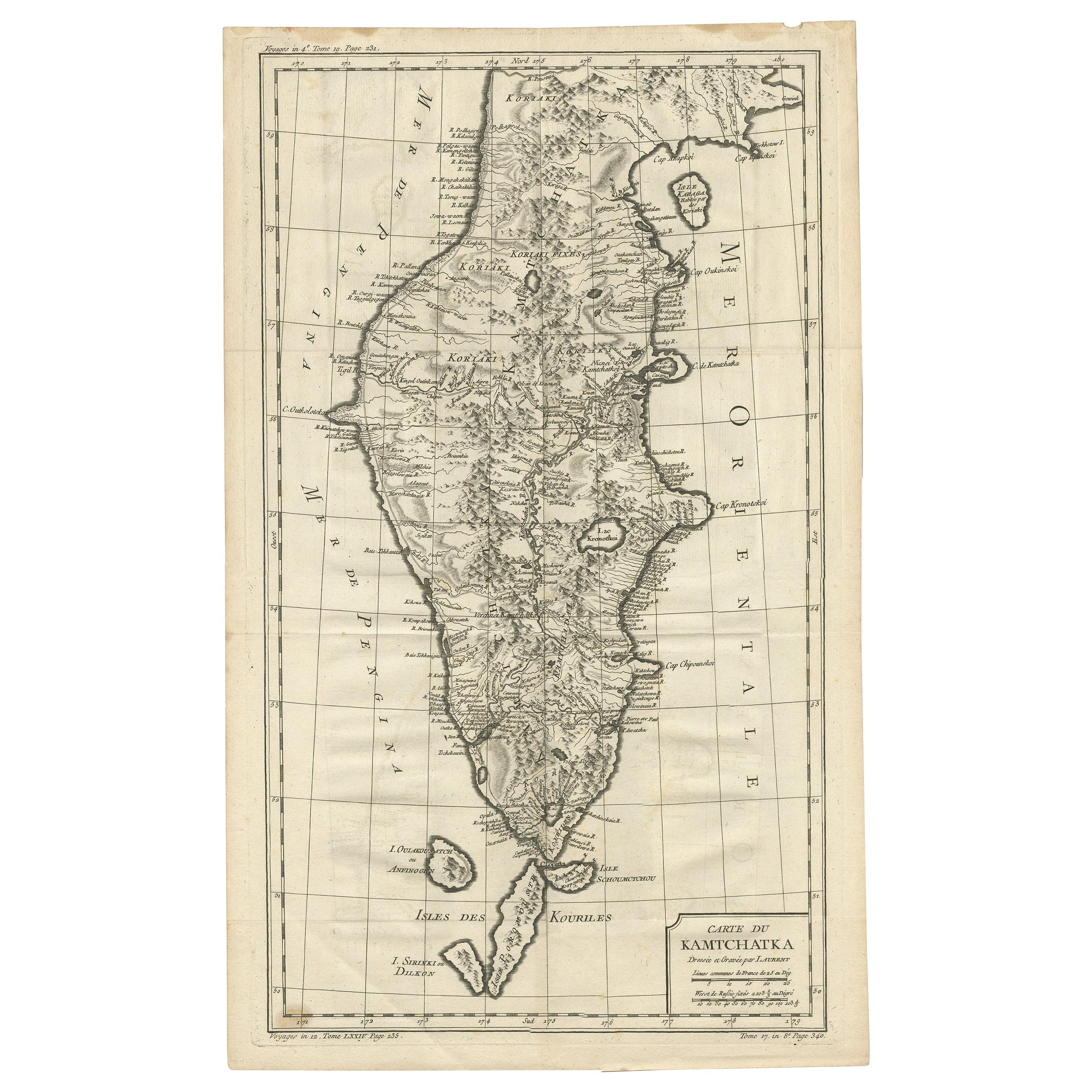
- Antique Map of Kamchatka by Bellin, '1757'By Jacques-Nicolas BellinLocated in Langweer, NLAntique map titled 'Carte du Kamtchatka'. Antique map of the Kamchatka Peninsula. The map includes the island of Ouiakous Atch ou Anfinogen, Schoumctchou, and Sirinki ou Dilkon. Orig...Category
Antique Mid-18th Century Maps
MaterialsPaper
- Antique Map of the Kamchatka Peninsula by Bellin, 1757By J. LaurentLocated in Langweer, NLAntique map titled 'Carte du Kamtchatka'. Antique map of the Kamchatka Peninsula. The map includes the island of Ouiakous Atch ou Anfinogen, Schoumctchou, and Sirinki ou Dilkon. Orig...Category
Antique 18th Century Maps
MaterialsPaper
- Antique Map of Nova Zembla 'Russia' by J.N. Bellin, 1757Located in Langweer, NLDecorative map of Nova Zembla and environs in the Arctic Sea. Includes a large decorative title cartouche. One of the maps produced by Jacques-Nicolas Bellin for Prevost d'Exiles inf...Category
Antique Mid-18th Century Maps
MaterialsPaper
 $242 Sale Price20% Off
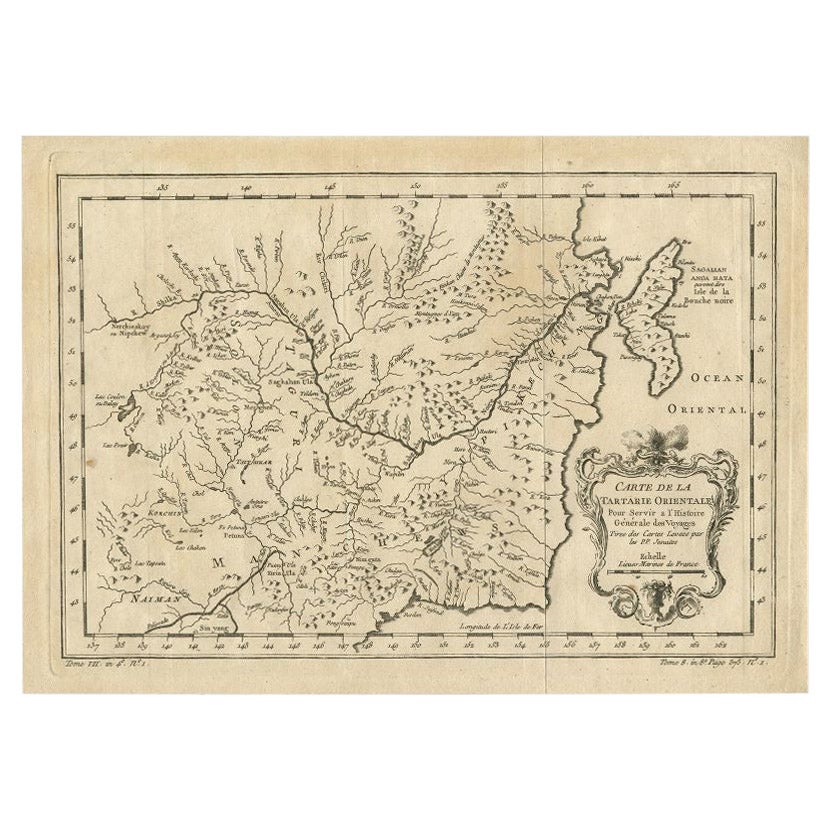
 - Antique Map of Northern China and Eastern Russia by Bellin, 1757Located in Langweer, NLAntique map titled 'Carte de la Tartarie Orientale (..)'. Original antique map of what is present day northern China and far eastern Russia. Centered on...Category
Antique 18th Century Maps
MaterialsPaper
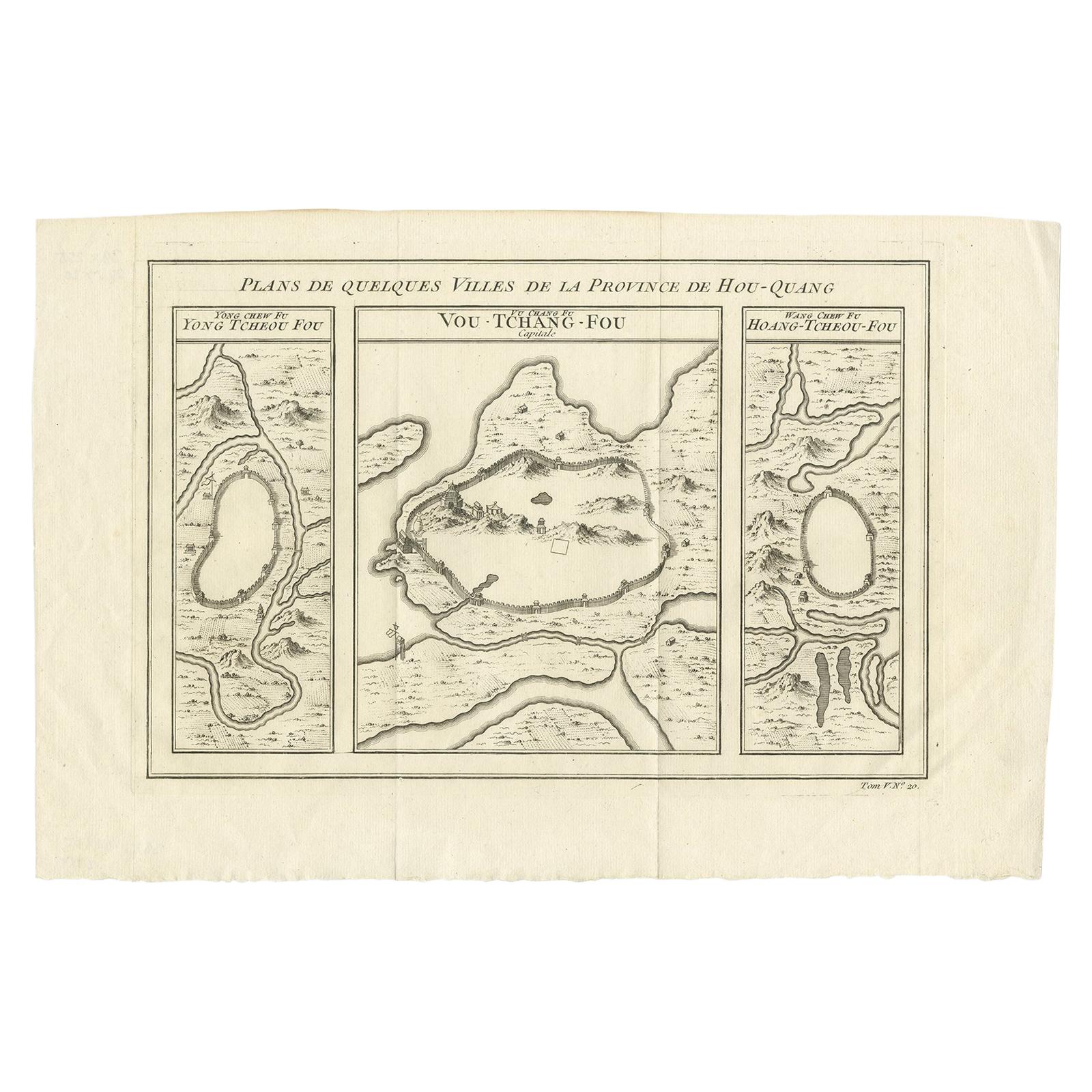
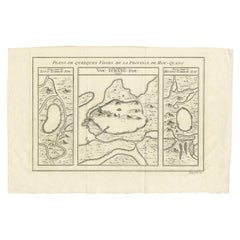
- Antique Map of Three Cities of China's Hubei and Hunan Provinces by BellinBy Jacques-Nicolas BellinLocated in Langweer, NLAntique print titled 'Plans de Quelques villes de la province de Hou-Quang.' Three bird's-eye view plans of walled cities in what are now China's Hubei (Hou-Quang) and Hunan Province...Category
Antique Mid-18th Century Maps
MaterialsPaper
 $137 Sale Price24% Off
You May Also Like
- Original Antique Map of Indonesia, 1861Located in St Annes, LancashireGreat map of Indonesia Drawn and engraved by Edward Weller Original color Published in The Weekly Dispatch Atlas, 1861 Repairs to minor e...Category
Antique 1860s English Victorian Maps
MaterialsPaper

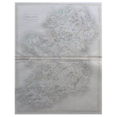
- Large Original Antique Map of Ireland by Sidney Hall, 1847Located in St Annes, LancashireGreat map of Ireland Drawn and engraved by Sidney Hall Steel engraving Original colour outline Published by A & C Black. 1847 Unframed Free shipping.Category
Antique 1840s Scottish Maps
MaterialsPaper
- Large Original Antique Map of Poland by Sidney Hall, 1847Located in St Annes, LancashireGreat map of Poland Drawn and engraved by Sidney Hall Steel engraving Original colour outline Published by A & C Black. 1847 Unframed ...Category
Antique 1840s Scottish Maps
MaterialsPaper
- Large Original Antique Map of Asia by Sidney Hall, 1847Located in St Annes, LancashireGreat map of Asia Drawn and engraved by Sidney Hall Steel engraving Original colour outline Published by A & C Black. 1847 Unframed Free shippingCategory
Antique 1840s Scottish Maps
MaterialsPaper
- Original Antique Map of Cyprus. Circa 1880Located in St Annes, LancashireGreat map of Cyprus Drawn and Engraved by R.Walker Published W.Mackenzie, London Original colour Unframed.Category
Antique 1880s English Maps
MaterialsPaper

- Original Large Antique Map of Paris, France by John Dower, 1861Located in St Annes, LancashireFabulous monochrome map of Paris. Vignettes of St Germain En Laye, Saint Cloud, Versailles and Fontainbleau. Unframed. Drawn by J.Dower. Lithography by Weller. 4 sheets j...Category
Antique 1860s English Victorian Maps
MaterialsPaper


Recently Viewed
View AllMore Ways To Browse
Bali Map
Balinese Antique Furniture
Bali Temple
Balinese Antique
Antique Map Bali
Balinese Temple
Map Of The World Antique
Rare Maps
Used World Atlas
Russian Collectable
Office World Map
Sea Collectables
Antique Curiosities Prints
Antique Appreciation
United States Map
Antique Collectible Plate
Prints Of Antique Maps
Antique Over A Hundred Years Old