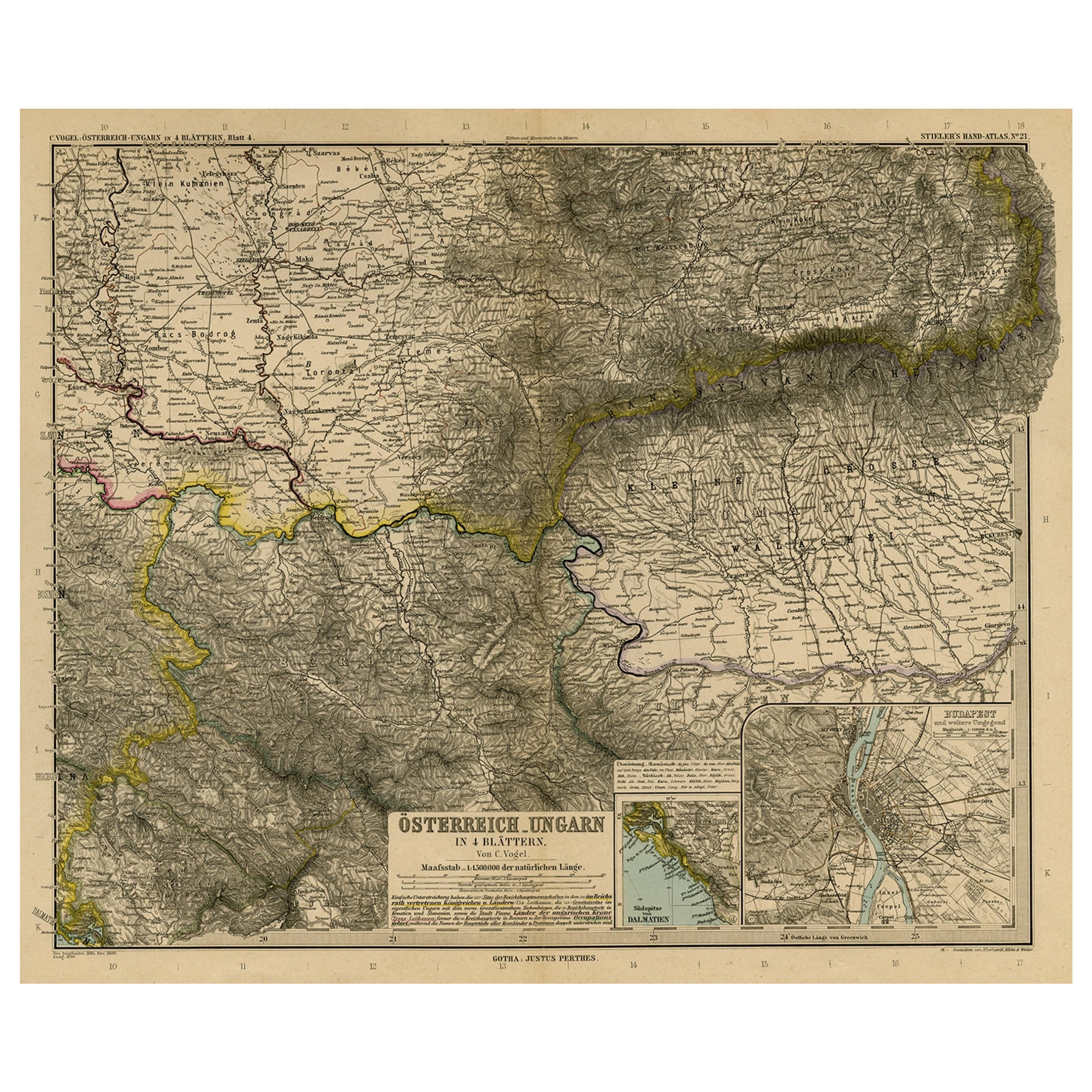
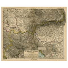
Antique Map of Eastern Europe by Stieler, 1890
View Similar Items


Want more images or videos?
Request additional images or videos from the seller
1 of 5
Antique Map of Eastern Europe by Stieler, 1890
About the Item
- Dimensions:Height: 15.63 in (39.7 cm)Width: 19.22 in (48.8 cm)Depth: 0 in (0.01 mm)
- Materials and Techniques:
- Period:
- Date of Manufacture:1890
- Condition:Repaired: Paper separation in the top and lower edge of the middle fold (closed with archival tape on the rear). Top edge reinforced on the rear. A few small closed tears in the margin edges. Condition: Good, given age. Original middle fold, as issued.
- Seller Location:Langweer, NL
- Reference Number:Seller: PCT-565161stDibs: LU3054325634542
About the Seller
5.0
Recognized Seller
These prestigious sellers are industry leaders and represent the highest echelon for item quality and design.
Platinum Seller
Premium sellers with a 4.7+ rating and 24-hour response times
Established in 2009
1stDibs seller since 2017
2,434 sales on 1stDibs
Typical response time: 1 hour
Authenticity Guarantee
In the unlikely event there’s an issue with an item’s authenticity, contact us within 1 year for a full refund. DetailsMoney-Back Guarantee
If your item is not as described, is damaged in transit, or does not arrive, contact us within 7 days for a full refund. Details24-Hour Cancellation
You have a 24-hour grace period in which to reconsider your purchase, with no questions asked.Vetted Professional Sellers
Our world-class sellers must adhere to strict standards for service and quality, maintaining the integrity of our listings.Price-Match Guarantee
If you find that a seller listed the same item for a lower price elsewhere, we’ll match it.Trusted Global Delivery
Our best-in-class carrier network provides specialized shipping options worldwide, including custom delivery.More From This Seller
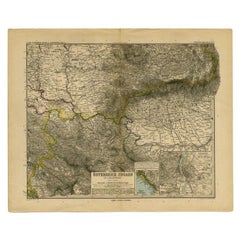
View AllAntique Map of Eastern Europe, Incl Montenegro & Serbia & a Budapest Map, 1890
Located in Langweer, NL
Antique map titled 'Osterreich-Ungarn in 4 Blattern, Blatt 4.'
Map of Eastern Europe, with Montenegro in the lower left corner, the southern ...
Category
Antique 1890s Maps
Materials
Paper
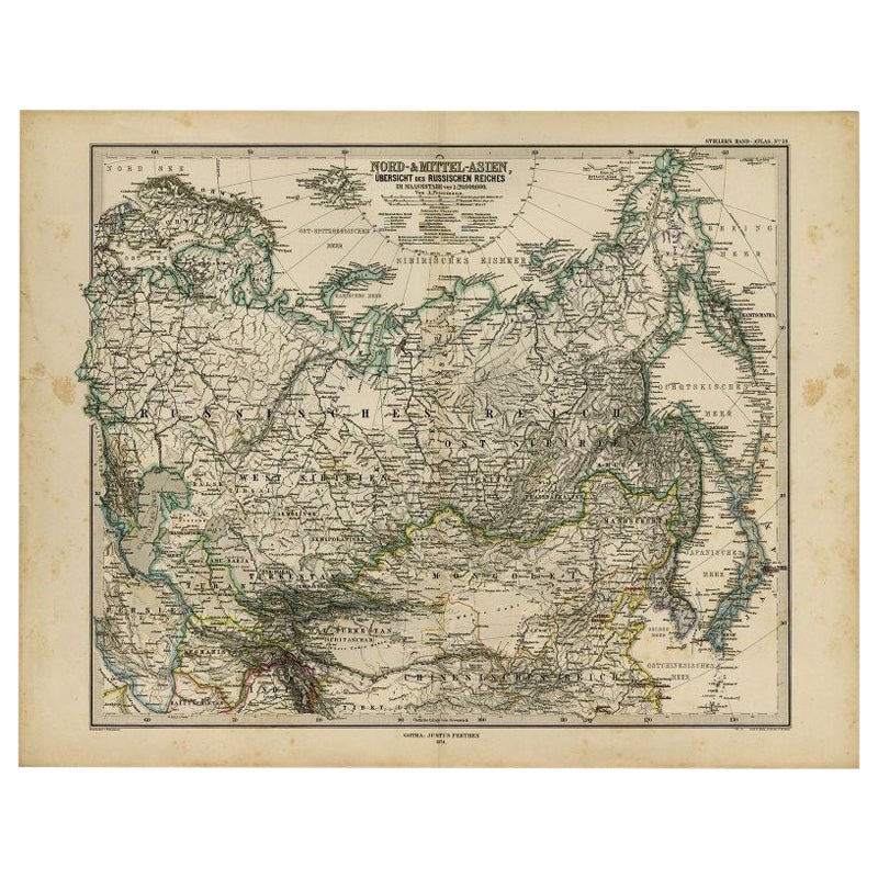
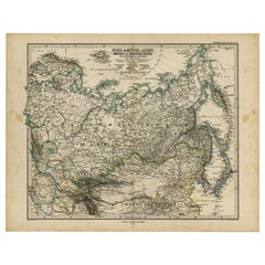
Antique Map of Russia and Surroundings by Stieler, 1874
Located in Langweer, NL
Antique map titled 'Nord- & Mittal-Asien, Ubersicht des Russischen Reiches.' A map of Russia in scale 1:20.000.000. The depicted area spans from Iran and Sweden in the left edge of t...
Category
Antique 19th Century Maps
Materials
Paper
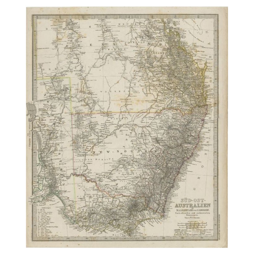
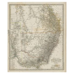
Antique Map of South East Australia by Stieler, c.1848
By Thomas Kitchin
Located in Langweer, NL
Antique map Australia titled 'Süd-Ost Australien'. Detailed map of South East Australia. Orginates from 'Stieler's Hand Atlas', published in Germ...
Category
Antique 19th Century Maps
Materials
Paper
Antique Map of Eastern Persia, 1852
Located in Langweer, NL
Antique map titled 'Eastern Persia'. Original map of Eastern Persia. This map originates from 'Lowry's Table Atlas constructed and engraved from the most recent Authorities' by J.W. ...
Category
Antique Mid-19th Century Maps
Materials
Paper

$92 Sale Price
20% Off
Antique Map of Eastern Polynesia, 1849
Located in Langweer, NL
Antique map titled 'Ost-Polynesien'. Interesting variant issue, with large detailed insets top right of Hawaii volcanos near Kilauea. Insets lower right of Honolulu harbour, island o...
Category
Antique Mid-19th Century Maps
Materials
Paper

$162 Sale Price
30% Off
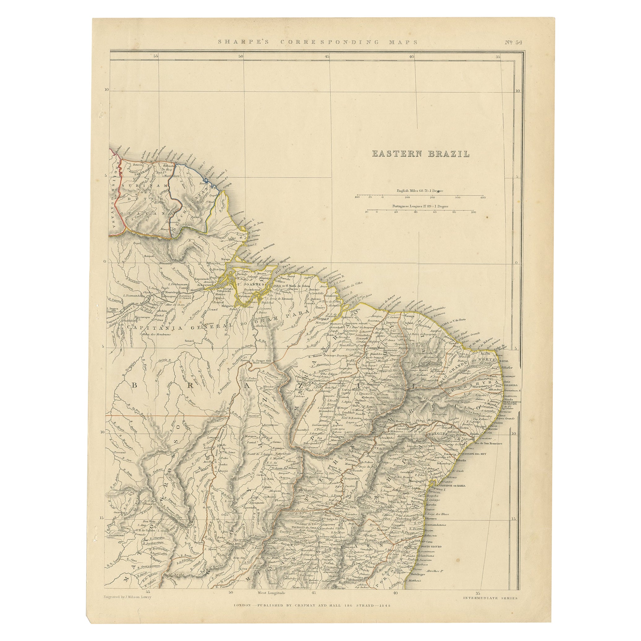
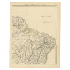
Antique Map of Eastern Brazil, 1849
Located in Langweer, NL
Antique map titled 'Eastern Brazil'. Old map of Eastern Brazil. This map originates from 'Sharpe's Corresponding Atlas (..)' by J. Sharpe.
Artists and Engravers: Published by Chap...
Category
Antique 19th Century Maps
Materials
Paper
$296 Sale Price
20% Off
You May Also Like
Scandinavia & Portions of Eastern Europe: 18th Century Hand-Colored Homann Map
By Johann Baptist Homann
Located in Alamo, CA
An early 18th century hand-colored copper-plate map entitled "Regni Sueciae in omnes suas Subjacentes Provincias accurate divisi Tabula Generalis" by Johann Baptist Homann (1663-1724...
Category
Antique Early 18th Century German Maps
Materials
Paper

Southern & Eastern Europe: A Large 17th C. Hand-colored Map by Sanson & Jaillot
By Nicolas Sanson
Located in Alamo, CA
This large hand-colored map entitled "Estats de L'Empire des Turqs en Europe, ou sont les Beglerbeglicz our Gouvernements" was originally created by Nicholas Sanson d'Abbeville and t...
Category
Antique 1690s French Maps
Materials
Paper

Original Antique Map of Europe, Arrowsmith, 1820
Located in St Annes, Lancashire
Great map of Europe
Drawn under the direction of Arrowsmith.
Copper-plate engraving.
Published by Longman, Hurst, Rees, Orme and Brown, 1820
...
Category
Antique 1820s English Maps
Materials
Paper

Large Original Antique Map of Europe by Sidney Hall, 1847
Located in St Annes, Lancashire
Great map of Europe
Drawn and engraved by Sidney Hall
Steel engraving
Original colour outline
Published by A & C Black. 1847
Unframed
Free shipping.
Category
Antique 1840s Scottish Maps
Materials
Paper

Original Antique Map of the American State of Pennsylvania( Eastern Part ), 1903
Located in St Annes, Lancashire
Antique map of Pennsylvania ( Eastern part )
Published By A & C Black. 1903
Original colour
Good condition
Unframed.
Free shipping
Category
Antique Early 1900s English Maps
Materials
Paper

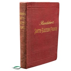
Small Antique Baedeker's South Eastern France Guide Book, Provence, Travel Maps
Located in Hele, Devon, GB
This is a delightful antique edition of Baedeker's South Eastern France guide book, complete with superb fold-out maps, centre-fold maps and informative text. A bound and intact late...
Category
Early 20th Century British Late Victorian Books
Materials
Paper