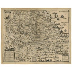
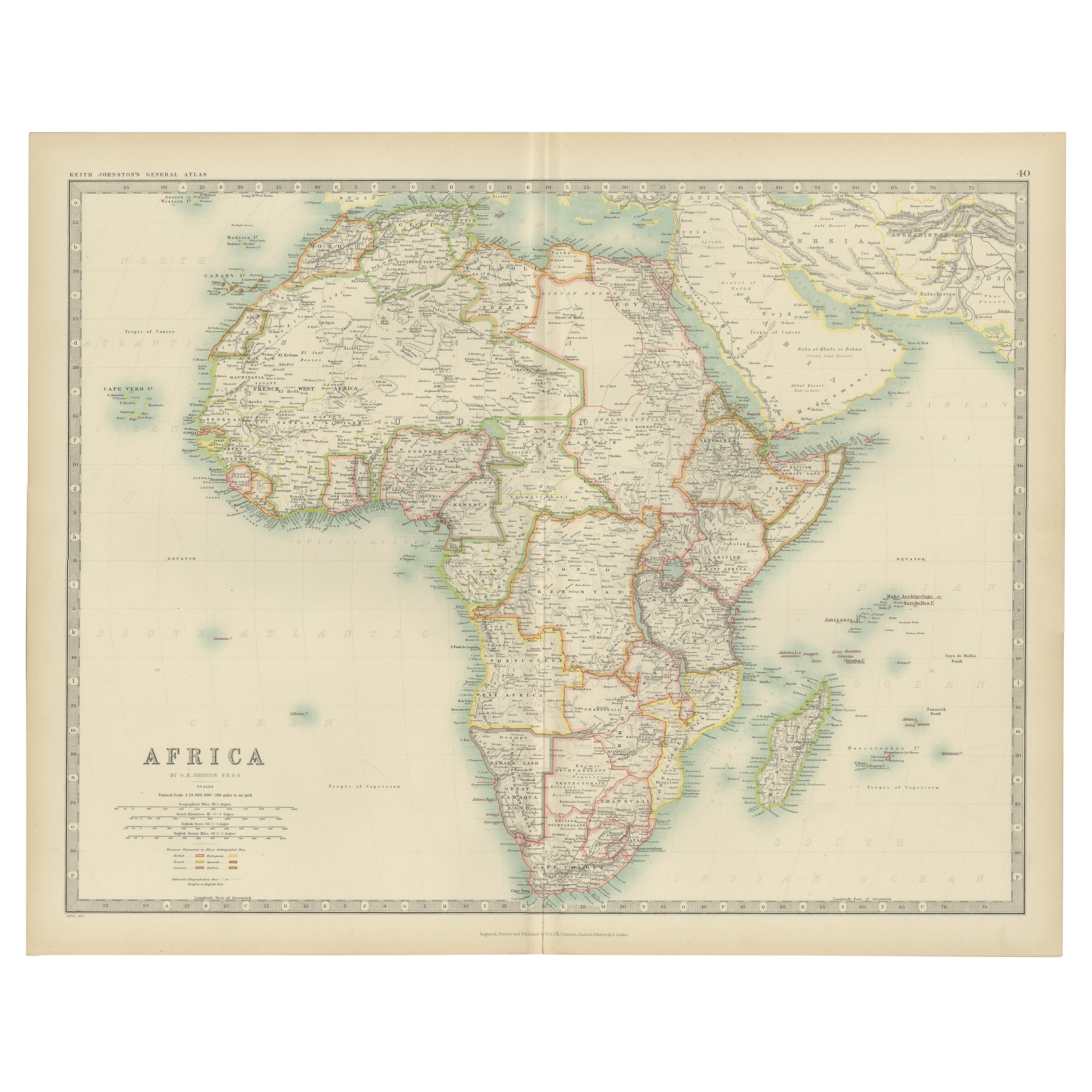
Antique Map of Ethiopia 'Africa' by H. Ludolf, 1683
View Similar Items


Want more images or videos?
Request additional images or videos from the seller
1 of 6
Antique Map of Ethiopia 'Africa' by H. Ludolf, 1683
About the Item
- Dimensions:Height: 18.12 in (46 cm)Width: 22.45 in (57 cm)Depth: 0.02 in (0.5 mm)
- Materials and Techniques:
- Period:Late 17th Century
- Date of Manufacture:1683
- Condition:Wear consistent with age and use. Please study images carefully.
- Seller Location:Langweer, NL
- Reference Number:Seller: BG-008151stDibs: LU305438972151
About the Seller
5.0
Recognized Seller
These prestigious sellers are industry leaders and represent the highest echelon for item quality and design.
Platinum Seller
Premium sellers with a 4.7+ rating and 24-hour response times
Established in 2009
1stDibs seller since 2017
2,439 sales on 1stDibs
Typical response time: 1 hour
Authenticity Guarantee
In the unlikely event there’s an issue with an item’s authenticity, contact us within 1 year for a full refund. DetailsMoney-Back Guarantee
If your item is not as described, is damaged in transit, or does not arrive, contact us within 7 days for a full refund. Details24-Hour Cancellation
You have a 24-hour grace period in which to reconsider your purchase, with no questions asked.Vetted Professional Sellers
Our world-class sellers must adhere to strict standards for service and quality, maintaining the integrity of our listings.Price-Match Guarantee
If you find that a seller listed the same item for a lower price elsewhere, we’ll match it.Trusted Global Delivery
Our best-in-class carrier network provides specialized shipping options worldwide, including custom delivery.More From This Seller
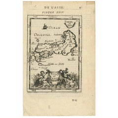
View AllAntique Map of Japan by A.M. Mallet, 1683
Located in Langweer, NL
A charming late 17th century French map with a very decorative title cartouche showing trumpet-blowing cherubs, by Allain Manneson Mallet (1630-1706), a well traveled military engine...
Category
Antique Late 17th Century Maps
Materials
Paper
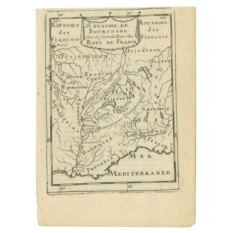
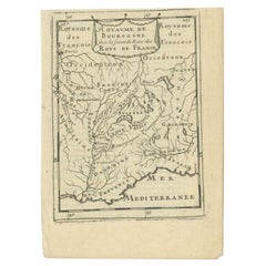
Antique Map of the Burgundy Region by Mallet, c.1683
Located in Langweer, NL
Antique map titled 'Royaume de Bourgogne sous la seconde Race des Roys de France'. Detailed miniature map of the Burgundy region, France. Originates from Mallet's 'Description de l'U...
Category
Antique 17th Century Maps
Materials
Paper
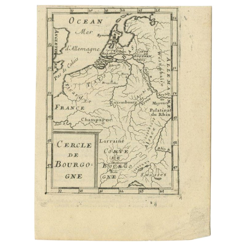
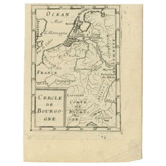
Antique Map of the Burgundy Region by Mallet, c.1683
Located in Langweer, NL
Antique map titled 'Cercle de Bourgogne'. Detailed miniature map of the Burgundy region, France. Also shows the Netherlands and Belgium. Originates from Mallet's 'Description de l'Un...
Category
Antique 17th Century Maps
Materials
Paper
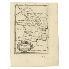
Detailed Antique Miniature Map of France by Mallet, c.1683
Located in Langweer, NL
Antique map titled 'France en General'. BG-11796-55. Originates from Mallet's 'Description de l'Univers'.
Artists and Engravers: Alain Manneson Mallet (1630-1706) spent the first ...
Category
Antique 17th Century Maps
Materials
Paper
$147 Sale Price
20% Off
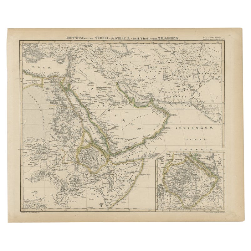
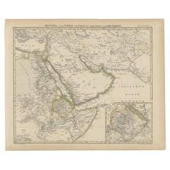
Antique Map of Africa and Arabia with Inset Map of Ethiopia and Eritrea, 1845
Located in Langweer, NL
Antique map titled 'Mittel- und Nord-Africa (östl. Theil) und Arabien'. This map depicts North and Central Africa and Arabia with an inset map of Habesch (Ethiopia and Eritrea).
Ar...
Category
Antique 19th Century Maps
Materials
Paper
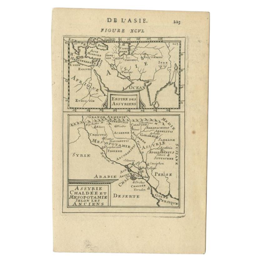
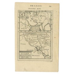
Antique Map of the Empire of the Assyriens by Mallet, 1683
By Alain Manesson Mallet
Located in Langweer, NL
Antique map titled 'Empire des Assyriens' and 'Assyrie Chaldee et Mesopotamie selon les Anciens'. Two maps on one sheet, the upper sheet showing the Empire of the Assyriens and the second showing the region of the Tigres and Euphrates Rivers. This map originates from Alain Manesson Mallet's 'Description de l 'Univers'.
Artists and Engravers: Alain Manesson Mallet (1630–1706) was a French cartographer and engineer. He started his career as a soldier in the army of Louis XIV, became a Sergeant-Major in the artillery and an Inspector of Fortifications. He also served under the King of Portugal, before returning to France, and his appointment to the court of Louis XIV. His military engineering and mathematical background led to his position teaching mathematics at court. His major publications were Description de L'Univers (1683) in 5 volumes, and Les Travaux de Mars ou l'Art de la Guerre (1684) in 3 volumes. His Description de L'Universe contains a wide variety of information, including star maps...
Category
Antique 17th Century Maps
Materials
Paper
$258 Sale Price
20% Off
You May Also Like
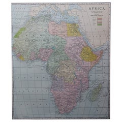
Large Original Antique Map of Africa. C.1900
Located in St Annes, Lancashire
Fabulous map of Africa
Original color.
Engraved and printed by the George F. Cram Company, Indianapolis.
Published, C.1900.
Unframed.
Free shipping.
Category
Antique 1890s American Maps
Materials
Paper
Original Antique Map of South Africa, Arrowsmith, 1820
Located in St Annes, Lancashire
Great map of South Africa.
Drawn under the direction of Arrowsmith.
Copper-plate engraving.
Published by Longman, Hurst, Rees, Orme and Br...
Category
Antique 1820s English Maps
Materials
Paper

London 1744 Published Watercolour Antique Map of East Africa by Eman Bowen
Located in West Sussex, Pulborough
We are delighted to offer for sale this New and Accurate Map of Nubia & Abissinia, together with all the Kingdoms Tributary Thereto, and bordering upon them published in 1744 by Emanuel Bowen
This is a decorative antique engraved map of East Africa...
Category
Antique 1740s English George III Maps
Materials
Paper

$1,045 Sale Price
20% Off
Large University Chart “Physical Map of Africa” by Bacon
Located in Godshill, Isle of Wight
Large university chart “Physical Map of Africa” by Bacon
W&A K Johnston’s Charts of Physical Maps By G W Bacon,
This is colorful Physical map of North America, it is large lithograph set...
Category
Early 20th Century Folk Art Posters
Materials
Linen

Antique Lithography Map, West Africa, English, Framed, Cartography, Victorian
Located in Hele, Devon, GB
This is an antique lithography map of Western Africa. An English, framed atlas engraving of cartographic interest by John Rapkin, dating to the early Victorian period and later, circ...
Category
Antique Mid-19th Century British Early Victorian Maps
Materials
Wood

Large Original Vintage Map of South Africa, circa 1920
Located in St Annes, Lancashire
Great map of South Africa
Original color.
Good condition / repair to a minor edge tear middle bottom
Published by Alexander Gross
Unframed.
...
Category
Vintage 1920s English Edwardian Maps
Materials
Paper
