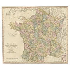
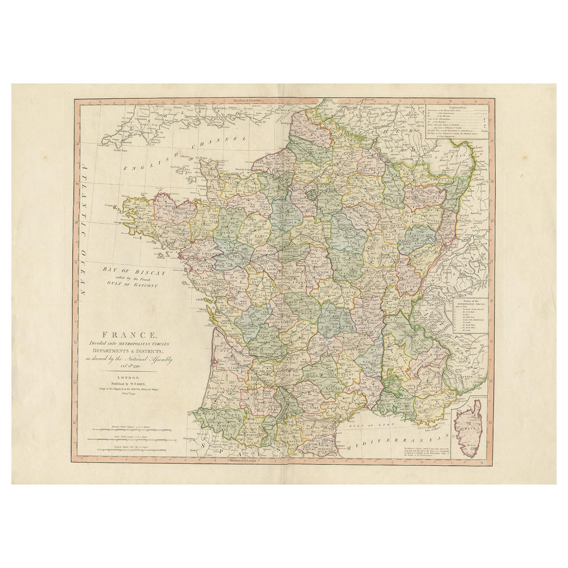
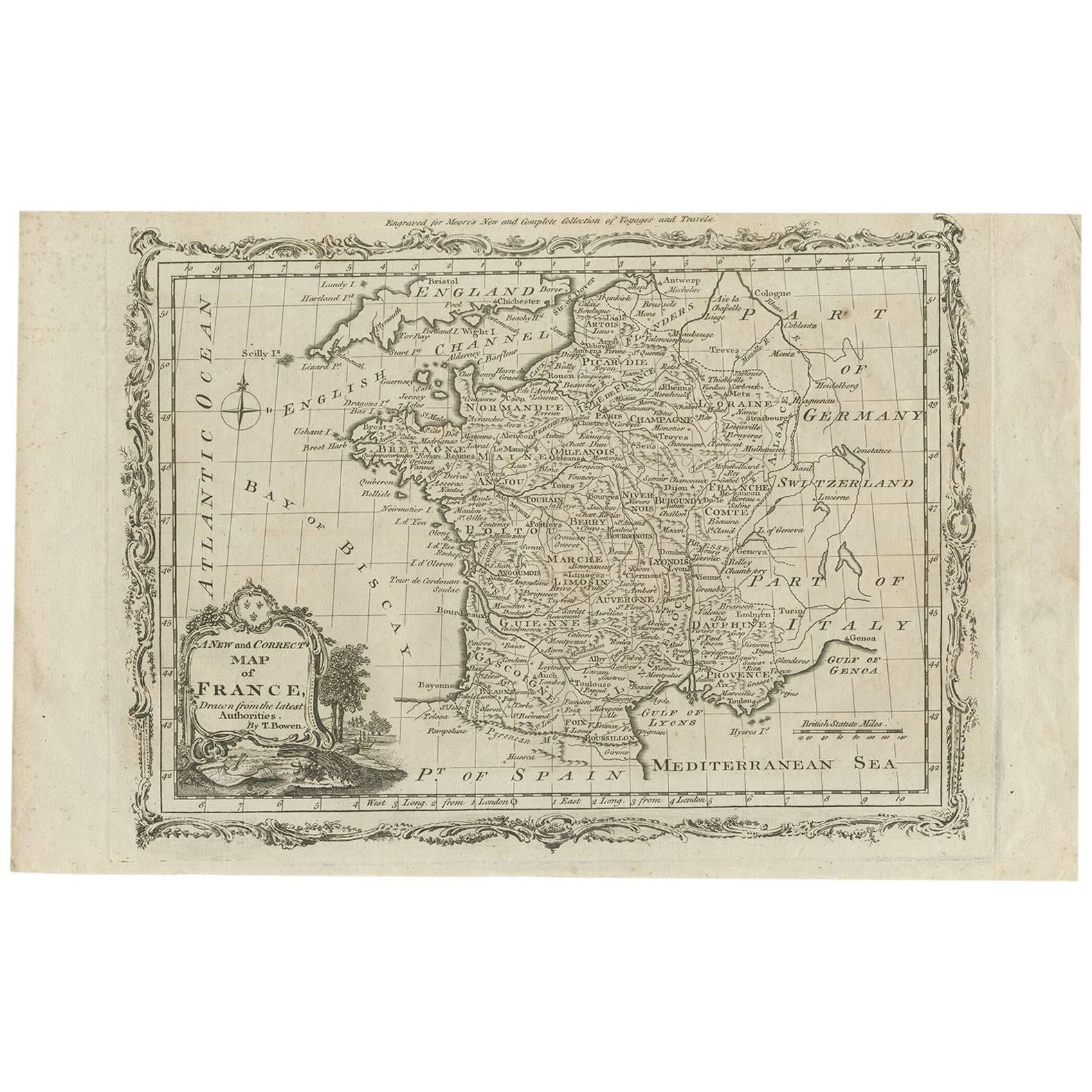
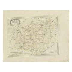
Antique Map of France by Faden, 1792
View Similar Items


Want more images or videos?
Request additional images or videos from the seller
1 of 5
Antique Map of France by Faden, 1792
About the Item
- Dimensions:Height: 21.66 in (55 cm)Width: 30.71 in (78 cm)Depth: 0 in (0.01 mm)
- Materials and Techniques:
- Period:
- Date of Manufacture:1792
- Condition:
- Seller Location:Langweer, NL
- Reference Number:Seller: BG-12834-191stDibs: LU3054326191502
About the Seller
5.0
Recognized Seller
These prestigious sellers are industry leaders and represent the highest echelon for item quality and design.
Gold Seller
Premium sellers maintaining a 4.3+ rating and 24-hour response times
Established in 2009
1stDibs seller since 2017
2,467 sales on 1stDibs
Typical response time: 1 hour
Authenticity Guarantee
In the unlikely event there’s an issue with an item’s authenticity, contact us within 1 year for a full refund. DetailsMoney-Back Guarantee
If your item is not as described, is damaged in transit, or does not arrive, contact us within 7 days for a full refund. Details24-Hour Cancellation
You have a 24-hour grace period in which to reconsider your purchase, with no questions asked.Vetted Professional Sellers
Our world-class sellers must adhere to strict standards for service and quality, maintaining the integrity of our listings.Price-Match Guarantee
If you find that a seller listed the same item for a lower price elsewhere, we’ll match it.Trusted Global Delivery
Our best-in-class carrier network provides specialized shipping options worldwide, including custom delivery.More From This Seller
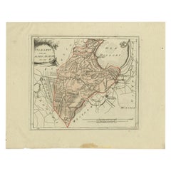
View AllAntique Map of France by Faden '1792'
Located in Langweer, NL
Antique map titled 'France divided into Metropolitan Circles (..)'. Large, original antique map of France, with a small inset of the island of Co...
Category
Antique Late 18th Century Maps
Materials
Paper
$604 Sale Price
20% Off
Antique Hand-Colored Map of France by J.B. Elwe, 1792
Located in Langweer, NL
Antique map titled 'Carte Nouvelle du Royaume de France'. Beautiful antique map of France, including the Southern part of England. Decorated with cartouche and 12 coats of arms.
Category
Antique Late 18th Century Maps
Materials
Paper

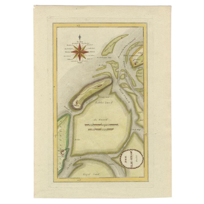
Antique Map of the Wadden Islands, 1792
Located in Langweer, NL
Antique map titled 'Der Vlie Strom'. Map of the Wadden islands with Vlieland in the middle (The Netherlands). This map originates from 'Schauplatz der fünf Theile der Welt' published...
Category
Antique 18th Century Maps
Materials
Paper
$325 Sale Price
20% Off
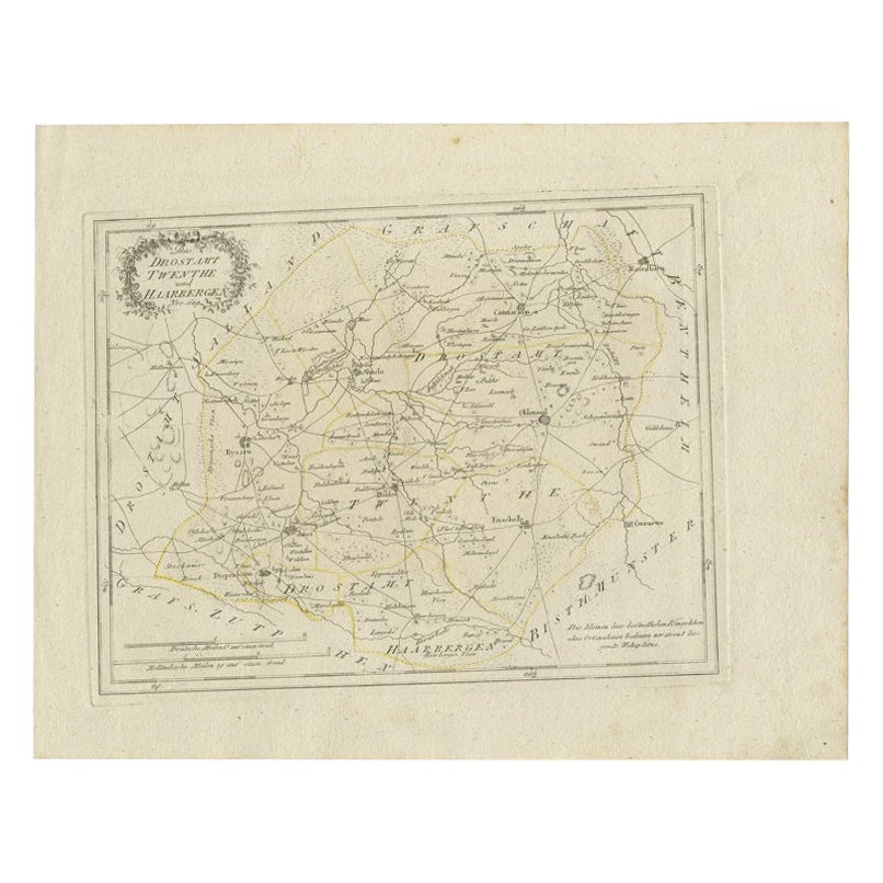
Antique Map of Part of Overijssel by Von Reilly, 1792
Located in Langweer, NL
Antique map titled 'Das Drostamt Twenthe und Haarbergen'. This map depicts part of The Netherlands (Overijssel). This map originates from 'Schauplatz der fünf Theile der Welt' publis...
Category
Antique 18th Century Maps
Materials
Paper
$116 Sale Price
20% Off
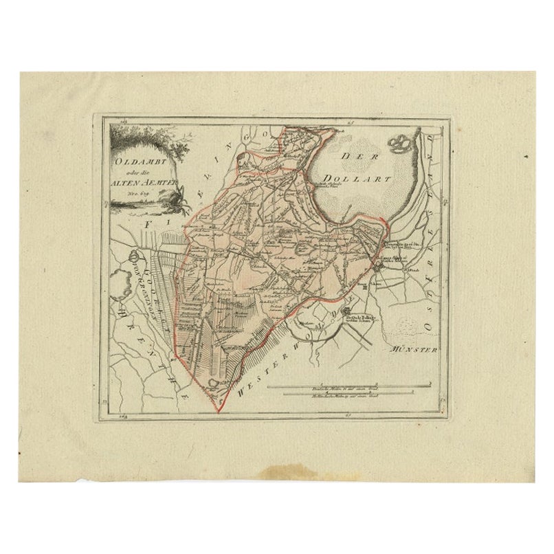
Antique Map of Part of Groningen by Von Reilly, 1792
Located in Langweer, NL
Antique map titled 'Oldambt oder die Alten Aemter'. This map depicts part of the Dutch province Groningen. This map originates from 'Schauplatz der fünf Theile der Welt' published in...
Category
Antique 18th Century Maps
Materials
Paper
$97 Sale Price
20% Off
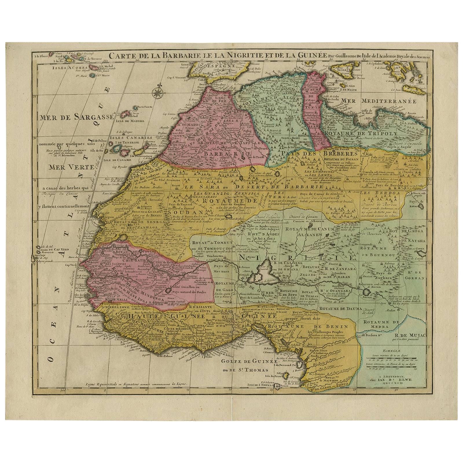
Original Hand-Colored Antique Map of Africa by Elwe '1792'
Located in Langweer, NL
Antique map titled 'l'Afrique Divisée en ses Empires, Royaumes, et Etats'. Decorative large map of Africa. The cartography is typical for the 17th century with the Nile originating i...
Category
Antique Late 18th Century Maps
Materials
Paper

$930 Sale Price
20% Off
You May Also Like
Plan of Paris, France, by A. Vuillemin, Antique Map, 1845
Located in Colorado Springs, CO
This large and detailed plan of Paris was published by Alexandre Vuillemin in 1845. The map conveys a wonderful amount of information and is decorated throughout with pictorial vigne...
Category
Antique 1840s American Maps
Materials
Paper

Original Large Antique Map of Paris, France by John Dower, 1861
Located in St Annes, Lancashire
Fabulous monochrome map of Paris.
Vignettes of St Germain En Laye, Saint Cloud, Versailles and Fontainbleau.
Unframed.
Drawn by J.Dower.
Lithography by Weller. 4 sheets joined to...
Category
Antique 1860s English Victorian Maps
Materials
Paper

Antique Map of Italy by Andriveau-Goujon, 1843
By Andriveau-Goujon
Located in New York, NY
Antique Map of Italy by Andriveau-Goujon, 1843. Map of Italy in two parts by Andriveau-Goujon for the Library of Prince Carini at Palazzo Carini i...
Category
Antique 1840s French Maps
Materials
Linen, Paper

$3,350 / set
1812 United States Map, by Pierre Tardieu, Antique French Map Depicting the U.S.
By Pierre François Tardieu
Located in Colorado Springs, CO
1812 "United States of Nth America -- Carte des Etats-Unis De L'Amerique Septentrionale" Two-Sheet Map by Tardieu
This attractive map, published in Paris in 1812, is one of the most rare large format maps from the period. It features a view of the East Coast of the U.S. from Maryland to just below South Carolina. Additionally, Ellicott’s plan for the City of Washington D.C. is included at the top right and an illustration of Niagara Falls is shown at the bottom right with a description in both French and English. This extremely detailed map not only depicts the mountainous regions of the southeastern U.S., but also includes names of regions, rivers, and towns.
Based on the first state of Arrowsmith’s 4-sheet map of the United States, this map is completely engraved by Tardieu in Paris and showcases high quality engravings. This detailed map of the recently independent United States includes one of the largest and earliest examples of the Ellicott plan of Washington DC.
The artist, Pierre François Tardieu (PF Tardieu) was a very well-known map engraver, geographer, and illustrator. Awarded a bronze medal by King Louis-Phillipe for the accuracy and beauty of his map-making, Tardieu produced many fine works including maps of Louisiana...
Category
Antique 1810s French Maps
Materials
Paper

Antique Map of Principality of Monaco
By Antonio Vallardi Editore
Located in Alessandria, Piemonte
ST/619 - "Old Geographical Atlas of Italy - Topographic map of ex-Principality of Monaco" -
ediz Vallardi - Milano -
A somewhat special edition ---
Category
Antique Late 19th Century Italian Other Prints
Materials
Paper

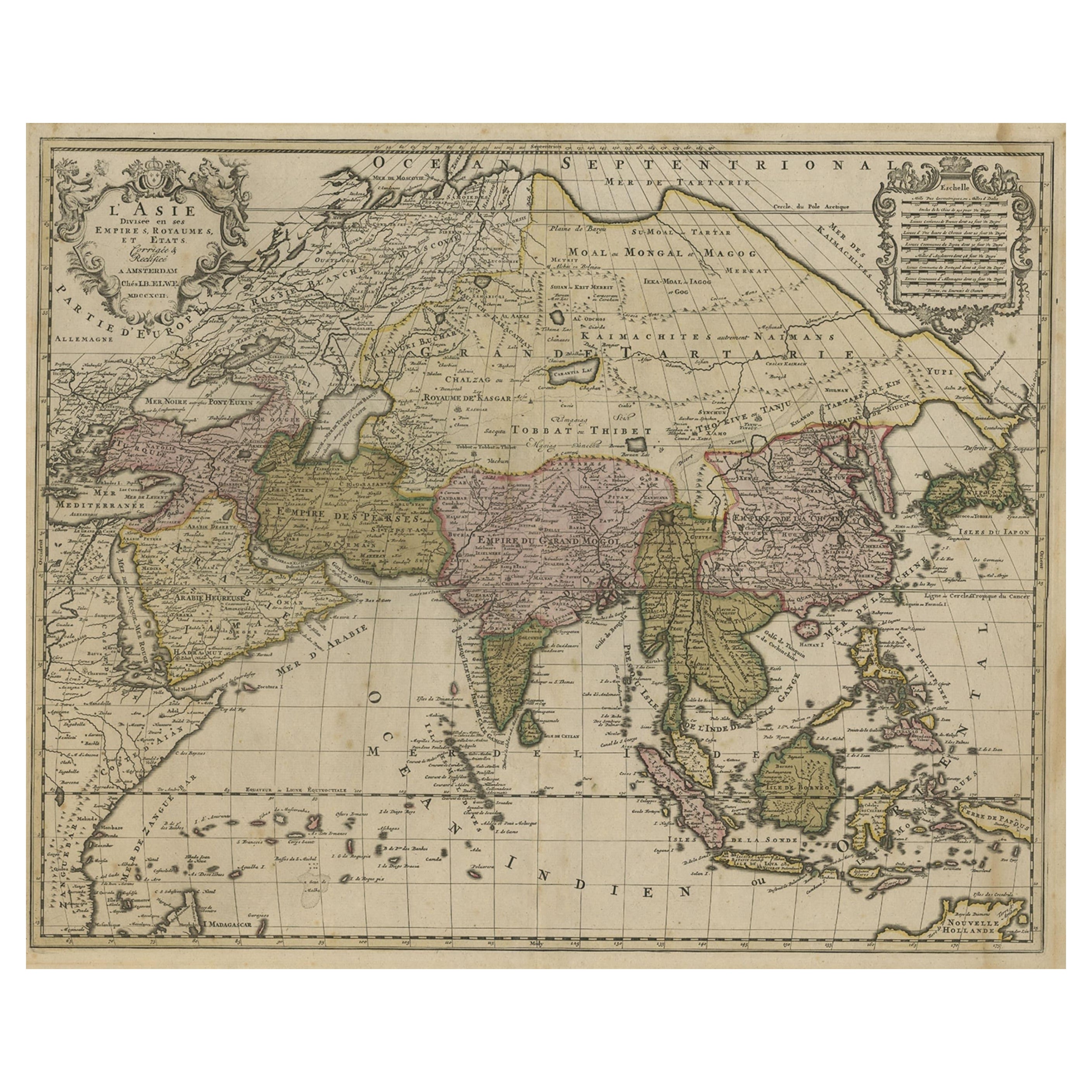
Antique French Map of Asia Including China Indoneseia India, 1783
Located in Amsterdam, Noord Holland
Very nice map of Asia. 1783 Dedie au Roy.
Additional information:
Country of Manufacturing: Europe
Period: 18th century Qing (1661 - 1912)
Condition: Overall Condition B (Good Used)...
Category
Antique 18th Century European Maps
Materials
Paper

$648 Sale Price
20% Off
Recently Viewed
View AllMore Ways To Browse
Vintage Yellow Formica Table
Vintage Chocolate Posters
Vitra Meda Chair
Vitra Soft Pad
Vladimir Kagan Bench
Vladimir Kagan Console
Walnut Cane Desk Chair
Walnut Library Ladder
Warren Platner Style Coffee Table
Wassily Style Leather Chair Marcel Breuer
Wedgwood Majolica Green Plate
West Side Story Vintage Poster
Whale Engraving
Wharton Esherick Stool
White Bamboo Shelf
White Footed Fruit Bowl
Wicker Trunks
Widdicomb Origins